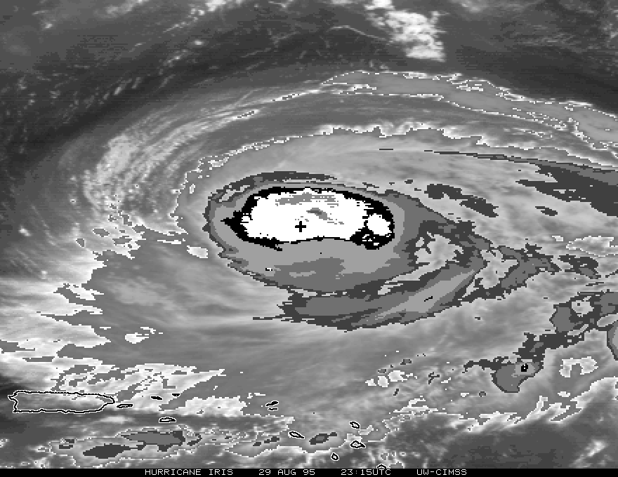
Figure 3. GOES-8 enhanced (BD curve) IR image during Hurricane Iris at 23 UTC on 29 August 1995. The + indicates the storm center in the central dense overcast (CDO) as located by reconnaissance aircraft.