Tropical Storm 30Y_09
|
Passive Microwave (PMW) Intensity Information Hurricane Intensity Estimation (HIE) Algorithm Version 9.0 |
Overpass Inten Ring Ring Wind Forecast Final Target
Date Time Score Meaning Pct Diam BTdiff Est Sat Lat Lon Lat Lon Lat Lon
20190826 074835 -1.3 N/A 5.5% 77.77 1.35 30.0 SSMI16 14.2 -130.4 14.2 -130.4 14.9 -130.4 Analysis Plot
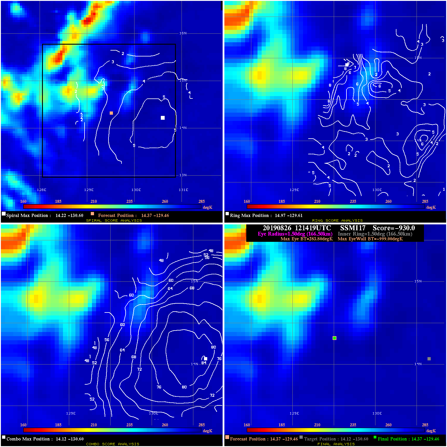
20190826 121419 -930.0 N/A N/A N/A 0.00 30.0 SSMI17 14.4 -129.5 14.4 -129.5 14.1 -130.6 Analysis Plot
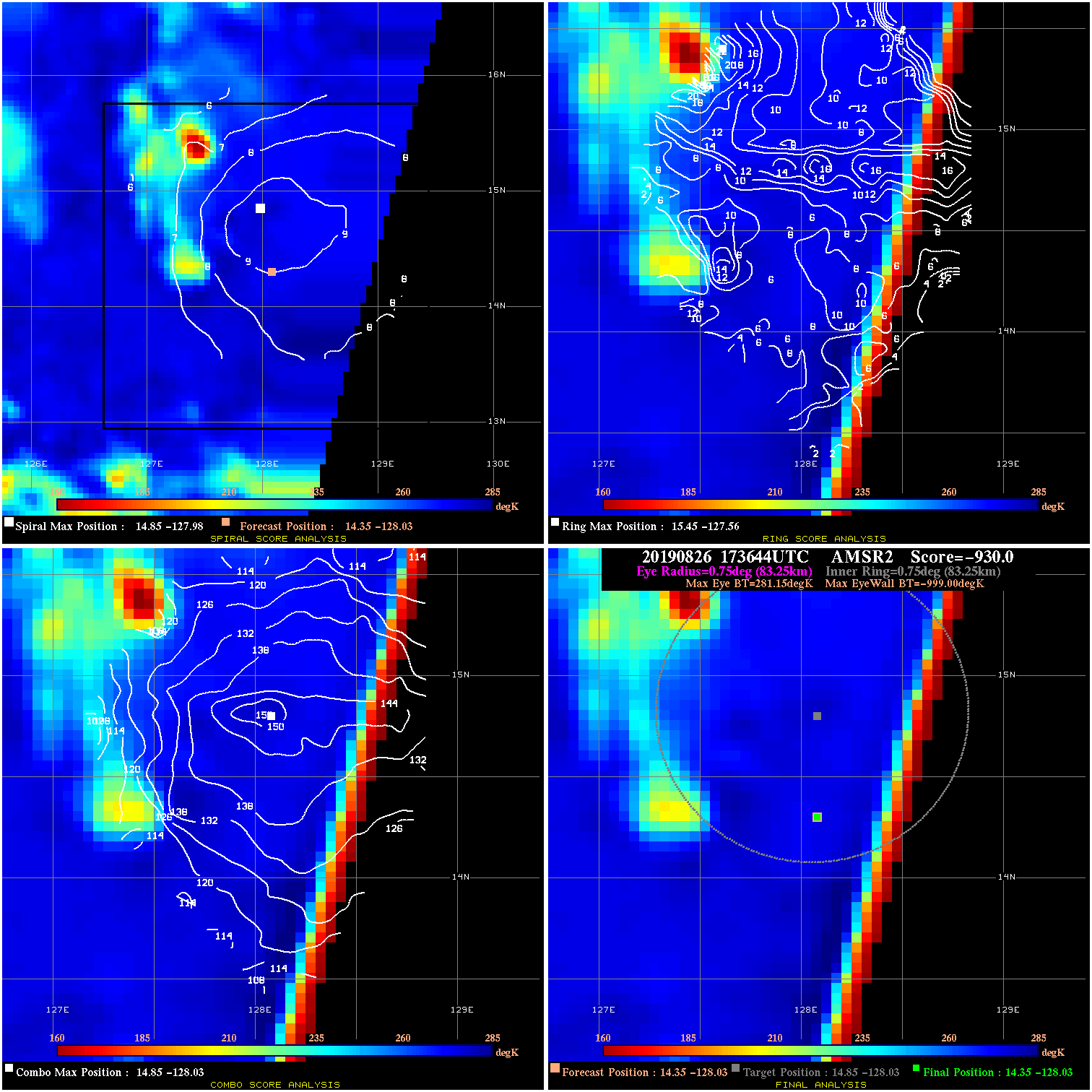
20190826 173644 -930.0 N/A N/A N/A 0.00 30.0 AMSR2 14.4 -128.0 14.4 -128.0 14.9 -128.0 Analysis Plot
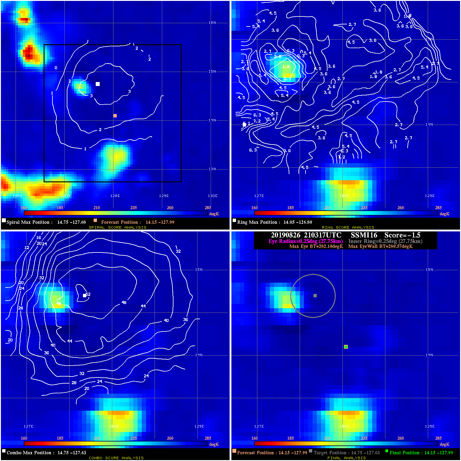
20190826 210317 -1.5 N/A 6.8% 55.55 1.53 30.0 SSMI16 14.1 -128.0 14.1 -128.0 14.8 -127.6 Analysis Plot
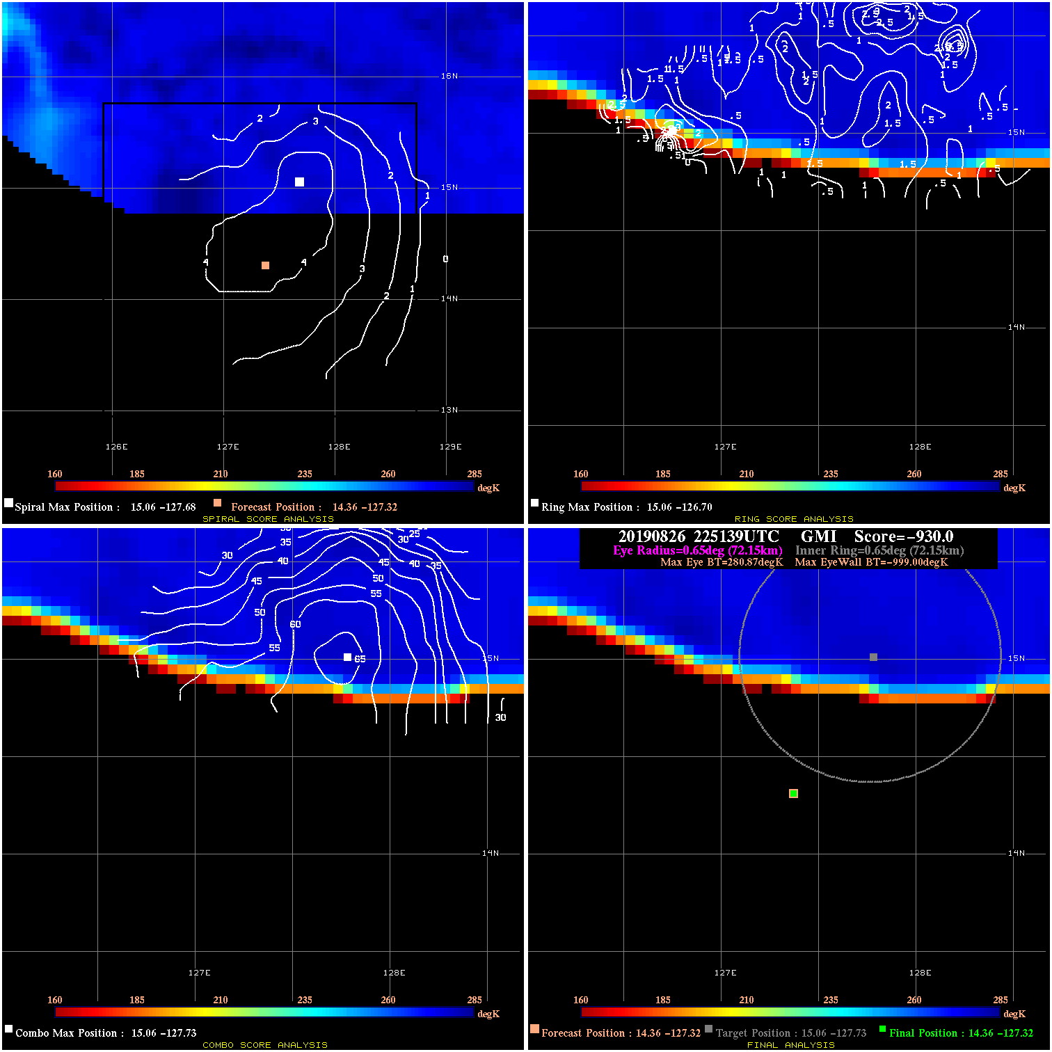
20190826 225139 -930.0 N/A N/A N/A 0.00 30.0 GMI 14.4 -127.3 14.4 -127.3 15.1 -127.7 Analysis Plot
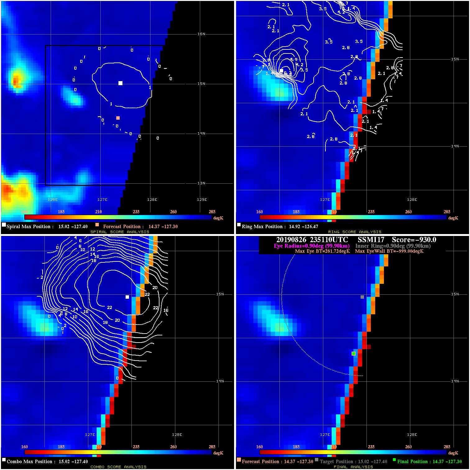
20190826 235110 -930.0 N/A N/A N/A 0.00 30.0 SSMI17 14.4 -127.3 14.4 -127.3 15.0 -127.4 Analysis Plot
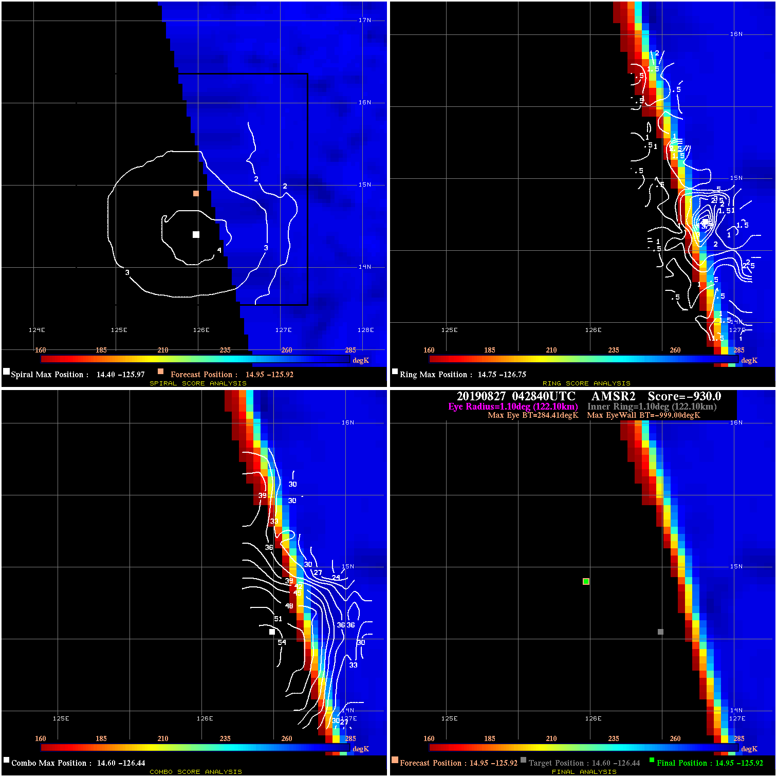
20190827 042840 -930.0 N/A N/A N/A 0.00 35.0 AMSR2 14.9 -125.9 14.9 -125.9 14.6 -126.4 Analysis Plot
20190827 073703 -930.0 N/A N/A N/A 0.00 35.0 SSMI16 15.1 -124.4 15.1 -124.4 15.2 -124.7 Analysis Plot
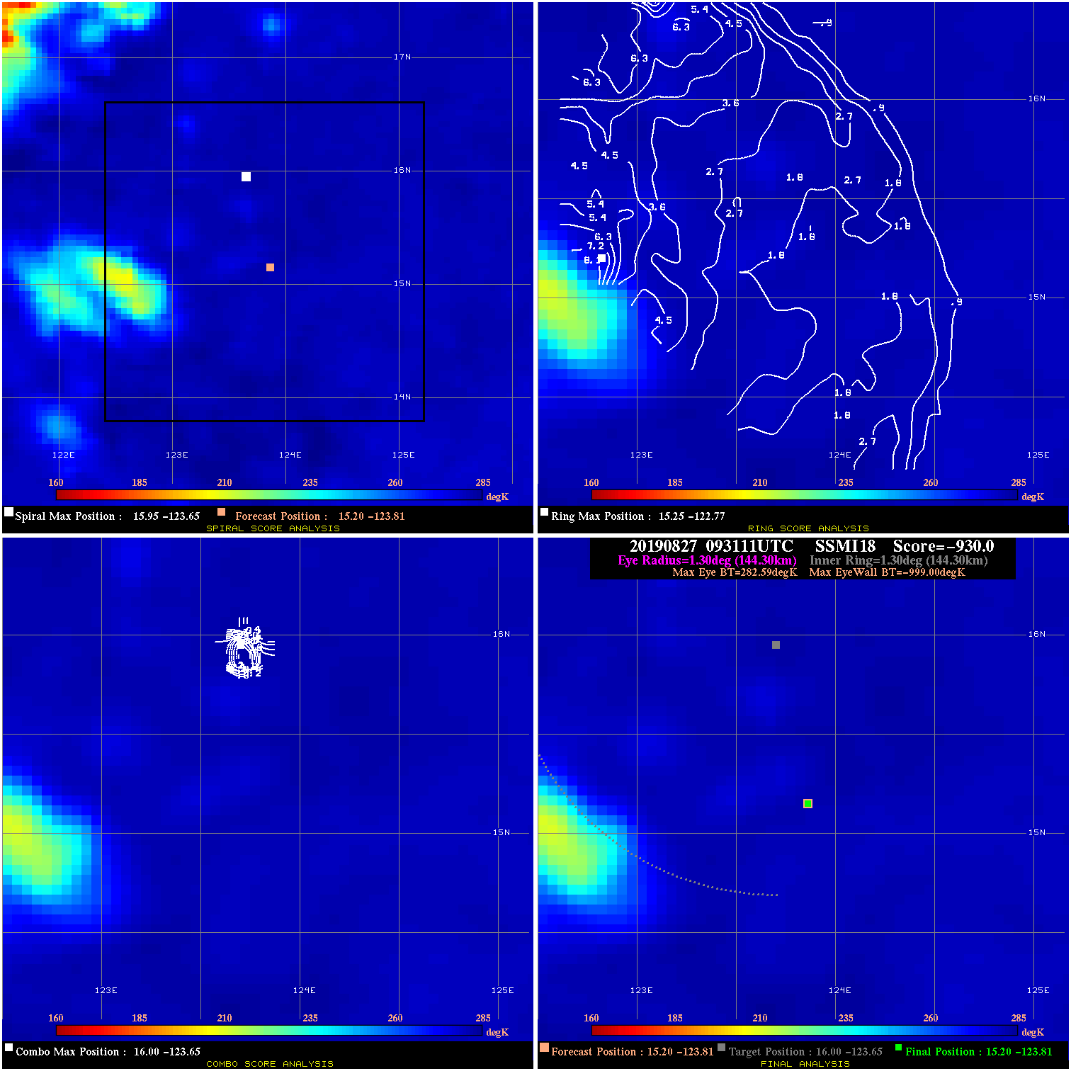
20190827 093111 -930.0 N/A N/A N/A 0.00 35.0 SSMI18 15.2 -123.8 15.2 -123.8 16.0 -123.7 Analysis Plot
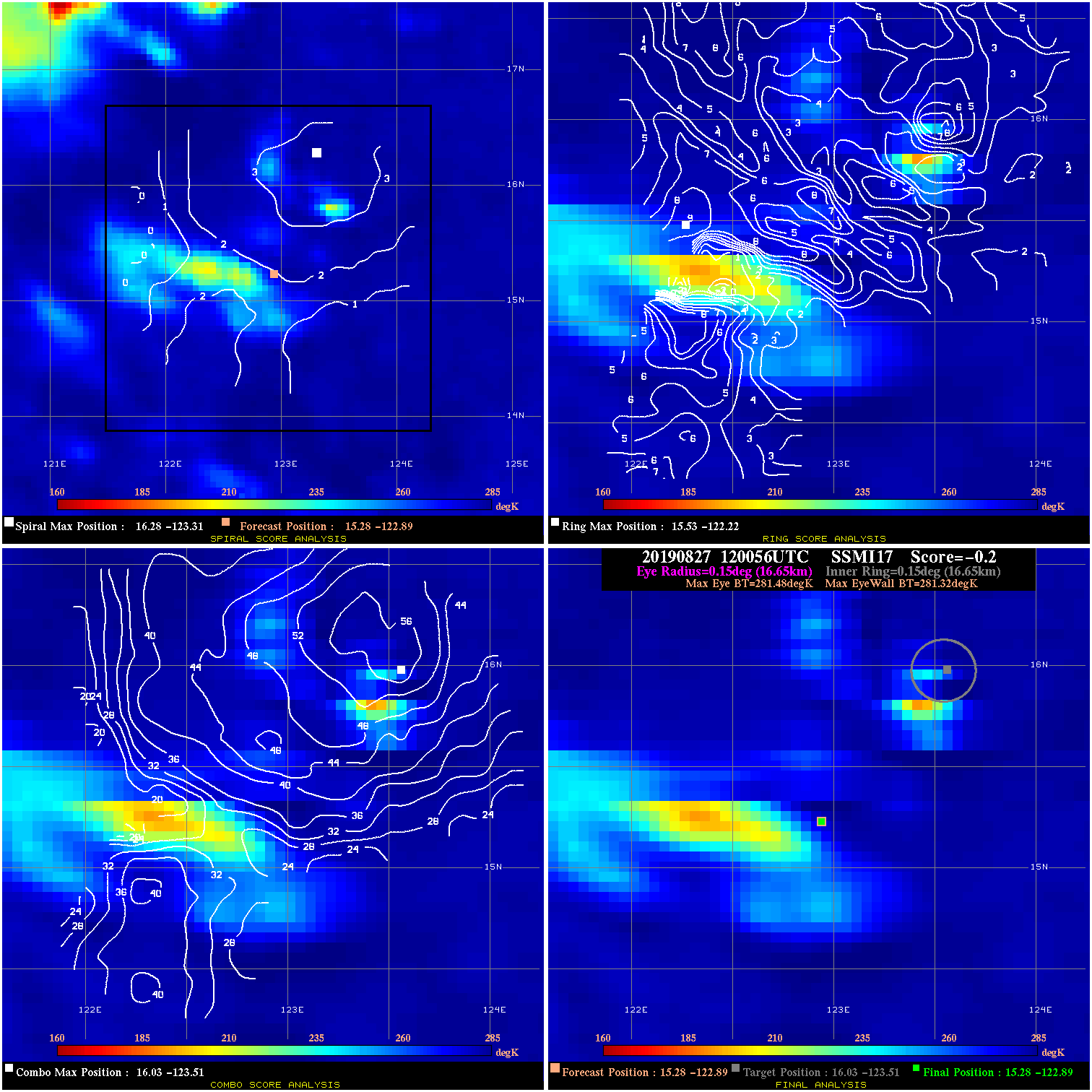
20190827 120056 -0.2 N/A 1.4% 33.33 .16 35.0 SSMI17 15.3 -122.9 15.3 -122.9 16.0 -123.5 Analysis Plot
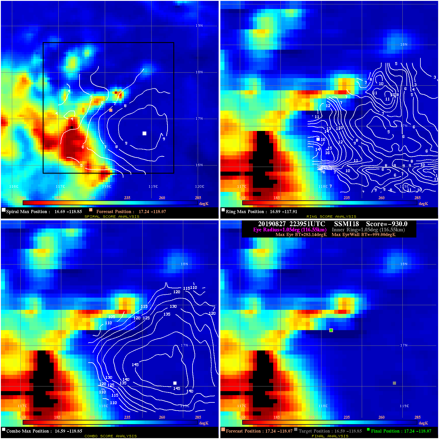
20190827 223951 -930.0 N/A N/A N/A 0.00 35.0 SSMI18 17.2 -118.1 17.2 -118.1 16.6 -118.8 Analysis Plot
20190827 233317 -930.0 N/A N/A N/A 0.00 35.0 GMI 17.1 -117.6 17.4 -116.9 17.4 -116.9 Analysis Plot
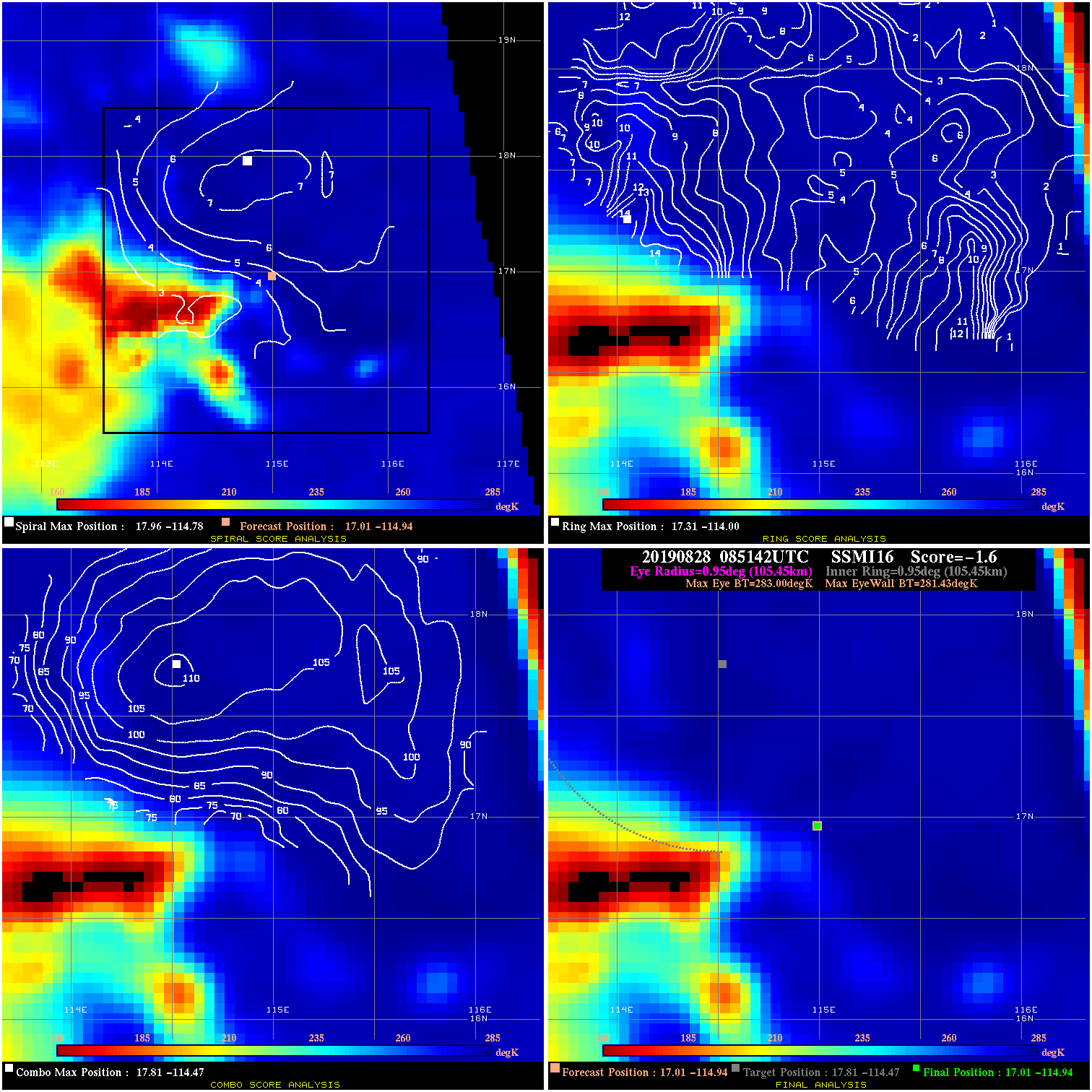
20190828 085142 -1.6 N/A 13.7% 211.09 1.57 45.0 SSMI16 17.0 -114.9 17.0 -114.9 17.8 -114.5 Analysis Plot
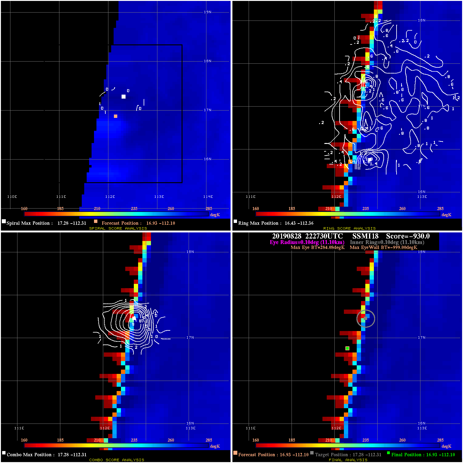
20190828 222730 -930.0 N/A N/A N/A 0.00 45.0 SSMI18 16.9 -112.1 16.9 -112.1 17.3 -112.3 Analysis Plot
20190829 084841 -930.0 N/A N/A N/A 0.00 45.0 SSMI16 17.3 -109.4 17.3 -109.4 17.7 -108.1 Analysis Plot
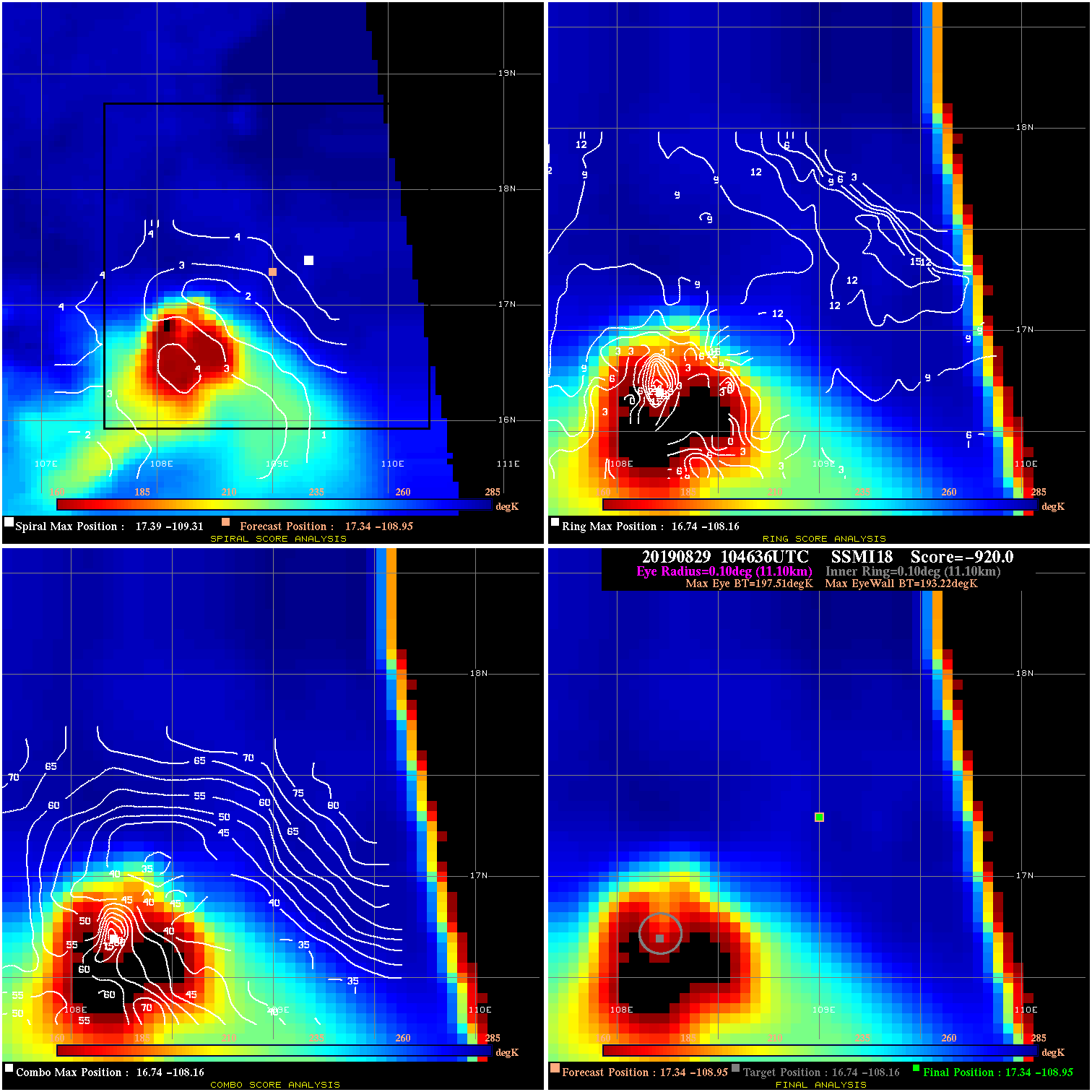
20190829 104636 -920.0 N/A 100.0% 22.22 4.29 45.0 SSMI18 17.3 -108.9 17.3 -108.9 16.7 -108.2 Analysis Plot
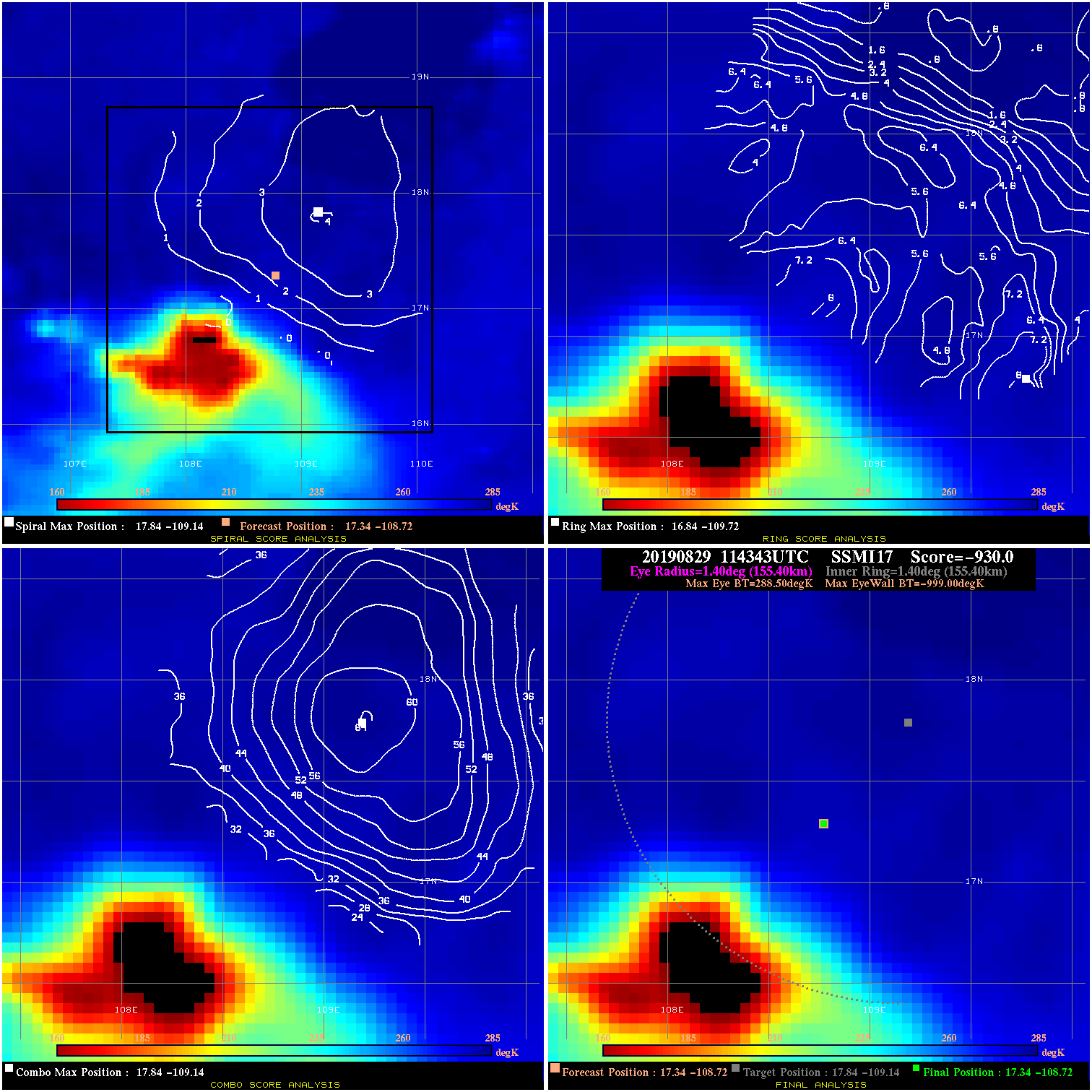
20190829 114343 -930.0 N/A N/A N/A 0.00 45.0 SSMI17 17.3 -108.7 17.3 -108.7 17.8 -109.1 Analysis Plot
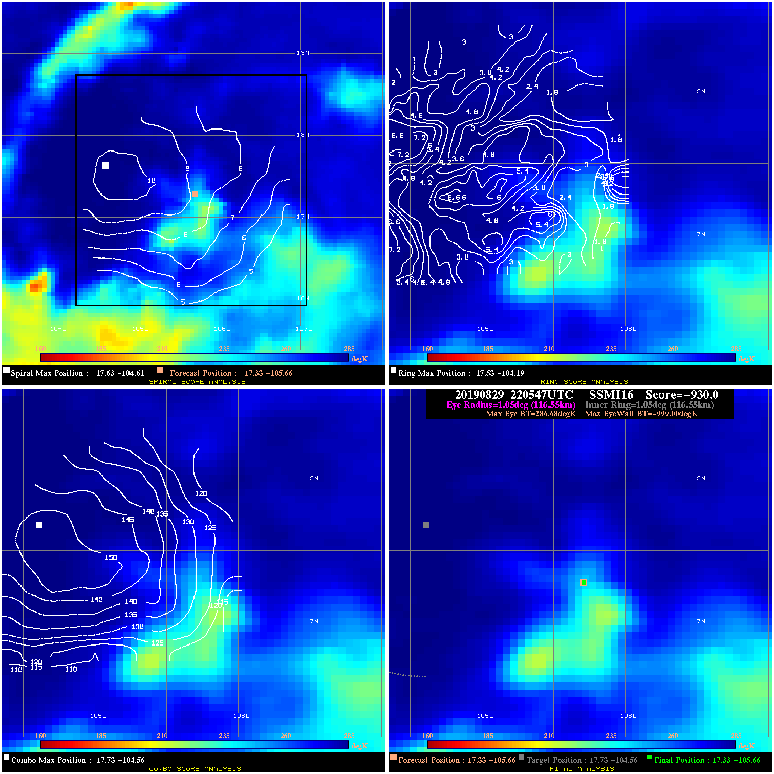
20190829 220547 -930.0 N/A N/A N/A 0.00 40.0 SSMI16 17.3 -105.7 17.3 -105.7 17.7 -104.6 Analysis Plot
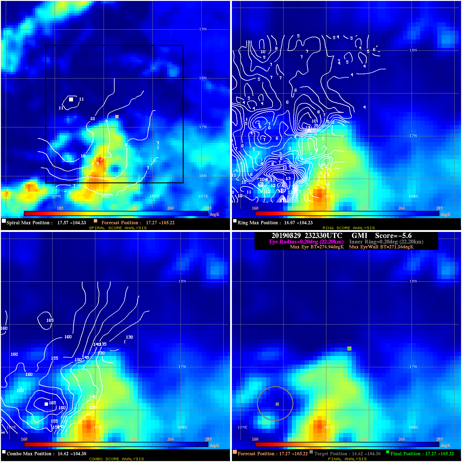
20190829 232330 -5.6 N/A 8.2% 44.44 5.58 40.0 GMI 17.3 -105.2 17.3 -105.2 16.6 -104.4 Analysis Plot
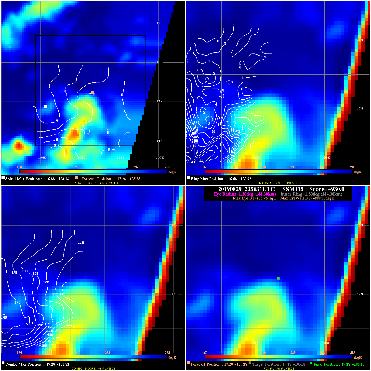
20190829 235631 -930.0 N/A N/A N/A 0.00 40.0 SSMI18 17.3 -105.3 17.3 -105.3 17.3 -103.8 Analysis Plot
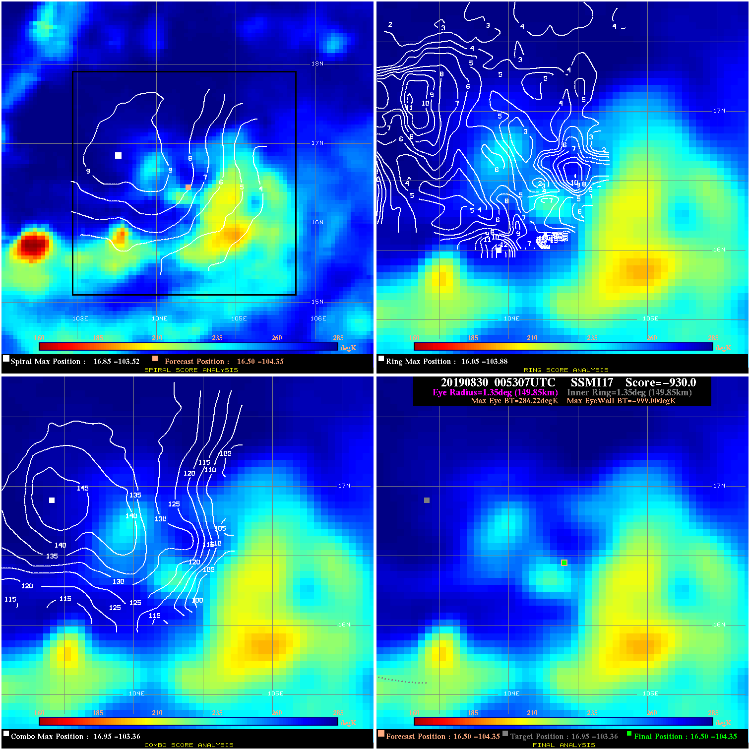
20190830 005307 -930.0 N/A N/A N/A 0.00 35.0 SSMI17 16.5 -104.3 16.5 -104.3 17.0 -103.4 Analysis Plot
20190830 063706 N/A N/A N/A N/A N/A 35.0 AMSR2 17.0 -103.3 17.0 -103.3 17.0 -103.3 Analysis Plot
20190830 102436 -0.4 N/A N/A 299.97 .43 35.0 SSMI18 17.1 -102.9 17.1 -102.9 17.0 -103.0 Analysis Plot
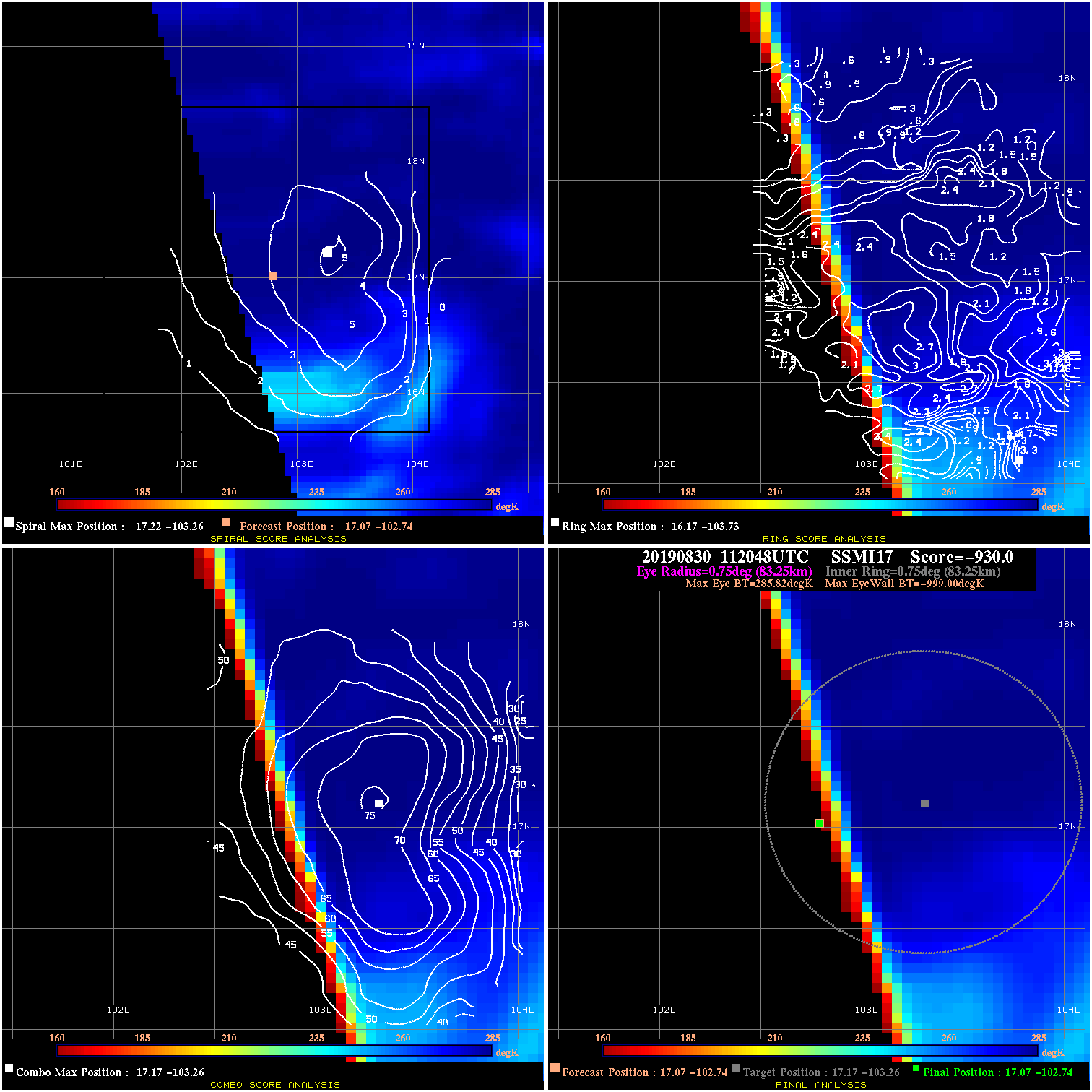
20190830 112048 -930.0 N/A N/A N/A 0.00 35.0 SSMI17 17.1 -102.7 17.1 -102.7 17.2 -103.3 Analysis Plot
|
|
Legend: - Date/Time are determined from PMW imagery at Forecast (initial guess) Lat/Lon position. - Positive/Negative Latitude = North/South Hemisphere; Longitude = Western/Eastern Hemisphere. - "Ring Diam" value indicates the estimated surface eyewall diameter in km (the MI eyewall edge diameter minus 10 km). - "Ring Pct" is the percentage of the "ring" (eyewall inner boundary) that is 1) colder than the "hot spot" (warmest eye pixel) in the eye by 20K, or 2) the percentage that is a) colder than 232K and b) colder than the "hot spot" by 10K, whichever is greater. - Values are red if Ring % <= 65, yellow/brown if Ring % <= 85 and green if Ring % > 85. - "Tb diff" is the difference between the "hot spot" (warmest eye pixel) and the warmest pixel on the eyewall. - Intensity score are listed as negative, and not used, when the JTWC or NHC estimated Vmax is <55 kts in order to rule out weak but highly symmetric TCs. - Error messages in intensity scores: -920 is used when the hottest pixel in the eye is <200K, to prevent false positives; -930 means <85% of eyewall has observations/data. |