Tropical Storm 31Y_01
|
Passive Microwave (PMW) Intensity Information Hurricane Intensity Estimation (HIE) Algorithm Version 9.0 |
Overpass Inten Ring Ring Wind Forecast Final Target
Date Time Score Meaning Pct Diam BTdiff Est Sat Lat Lon Lat Lon Lat Lon
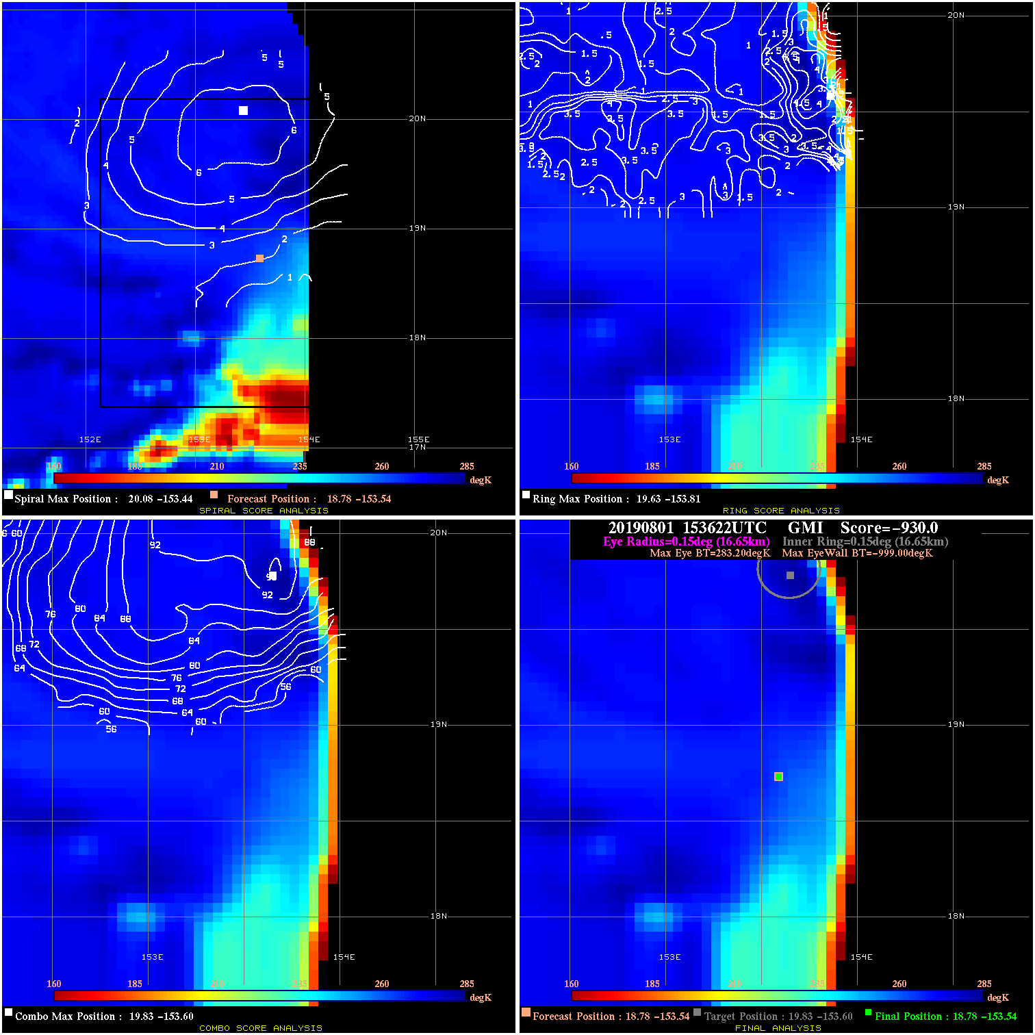
20190801 153622 -930.0 N/A N/A N/A 0.00 30.0 GMI 18.8 -153.5 18.8 -153.5 19.8 -153.6 Analysis Plot
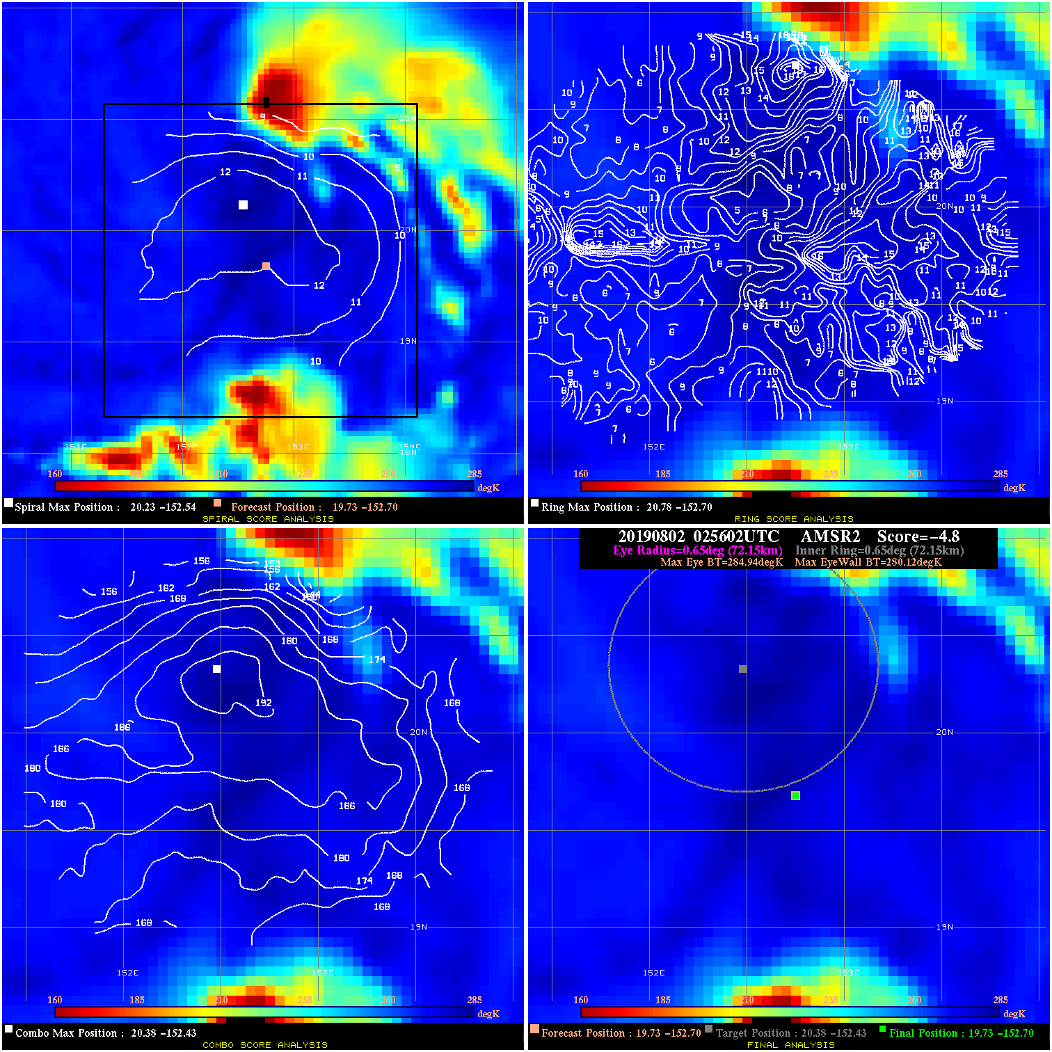
20190802 025602 -4.8 N/A 15.1% 144.43 4.82 35.0 AMSR2 19.7 -152.7 19.7 -152.7 20.4 -152.4 Analysis Plot
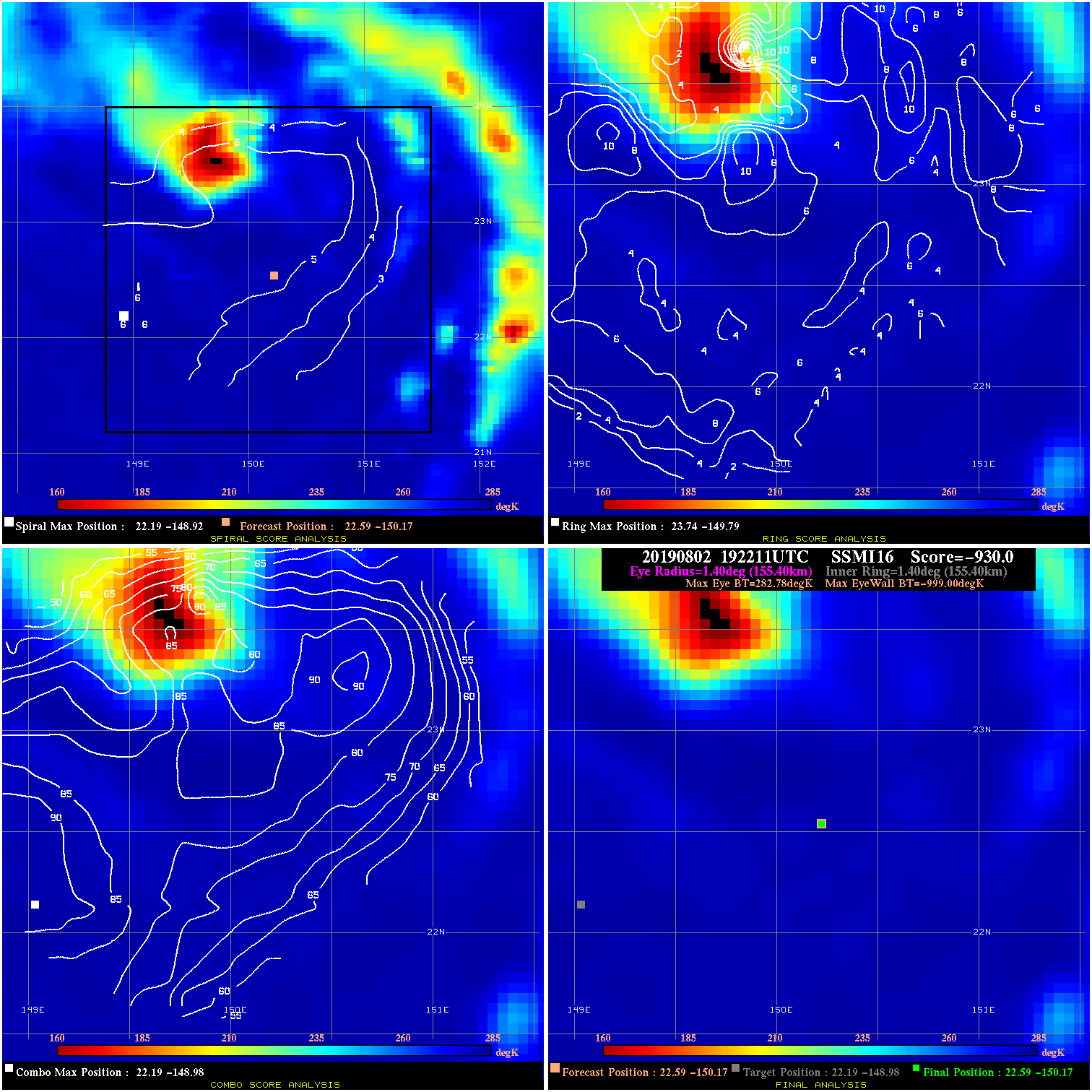
20190802 192211 -930.0 N/A N/A N/A 0.00 40.0 SSMI16 22.6 -150.2 22.6 -150.2 22.2 -149.0 Analysis Plot
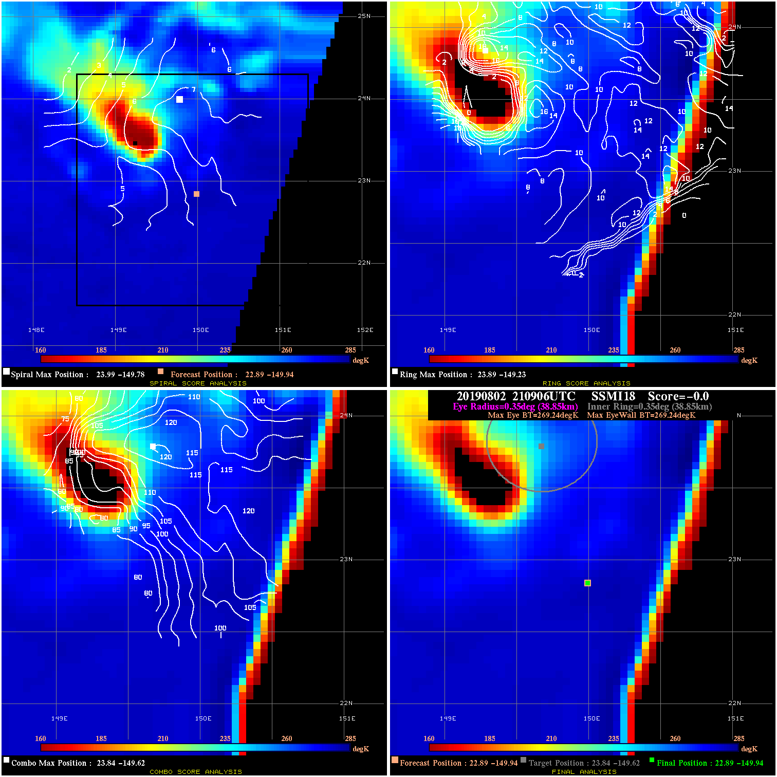
20190802 210906 N/A N/A N/A N/A N/A 40.0 SSMI18 22.9 -149.9 22.9 -149.9 23.8 -149.6 Analysis Plot
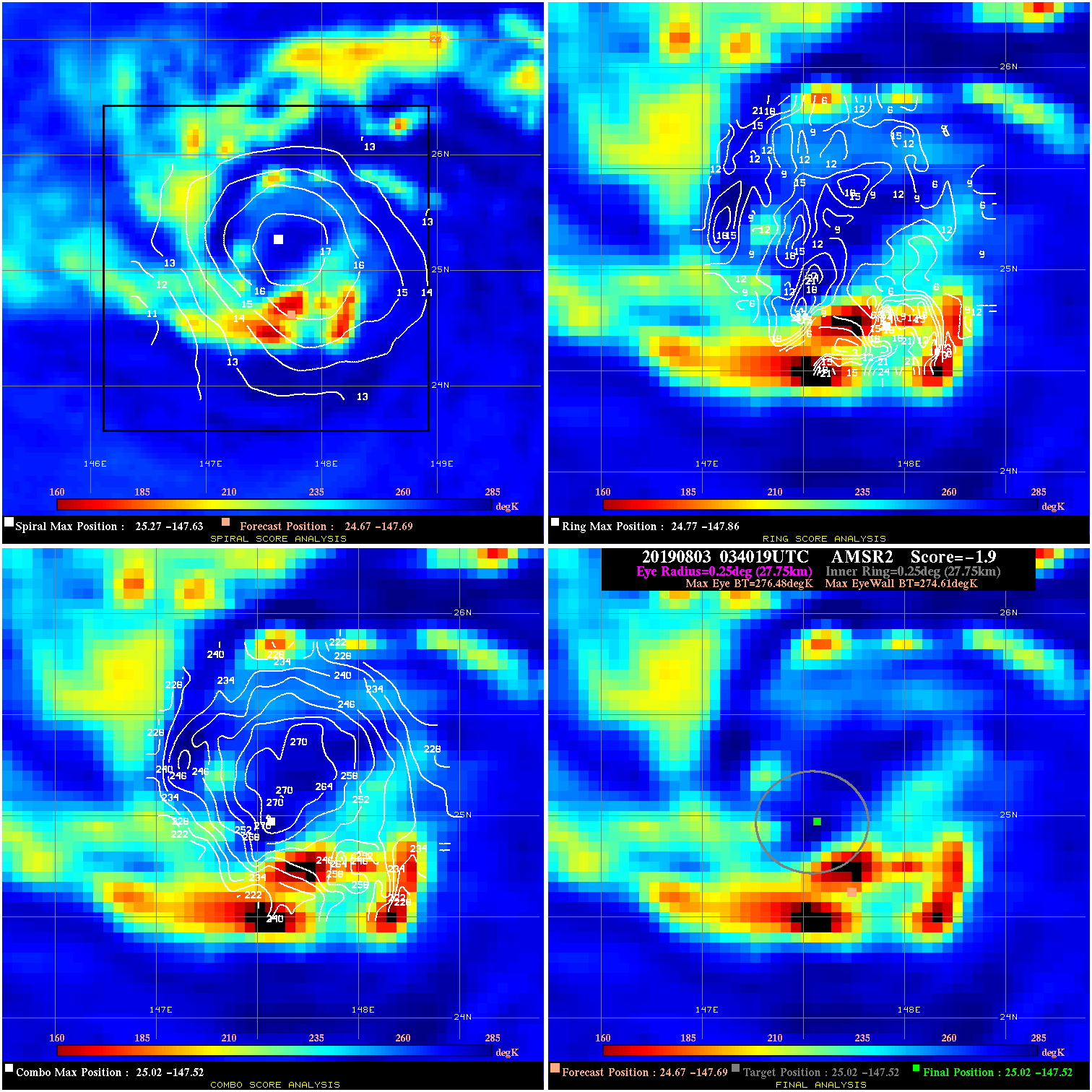
20190803 034019 -1.9 N/A 23.3% 55.55 1.87 40.0 AMSR2 24.7 -147.7 25.0 -147.5 25.0 -147.5 Analysis Plot
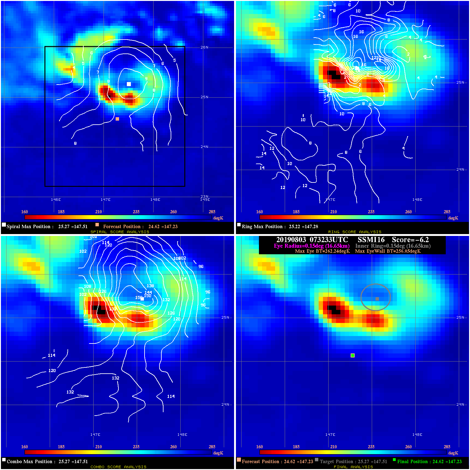
20190803 073233 -6.2 N/A 39.7% 33.33 6.19 40.0 SSMI16 24.6 -147.2 24.6 -147.2 25.3 -147.5 Analysis Plot
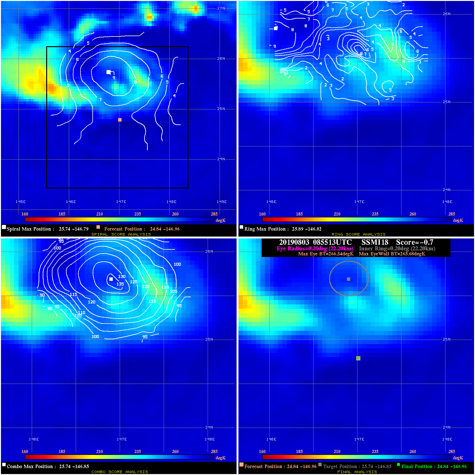
20190803 085513 -0.7 N/A N/A 44.44 .66 40.0 SSMI18 24.8 -147.0 24.8 -147.0 25.7 -146.9 Analysis Plot
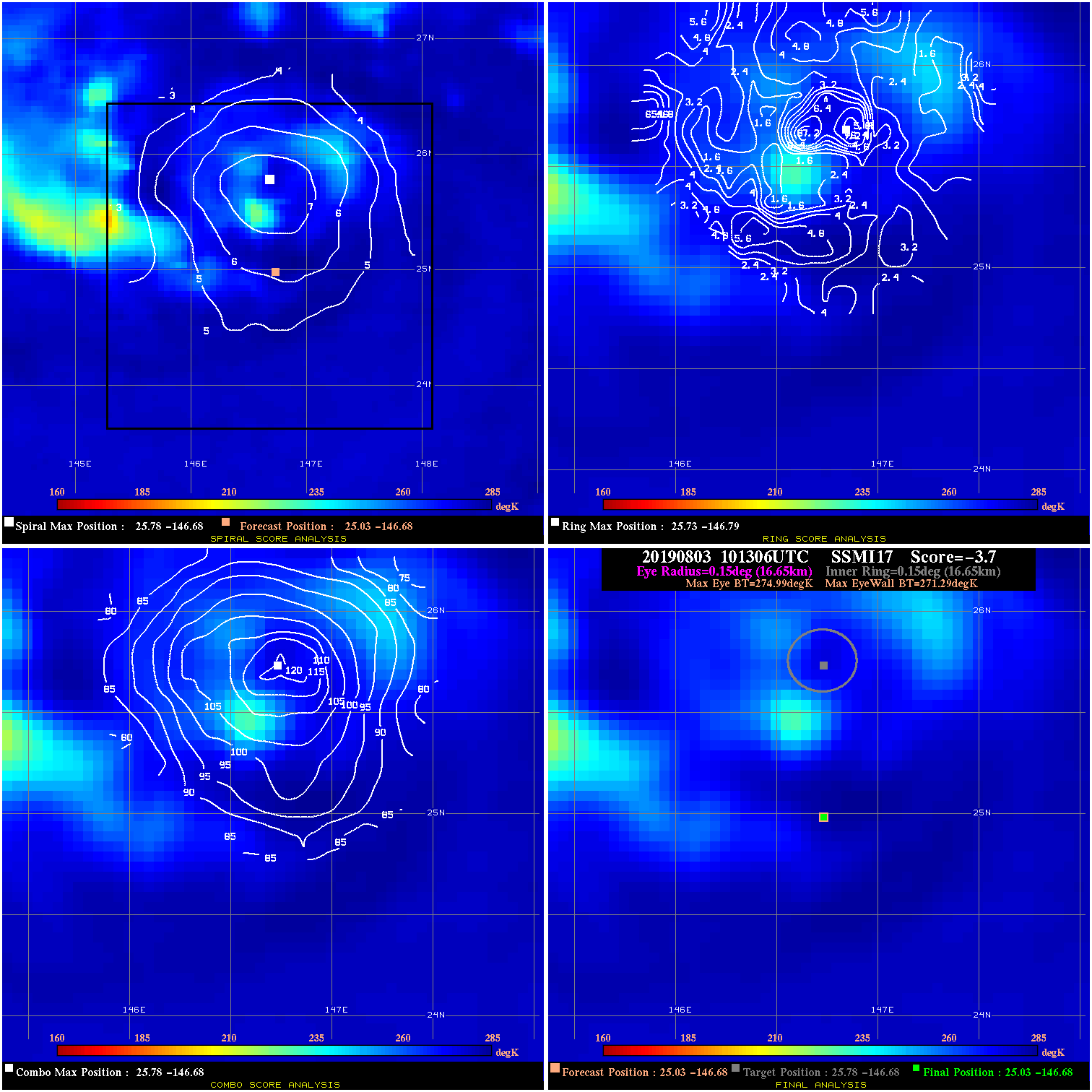
20190803 101306 -3.7 N/A N/A 33.33 3.70 40.0 SSMI17 25.0 -146.7 25.0 -146.7 25.8 -146.7 Analysis Plot
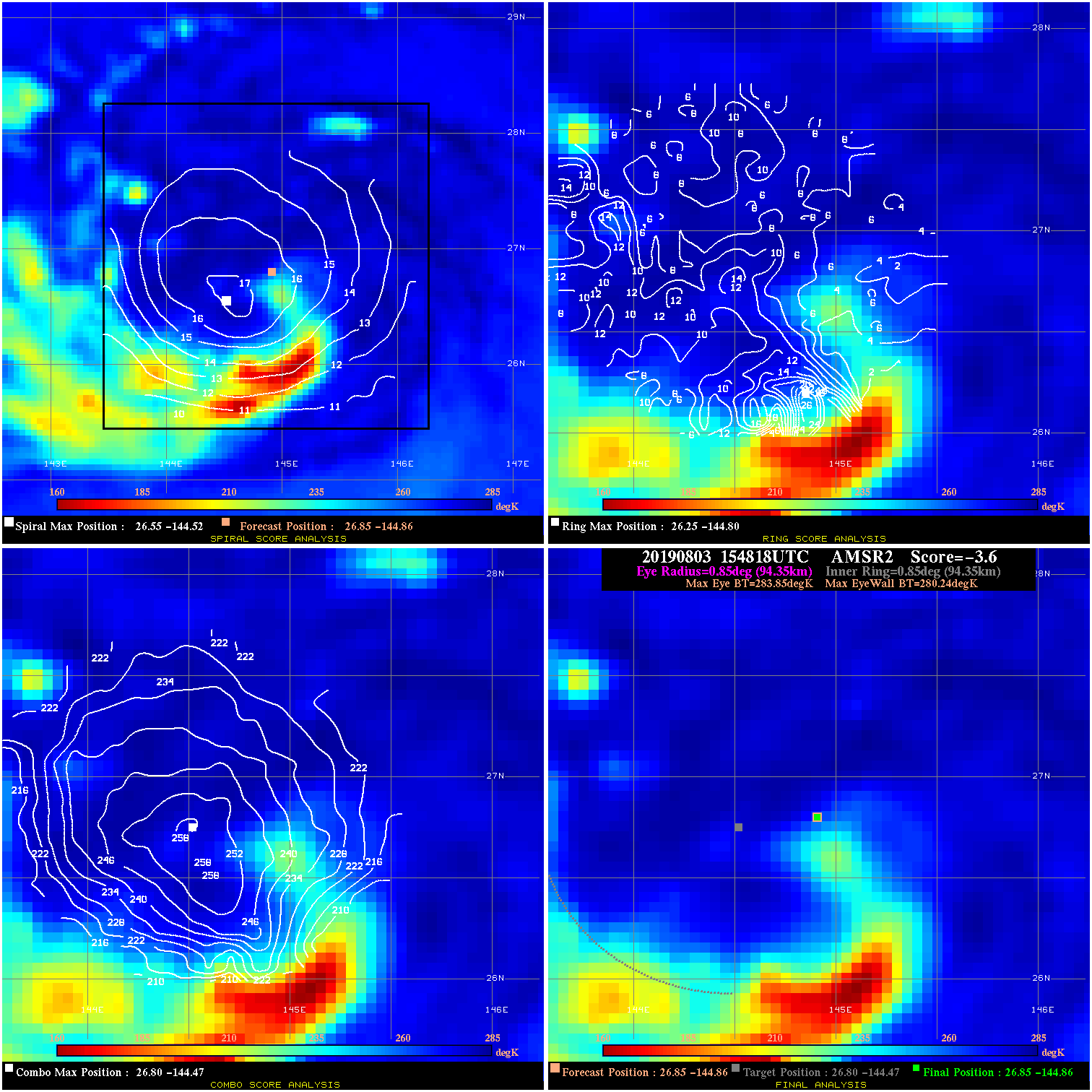
20190803 154818 -3.6 N/A 30.1% 188.87 3.61 45.0 AMSR2 26.9 -144.9 26.9 -144.9 26.8 -144.5 Analysis Plot
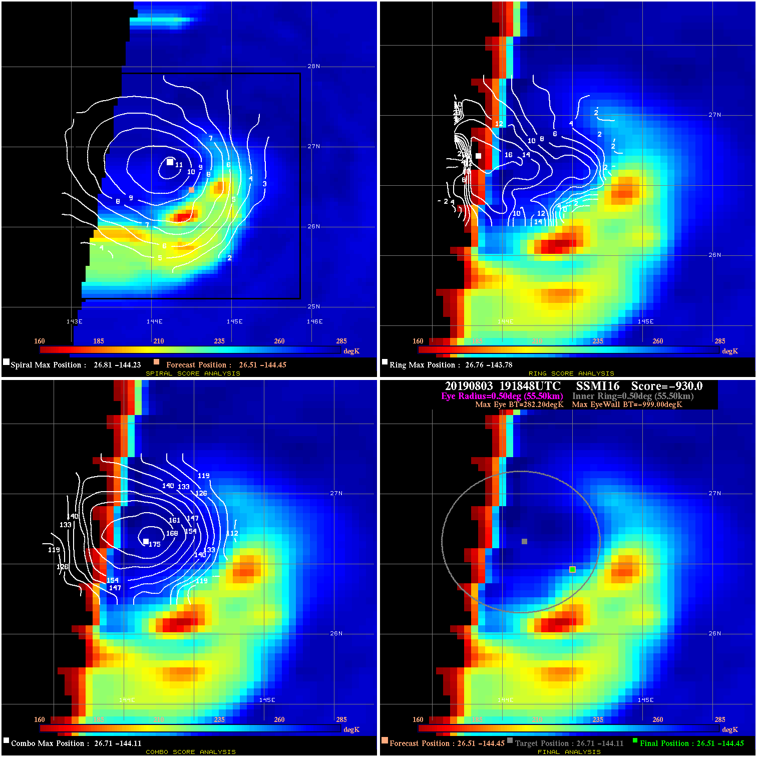
20190803 191848 -930.0 N/A N/A N/A 0.00 50.0 SSMI16 26.5 -144.4 26.5 -144.4 26.7 -144.1 Analysis Plot
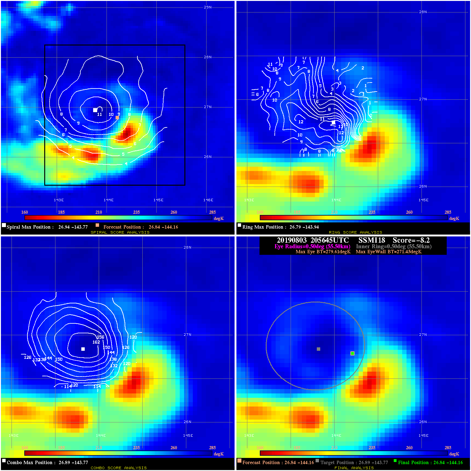
20190803 205645 -8.2 N/A 13.7% 111.10 8.16 50.0 SSMI18 26.8 -144.2 26.8 -144.2 26.9 -143.8 Analysis Plot
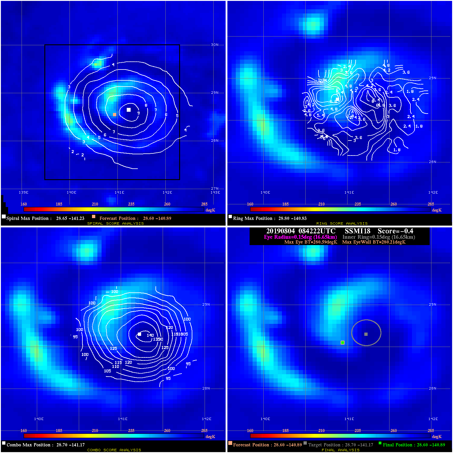
20190804 084222 -0.4 N/A N/A 33.33 .38 50.0 SSMI18 28.6 -140.9 28.6 -140.9 28.7 -141.2 Analysis Plot
20190804 095834 -1.1 N/A 8.2% 66.66 1.07 50.0 SSMI17 28.8 -140.5 28.8 -140.5 29.0 -141.0 Analysis Plot
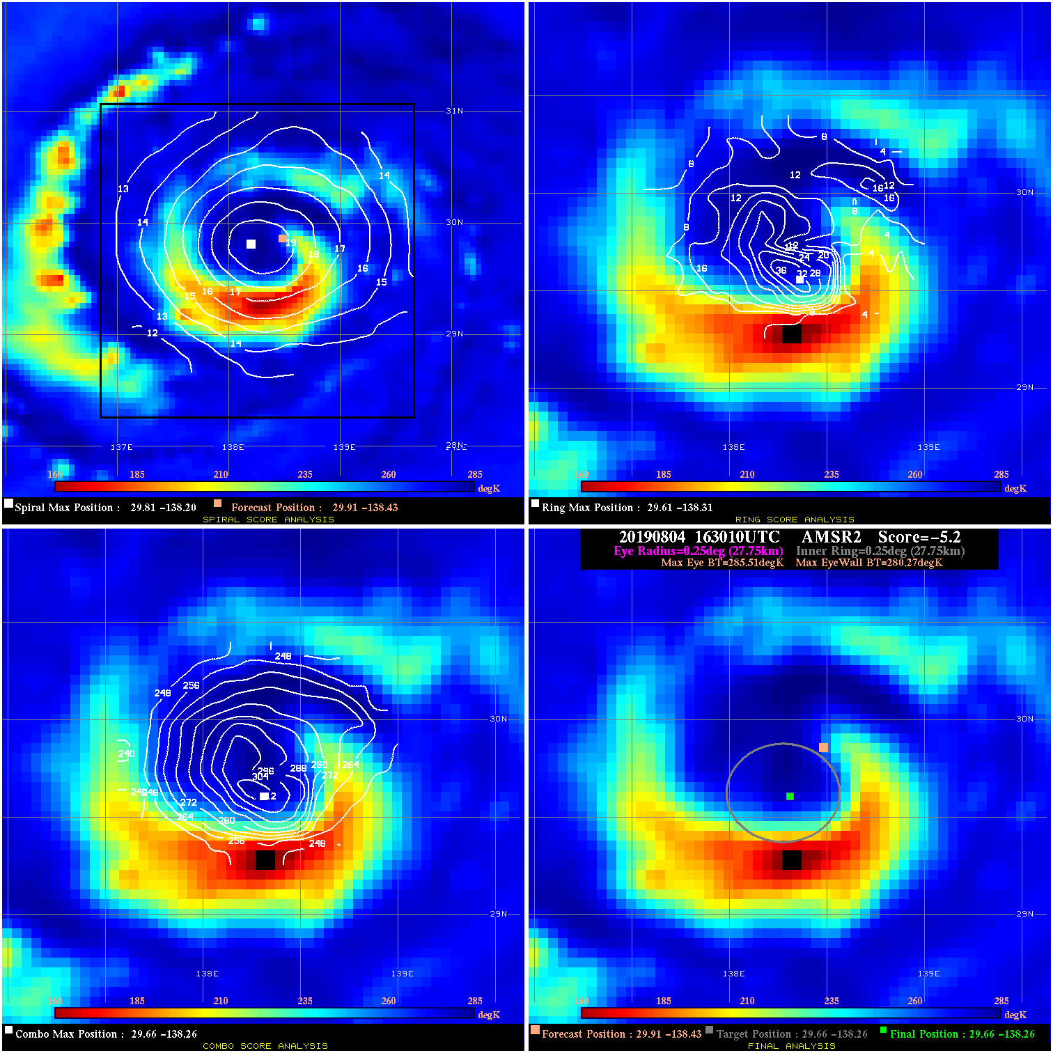
20190804 163010 -5.2 N/A 53.4% 55.55 5.24 50.0 AMSR2 29.9 -138.4 29.7 -138.3 29.7 -138.3 Analysis Plot
20190804 204714 8.1 N/A N/A 55.55 8.06 55.0 SSMI16 29.9 -137.7 29.9 -137.7 30.1 -137.4 Analysis Plot
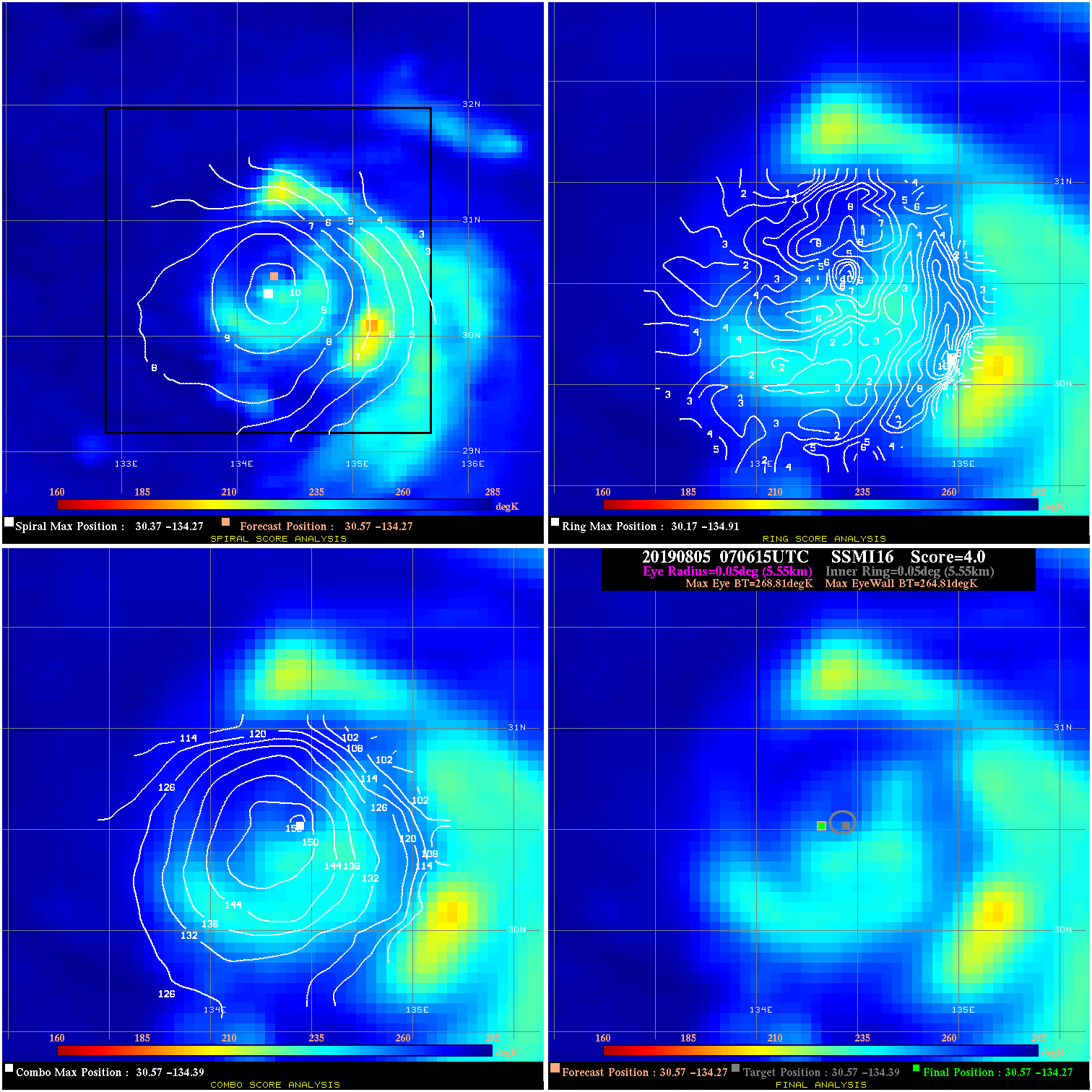
20190805 070615 4.0 N/A 8.2% 11.11 4.00 65.0 SSMI16 30.6 -134.3 30.6 -134.3 30.6 -134.4 Analysis Plot
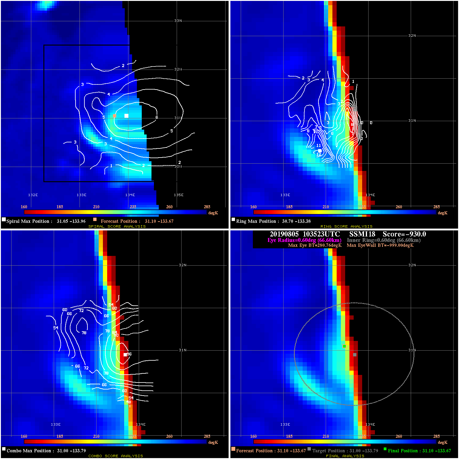
20190805 103523 -930.0 N/A N/A N/A 0.00 65.0 SSMI18 31.1 -133.7 31.1 -133.7 31.0 -133.8 Analysis Plot
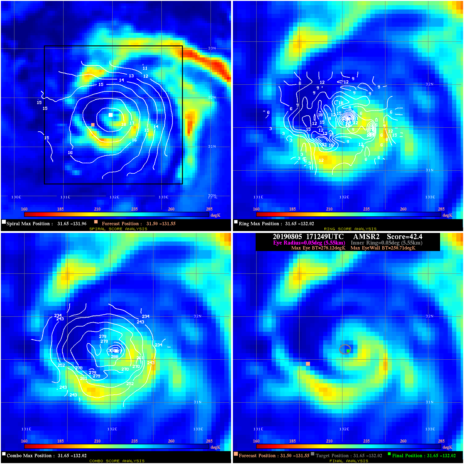
20190805 171249 42.4 >65 kts 100.0% 11.11 27.41 70.0 AMSR2 31.5 -131.6 31.6 -132.0 31.6 -132.0 Analysis Plot
20190805 195621 36.8 >65 kts 100.0% 11.11 21.79 70.0 SSMI15 31.7 -131.3 32.0 -131.7 32.0 -131.7 Analysis Plot
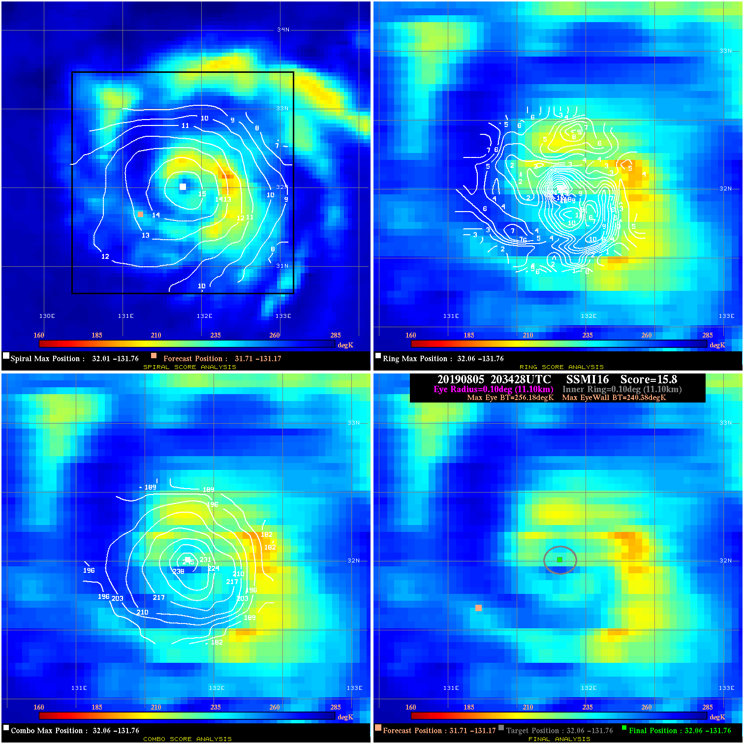
20190805 203428 15.8 N/A 84.9% 22.22 15.80 70.0 SSMI16 31.7 -131.2 32.1 -131.8 32.1 -131.8 Analysis Plot
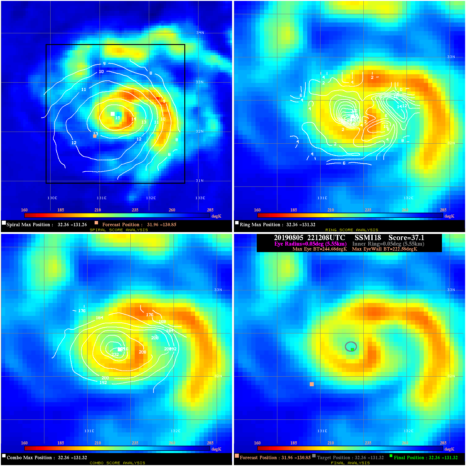
20190805 221208 37.1 >65 kts 100.0% 11.11 22.10 70.0 SSMI18 32.0 -130.9 32.4 -131.3 32.4 -131.3 Analysis Plot
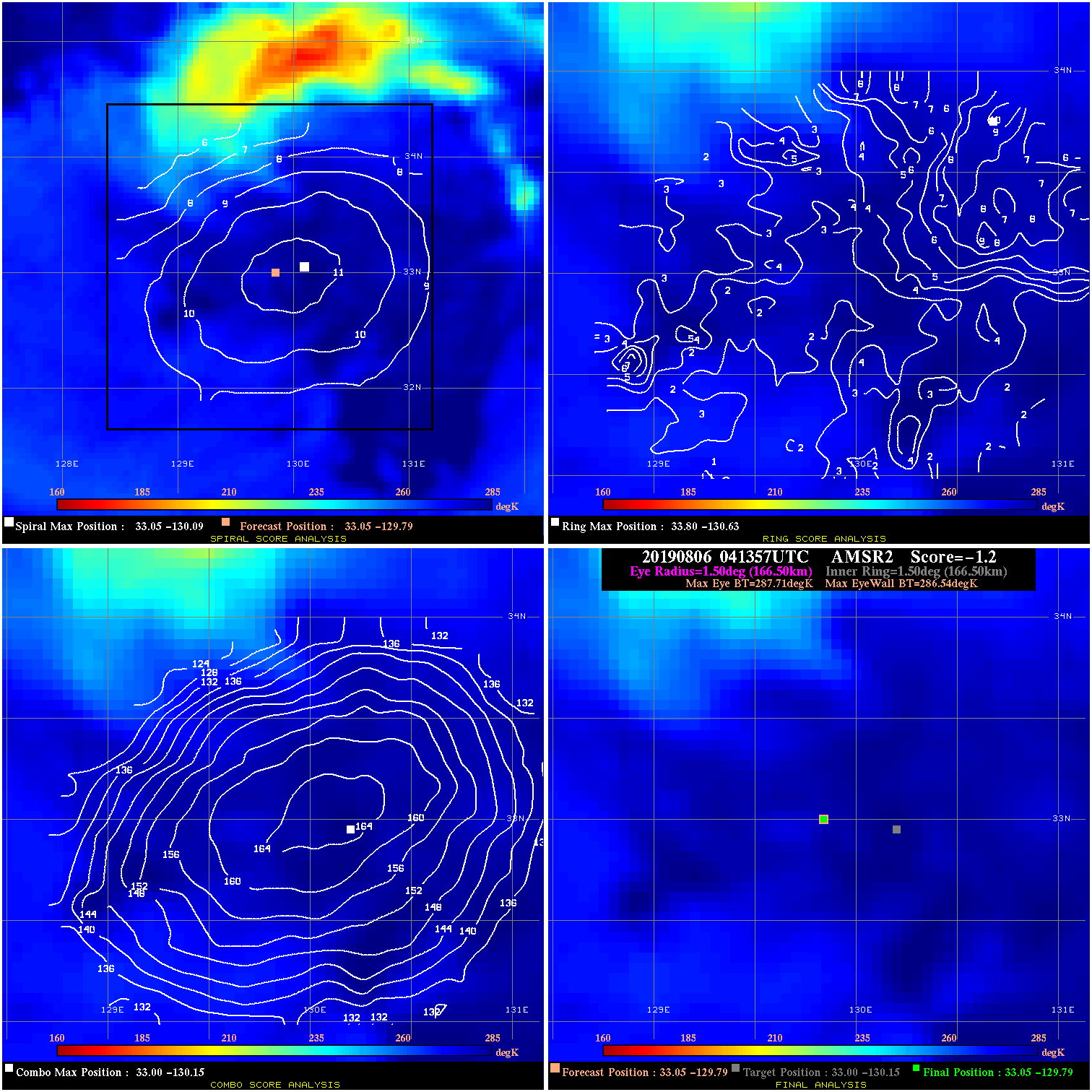
20190806 041357 -1.2 N/A 9.5% 333.30 1.17 45.0 AMSR2 33.0 -129.8 33.0 -129.8 33.0 -130.1 Analysis Plot
20190806 065406 -1.0 N/A N/A 299.97 1.04 45.0 SSMI16 33.6 -129.5 33.6 -129.5 33.2 -129.9 Analysis Plot
20190806 102247 N/A N/A N/A N/A N/A 45.0 SSMI18 34.5 -129.4 34.5 -129.4 34.0 -129.5 Analysis Plot
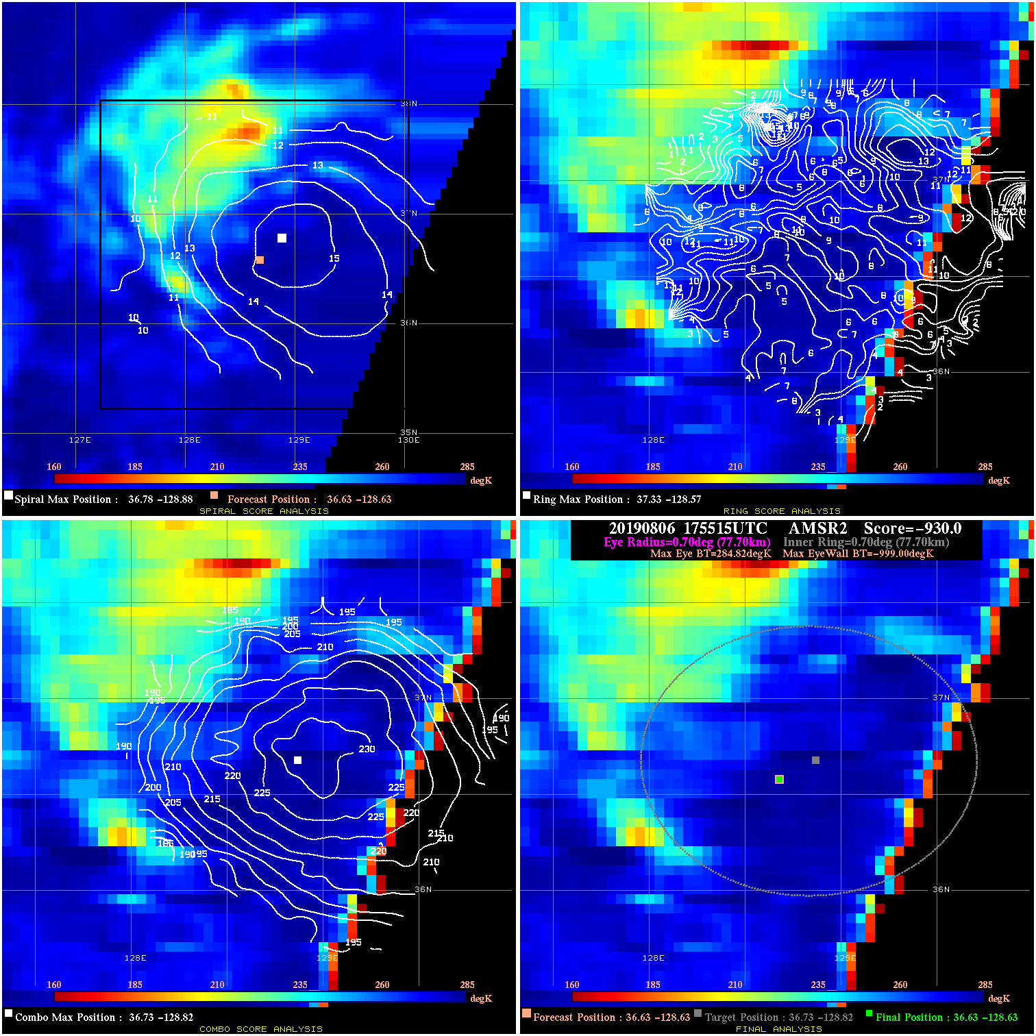
20190806 175515 -930.0 N/A N/A N/A 0.00 35.0 AMSR2 36.6 -128.6 36.6 -128.6 36.7 -128.8 Analysis Plot
20190806 231439 -930.0 N/A N/A N/A 0.00 35.0 SSMI17 37.6 -129.0 37.6 -129.0 36.9 -129.0 Analysis Plot
|
|
Legend: - Date/Time are determined from PMW imagery at Forecast (initial guess) Lat/Lon position. - Positive/Negative Latitude = North/South Hemisphere; Longitude = Western/Eastern Hemisphere. - "Ring Diam" value indicates the estimated surface eyewall diameter in km (the MI eyewall edge diameter minus 10 km). - "Ring Pct" is the percentage of the "ring" (eyewall inner boundary) that is 1) colder than the "hot spot" (warmest eye pixel) in the eye by 20K, or 2) the percentage that is a) colder than 232K and b) colder than the "hot spot" by 10K, whichever is greater. - Values are red if Ring % <= 65, yellow/brown if Ring % <= 85 and green if Ring % > 85. - "Tb diff" is the difference between the "hot spot" (warmest eye pixel) and the warmest pixel on the eyewall. - Intensity score are listed as negative, and not used, when the JTWC or NHC estimated Vmax is <55 kts in order to rule out weak but highly symmetric TCs. - Error messages in intensity scores: -920 is used when the hottest pixel in the eye is <200K, to prevent false positives; -930 means <85% of eyewall has observations/data. |