Tropical Storm 31Y_05
|
Passive Microwave (PMW) Intensity Information Hurricane Intensity Estimation (HIE) Algorithm Version 9.0 |
Overpass Inten Ring Ring Wind Forecast Final Target
Date Time Score Meaning Pct Diam BTdiff Est Sat Lat Lon Lat Lon Lat Lon
20191111 183923 -5.5 N/A N/A 88.88 5.53 30.0 SSMI15 12.4 -131.4 12.4 -131.4 12.1 -132.0 Analysis Plot
20191111 215442 -930.0 N/A N/A N/A 0.00 30.0 SSMI18 12.4 -131.3 12.4 -131.3 12.1 -131.1 Analysis Plot
20191112 073039 -930.0 N/A N/A N/A 0.00 30.0 SSMI16 12.2 -130.0 12.2 -130.0 11.9 -131.1 Analysis Plot
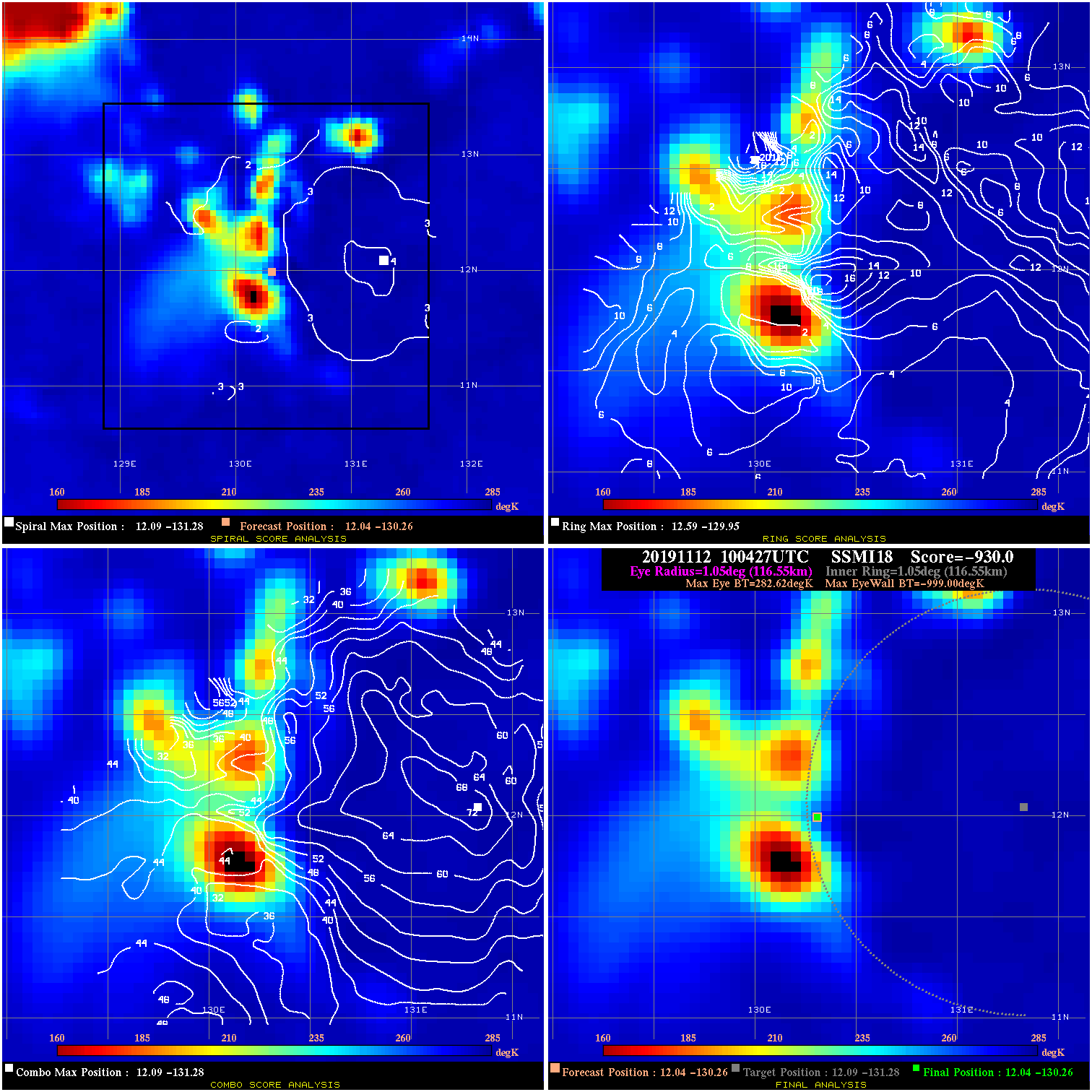
20191112 100427 -930.0 N/A N/A N/A 0.00 30.0 SSMI18 12.0 -130.3 12.0 -130.3 12.1 -131.3 Analysis Plot
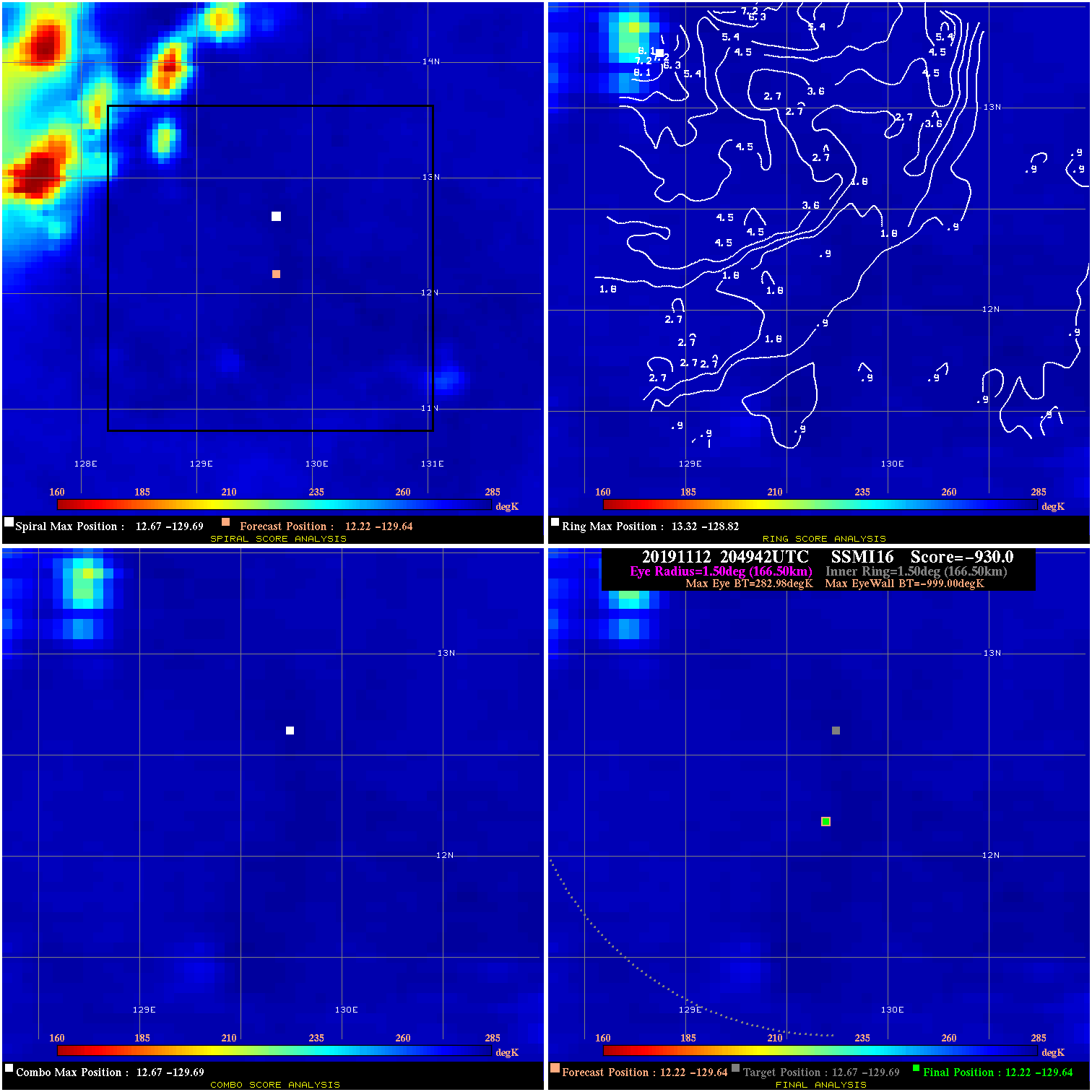
20191112 204942 -930.0 N/A N/A N/A 0.00 30.0 SSMI16 12.2 -129.6 12.2 -129.6 12.7 -129.7 Analysis Plot
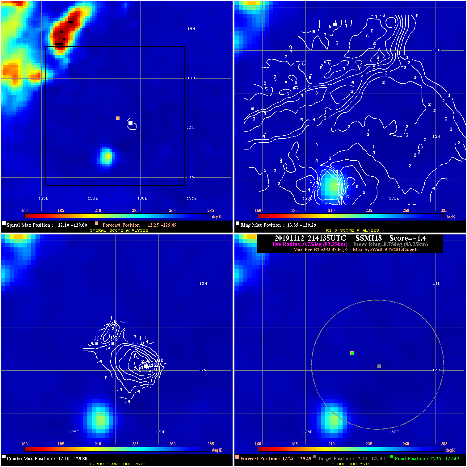
20191112 214135 -1.4 N/A N/A 166.65 1.45 30.0 SSMI18 12.3 -129.5 12.3 -129.5 12.1 -129.8 Analysis Plot
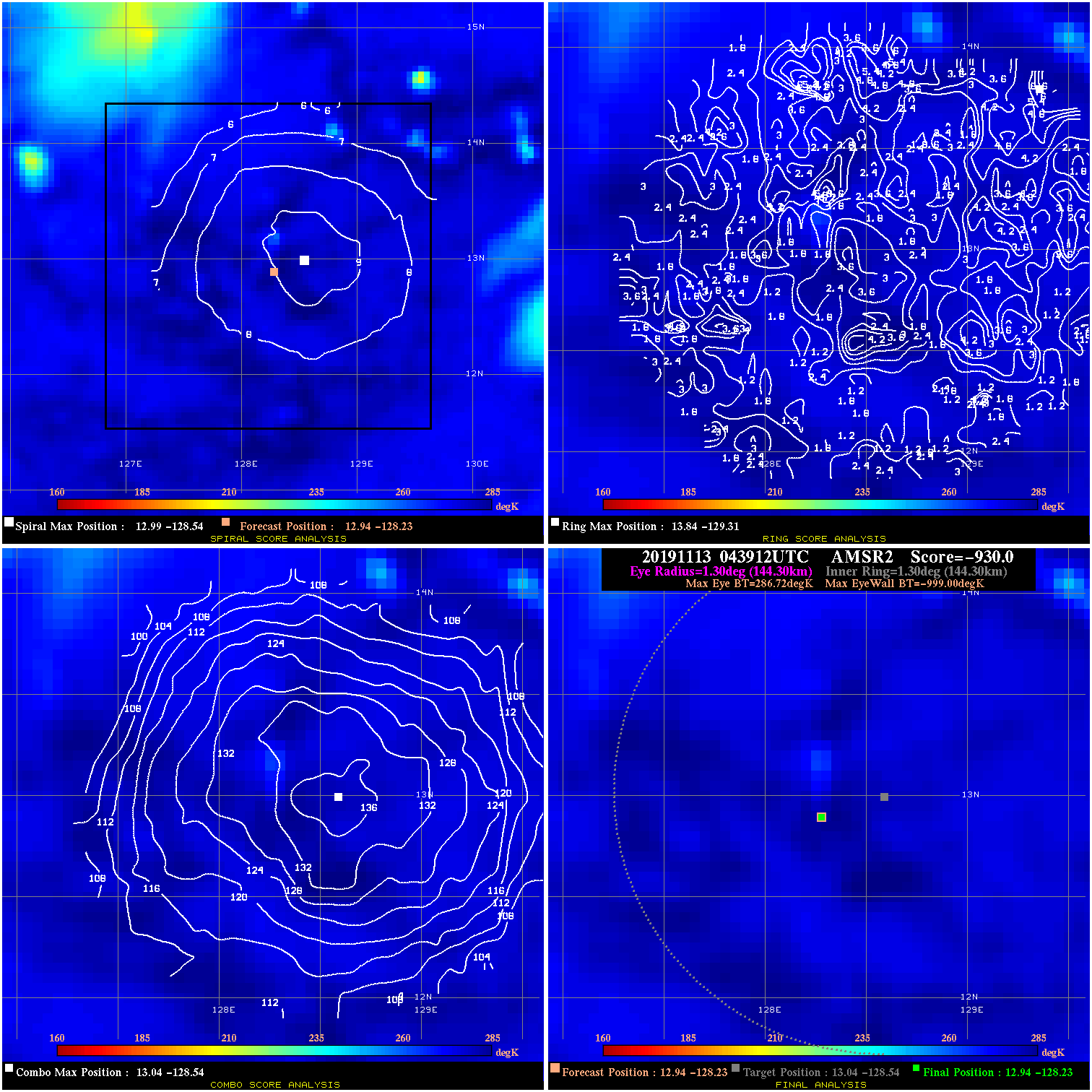
20191113 043912 -930.0 N/A N/A N/A 0.00 35.0 AMSR2 12.9 -128.2 12.9 -128.2 13.0 -128.5 Analysis Plot
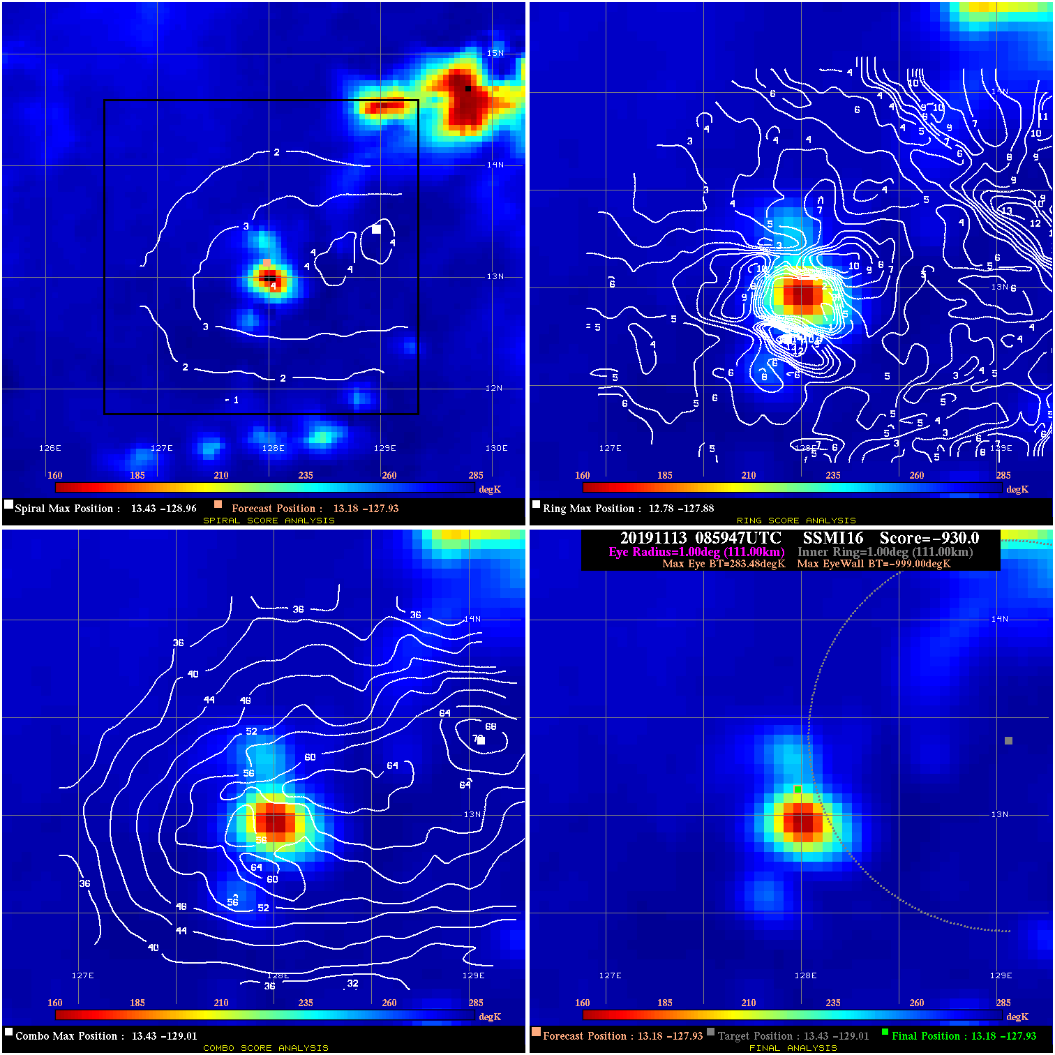
20191113 085947 -930.0 N/A N/A N/A 0.00 35.0 SSMI16 13.2 -127.9 13.2 -127.9 13.4 -129.0 Analysis Plot
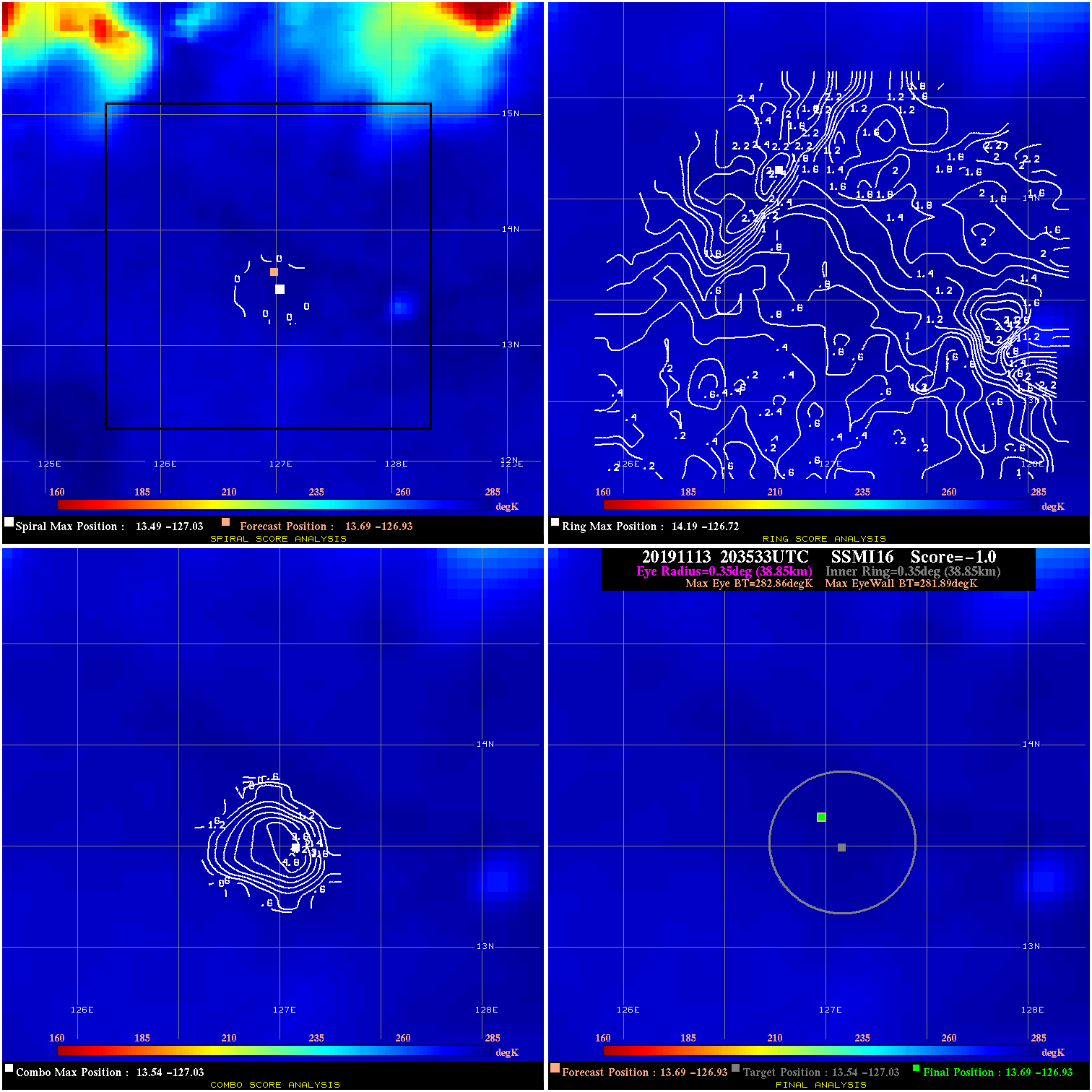
20191113 203533 -1.0 N/A N/A 77.77 .97 35.0 SSMI16 13.7 -126.9 13.7 -126.9 13.5 -127.0 Analysis Plot
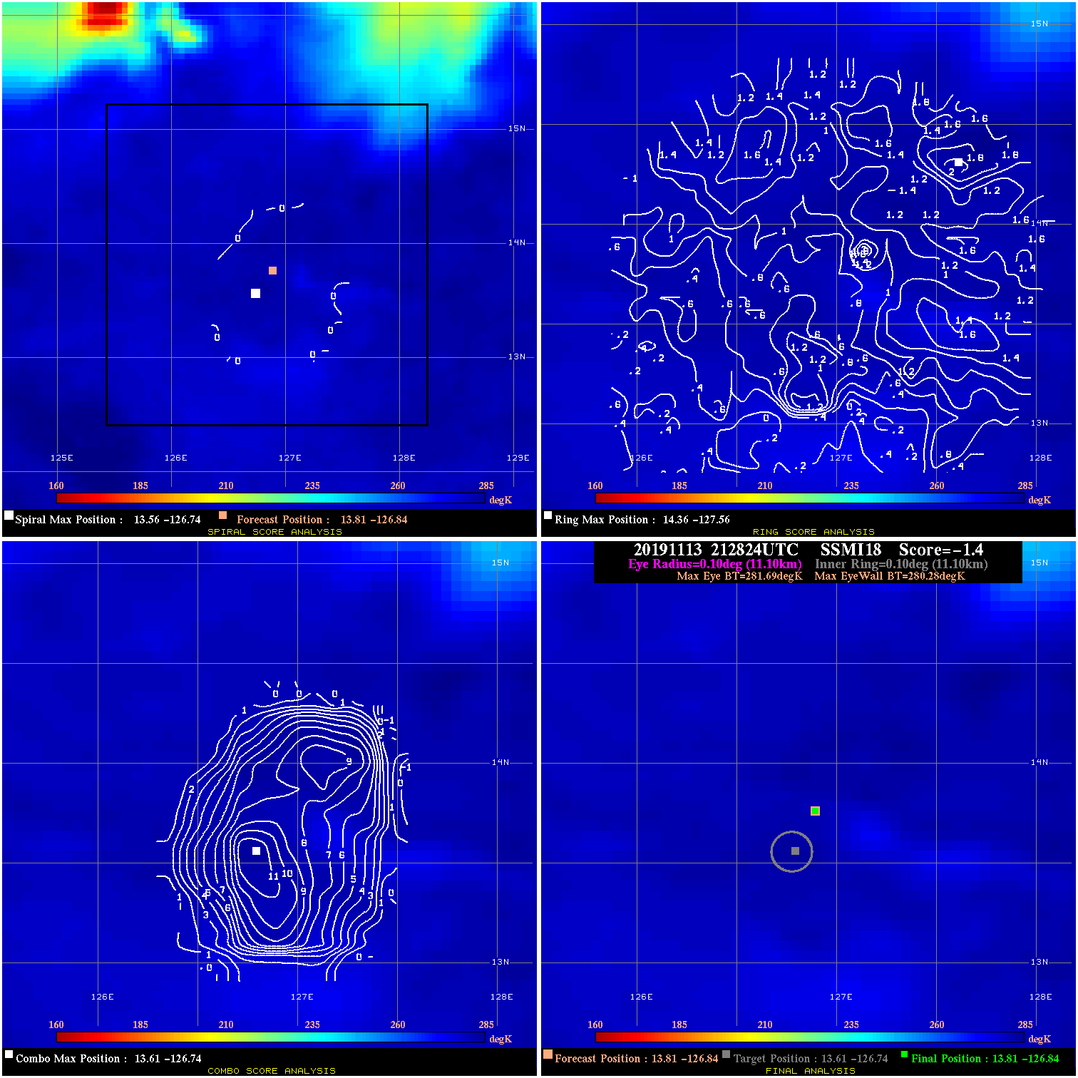
20191113 212824 -1.4 N/A N/A 22.22 1.41 35.0 SSMI18 13.8 -126.8 13.8 -126.8 13.6 -126.7 Analysis Plot
20191114 052323 -2.1 N/A 54.8% 22.22 2.08 35.0 AMSR2 15.3 -126.3 15.3 -126.3 15.5 -126.5 Analysis Plot
20191114 195646 -1.7 N/A 27.4% 77.77 1.65 40.0 SSMI16 17.1 -126.4 17.1 -126.4 17.6 -126.7 Analysis Plot
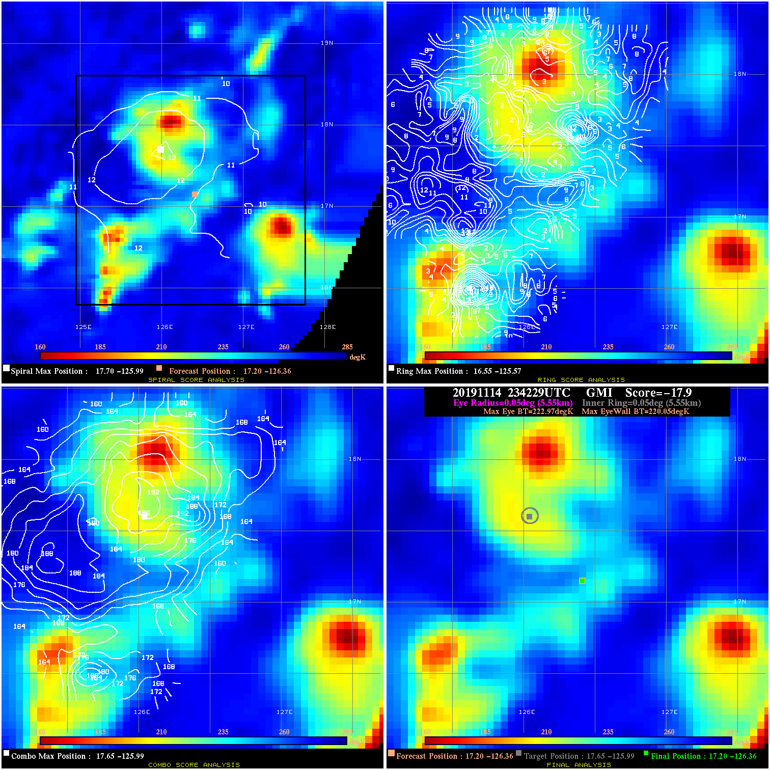
20191114 234229 -17.9 N/A 100.0% 11.11 2.92 40.0 GMI 17.2 -126.4 17.2 -126.4 17.6 -126.0 Analysis Plot
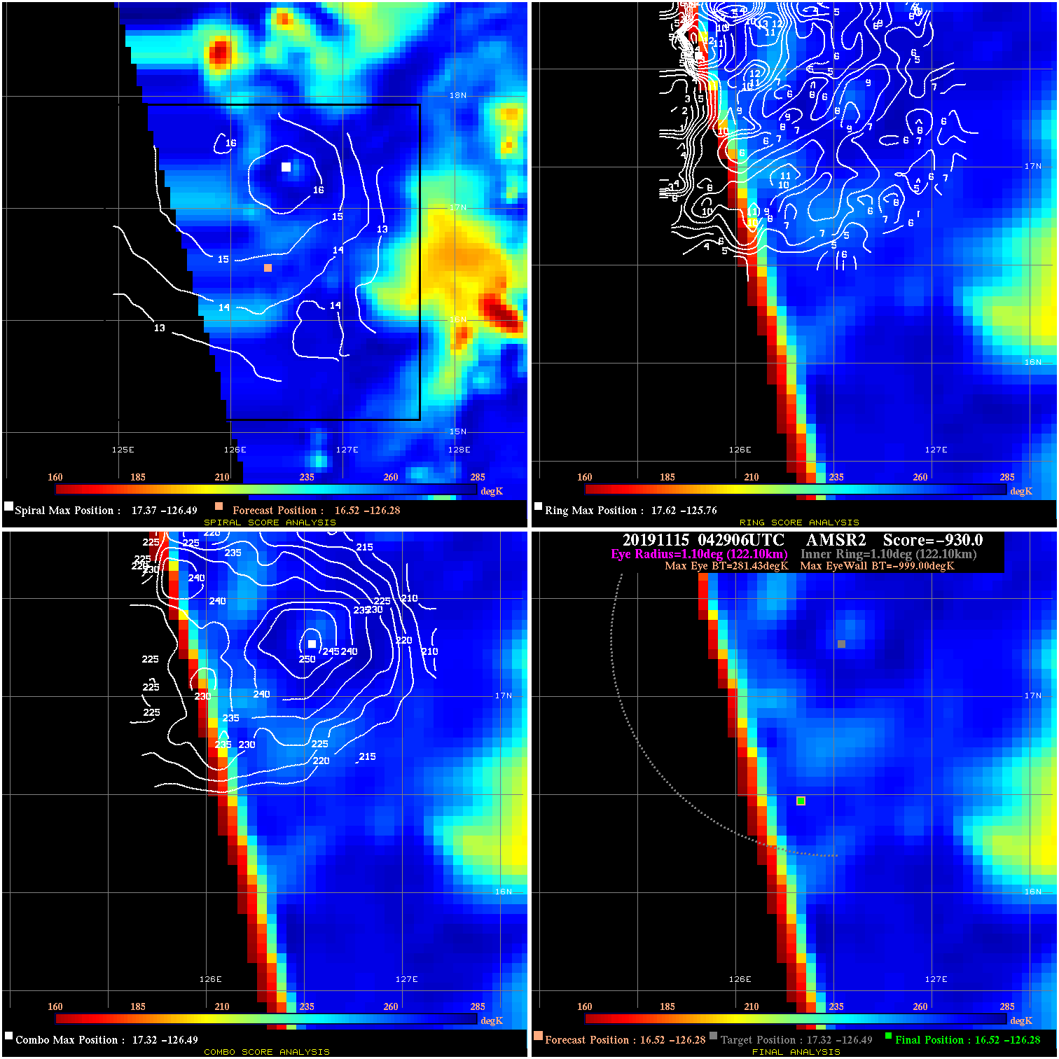
20191115 042906 -930.0 N/A N/A N/A 0.00 40.0 AMSR2 16.5 -126.3 16.5 -126.3 17.3 -126.5 Analysis Plot
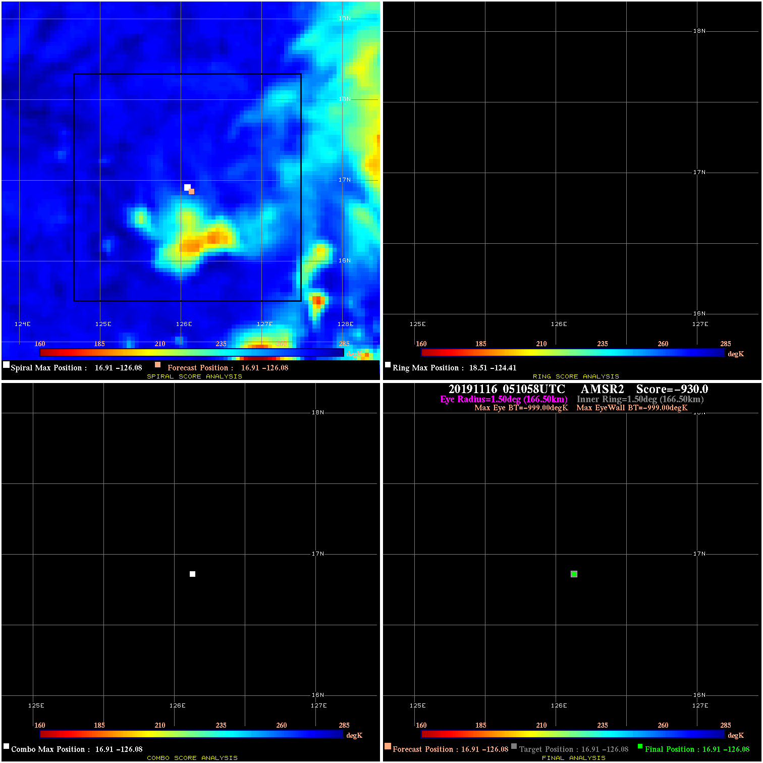
20191116 051058 N/A N/A N/A N/A N/A 40.0 AMSR2 16.9 -126.1 16.9 -126.1 16.9 -126.1 Analysis Plot
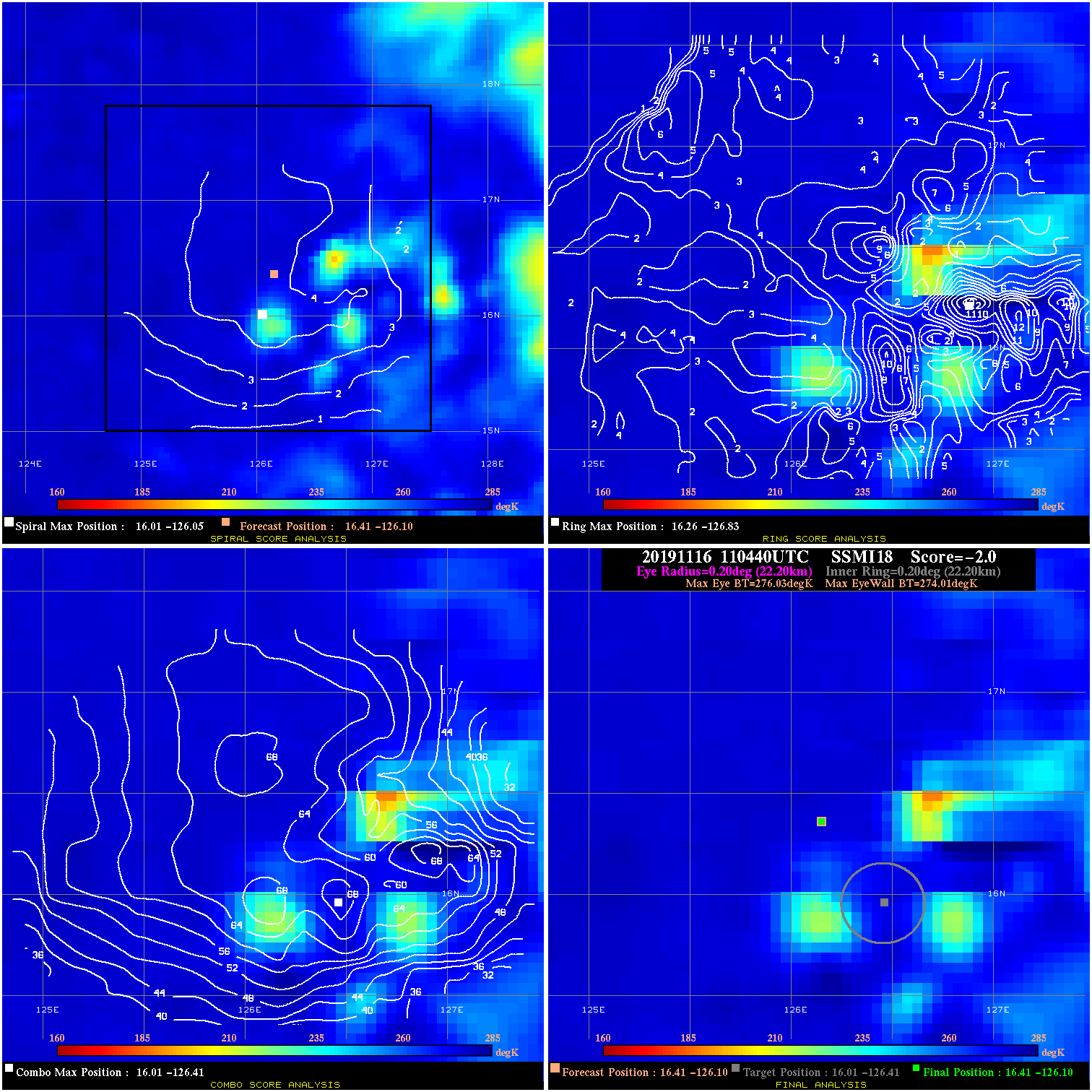
20191116 110440 -2.0 N/A 16.4% 44.44 2.02 35.0 SSMI18 16.4 -126.1 16.4 -126.1 16.0 -126.4 Analysis Plot
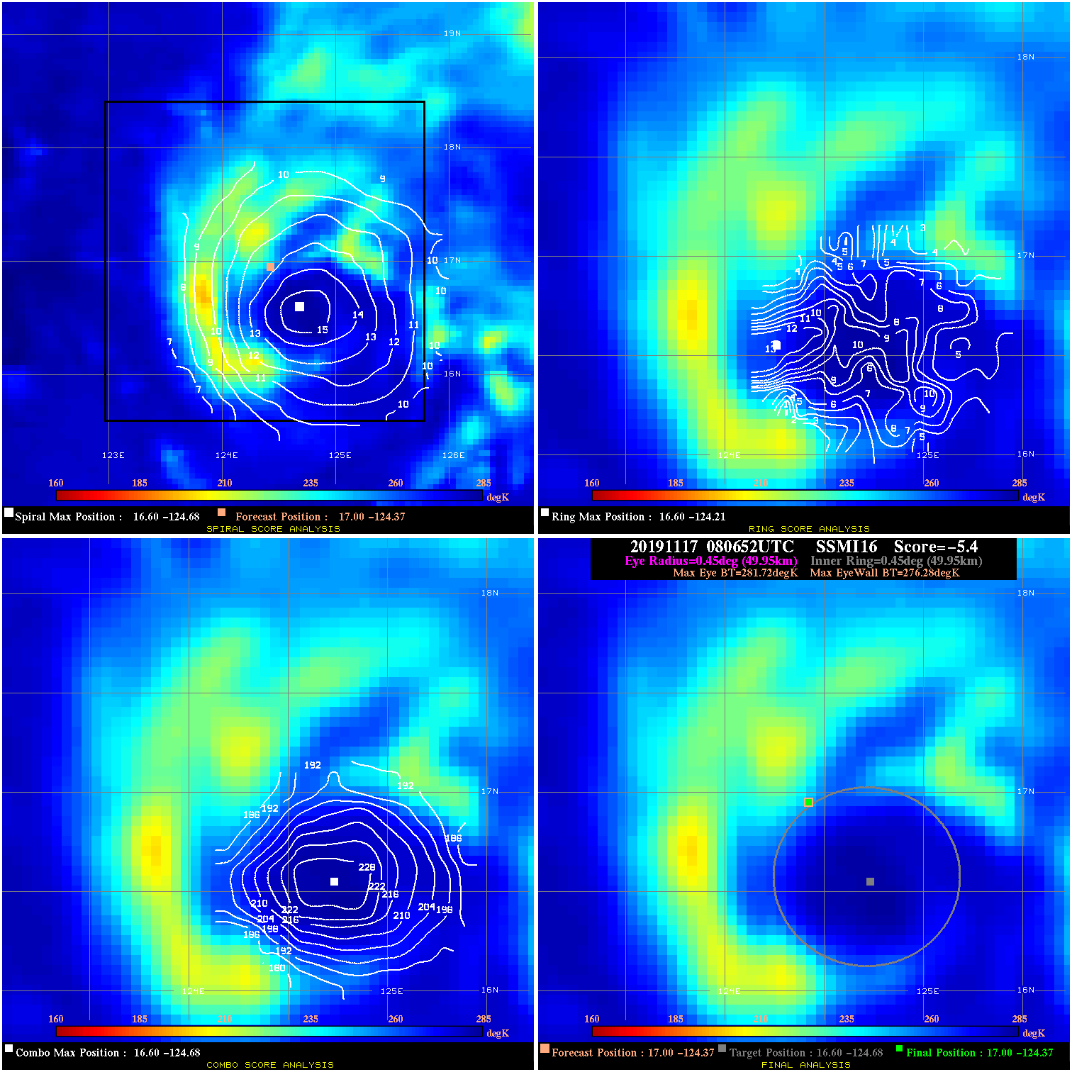
20191117 080652 -5.4 N/A 5.5% 99.99 5.44 40.0 SSMI16 17.0 -124.4 17.0 -124.4 16.6 -124.7 Analysis Plot
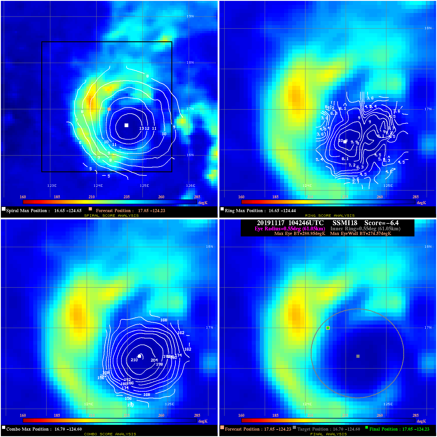
20191117 104246 -6.4 N/A 46.6% 122.21 6.38 40.0 SSMI18 17.0 -124.2 17.0 -124.2 16.7 -124.6 Analysis Plot
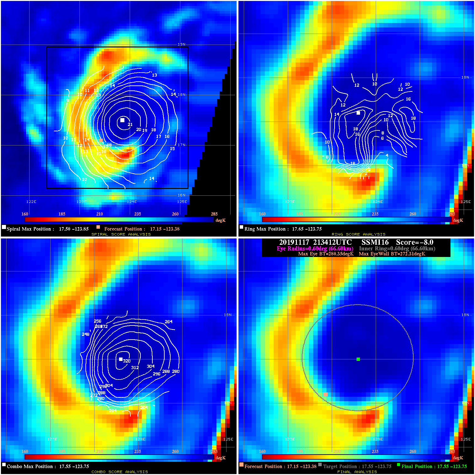
20191117 213412 -8.0 N/A 52.1% 133.32 8.04 40.0 SSMI16 17.1 -123.4 17.5 -123.8 17.5 -123.8 Analysis Plot
20191117 222030 -9.9 N/A 47.9% 155.54 9.86 40.0 SSMI18 17.2 -123.3 17.7 -123.8 17.7 -123.8 Analysis Plot
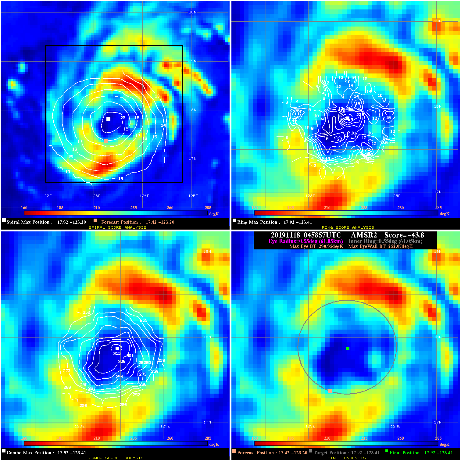
20191118 045857 -43.8 N/A 100.0% 122.21 28.78 45.0 AMSR2 17.4 -123.2 17.9 -123.4 17.9 -123.4 Analysis Plot
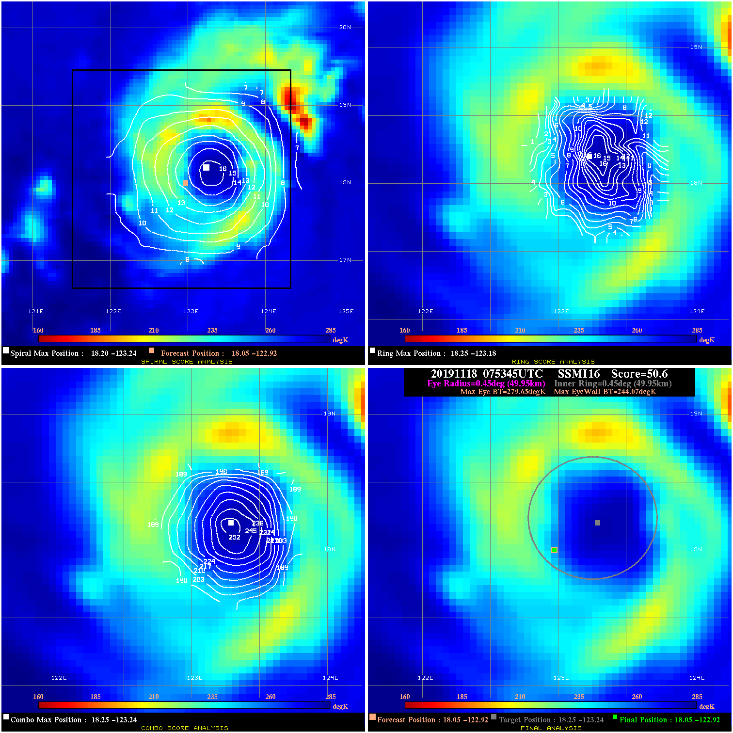
20191118 075345 50.6 >65 kts 100.0% 99.99 35.58 55.0 SSMI16 18.0 -122.9 18.0 -122.9 18.3 -123.2 Analysis Plot
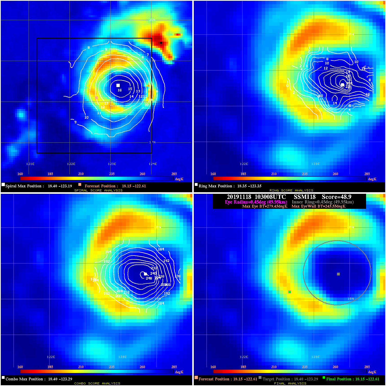
20191118 103008 48.9 >65 kts 100.0% 99.99 33.90 55.0 SSMI18 18.1 -122.6 18.1 -122.6 18.4 -123.3 Analysis Plot
20191118 171107 17.1 N/A 50.7% 77.77 17.06 55.0 AMSR2 19.1 -122.3 19.1 -122.3 19.0 -122.7 Analysis Plot
20191118 211230 6.6 N/A 34.2% 66.66 6.60 55.0 SSMI16 19.1 -122.4 19.1 -122.4 19.2 -122.6 Analysis Plot
20191118 220657 12.4 N/A 32.9% 66.66 12.43 55.0 SSMI18 19.1 -122.3 19.1 -122.3 19.3 -122.6 Analysis Plot
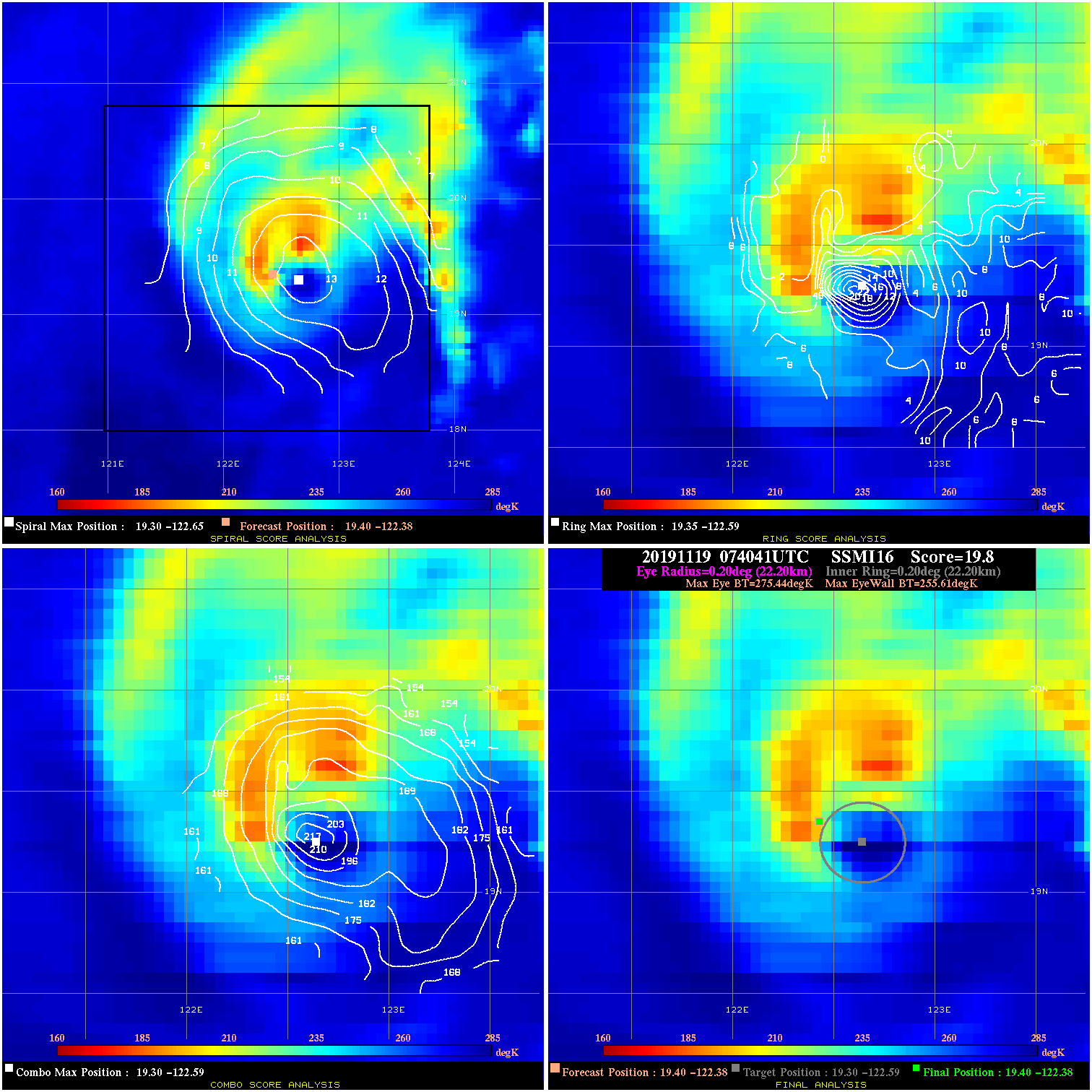
20191119 074041 19.8 N/A 49.3% 44.44 19.83 60.0 SSMI16 19.4 -122.4 19.4 -122.4 19.3 -122.6 Analysis Plot
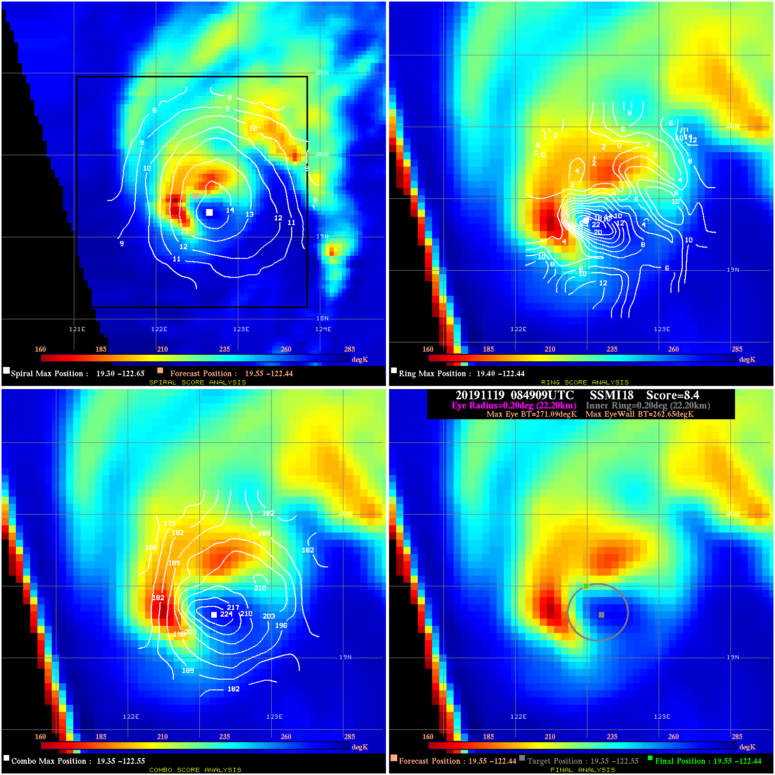
20191119 084909 8.4 N/A 61.6% 44.44 8.44 60.0 SSMI18 19.5 -122.4 19.5 -122.4 19.4 -122.6 Analysis Plot
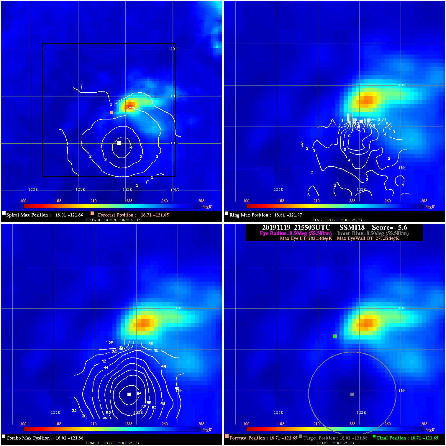
20191119 215503 -5.6 N/A N/A 111.10 5.62 45.0 SSMI18 18.7 -121.7 18.7 -121.7 18.0 -121.9 Analysis Plot
|
|
Legend: - Date/Time are determined from PMW imagery at Forecast (initial guess) Lat/Lon position. - Positive/Negative Latitude = North/South Hemisphere; Longitude = Western/Eastern Hemisphere. - "Ring Diam" value indicates the estimated surface eyewall diameter in km (the MI eyewall edge diameter minus 10 km). - "Ring Pct" is the percentage of the "ring" (eyewall inner boundary) that is 1) colder than the "hot spot" (warmest eye pixel) in the eye by 20K, or 2) the percentage that is a) colder than 232K and b) colder than the "hot spot" by 10K, whichever is greater. - Values are red if Ring % <= 65, yellow/brown if Ring % <= 85 and green if Ring % > 85. - "Tb diff" is the difference between the "hot spot" (warmest eye pixel) and the warmest pixel on the eyewall. - Intensity score are listed as negative, and not used, when the JTWC or NHC estimated Vmax is <55 kts in order to rule out weak but highly symmetric TCs. - Error messages in intensity scores: -920 is used when the hottest pixel in the eye is <200K, to prevent false positives; -930 means <85% of eyewall has observations/data. |