Tropical Depression 07U
|
Passive Microwave (PMW) Intensity Information Hurricane Intensity Estimation (HIE) Algorithm Version 9.0 |
Overpass Inten Ring Ring Wind Forecast Final Target
Date Time Score Meaning Pct Diam BTdiff Est Sat Lat Lon Lat Lon Lat Lon
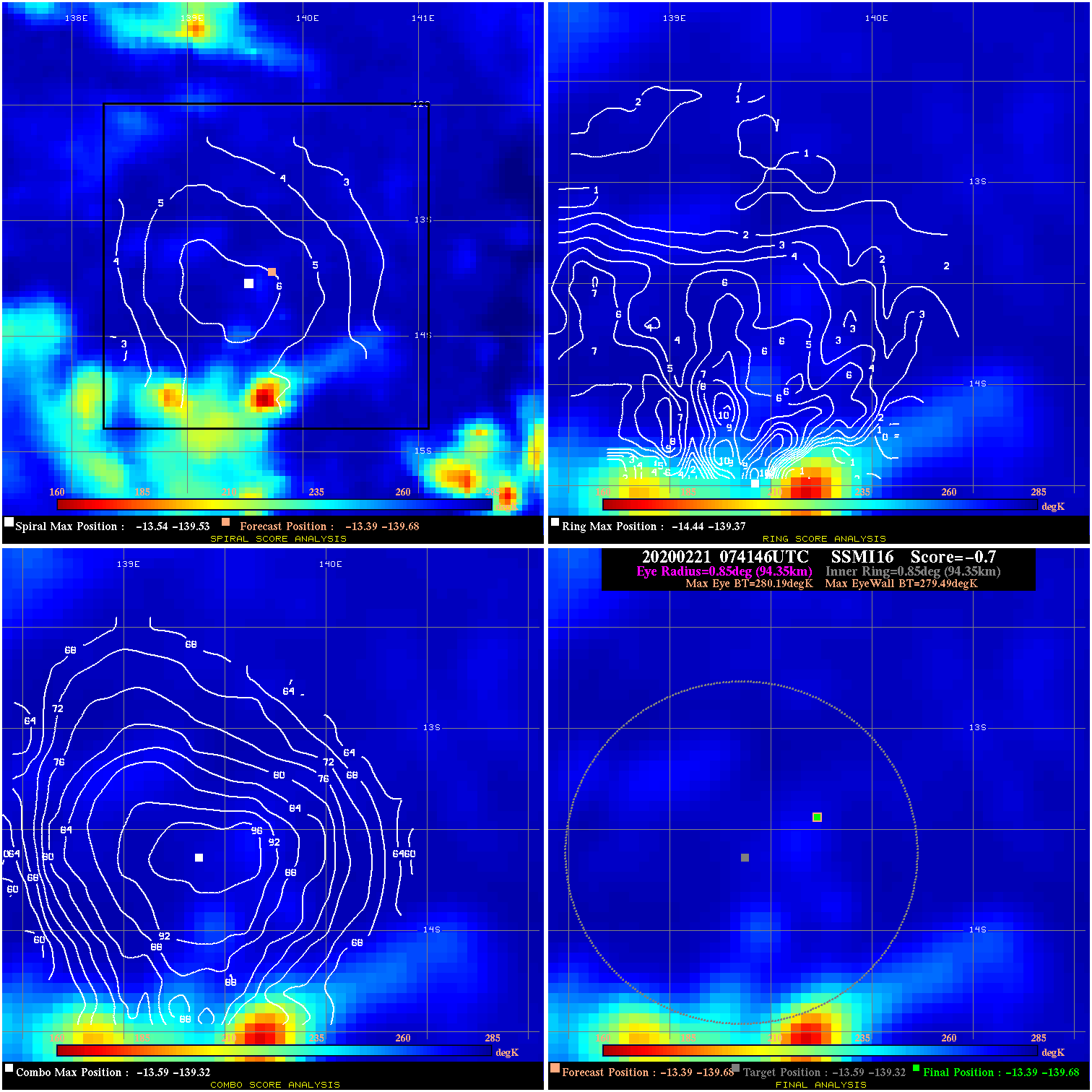
20200221 074146 -0.7 N/A 17.8% 188.87 .70 20.0 SSMI16 -13.4 -139.7 -13.4 -139.7 -13.6 -139.3 Analysis Plot
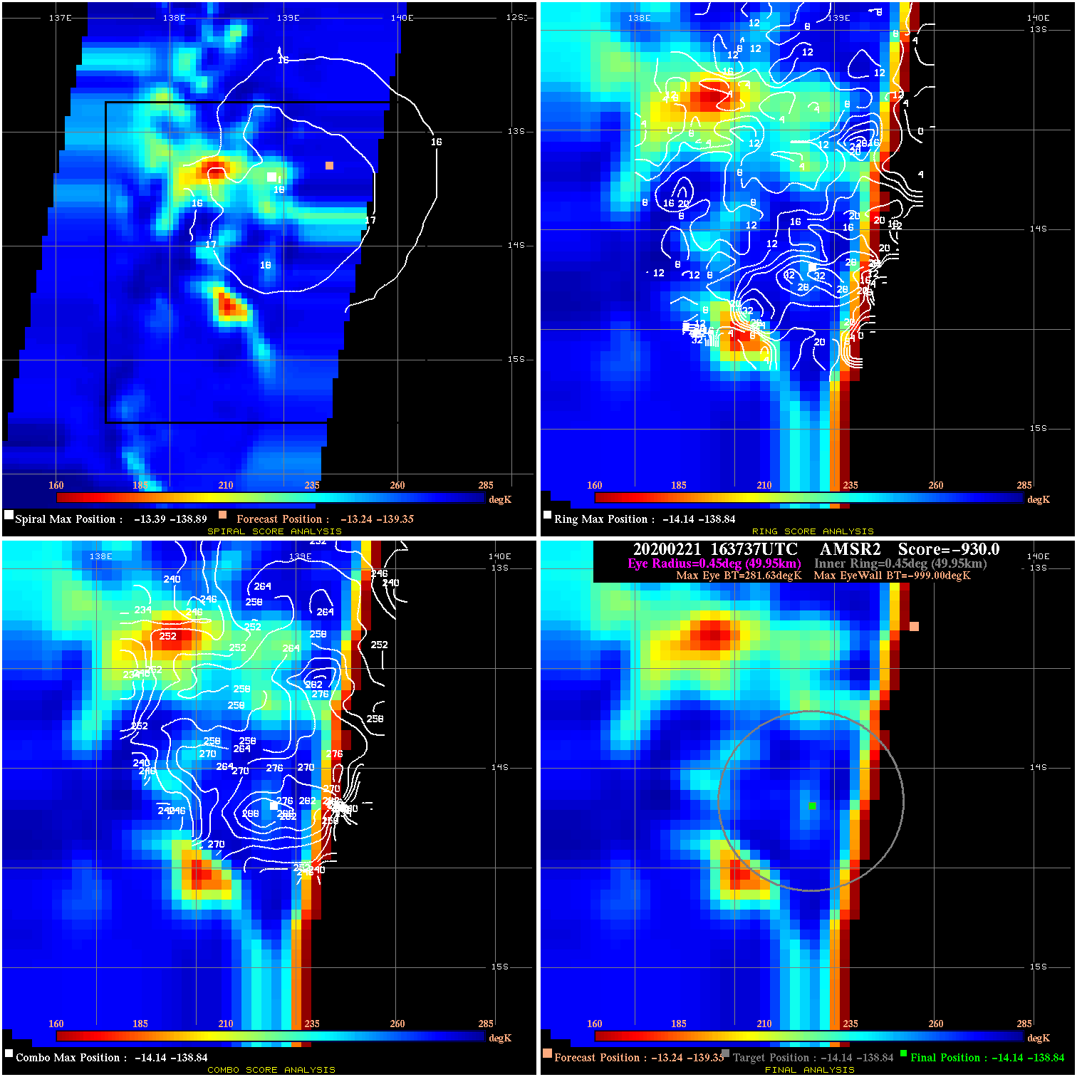
20200221 163737 -930.0 N/A N/A N/A 0.00 20.0 AMSR2 -13.2 -139.4 -14.1 -138.8 -14.1 -138.8 Analysis Plot
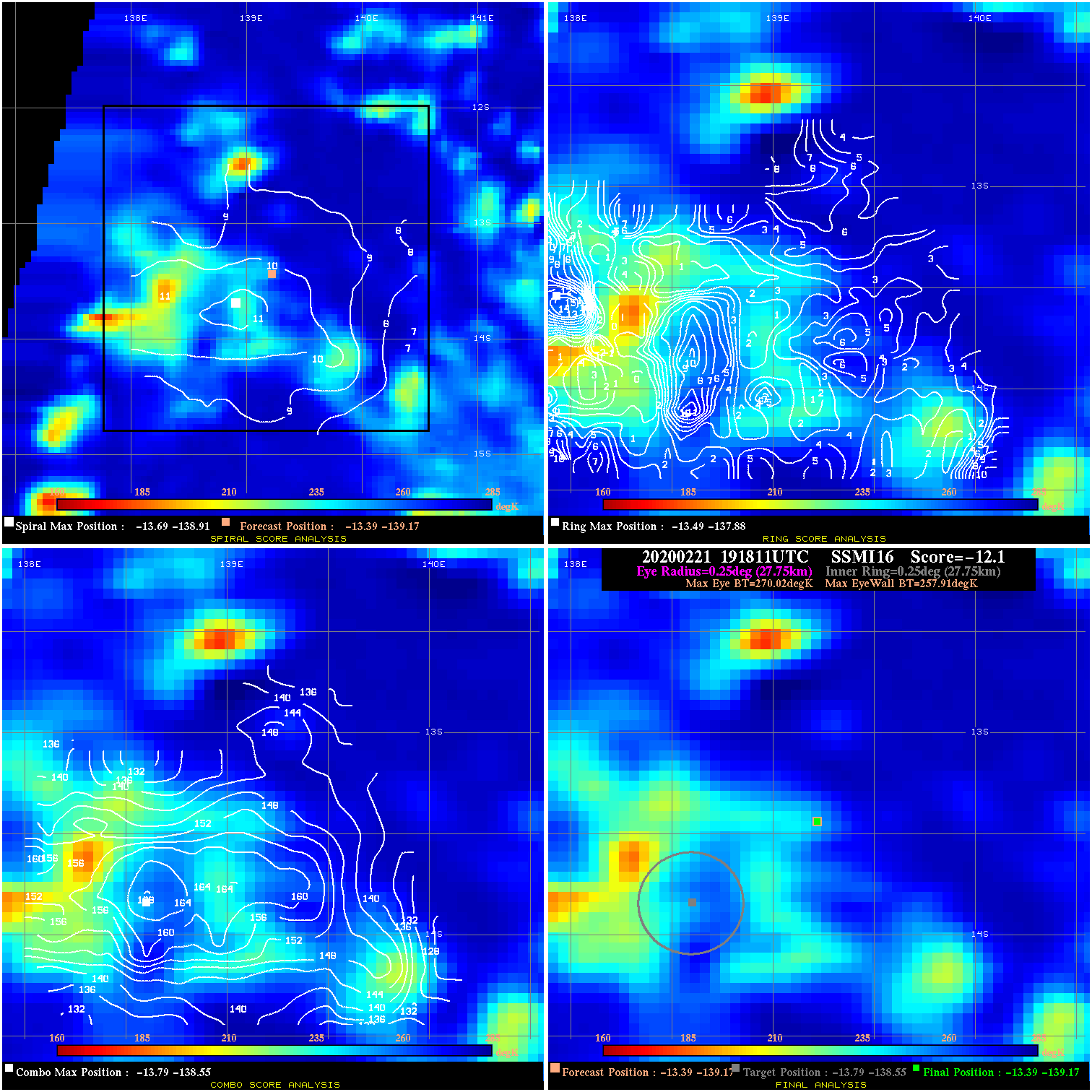
20200221 191811 -12.1 N/A 37.0% 55.55 12.11 20.0 SSMI16 -13.4 -139.2 -13.4 -139.2 -13.8 -138.6 Analysis Plot
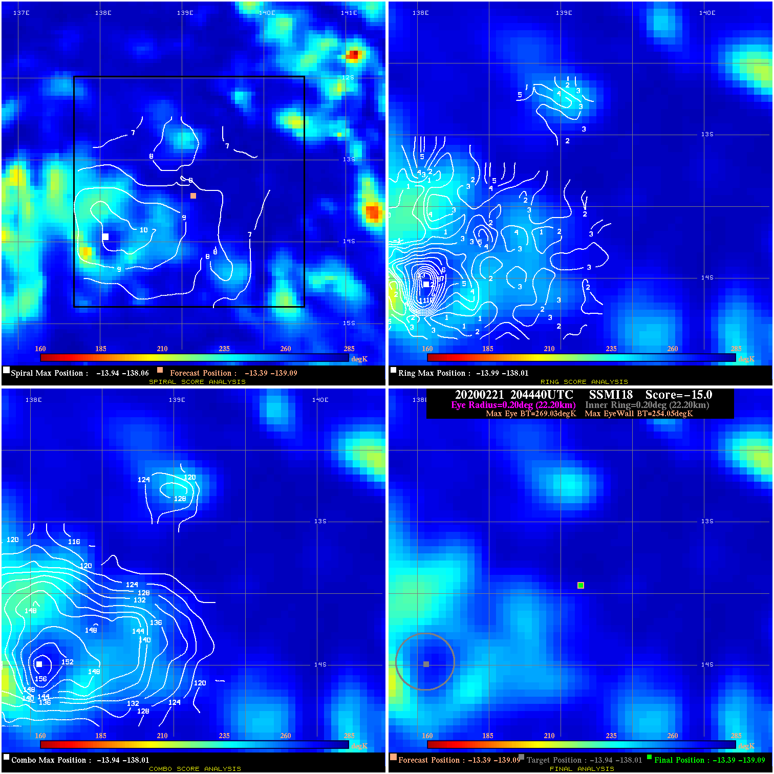
20200221 204440 -15.0 N/A 74.0% 44.44 14.98 20.0 SSMI18 -13.4 -139.1 -13.4 -139.1 -13.9 -138.0 Analysis Plot
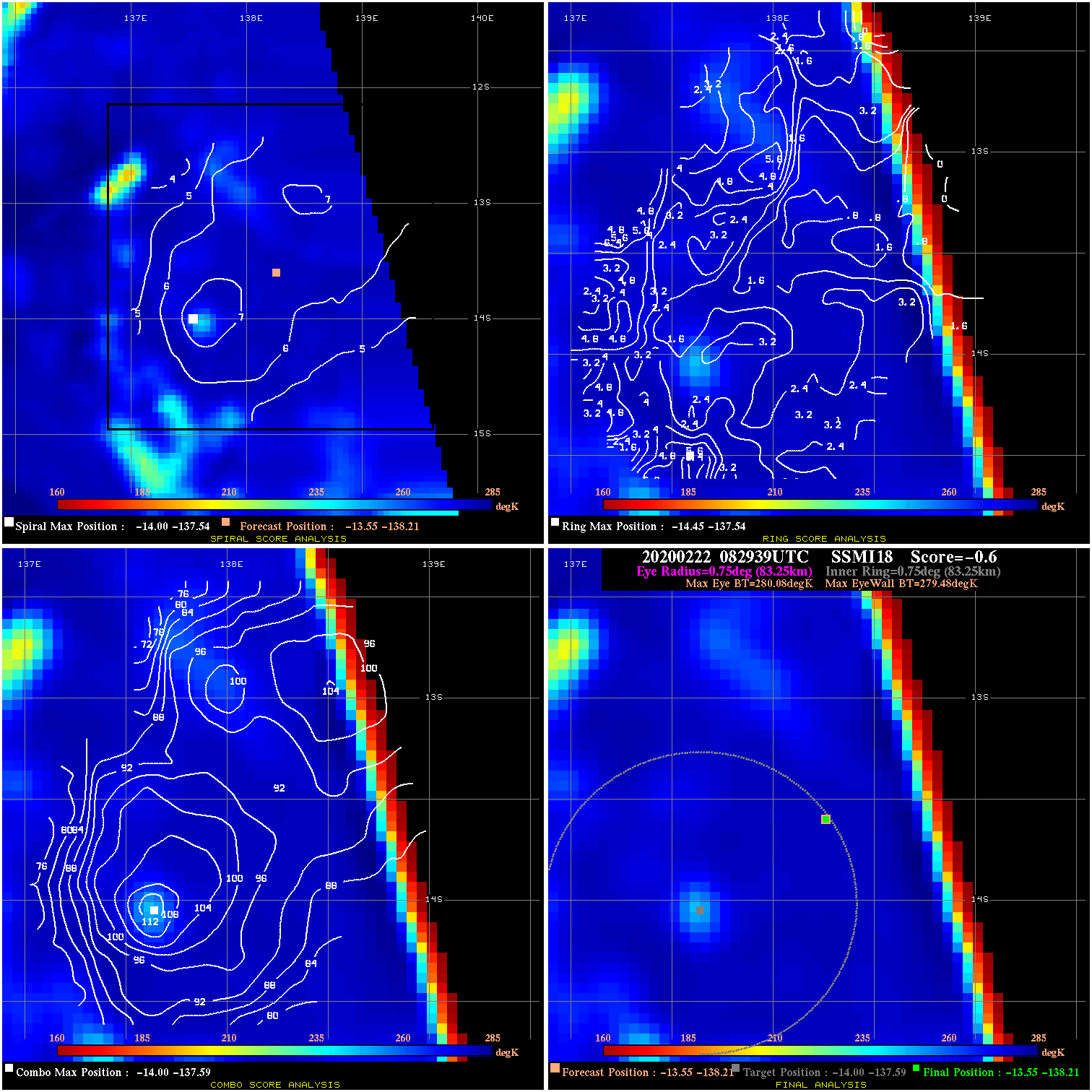
20200222 082939 -0.6 N/A N/A 166.65 .60 20.0 SSMI18 -13.6 -138.2 -13.6 -138.2 -14.0 -137.6 Analysis Plot
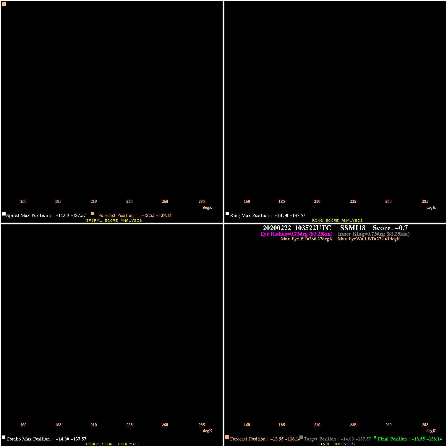
20200222 103522 -0.7 N/A N/A 166.65 .66 20.0 SSMI18 -13.6 -138.1 -13.6 -138.1 -14.0 -137.6 Analysis Plot
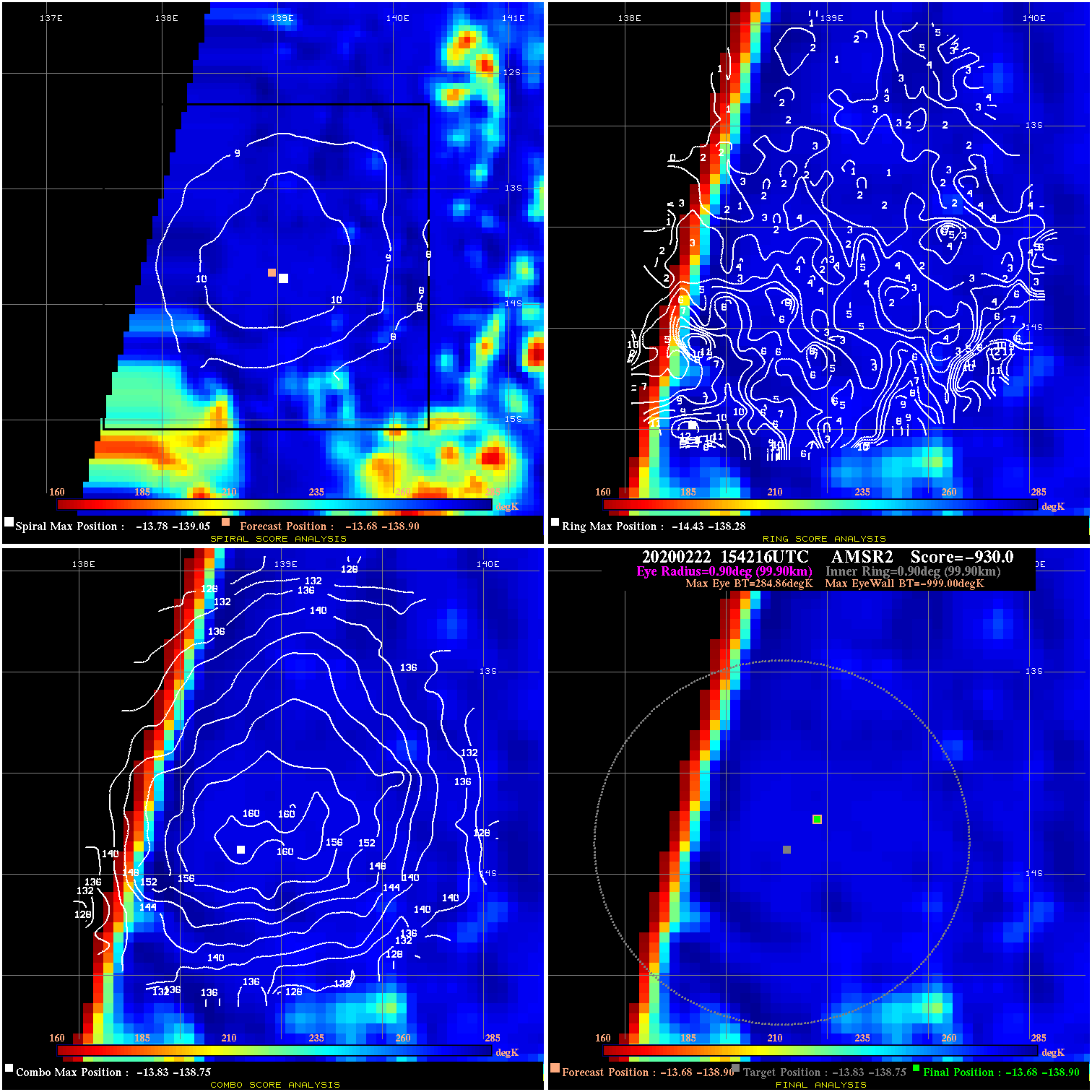
20200222 154216 -930.0 N/A N/A N/A 0.00 20.0 AMSR2 -13.7 -138.9 -13.7 -138.9 -13.8 -138.8 Analysis Plot
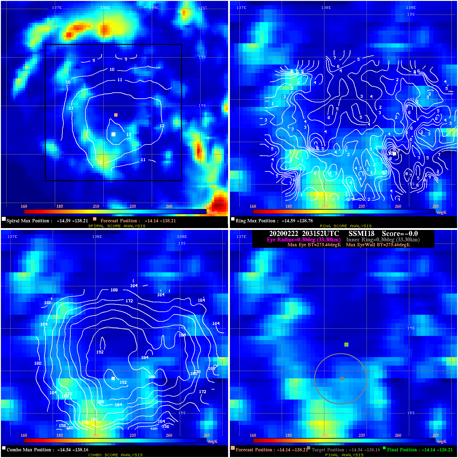
20200222 203152 N/A N/A N/A N/A N/A 20.0 SSMI18 -14.1 -138.2 -14.1 -138.2 -14.5 -138.2 Analysis Plot
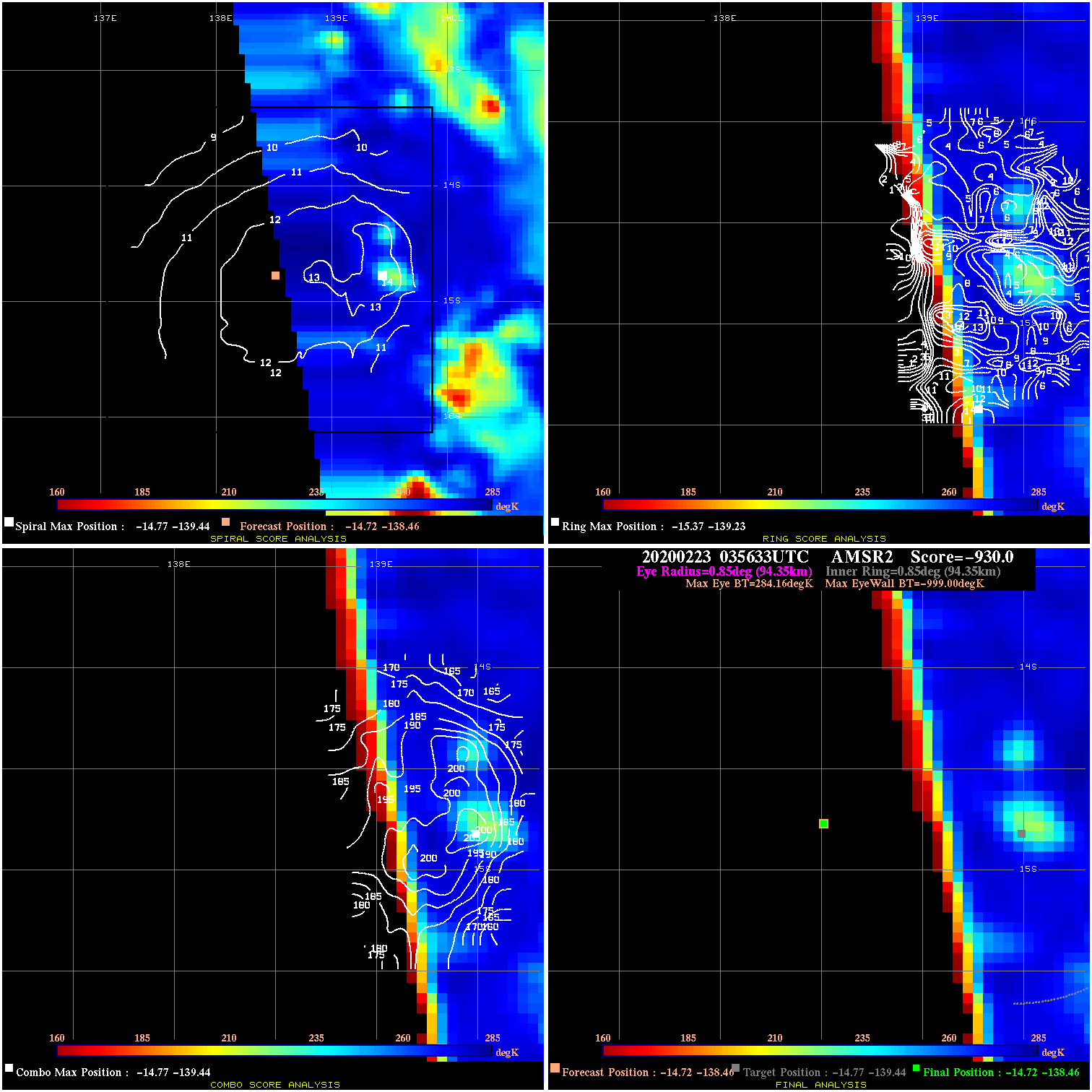
20200223 035633 -930.0 N/A N/A N/A 0.00 25.0 AMSR2 -14.7 -138.5 -14.7 -138.5 -14.8 -139.4 Analysis Plot
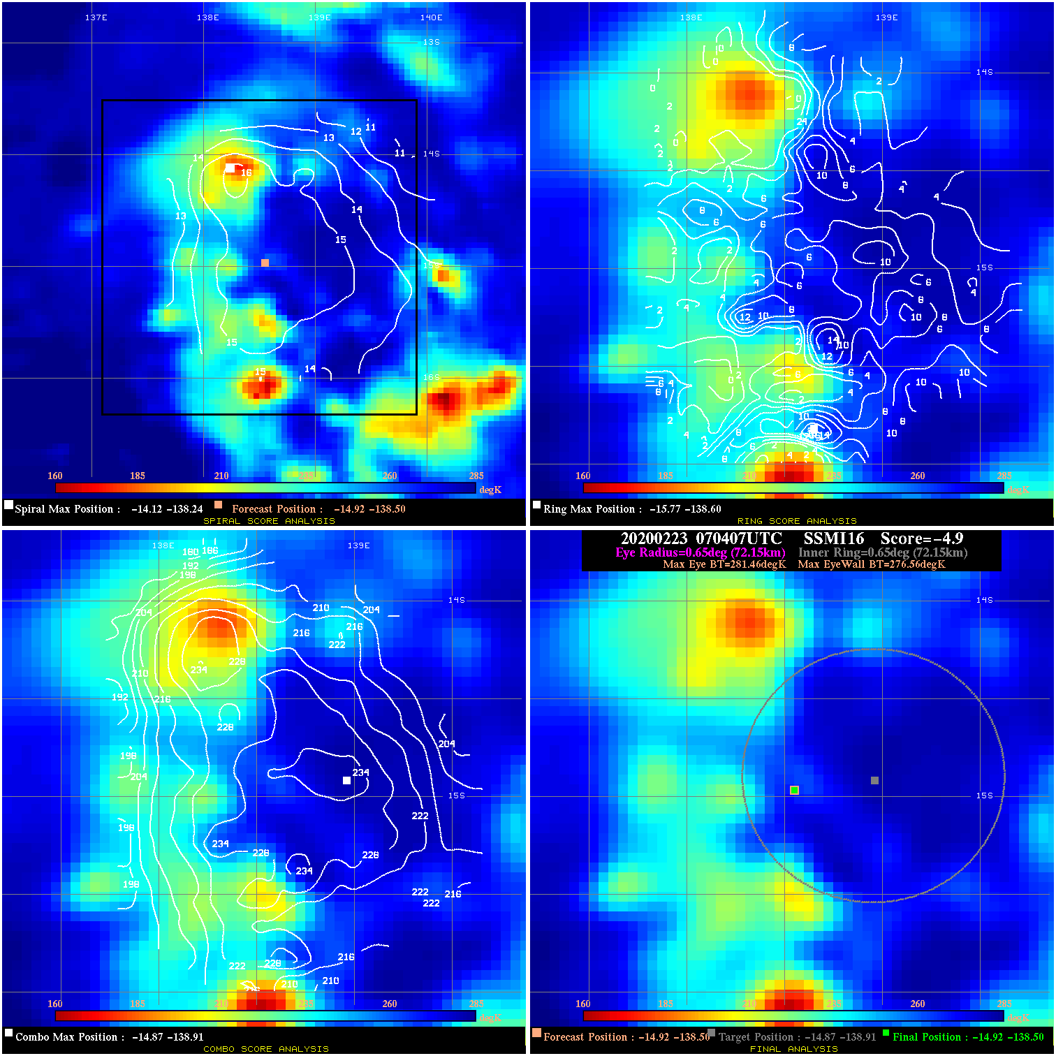
20200223 070407 -4.9 N/A 13.7% 144.43 4.90 25.0 SSMI16 -14.9 -138.5 -14.9 -138.5 -14.9 -138.9 Analysis Plot
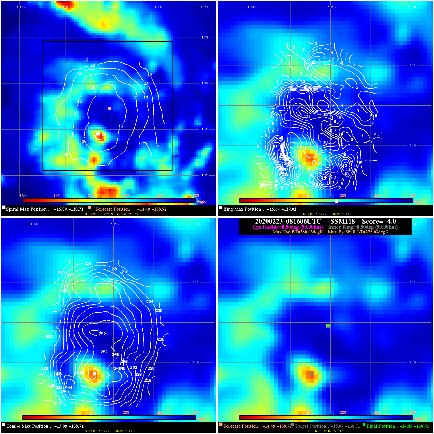
20200223 081606 -4.0 N/A 32.9% 199.98 4.00 25.0 SSMI18 -14.5 -138.9 -14.5 -138.9 -15.1 -138.7 Analysis Plot
20200223 102246 -3.5 N/A 32.9% 199.98 3.51 25.0 SSMI18 -14.7 -138.9 -14.7 -138.9 -15.1 -138.7 Analysis Plot
20200223 162454 -4.3 N/A 19.2% 222.20 4.27 30.0 AMSR2 -15.8 -139.0 -15.8 -139.0 -15.7 -139.4 Analysis Plot
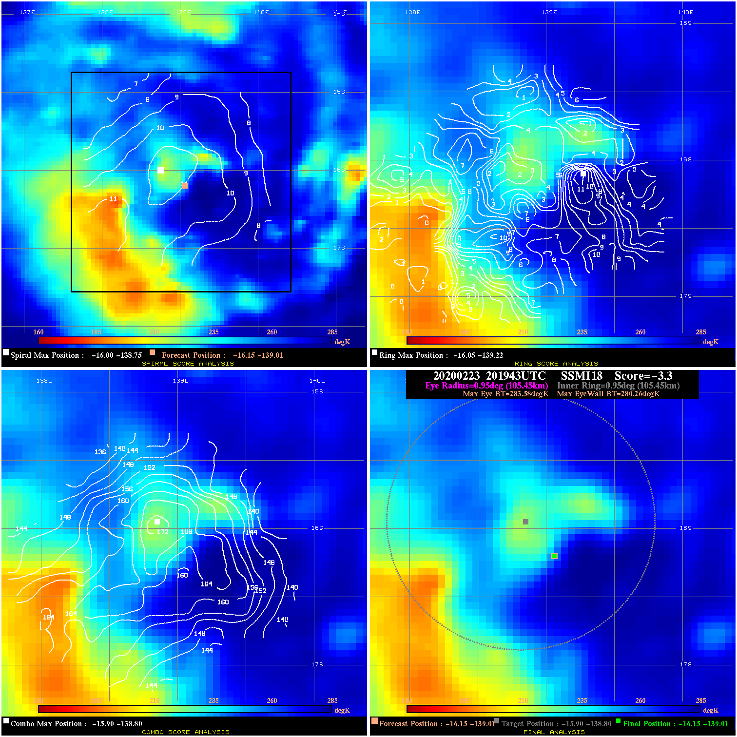
20200223 201943 -3.3 N/A 26.0% 211.09 3.32 40.0 SSMI18 -16.1 -139.0 -16.1 -139.0 -15.9 -138.8 Analysis Plot
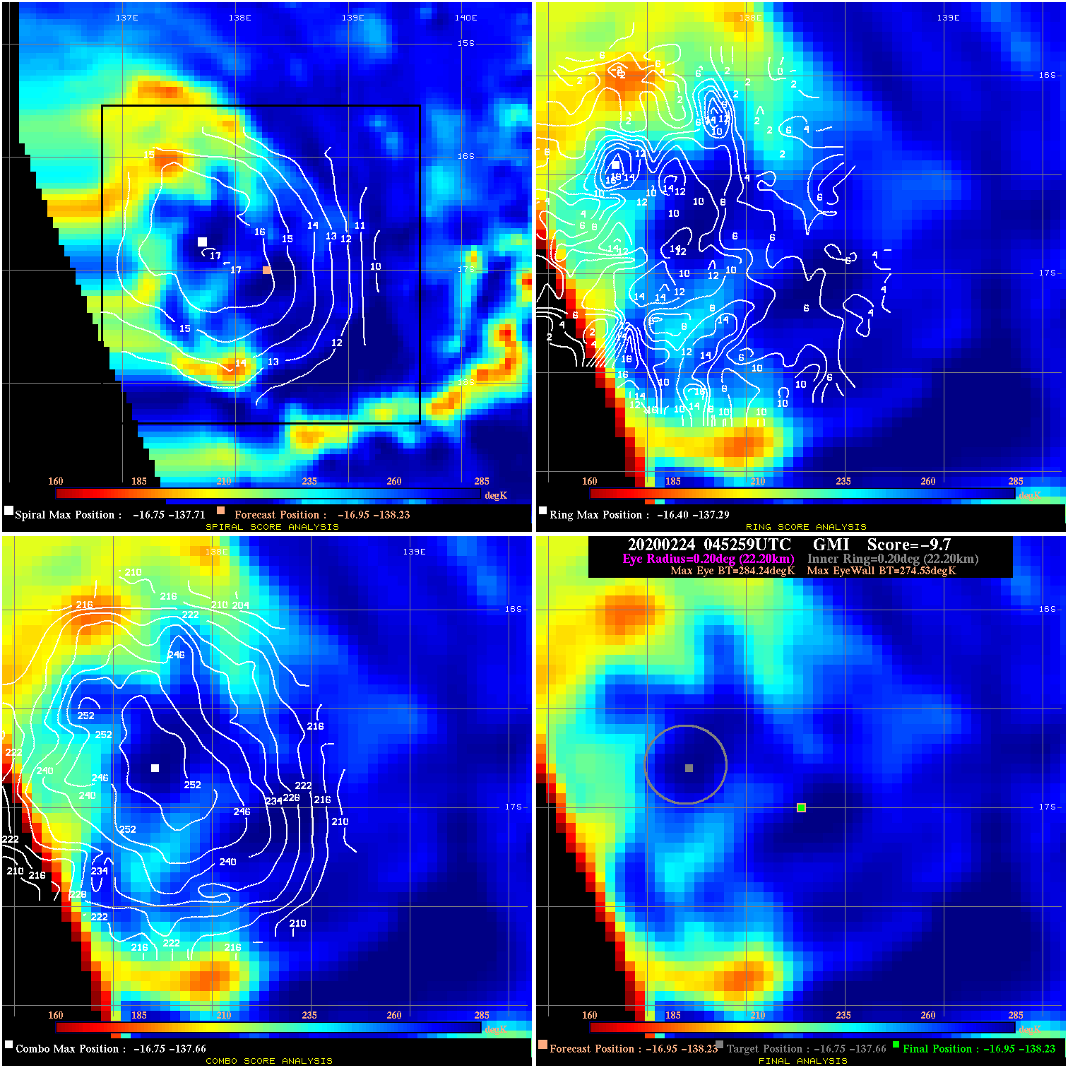
20200224 045259 -9.7 N/A 19.2% 44.44 9.71 40.0 GMI -17.0 -138.2 -17.0 -138.2 -16.8 -137.7 Analysis Plot
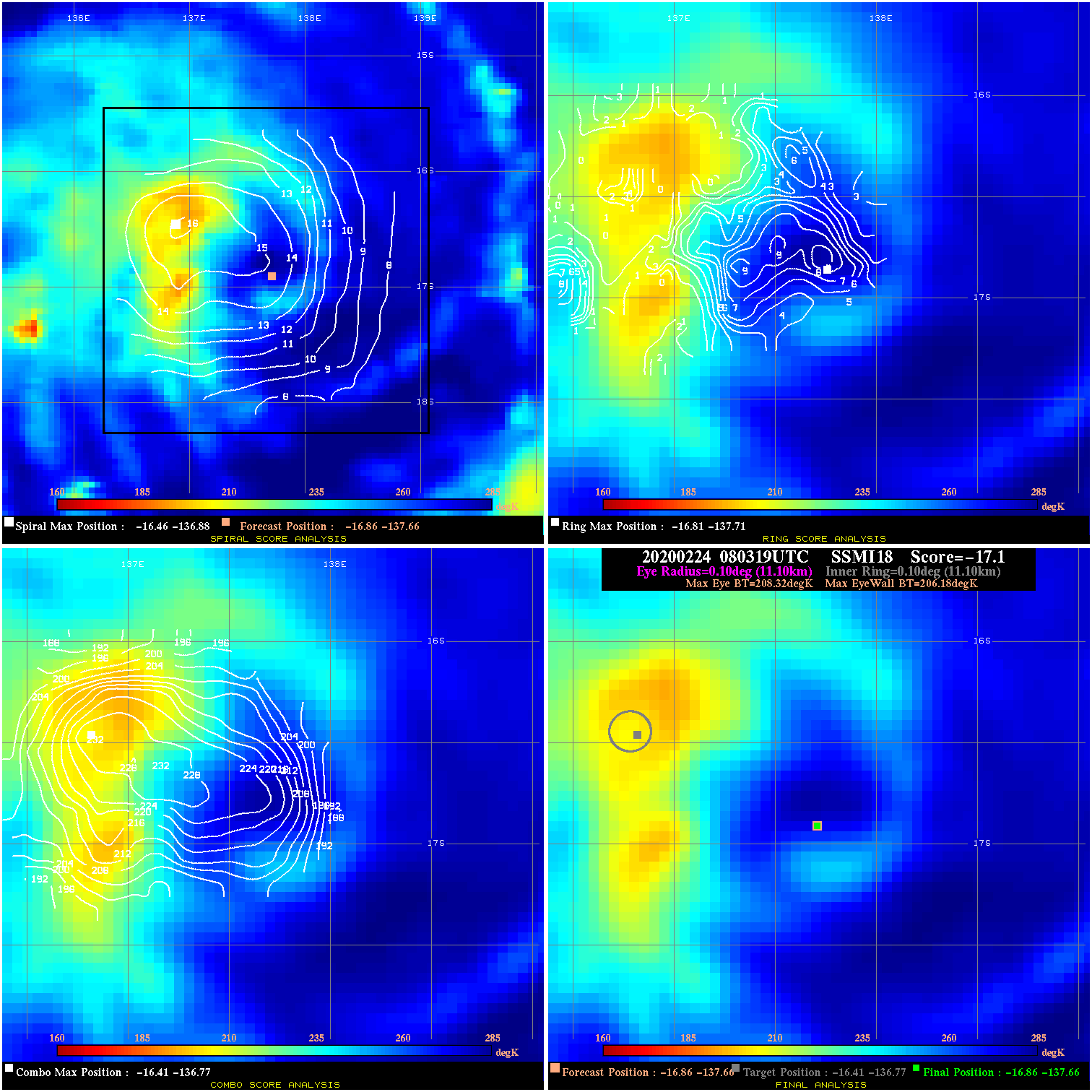
20200224 080319 -17.1 N/A 100.0% 22.22 2.14 40.0 SSMI18 -16.9 -137.7 -16.9 -137.7 -16.4 -136.8 Analysis Plot
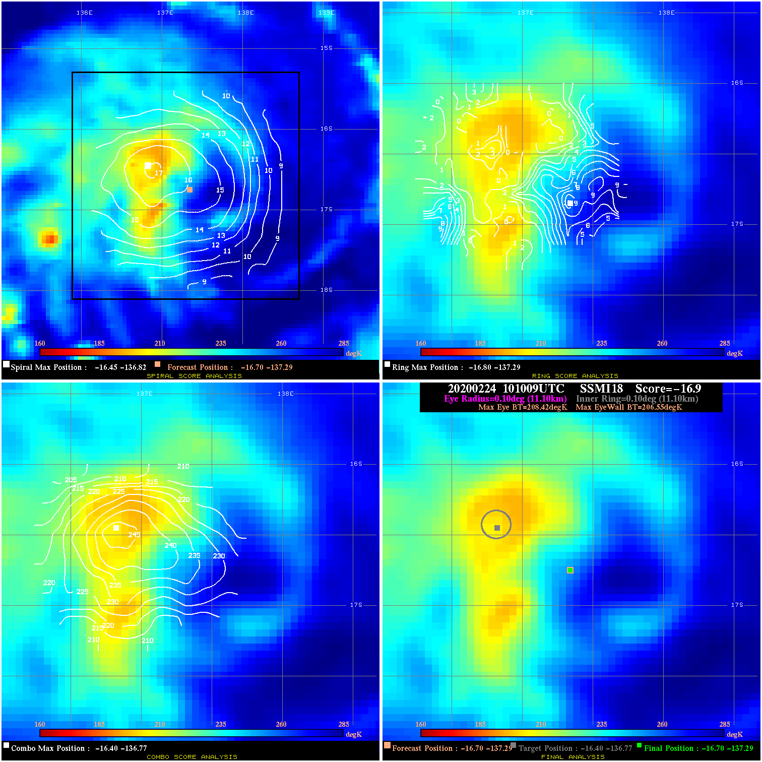
20200224 101009 -16.9 N/A 100.0% 22.22 1.87 30.0 SSMI18 -16.7 -137.3 -16.7 -137.3 -16.4 -136.8 Analysis Plot
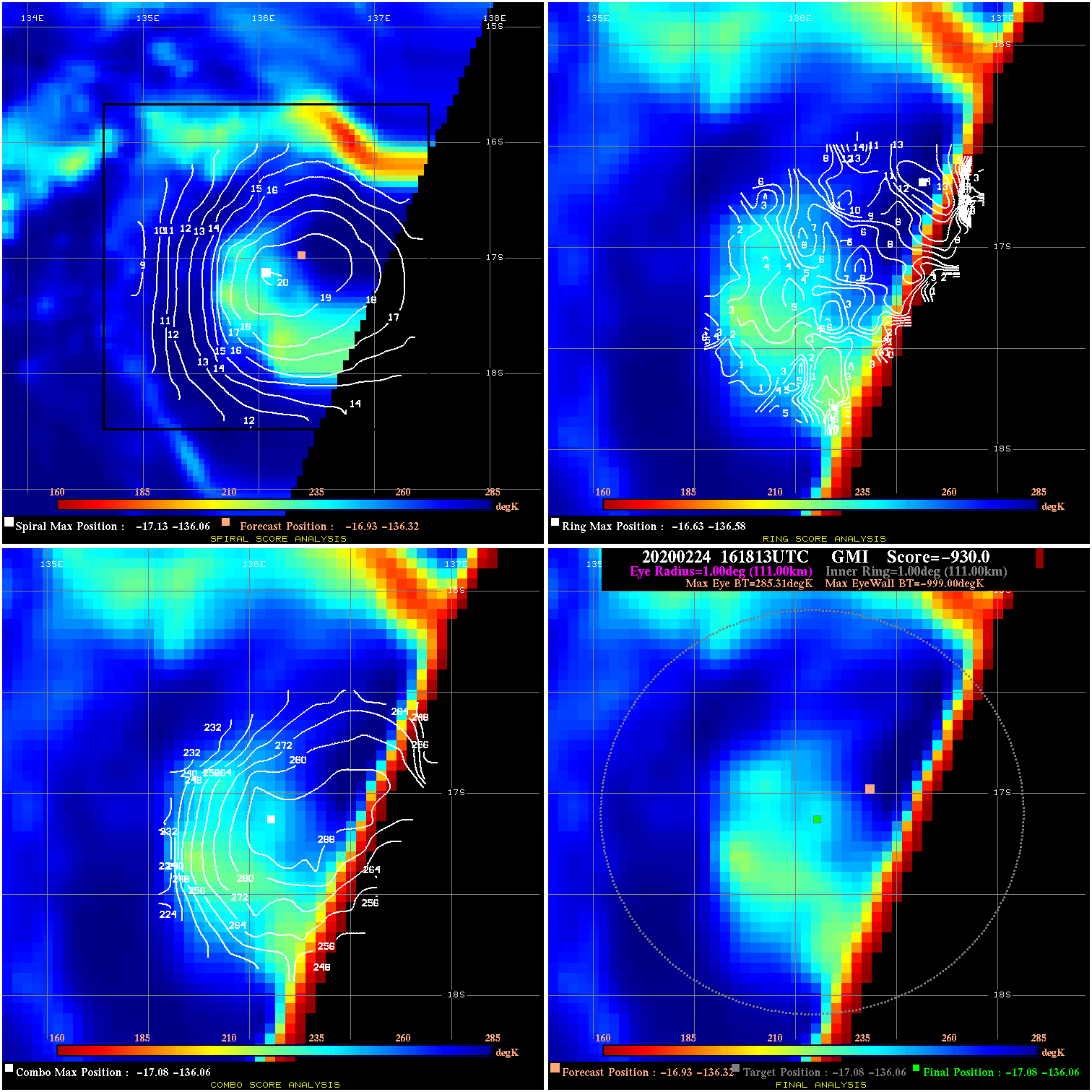
20200224 161813 -930.0 N/A N/A N/A 0.00 30.0 GMI -16.9 -136.3 -17.1 -136.1 -17.1 -136.1 Analysis Plot
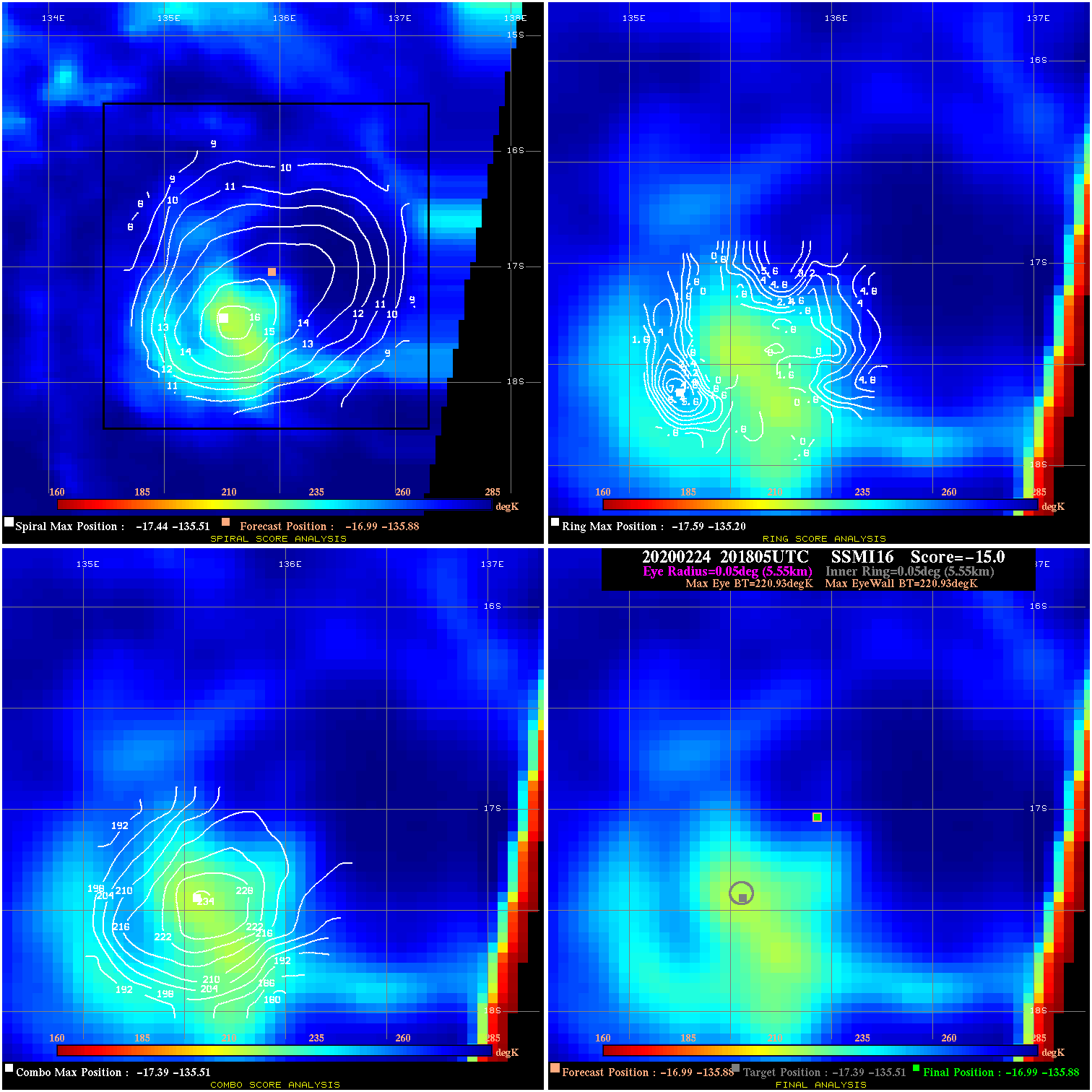
20200224 201805 N/A N/A N/A N/A N/A 30.0 SSMI16 -17.0 -135.9 -17.0 -135.9 -17.4 -135.5 Analysis Plot
|
|
Legend: - Date/Time are determined from PMW imagery at Forecast (initial guess) Lat/Lon position. - Positive/Negative Latitude = North/South Hemisphere; Longitude = Western/Eastern Hemisphere. - "Ring Diam" value indicates the estimated surface eyewall diameter in km (the MI eyewall edge diameter minus 10 km). - "Ring Pct" is the percentage of the "ring" (eyewall inner boundary) that is 1) colder than the "hot spot" (warmest eye pixel) in the eye by 20K, or 2) the percentage that is a) colder than 232K and b) colder than the "hot spot" by 10K, whichever is greater. - Values are red if Ring % <= 65, yellow/brown if Ring % <= 85 and green if Ring % > 85. - "Tb diff" is the difference between the "hot spot" (warmest eye pixel) and the warmest pixel on the eyewall. - Intensity score are listed as negative, and not used, when the JTWC or NHC estimated Vmax is <55 kts in order to rule out weak but highly symmetric TCs. - Error messages in intensity scores: -920 is used when the hottest pixel in the eye is <200K, to prevent false positives; -930 means <85% of eyewall has observations/data. |