Tropical Depression 08R
|
Passive Microwave (PMW) Intensity Information Hurricane Intensity Estimation (HIE) Algorithm Version 9.0 |
Overpass Inten Ring Ring Wind Forecast Final Target
Date Time Score Meaning Pct Diam BTdiff Est Sat Lat Lon Lat Lon Lat Lon
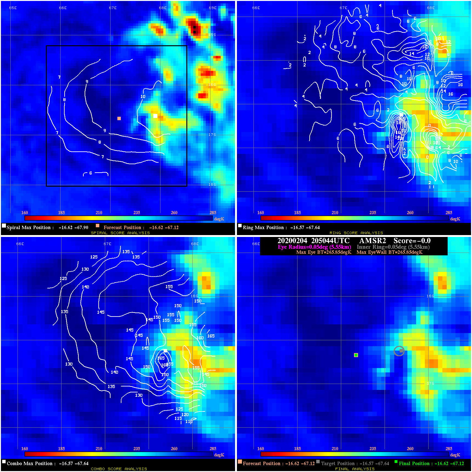
20200204 205044 N/A N/A N/A N/A N/A 30.0 AMSR2 -16.6 -67.1 -16.6 -67.1 -16.6 -67.6 Analysis Plot
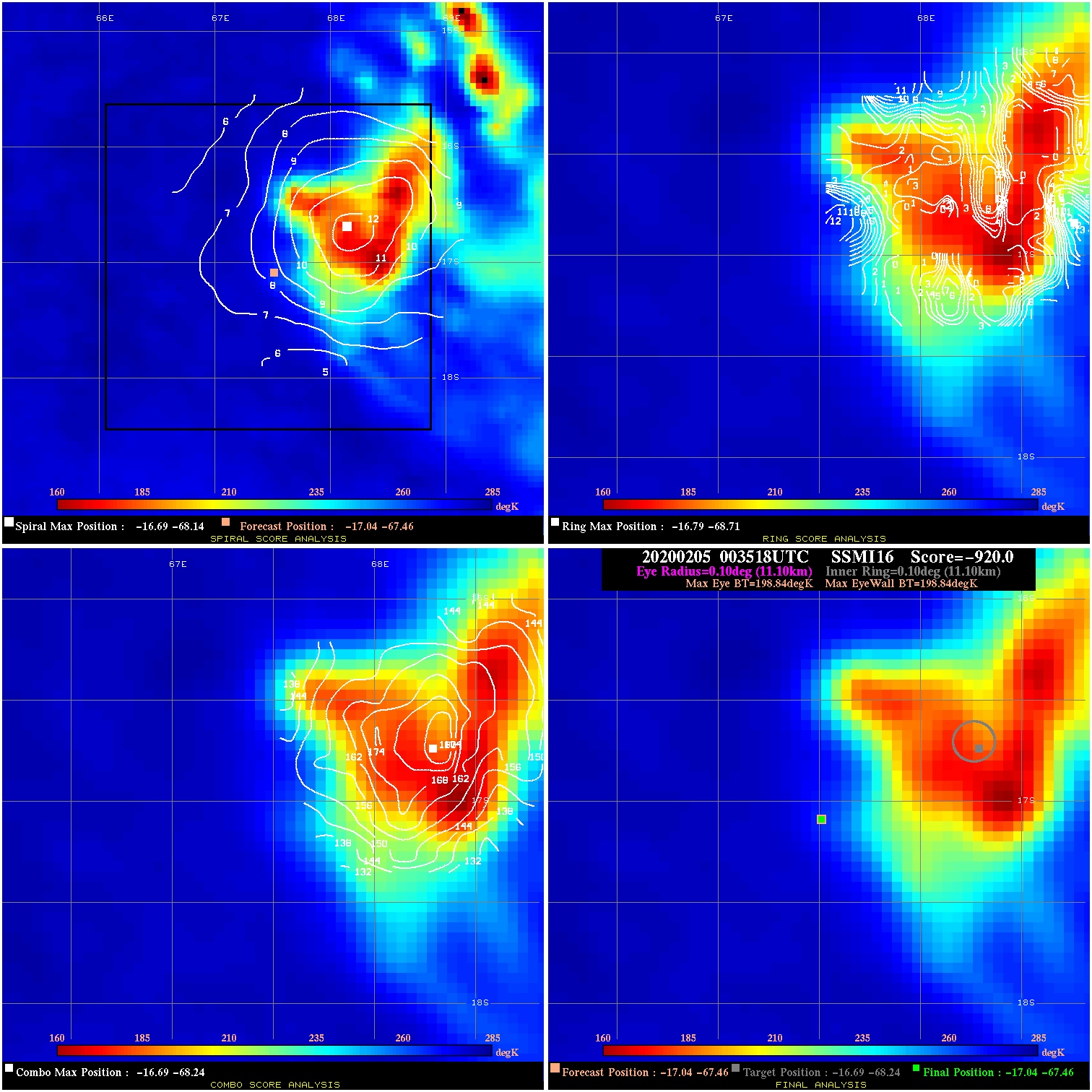
20200205 003518 N/A N/A N/A N/A N/A 30.0 SSMI16 -17.0 -67.5 -17.0 -67.5 -16.7 -68.2 Analysis Plot
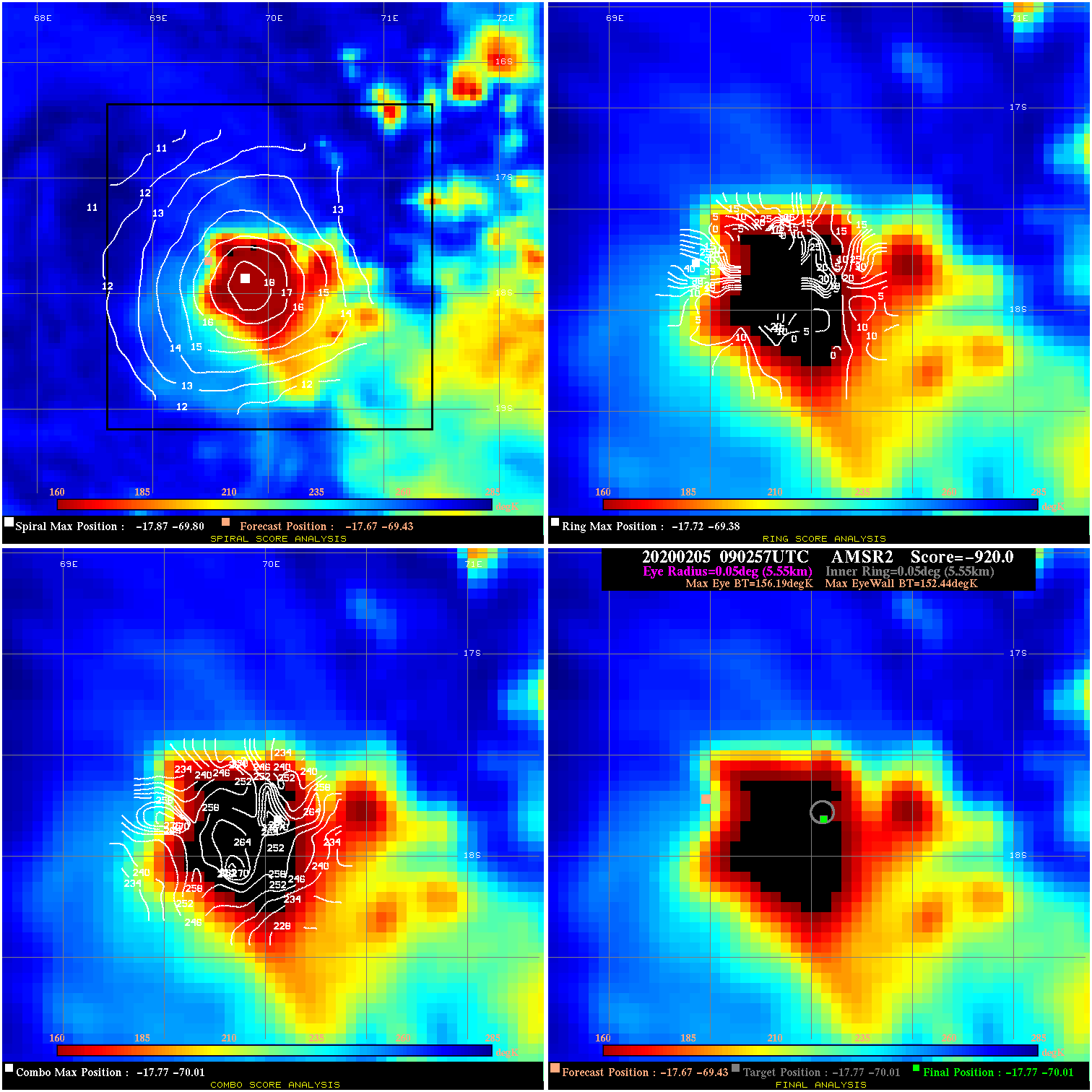
20200205 090257 -920.0 N/A 100.0% 11.11 3.75 40.0 AMSR2 -17.7 -69.4 -17.8 -70.0 -17.8 -70.0 Analysis Plot
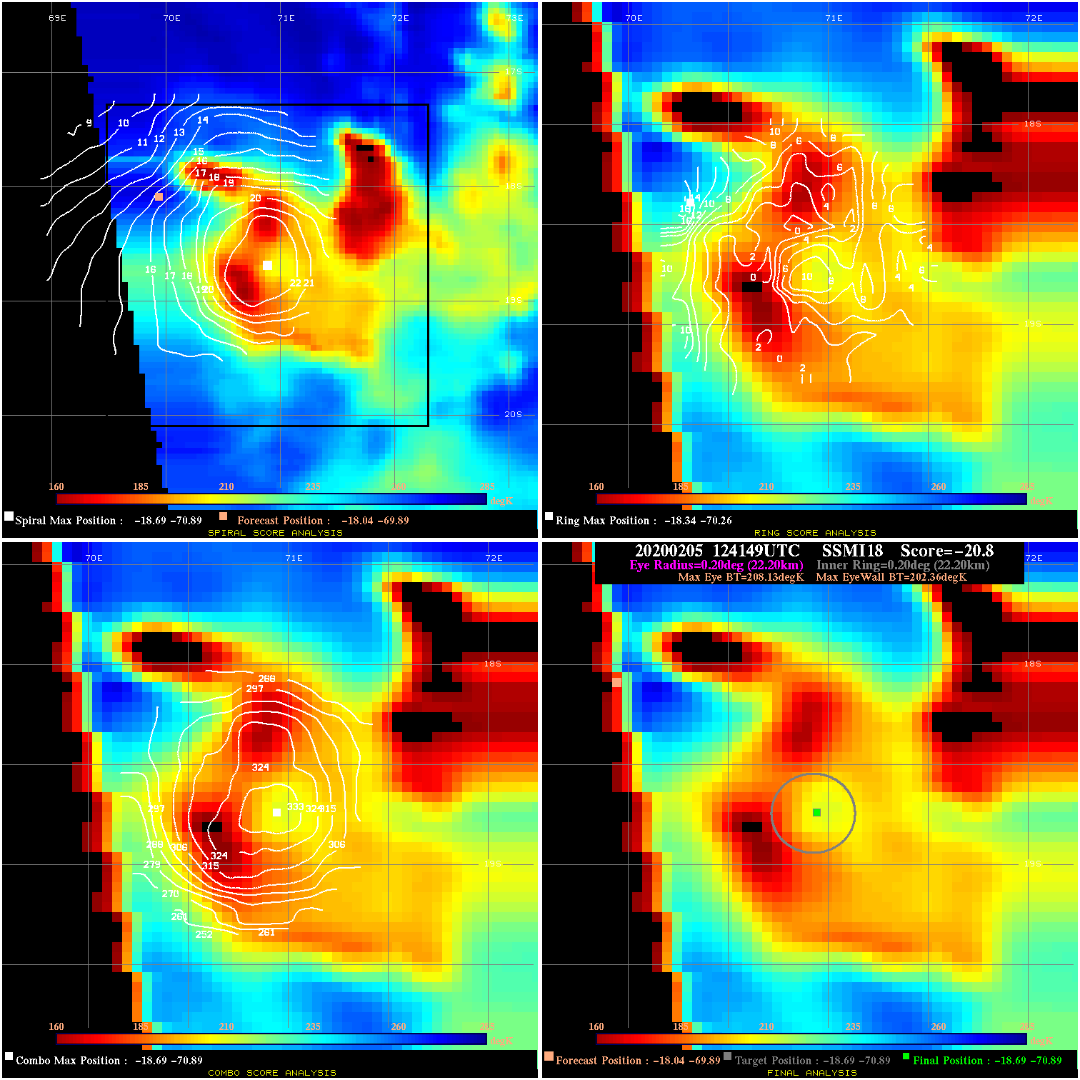
20200205 124149 -20.8 N/A 100.0% 44.44 5.77 40.0 SSMI18 -18.0 -69.9 -18.7 -70.9 -18.7 -70.9 Analysis Plot
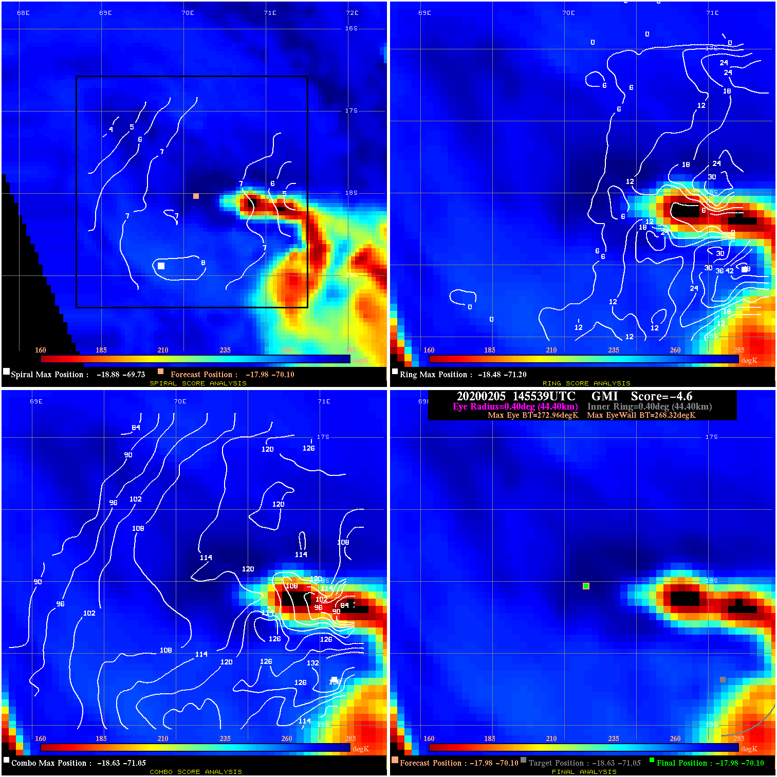
20200205 145539 -4.6 N/A 63.0% 88.88 4.64 40.0 GMI -18.0 -70.1 -18.0 -70.1 -18.6 -71.1 Analysis Plot
20200206 002214 N/A N/A N/A N/A N/A 35.0 SSMI16 -17.7 -70.9 -17.7 -70.9 -17.8 -71.4 Analysis Plot
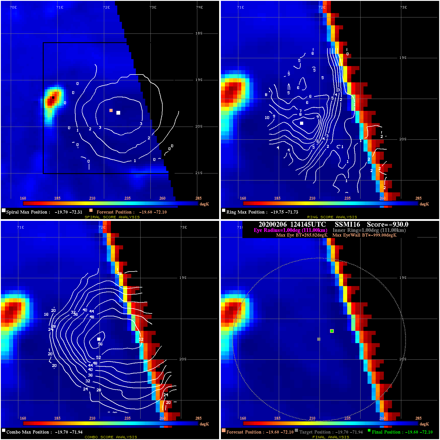
20200206 124145 -930.0 N/A N/A N/A 0.00 35.0 SSMI16 -19.6 -72.1 -19.6 -72.1 -19.7 -71.9 Analysis Plot
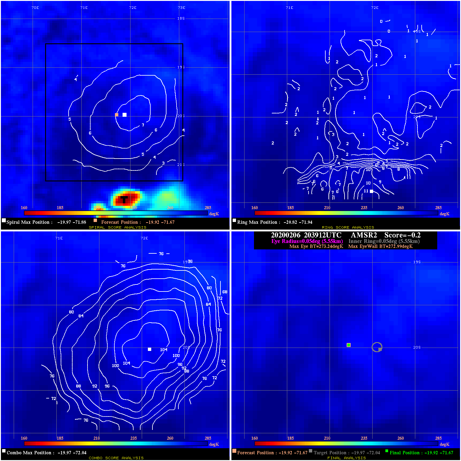
20200206 203912 -0.2 N/A N/A 11.11 .25 35.0 AMSR2 -19.9 -71.7 -19.9 -71.7 -20.0 -72.0 Analysis Plot
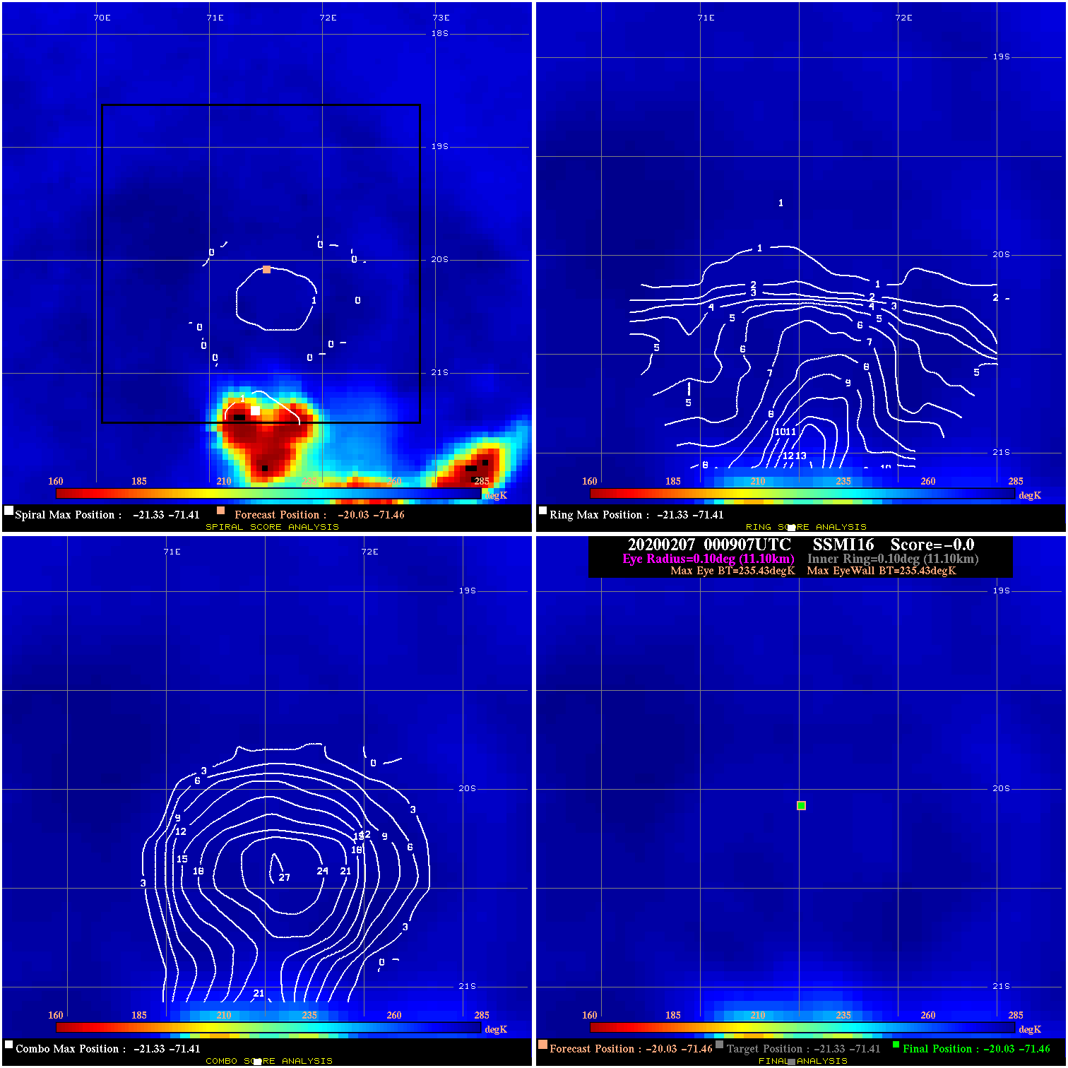
20200207 000907 N/A N/A N/A N/A N/A 35.0 SSMI16 -20.0 -71.5 -20.0 -71.5 -21.3 -71.4 Analysis Plot
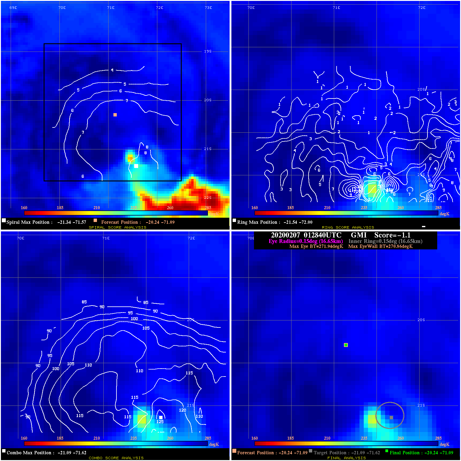
20200207 012840 -1.1 N/A N/A 33.33 1.08 35.0 GMI -20.2 -71.1 -20.2 -71.1 -21.1 -71.6 Analysis Plot
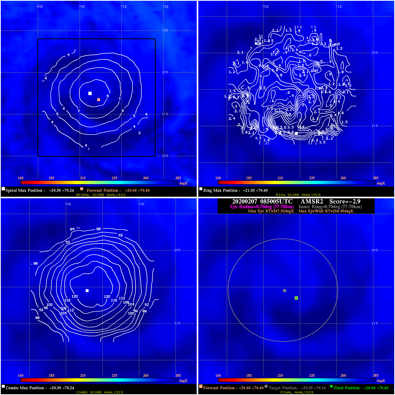
20200207 085005 -2.9 N/A N/A 155.54 2.94 30.0 AMSR2 -20.6 -70.4 -20.6 -70.4 -20.5 -70.2 Analysis Plot
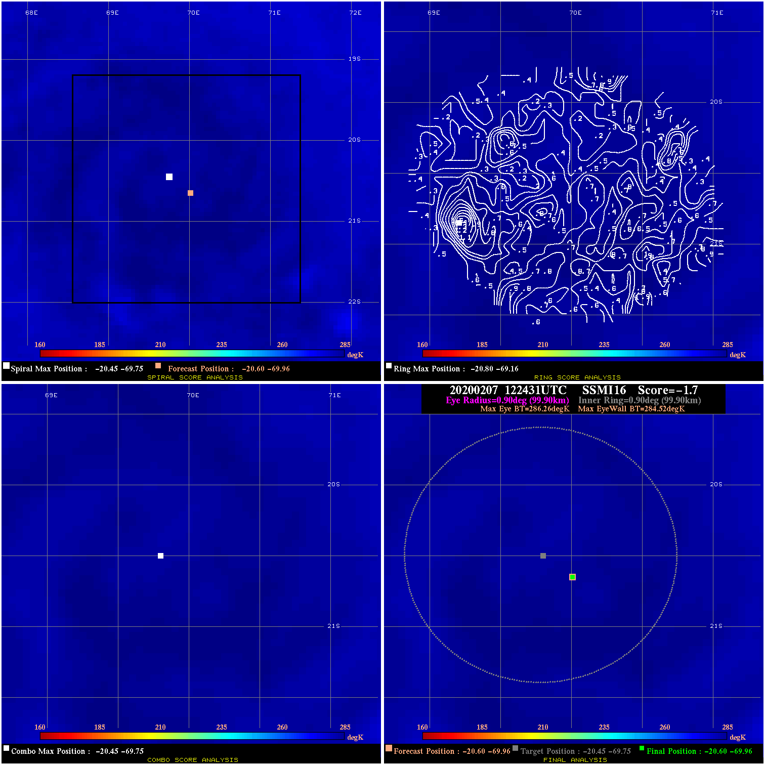
20200207 122431 -1.7 N/A N/A 199.98 1.74 30.0 SSMI16 -20.6 -70.0 -20.6 -70.0 -20.5 -69.8 Analysis Plot
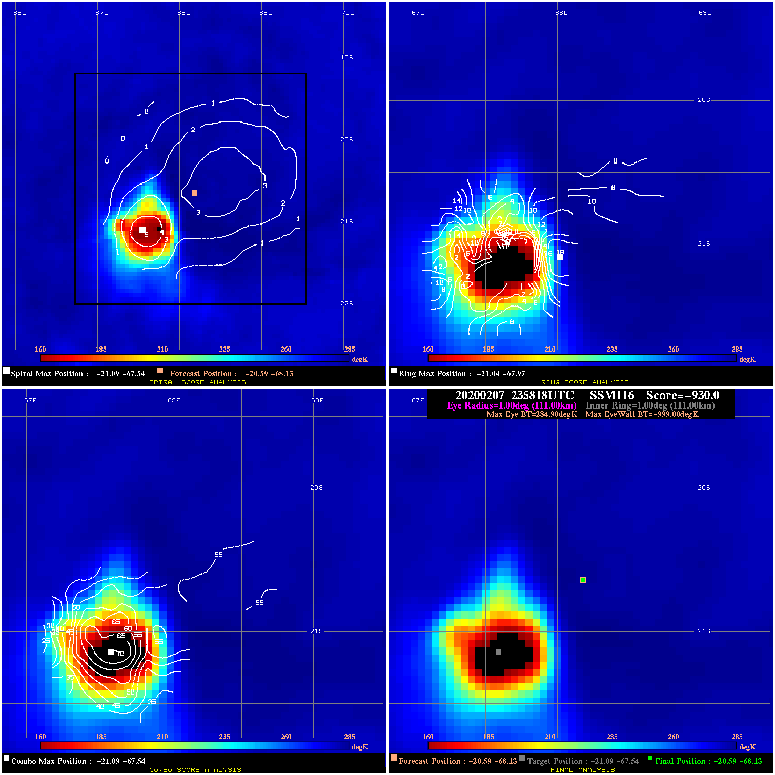
20200207 235818 -930.0 N/A N/A N/A 0.00 30.0 SSMI16 -20.6 -68.1 -20.6 -68.1 -21.1 -67.5 Analysis Plot
20200213 141713 N/A N/A N/A N/A N/A 30.0 GMI -17.9 -50.6 -17.9 -50.6 -18.3 -49.8 Analysis Plot
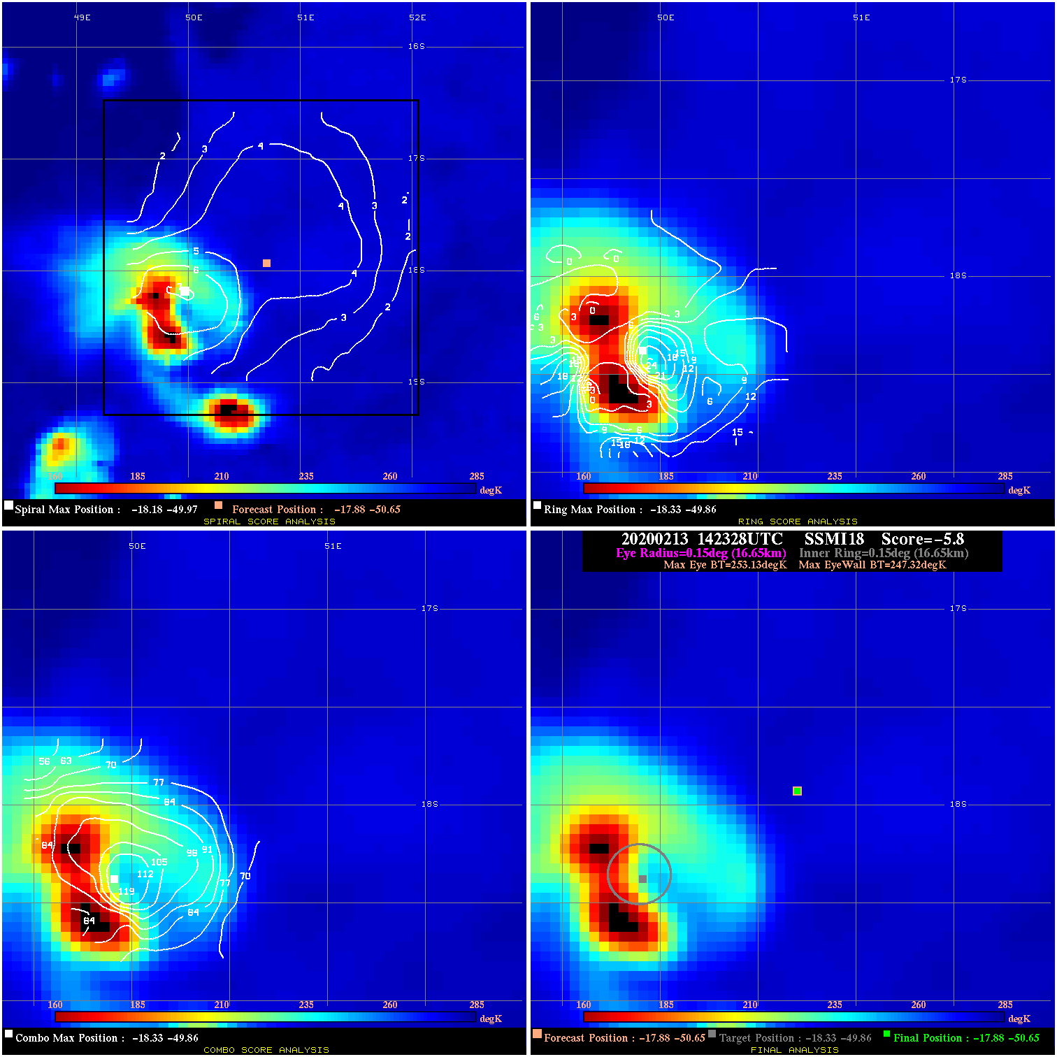
20200213 142328 -5.8 N/A 67.1% 33.33 5.81 30.0 SSMI18 -17.9 -50.7 -17.9 -50.7 -18.3 -49.9 Analysis Plot
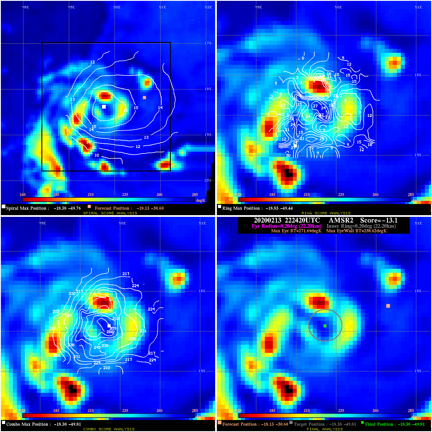
20200213 222420 -13.1 N/A 60.3% 44.44 13.07 30.0 AMSR2 -18.1 -50.6 -18.4 -49.8 -18.4 -49.8 Analysis Plot
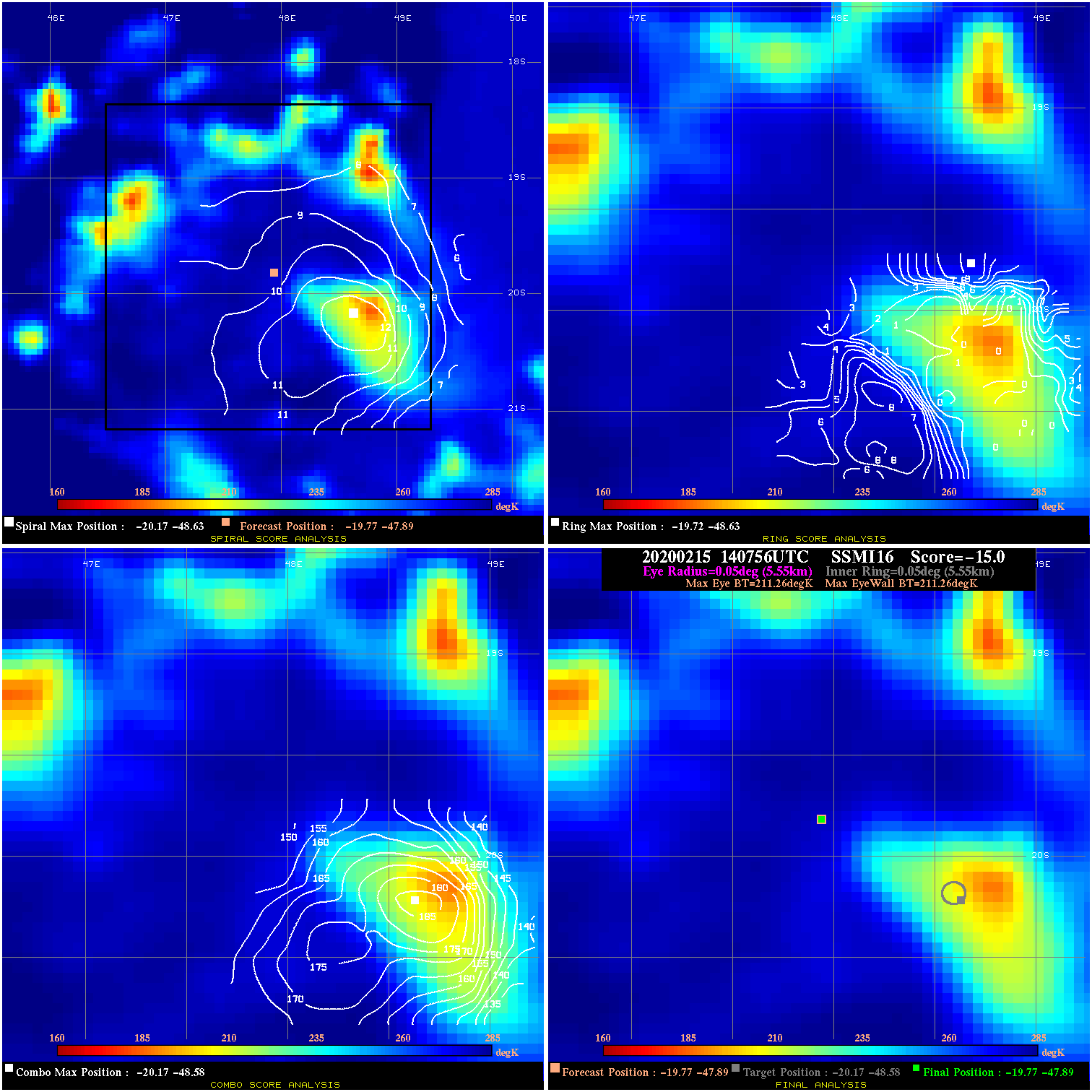
20200215 140756 N/A N/A N/A N/A N/A 35.0 SSMI16 -19.8 -47.9 -19.8 -47.9 -20.2 -48.6 Analysis Plot
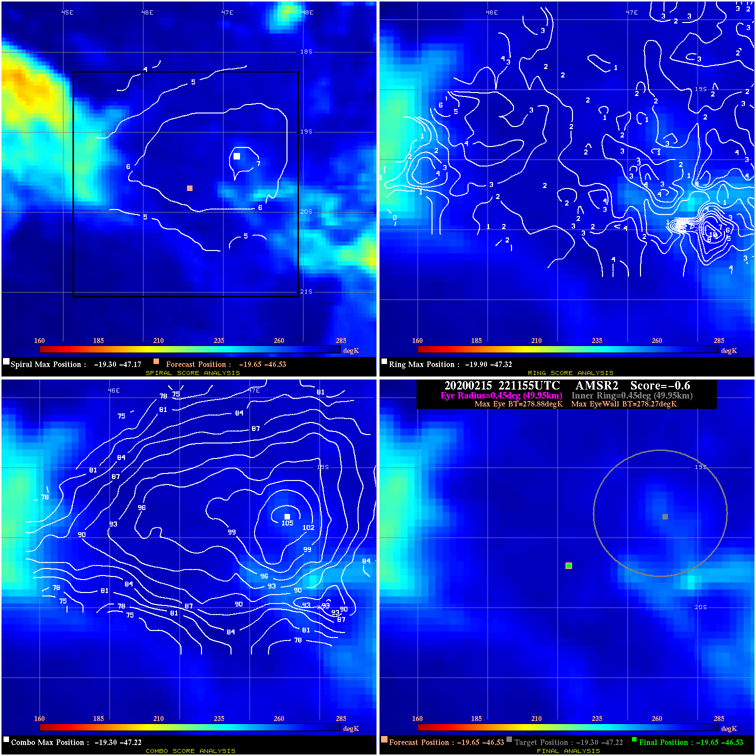
20200215 221155 -0.6 N/A N/A 99.99 .61 35.0 AMSR2 -19.6 -46.5 -19.6 -46.5 -19.3 -47.2 Analysis Plot
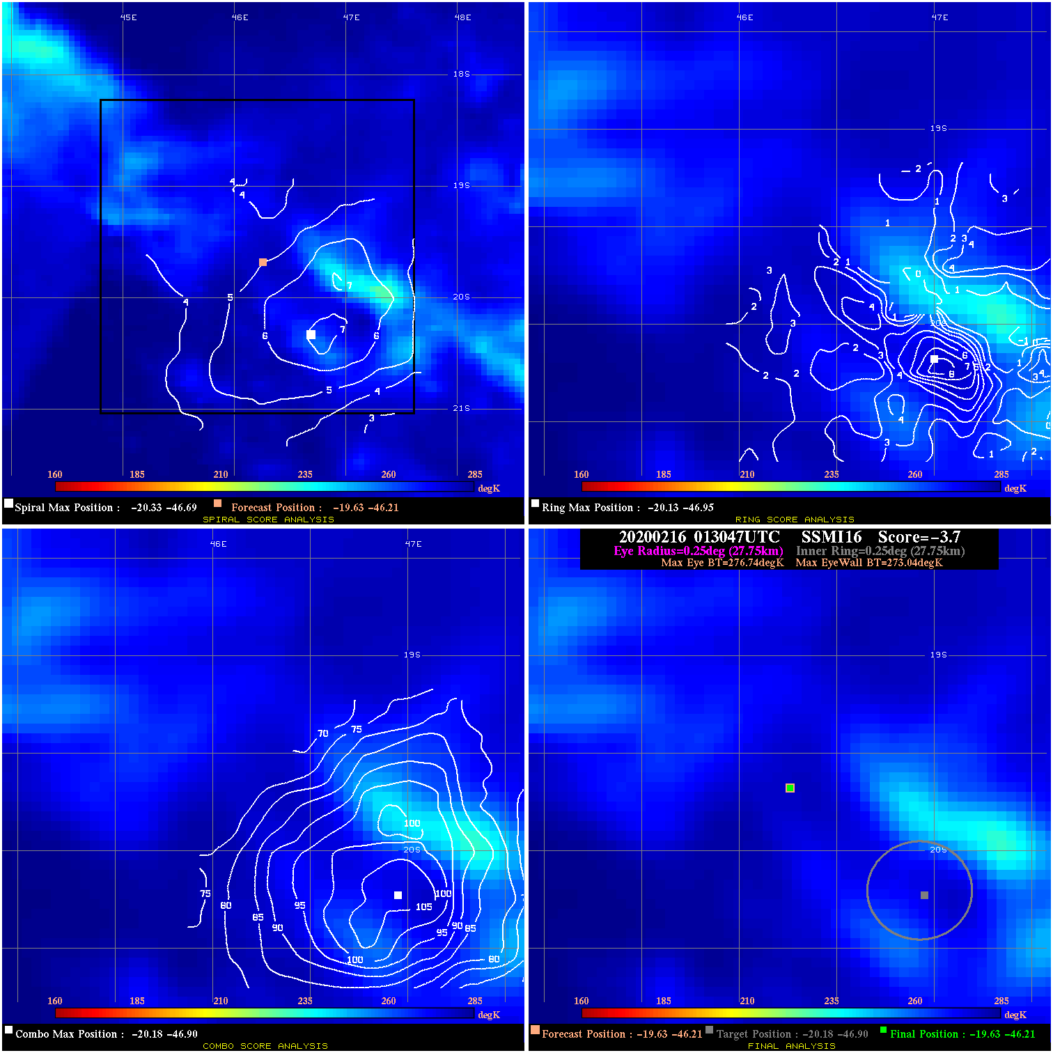
20200216 013047 -3.7 N/A N/A 55.55 3.70 35.0 SSMI16 -19.6 -46.2 -19.6 -46.2 -20.2 -46.9 Analysis Plot
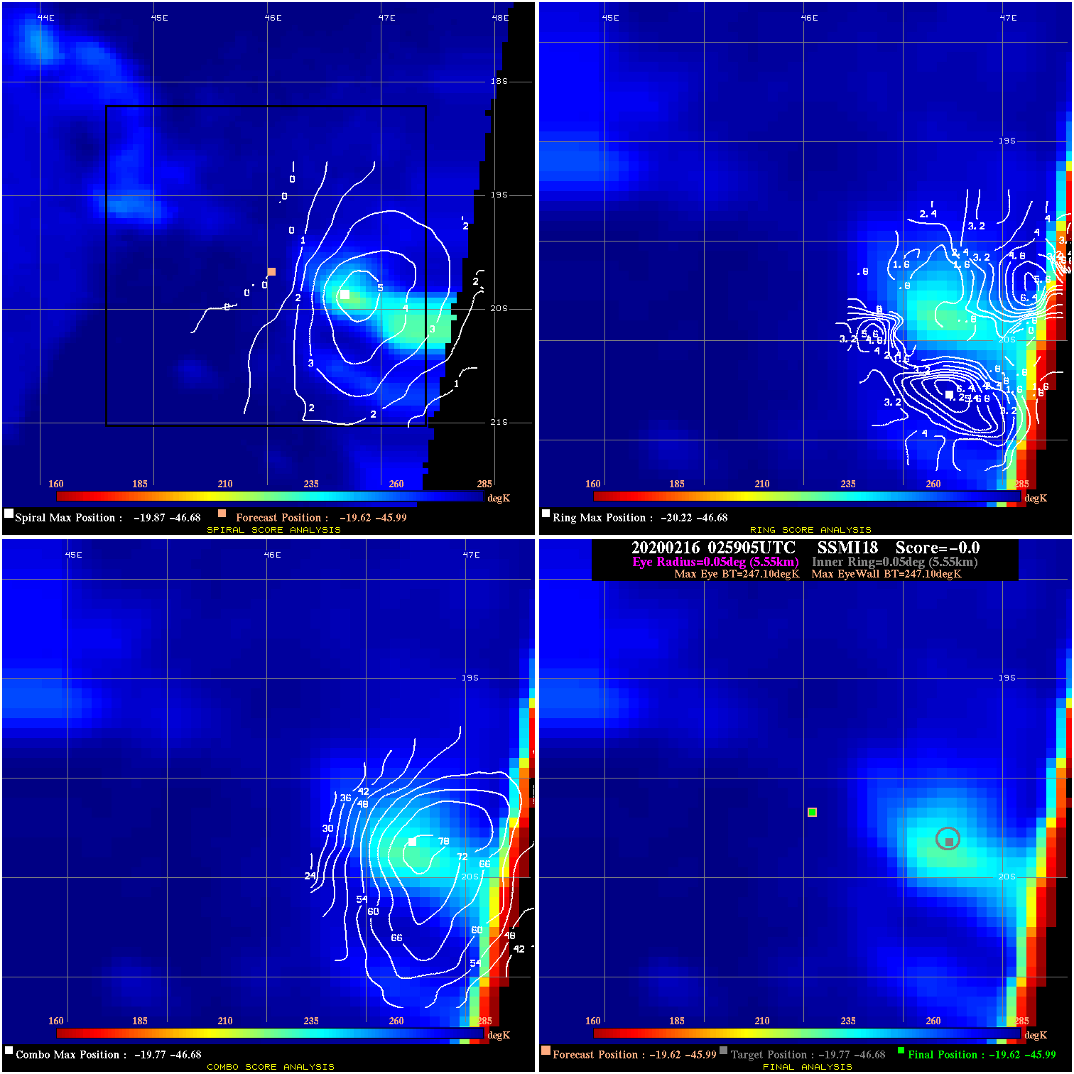
20200216 025905 N/A N/A N/A N/A N/A 35.0 SSMI18 -19.6 -46.0 -19.6 -46.0 -19.8 -46.7 Analysis Plot
|
|
Legend: - Date/Time are determined from PMW imagery at Forecast (initial guess) Lat/Lon position. - Positive/Negative Latitude = North/South Hemisphere; Longitude = Western/Eastern Hemisphere. - "Ring Diam" value indicates the estimated surface eyewall diameter in km (the MI eyewall edge diameter minus 10 km). - "Ring Pct" is the percentage of the "ring" (eyewall inner boundary) that is 1) colder than the "hot spot" (warmest eye pixel) in the eye by 20K, or 2) the percentage that is a) colder than 232K and b) colder than the "hot spot" by 10K, whichever is greater. - Values are red if Ring % <= 65, yellow/brown if Ring % <= 85 and green if Ring % > 85. - "Tb diff" is the difference between the "hot spot" (warmest eye pixel) and the warmest pixel on the eyewall. - Intensity score are listed as negative, and not used, when the JTWC or NHC estimated Vmax is <55 kts in order to rule out weak but highly symmetric TCs. - Error messages in intensity scores: -920 is used when the hottest pixel in the eye is <200K, to prevent false positives; -930 means <85% of eyewall has observations/data. |