Tropical Storm 11R
|
Passive Microwave (PMW) Intensity Information Hurricane Intensity Estimation (HIE) Algorithm Version 9.0 |
Overpass Inten Ring Ring Wind Forecast Final Target
Date Time Score Meaning Pct Diam BTdiff Est Sat Lat Lon Lat Lon Lat Lon
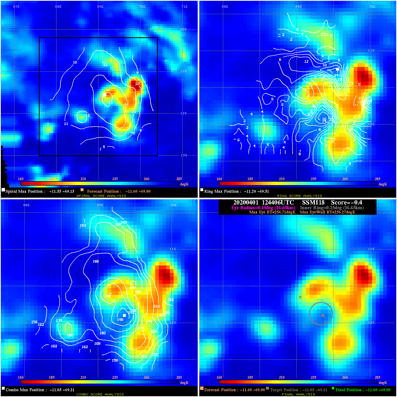
20200401 124406 -0.4 N/A 35.6% 33.33 .44 25.0 SSMI18 -11.6 -69.0 -11.6 -69.0 -11.9 -69.3 Analysis Plot
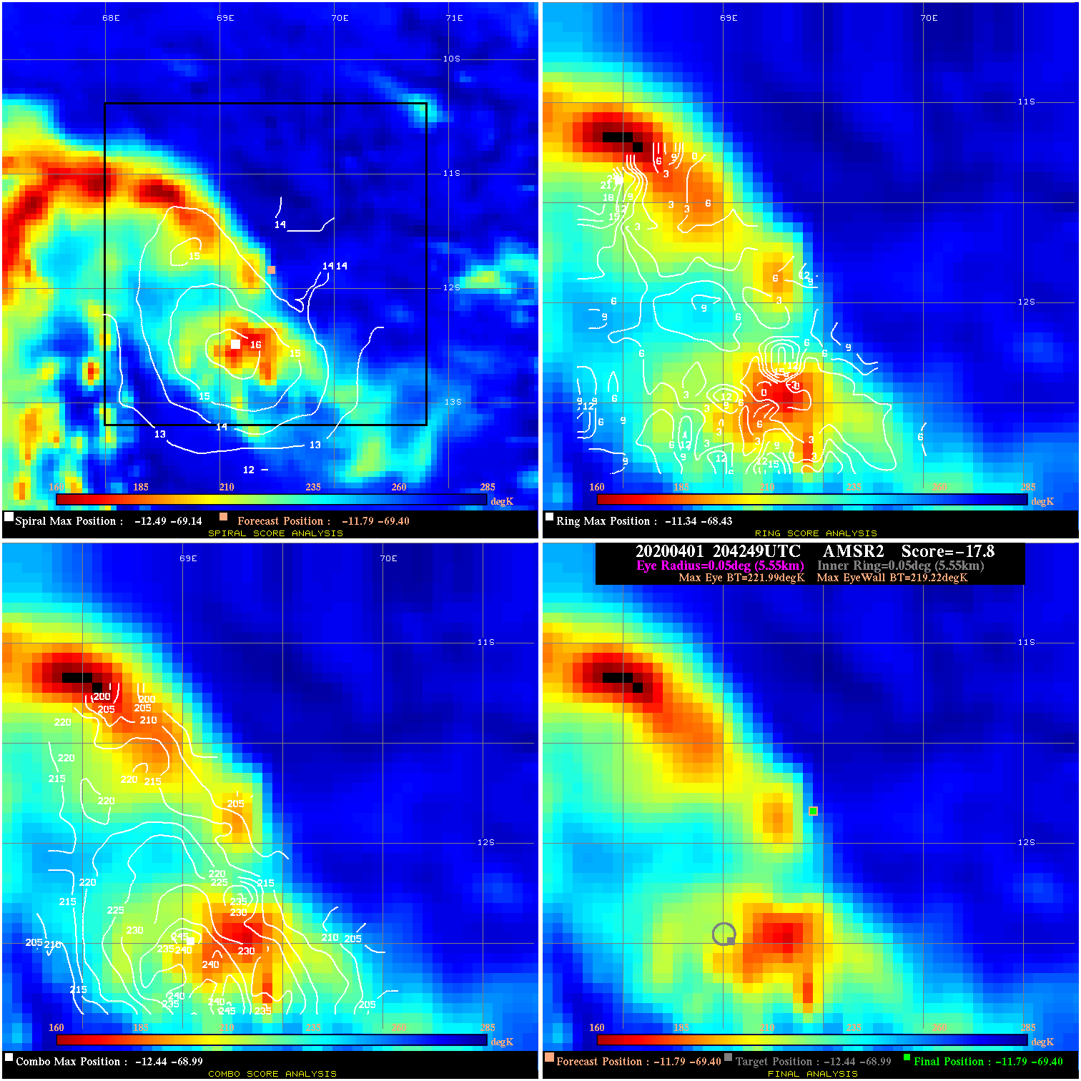
20200401 204249 -17.8 N/A 100.0% 11.11 2.77 25.0 AMSR2 -11.8 -69.4 -11.8 -69.4 -12.4 -69.0 Analysis Plot
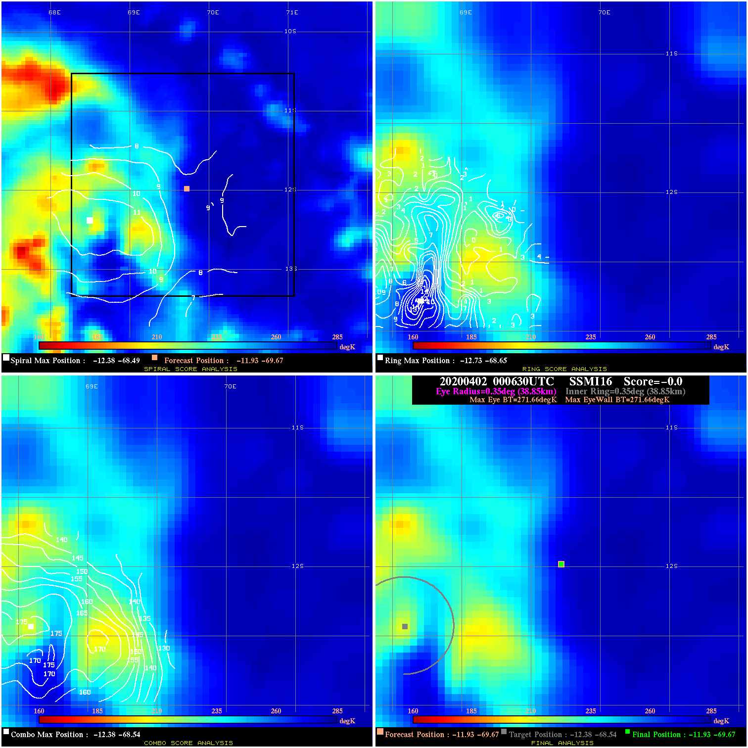
20200402 000630 N/A N/A N/A N/A N/A 25.0 SSMI16 -11.9 -69.7 -11.9 -69.7 -12.4 -68.5 Analysis Plot
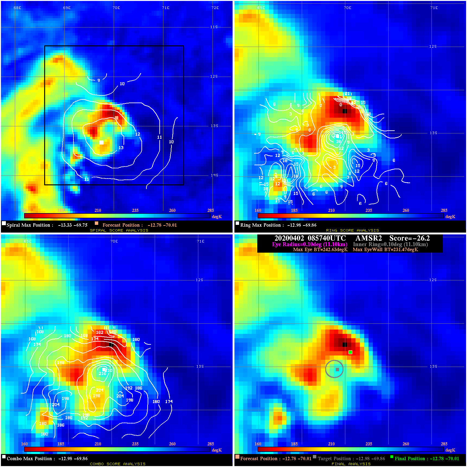
20200402 085740 -26.2 N/A 100.0% 22.22 11.16 35.0 AMSR2 -12.8 -70.0 -12.8 -70.0 -13.0 -69.9 Analysis Plot
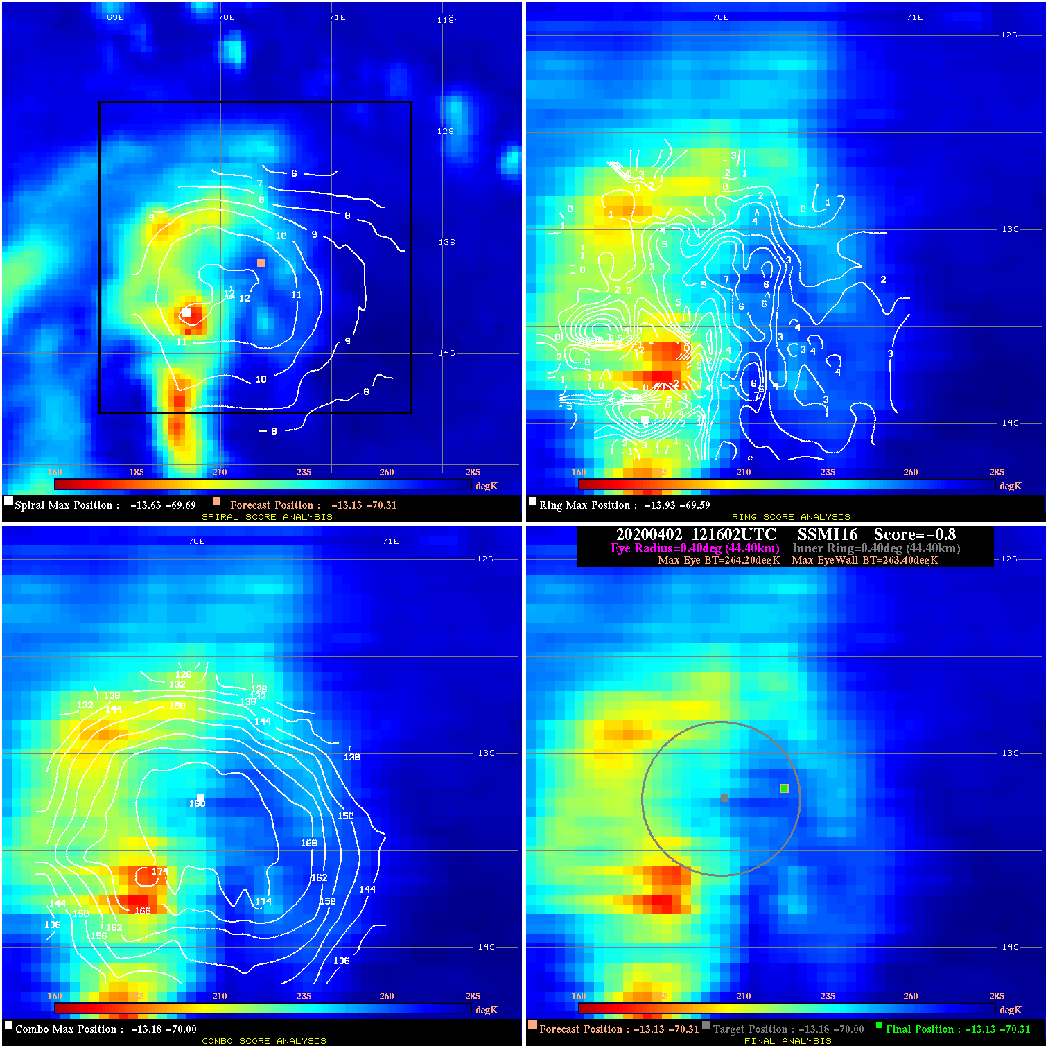
20200402 121602 -0.8 N/A 53.4% 88.88 .80 35.0 SSMI16 -13.1 -70.3 -13.1 -70.3 -13.2 -70.0 Analysis Plot
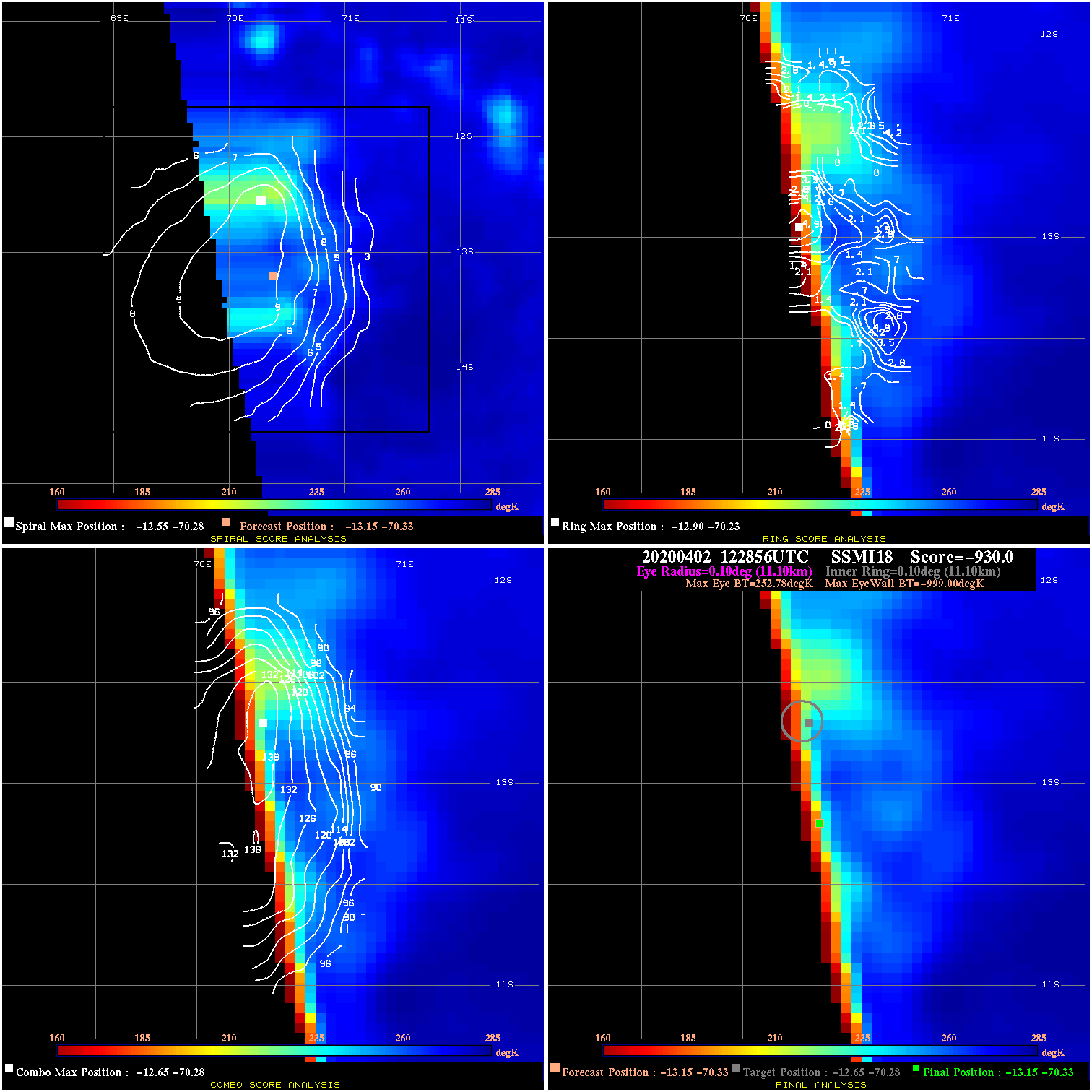
20200402 122856 -930.0 N/A N/A N/A 0.00 35.0 SSMI18 -13.1 -70.3 -13.1 -70.3 -12.6 -70.3 Analysis Plot
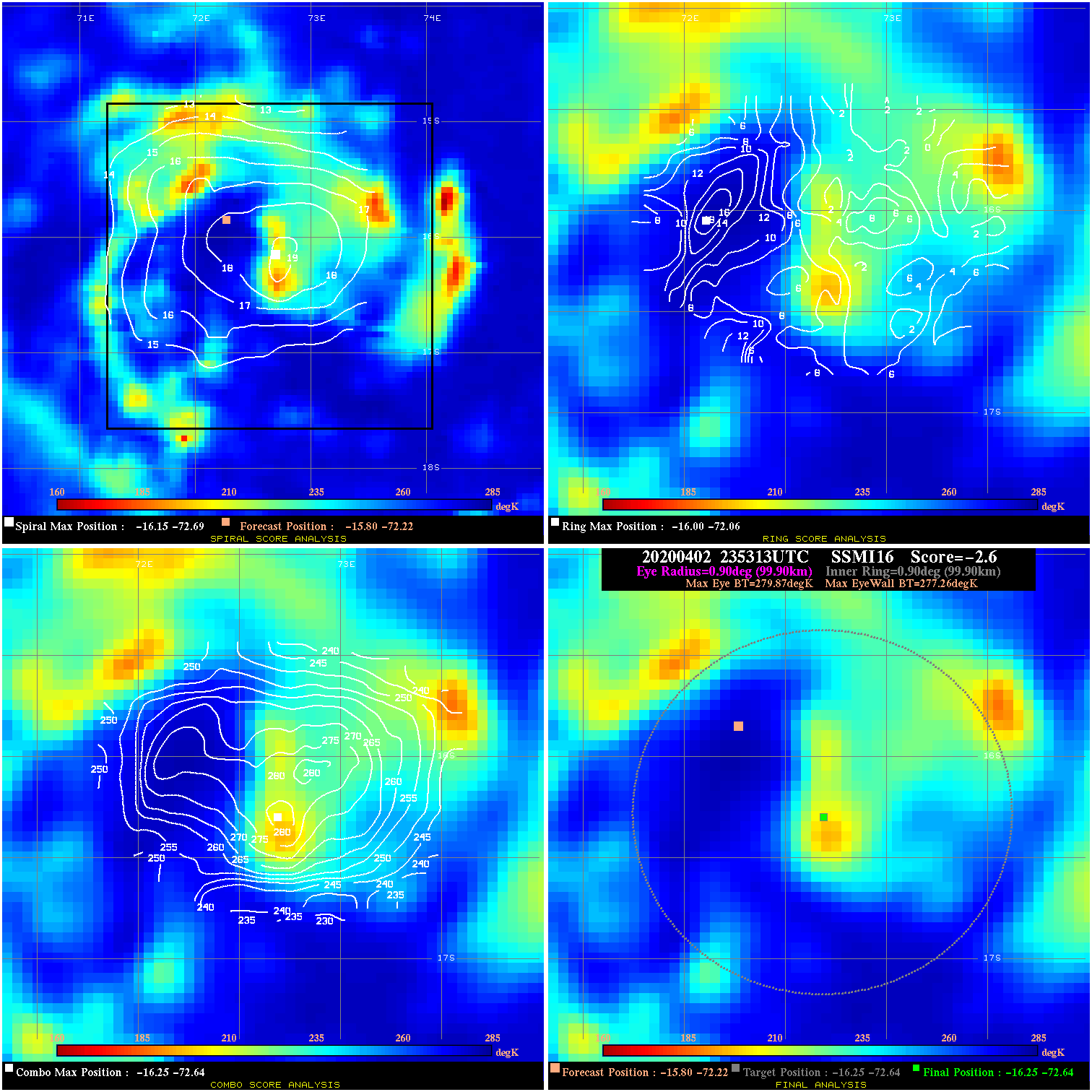
20200402 235313 -2.6 N/A 28.8% 199.98 2.61 40.0 SSMI16 -15.8 -72.2 -16.3 -72.6 -16.3 -72.6 Analysis Plot
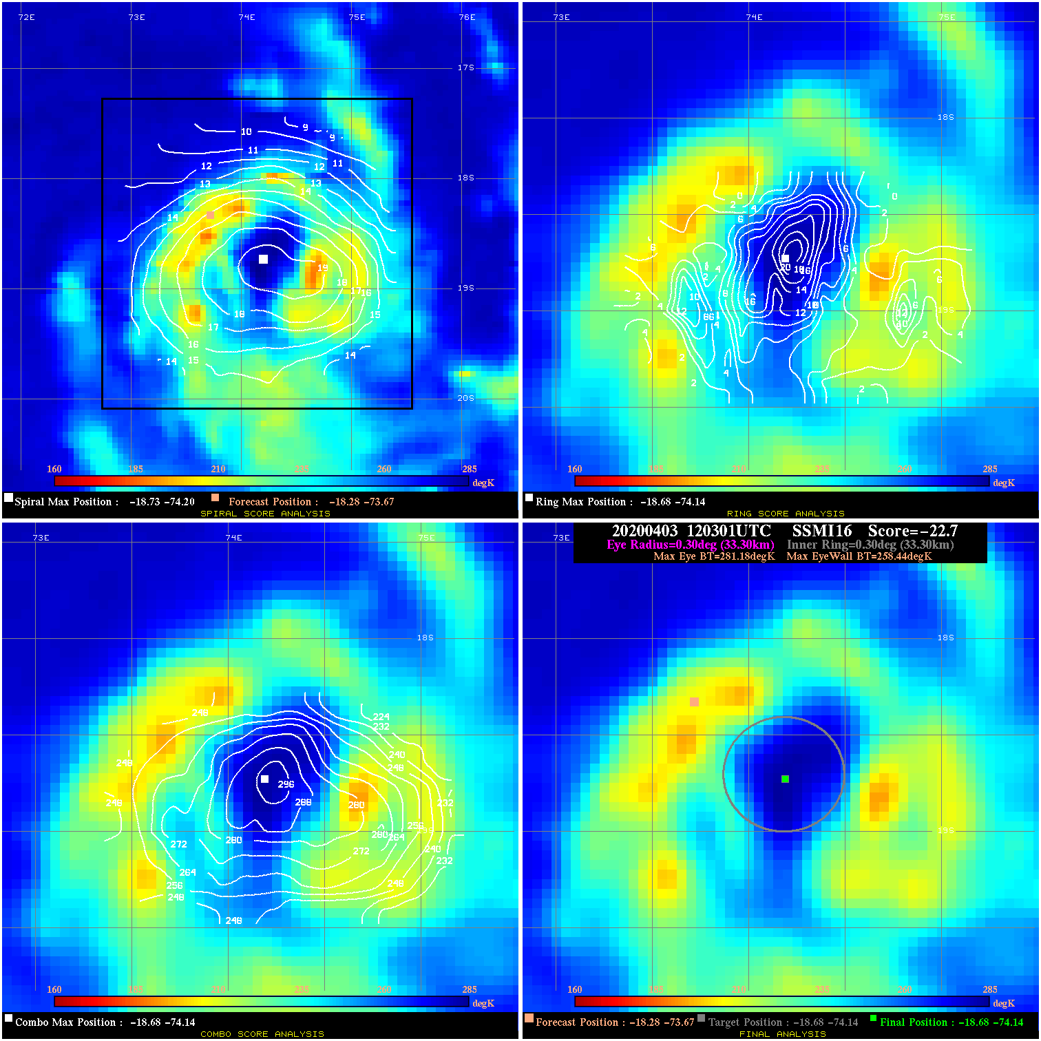
20200403 120301 -22.7 N/A 75.3% 66.66 22.74 50.0 SSMI16 -18.3 -73.7 -18.7 -74.1 -18.7 -74.1 Analysis Plot
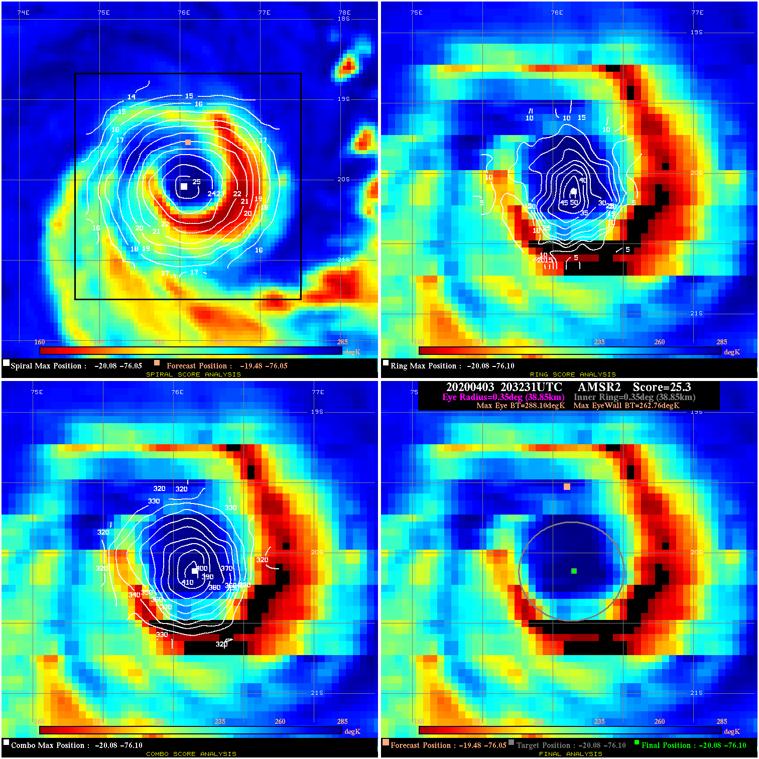
20200403 203231 25.3 >65 kts 79.5% 77.77 25.34 65.0 AMSR2 -19.5 -76.1 -20.1 -76.1 -20.1 -76.1 Analysis Plot
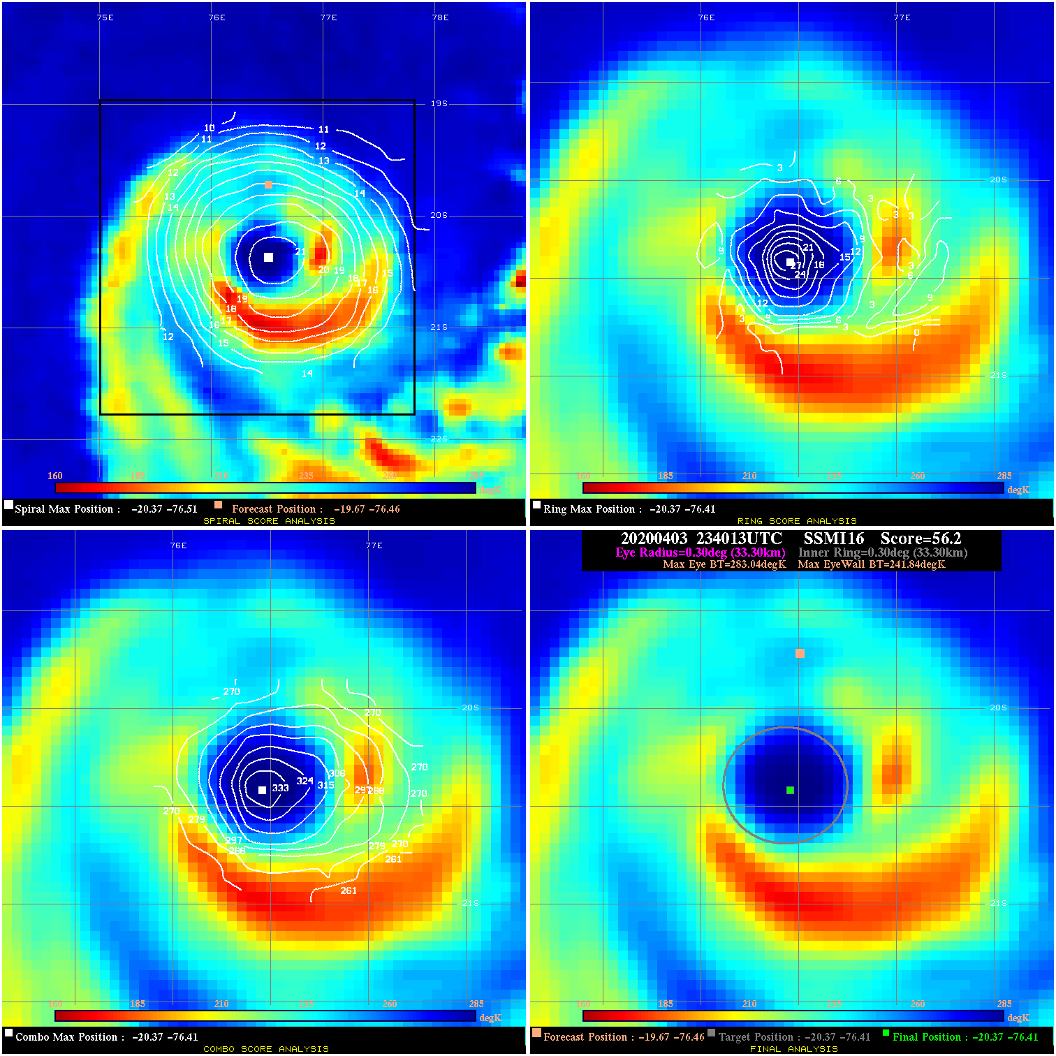
20200403 234013 56.2 >65 kts 100.0% 66.66 41.20 65.0 SSMI16 -19.7 -76.5 -20.4 -76.4 -20.4 -76.4 Analysis Plot
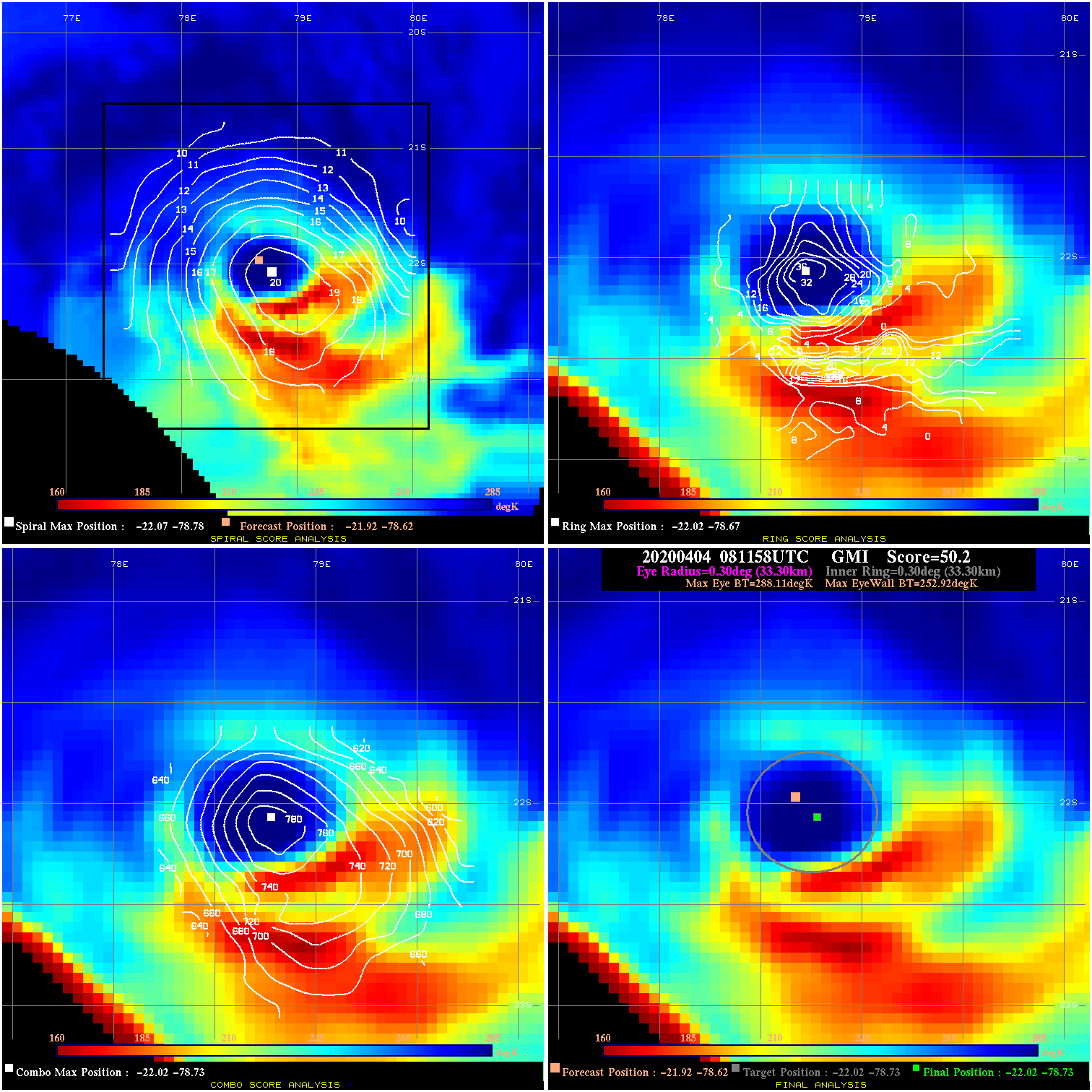
20200404 081158 50.2 >65 kts 100.0% 66.66 35.19 95.0 GMI -21.9 -78.6 -22.0 -78.7 -22.0 -78.7 Analysis Plot
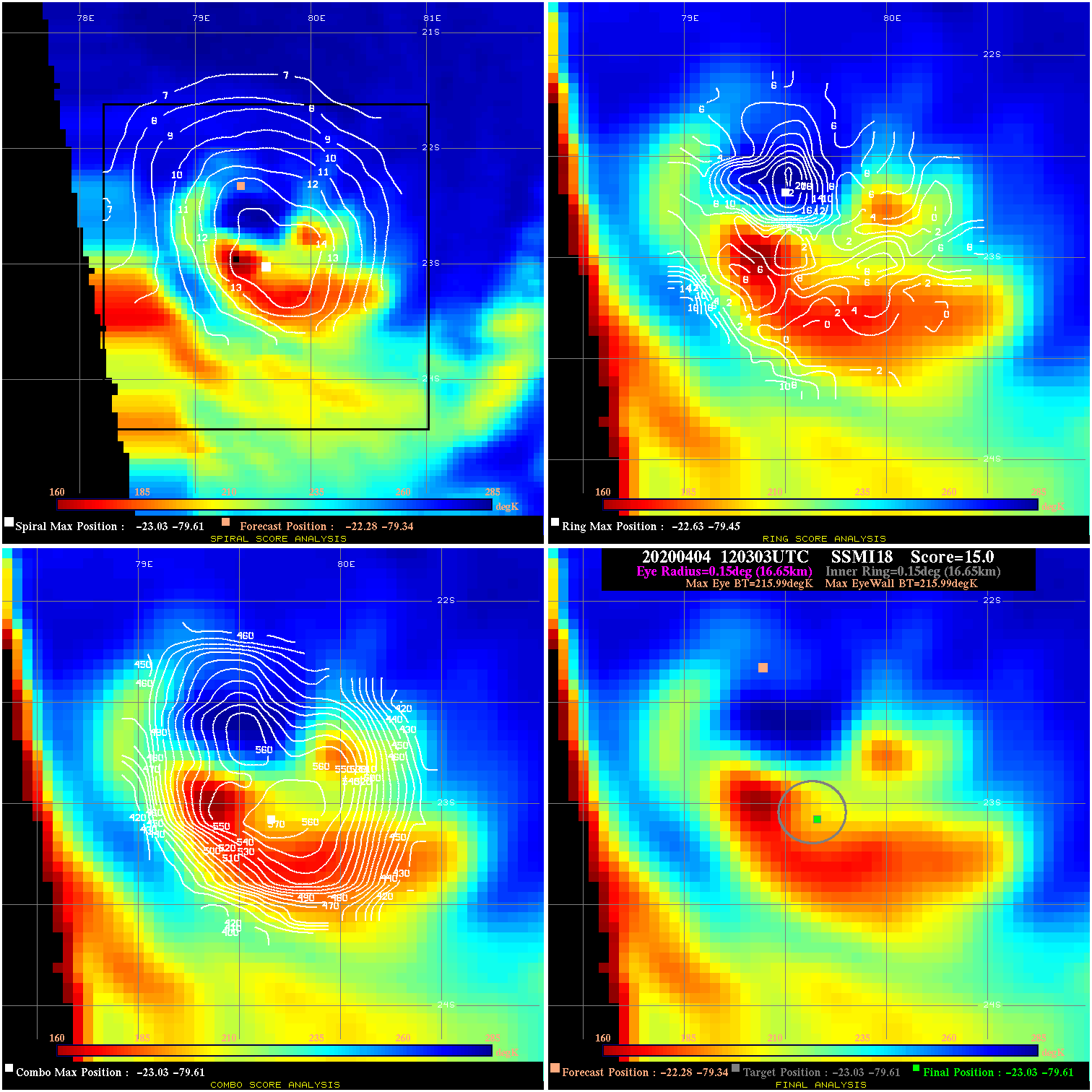
20200404 120303 N/A N/A N/A N/A N/A 95.0 SSMI18 -22.3 -79.3 -23.0 -79.6 -23.0 -79.6 Analysis Plot
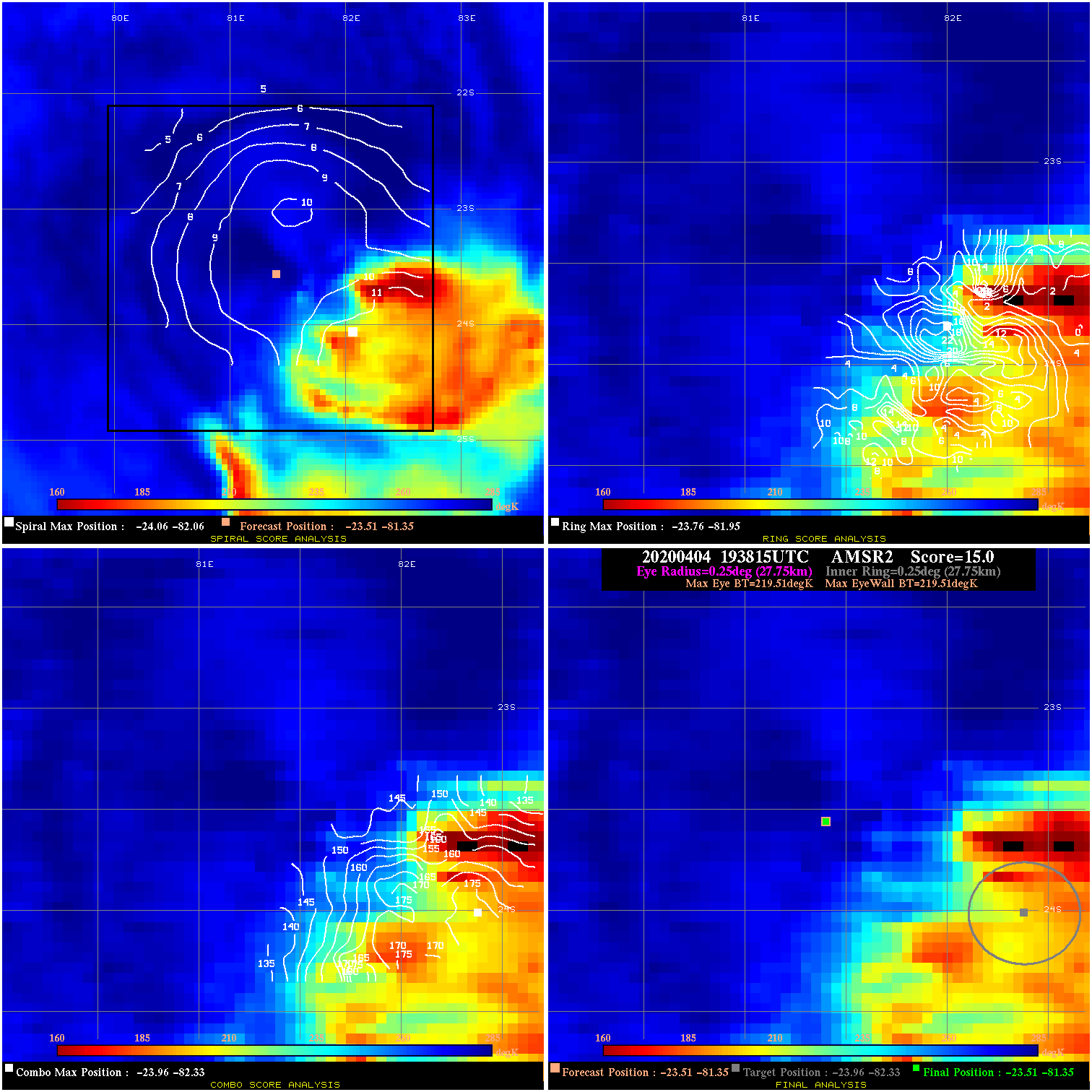
20200404 193815 N/A N/A N/A N/A N/A 80.0 AMSR2 -23.5 -81.3 -23.5 -81.3 -24.0 -82.3 Analysis Plot
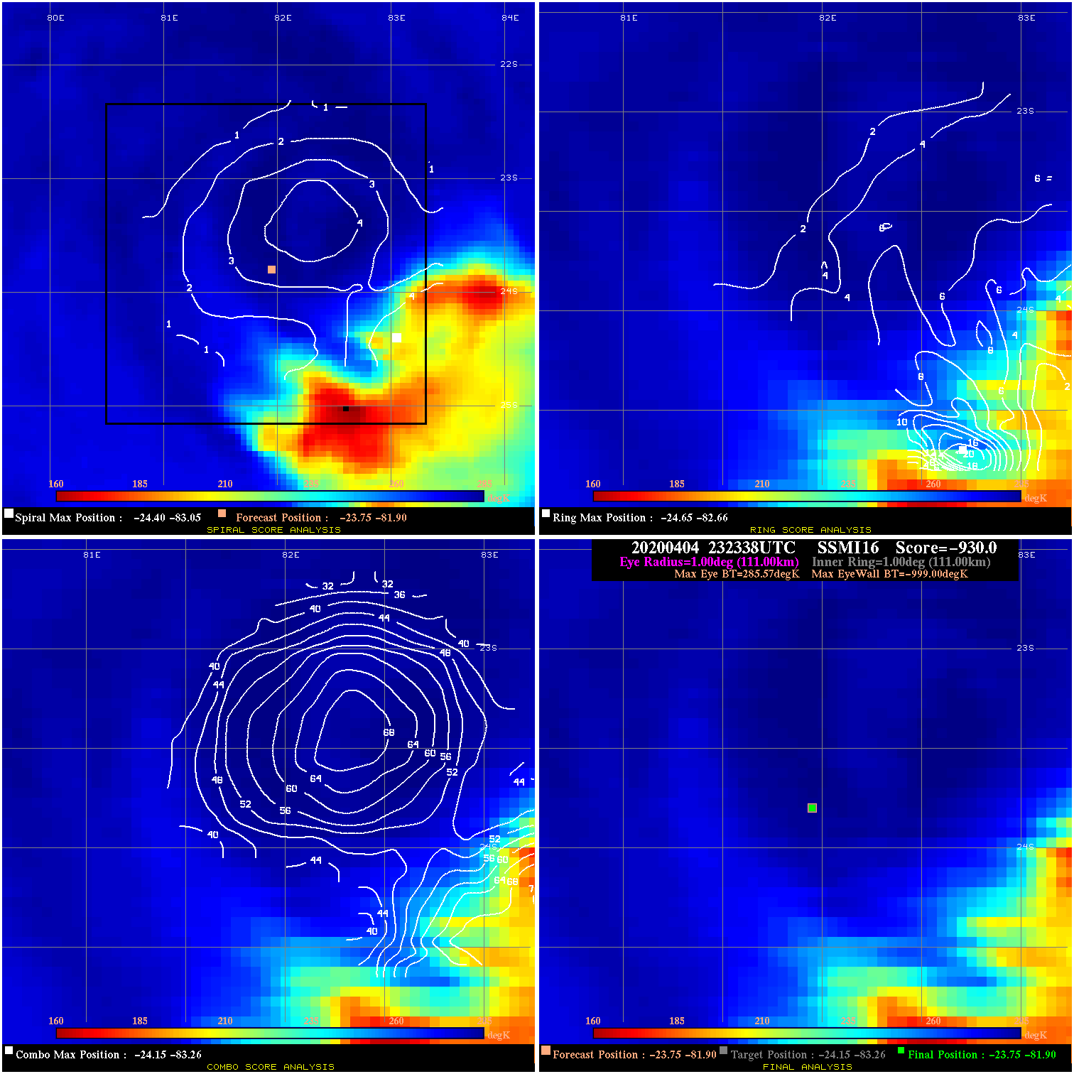
20200404 232338 -930.0 N/A N/A N/A 0.00 80.0 SSMI16 -23.8 -81.9 -23.8 -81.9 -24.1 -83.3 Analysis Plot
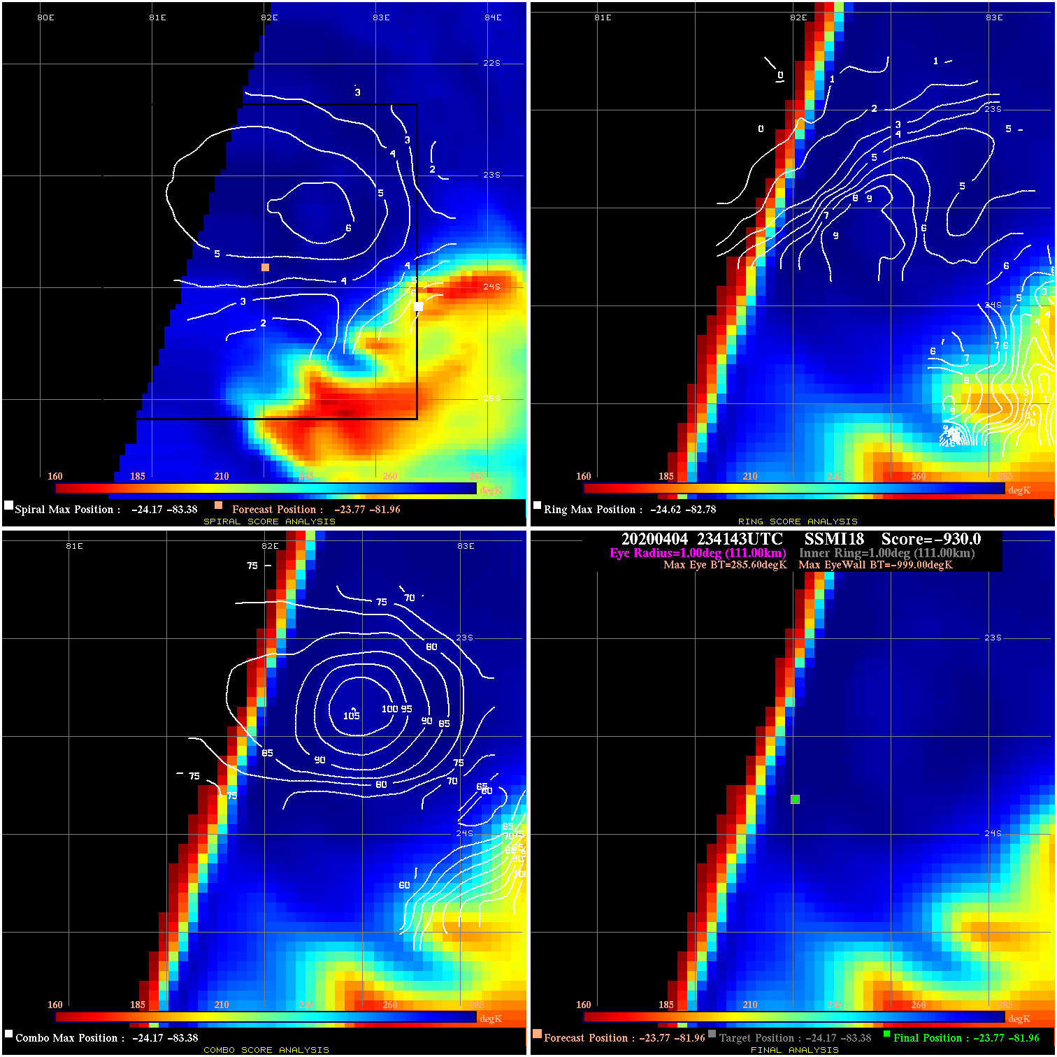
20200404 234143 -930.0 N/A N/A N/A 0.00 80.0 SSMI18 -23.8 -82.0 -23.8 -82.0 -24.2 -83.4 Analysis Plot
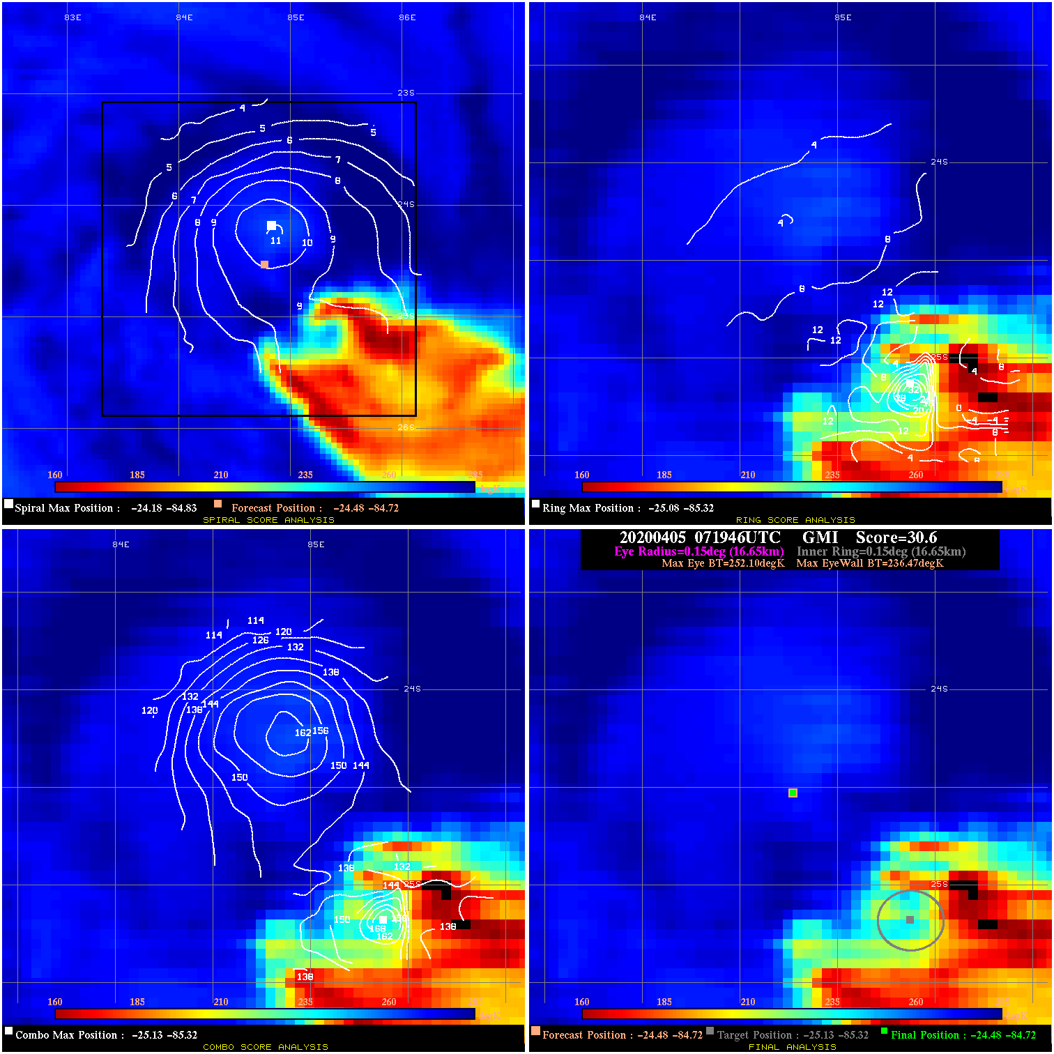
20200405 071946 30.6 >65 kts 91.8% 33.33 15.63 60.0 GMI -24.5 -84.7 -24.5 -84.7 -25.1 -85.3 Analysis Plot
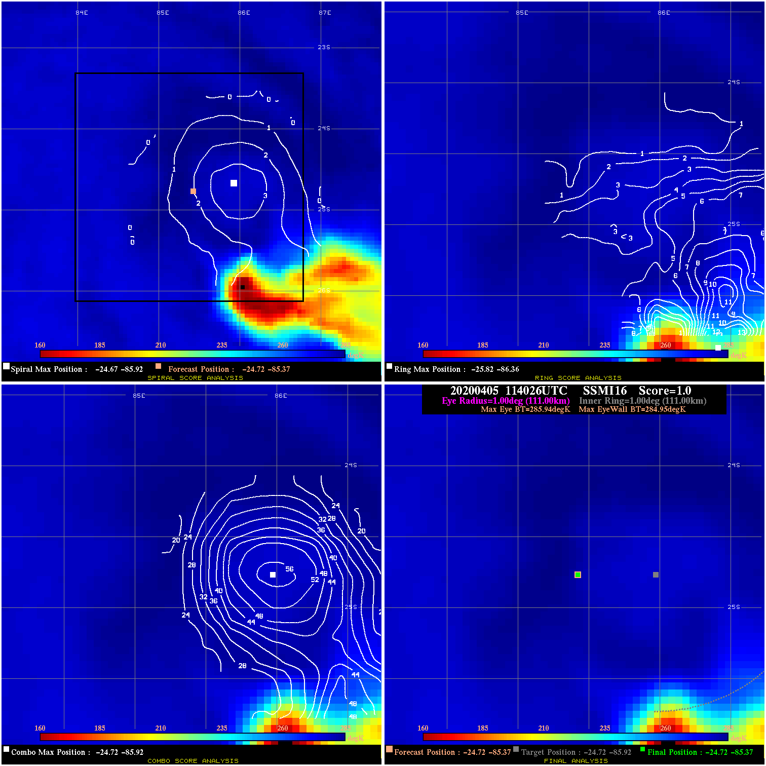
20200405 114026 1.0 N/A 17.8% 222.20 .99 60.0 SSMI16 -24.7 -85.4 -24.7 -85.4 -24.7 -85.9 Analysis Plot
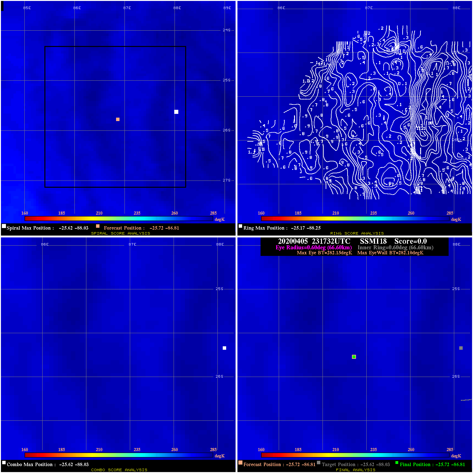
20200405 231732 0.0 N/A N/A 133.32 .05 60.0 SSMI18 -25.7 -86.8 -25.7 -86.8 -25.6 -88.0 Analysis Plot
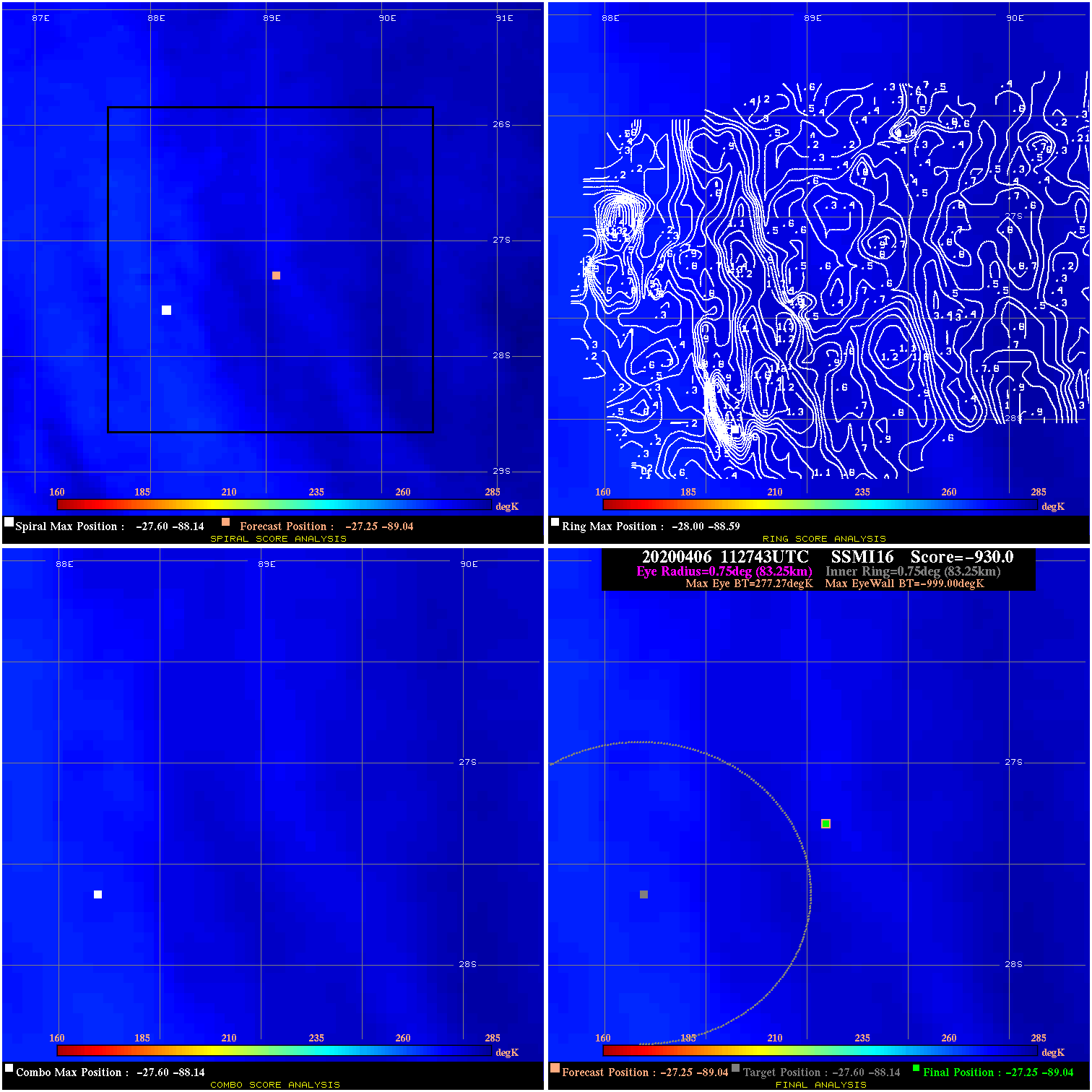
20200406 112743 -930.0 N/A N/A N/A 0.00 60.0 SSMI16 -27.3 -89.0 -27.3 -89.0 -27.6 -88.1 Analysis Plot
|
|
Legend: - Date/Time are determined from PMW imagery at Forecast (initial guess) Lat/Lon position. - Positive/Negative Latitude = North/South Hemisphere; Longitude = Western/Eastern Hemisphere. - "Ring Diam" value indicates the estimated surface eyewall diameter in km (the MI eyewall edge diameter minus 10 km). - "Ring Pct" is the percentage of the "ring" (eyewall inner boundary) that is 1) colder than the "hot spot" (warmest eye pixel) in the eye by 20K, or 2) the percentage that is a) colder than 232K and b) colder than the "hot spot" by 10K, whichever is greater. - Values are red if Ring % <= 65, yellow/brown if Ring % <= 85 and green if Ring % > 85. - "Tb diff" is the difference between the "hot spot" (warmest eye pixel) and the warmest pixel on the eyewall. - Intensity score are listed as negative, and not used, when the JTWC or NHC estimated Vmax is <55 kts in order to rule out weak but highly symmetric TCs. - Error messages in intensity scores: -920 is used when the hottest pixel in the eye is <200K, to prevent false positives; -930 means <85% of eyewall has observations/data. |