Tropical Storm 30Y_05
|
Passive Microwave (PMW) Intensity Information Hurricane Intensity Estimation (HIE) Algorithm Version 9.0 |
Overpass Inten Ring Ring Wind Forecast Final Target
Date Time Score Meaning Pct Diam BTdiff Est Sat Lat Lon Lat Lon Lat Lon
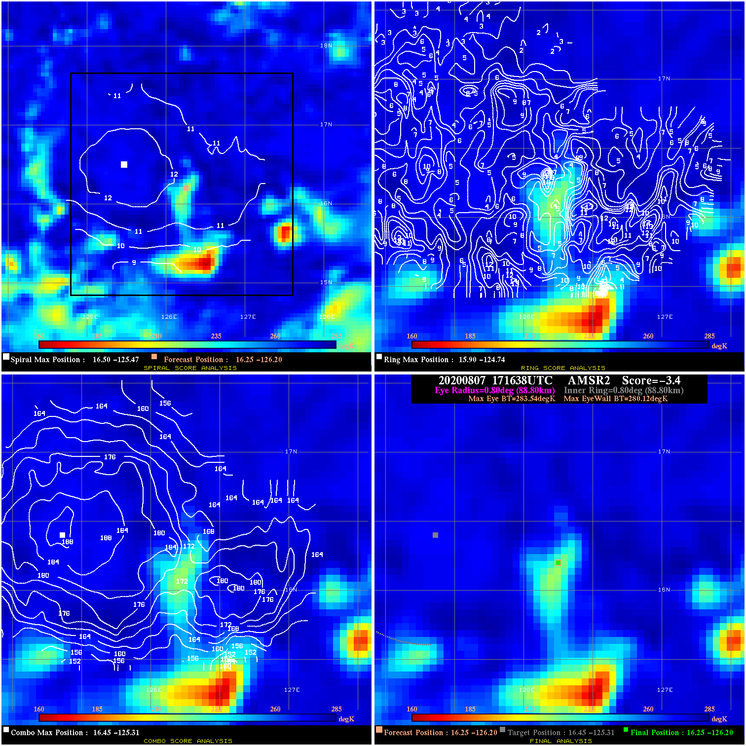
20200807 171638 -3.4 N/A 13.7% 177.76 3.42 30.0 AMSR2 16.3 -126.2 16.3 -126.2 16.5 -125.3 Analysis Plot
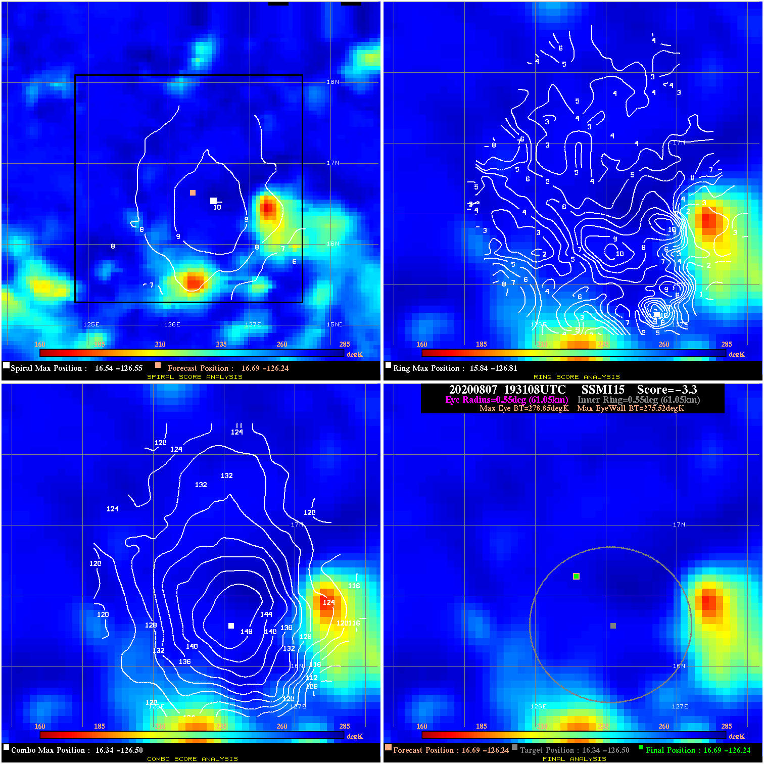
20200807 193108 -3.3 N/A 24.7% 122.21 3.33 30.0 SSMI15 16.7 -126.2 16.7 -126.2 16.3 -126.5 Analysis Plot
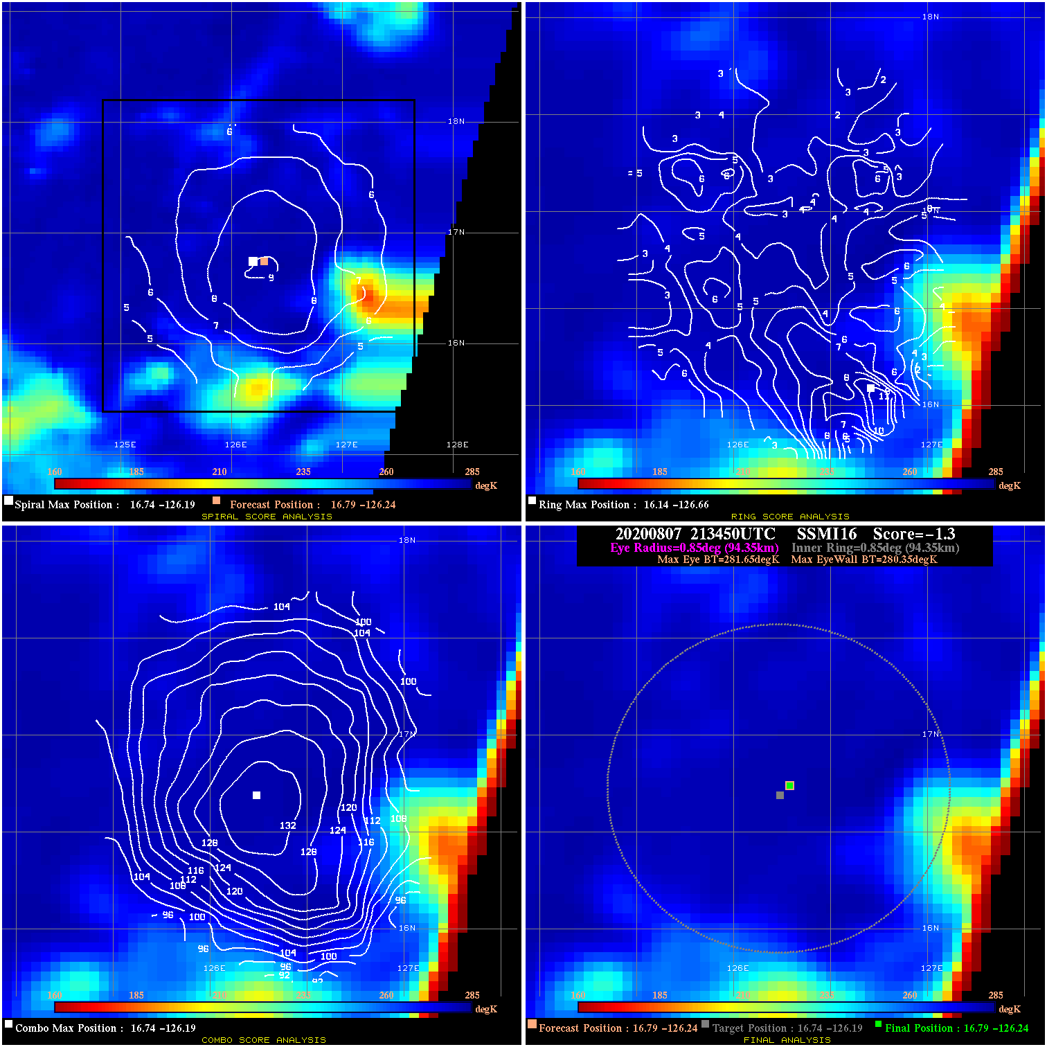
20200807 213450 -1.3 N/A 8.2% 188.87 1.30 30.0 SSMI16 16.8 -126.2 16.8 -126.2 16.7 -126.2 Analysis Plot
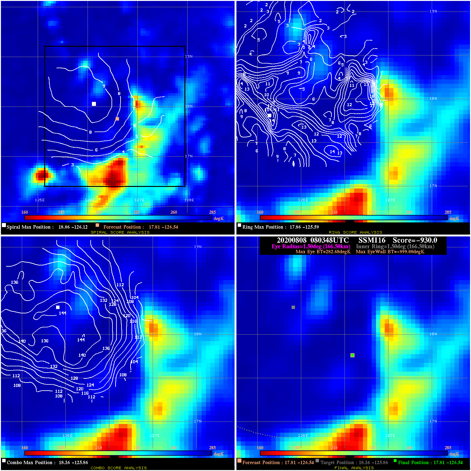
20200808 080348 -930.0 N/A N/A N/A 0.00 30.0 SSMI16 17.8 -126.5 17.8 -126.5 18.4 -125.9 Analysis Plot
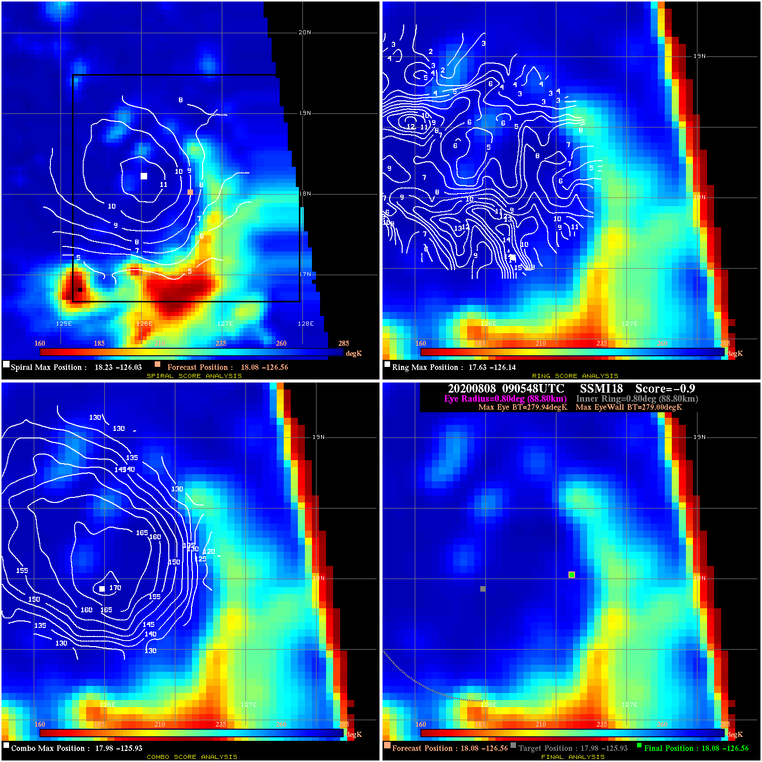
20200808 090548 -0.9 N/A 37.0% 177.76 .94 30.0 SSMI18 18.1 -126.6 18.1 -126.6 18.0 -125.9 Analysis Plot
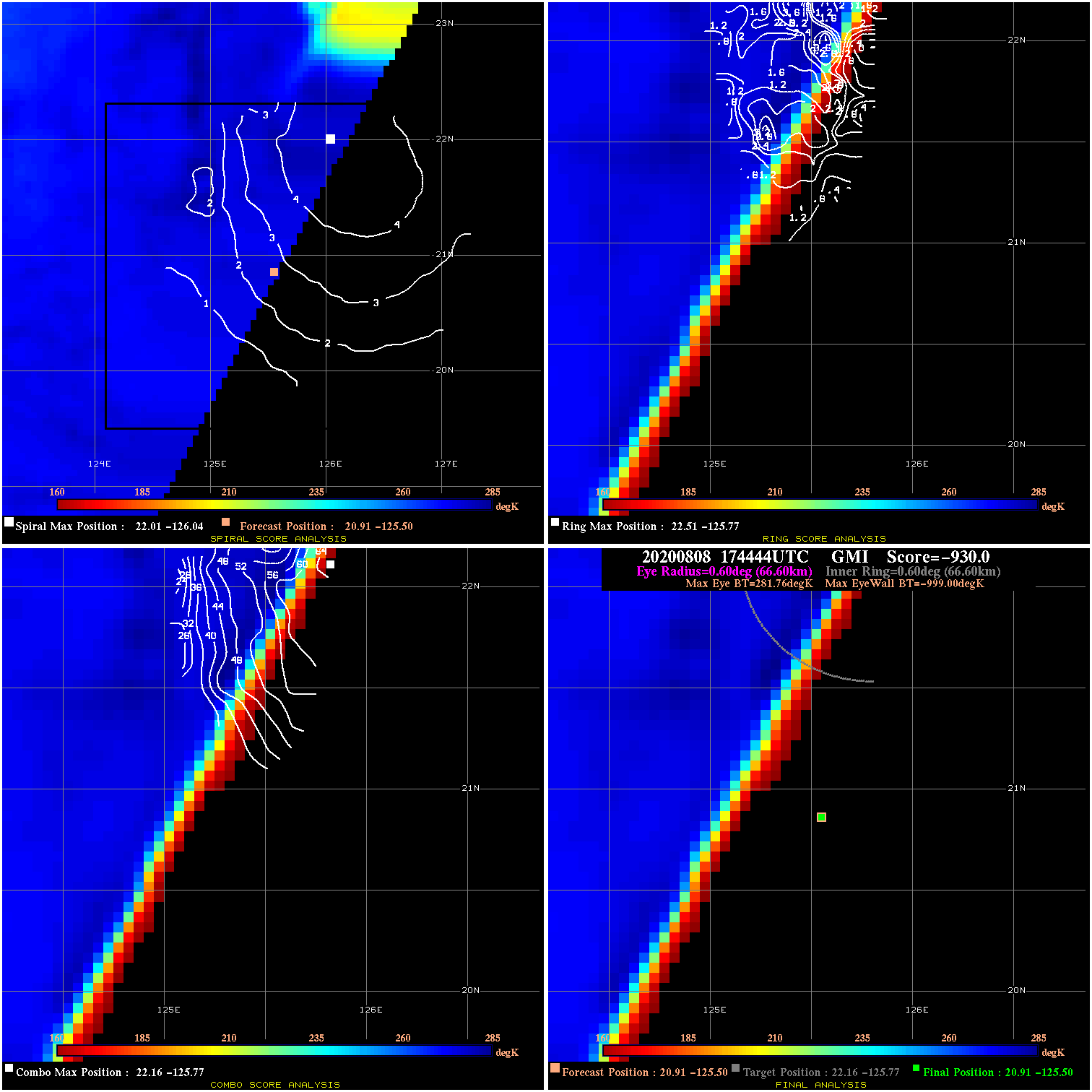
20200808 174444 -930.0 N/A N/A N/A 0.00 30.0 GMI 20.9 -125.5 20.9 -125.5 22.2 -125.8 Analysis Plot
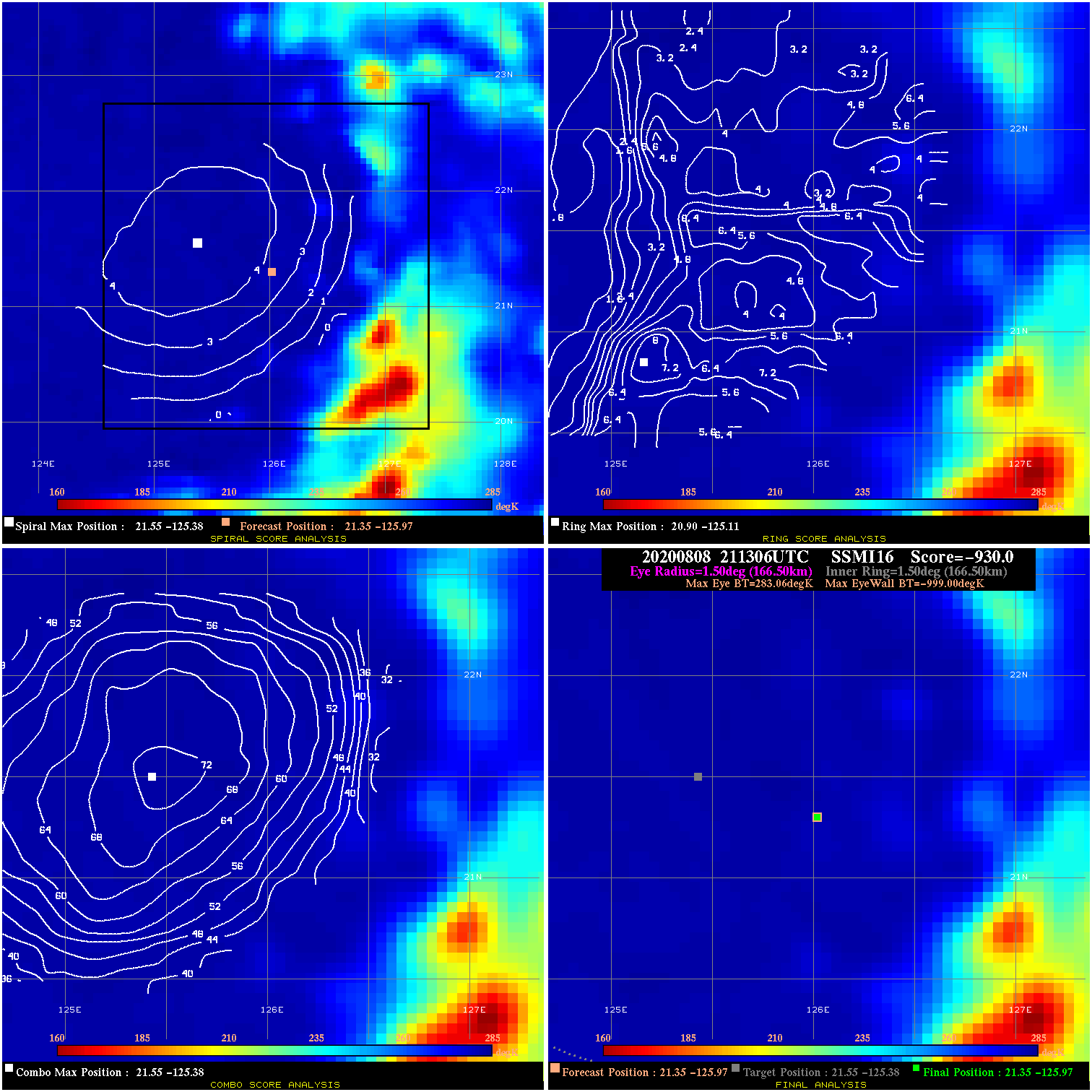
20200808 211306 -930.0 N/A N/A N/A 0.00 35.0 SSMI16 21.4 -126.0 21.4 -126.0 21.5 -125.4 Analysis Plot
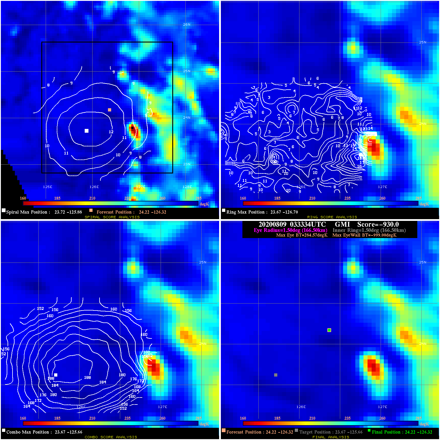
20200809 033334 -930.0 N/A N/A N/A 0.00 40.0 GMI 24.2 -126.3 24.2 -126.3 23.7 -125.7 Analysis Plot
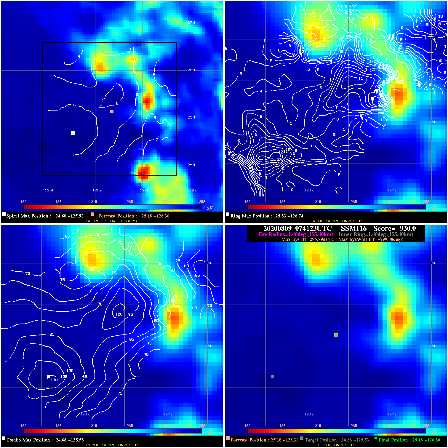
20200809 074123 -930.0 N/A N/A N/A 0.00 40.0 SSMI16 25.2 -126.3 25.2 -126.3 24.7 -125.5 Analysis Plot
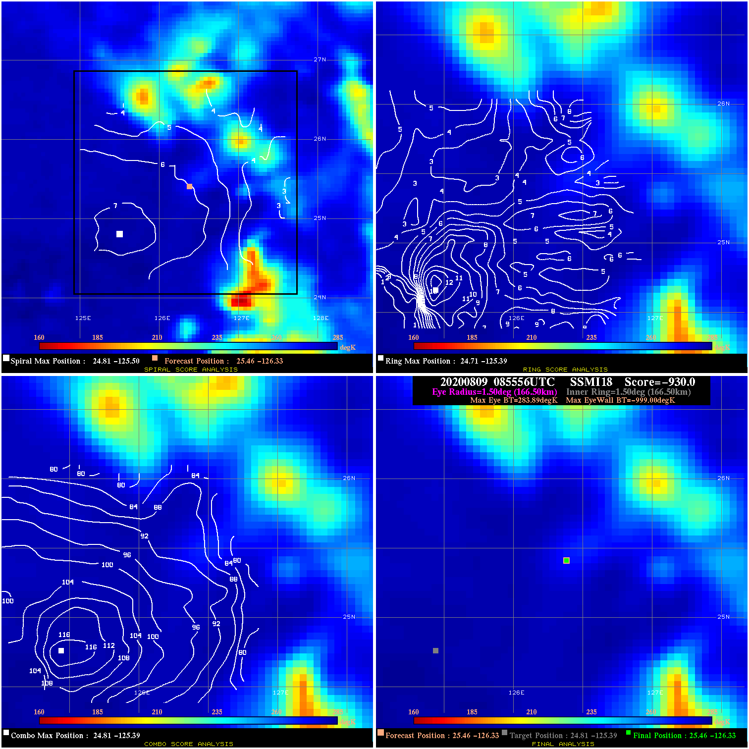
20200809 085556 -930.0 N/A N/A N/A 0.00 40.0 SSMI18 25.5 -126.3 25.5 -126.3 24.8 -125.4 Analysis Plot
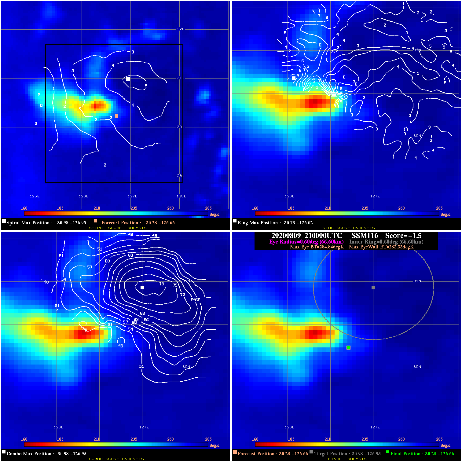
20200809 210000 -1.5 N/A 5.5% 133.32 1.51 45.0 SSMI16 30.3 -126.7 30.3 -126.7 31.0 -126.9 Analysis Plot
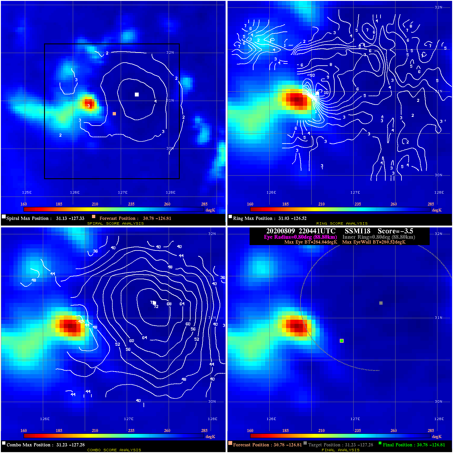
20200809 220441 -3.5 N/A 1.4% 177.76 3.52 45.0 SSMI18 30.8 -126.8 30.8 -126.8 31.2 -127.3 Analysis Plot
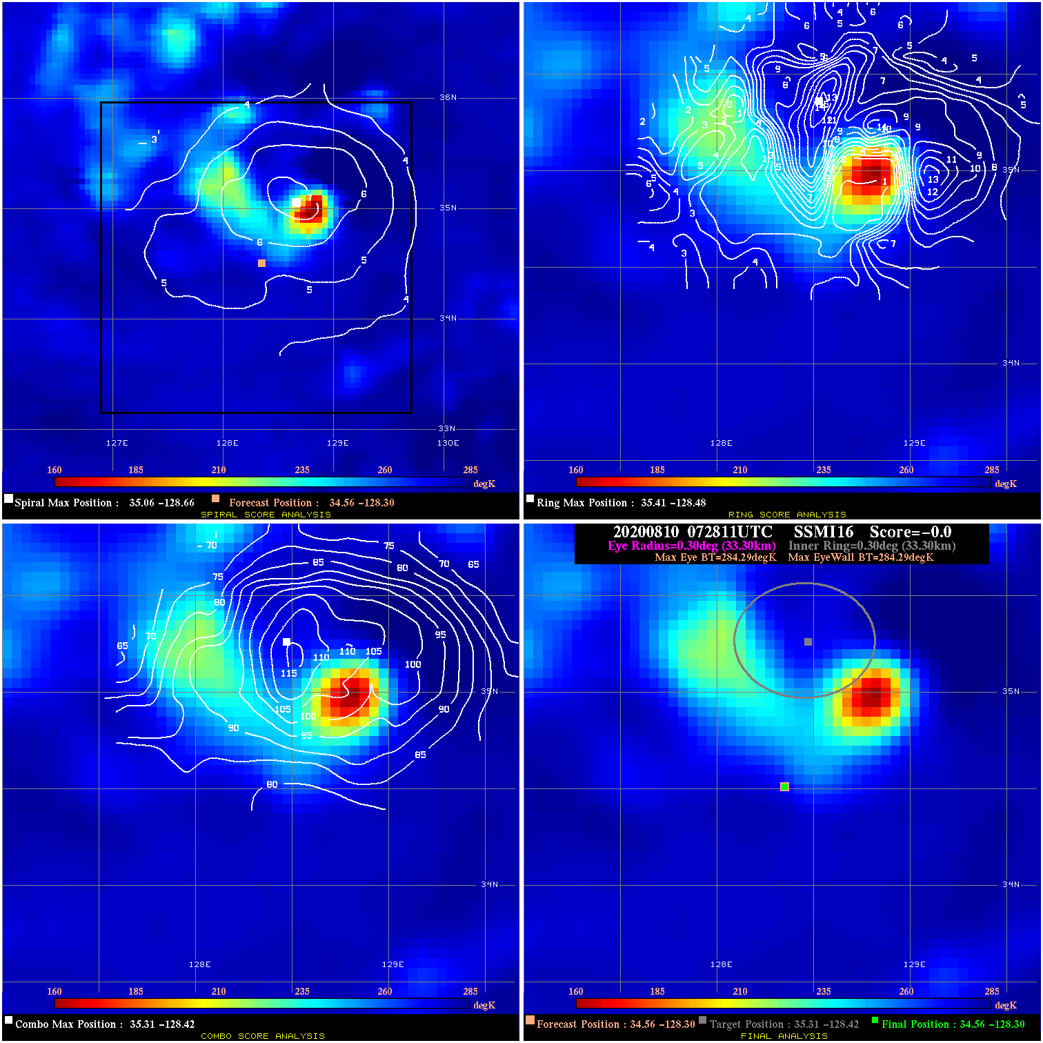
20200810 072811 N/A N/A N/A N/A N/A 40.0 SSMI16 34.6 -128.3 34.6 -128.3 35.3 -128.4 Analysis Plot
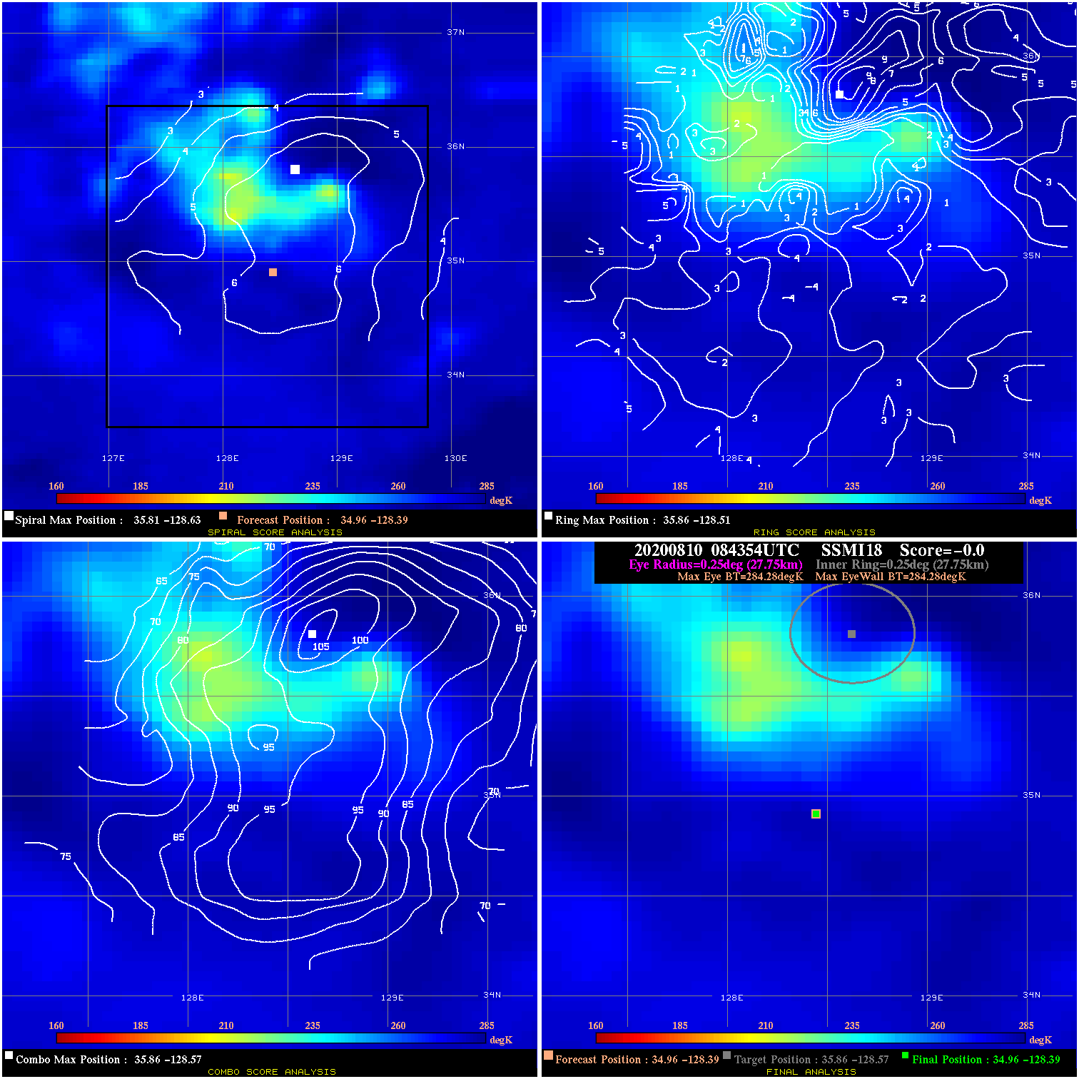
20200810 084354 N/A N/A N/A N/A N/A 40.0 SSMI18 35.0 -128.4 35.0 -128.4 35.9 -128.6 Analysis Plot
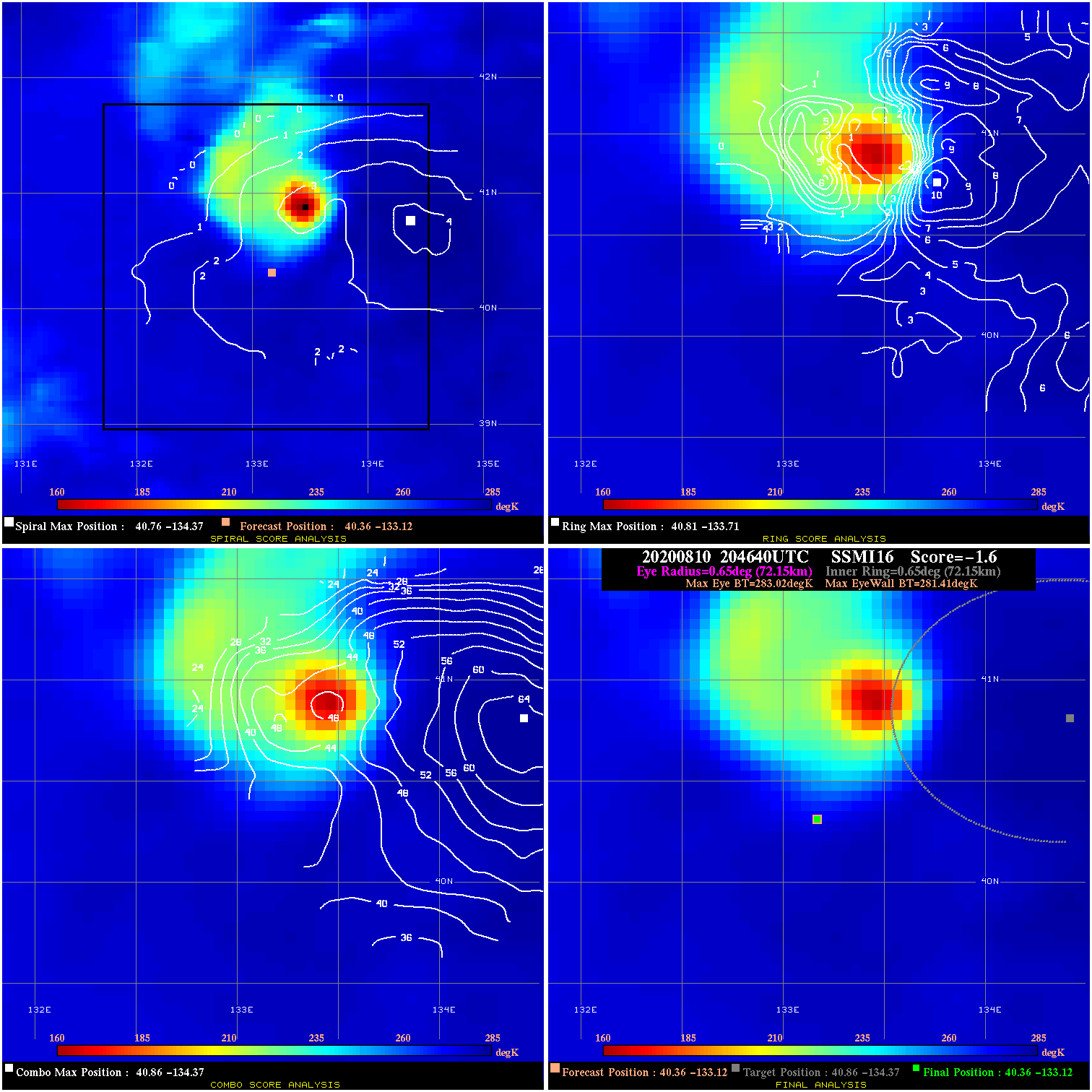
20200810 204640 -1.6 N/A 9.6% 144.43 1.61 40.0 SSMI16 40.4 -133.1 40.4 -133.1 40.9 -134.4 Analysis Plot
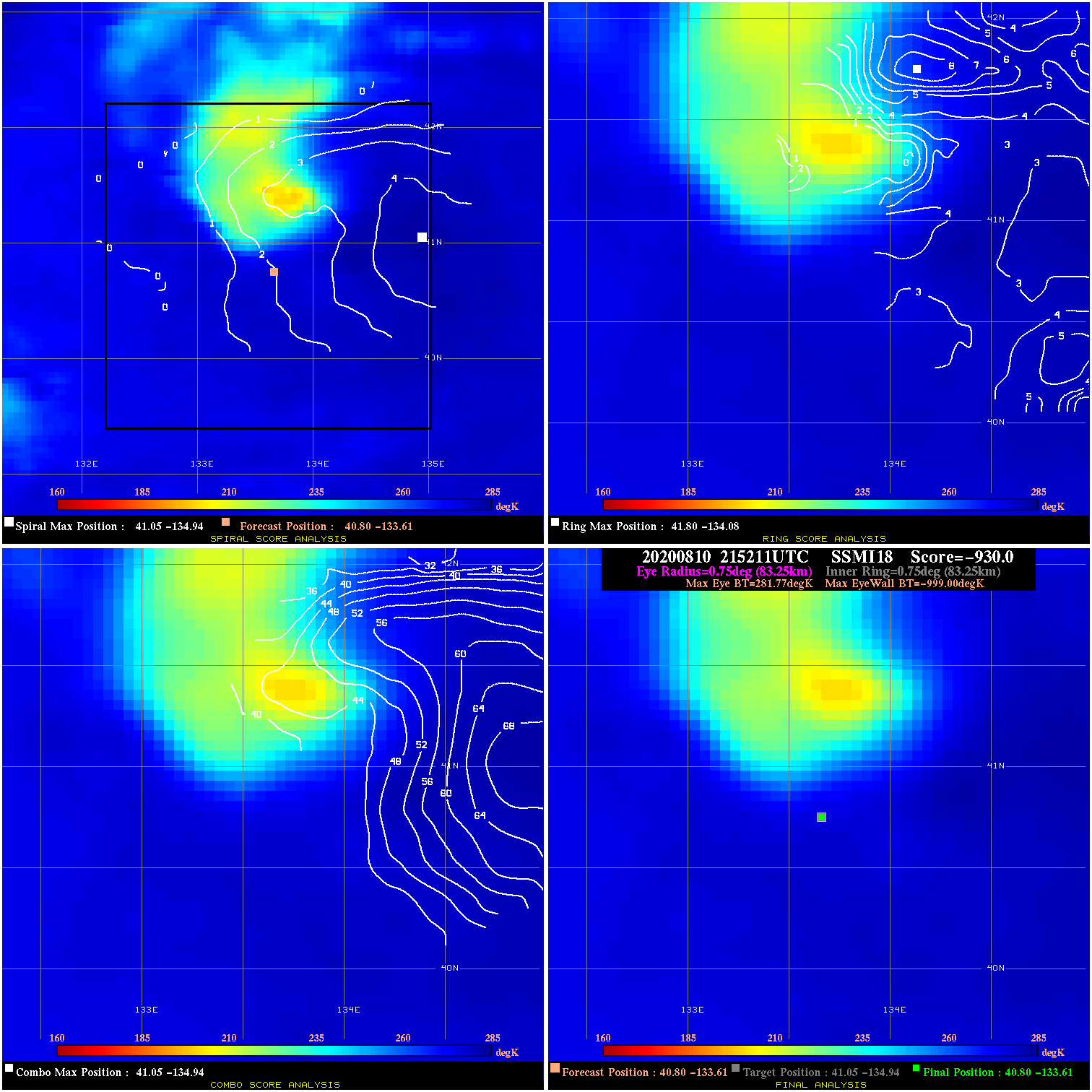
20200810 215211 -930.0 N/A N/A N/A 0.00 40.0 SSMI18 40.8 -133.6 40.8 -133.6 41.0 -134.9 Analysis Plot
|
|
Legend: - Date/Time are determined from PMW imagery at Forecast (initial guess) Lat/Lon position. - Positive/Negative Latitude = North/South Hemisphere; Longitude = Western/Eastern Hemisphere. - "Ring Diam" value indicates the estimated surface eyewall diameter in km (the MI eyewall edge diameter minus 10 km). - "Ring Pct" is the percentage of the "ring" (eyewall inner boundary) that is 1) colder than the "hot spot" (warmest eye pixel) in the eye by 20K, or 2) the percentage that is a) colder than 232K and b) colder than the "hot spot" by 10K, whichever is greater. - Values are red if Ring % <= 65, yellow/brown if Ring % <= 85 and green if Ring % > 85. - "Tb diff" is the difference between the "hot spot" (warmest eye pixel) and the warmest pixel on the eyewall. - Intensity score are listed as negative, and not used, when the JTWC or NHC estimated Vmax is <55 kts in order to rule out weak but highly symmetric TCs. - Error messages in intensity scores: -920 is used when the hottest pixel in the eye is <200K, to prevent false positives; -930 means <85% of eyewall has observations/data. |