Tropical Storm 30Y_07
|
Passive Microwave (PMW) Intensity Information Hurricane Intensity Estimation (HIE) Algorithm Version 9.0 |
Overpass Inten Ring Ring Wind Forecast Final Target
Date Time Score Meaning Pct Diam BTdiff Est Sat Lat Lon Lat Lon Lat Lon
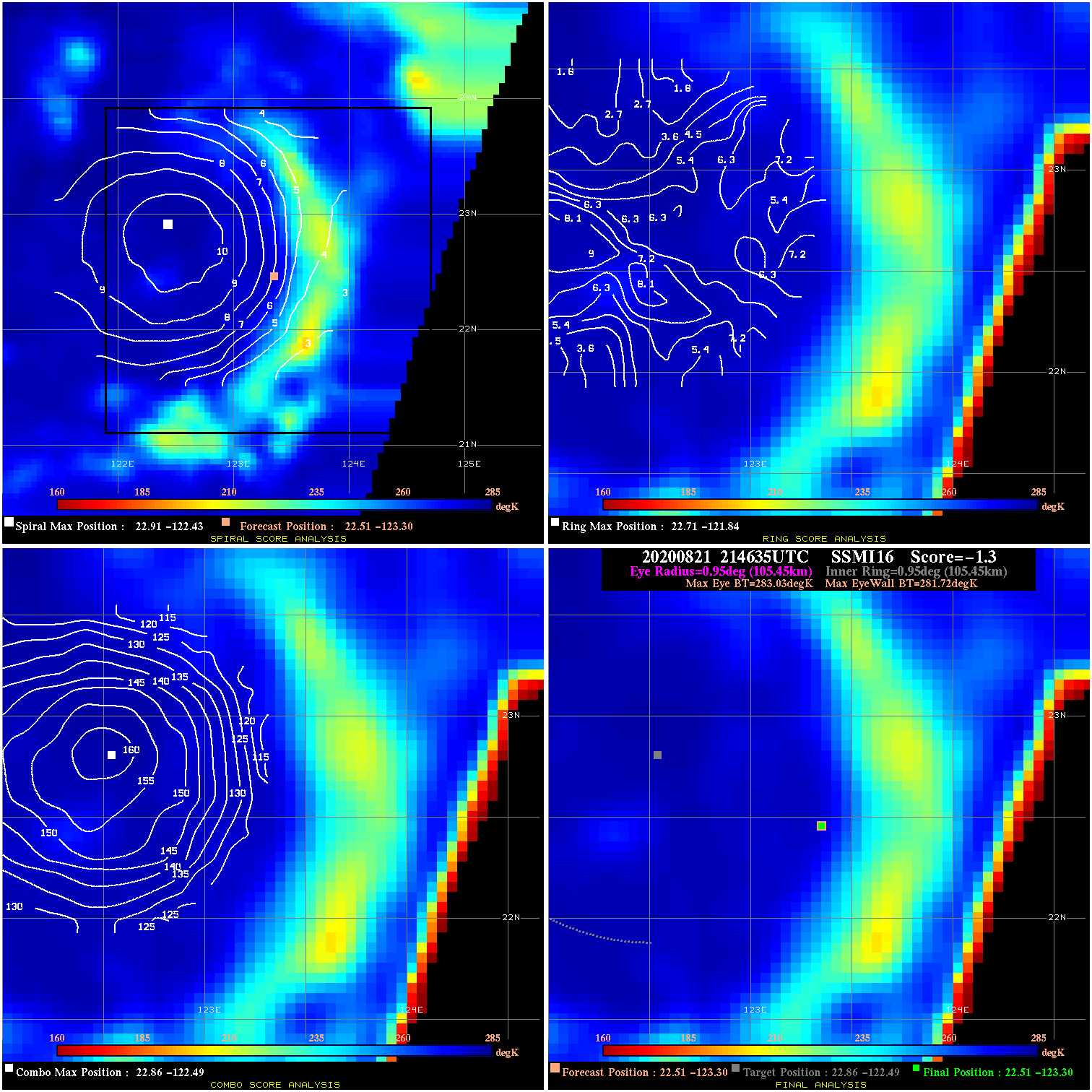
20200821 214635 -1.3 N/A 13.7% 211.09 1.31 30.0 SSMI16 22.5 -123.3 22.5 -123.3 22.9 -122.5 Analysis Plot
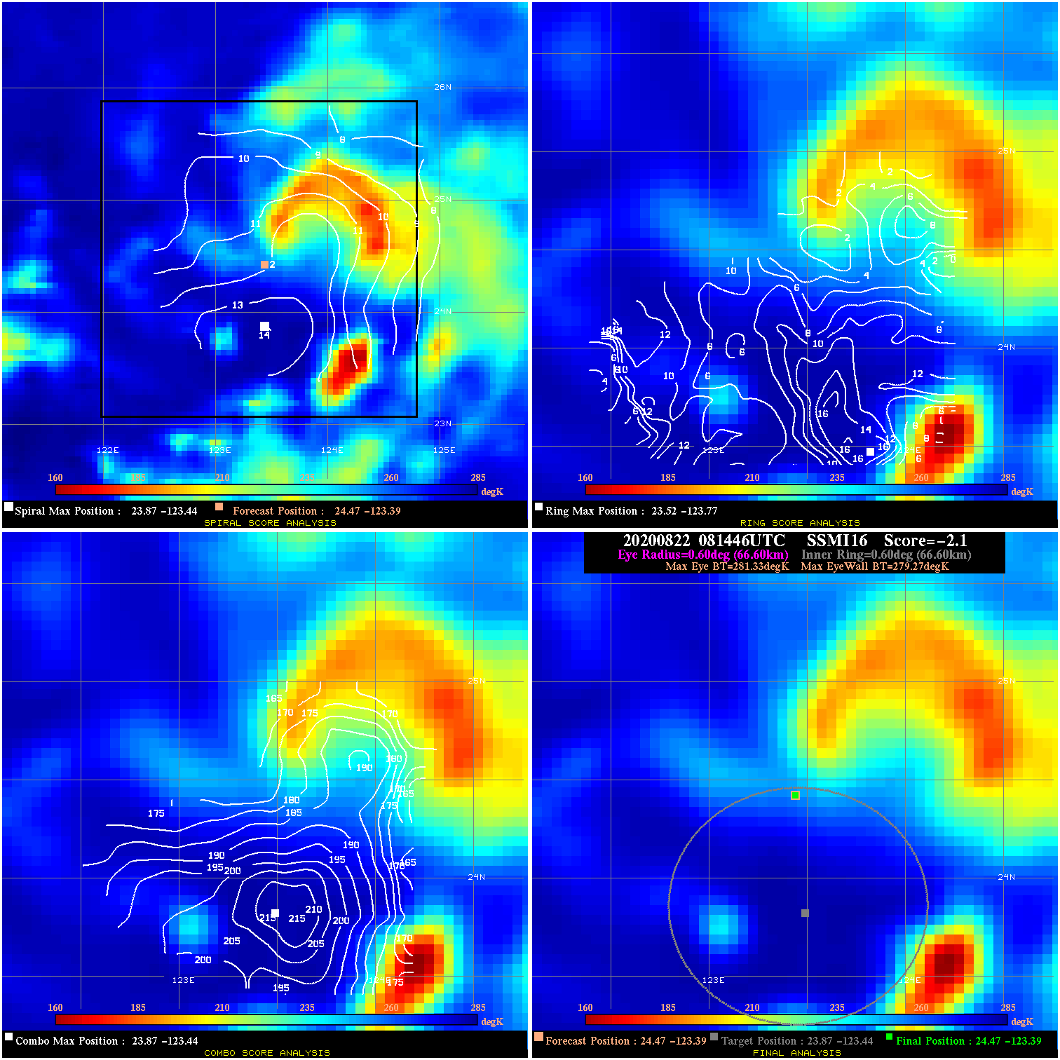
20200822 081446 -2.1 N/A 22.1% 133.32 2.06 45.0 SSMI16 24.5 -123.4 24.5 -123.4 23.9 -123.4 Analysis Plot
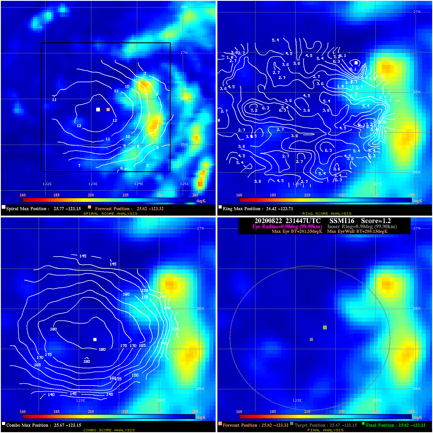
20200822 231447 1.2 N/A 19.2% 199.98 1.20 55.0 SSMI16 25.8 -123.3 25.8 -123.3 25.7 -123.2 Analysis Plot
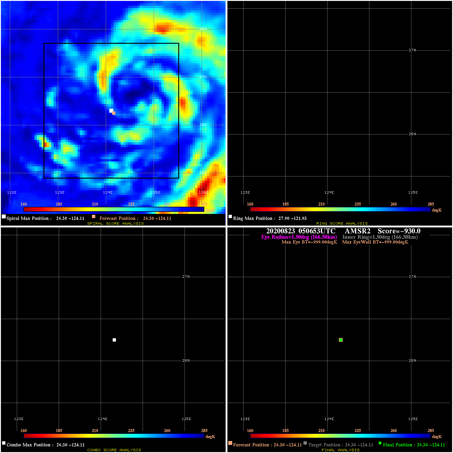
20200823 050653 N/A N/A N/A N/A N/A 55.0 AMSR2 26.3 -124.1 26.3 -124.1 26.3 -124.1 Analysis Plot
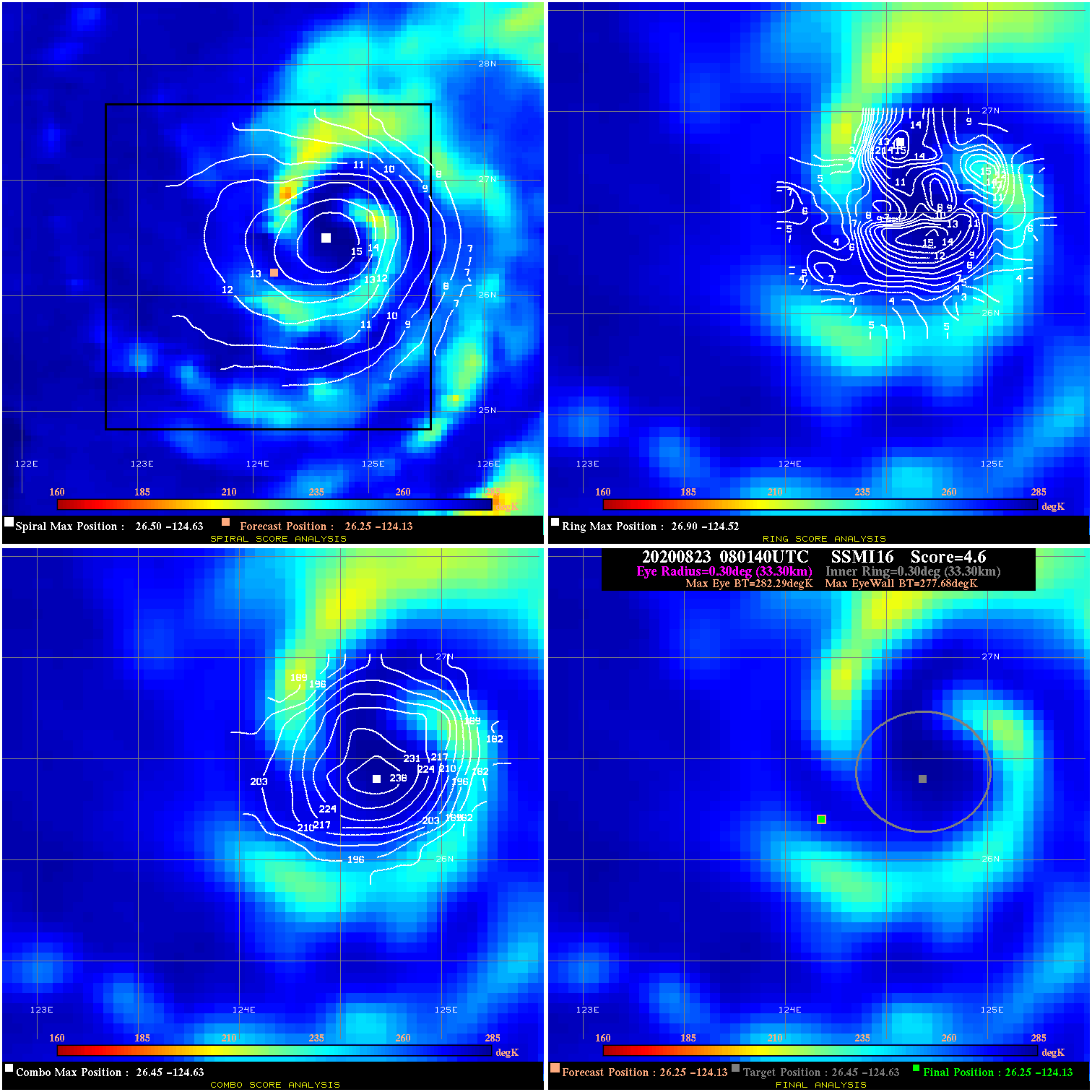
20200823 080140 4.6 N/A 12.3% 66.66 4.61 55.0 SSMI16 26.3 -124.1 26.3 -124.1 26.5 -124.6 Analysis Plot
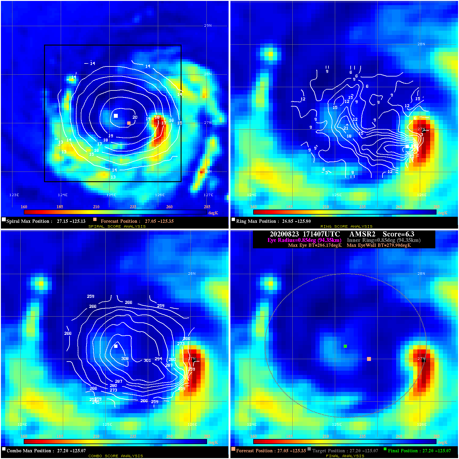
20200823 171407 6.3 N/A 31.5% 188.87 6.27 60.0 AMSR2 27.0 -125.3 27.2 -125.1 27.2 -125.1 Analysis Plot
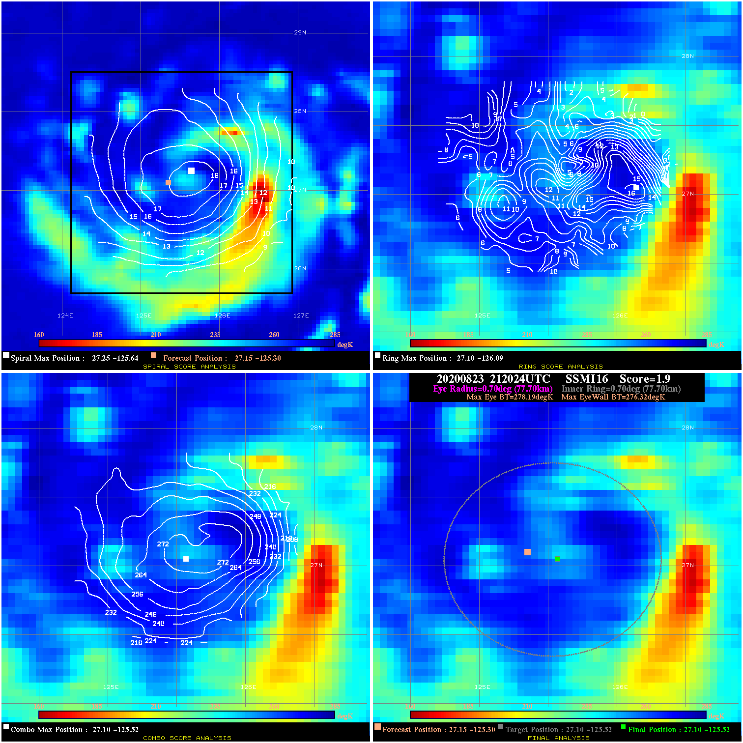
20200823 212024 1.9 N/A 32.9% 155.54 1.87 60.0 SSMI16 27.1 -125.3 27.1 -125.5 27.1 -125.5 Analysis Plot
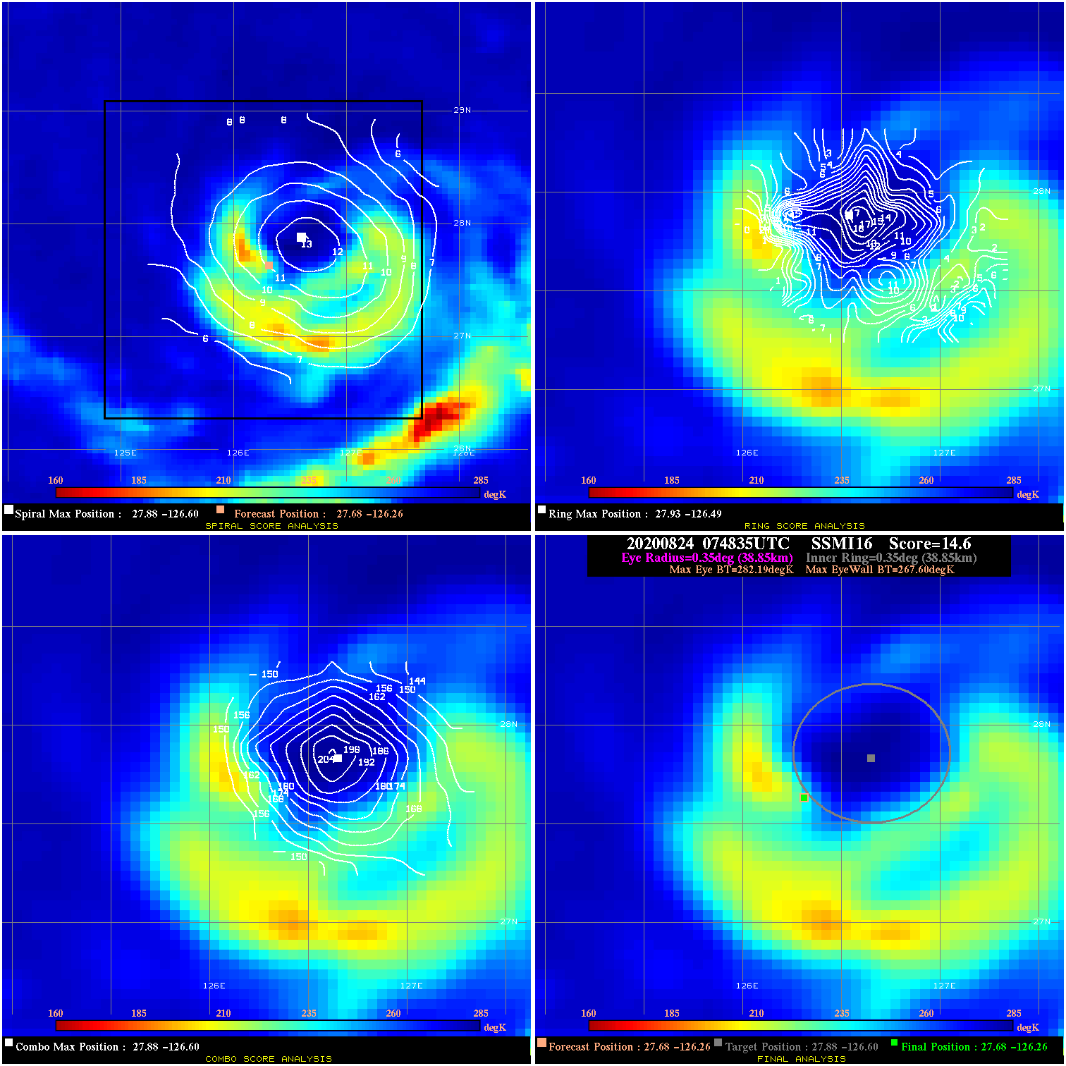
20200824 074835 14.6 N/A 43.8% 77.77 14.59 65.0 SSMI16 27.7 -126.3 27.7 -126.3 27.9 -126.6 Analysis Plot
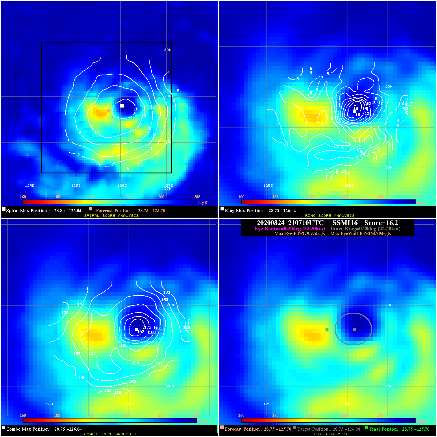
20200824 210710 16.2 N/A 35.6% 44.44 16.18 75.0 SSMI16 28.8 -125.7 28.8 -125.7 28.8 -126.0 Analysis Plot
20200824 221745 46.1 >65 kts 100.0% 77.77 31.10 75.0 SSMI18 28.9 -125.6 28.8 -125.9 28.8 -125.9 Analysis Plot
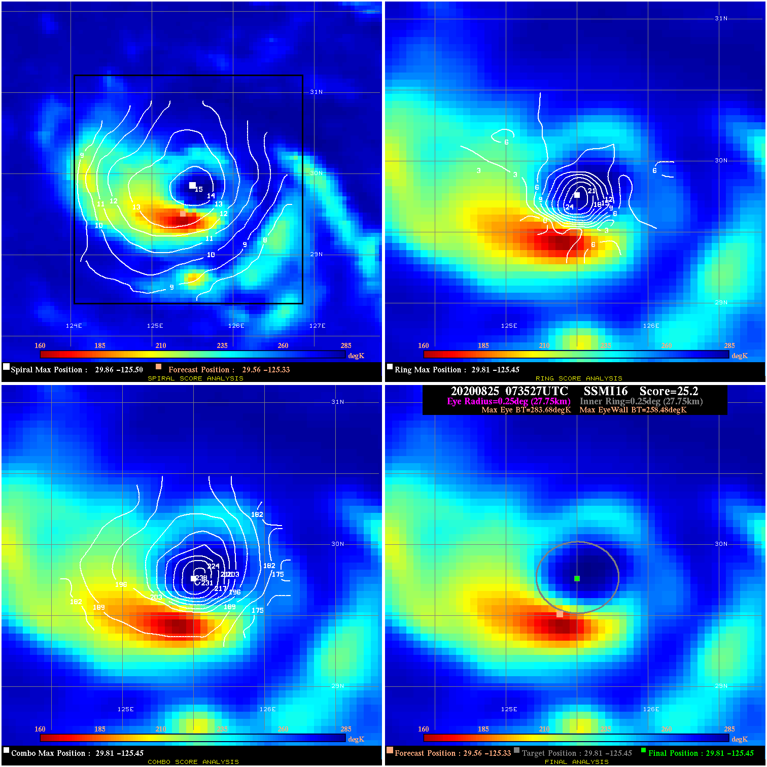
20200825 073527 25.2 >65 kts 47.9% 55.55 25.20 80.0 SSMI16 29.6 -125.3 29.8 -125.4 29.8 -125.4 Analysis Plot
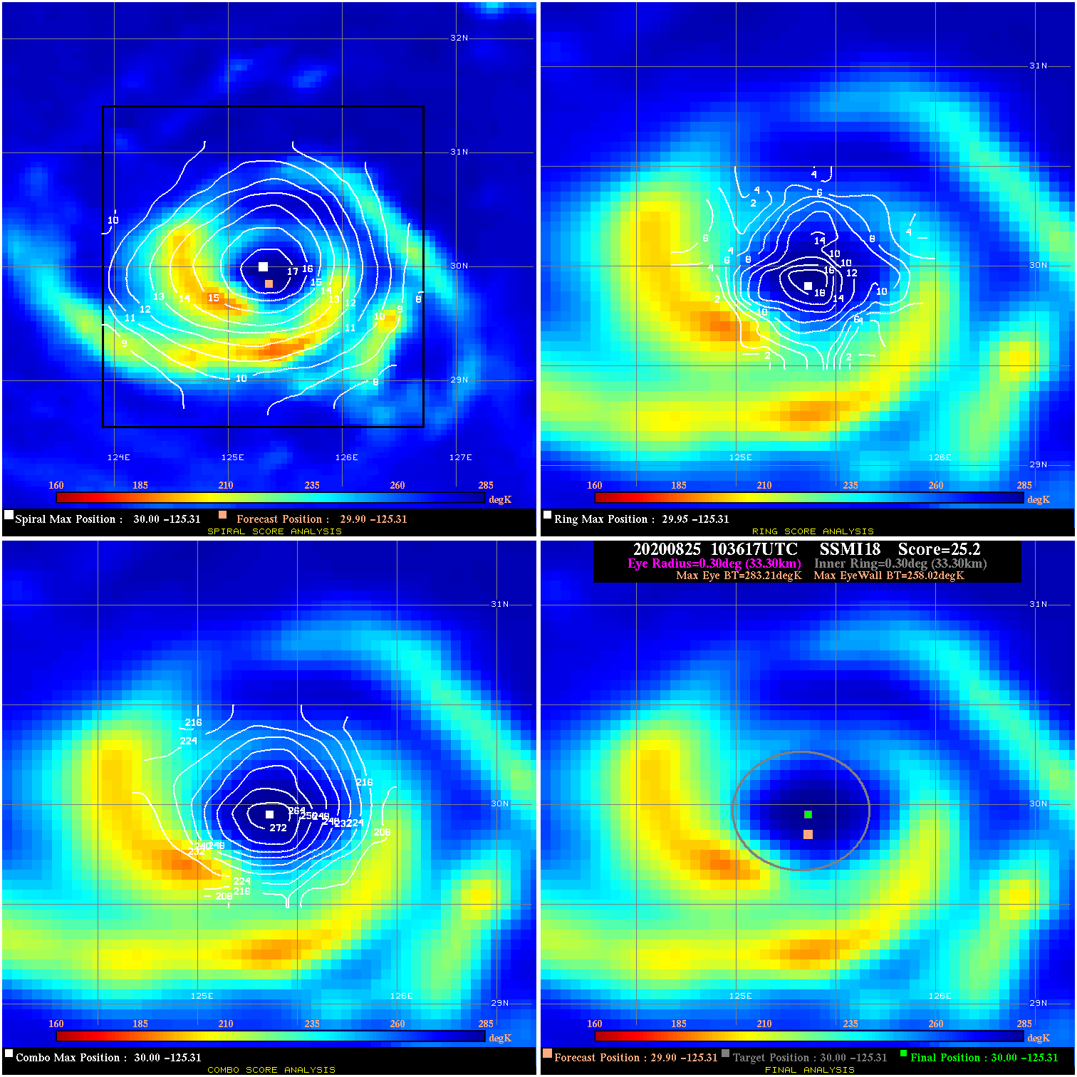
20200825 103617 25.2 >65 kts 12.3% 66.66 25.19 80.0 SSMI18 29.9 -125.3 30.0 -125.3 30.0 -125.3 Analysis Plot
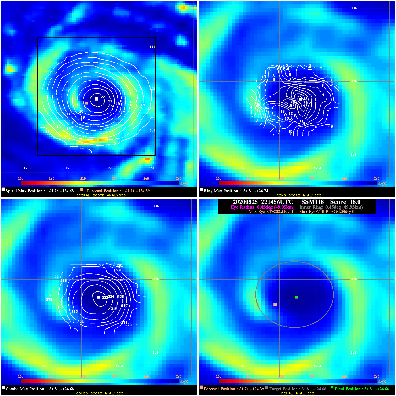
20200825 221456 18.0 N/A 20.5% 99.99 18.04 80.0 SSMI18 31.7 -124.4 31.8 -124.7 31.8 -124.7 Analysis Plot
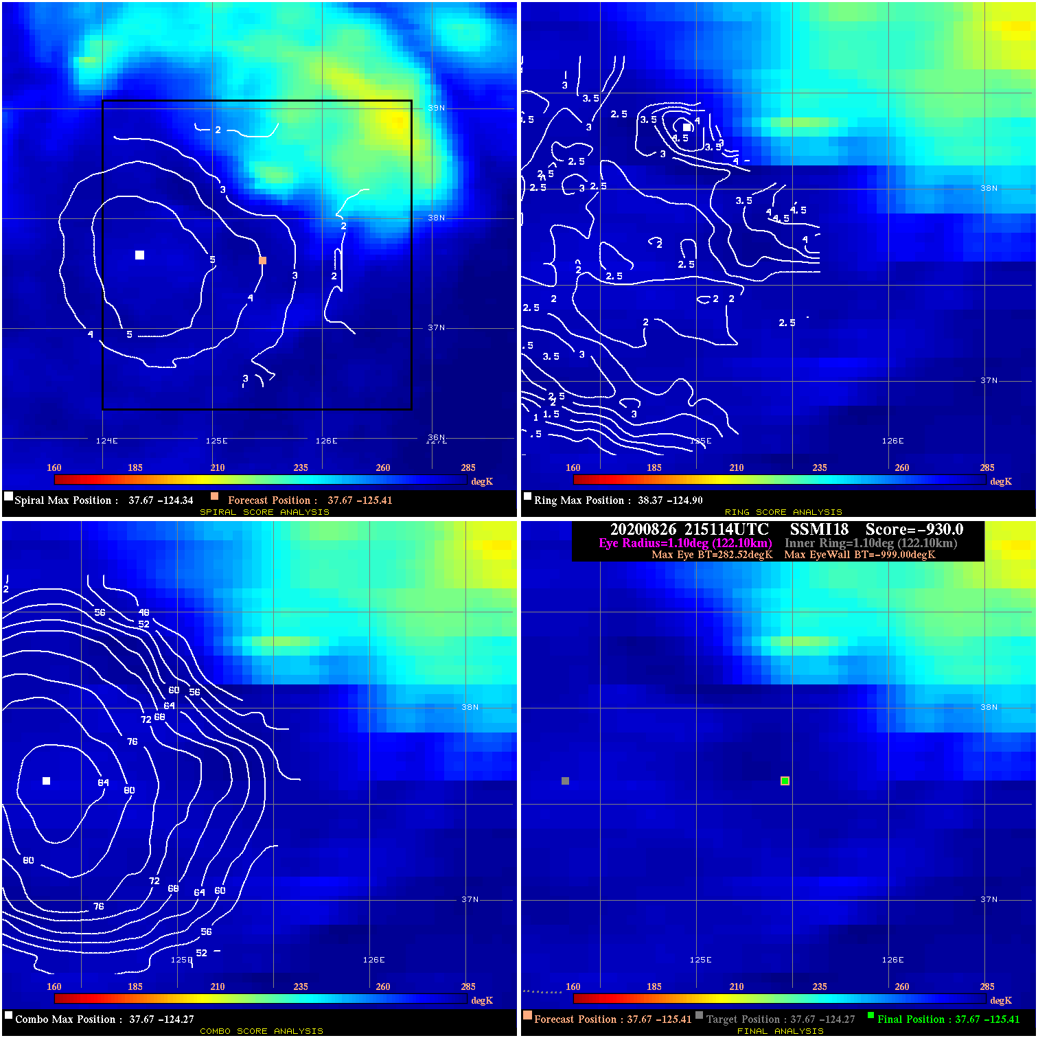
20200826 215114 -930.0 N/A N/A N/A 0.00 70.0 SSMI18 37.7 -125.4 37.7 -125.4 37.7 -124.3 Analysis Plot
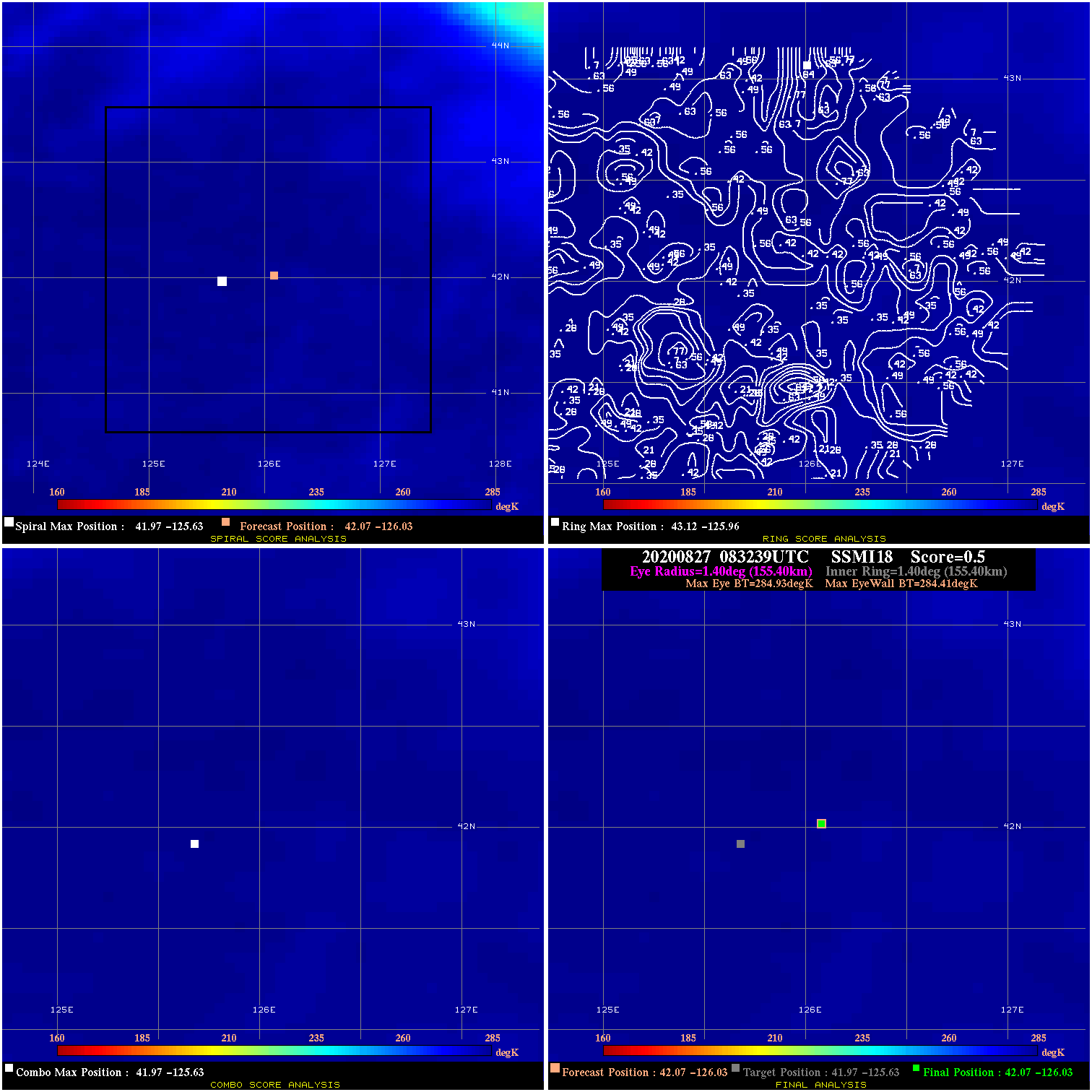
20200827 083239 0.5 N/A N/A 311.08 .52 60.0 SSMI18 42.1 -126.0 42.1 -126.0 42.0 -125.6 Analysis Plot
|
|
Legend: - Date/Time are determined from PMW imagery at Forecast (initial guess) Lat/Lon position. - Positive/Negative Latitude = North/South Hemisphere; Longitude = Western/Eastern Hemisphere. - "Ring Diam" value indicates the estimated surface eyewall diameter in km (the MI eyewall edge diameter minus 10 km). - "Ring Pct" is the percentage of the "ring" (eyewall inner boundary) that is 1) colder than the "hot spot" (warmest eye pixel) in the eye by 20K, or 2) the percentage that is a) colder than 232K and b) colder than the "hot spot" by 10K, whichever is greater. - Values are red if Ring % <= 65, yellow/brown if Ring % <= 85 and green if Ring % > 85. - "Tb diff" is the difference between the "hot spot" (warmest eye pixel) and the warmest pixel on the eyewall. - Intensity score are listed as negative, and not used, when the JTWC or NHC estimated Vmax is <55 kts in order to rule out weak but highly symmetric TCs. - Error messages in intensity scores: -920 is used when the hottest pixel in the eye is <200K, to prevent false positives; -930 means <85% of eyewall has observations/data. |