Tropical Storm 30Y_12
|
Passive Microwave (PMW) Intensity Information Hurricane Intensity Estimation (HIE) Algorithm Version 9.0 |
Overpass Inten Ring Ring Wind Forecast Final Target
Date Time Score Meaning Pct Diam BTdiff Est Sat Lat Lon Lat Lon Lat Lon
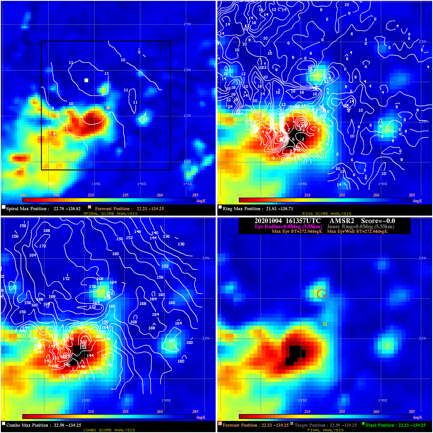
20201004 161357 N/A N/A N/A N/A N/A 30.0 AMSR2 22.2 -139.3 22.2 -139.3 22.6 -139.3 Analysis Plot
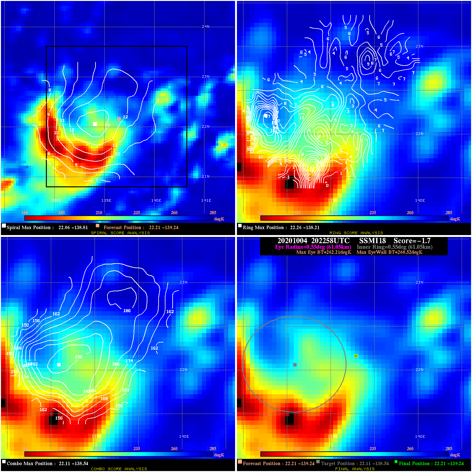
20201004 202258 -1.7 N/A 60.3% 122.21 1.69 30.0 SSMI18 22.2 -139.2 22.2 -139.2 22.1 -138.5 Analysis Plot
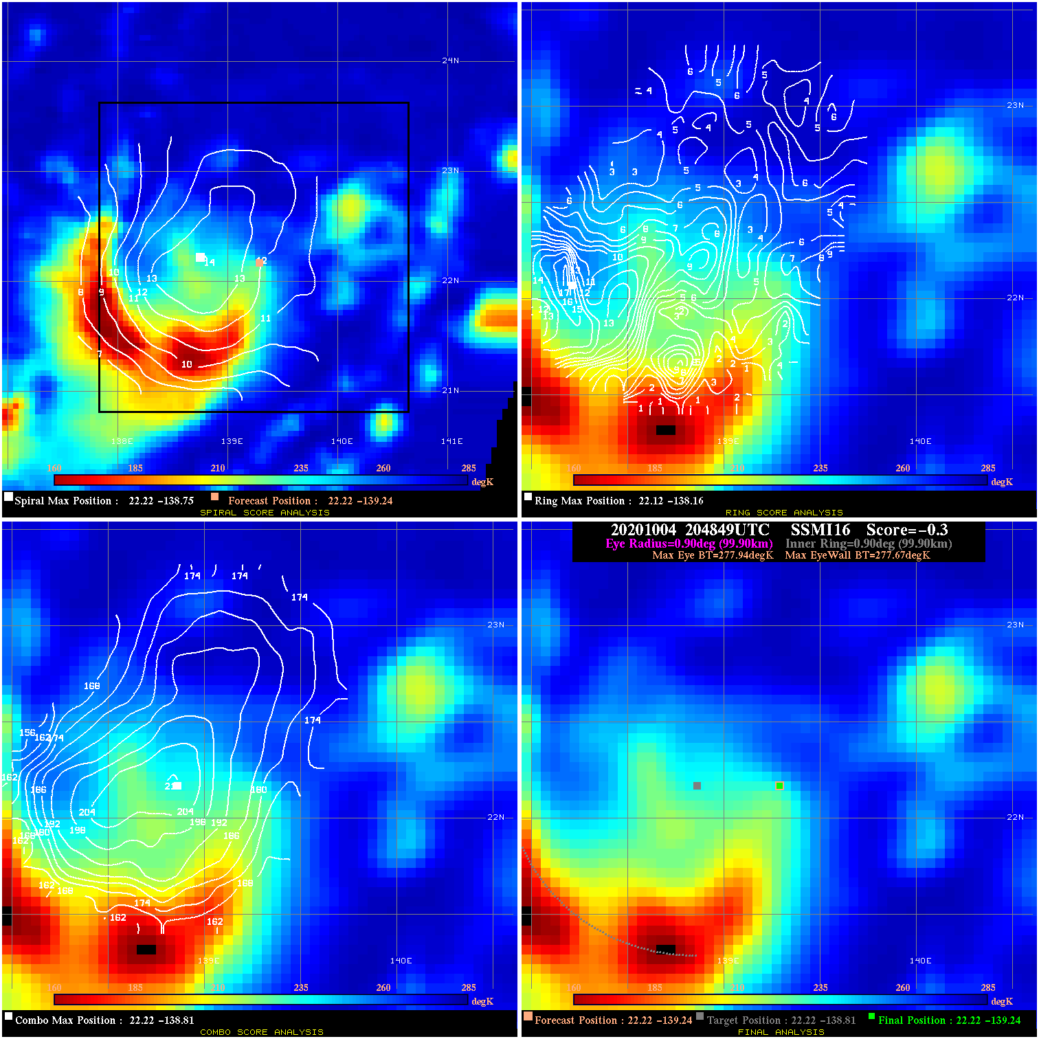
20201004 204849 -0.3 N/A 37.0% 199.98 .27 30.0 SSMI16 22.2 -139.2 22.2 -139.2 22.2 -138.8 Analysis Plot
20201005 070844 -930.0 N/A N/A N/A 0.00 35.0 SSMI16 22.2 -139.1 22.2 -139.1 22.8 -139.0 Analysis Plot
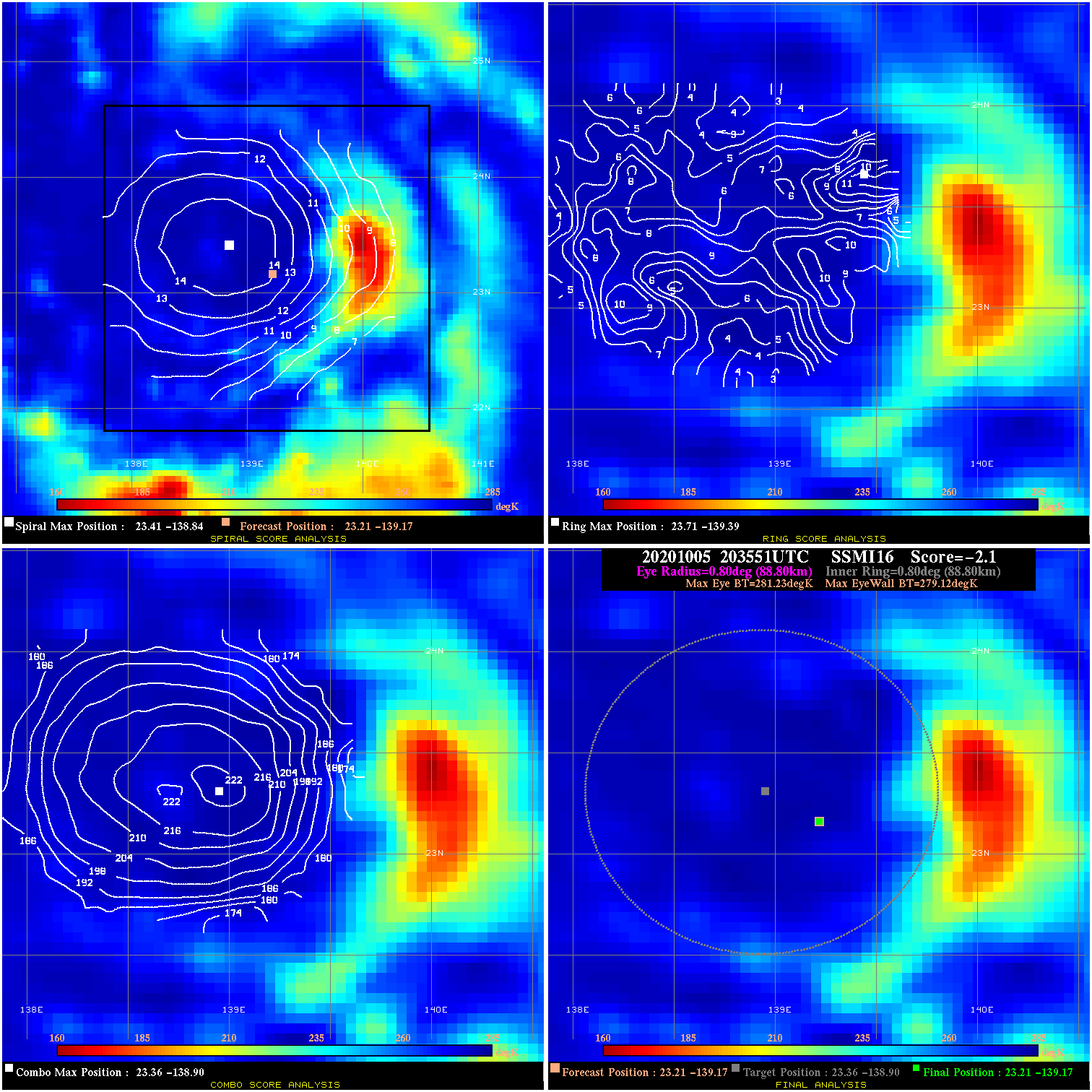
20201005 203551 -2.1 N/A 20.5% 177.76 2.11 40.0 SSMI16 23.2 -139.2 23.2 -139.2 23.4 -138.9 Analysis Plot
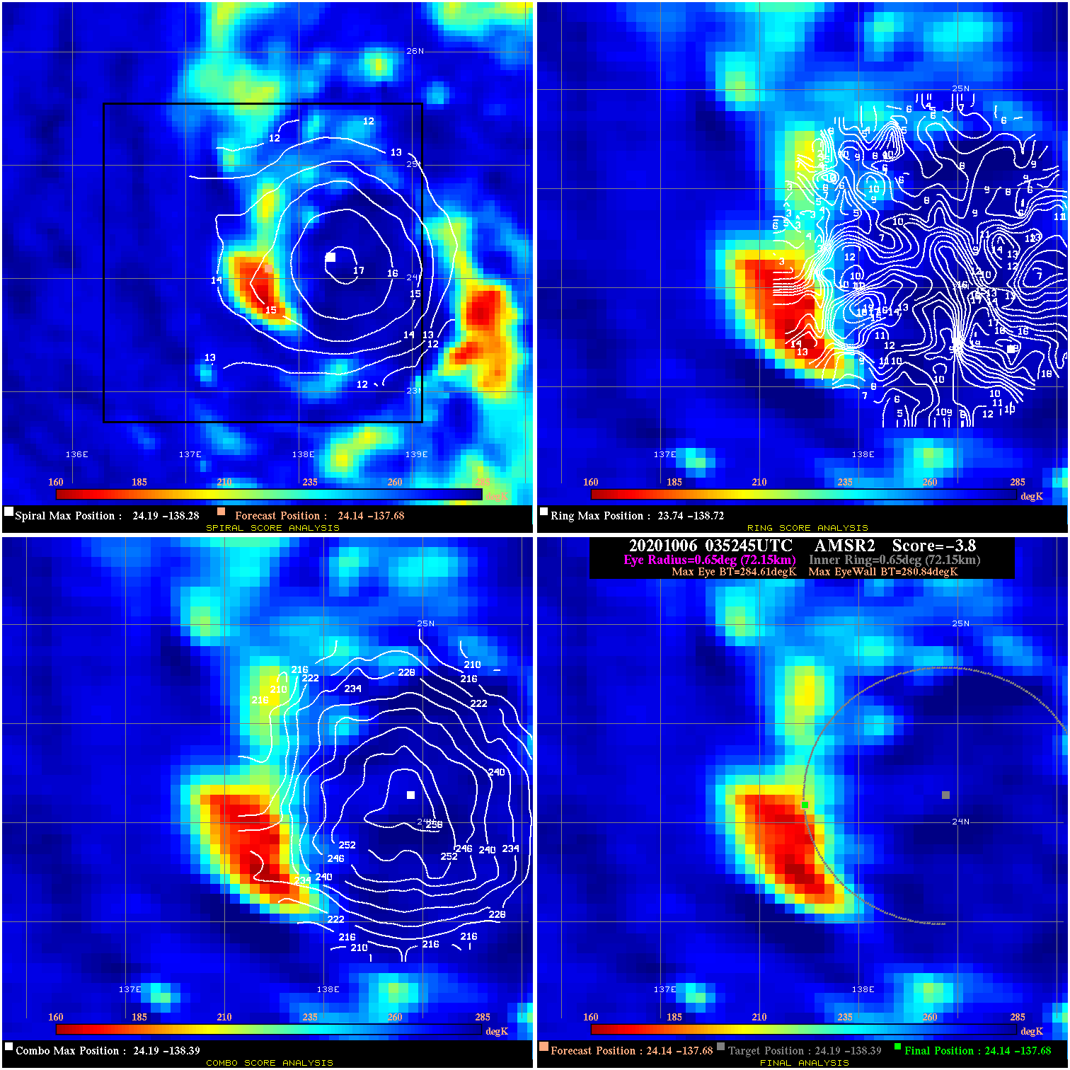
20201006 035245 -3.8 N/A 27.4% 144.43 3.77 45.0 AMSR2 24.1 -137.7 24.1 -137.7 24.2 -138.4 Analysis Plot
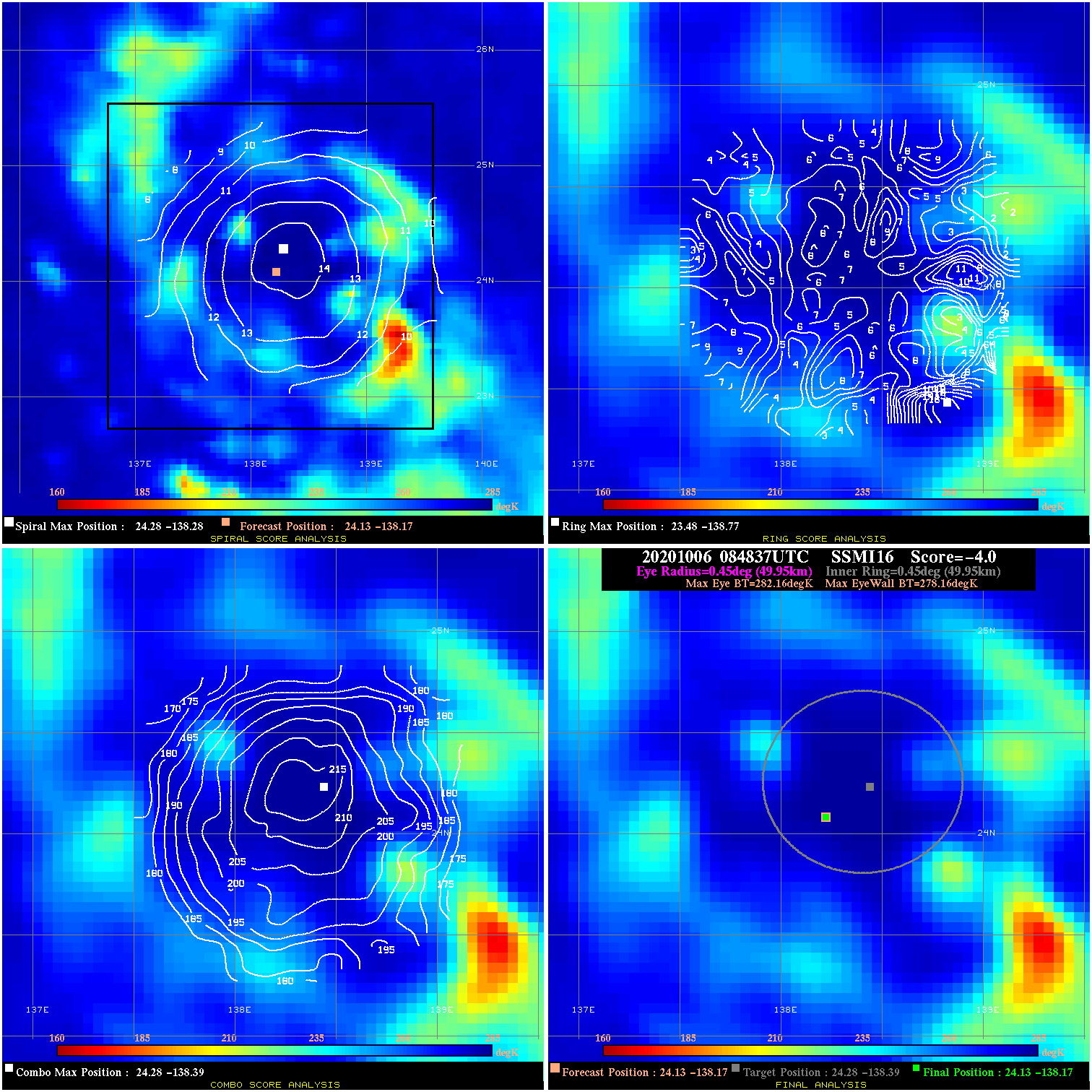
20201006 084837 -4.0 N/A 6.8% 99.99 4.00 45.0 SSMI16 24.1 -138.2 24.1 -138.2 24.3 -138.4 Analysis Plot
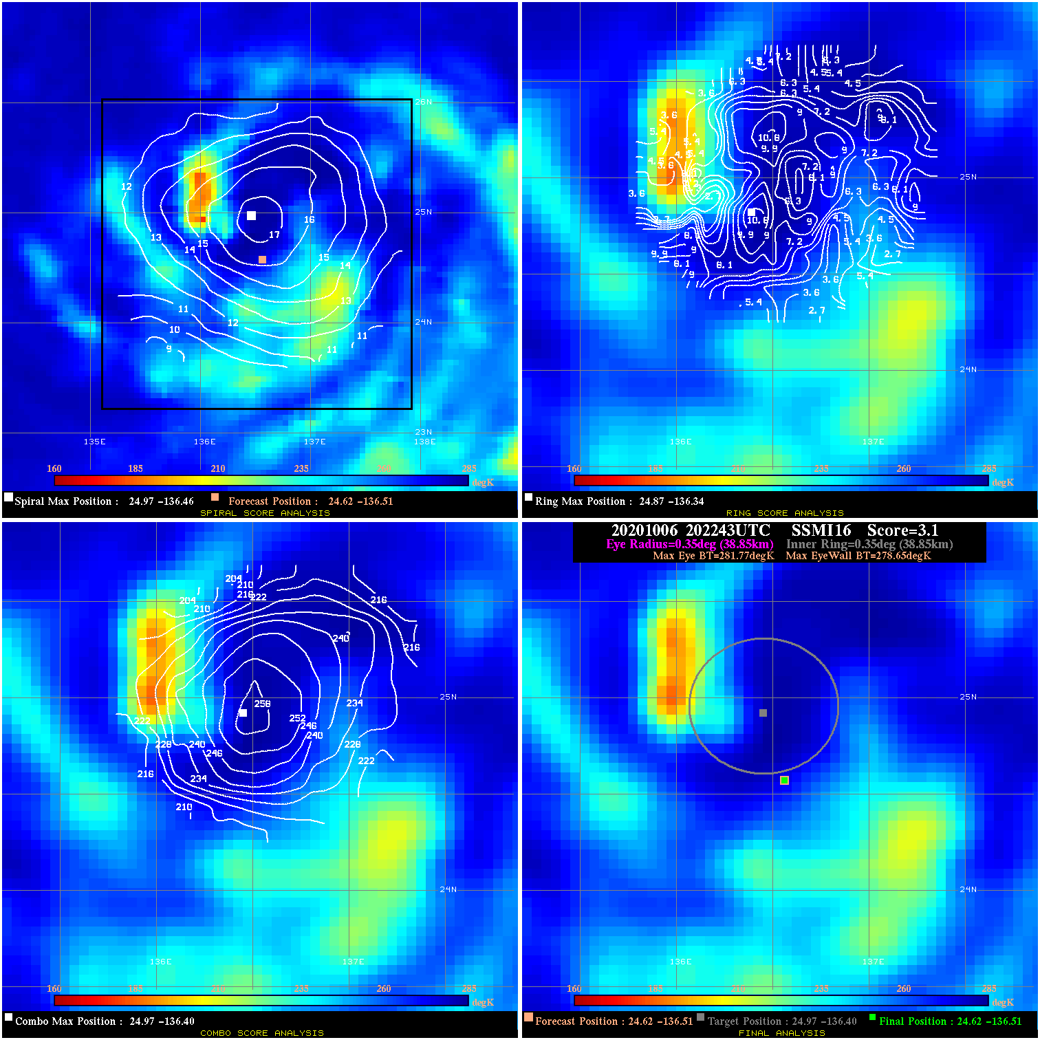
20201006 202243 3.1 N/A 17.8% 77.77 3.12 55.0 SSMI16 24.6 -136.5 24.6 -136.5 25.0 -136.4 Analysis Plot
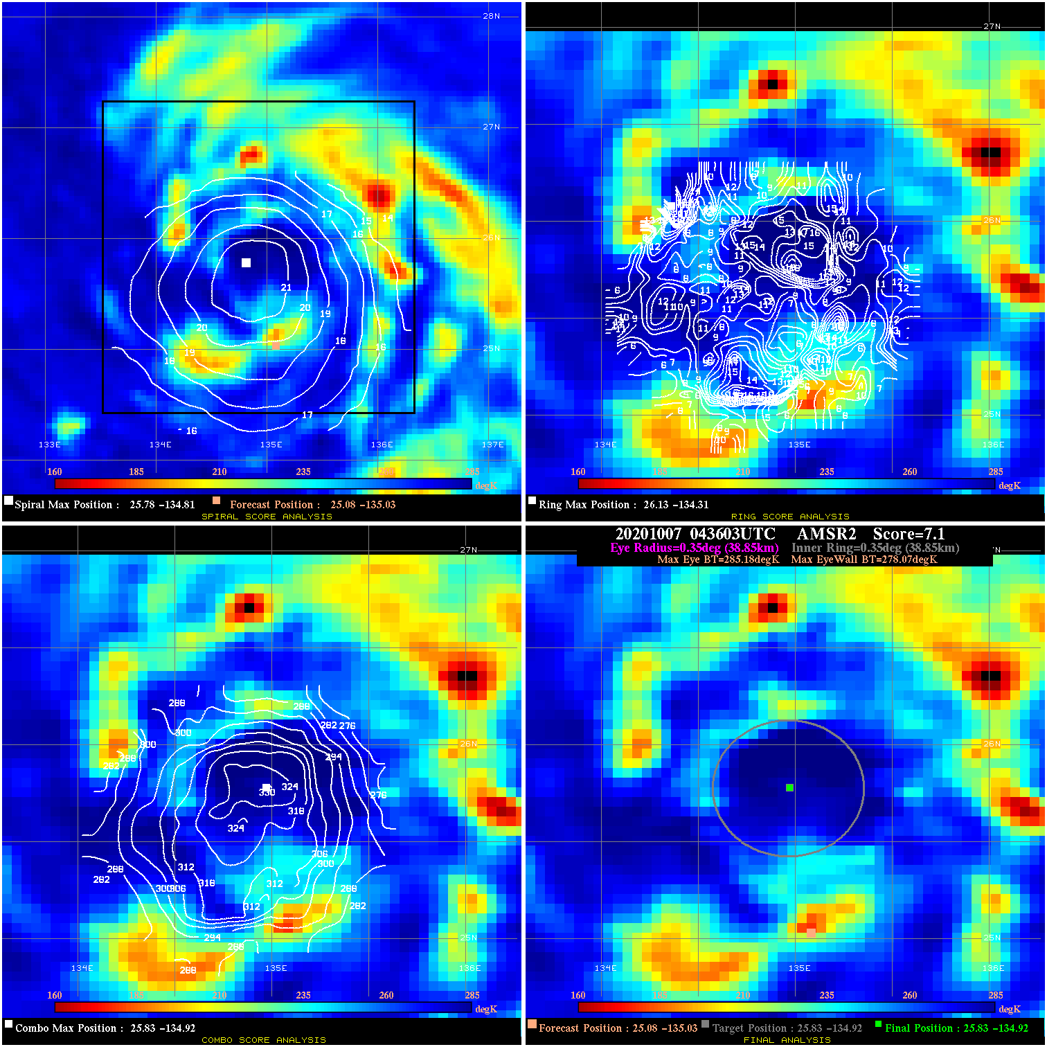
20201007 043603 7.1 N/A 9.6% 77.77 7.11 60.0 AMSR2 25.1 -135.0 25.8 -134.9 25.8 -134.9 Analysis Plot
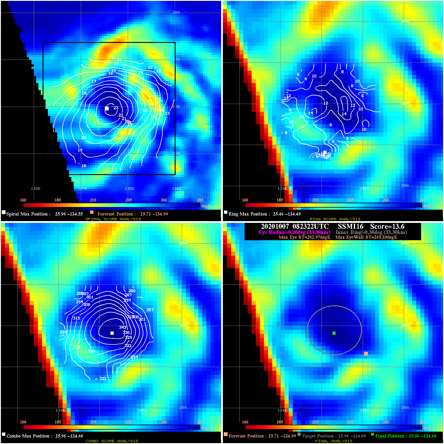
20201007 082322 13.6 N/A 20.5% 66.66 13.58 65.0 SSMI16 25.7 -135.0 26.0 -134.6 26.0 -134.6 Analysis Plot
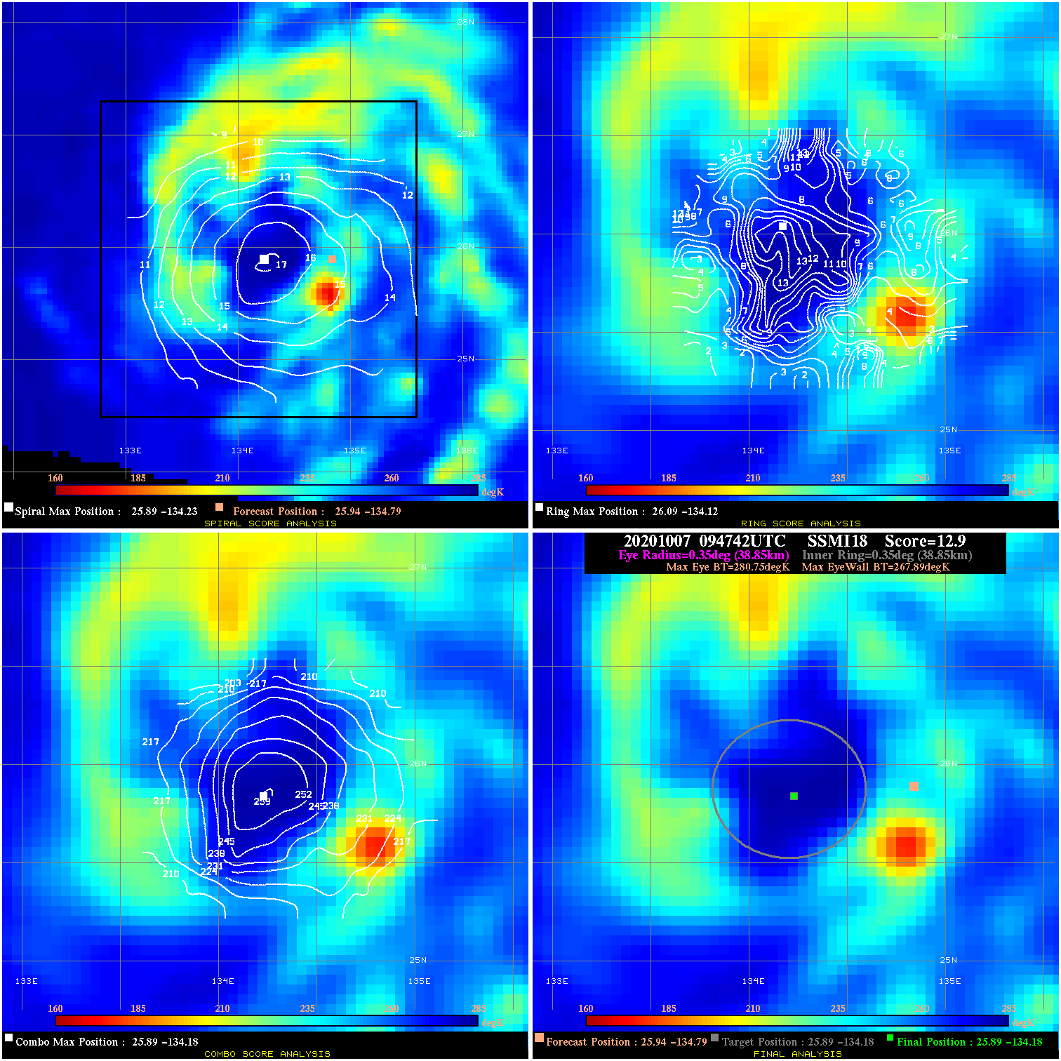
20201007 094742 12.9 N/A 30.1% 77.77 12.86 65.0 SSMI18 25.9 -134.8 25.9 -134.2 25.9 -134.2 Analysis Plot
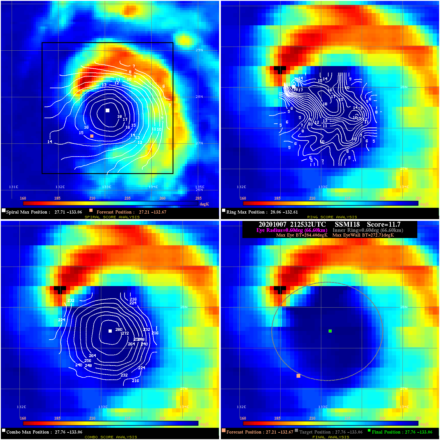
20201007 212532 11.7 N/A 43.8% 133.32 11.69 65.0 SSMI18 27.2 -132.7 27.8 -133.1 27.8 -133.1 Analysis Plot
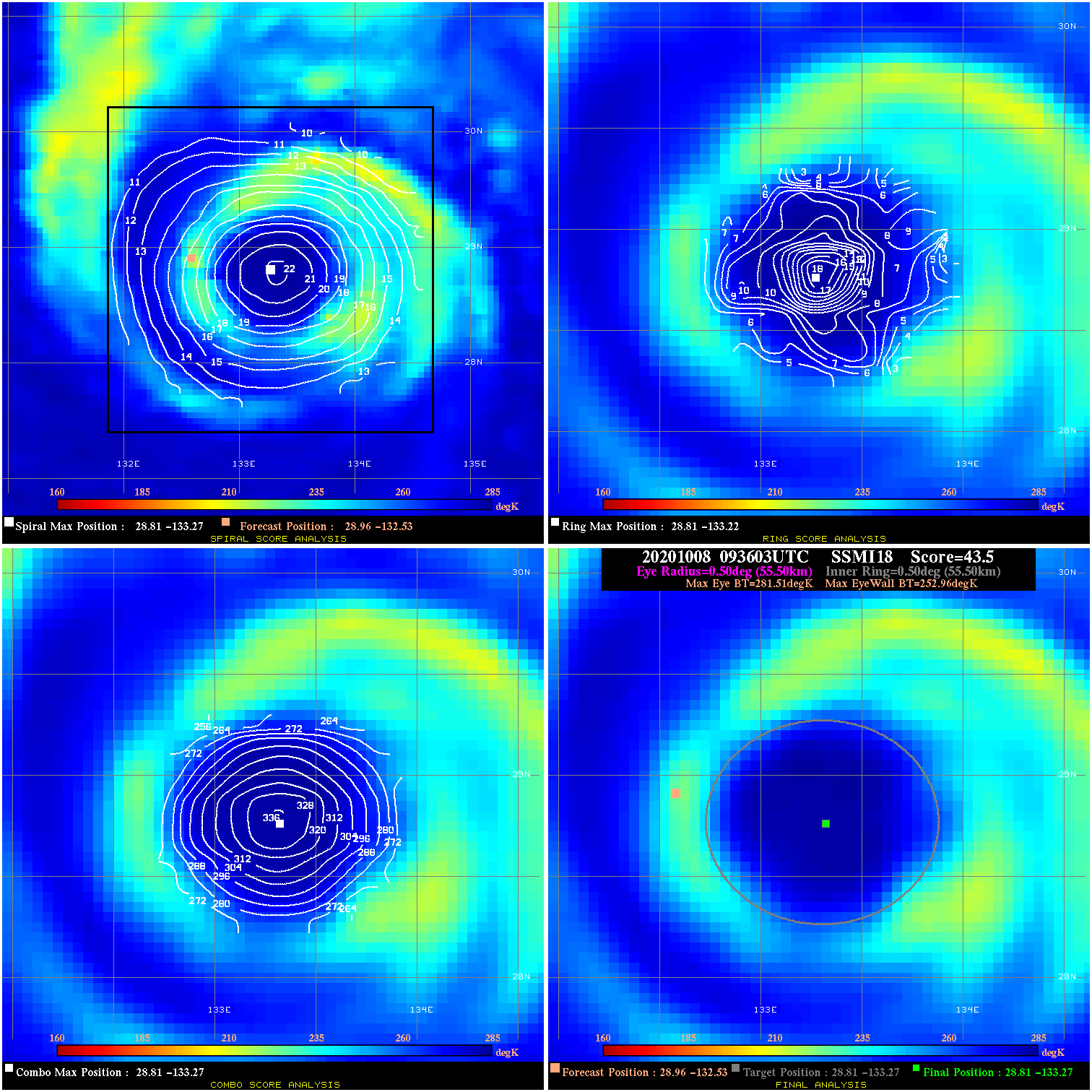
20201008 093603 43.5 >65 kts 100.0% 111.10 28.55 65.0 SSMI18 29.0 -132.5 28.8 -133.3 28.8 -133.3 Analysis Plot
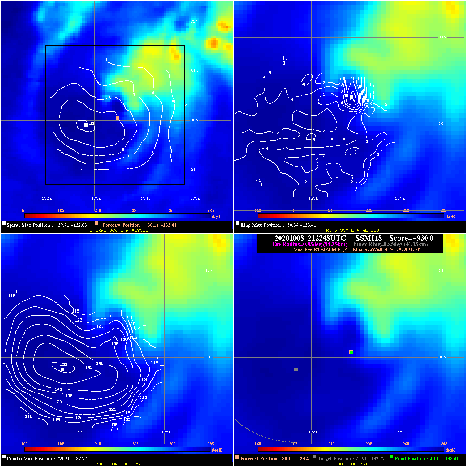
20201008 212248 -930.0 N/A N/A N/A 0.00 70.0 SSMI18 30.1 -133.4 30.1 -133.4 29.9 -132.8 Analysis Plot
20201009 042452 4.7 N/A 17.8% 99.99 4.67 70.0 AMSR2 30.4 -134.0 30.4 -134.0 30.6 -134.1 Analysis Plot
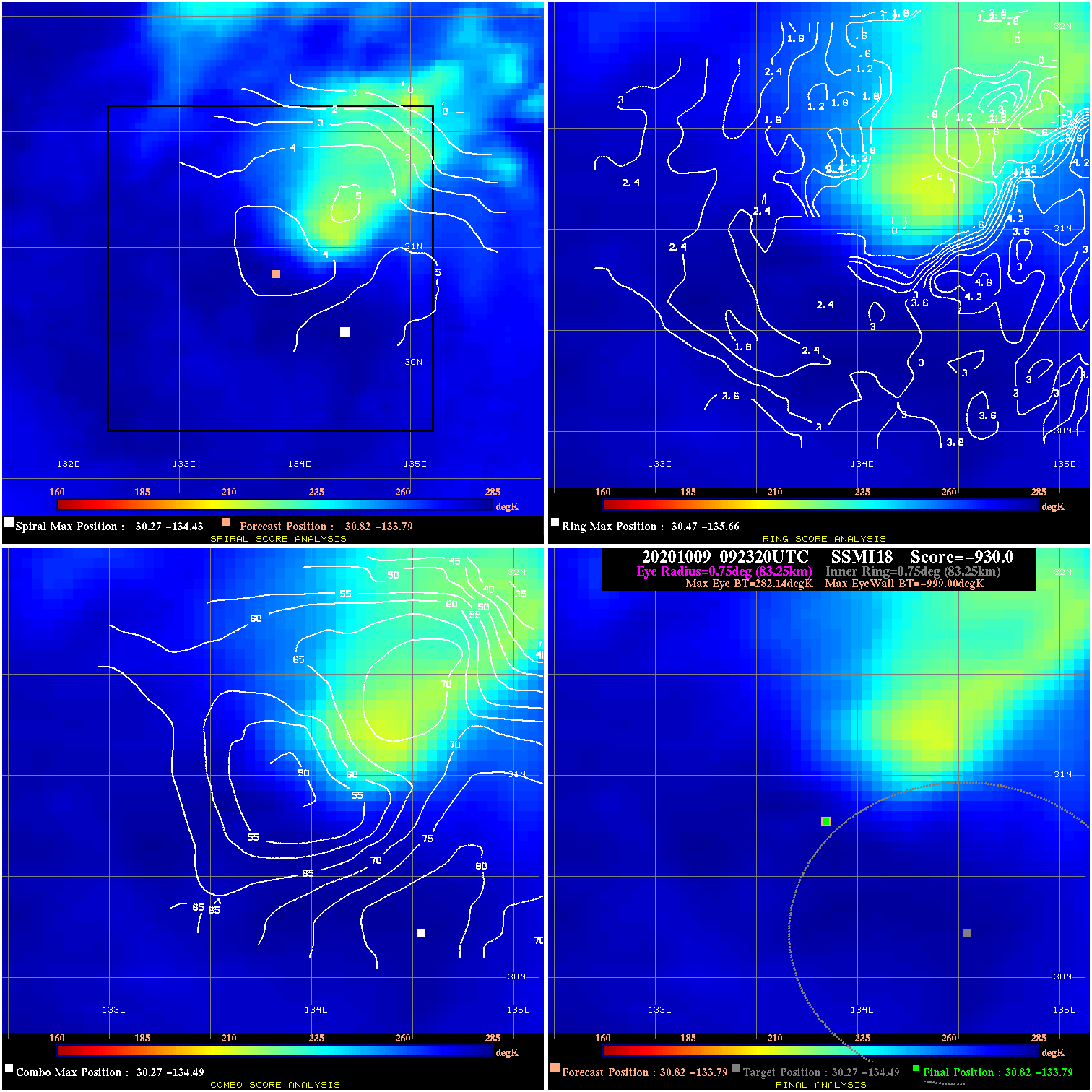
20201009 092320 -930.0 N/A N/A N/A 0.00 70.0 SSMI18 30.8 -133.8 30.8 -133.8 30.3 -134.5 Analysis Plot
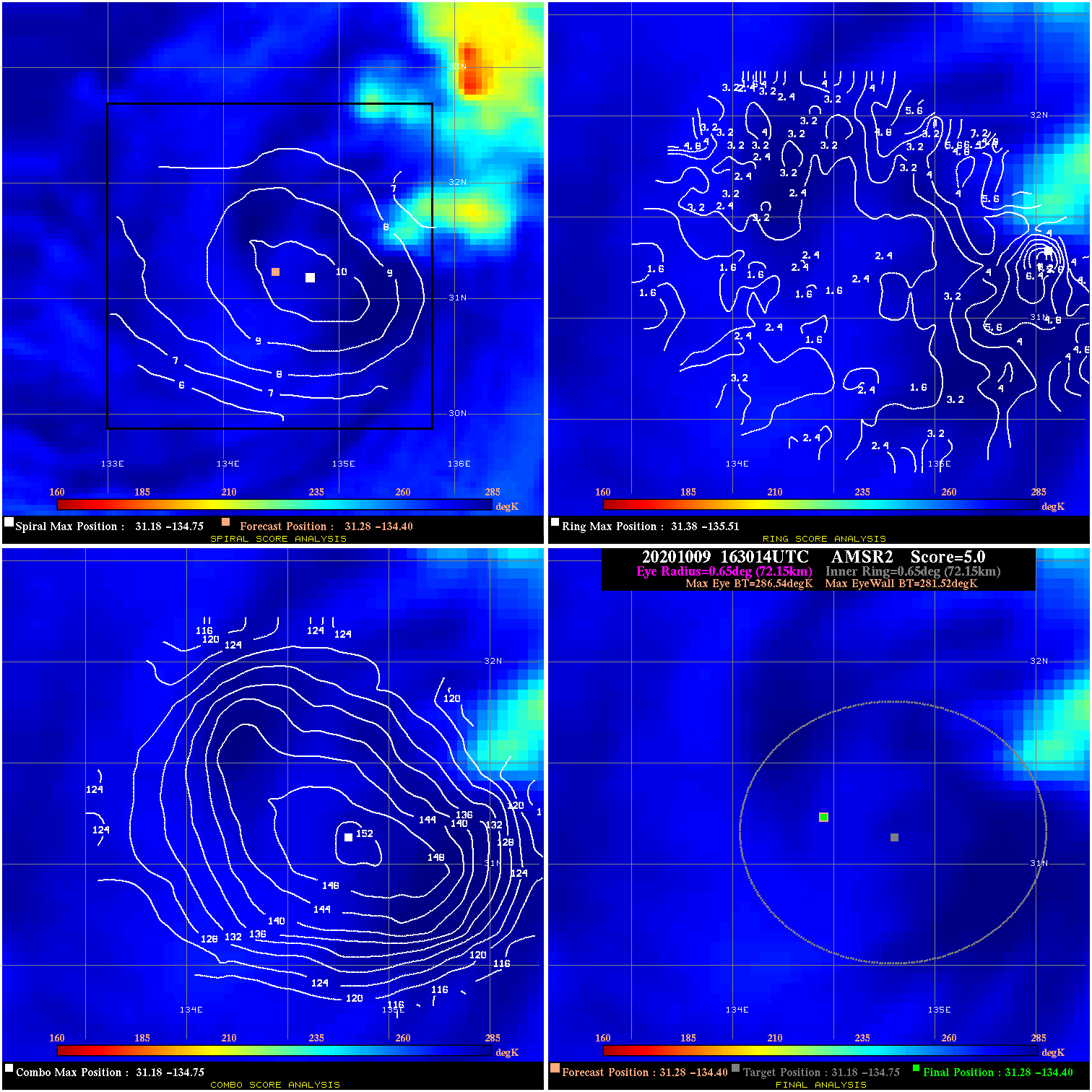
20201009 163014 5.0 N/A 2.7% 144.43 5.02 60.0 AMSR2 31.3 -134.4 31.3 -134.4 31.2 -134.8 Analysis Plot
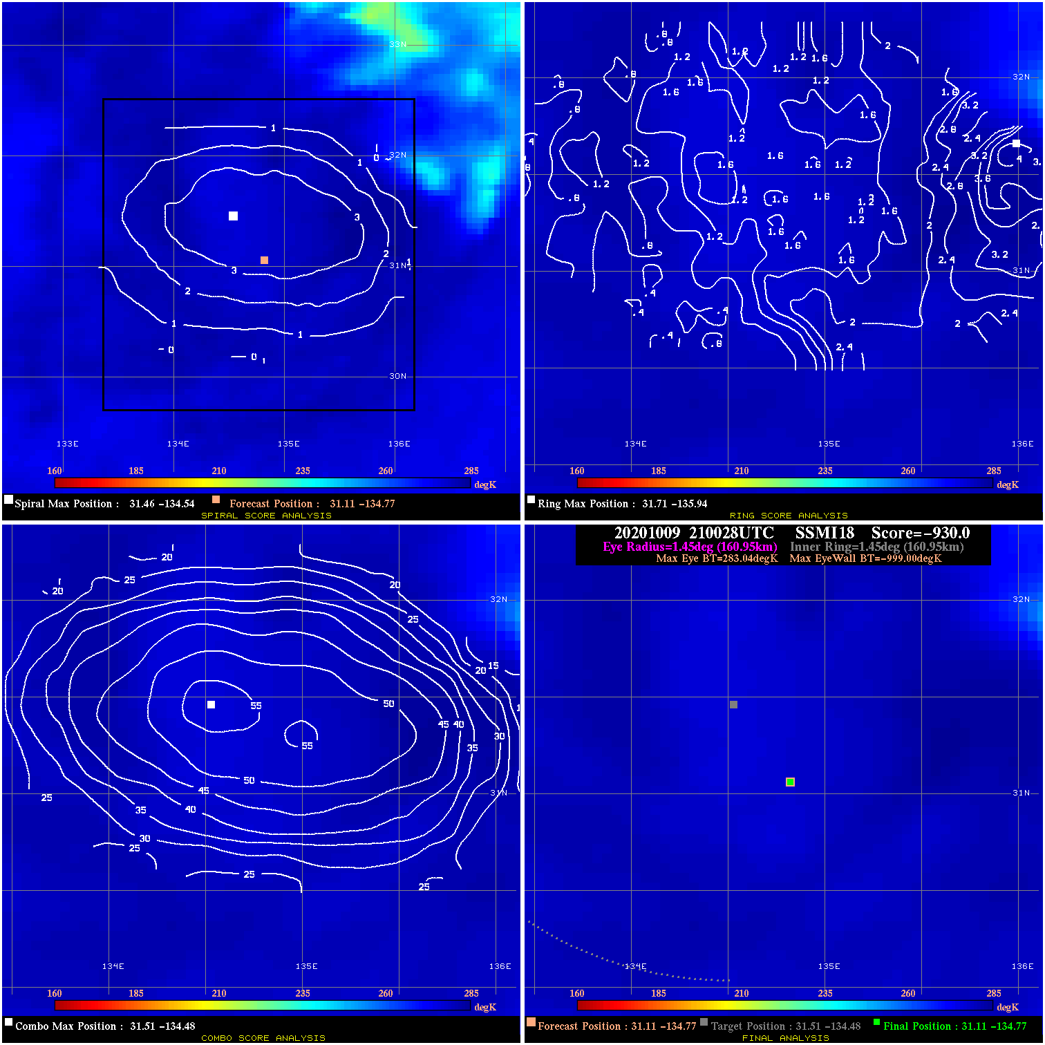
20201009 210028 -930.0 N/A N/A N/A 0.00 55.0 SSMI18 31.1 -134.8 31.1 -134.8 31.5 -134.5 Analysis Plot
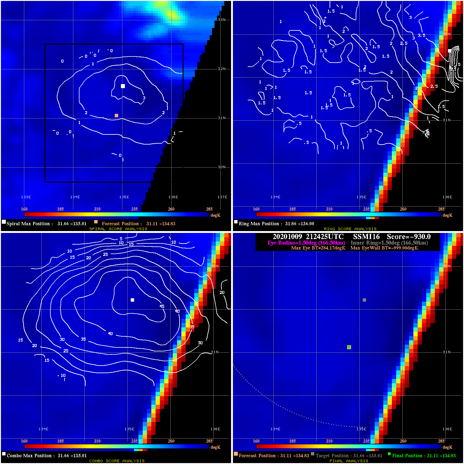
20201009 212425 -930.0 N/A N/A N/A 0.00 55.0 SSMI16 31.1 -134.8 31.1 -134.8 31.7 -135.0 Analysis Plot
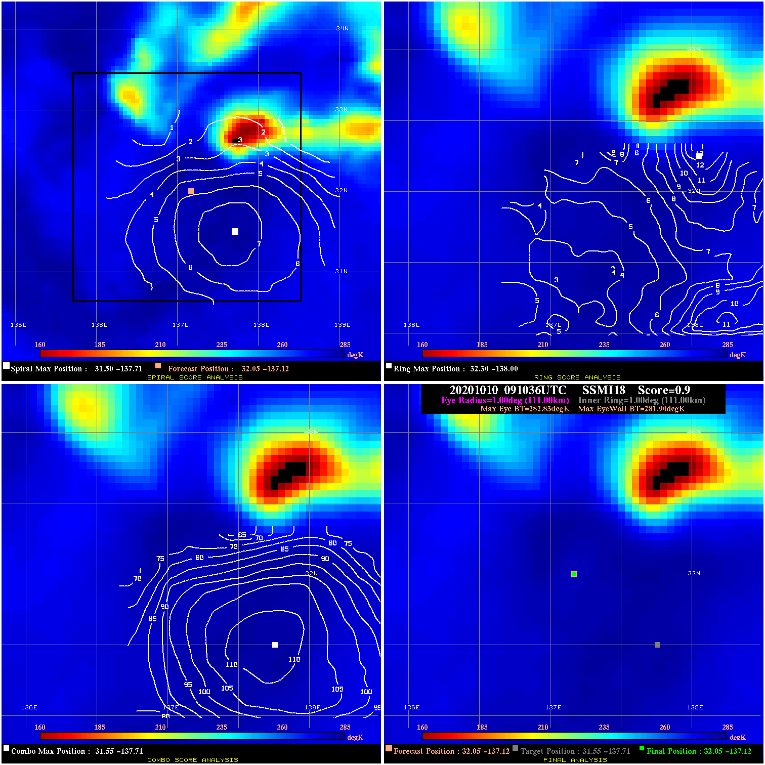
20201010 091036 0.9 N/A 12.3% 222.20 .93 55.0 SSMI18 32.0 -137.1 32.0 -137.1 31.5 -137.7 Analysis Plot
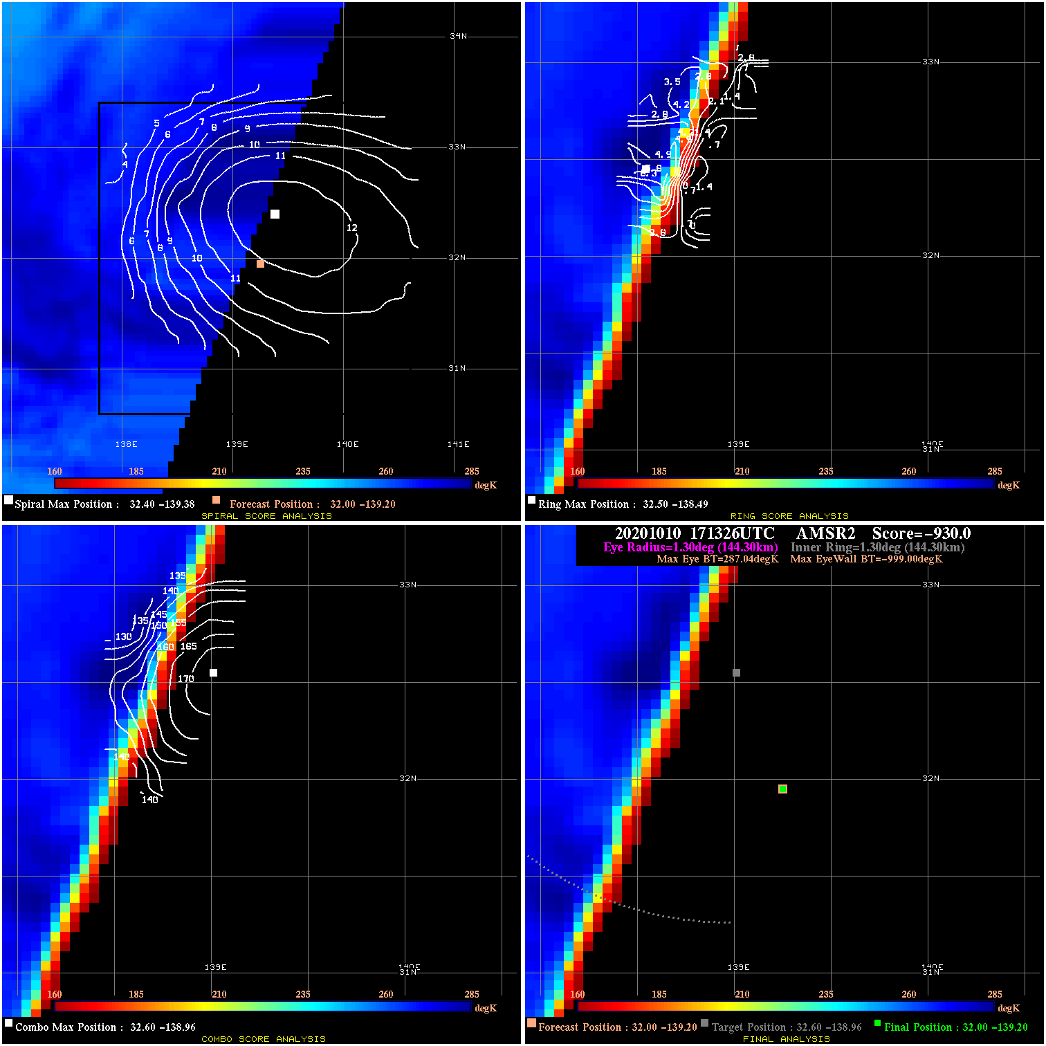
20201010 171326 -930.0 N/A N/A N/A 0.00 50.0 AMSR2 32.0 -139.2 32.0 -139.2 32.6 -139.0 Analysis Plot
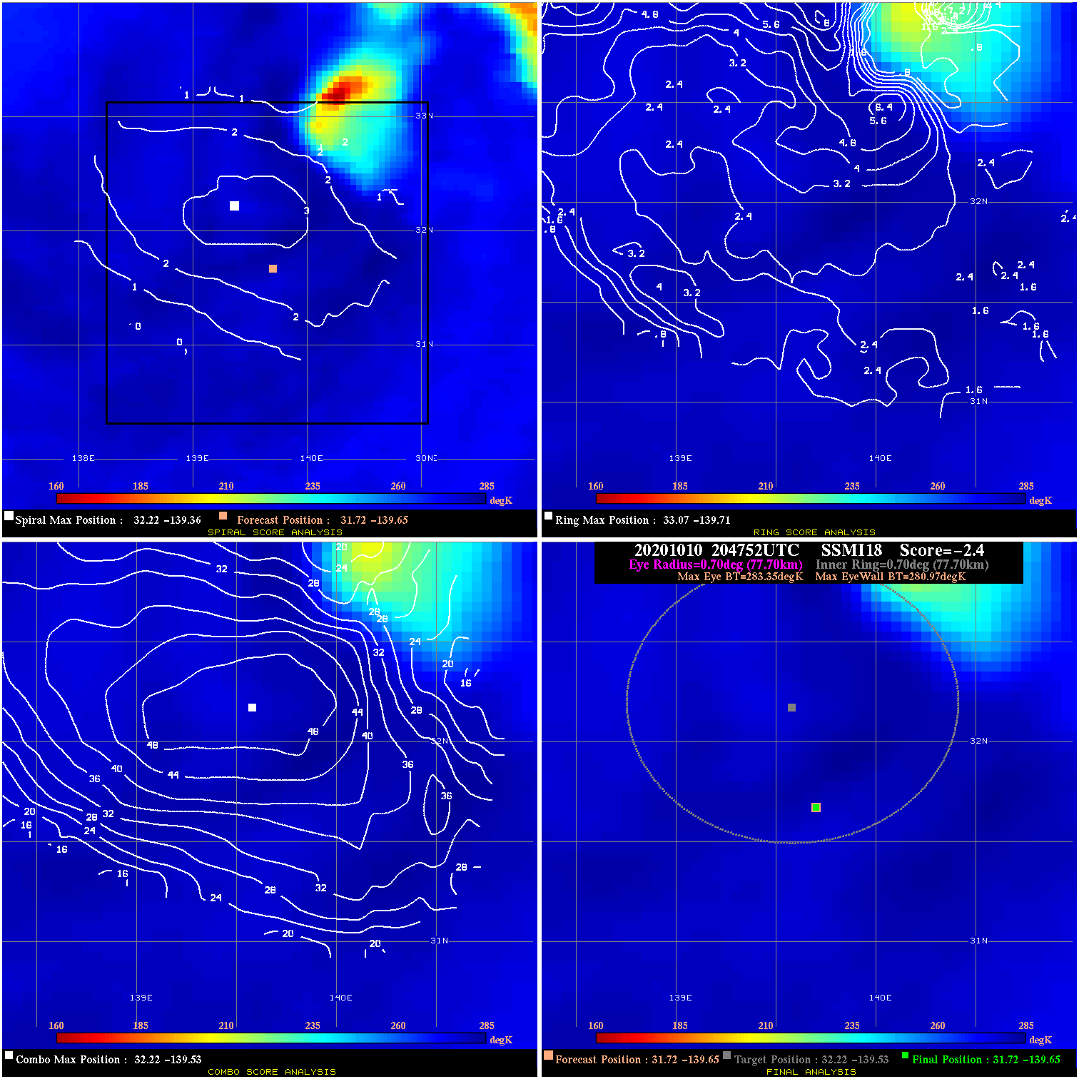
20201010 204752 -2.4 N/A 9.6% 155.54 2.38 50.0 SSMI18 31.7 -139.6 31.7 -139.6 32.2 -139.5 Analysis Plot
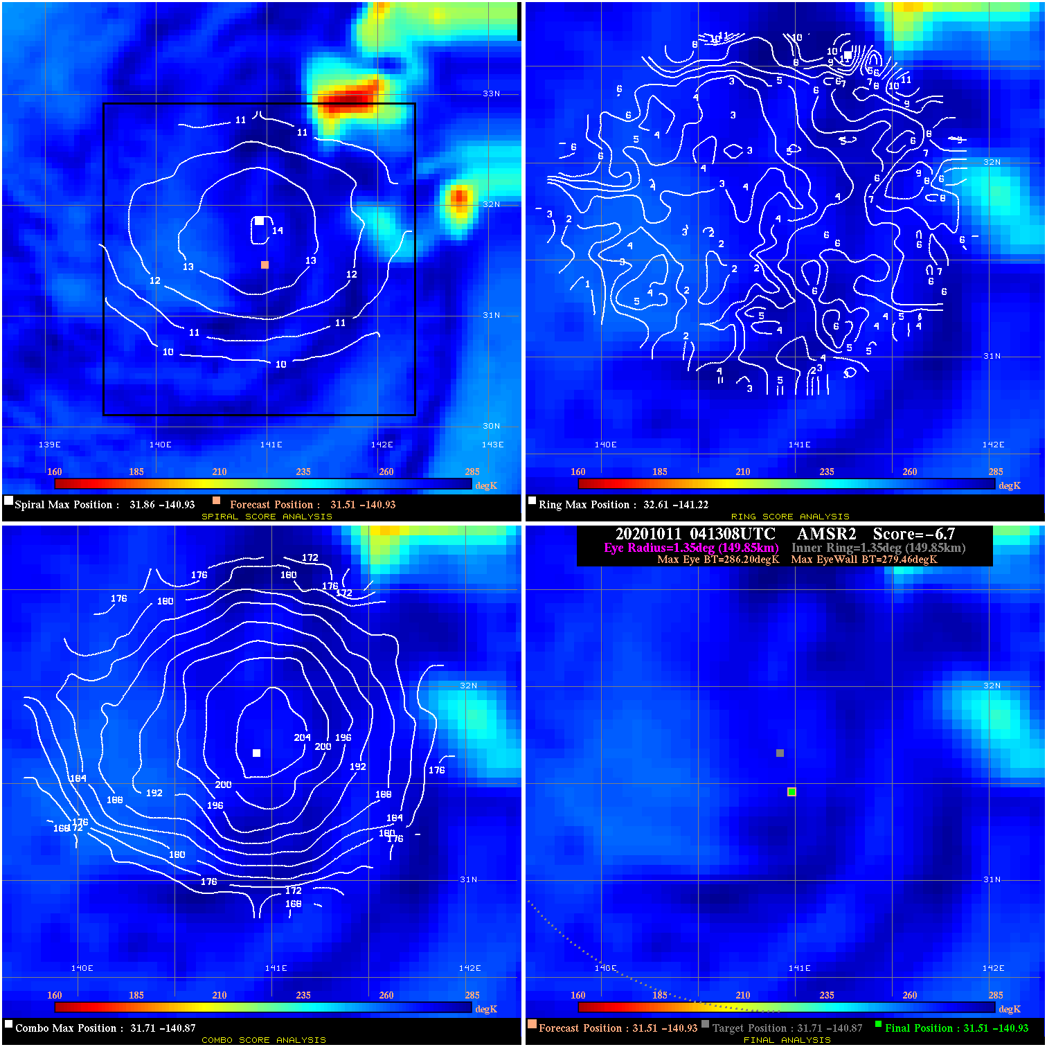
20201011 041308 -6.7 N/A 5.5% 299.97 6.74 45.0 AMSR2 31.5 -140.9 31.5 -140.9 31.7 -140.9 Analysis Plot
20201011 085757 -3.3 N/A 9.6% 199.98 3.31 40.0 SSMI18 31.5 -141.3 31.5 -141.3 31.6 -141.1 Analysis Plot
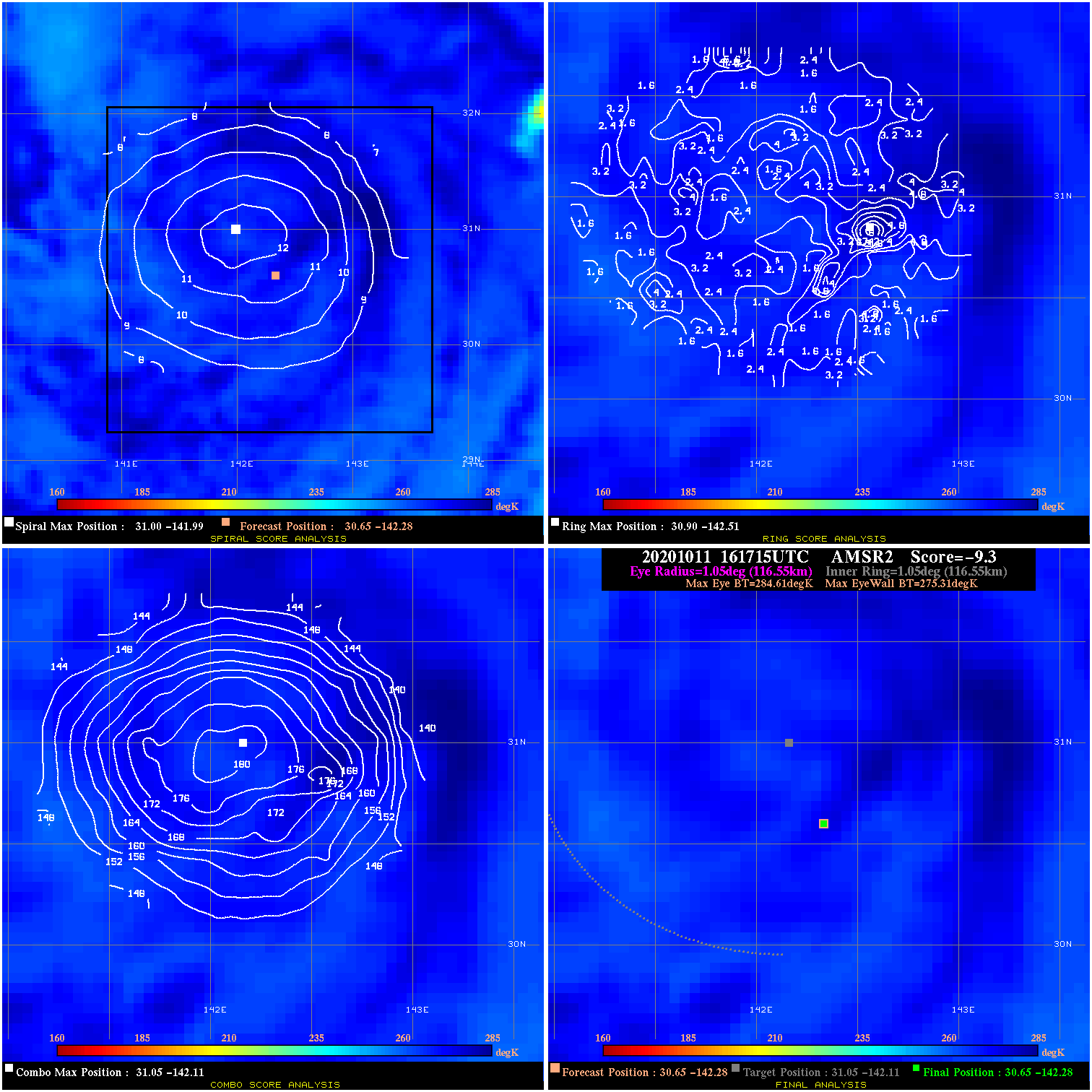
20201011 161715 -9.3 N/A N/A 233.31 9.30 35.0 AMSR2 30.6 -142.3 30.6 -142.3 31.0 -142.1 Analysis Plot
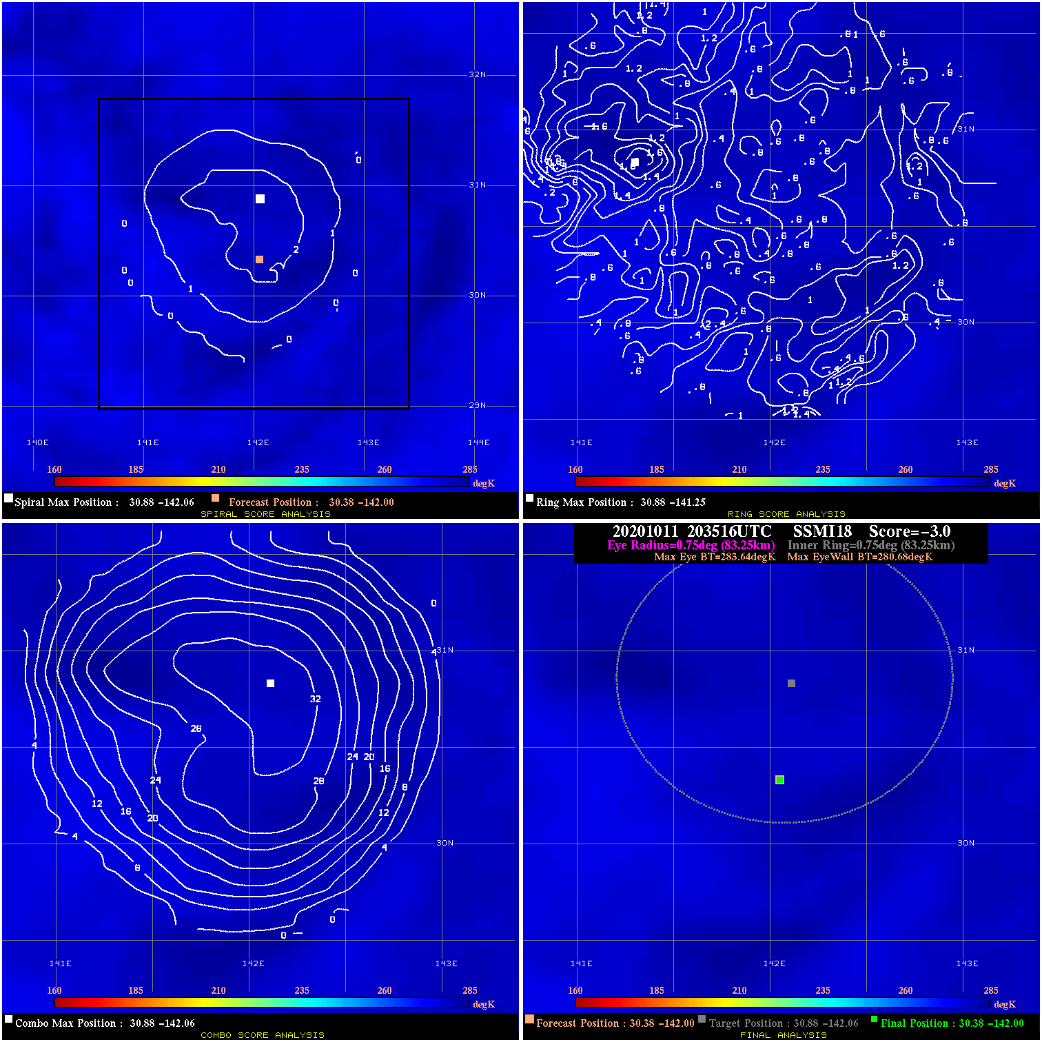
20201011 203516 -3.0 N/A N/A 166.65 2.96 35.0 SSMI18 30.4 -142.0 30.4 -142.0 30.9 -142.1 Analysis Plot
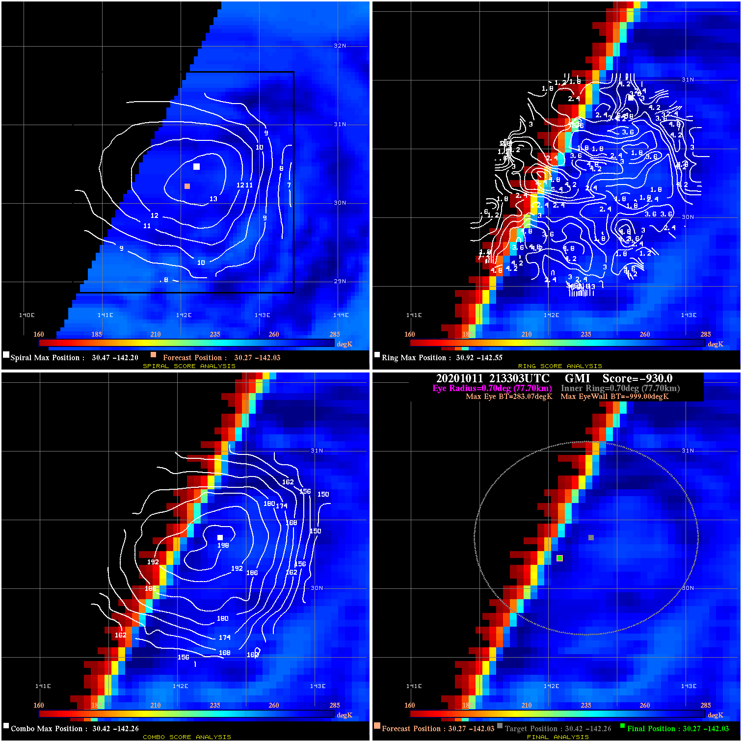
20201011 213303 -930.0 N/A N/A N/A 0.00 35.0 GMI 30.3 -142.0 30.3 -142.0 30.4 -142.3 Analysis Plot
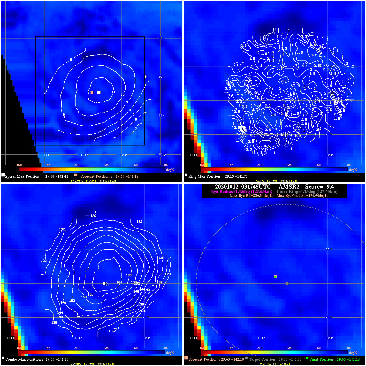
20201012 031745 -9.4 N/A N/A 255.53 9.40 35.0 AMSR2 29.6 -142.2 29.6 -142.2 29.5 -142.4 Analysis Plot
|
|
Legend: - Date/Time are determined from PMW imagery at Forecast (initial guess) Lat/Lon position. - Positive/Negative Latitude = North/South Hemisphere; Longitude = Western/Eastern Hemisphere. - "Ring Diam" value indicates the estimated surface eyewall diameter in km (the MI eyewall edge diameter minus 10 km). - "Ring Pct" is the percentage of the "ring" (eyewall inner boundary) that is 1) colder than the "hot spot" (warmest eye pixel) in the eye by 20K, or 2) the percentage that is a) colder than 232K and b) colder than the "hot spot" by 10K, whichever is greater. - Values are red if Ring % <= 65, yellow/brown if Ring % <= 85 and green if Ring % > 85. - "Tb diff" is the difference between the "hot spot" (warmest eye pixel) and the warmest pixel on the eyewall. - Intensity score are listed as negative, and not used, when the JTWC or NHC estimated Vmax is <55 kts in order to rule out weak but highly symmetric TCs. - Error messages in intensity scores: -920 is used when the hottest pixel in the eye is <200K, to prevent false positives; -930 means <85% of eyewall has observations/data. |