Tropical Storm 30Y_09
|
Passive Microwave (PMW) Intensity Information Hurricane Intensity Estimation (HIE) Algorithm Version 9.0 |
Overpass Inten Ring Ring Wind Forecast Final Target
Date Time Score Meaning Pct Diam BTdiff Est Sat Lat Lon Lat Lon Lat Lon
20211212 073051 -2.9 N/A N/A 22.22 2.87 30.0 SSMI16 4.6 -144.4 4.6 -144.4 4.1 -143.6 Analysis Plot
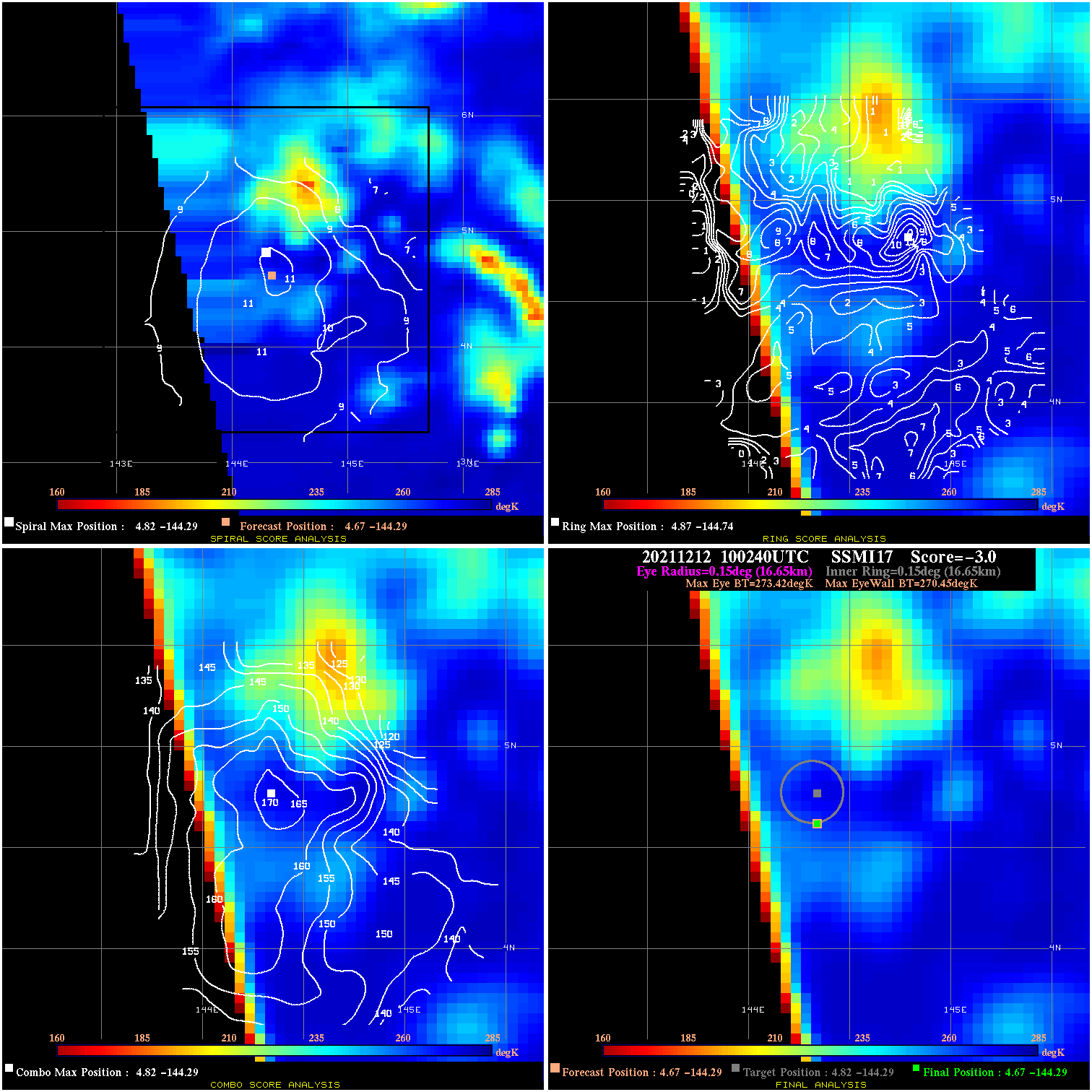
20211212 100240 -3.0 N/A N/A 33.33 2.97 30.0 SSMI17 4.7 -144.3 4.7 -144.3 4.8 -144.3 Analysis Plot
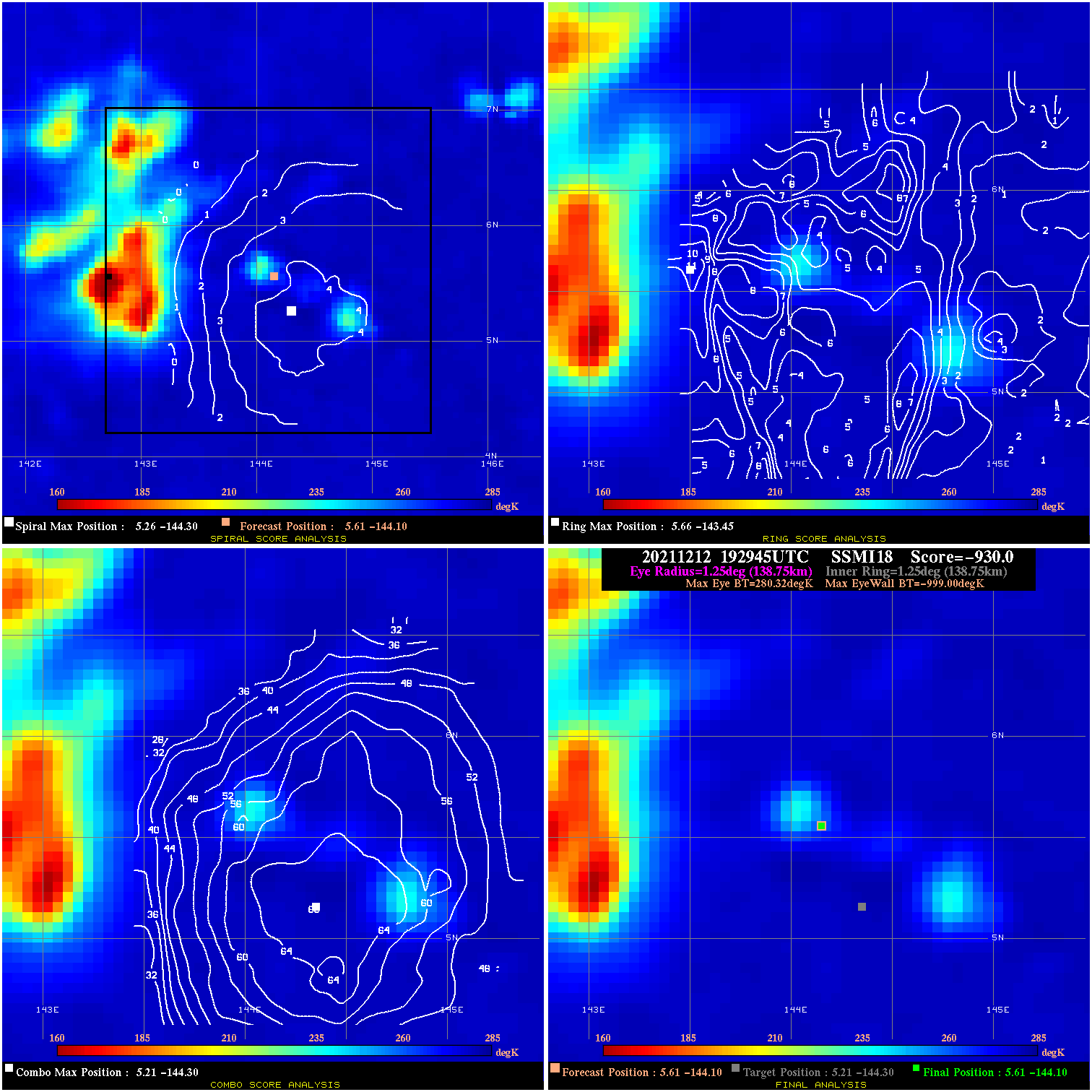
20211212 192945 -930.0 N/A N/A N/A 0.00 30.0 SSMI18 5.6 -144.1 5.6 -144.1 5.2 -144.3 Analysis Plot
20211212 220438 -930.0 N/A N/A N/A 0.00 30.0 SSMI17 5.8 -144.3 5.8 -144.3 5.2 -144.0 Analysis Plot
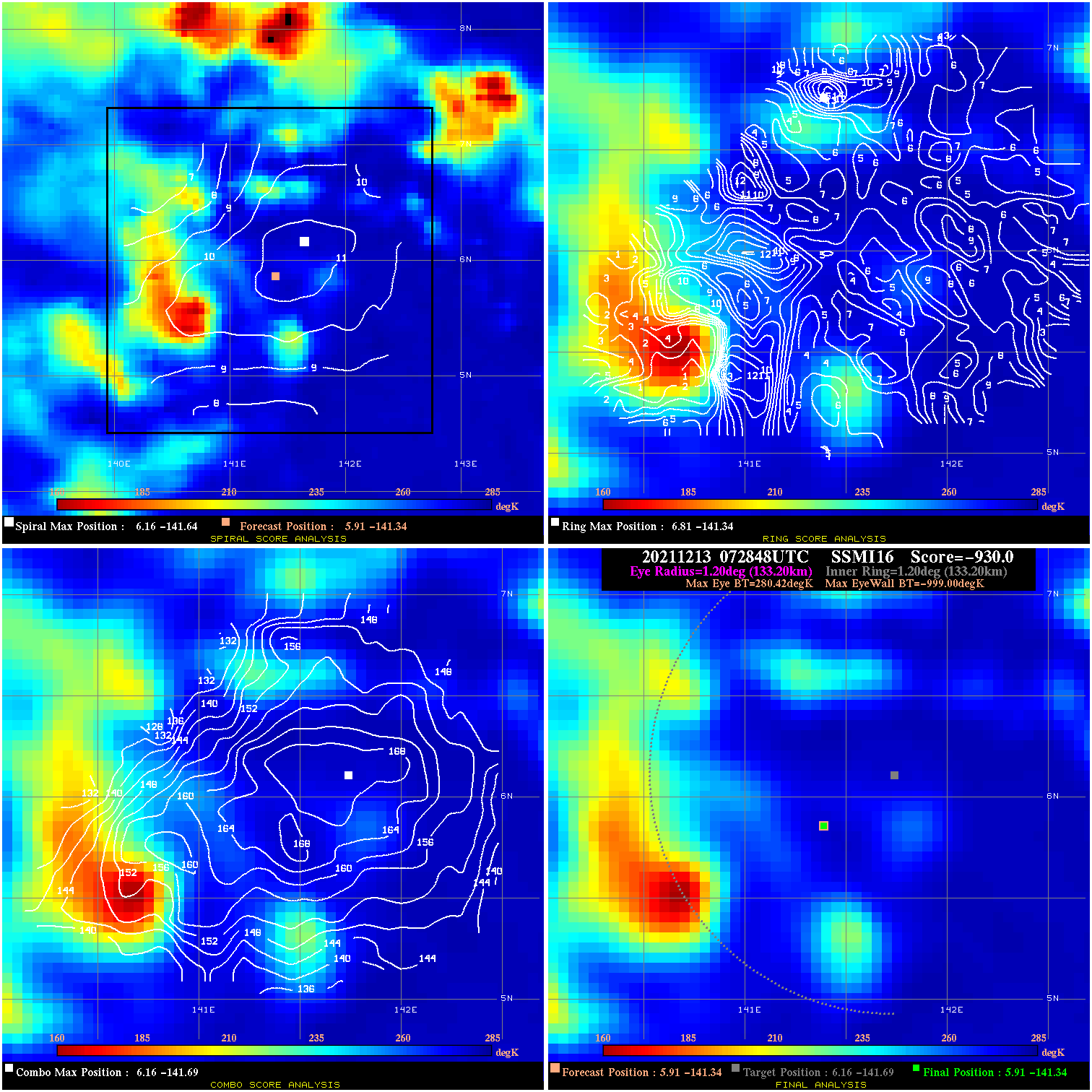
20211213 072848 -930.0 N/A N/A N/A 0.00 30.0 SSMI16 5.9 -141.3 5.9 -141.3 6.2 -141.7 Analysis Plot
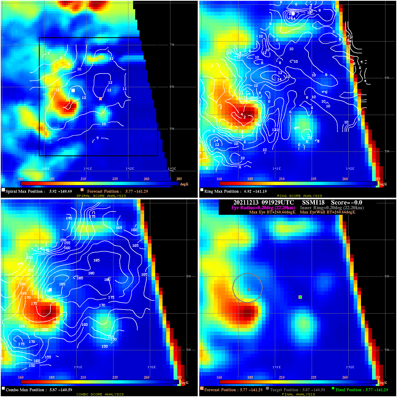
20211213 091929 N/A N/A N/A N/A N/A 30.0 SSMI18 5.8 -141.3 5.8 -141.3 5.9 -140.6 Analysis Plot
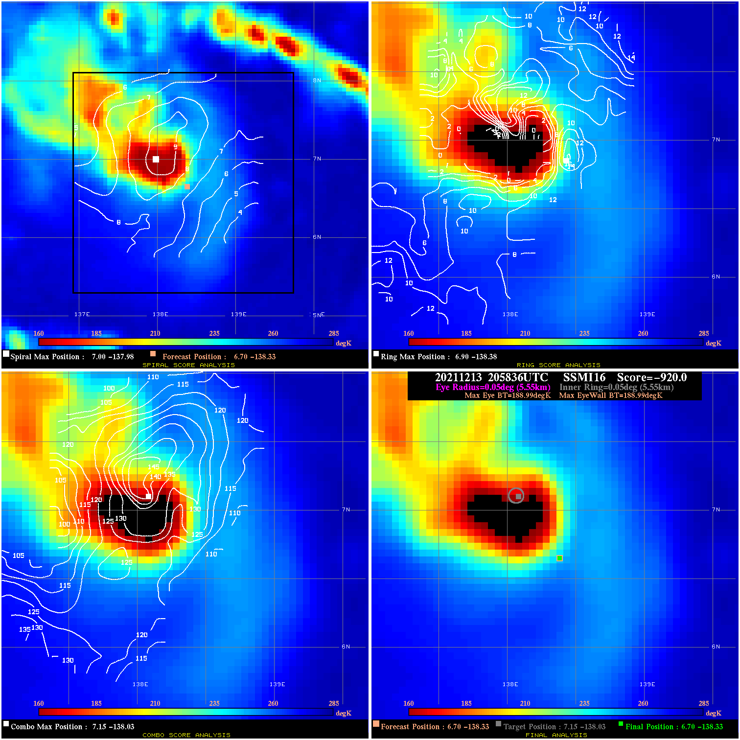
20211213 205836 N/A N/A N/A N/A N/A 35.0 SSMI16 6.7 -138.3 6.7 -138.3 7.2 -138.0 Analysis Plot
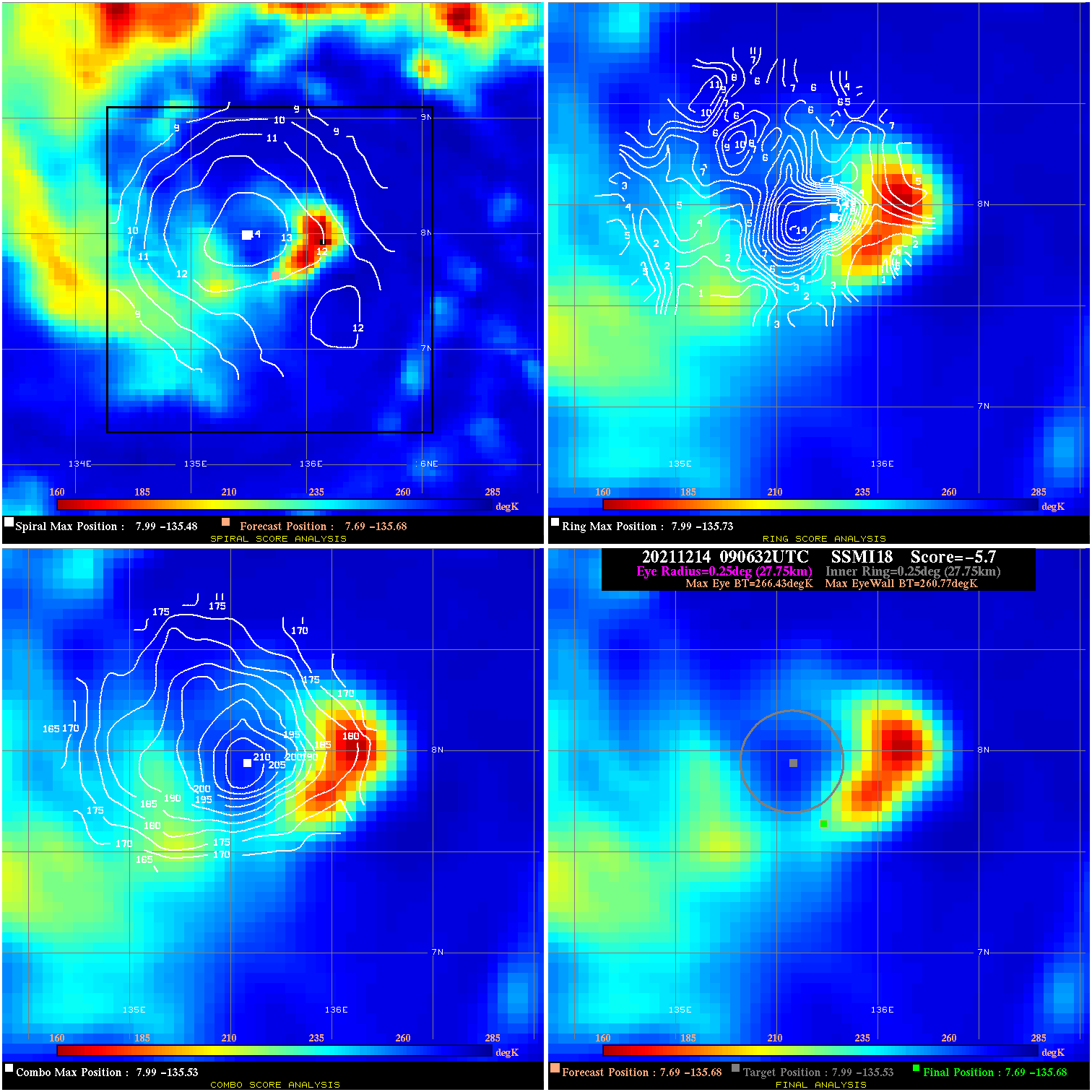
20211214 090632 -5.7 N/A 31.5% 55.55 5.66 50.0 SSMI18 7.7 -135.7 7.7 -135.7 8.0 -135.5 Analysis Plot
20211214 204531 42.8 >65 kts 100.0% 44.44 27.83 55.0 SSMI16 8.6 -133.3 8.6 -133.3 8.8 -133.0 Analysis Plot
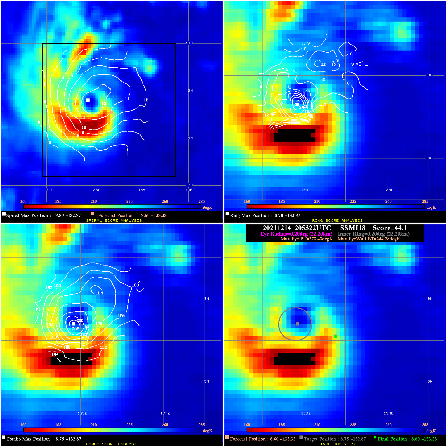
20211214 205322 44.1 >65 kts 100.0% 44.44 29.15 55.0 SSMI18 8.6 -133.3 8.6 -133.3 8.8 -132.9 Analysis Plot
20211215 042028 42.9 >65 kts 100.0% 33.33 27.87 60.0 AMSR2 9.2 -132.3 9.0 -131.4 9.0 -131.4 Analysis Plot
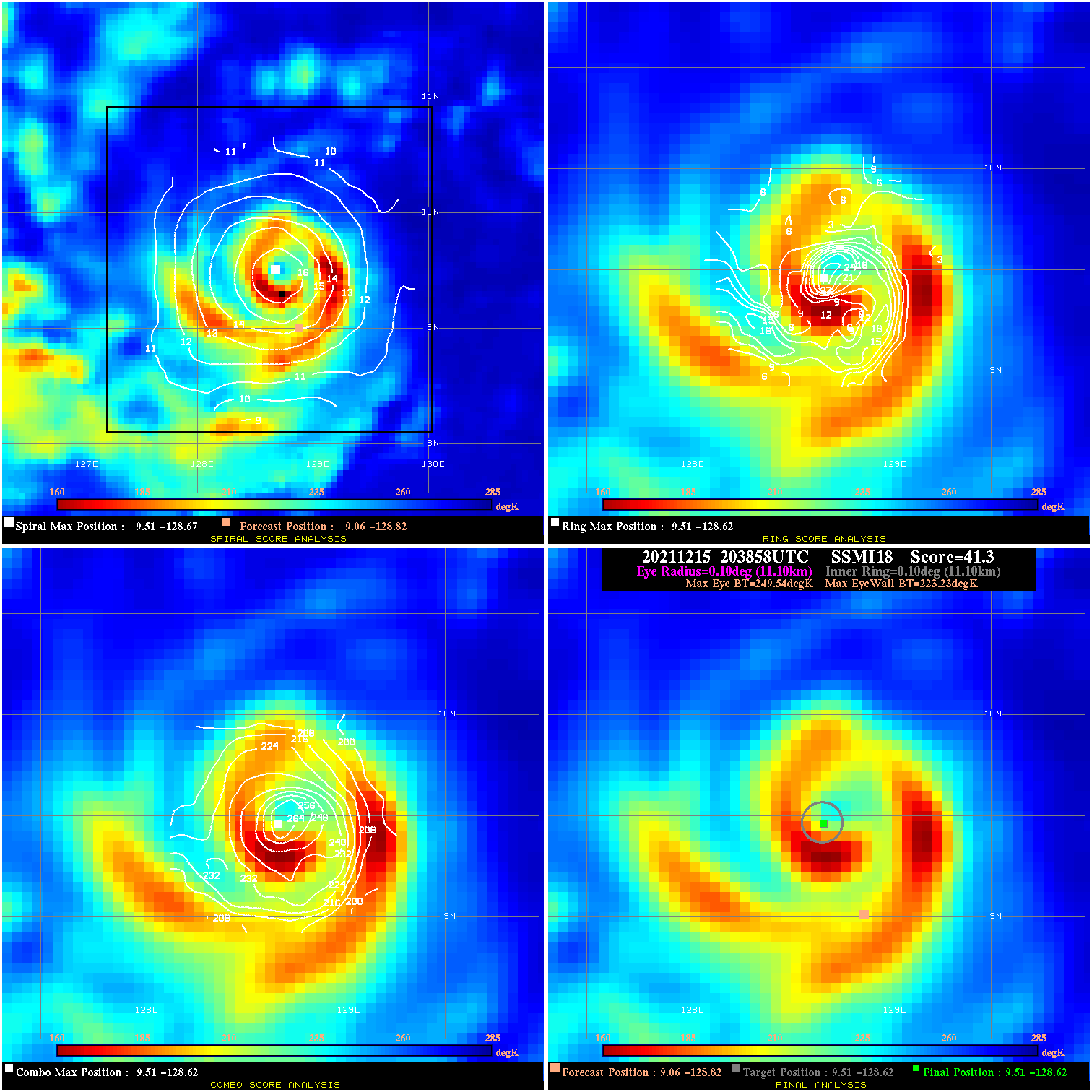
20211215 203858 41.3 >65 kts 100.0% 22.22 26.31 75.0 SSMI18 9.1 -128.8 9.5 -128.6 9.5 -128.6 Analysis Plot
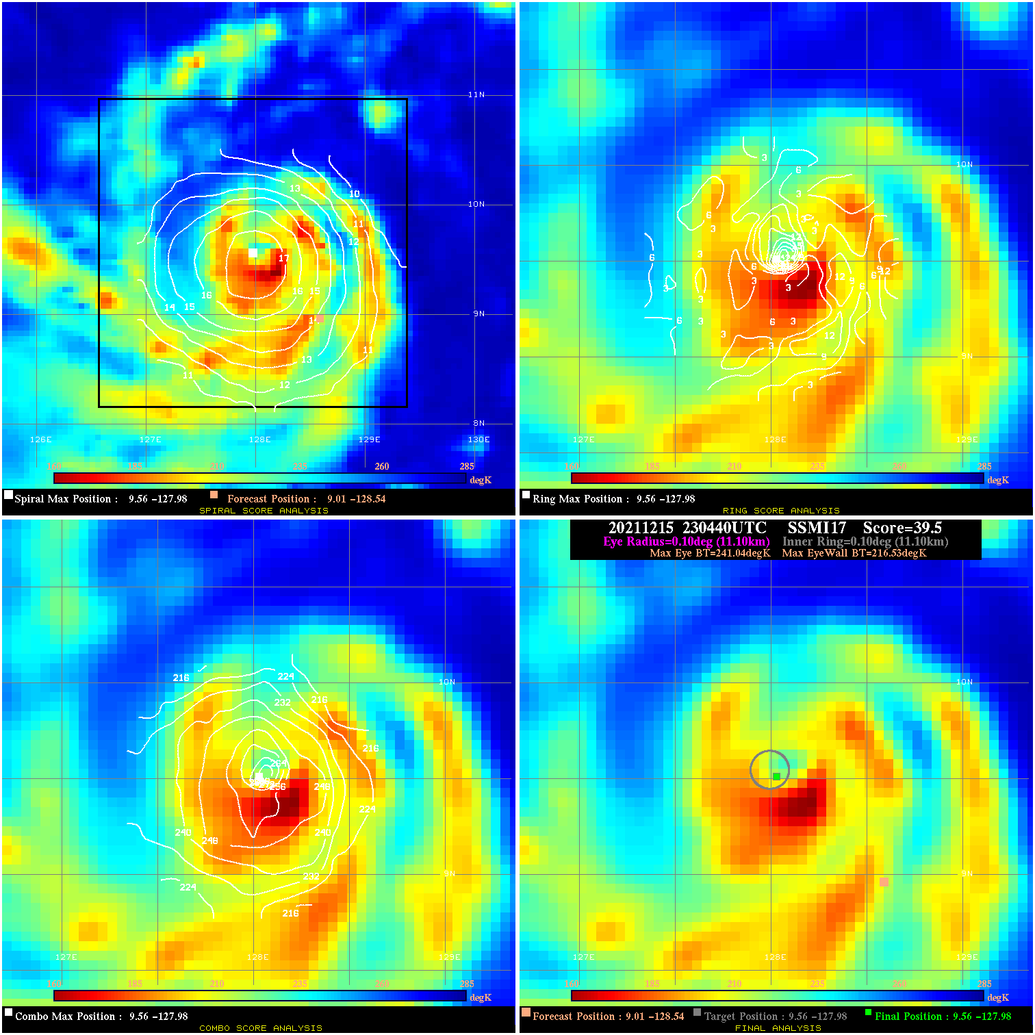
20211215 230440 39.5 >65 kts 100.0% 22.22 24.51 75.0 SSMI17 9.0 -128.5 9.6 -128.0 9.6 -128.0 Analysis Plot
20211216 084156 22.8 >65 kts 98.6% 33.33 7.79 100.0 SSMI16 9.6 -125.9 9.9 -125.5 9.9 -125.5 Analysis Plot
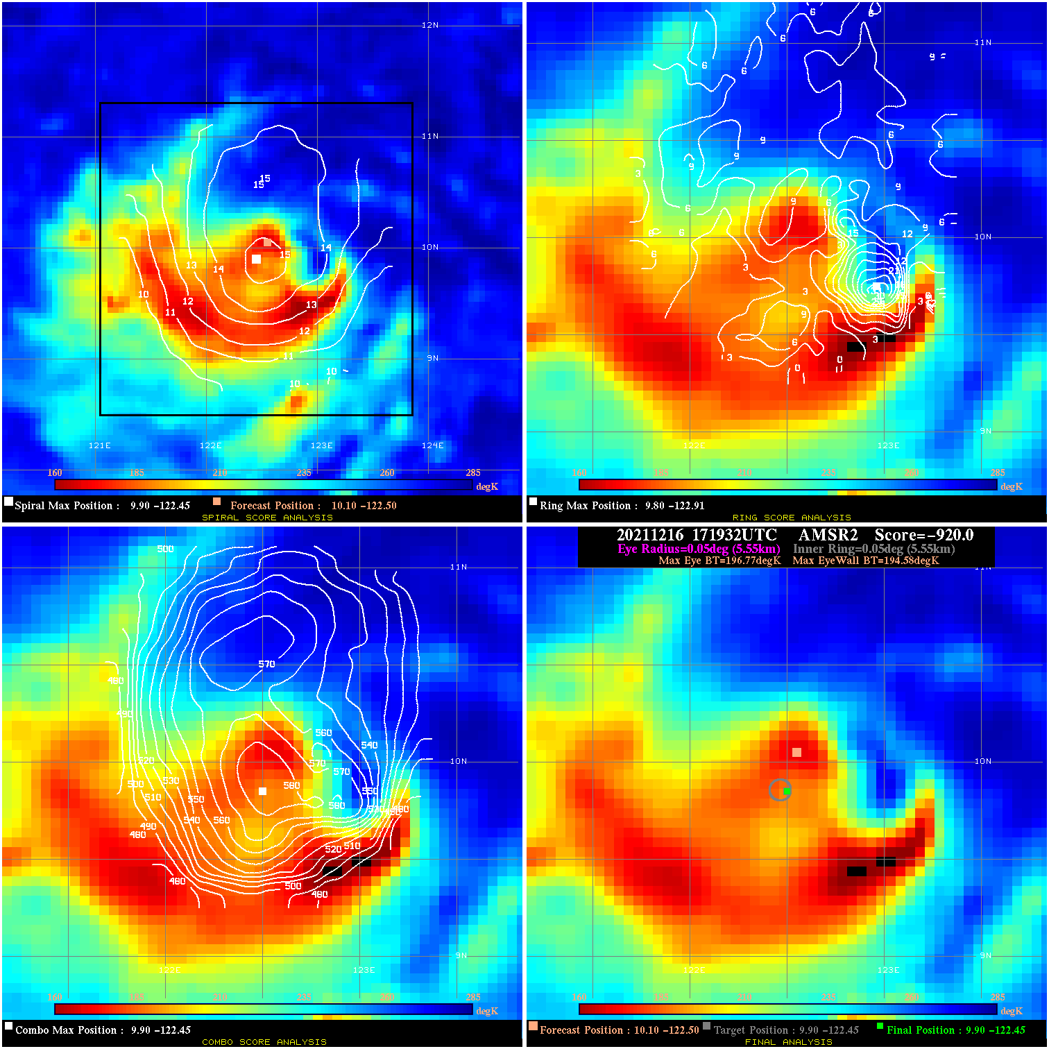
20211216 171932 -920.0 N/A 100.0% 11.11 2.19 95.0 AMSR2 10.1 -122.5 9.9 -122.4 9.9 -122.4 Analysis Plot
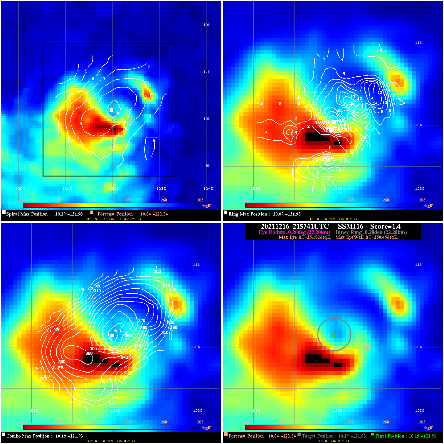
20211216 215741 1.4 N/A 46.6% 44.44 1.37 95.0 SSMI16 10.0 -122.3 10.2 -121.9 10.2 -121.9 Analysis Plot
20211217 082038 23.0 >65 kts 82.2% 88.88 22.97 80.0 SSMI18 10.1 -119.7 10.4 -119.4 10.4 -119.4 Analysis Plot
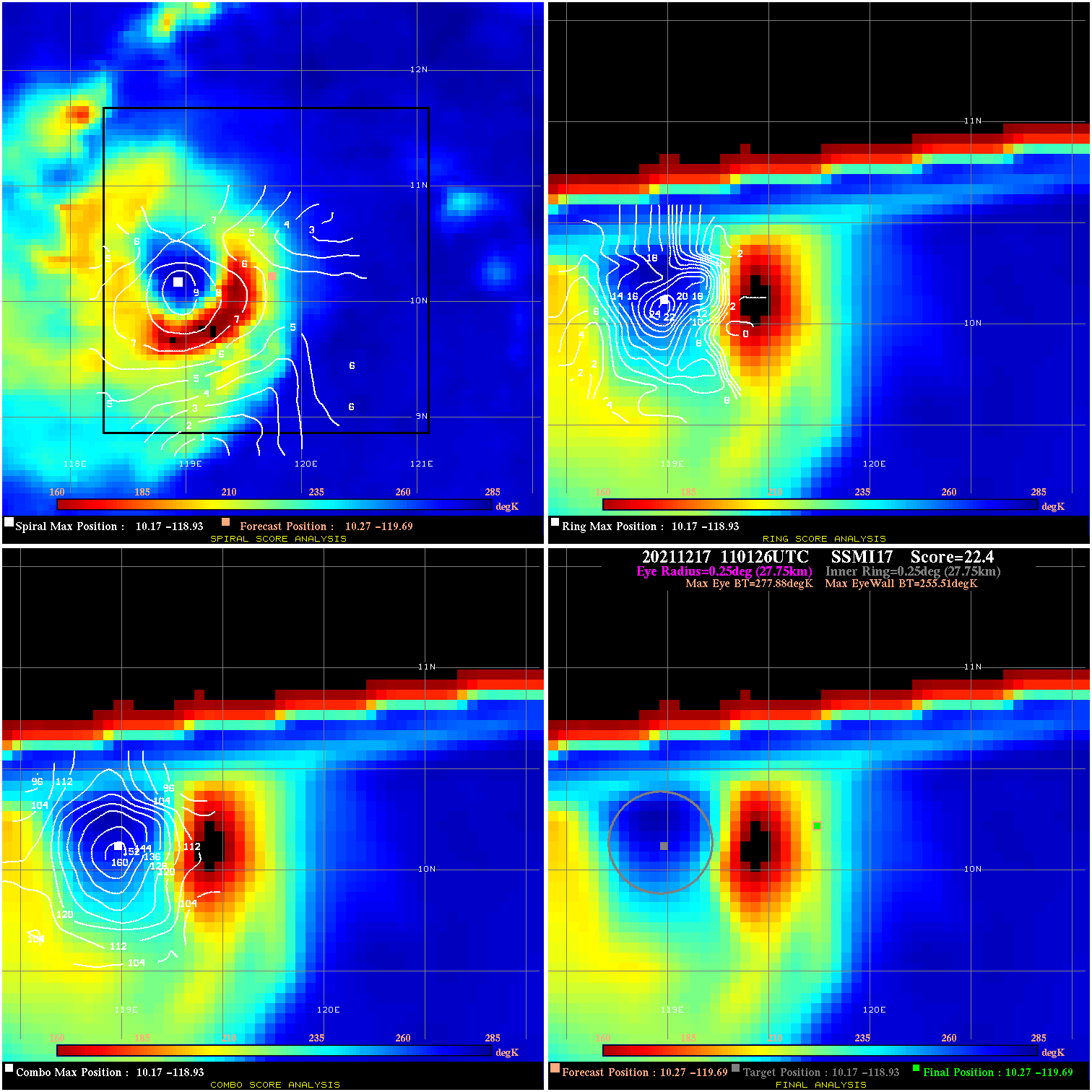
20211217 110126 22.4 >65 kts 46.6% 55.55 22.37 80.0 SSMI17 10.3 -119.7 10.3 -119.7 10.2 -118.9 Analysis Plot
20211217 180232 N/A N/A N/A N/A N/A 80.0 AMSR2 10.4 -117.0 10.4 -117.0 11.1 -117.7 Analysis Plot
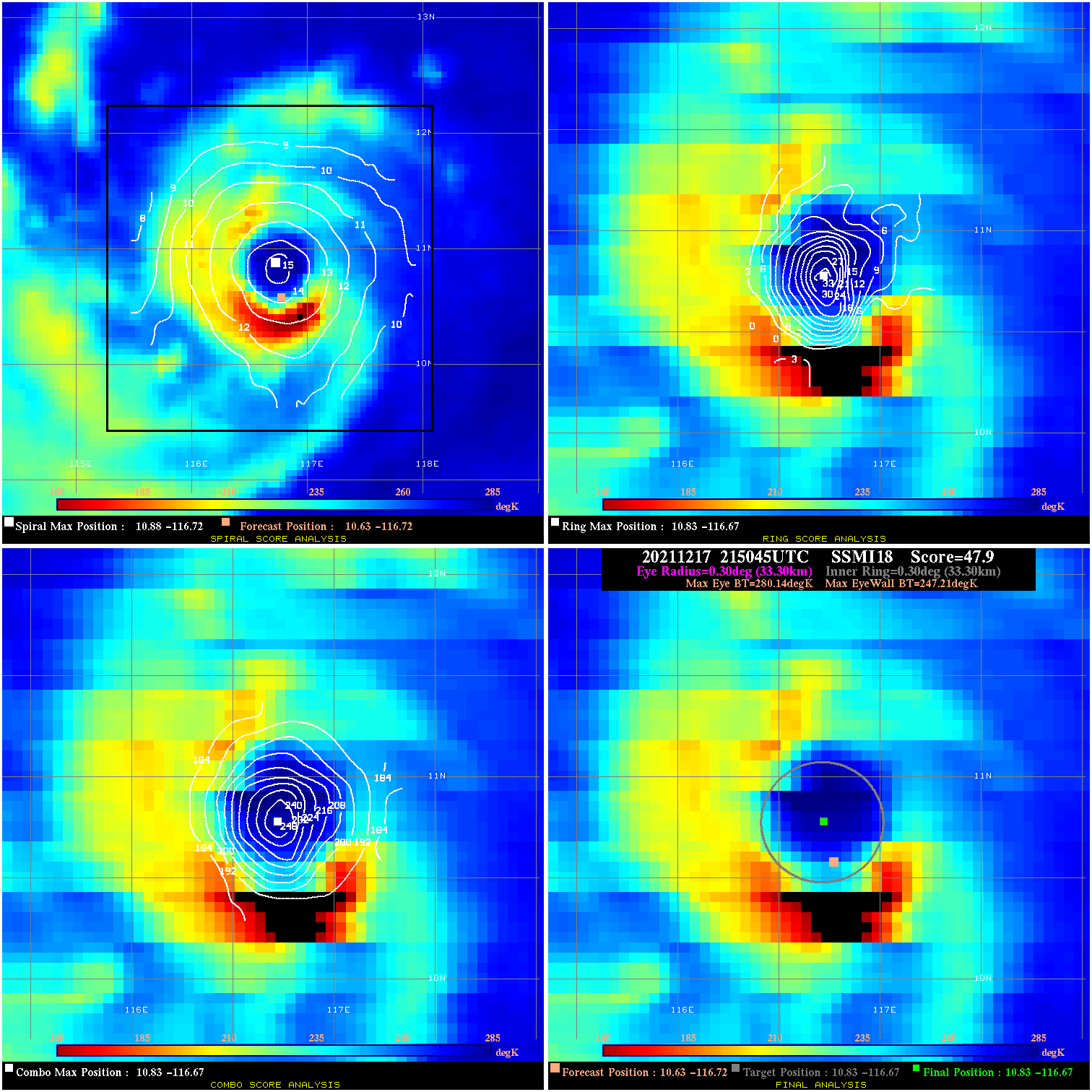
20211217 215045 47.9 >65 kts 100.0% 66.66 32.93 80.0 SSMI18 10.6 -116.7 10.8 -116.7 10.8 -116.7 Analysis Plot
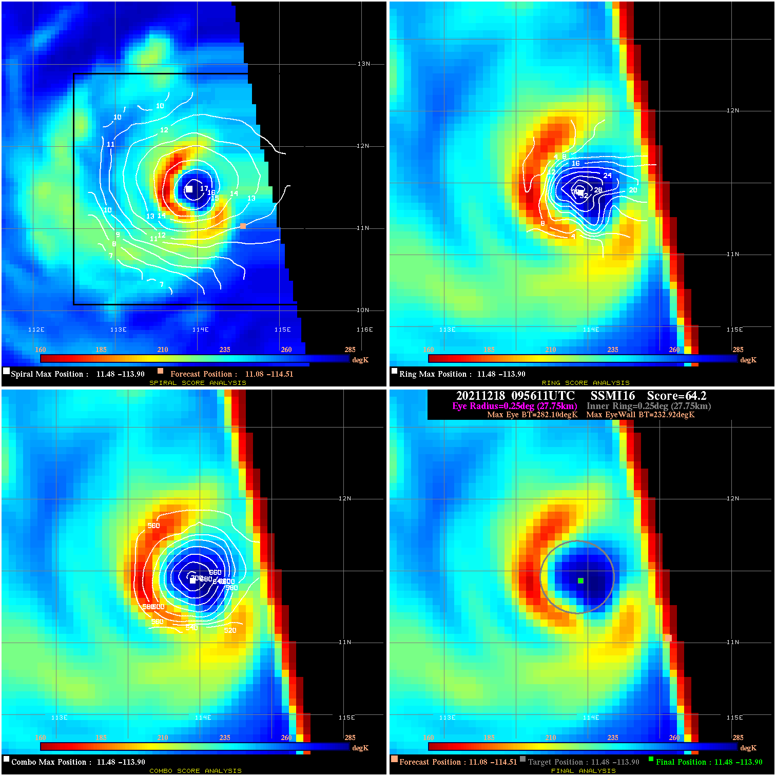
20211218 095611 64.2 >85 kts 102.8% 55.55 49.18 85.0 SSMI16 11.1 -114.5 11.5 -113.9 11.5 -113.9 Analysis Plot
20211218 103700 59.2 >65 kts 100.0% 55.55 44.18 85.0 SSMI17 11.1 -114.5 11.7 -113.9 11.7 -113.9 Analysis Plot
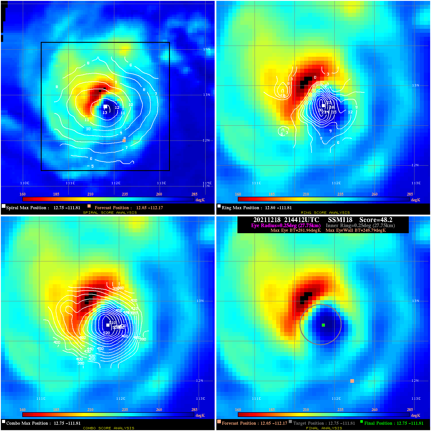
20211218 214412 48.2 >65 kts 100.0% 55.55 33.17 100.0 SSMI18 12.1 -112.2 12.8 -111.8 12.8 -111.8 Analysis Plot
20211219 094315 2.6 N/A 9.6% 66.66 2.58 105.0 SSMI16 13.6 -110.6 14.3 -110.8 14.3 -110.8 Analysis Plot
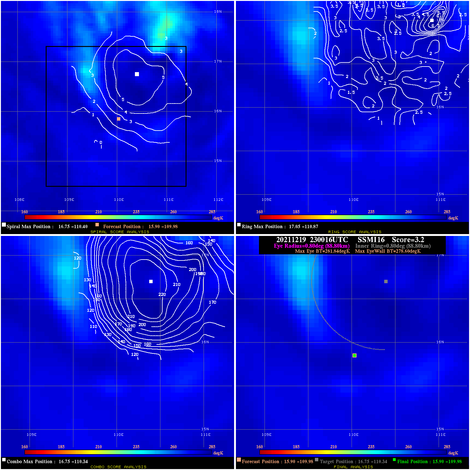
20211219 230016 3.2 N/A N/A 177.76 3.24 90.0 SSMI16 15.9 -110.0 15.9 -110.0 16.8 -110.3 Analysis Plot
20211220 062009 4.4 N/A N/A 122.21 4.38 70.0 AMSR2 18.3 -111.1 18.3 -111.1 18.4 -111.3 Analysis Plot
20211220 093013 3.2 N/A N/A 211.09 3.20 70.0 SSMI16 18.3 -111.4 18.3 -111.4 18.4 -111.5 Analysis Plot
|
|
Legend: - Date/Time are determined from PMW imagery at Forecast (initial guess) Lat/Lon position. - Positive/Negative Latitude = North/South Hemisphere; Longitude = Western/Eastern Hemisphere. - "Ring Diam" value indicates the estimated surface eyewall diameter in km (the MI eyewall edge diameter minus 10 km). - "Ring Pct" is the percentage of the "ring" (eyewall inner boundary) that is 1) colder than the "hot spot" (warmest eye pixel) in the eye by 20K, or 2) the percentage that is a) colder than 232K and b) colder than the "hot spot" by 10K, whichever is greater. - Values are red if Ring % <= 65, yellow/brown if Ring % <= 85 and green if Ring % > 85. - "Tb diff" is the difference between the "hot spot" (warmest eye pixel) and the warmest pixel on the eyewall. - Intensity score are listed as negative, and not used, when the JTWC or NHC estimated Vmax is <55 kts in order to rule out weak but highly symmetric TCs. - Error messages in intensity scores: -920 is used when the hottest pixel in the eye is <200K, to prevent false positives; -930 means <85% of eyewall has observations/data. |