Tropical Storm 31Y_04
|
Passive Microwave (PMW) Intensity Information Hurricane Intensity Estimation (HIE) Algorithm Version 9.0 |
Overpass Inten Ring Ring Wind Forecast Final Target
Date Time Score Meaning Pct Diam BTdiff Est Sat Lat Lon Lat Lon Lat Lon
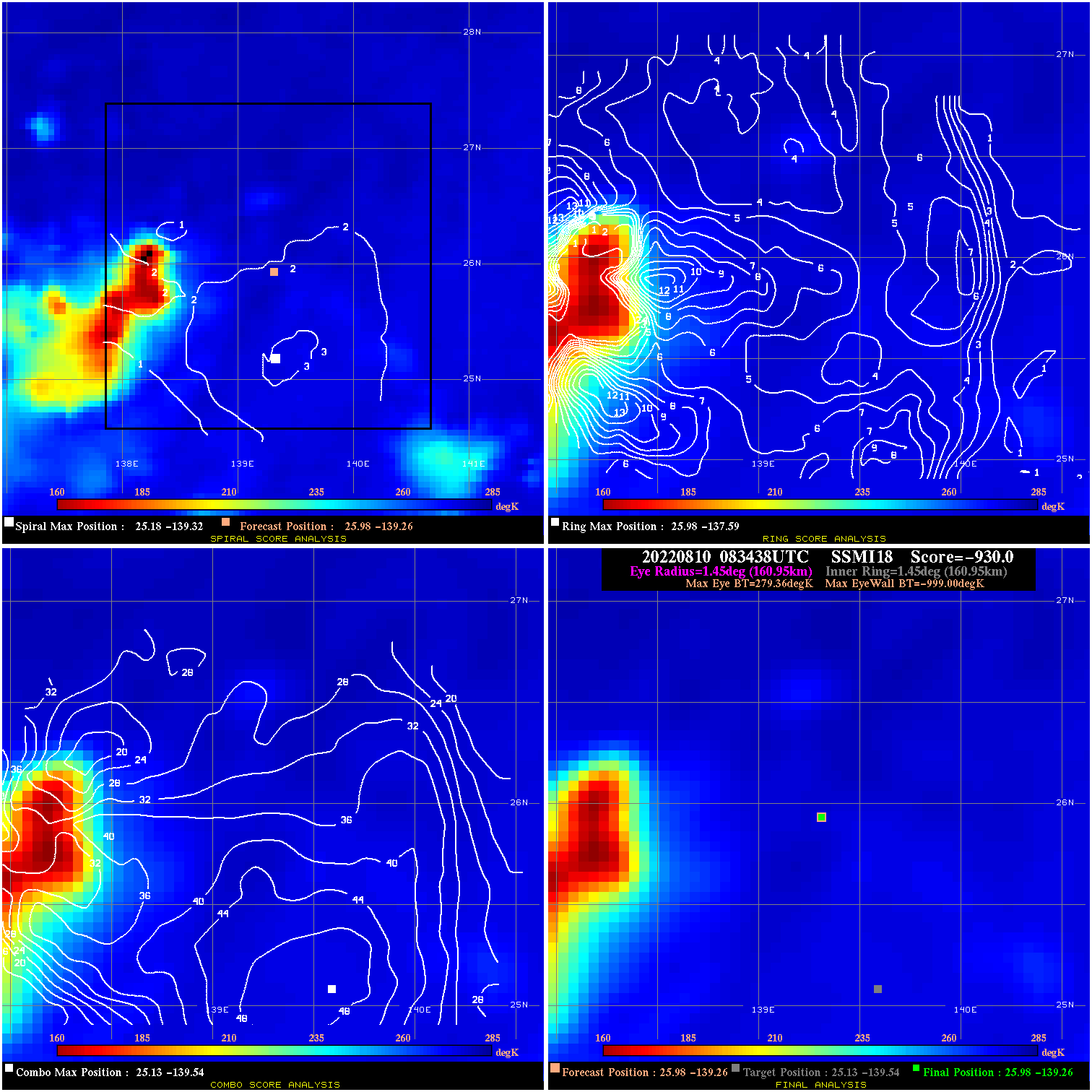
20220810 083438 -930.0 N/A N/A N/A 0.00 30.0 SSMI18 26.0 -139.3 26.0 -139.3 25.1 -139.5 Analysis Plot
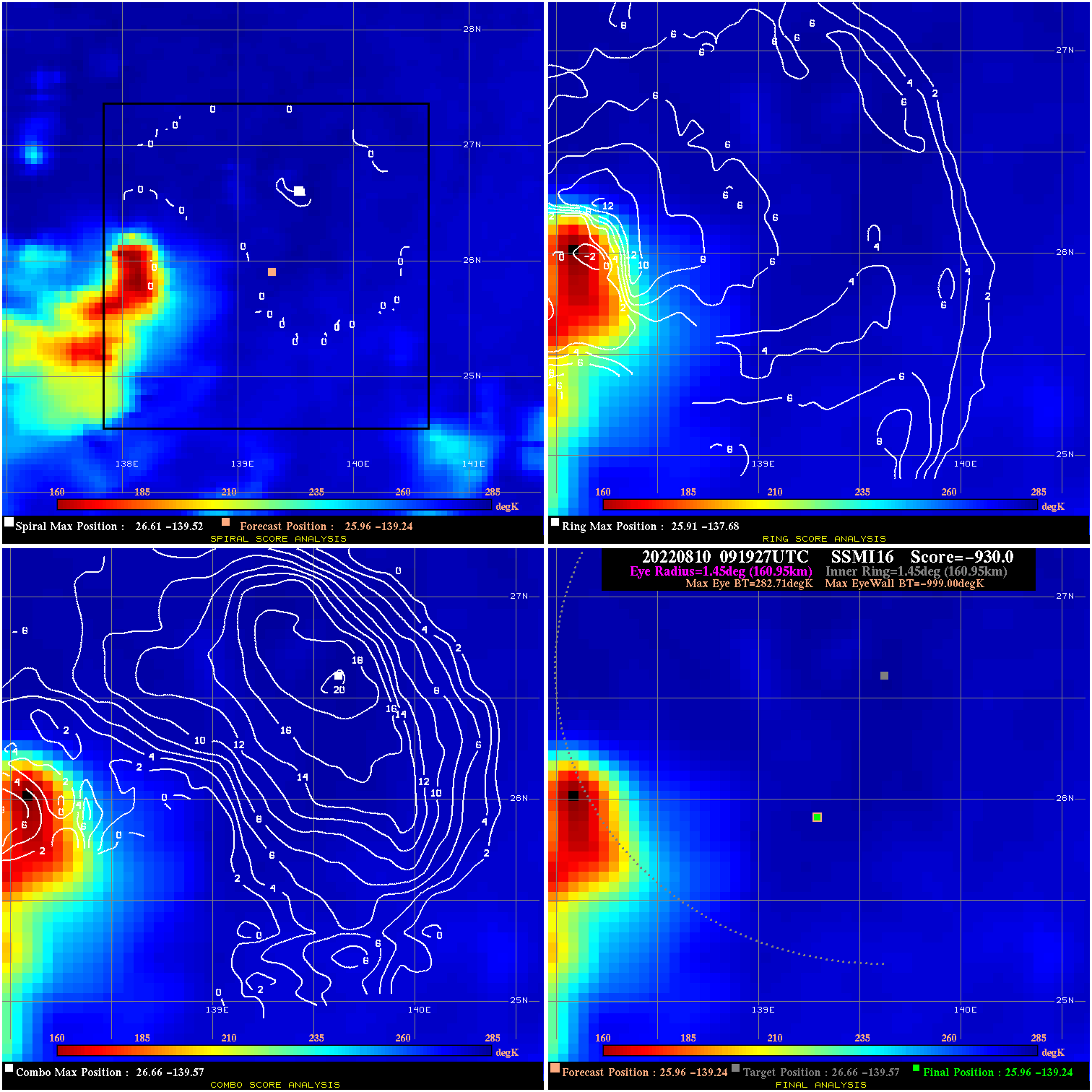
20220810 091927 -930.0 N/A N/A N/A 0.00 30.0 SSMI16 26.0 -139.2 26.0 -139.2 26.7 -139.6 Analysis Plot
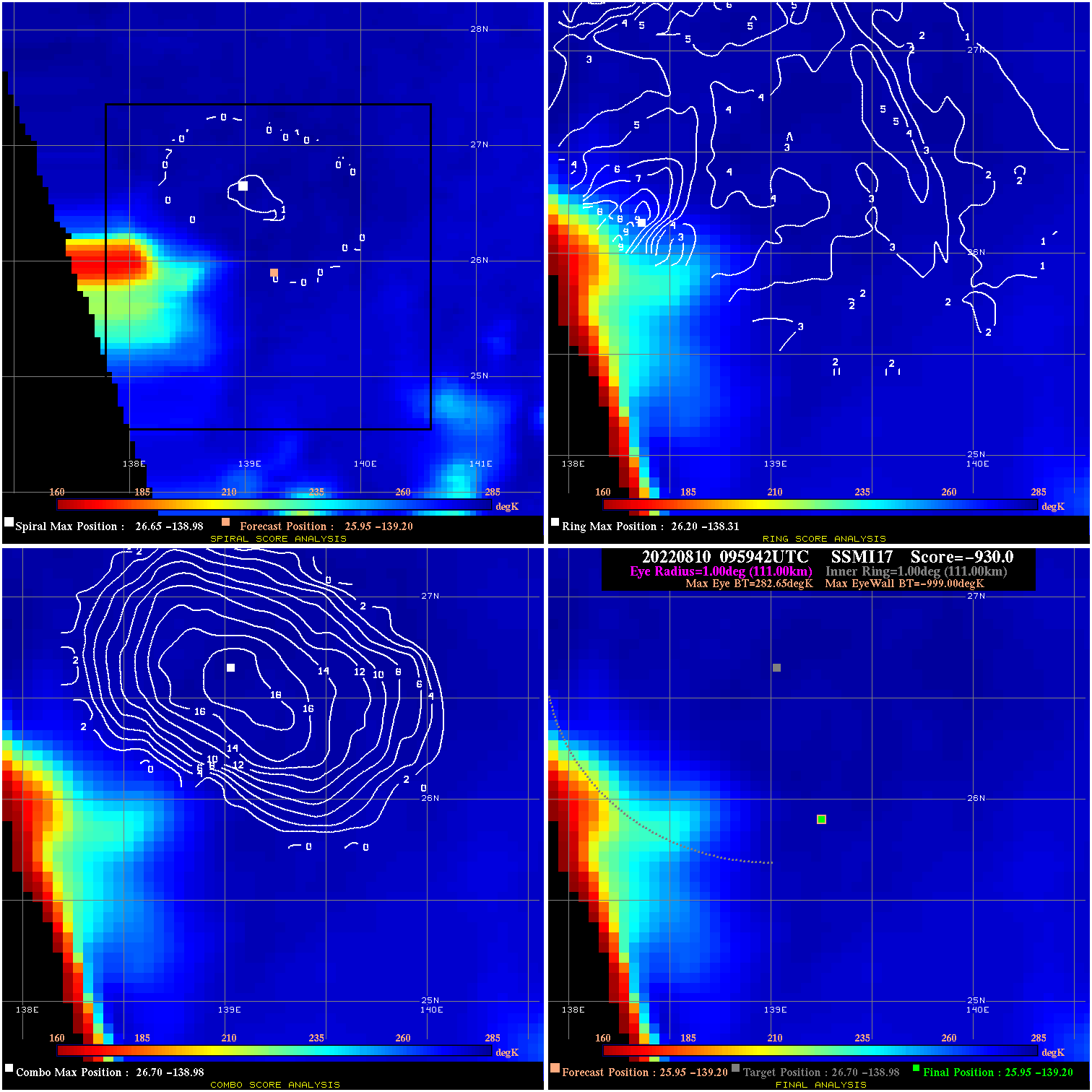
20220810 095942 -930.0 N/A N/A N/A 0.00 30.0 SSMI17 26.0 -139.2 26.0 -139.2 26.7 -139.0 Analysis Plot
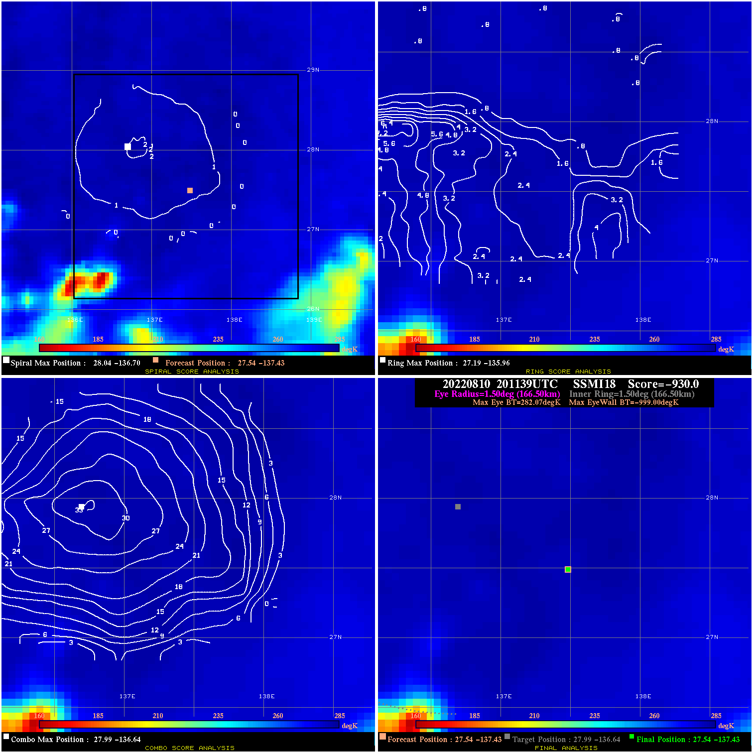
20220810 201139 -930.0 N/A N/A N/A 0.00 30.0 SSMI18 27.5 -137.4 27.5 -137.4 28.0 -136.6 Analysis Plot
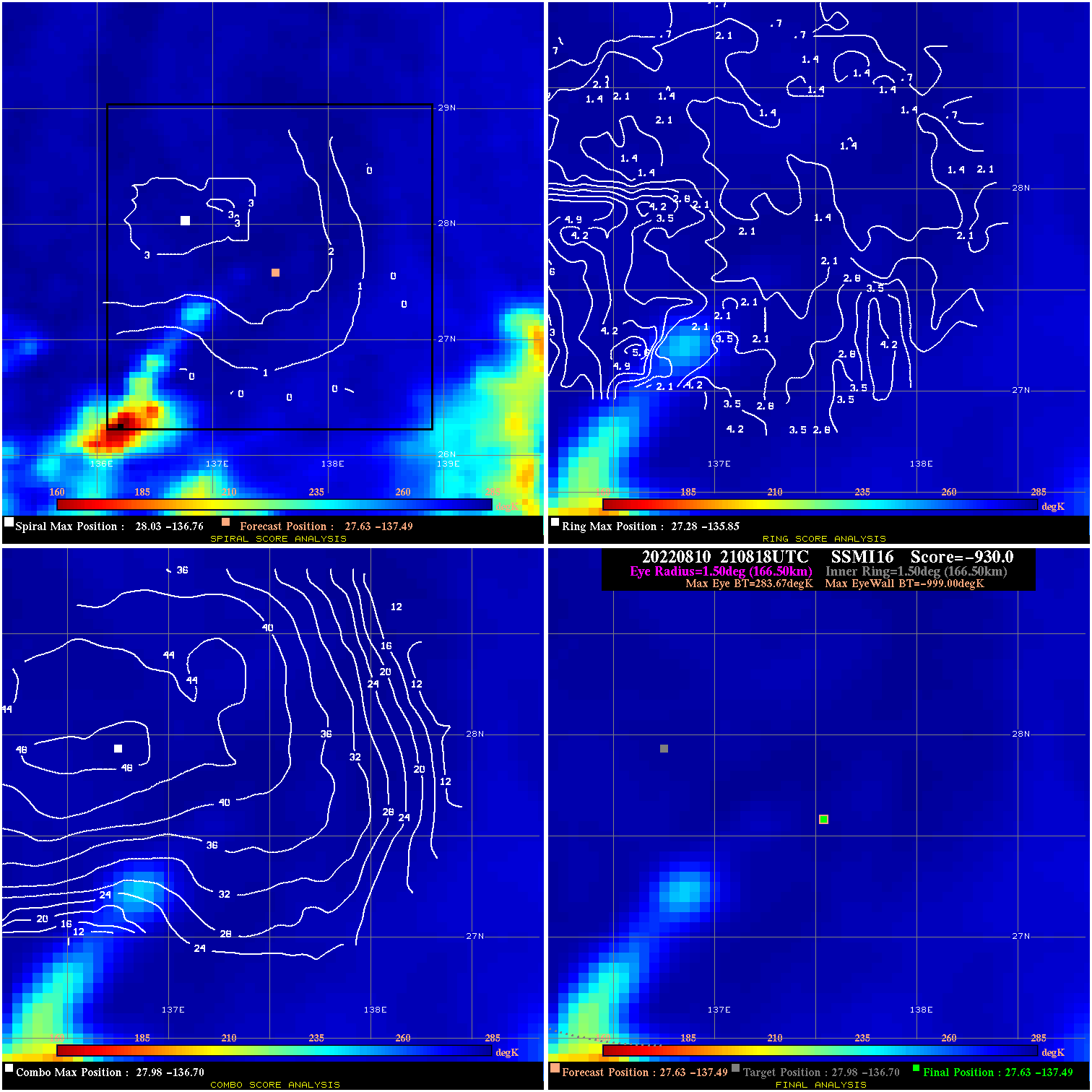
20220810 210818 -930.0 N/A N/A N/A 0.00 30.0 SSMI16 27.6 -137.5 27.6 -137.5 28.0 -136.7 Analysis Plot
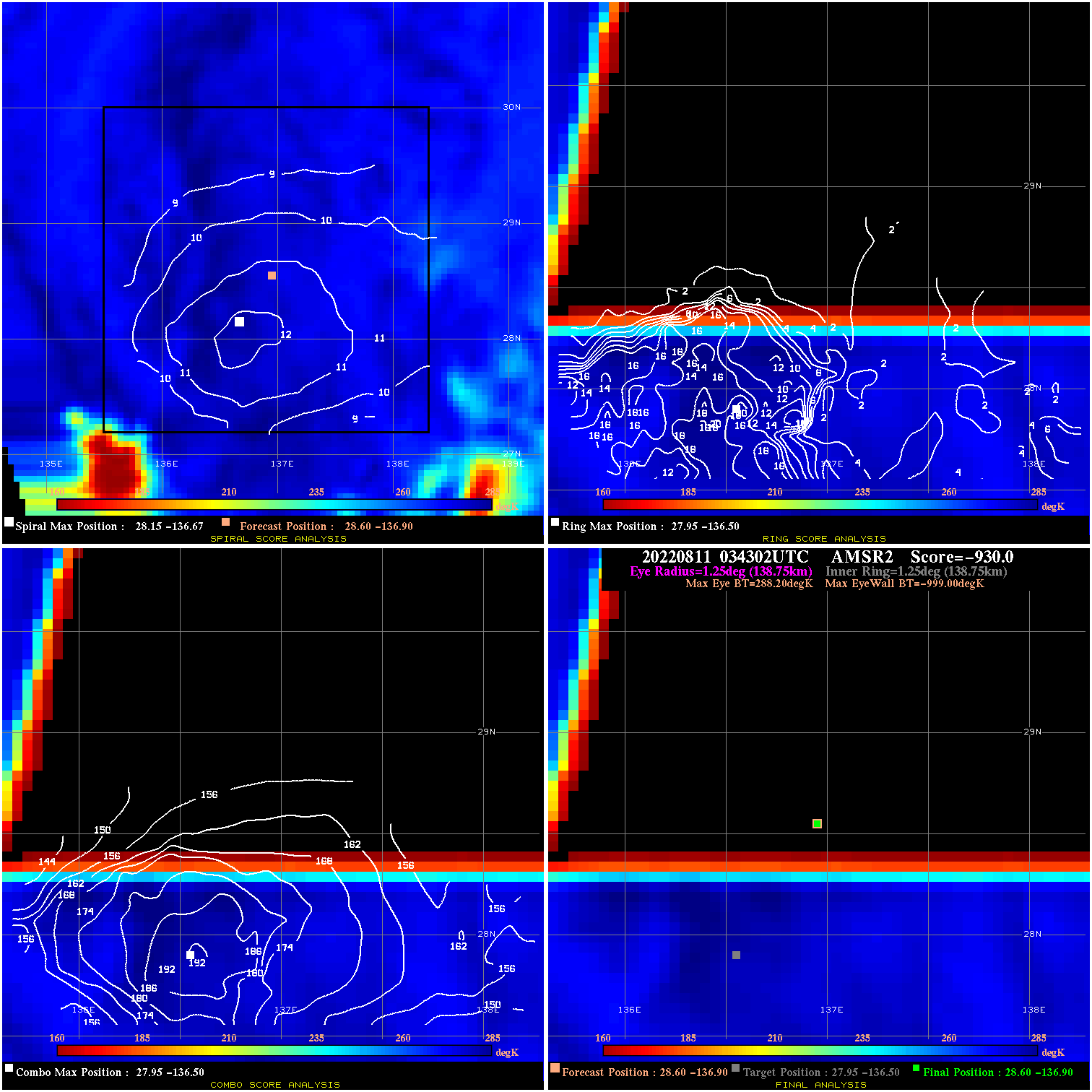
20220811 034302 -930.0 N/A N/A N/A 0.00 30.0 AMSR2 28.6 -136.9 28.6 -136.9 28.0 -136.5 Analysis Plot
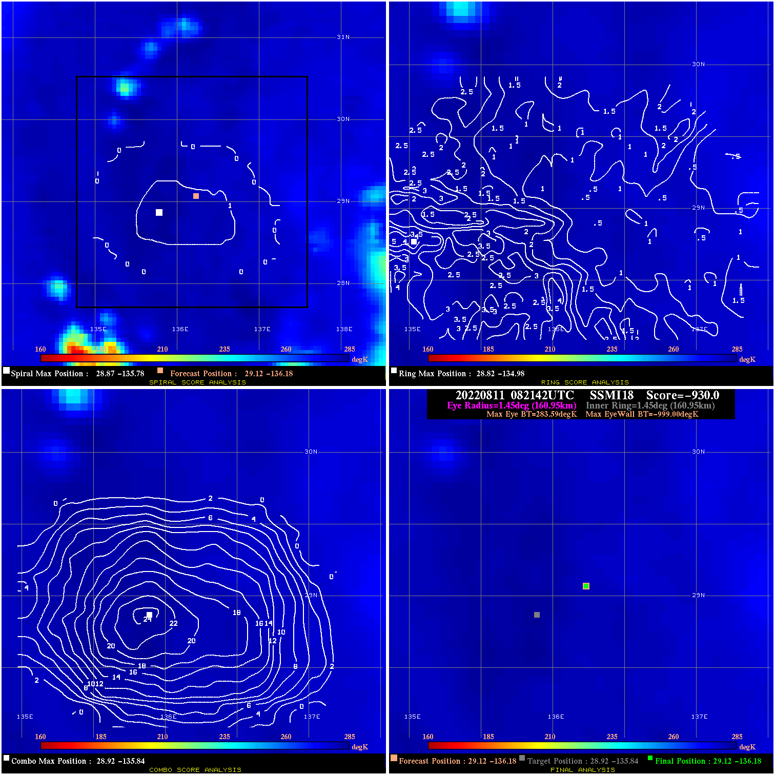
20220811 082142 -930.0 N/A N/A N/A 0.00 30.0 SSMI18 29.1 -136.2 29.1 -136.2 28.9 -135.8 Analysis Plot
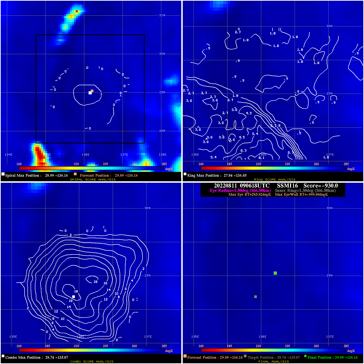
20220811 090618 -930.0 N/A N/A N/A 0.00 30.0 SSMI16 29.1 -136.2 29.1 -136.2 28.7 -135.9 Analysis Plot
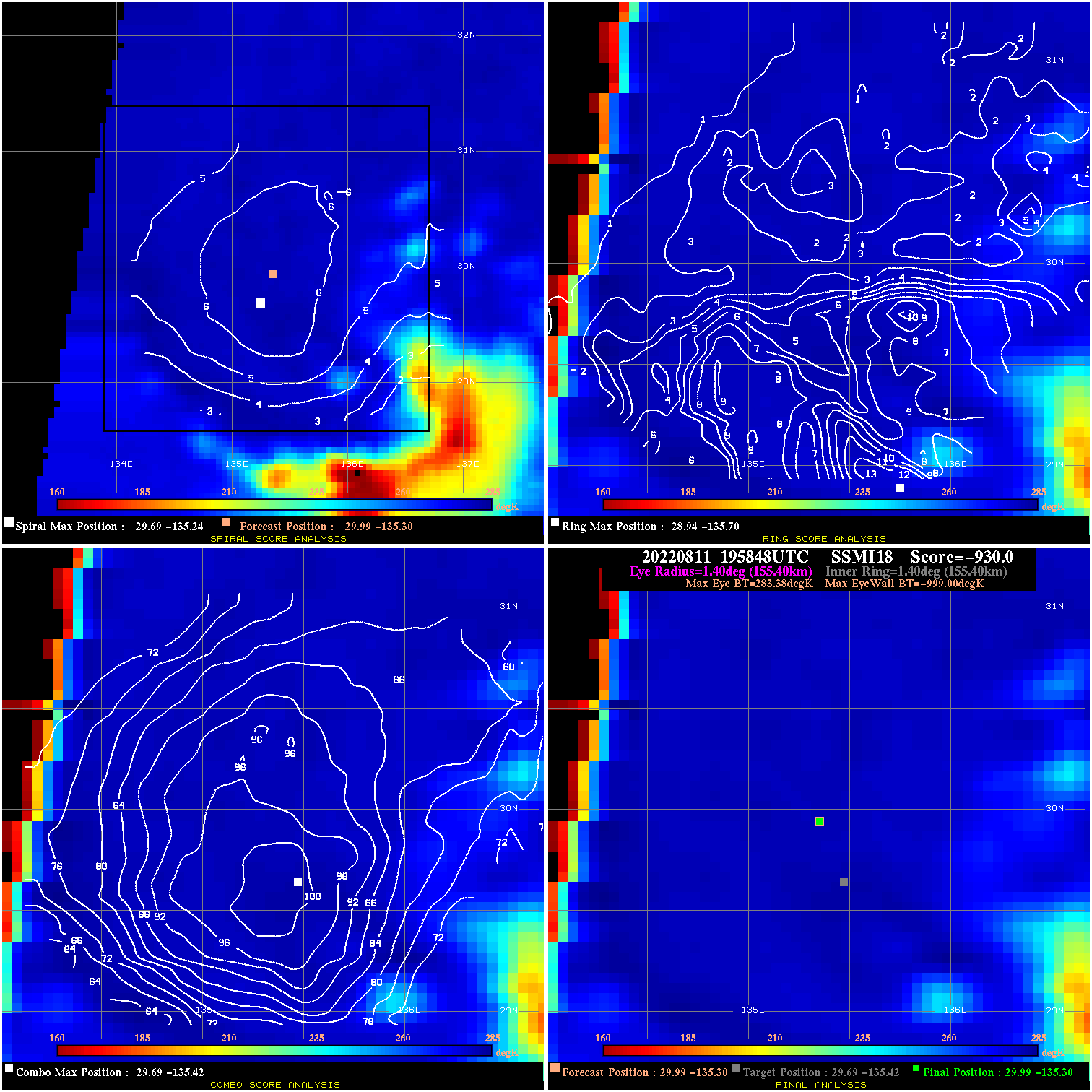
20220811 195848 -930.0 N/A N/A N/A 0.00 30.0 SSMI18 30.0 -135.3 30.0 -135.3 29.7 -135.4 Analysis Plot
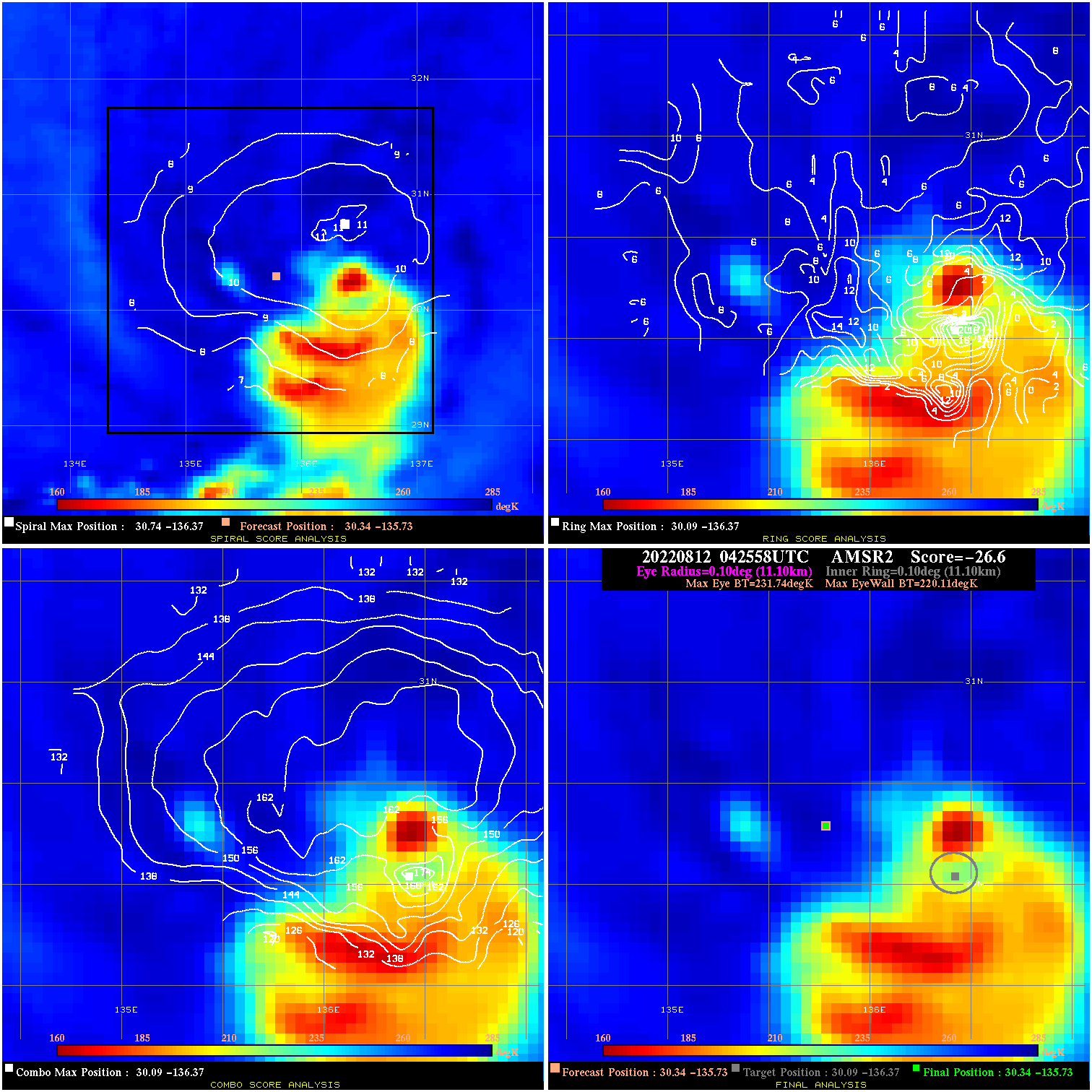
20220812 042558 -26.6 N/A 100.0% 22.22 11.63 35.0 AMSR2 30.3 -135.7 30.3 -135.7 30.1 -136.4 Analysis Plot
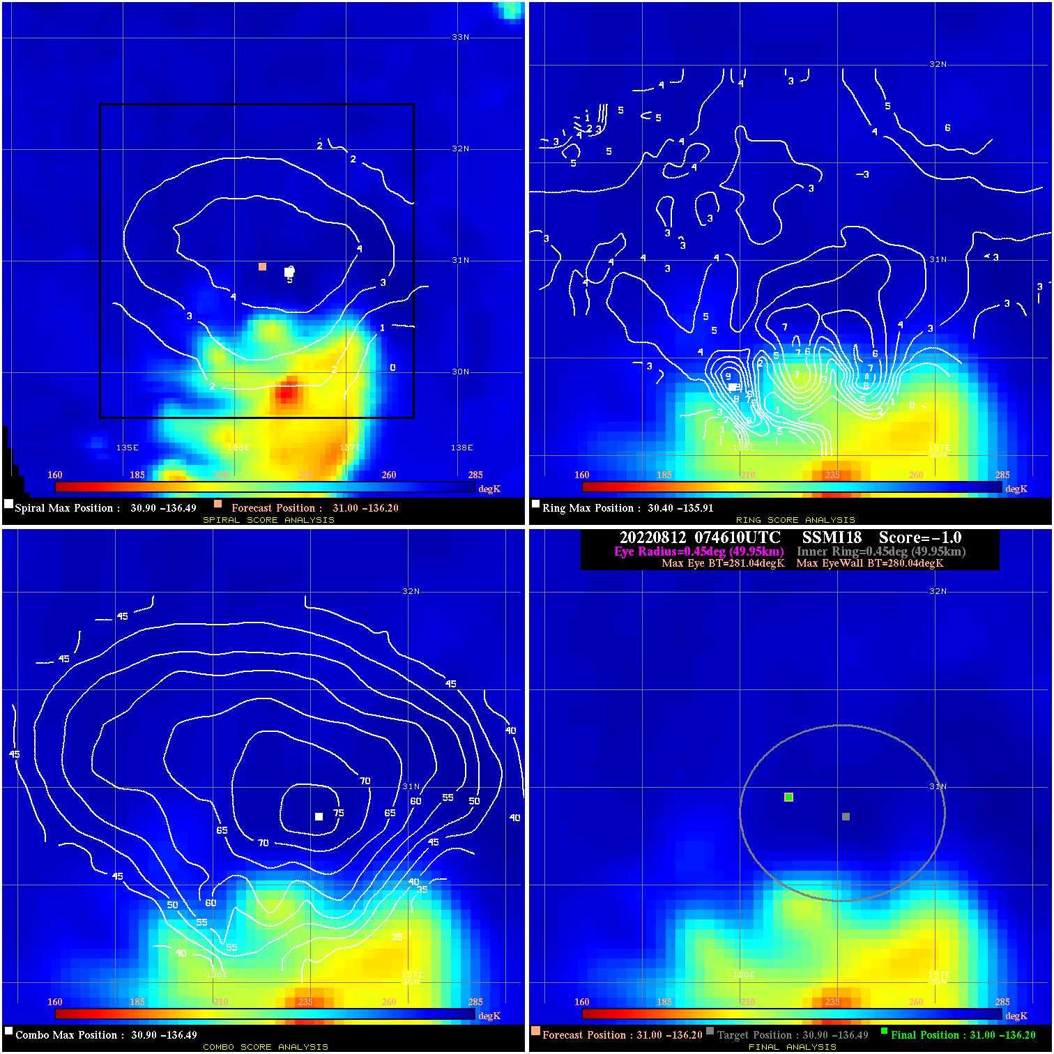
20220812 074610 -1.0 N/A 2.7% 99.99 1.00 35.0 SSMI18 31.0 -136.2 31.0 -136.2 30.9 -136.5 Analysis Plot
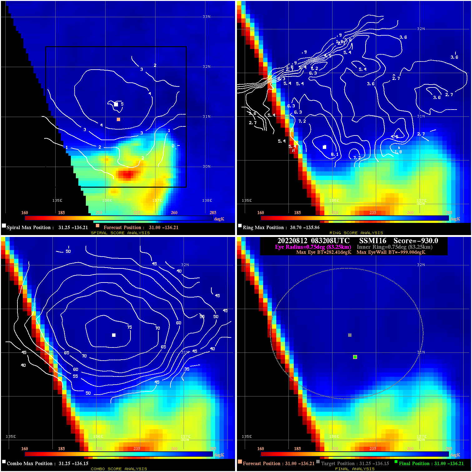
20220812 083208 -930.0 N/A N/A N/A 0.00 35.0 SSMI16 31.0 -136.2 31.0 -136.2 31.3 -136.1 Analysis Plot
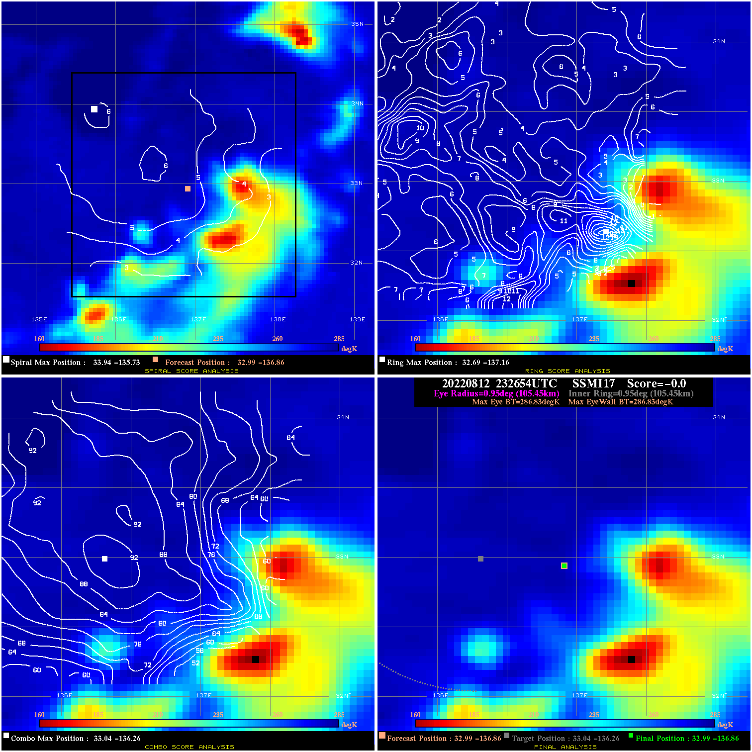
20220812 232654 N/A N/A N/A N/A N/A 35.0 SSMI17 33.0 -136.9 33.0 -136.9 33.0 -136.3 Analysis Plot
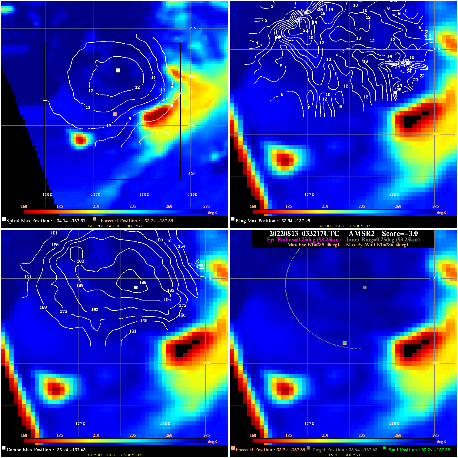
20220813 033217 -3.0 N/A 23.3% 166.65 2.96 40.0 AMSR2 33.3 -137.4 33.3 -137.4 33.9 -137.6 Analysis Plot
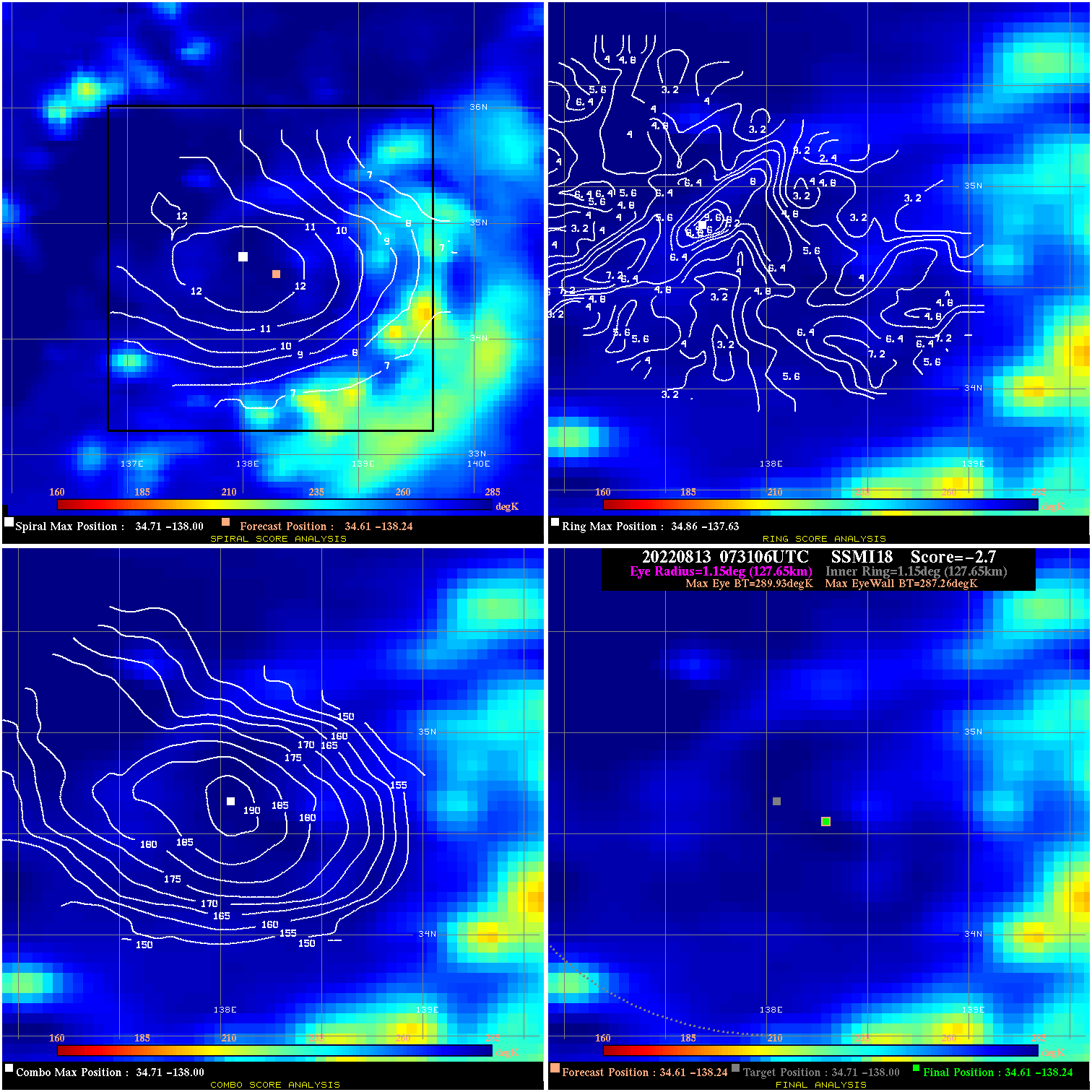
20220813 073106 -2.7 N/A 12.1% 255.53 2.67 40.0 SSMI18 34.6 -138.2 34.6 -138.2 34.7 -138.0 Analysis Plot
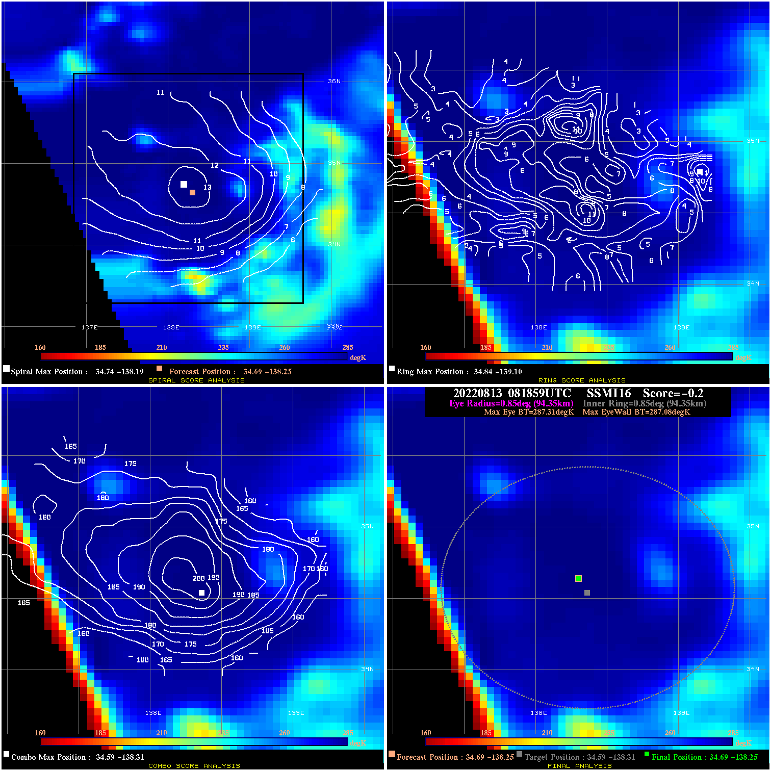
20220813 081859 -0.2 N/A N/A 188.87 .23 40.0 SSMI16 34.7 -138.3 34.7 -138.3 34.6 -138.3 Analysis Plot
20220813 113347 -0.3 N/A N/A 66.66 .34 40.0 SSMI17 35.0 -138.5 35.0 -138.5 35.1 -137.3 Analysis Plot
20220813 193330 -930.0 N/A N/A N/A 0.00 40.0 SSMI18 37.2 -142.3 37.2 -142.3 36.9 -142.5 Analysis Plot
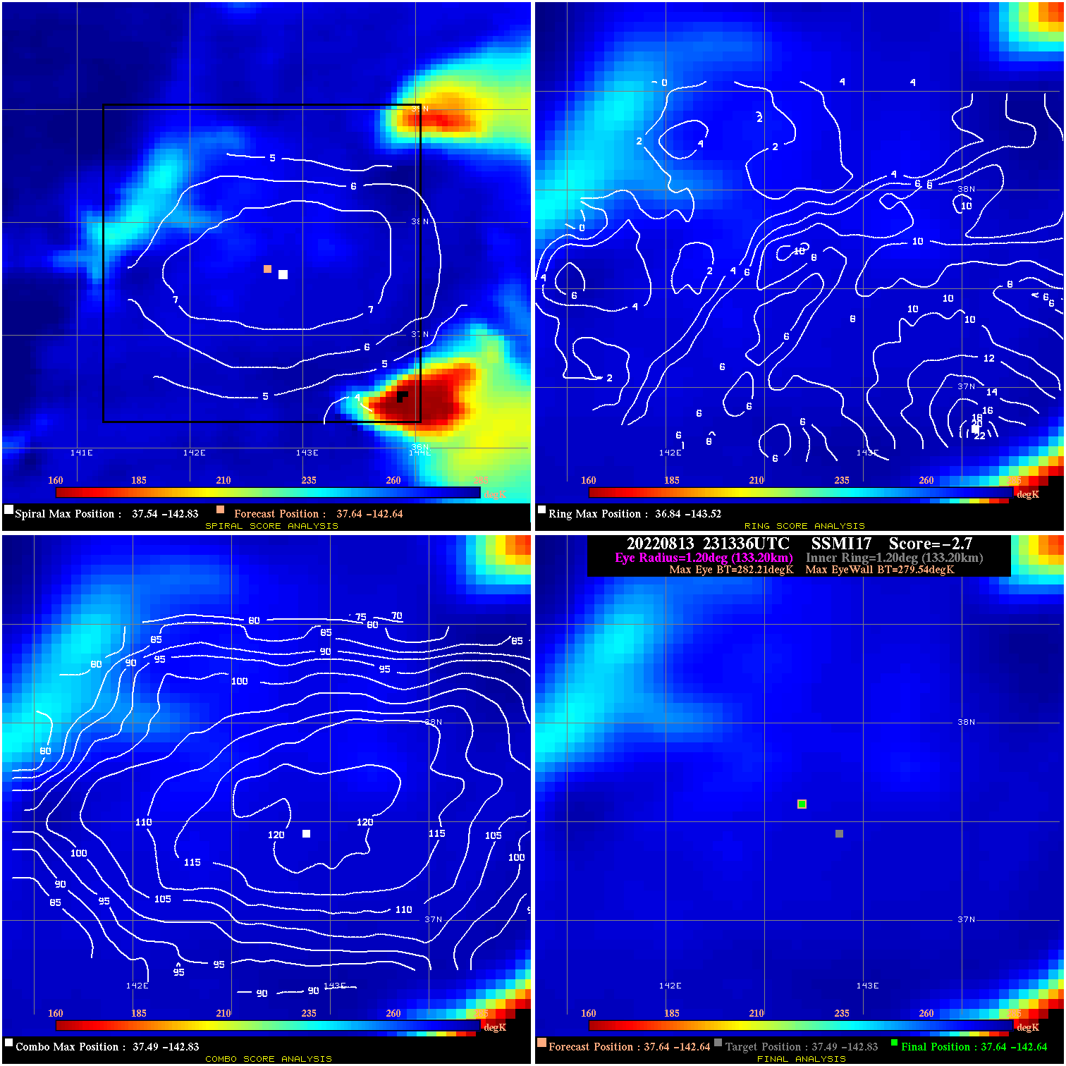
20220813 231336 -2.7 N/A 12.3% 266.64 2.67 40.0 SSMI17 37.6 -142.6 37.6 -142.6 37.5 -142.8 Analysis Plot
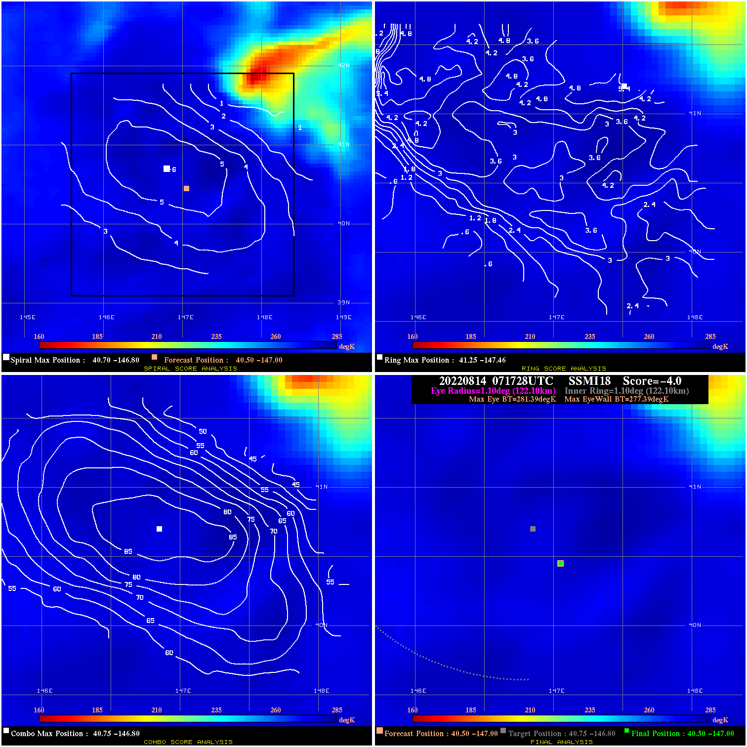
20220814 071728 -4.0 N/A 11.0% 244.42 4.00 40.0 SSMI18 40.5 -147.0 40.5 -147.0 40.8 -146.8 Analysis Plot
20220814 074758 -930.0 N/A N/A N/A 0.00 40.0 SSMI17 40.5 -147.0 40.5 -147.0 41.0 -147.5 Analysis Plot
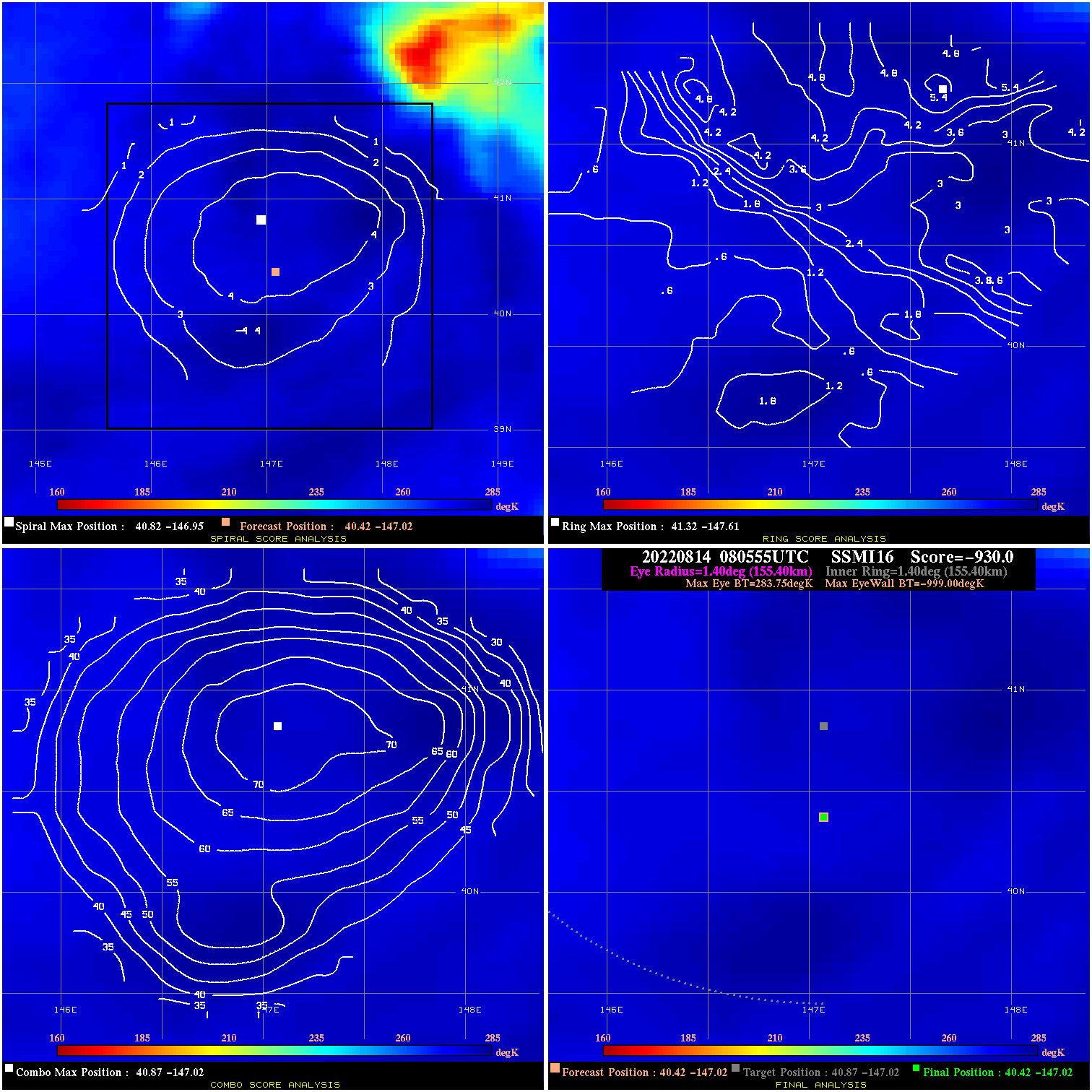
20220814 080555 -930.0 N/A N/A N/A 0.00 40.0 SSMI16 40.4 -147.0 40.4 -147.0 40.9 -147.0 Analysis Plot
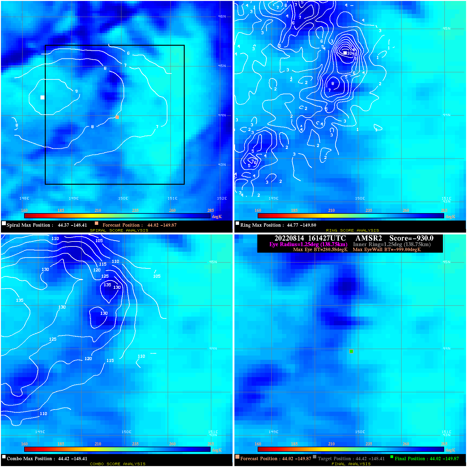
20220814 161427 -930.0 N/A N/A N/A 0.00 40.0 AMSR2 44.0 -149.9 44.0 -149.9 44.4 -148.4 Analysis Plot
|
|
Legend: - Date/Time are determined from PMW imagery at Forecast (initial guess) Lat/Lon position. - Positive/Negative Latitude = North/South Hemisphere; Longitude = Western/Eastern Hemisphere. - "Ring Diam" value indicates the estimated surface eyewall diameter in km (the MI eyewall edge diameter minus 10 km). - "Ring Pct" is the percentage of the "ring" (eyewall inner boundary) that is 1) colder than the "hot spot" (warmest eye pixel) in the eye by 20K, or 2) the percentage that is a) colder than 232K and b) colder than the "hot spot" by 10K, whichever is greater. - Values are red if Ring % <= 65, yellow/brown if Ring % <= 85 and green if Ring % > 85. - "Tb diff" is the difference between the "hot spot" (warmest eye pixel) and the warmest pixel on the eyewall. - Intensity score are listed as negative, and not used, when the JTWC or NHC estimated Vmax is <55 kts in order to rule out weak but highly symmetric TCs. - Error messages in intensity scores: -920 is used when the hottest pixel in the eye is <200K, to prevent false positives; -930 means <85% of eyewall has observations/data. |