Tropical Storm 31Y_08
|
Passive Microwave (PMW) Intensity Information Hurricane Intensity Estimation (HIE) Algorithm Version 9.0 |
Overpass Inten Ring Ring Wind Forecast Final Target
Date Time Score Meaning Pct Diam BTdiff Est Sat Lat Lon Lat Lon Lat Lon
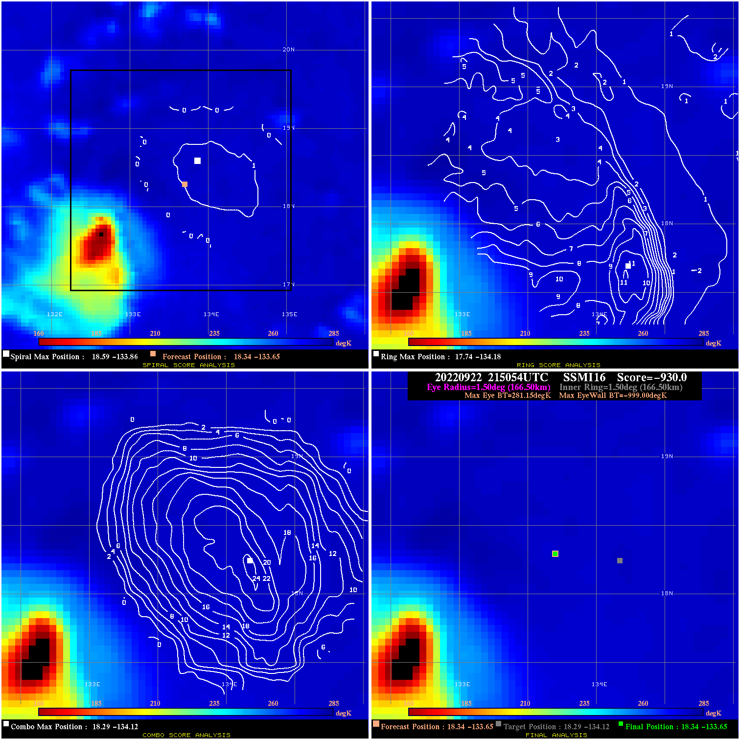
20220922 215054 -930.0 N/A N/A N/A 0.00 30.0 SSMI16 18.3 -133.6 18.3 -133.6 18.3 -134.1 Analysis Plot
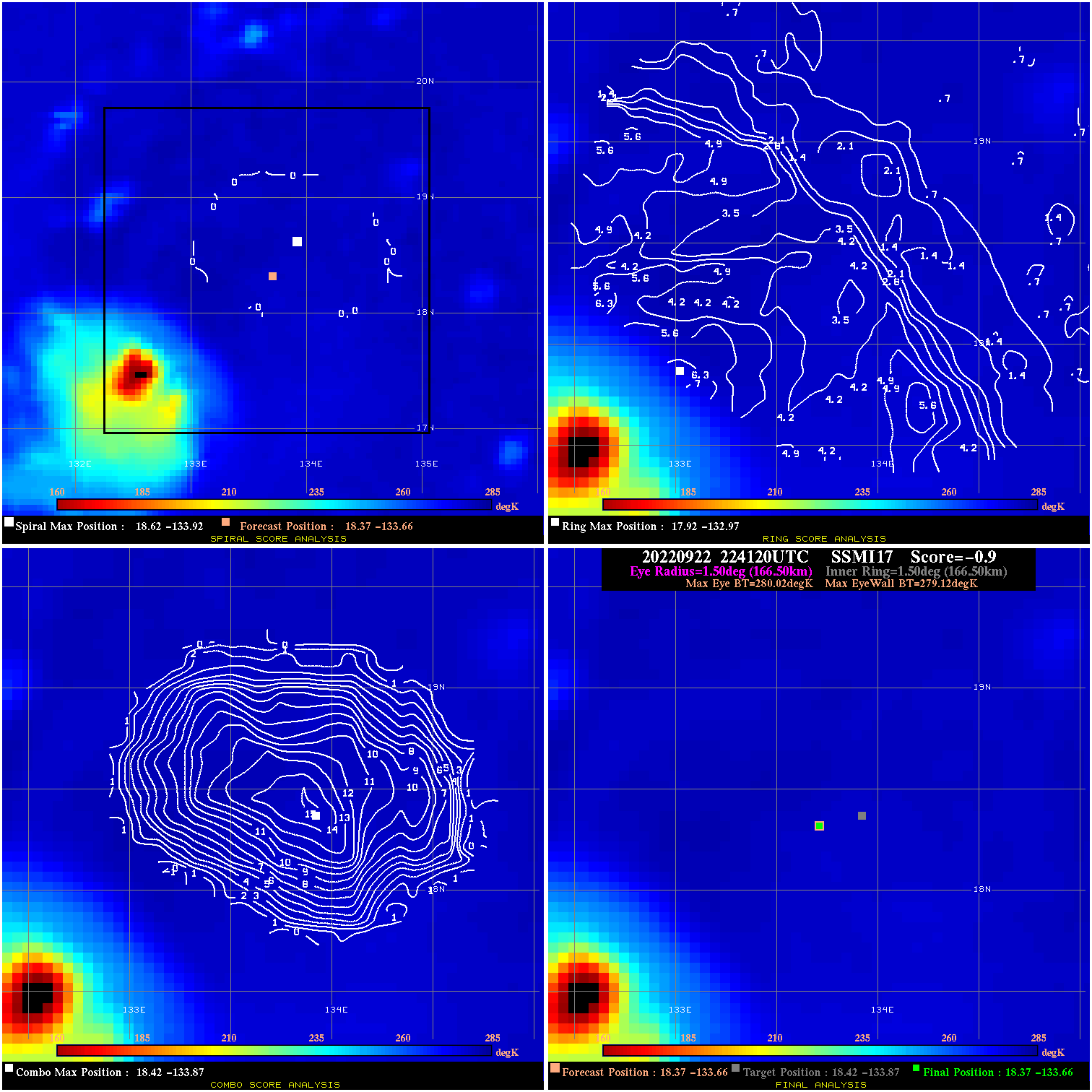
20220922 224120 -0.9 N/A 9.5% 333.30 .90 30.0 SSMI17 18.4 -133.7 18.4 -133.7 18.4 -133.9 Analysis Plot
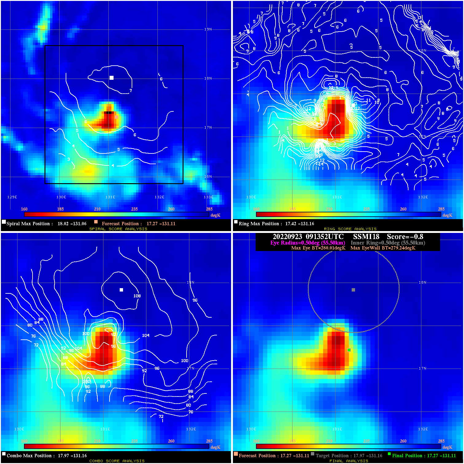
20220923 091352 -0.8 N/A 9.6% 111.10 .77 30.0 SSMI18 17.3 -131.1 17.3 -131.1 18.0 -131.2 Analysis Plot
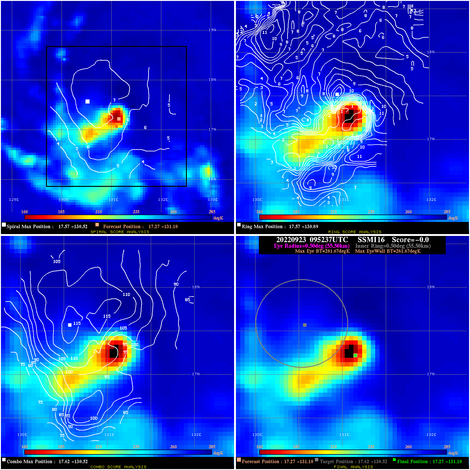
20220923 095237 N/A N/A N/A N/A N/A 30.0 SSMI16 17.3 -131.1 17.3 -131.1 17.6 -130.5 Analysis Plot
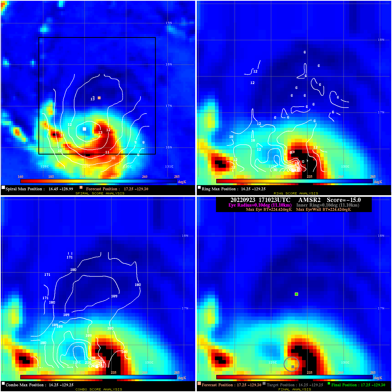
20220923 171023 N/A N/A N/A N/A N/A 40.0 AMSR2 17.3 -129.3 17.3 -129.3 16.3 -129.3 Analysis Plot
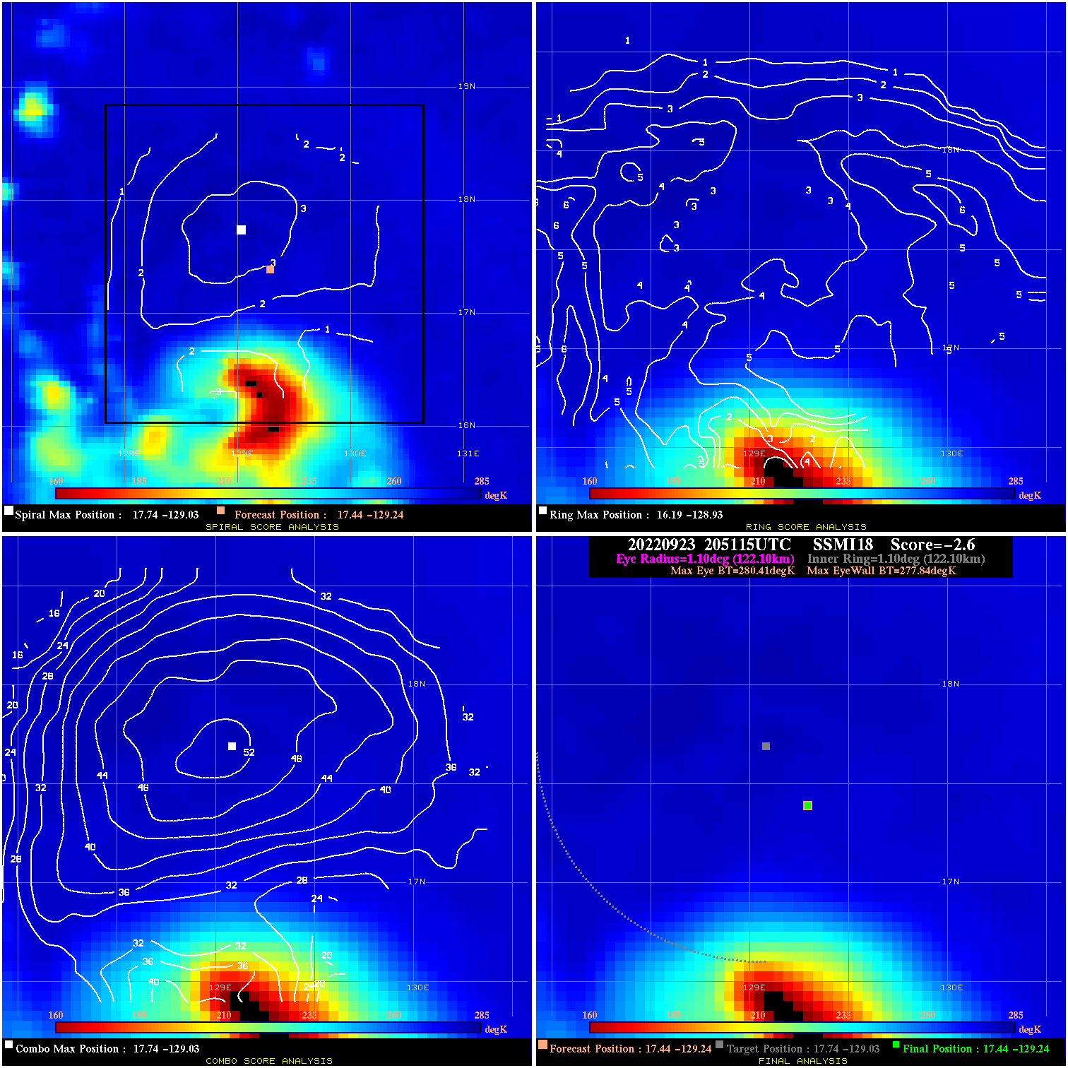
20220923 205115 -2.6 N/A 11.0% 244.42 2.57 40.0 SSMI18 17.4 -129.2 17.4 -129.2 17.7 -129.0 Analysis Plot
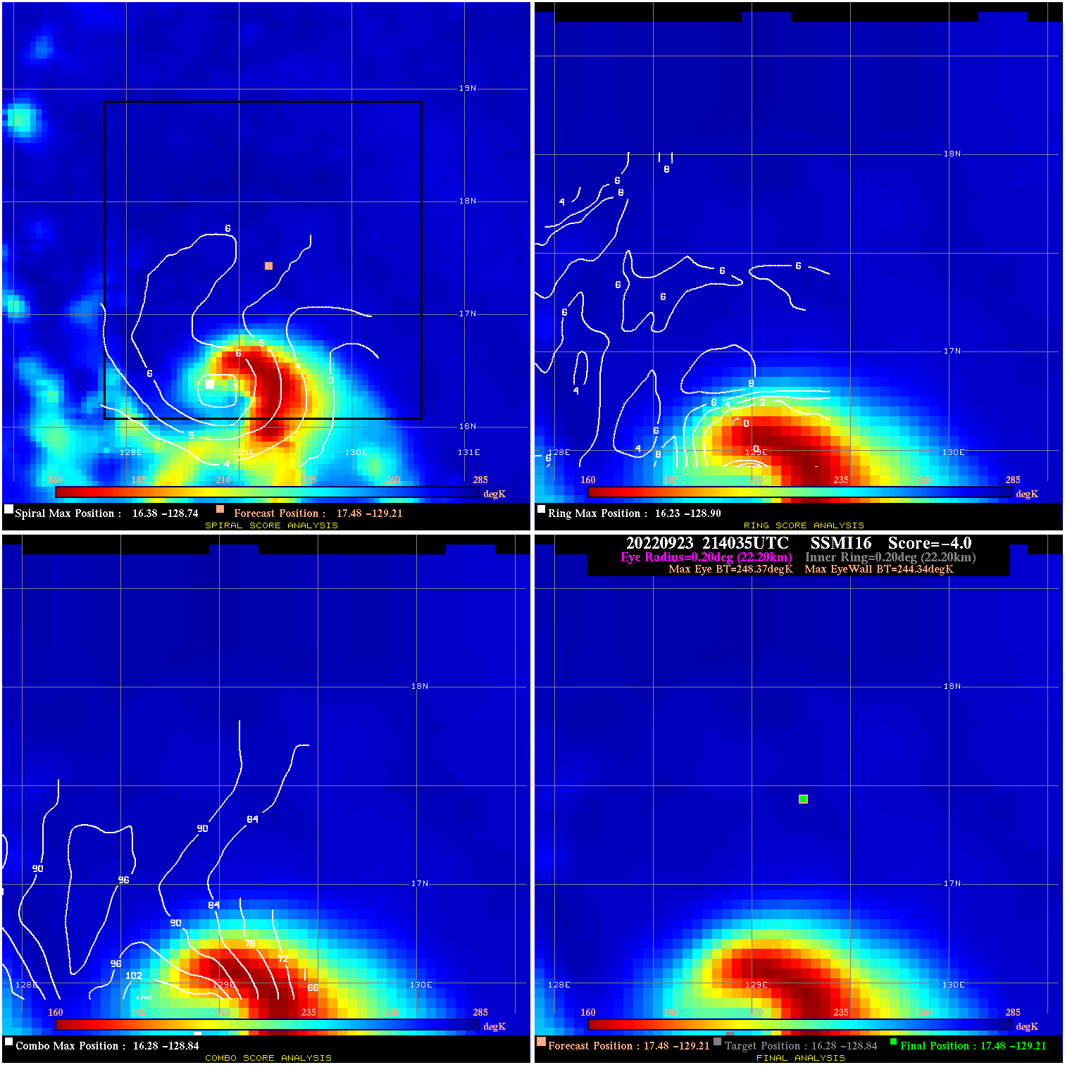
20220923 214035 -4.0 N/A 58.9% 44.44 4.03 40.0 SSMI16 17.5 -129.2 17.5 -129.2 16.3 -128.8 Analysis Plot
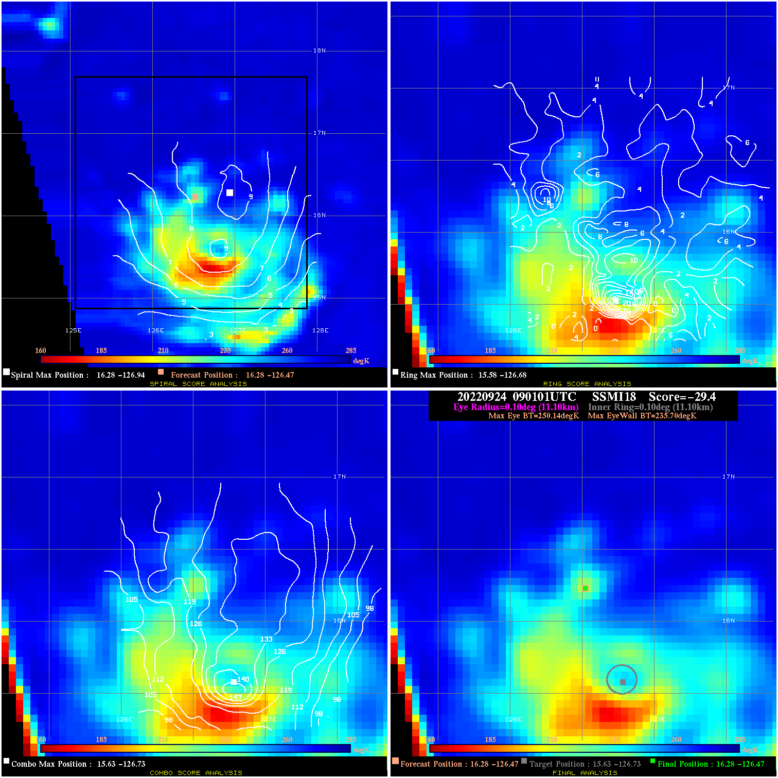
20220924 090101 -29.4 N/A 86.3% 22.22 14.44 50.0 SSMI18 16.3 -126.5 16.3 -126.5 15.6 -126.7 Analysis Plot
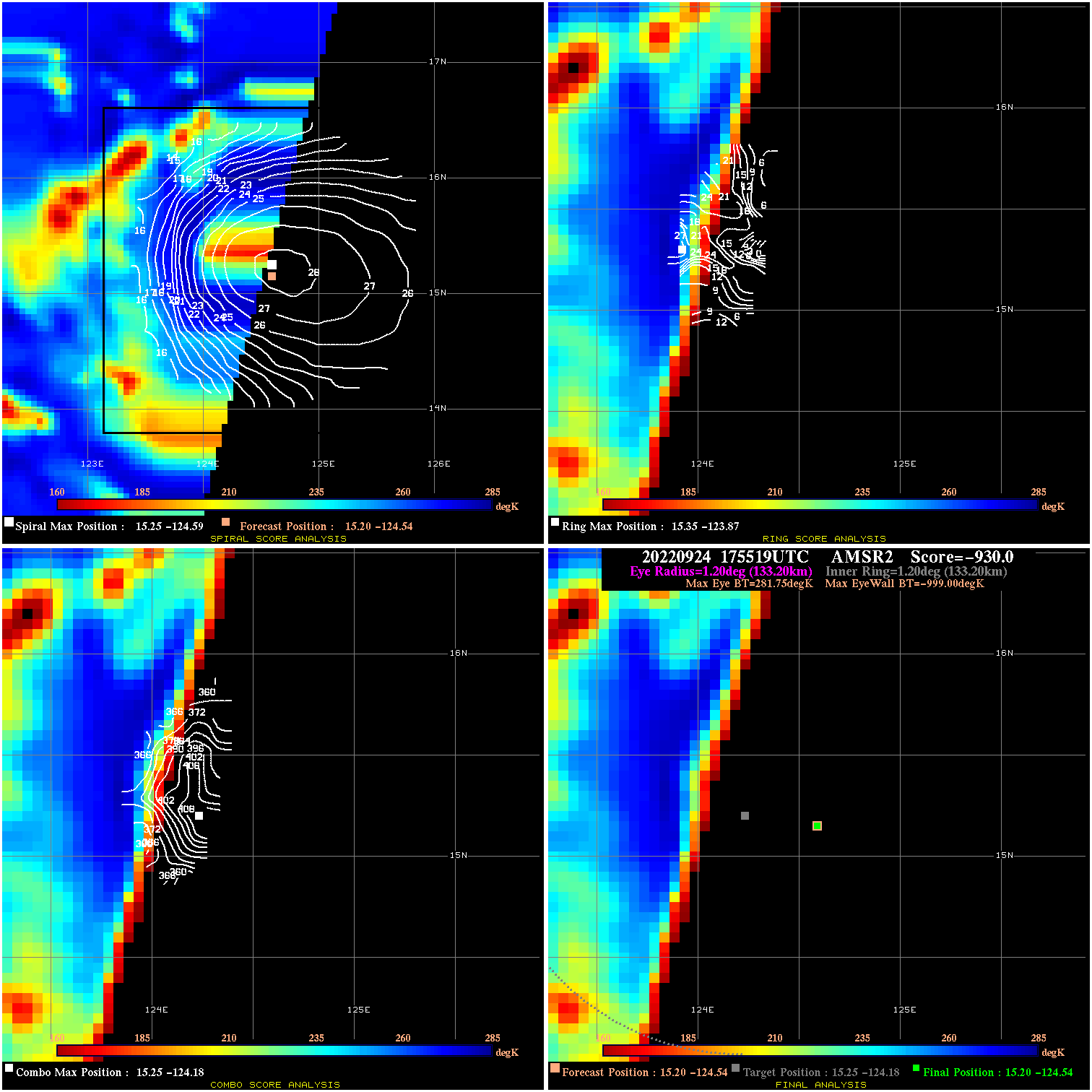
20220924 175519 -930.0 N/A N/A N/A 0.00 70.0 AMSR2 15.2 -124.5 15.2 -124.5 15.3 -124.2 Analysis Plot
20220924 203752 43.7 >65 kts 100.0% 11.11 28.69 70.0 SSMI18 15.2 -124.5 15.1 -124.4 15.1 -124.4 Analysis Plot
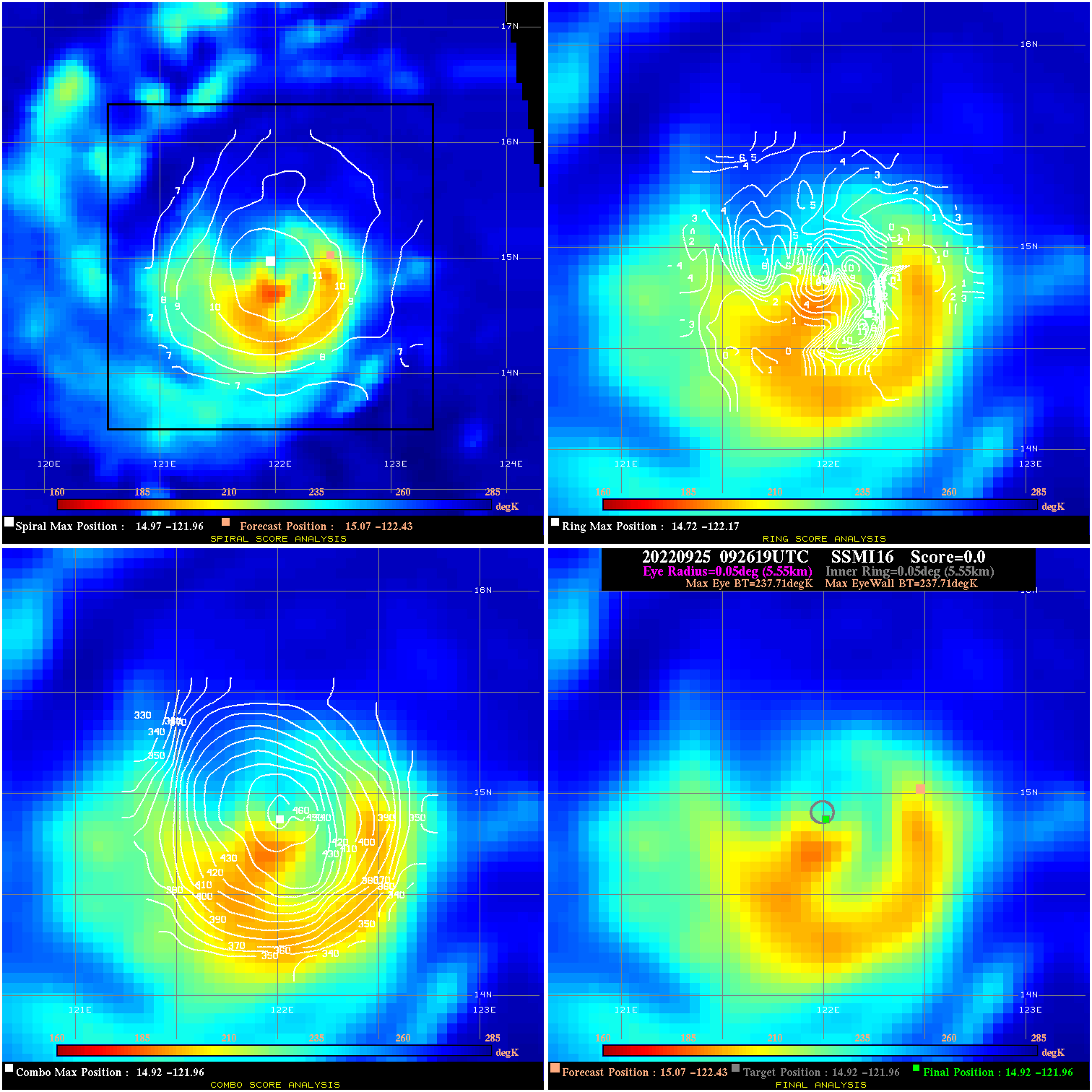
20220925 092619 N/A N/A N/A N/A N/A 95.0 SSMI16 15.1 -122.4 14.9 -122.0 14.9 -122.0 Analysis Plot
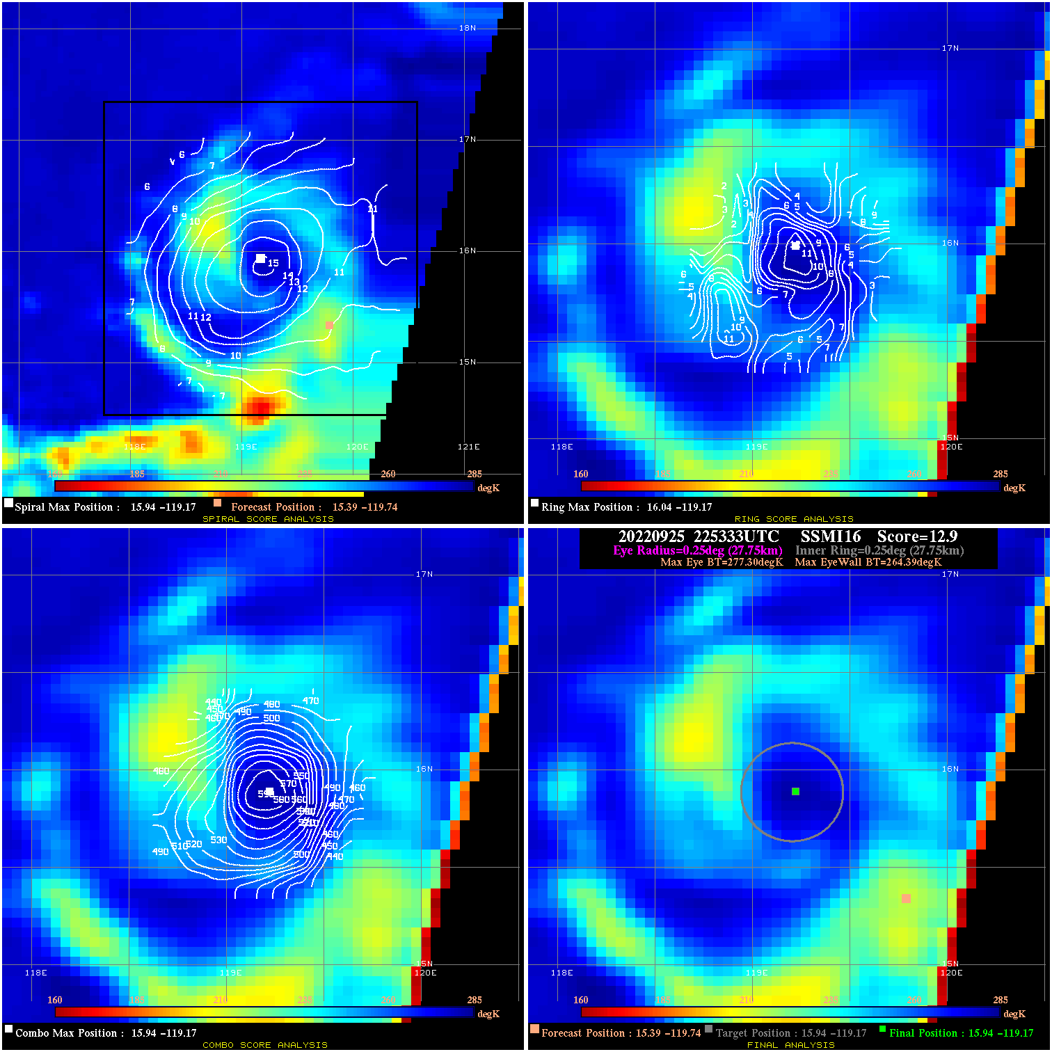
20220925 225333 12.9 N/A 11.0% 55.55 12.91 85.0 SSMI16 15.4 -119.7 15.9 -119.2 15.9 -119.2 Analysis Plot
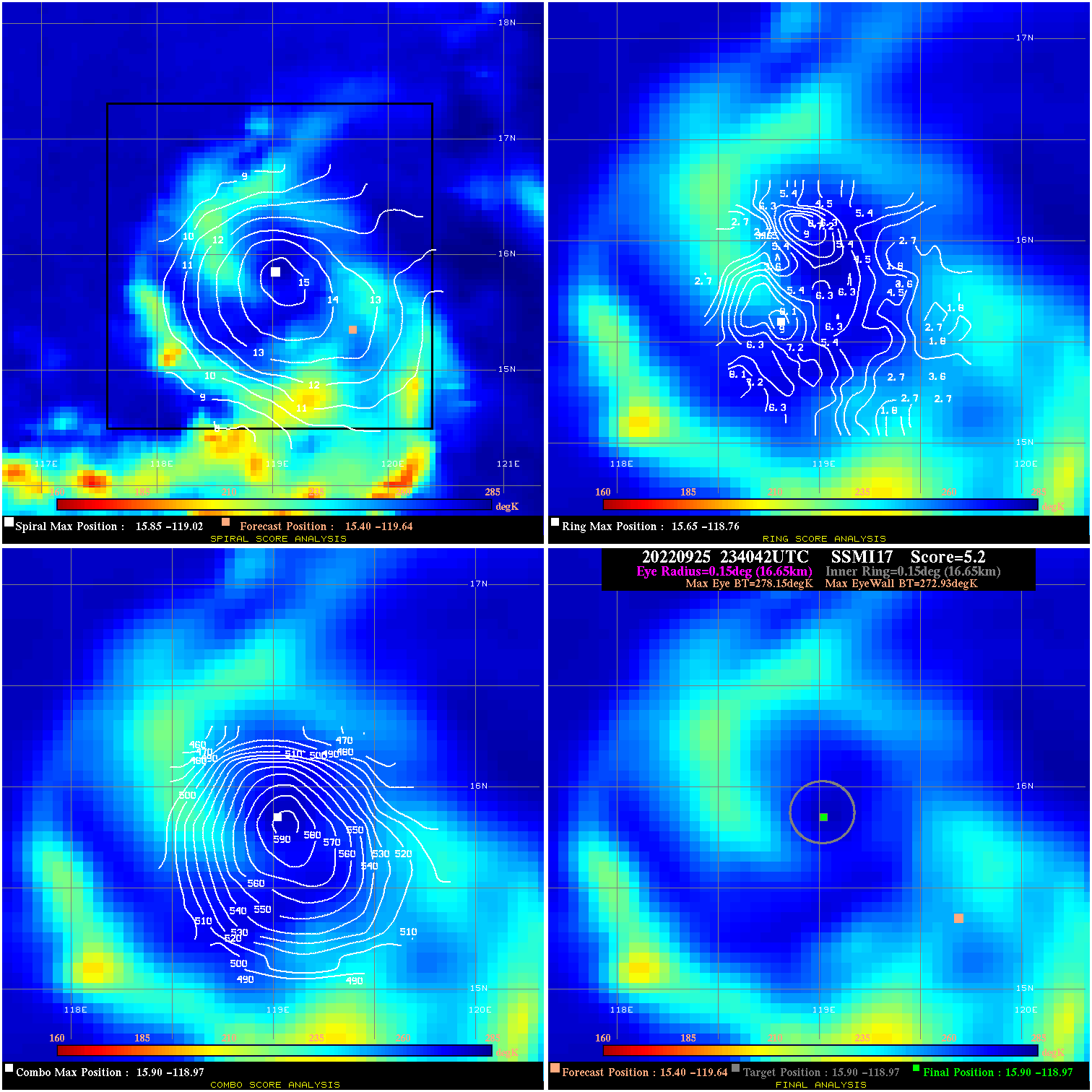
20220925 234042 5.2 N/A N/A 33.33 5.22 85.0 SSMI17 15.4 -119.6 15.9 -119.0 15.9 -119.0 Analysis Plot
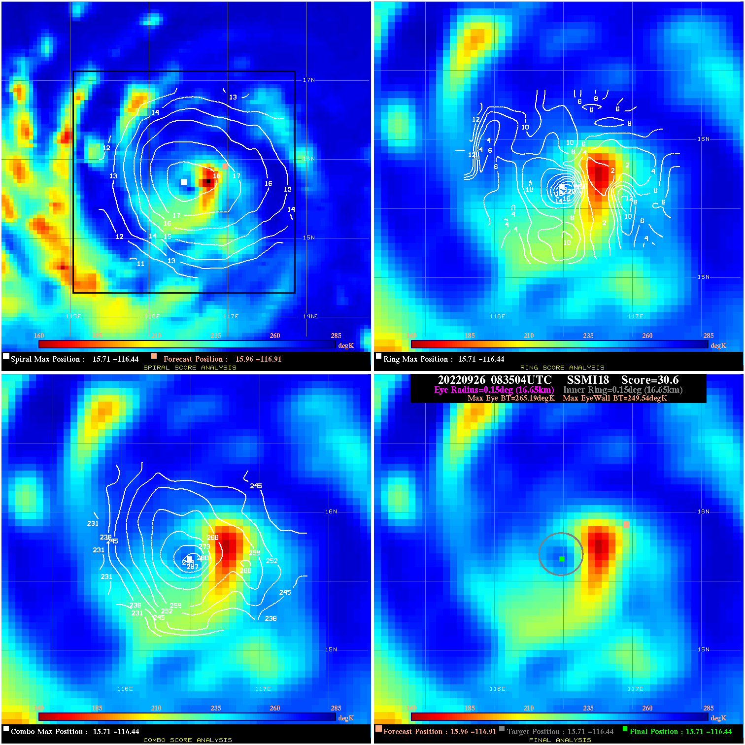
20220926 083504 30.6 >65 kts 86.3% 33.33 15.65 70.0 SSMI18 16.0 -116.9 15.7 -116.4 15.7 -116.4 Analysis Plot
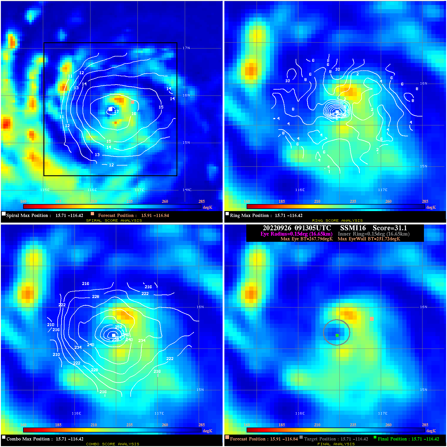
20220926 091305 31.1 >65 kts 90.4% 33.33 16.07 70.0 SSMI16 15.9 -116.8 15.7 -116.4 15.7 -116.4 Analysis Plot
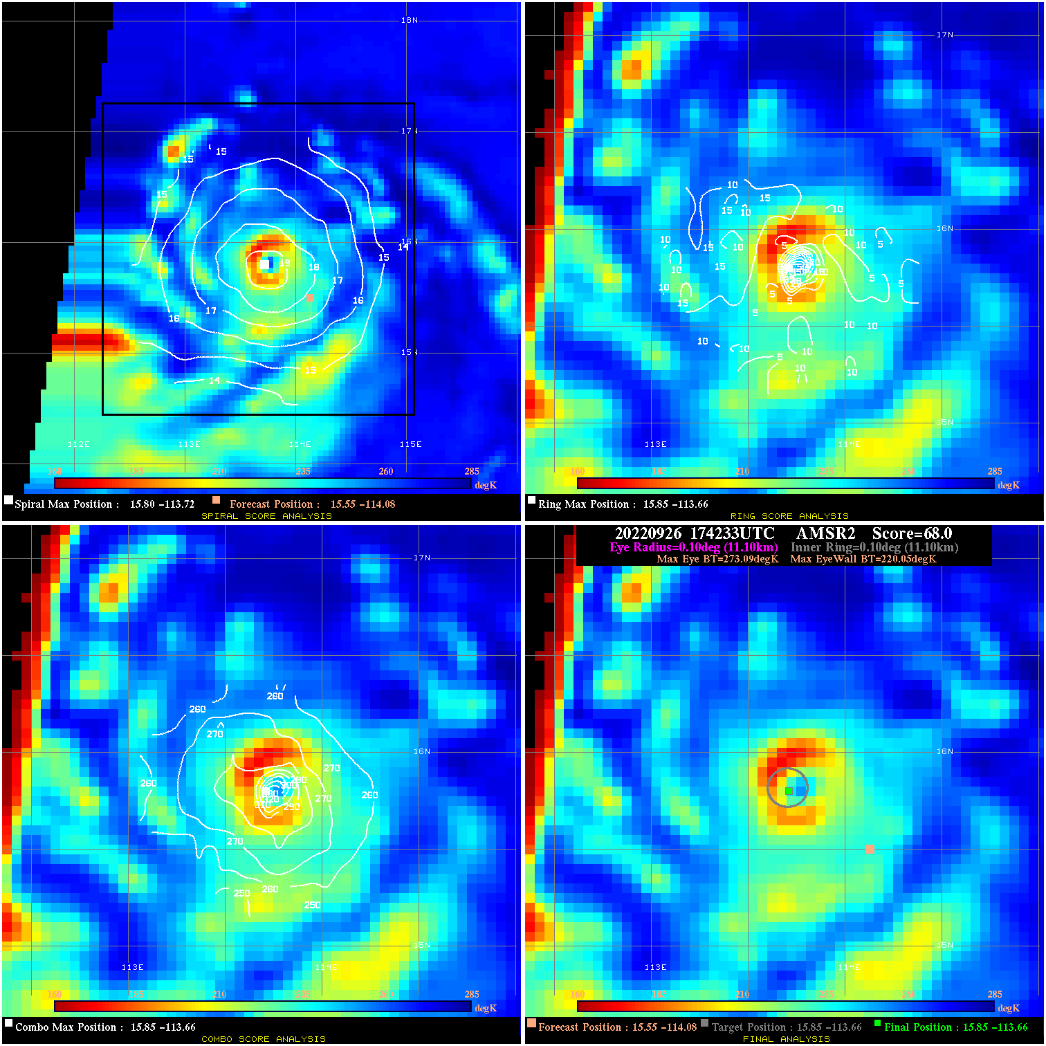
20220926 174233 68.0 >85 kts 100.0% 22.22 53.04 65.0 AMSR2 15.6 -114.1 15.9 -113.7 15.9 -113.7 Analysis Plot
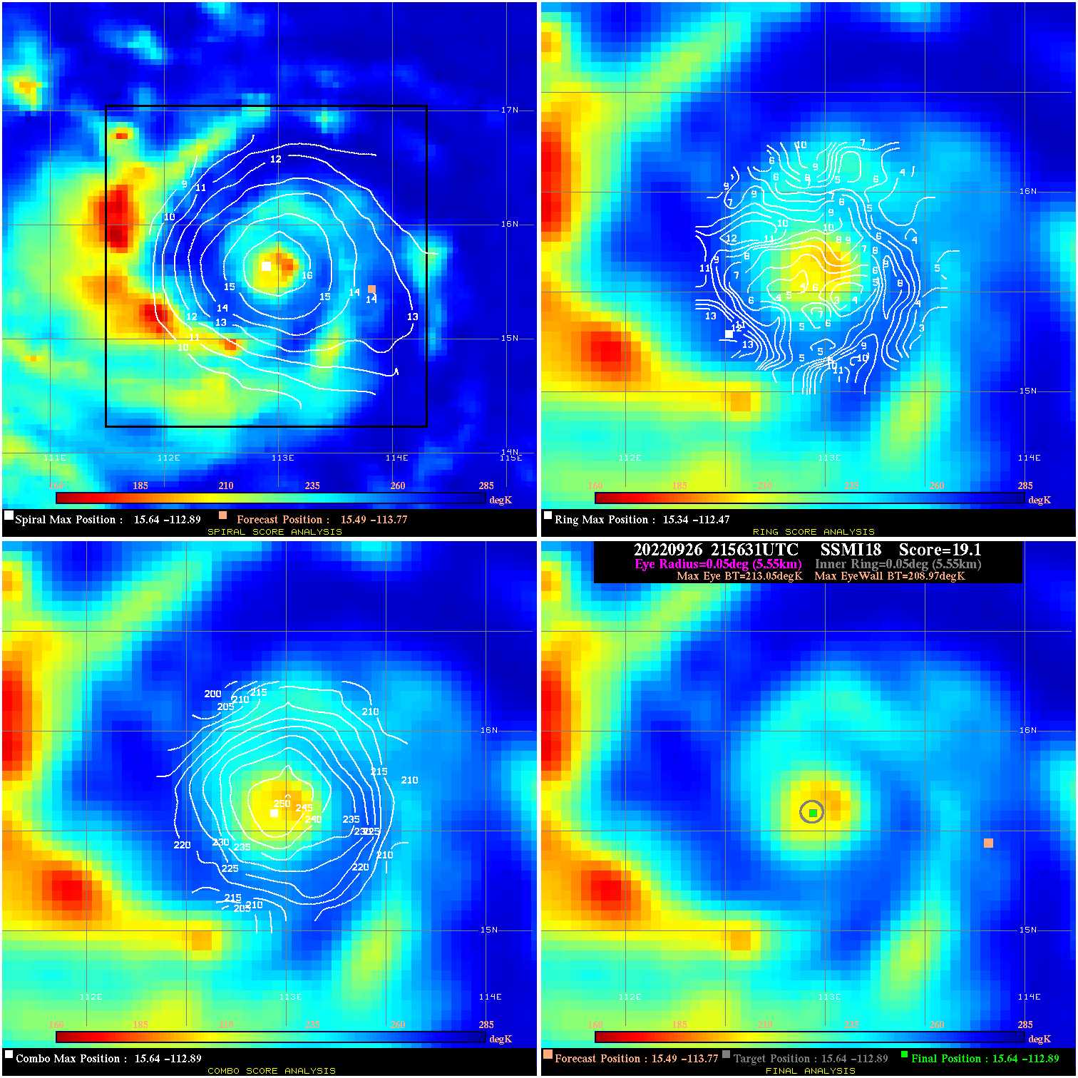
20220926 215631 19.1 N/A 100.0% 11.11 4.08 65.0 SSMI18 15.5 -113.8 15.6 -112.9 15.6 -112.9 Analysis Plot
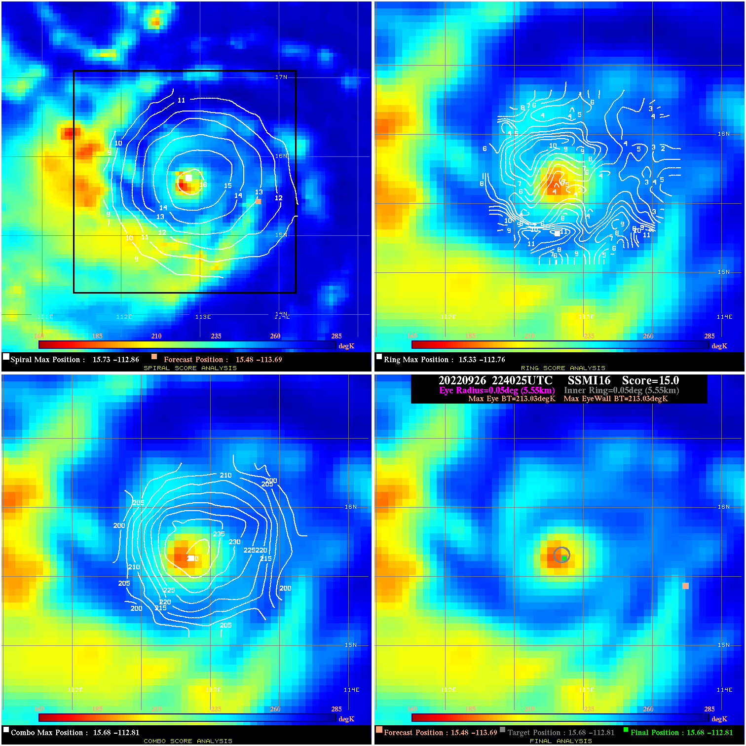
20220926 224025 N/A N/A N/A N/A N/A 65.0 SSMI16 15.5 -113.7 15.7 -112.8 15.7 -112.8 Analysis Plot
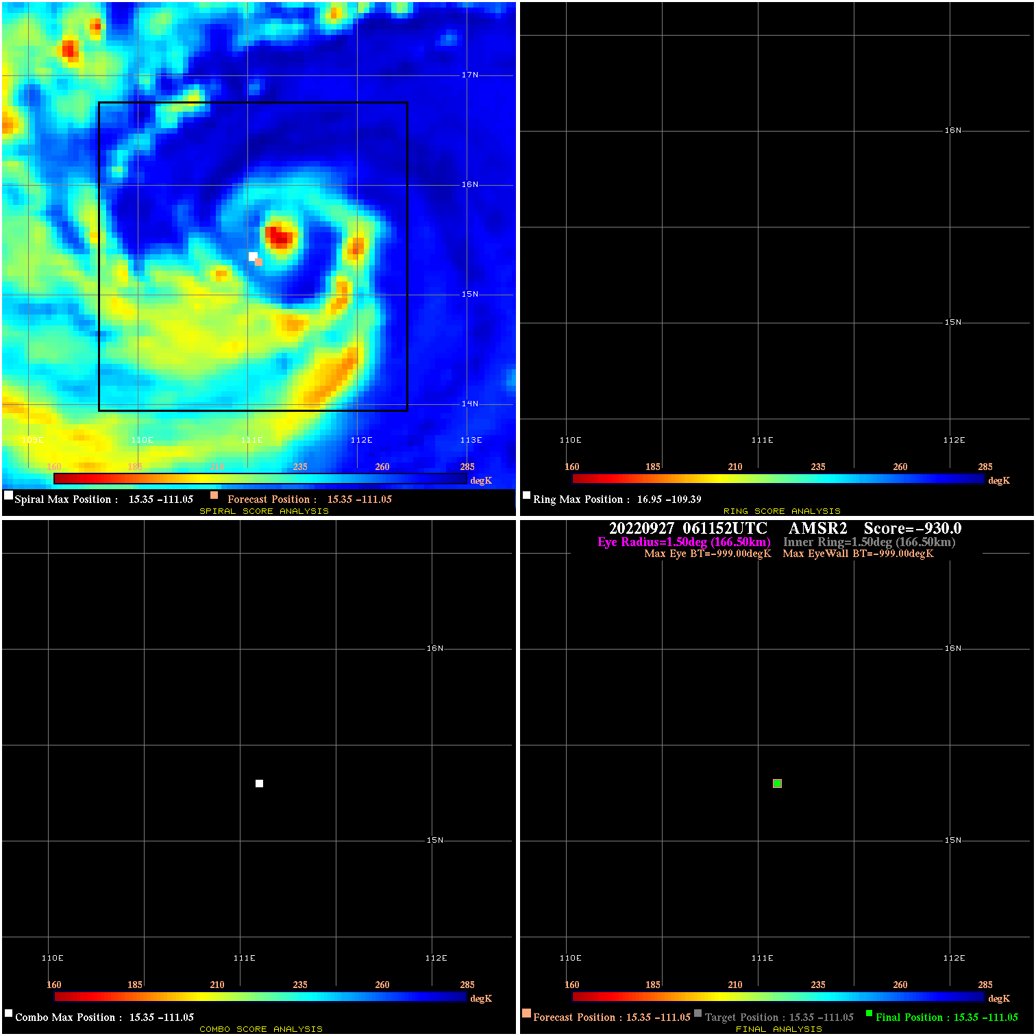
20220927 061152 N/A N/A N/A N/A N/A 85.0 AMSR2 15.4 -111.1 15.4 -111.1 15.4 -111.1 Analysis Plot
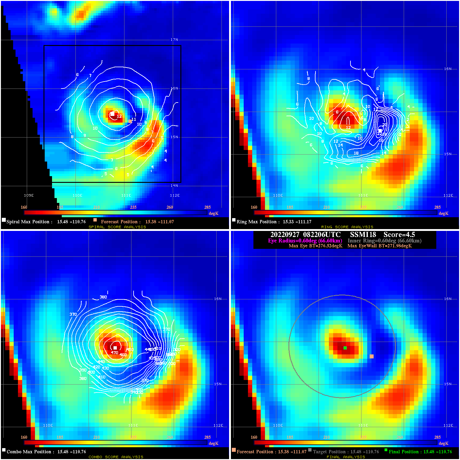
20220927 082206 4.5 N/A 47.9% 133.32 4.54 85.0 SSMI18 15.4 -111.1 15.5 -110.8 15.5 -110.8 Analysis Plot
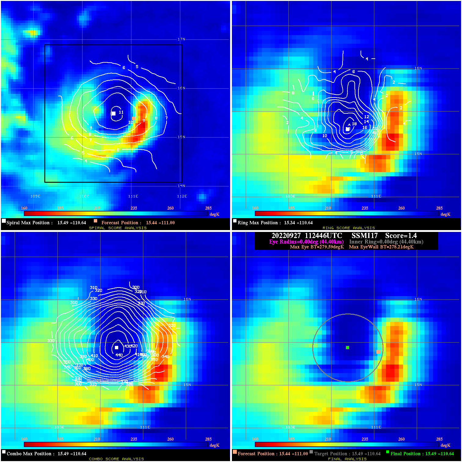
20220927 112446 1.4 N/A 71.2% 88.88 1.38 85.0 SSMI17 15.4 -111.0 15.5 -110.6 15.5 -110.6 Analysis Plot
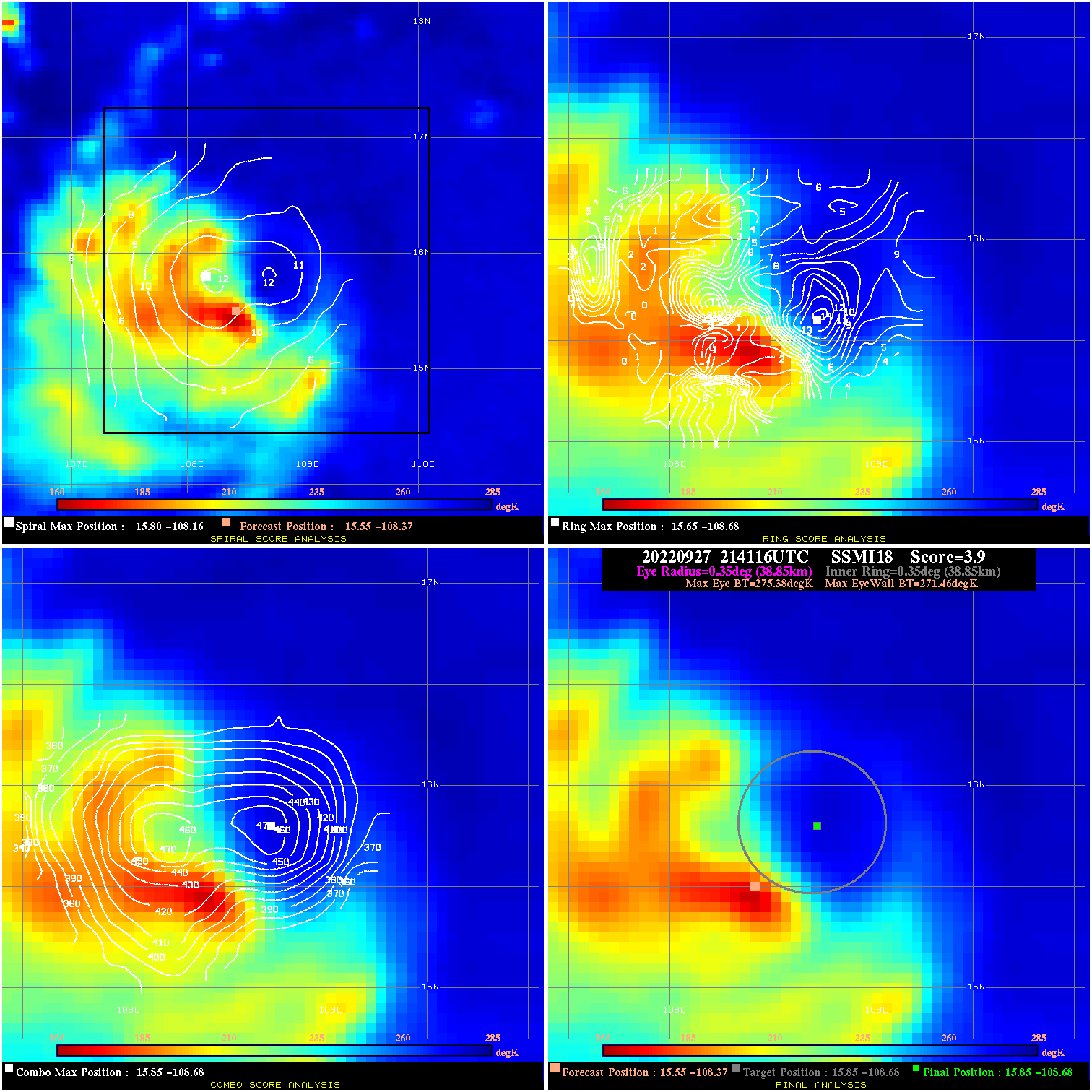
20220927 214116 3.9 N/A 16.4% 77.77 3.92 85.0 SSMI18 15.6 -108.4 15.9 -108.7 15.9 -108.7 Analysis Plot
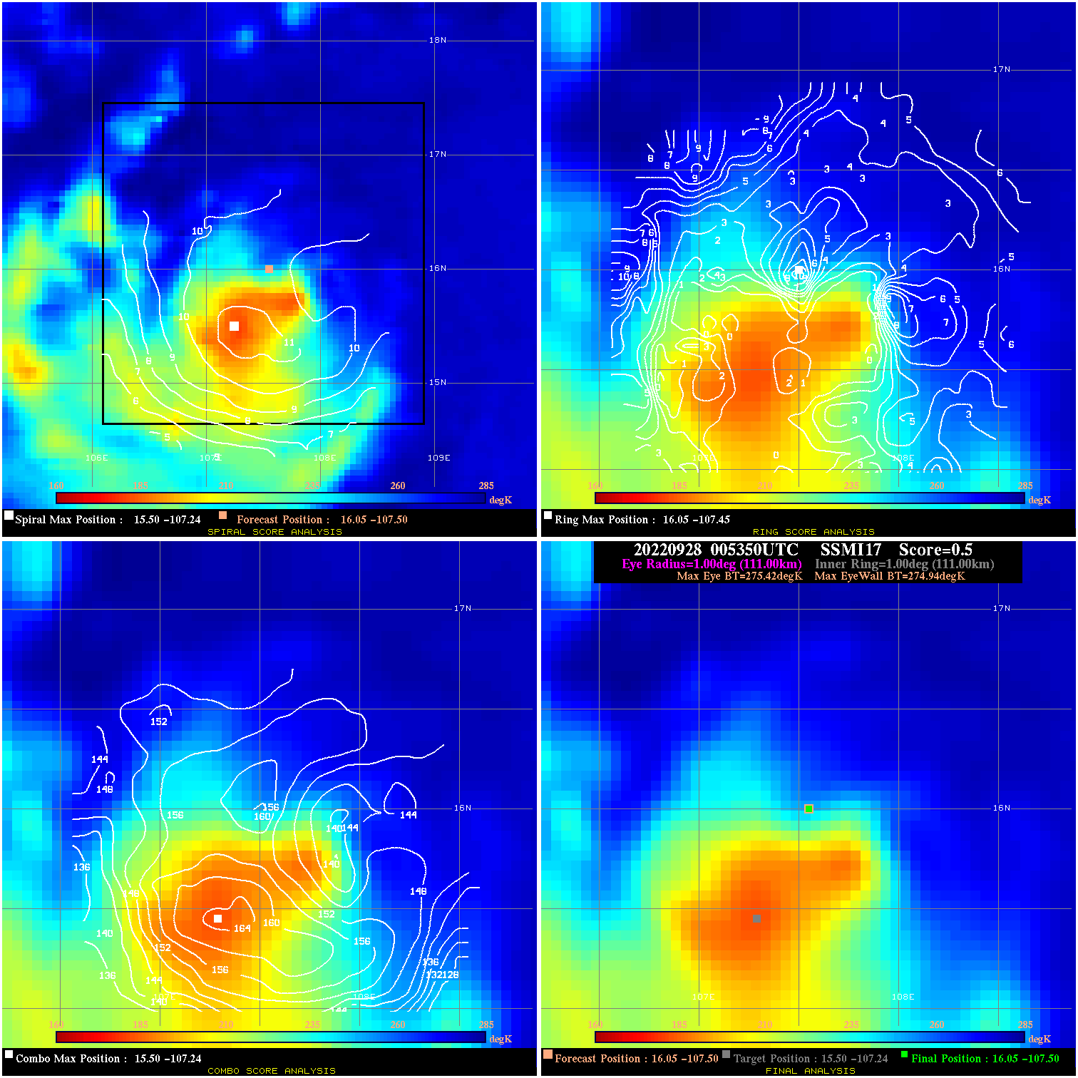
20220928 005350 0.5 N/A 35.6% 222.20 .48 80.0 SSMI17 16.0 -107.5 16.0 -107.5 15.5 -107.2 Analysis Plot
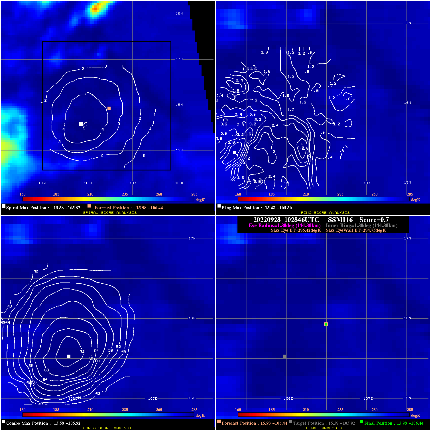
20220928 102846 0.7 N/A N/A 288.86 .67 55.0 SSMI16 16.0 -106.4 16.0 -106.4 15.6 -105.9 Analysis Plot
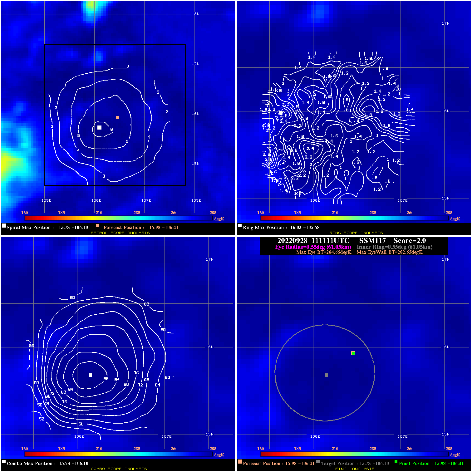
20220928 111111 2.0 N/A N/A 122.21 2.00 55.0 SSMI17 16.0 -106.4 16.0 -106.4 15.7 -106.1 Analysis Plot
|
|
Legend: - Date/Time are determined from PMW imagery at Forecast (initial guess) Lat/Lon position. - Positive/Negative Latitude = North/South Hemisphere; Longitude = Western/Eastern Hemisphere. - "Ring Diam" value indicates the estimated surface eyewall diameter in km (the MI eyewall edge diameter minus 10 km). - "Ring Pct" is the percentage of the "ring" (eyewall inner boundary) that is 1) colder than the "hot spot" (warmest eye pixel) in the eye by 20K, or 2) the percentage that is a) colder than 232K and b) colder than the "hot spot" by 10K, whichever is greater. - Values are red if Ring % <= 65, yellow/brown if Ring % <= 85 and green if Ring % > 85. - "Tb diff" is the difference between the "hot spot" (warmest eye pixel) and the warmest pixel on the eyewall. - Intensity score are listed as negative, and not used, when the JTWC or NHC estimated Vmax is <55 kts in order to rule out weak but highly symmetric TCs. - Error messages in intensity scores: -920 is used when the hottest pixel in the eye is <200K, to prevent false positives; -930 means <85% of eyewall has observations/data. |