Typhoon 18U


UW-CIMSS Automated Satellite-Based
Advanced Dvorak Technique (ADT)
Version 9.0
 
Current Intensity Analysis


                     UW - CIMSS                     
              ADVANCED DVORAK TECHNIQUE       
                    ADT-Version 9.0                
         Tropical Cyclone Intensity Algorithm       
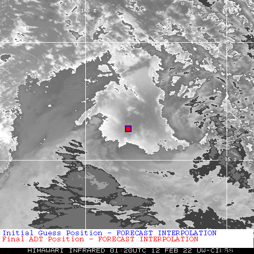
             ----- Current Analysis ----- 
     Date :  12 FEB 2022    Time :   012000 UTC
      Lat :   33:40:05 S     Lon :  166:31:21 E

     
                CI# /Pressure/ Vmax
                2.9 /  990mb /  43kts

     
             Final T#  Adj T#  Raw T# 
                2.4     2.2     1.5

 Center Temp : +18.0C    Cloud Region Temp :   5.2C

 Scene Type : SHEAR (>1.25^ TO DG) 

 Subtropical Adjustment : OFF 

 Extratropical Adjustment : OFF 

 Positioning Method : FORECAST INTERPOLATION 

 Ocean Basin : WEST PACIFIC  
 Dvorak CI > MSLP Conversion Used : CKZ Method  

 Tno/CI Rules : Constraint Limits : 1.0T/6hr 
                   Weakening Flag : ON    
           Rapid Dissipation Flag : ON    

 C/K/Z MSLP Estimate Inputs :
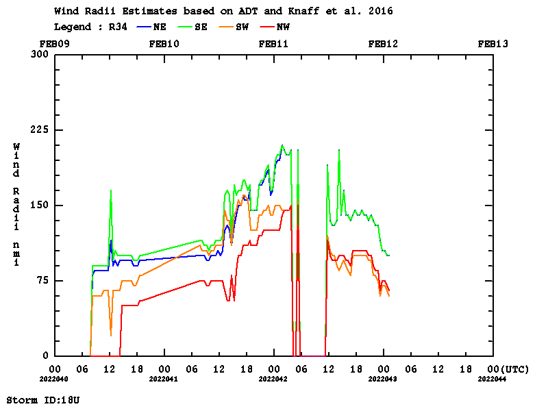
  - Average 34 knot radii :   85nmi
  - Environmental MSLP    : 1008mb

 Satellite Name :   HIM-8 
 Satellite Viewing Angle : 47.9 degrees 

****************************************************
History File Listing
Thresholds
(AtlEastCentPac / Other)
12.0 /10.0
ARCHER Information
PMW Information
Wind Radii Estimates
(based on Knaff et al. 2016)

(naut.mi.) R34 R50 R64
NE 100.0  0.0  0.0 
SE 100.0  0.0  0.0 
SW 60.0  0.0  0.0 
NW 65.0  0.0  0.0 
Parameters Used
RMW derived from Climatology
TC current intensity from ADT = 43.0 (kts)
TC forward speed from Forecast Interpolation = 24.0 (kts)
TC heading from Forecast Interpolation = 182.0 (deg)
Historical listing of wind radii values
Timeline plots of Wind Radii : 34kt   50kt   64kt
Satellite Imagery
Time Series
HTML5 Movie