Tropical Storm 03L
|
Passive Microwave (PMW) Intensity Information Advanced Dvorak Technique (ADT) Version 8.1.4 |
Overpass Inten Ring Ring Wind Forecast Final Target
Date Time Score Meaning Pct Diam BTdiff Est Sat Lat Lon Lat Lon Lat Lon
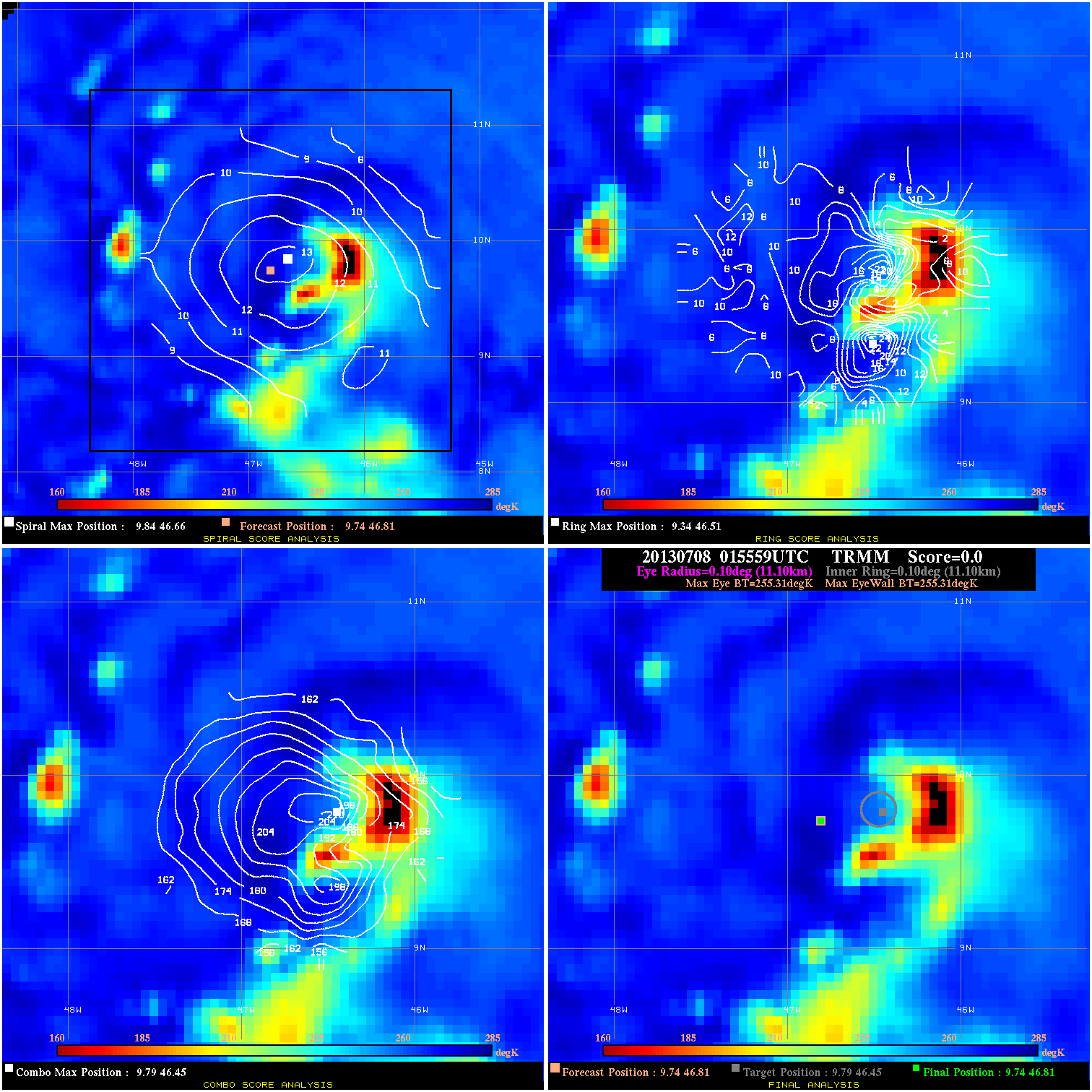
20130708 015559 N/A N/A N/A N/A N/A 35.0 TRMM 9.7 46.8 9.7 46.8 9.8 46.5 Analysis Plot
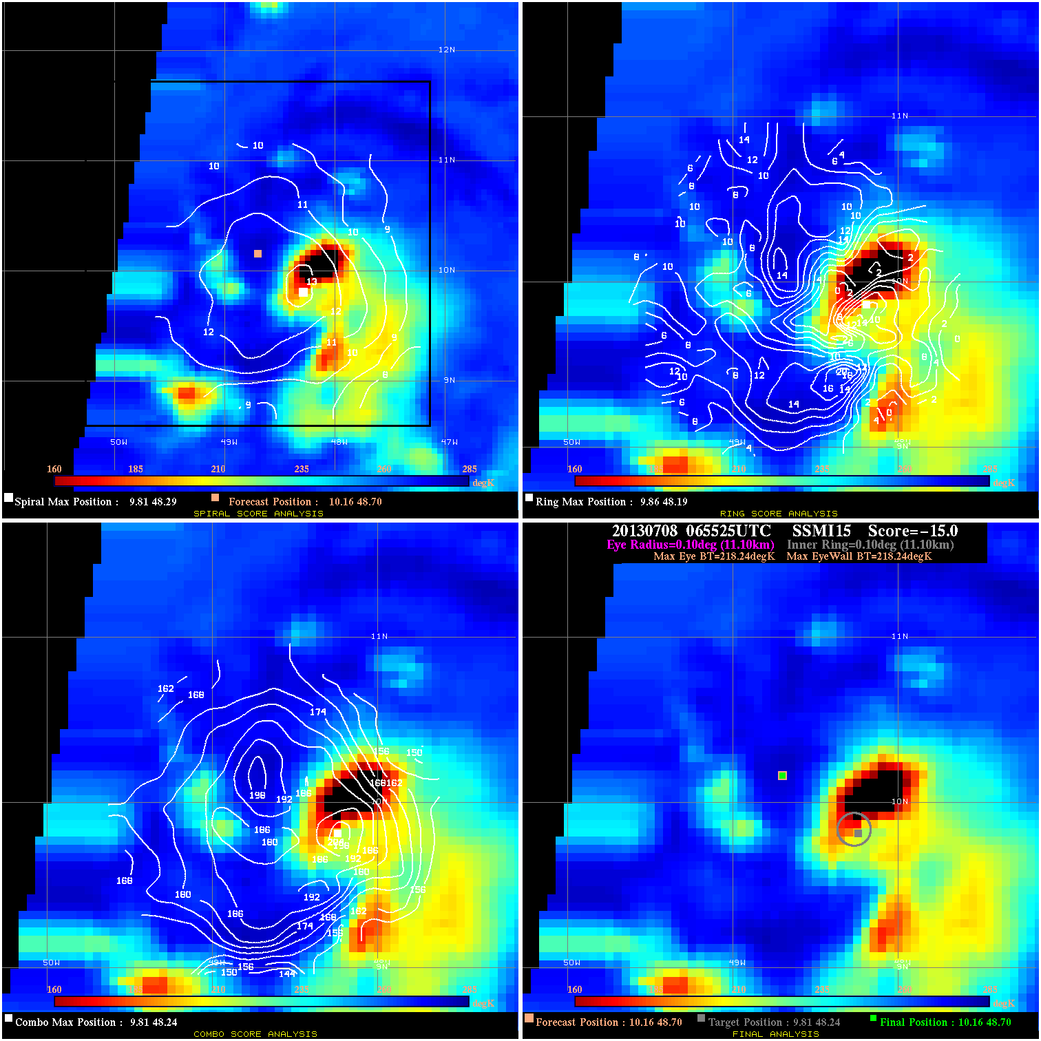
20130708 065525 N/A N/A N/A N/A N/A 35.0 SSMI15 10.2 48.7 10.2 48.7 9.8 48.2 Analysis Plot
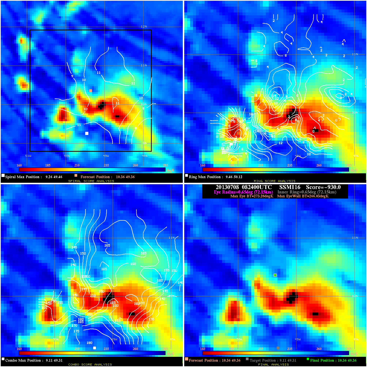
20130708 082400 -930.0 N/A N/A 144.43 7.25 35.0 SSMI16 10.4 49.4 10.4 49.4 9.1 49.3 Analysis Plot
20130708 093900 -1.6 N/A 35.6% 99.99 1.65 35.0 SSMI17 10.5 49.9 10.5 49.9 10.7 49.6 Analysis Plot
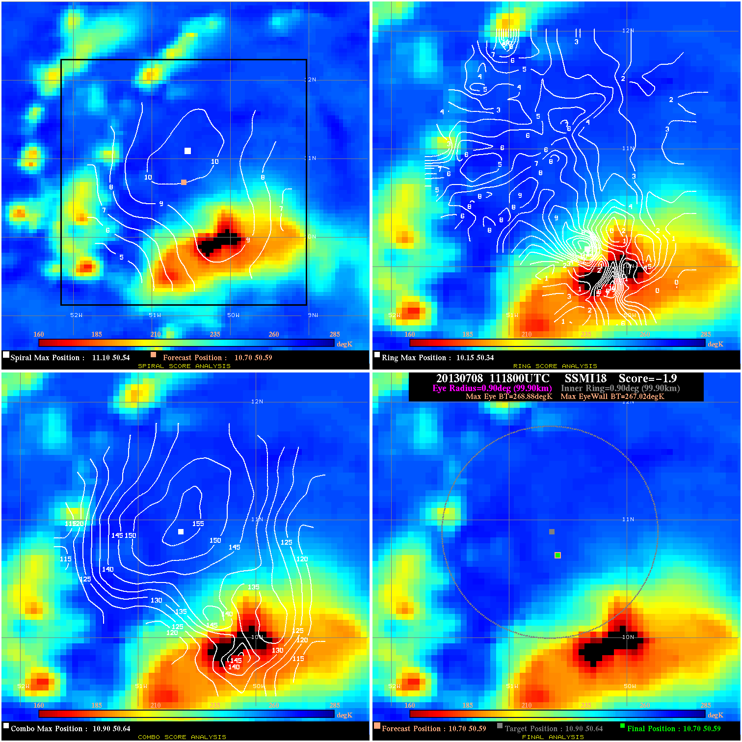
20130708 111800 -1.9 N/A 28.8% 199.98 1.86 35.0 SSMI18 10.7 50.6 10.7 50.6 10.9 50.6 Analysis Plot
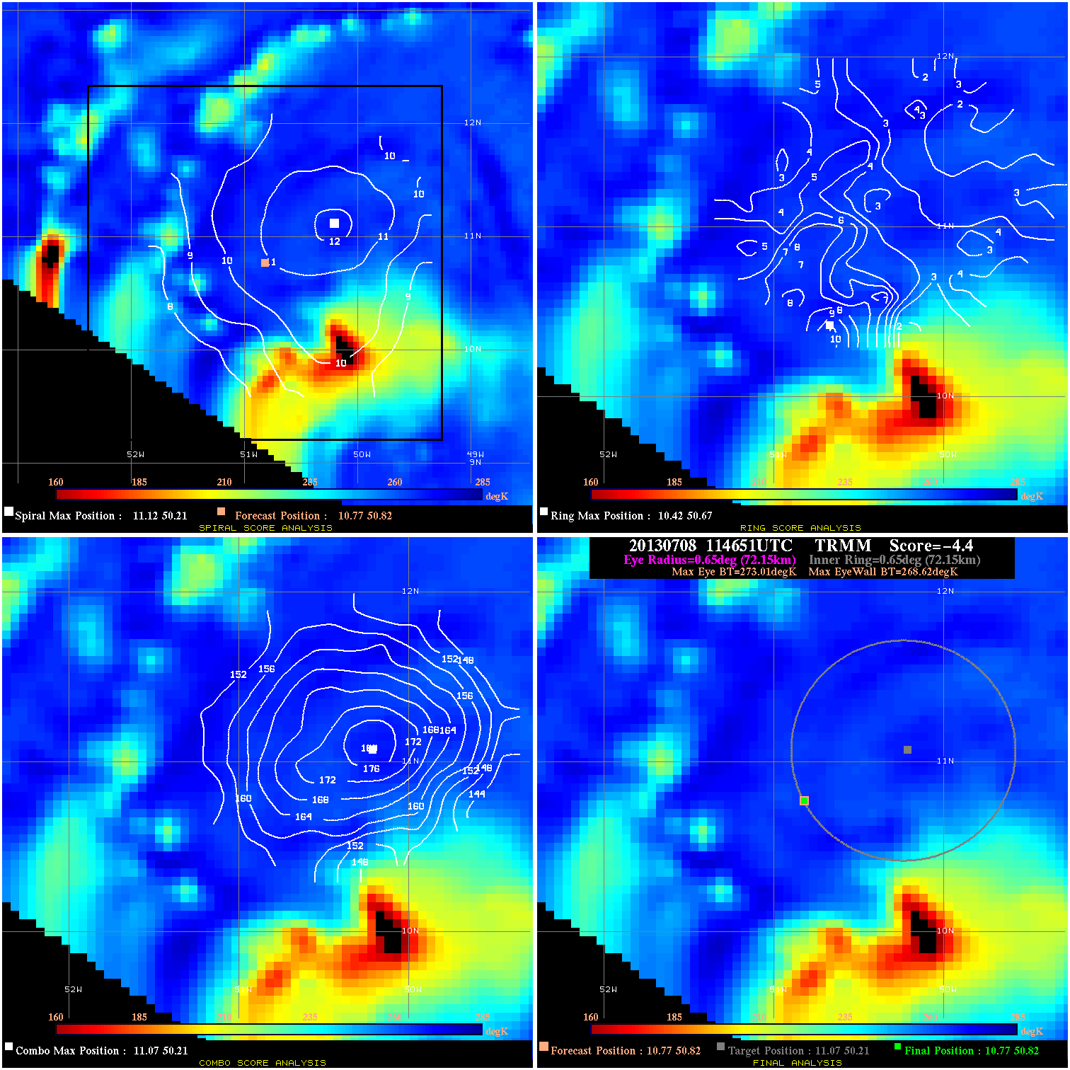
20130708 114651 -4.4 N/A 16.4% 144.43 4.39 35.0 TRMM 10.8 50.8 10.8 50.8 11.1 50.2 Analysis Plot
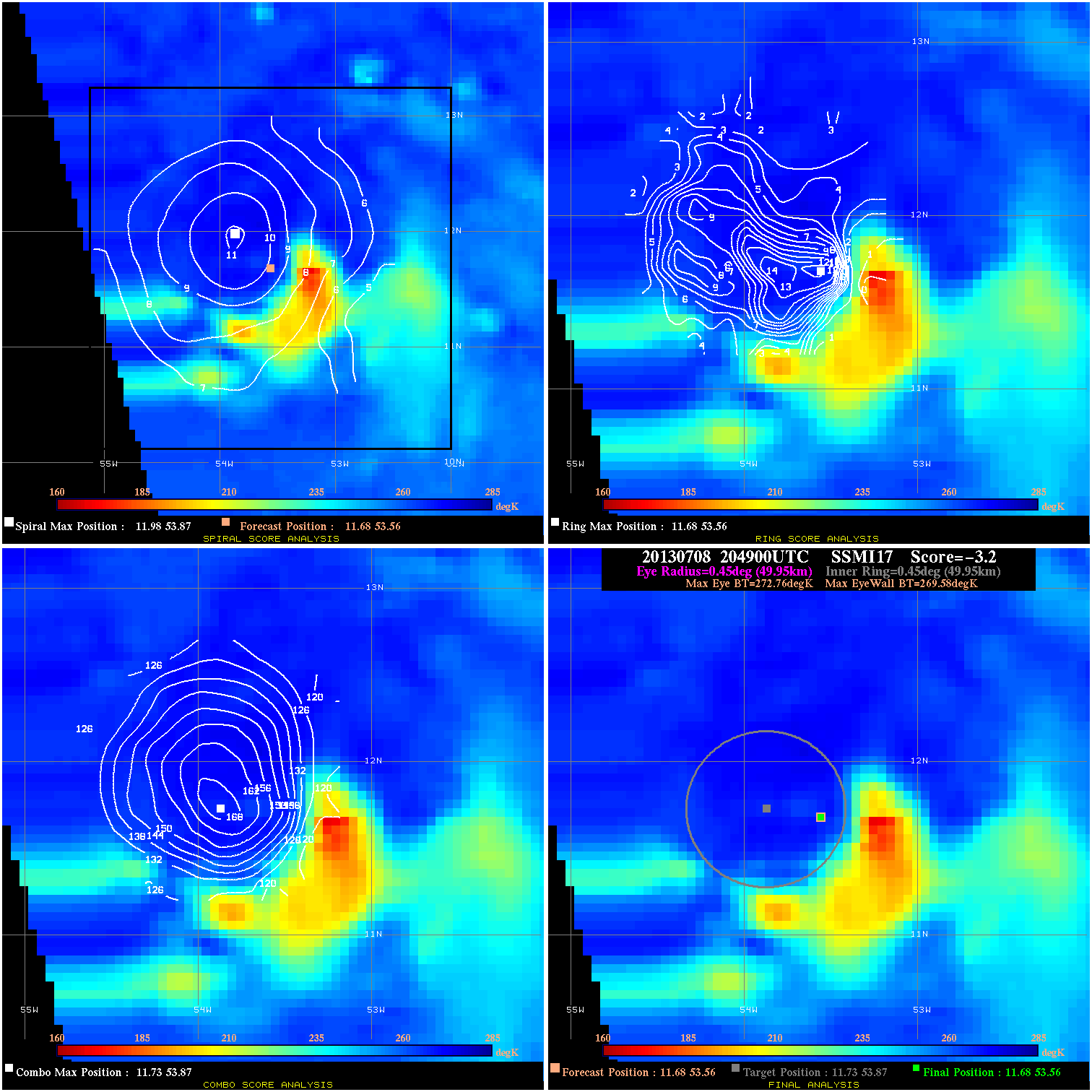
20130708 204900 -3.2 N/A 23.3% 99.99 3.18 40.0 SSMI17 11.7 53.6 11.7 53.6 11.7 53.9 Analysis Plot
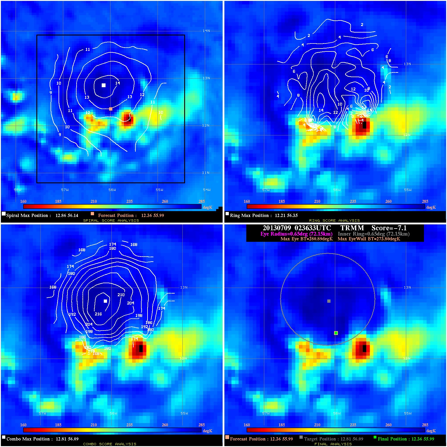
20130709 023633 -7.1 N/A 21.9% 144.43 7.09 45.0 TRMM 12.4 56.0 12.4 56.0 12.8 56.1 Analysis Plot
20130709 075931 -930.0 N/A N/A 199.98 8.08 45.0 SSMI15 13.2 58.1 13.2 58.1 13.5 58.4 Analysis Plot
20130709 092600 -2.1 N/A 19.2% 133.32 2.15 45.0 SSMI17 13.4 58.7 13.4 58.7 13.2 58.8 Analysis Plot
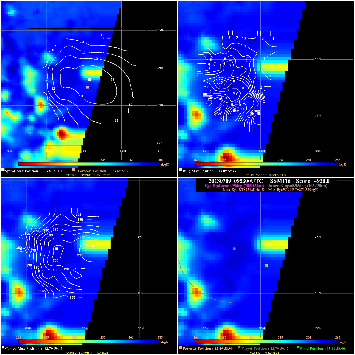
20130709 095300 -930.0 N/A N/A 211.09 5.16 45.0 SSMI16 13.5 58.9 13.5 58.9 13.8 59.5 Analysis Plot
20130709 124700 -930.0 N/A N/A 99.99 11.98 50.0 SSMI18 14.1 60.8 14.1 60.8 14.1 60.8 Analysis Plot
20130709 210300 7.2 N/A 12.3% 177.76 7.19 55.0 SSMI16 15.1 63.5 15.1 63.5 15.6 63.8 Analysis Plot
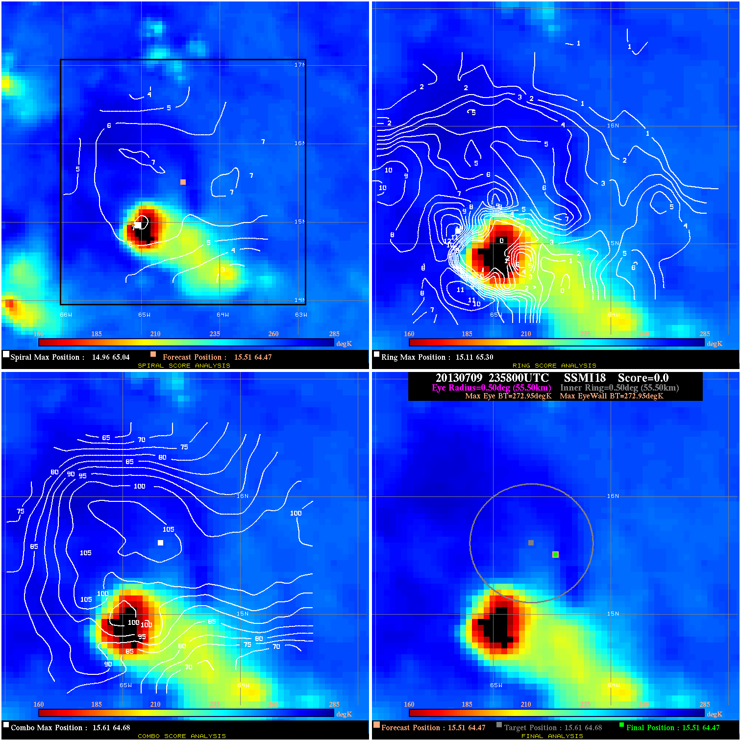
20130709 235800 N/A N/A N/A N/A N/A 55.0 SSMI18 15.5 64.5 15.5 64.5 15.6 64.7 Analysis Plot
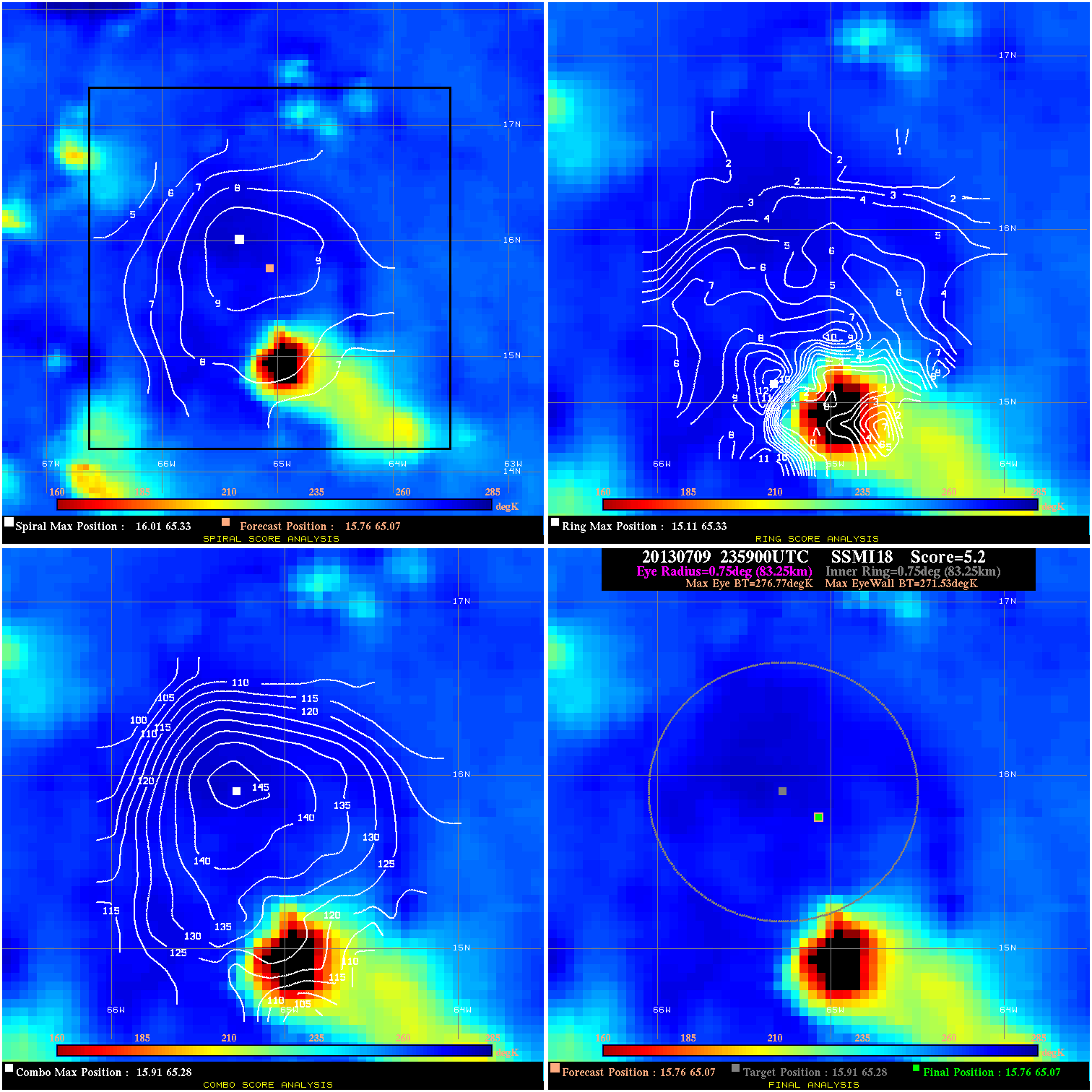
20130709 235900 5.2 N/A 6.8% 166.65 5.24 55.0 SSMI18 15.8 65.1 15.8 65.1 15.9 65.3 Analysis Plot
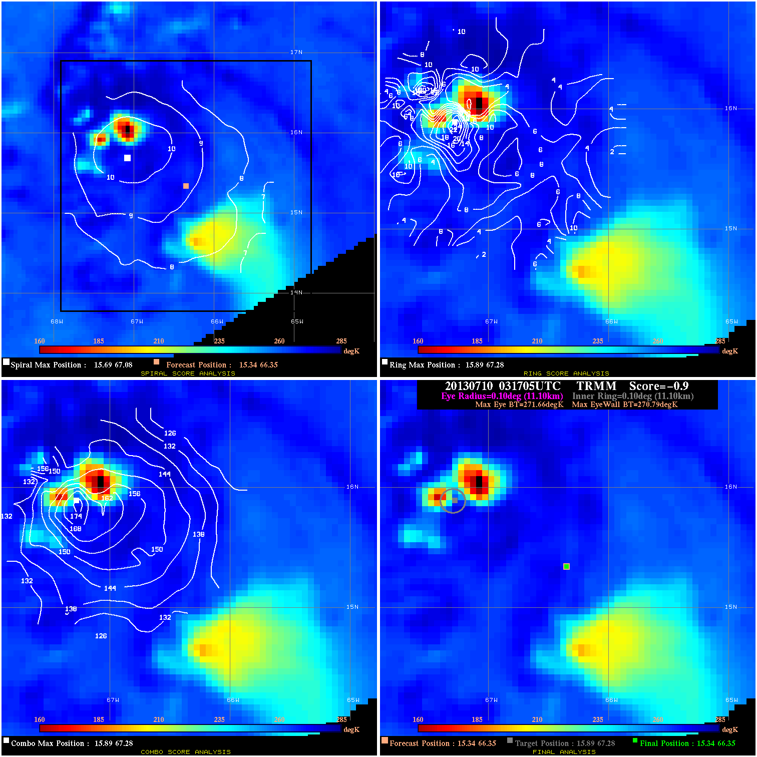
20130710 031705 -0.9 N/A 42.5% 22.22 .87 50.0 TRMM 15.3 66.3 15.3 66.3 15.9 67.3 Analysis Plot
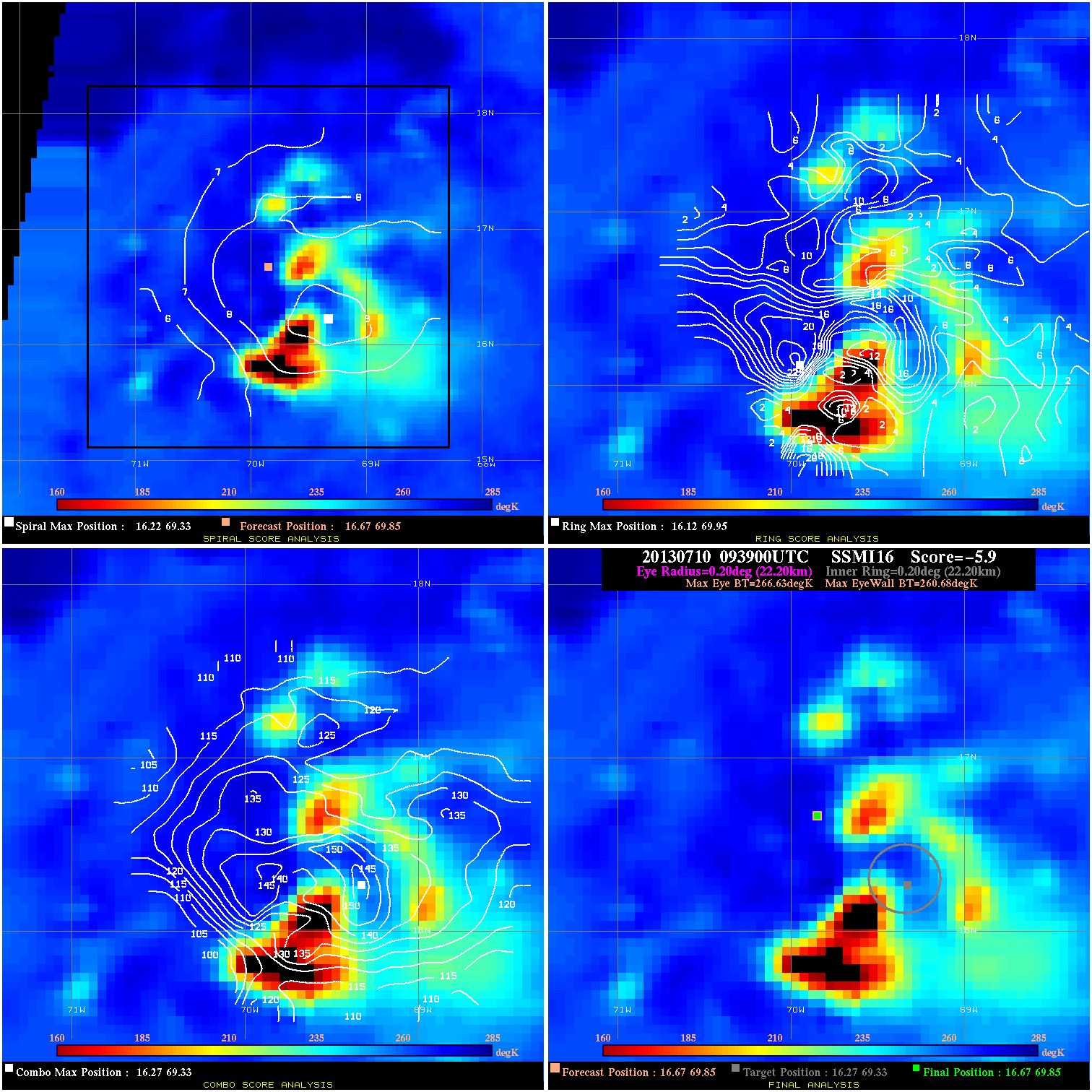
20130710 093900 -5.9 N/A 63.0% 44.44 5.95 40.0 SSMI16 16.7 69.8 16.7 69.8 16.3 69.3 Analysis Plot
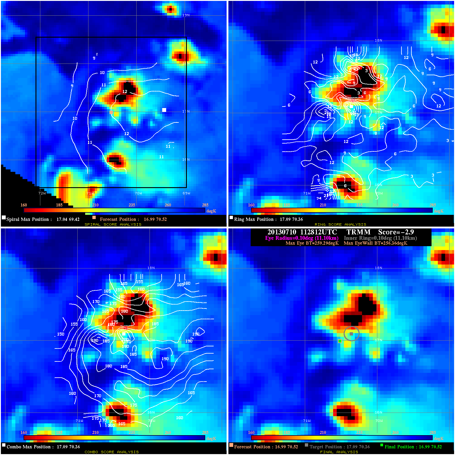
20130710 112812 -2.9 N/A 69.9% 22.22 2.93 40.0 TRMM 17.0 70.5 17.0 70.5 17.1 70.4 Analysis Plot
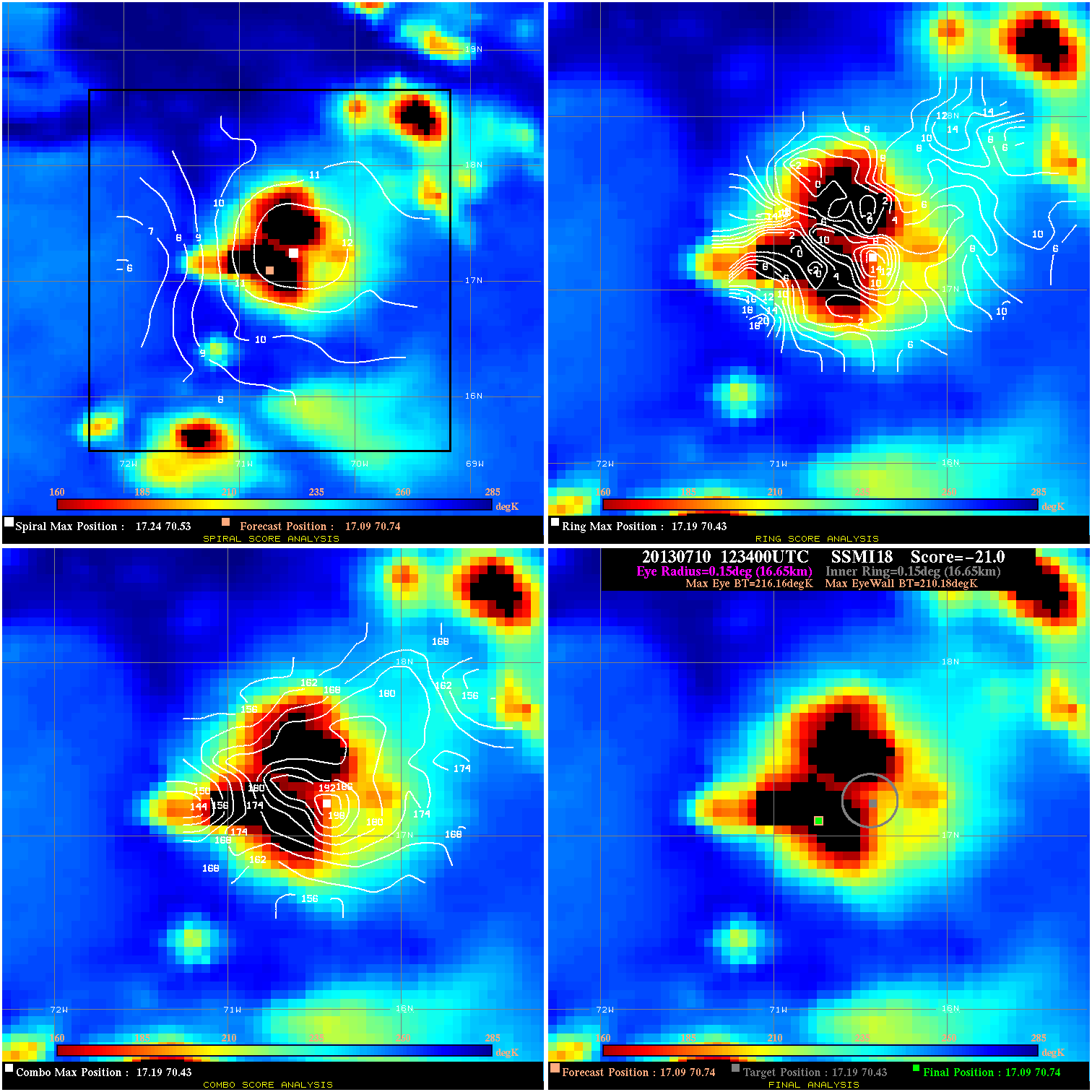
20130710 123400 -21.0 N/A 100.0% 33.33 5.98 40.0 SSMI18 17.1 70.7 17.1 70.7 17.2 70.4 Analysis Plot
20130710 223300 -930.0 N/A N/A 44.44 14.46 40.0 SSMI16 17.6 74.6 17.6 74.6 18.4 74.4 Analysis Plot
20130710 223300 -930.0 N/A N/A 44.44 14.64 40.0 SSMI16 18.0 75.3 18.0 75.3 18.4 74.4 Analysis Plot
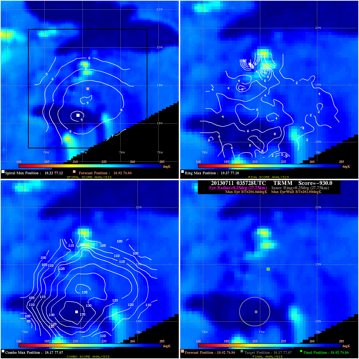
20130711 035728 -930.0 N/A N/A 55.55 4.24 40.0 TRMM 18.9 76.9 18.9 76.9 18.2 77.1 Analysis Plot
|
|
Legend: - Date/Time are determined from PMW imagery at Forecast (initial guess) Lat/Lon position. - Positive/Negative Latitude = North/South Hemisphere; Longitude = Western/Eastern Hemisphere. - "Ring Diam" value indicates the estimated surface eyewall diameter in km (the MI eyewall edge diameter minus 10 km). - "Ring Pct" is the percentage of the "ring" (eyewall inner boundary) that is 1) colder than the "hot spot" (warmest eye pixel) in the eye by 20K, or 2) the percentage that is a) colder than 232K and b) colder than the "hot spot" by 10K, whichever is greater. - Values are red if Ring % <= 65, yellow/brown if Ring % <= 85 and green if Ring % > 85. - "Tb diff" is the difference between the "hot spot" (warmest eye pixel) and the warmest pixel on the eyewall. - Intensity score are listed as negative, and not used, when the JTWC or NHC estimated Vmax is <55 kts in order to rule out weak but highly symmetric TCs. - Error messages in intensity scores: -920 is used when the hottest pixel in the eye is <200K, to prevent false positives; -930 means <85% of eyewall has observations/data. |