Tropical Storm 03W
|
Passive Microwave (PMW) Intensity Information Advanced Dvorak Technique (ADT) Version 8.1.4 (experimental) |
Overpass Inten Ring Ring Wind Forecast Final Target
Date Time Score Meaning Pct Diam BTdiff Est Sat Lat Lon Lat Lon Lat Lon
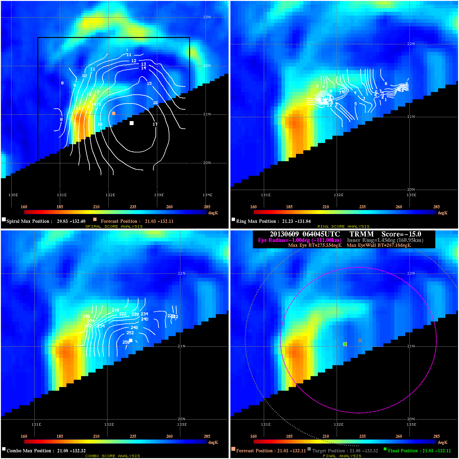
20130609 064045 -15.0 N/A N/A N/A 8.17 40.0 TRMM 21.0 -132.1 21.0 -132.1 21.1 -132.3 Analysis Plot
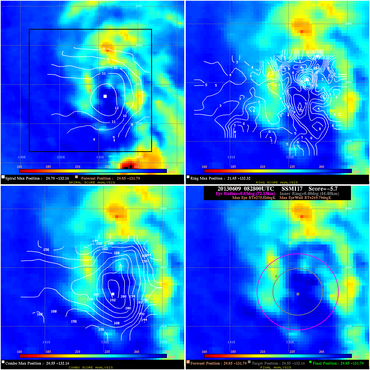
20130609 082800 -5.7 N/A 19.2% 144.43 5.74 35.0 SSMI17 20.9 -131.8 20.9 -131.8 20.6 -132.2 Analysis Plot
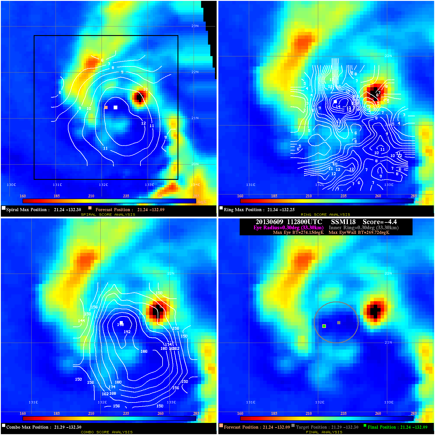
20130609 112800 -4.4 N/A 11.0% 66.66 4.43 35.0 SSMI18 21.2 -132.1 21.2 -132.1 21.3 -132.3 Analysis Plot
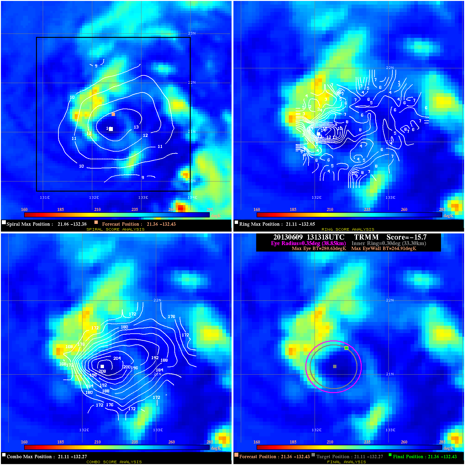
20130609 131318 -15.7 N/A 19.2% 77.77 15.72 35.0 TRMM 21.4 -132.4 21.4 -132.4 21.1 -132.3 Analysis Plot
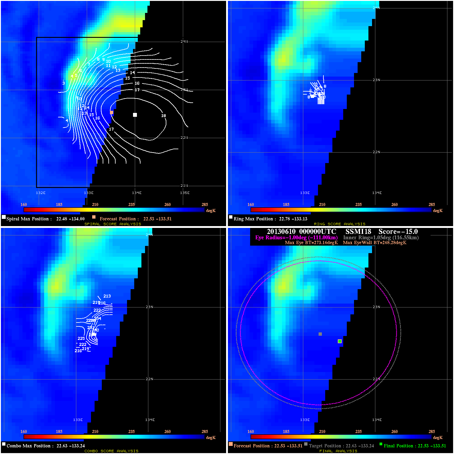
20130610 000000 -15.0 N/A N/A N/A 4.88 35.0 SSMI18 22.5 -133.5 22.5 -133.5 22.6 -133.2 Analysis Plot
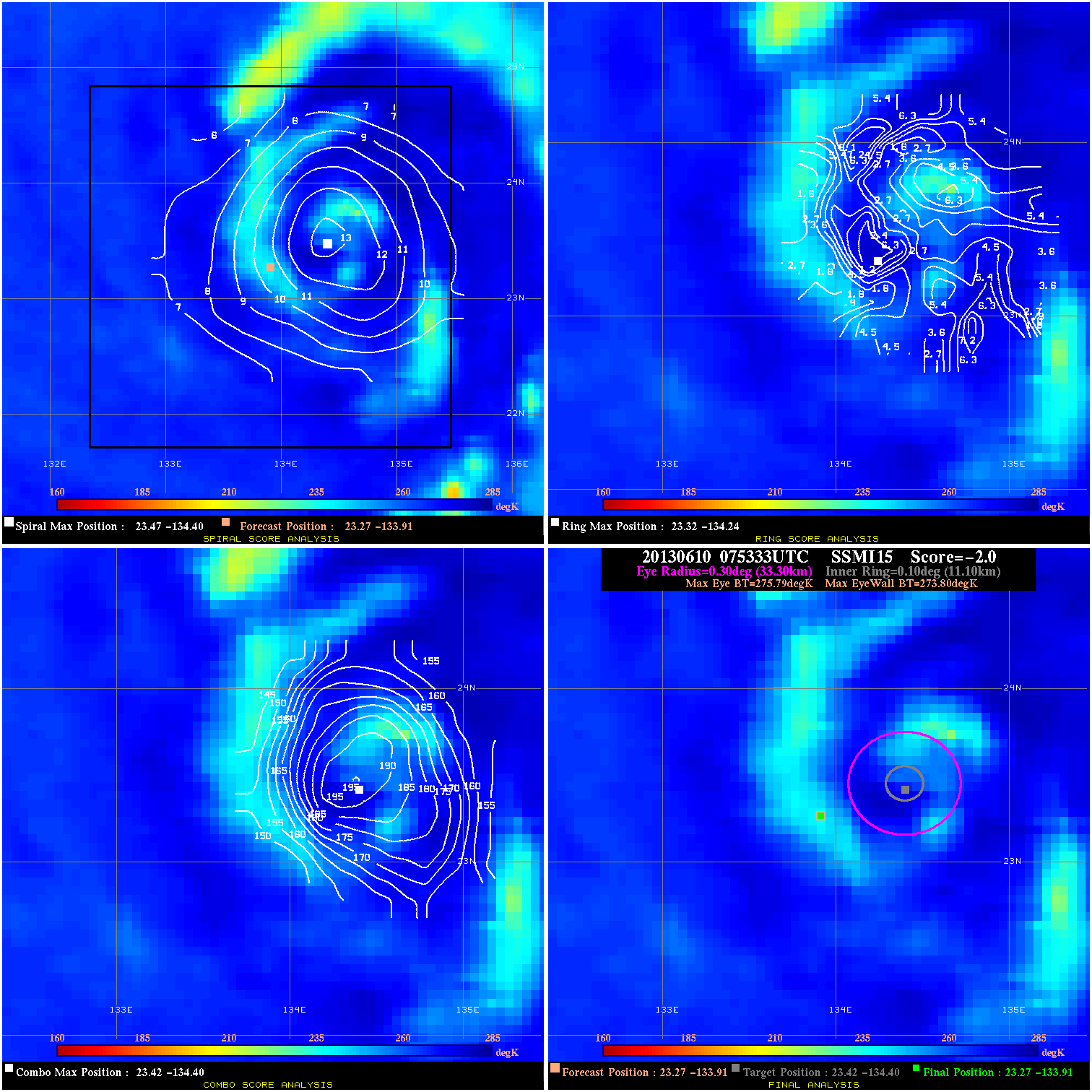
20130610 075333 -2.0 N/A N/A 66.66 1.99 35.0 SSMI15 23.3 -133.9 23.3 -133.9 23.4 -134.4 Analysis Plot
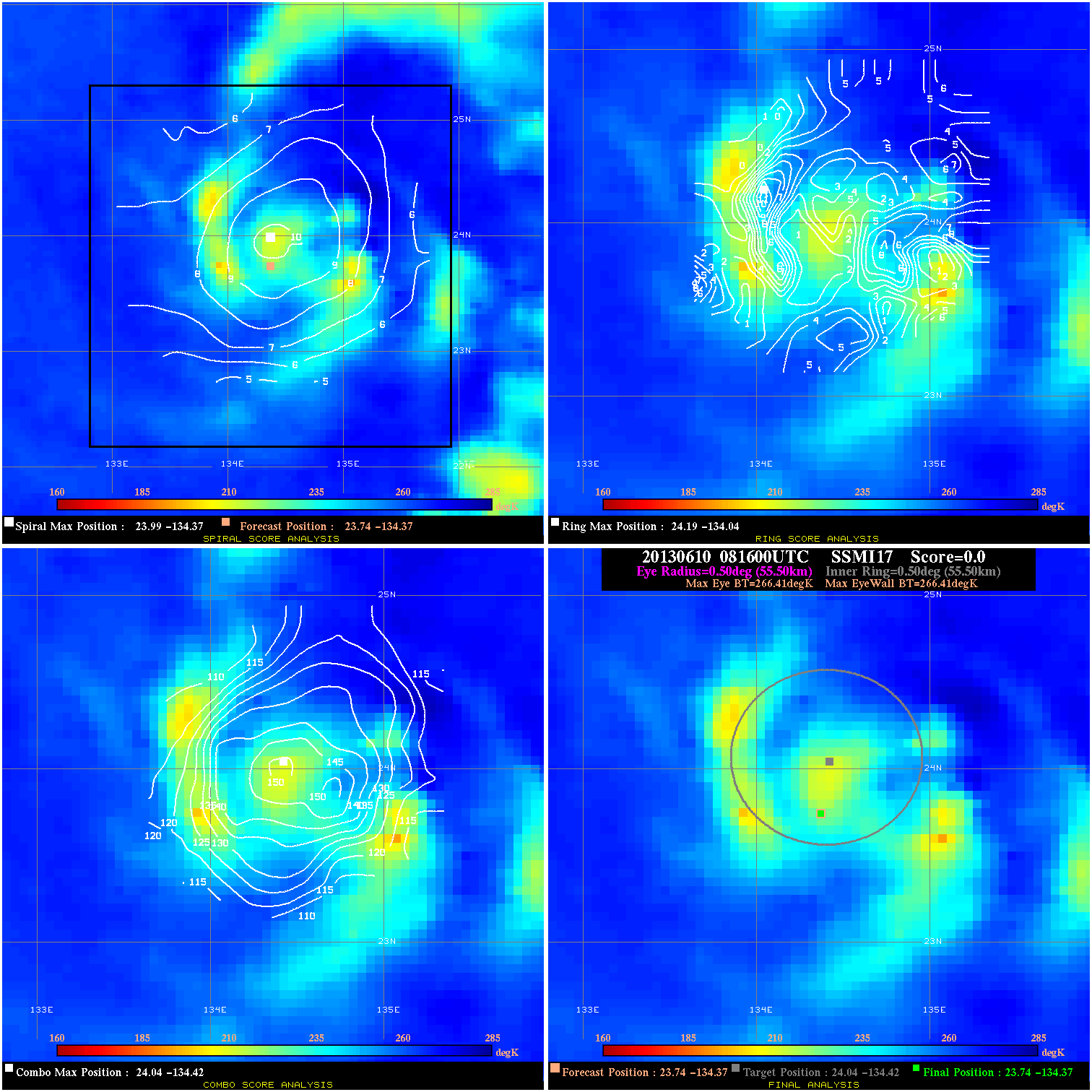
20130610 081600 N/A N/A N/A N/A N/A 40.0 SSMI17 23.7 -134.4 23.7 -134.4 24.0 -134.4 Analysis Plot
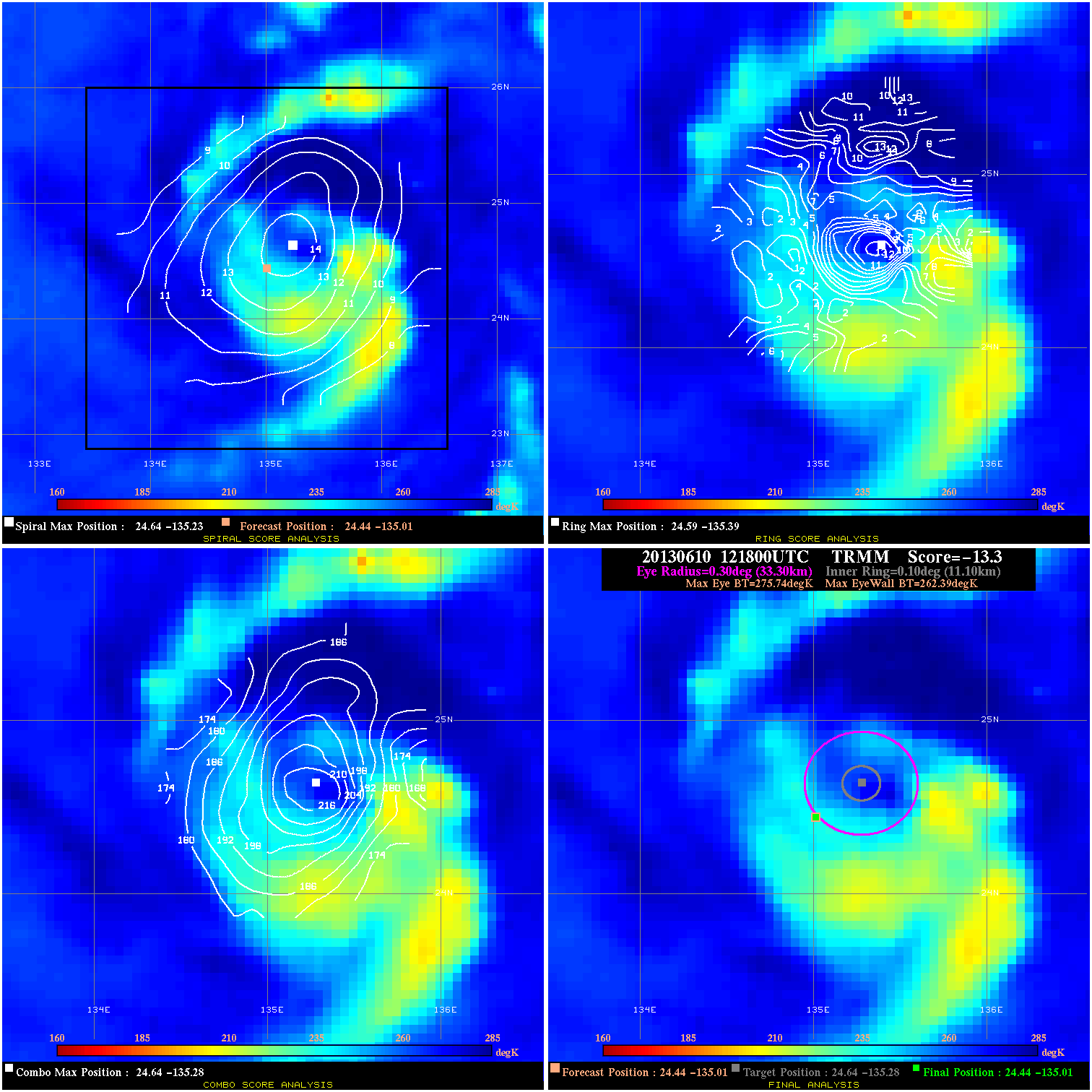
20130610 121800 -13.3 N/A 16.4% 66.66 13.35 45.0 TRMM 24.4 -135.0 24.4 -135.0 24.6 -135.3 Analysis Plot
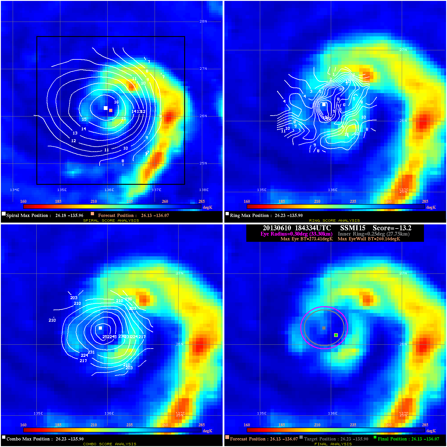
20130610 184334 -13.2 N/A 4.1% 66.66 13.25 50.0 SSMI15 26.1 -136.1 26.1 -136.1 26.2 -135.9 Analysis Plot
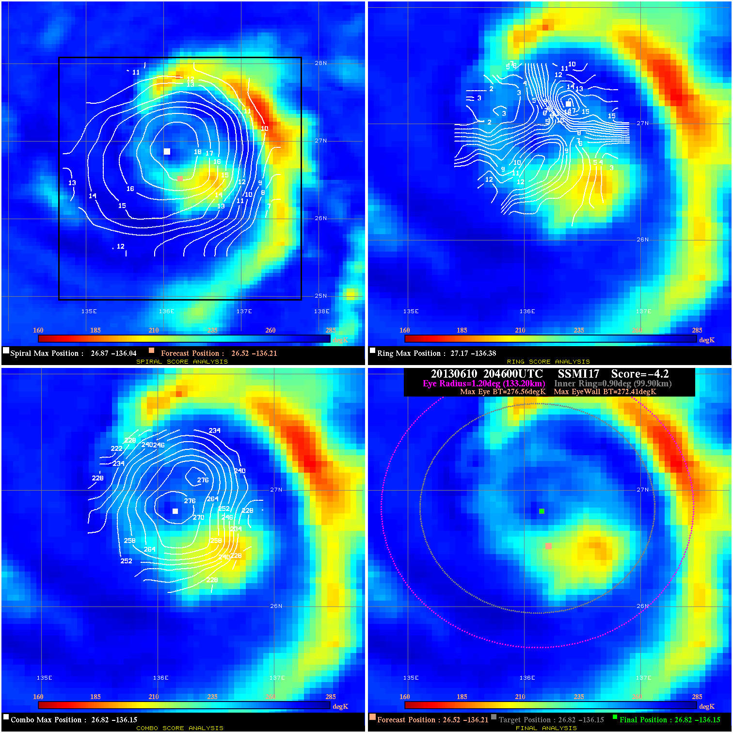
20130610 204600 -4.2 N/A 37.0% 266.64 4.15 50.0 SSMI17 26.5 -136.2 26.8 -136.2 26.8 -136.2 Analysis Plot
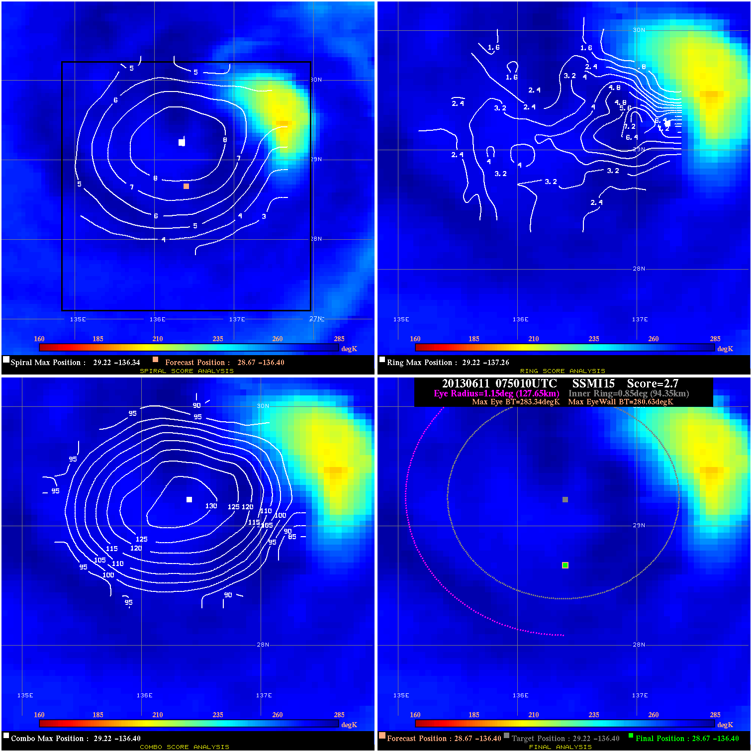
20130611 075010 2.7 N/A 16.4% 255.53 2.71 55.0 SSMI15 28.7 -136.4 28.7 -136.4 29.2 -136.4 Analysis Plot
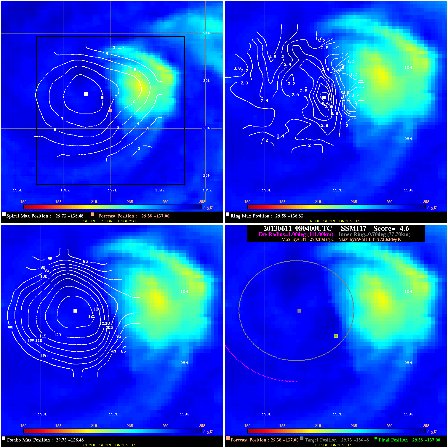
20130611 080400 -4.6 N/A 17.8% 222.20 4.65 50.0 SSMI17 29.4 -137.0 29.4 -137.0 29.7 -136.5 Analysis Plot
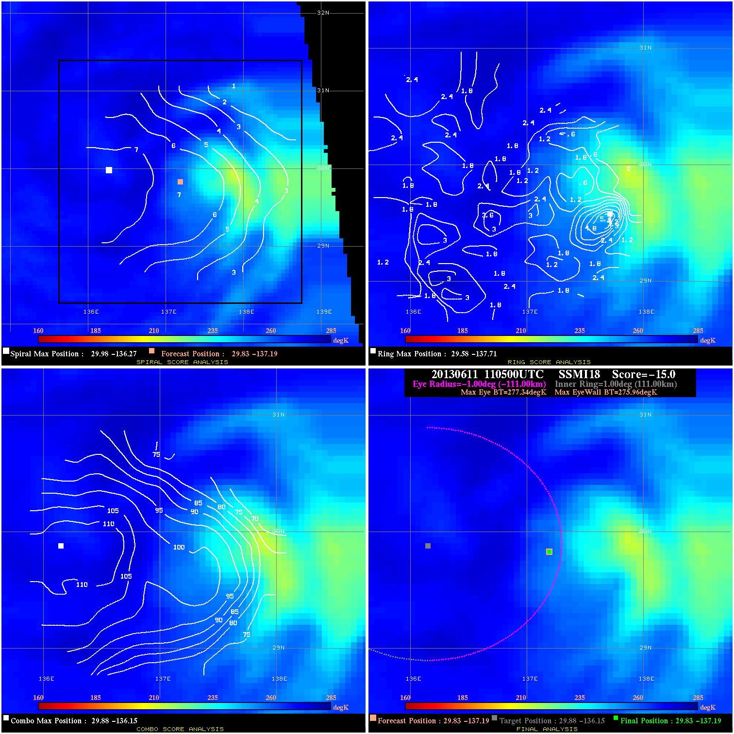
20130611 110500 -15.0 N/A N/A N/A 1.38 50.0 SSMI18 29.8 -137.2 29.8 -137.2 29.9 -136.2 Analysis Plot
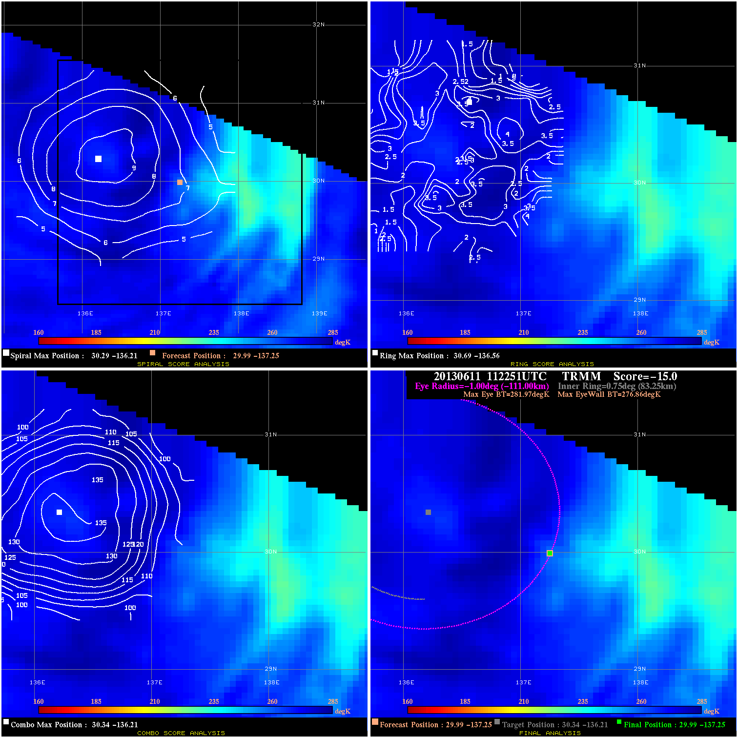
20130611 112251 -15.0 N/A N/A N/A 5.11 50.0 TRMM 30.0 -137.3 30.0 -137.3 30.3 -136.2 Analysis Plot
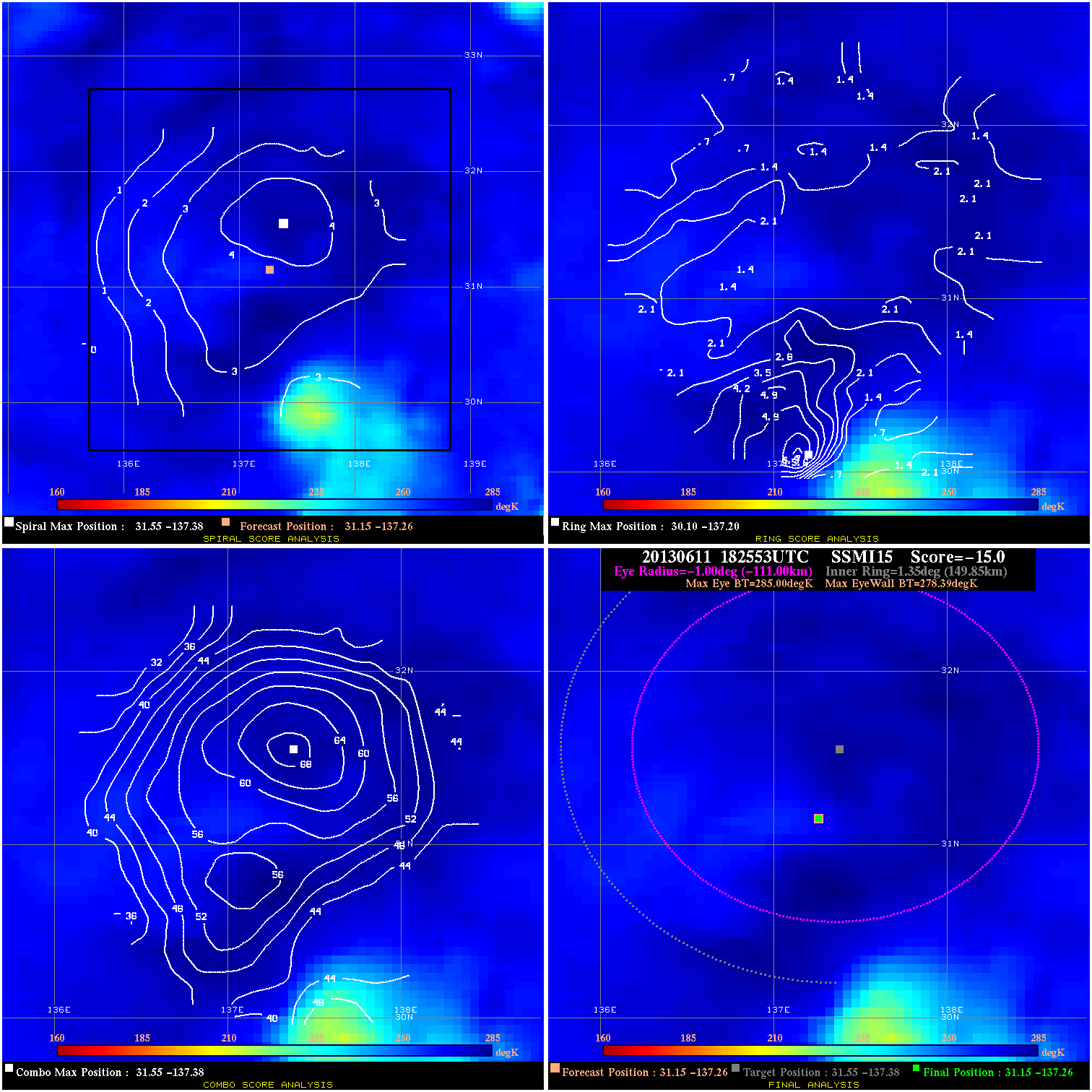
20130611 182553 -15.0 N/A N/A N/A 6.61 40.0 SSMI15 31.1 -137.3 31.1 -137.3 31.6 -137.4 Analysis Plot
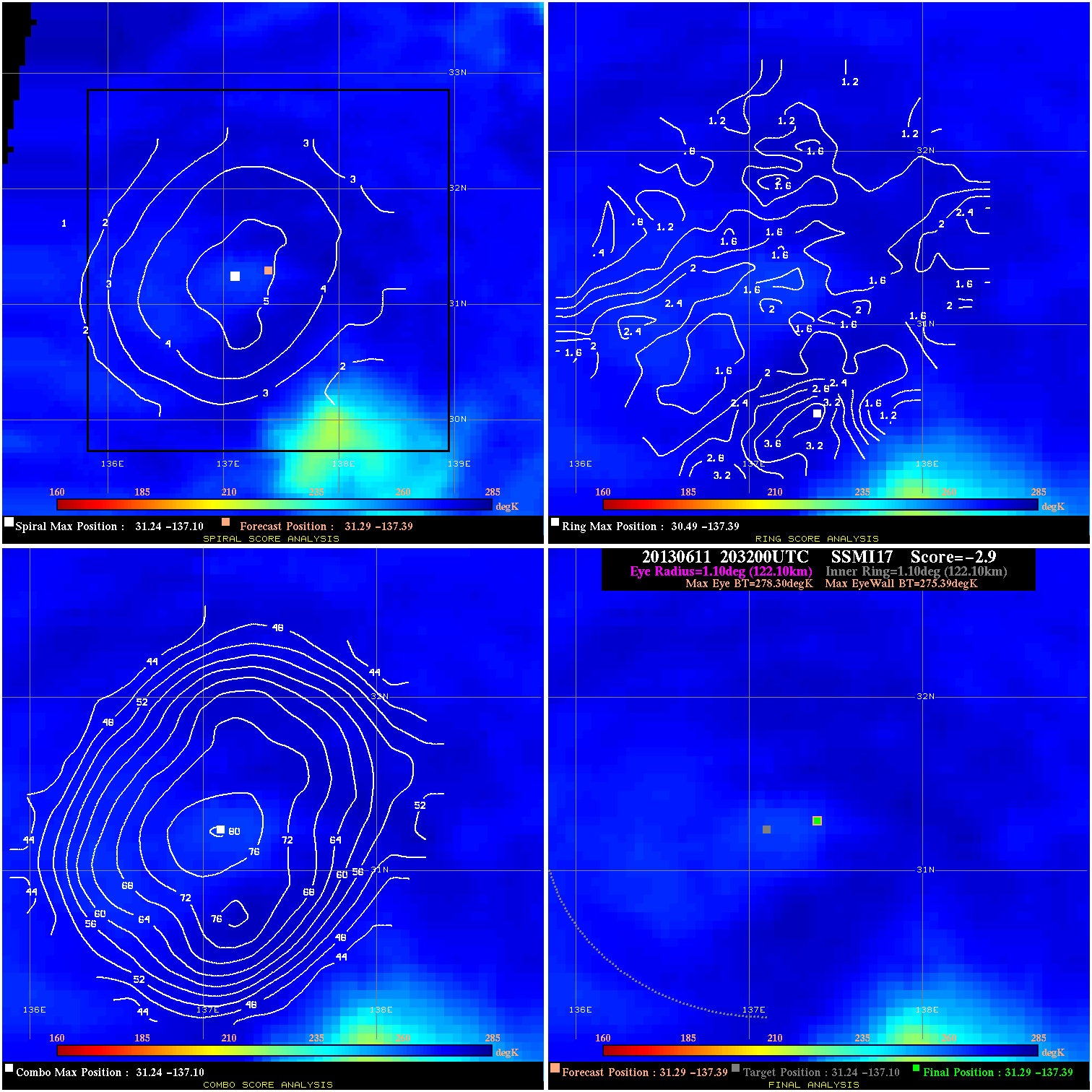
20130611 203200 -2.9 N/A N/A 244.42 2.91 40.0 SSMI17 31.3 -137.4 31.3 -137.4 31.2 -137.1 Analysis Plot
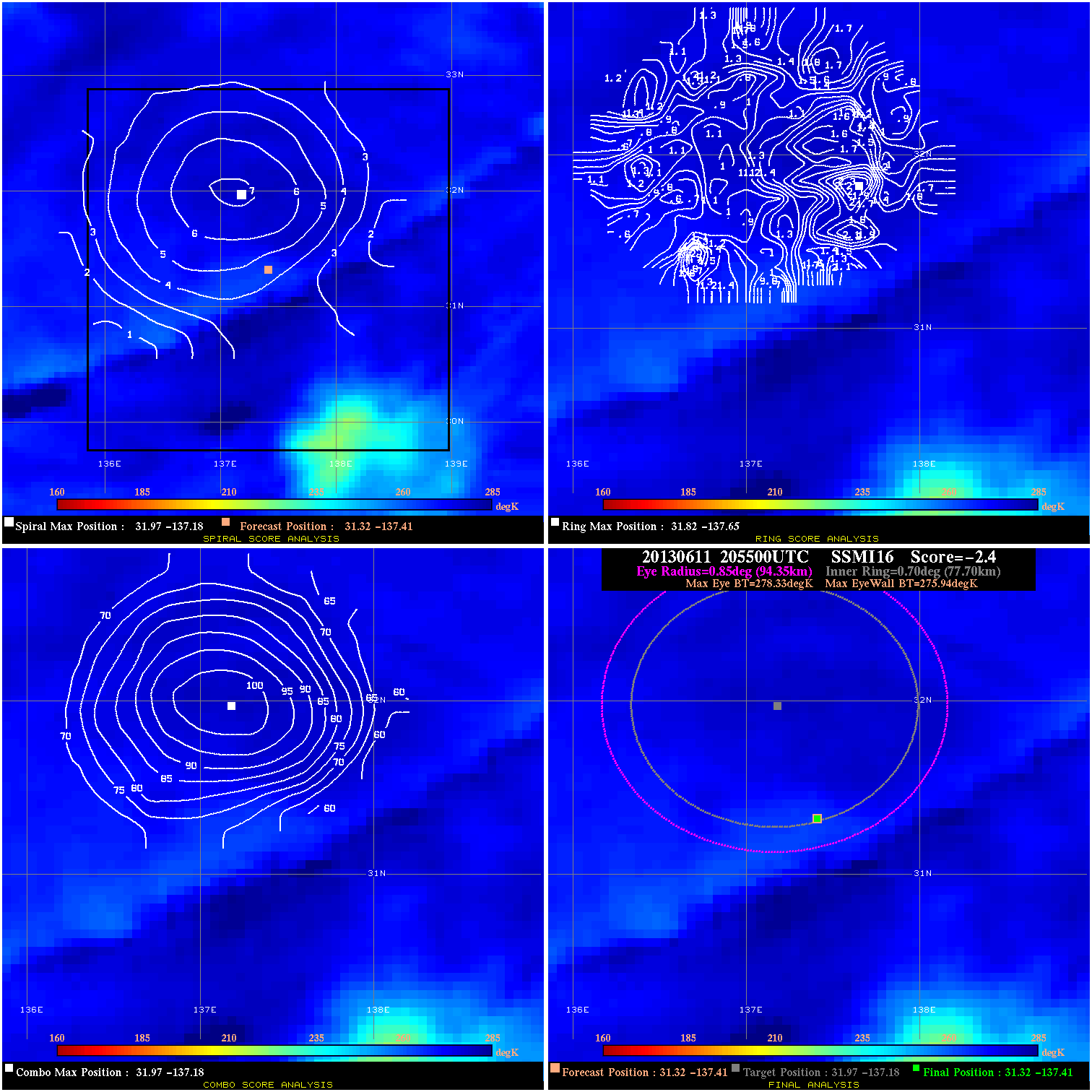
20130611 205500 -2.4 N/A N/A 188.87 2.39 40.0 SSMI16 31.3 -137.4 31.3 -137.4 32.0 -137.2 Analysis Plot
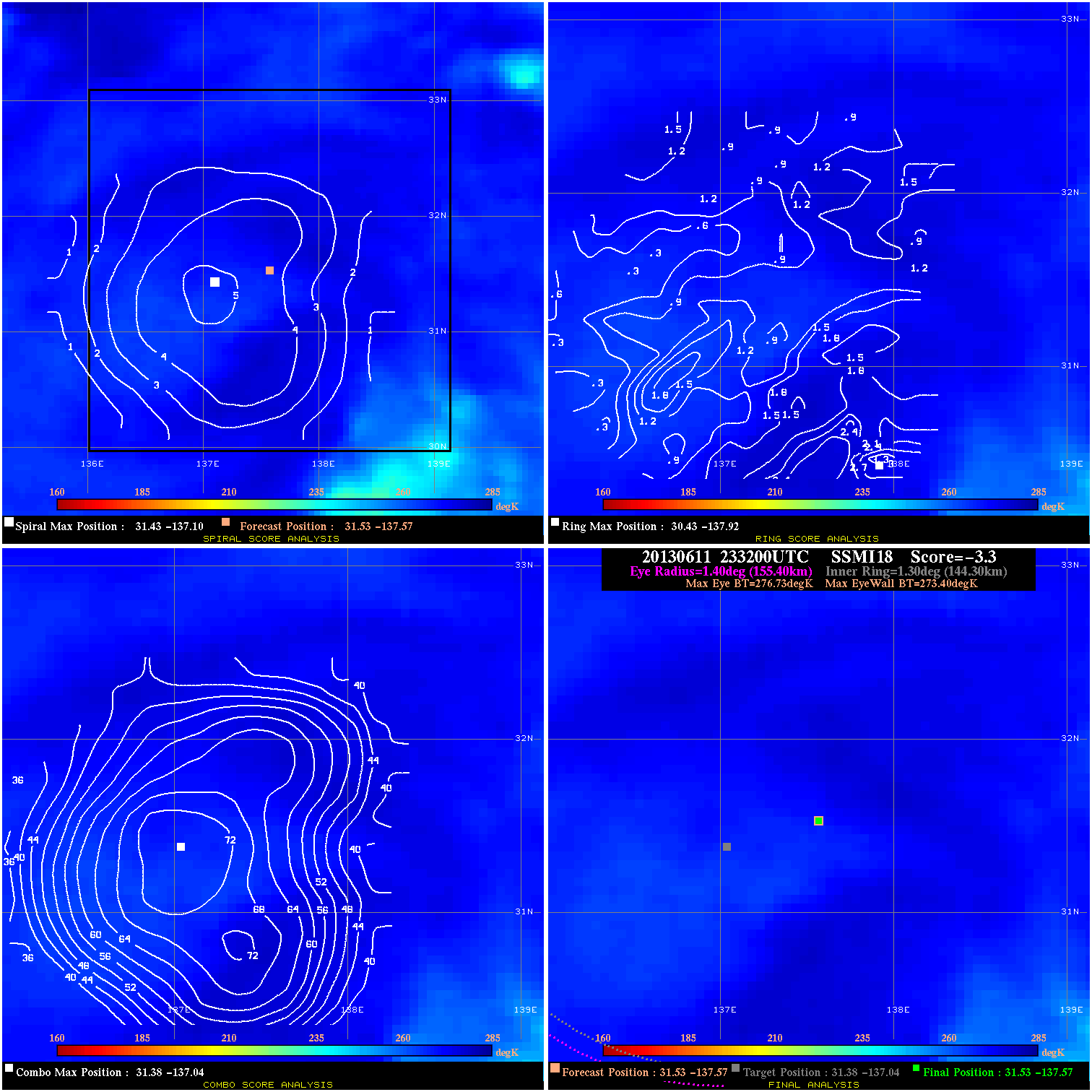
20130611 233200 -3.3 N/A N/A 311.08 3.33 40.0 SSMI18 31.5 -137.6 31.5 -137.6 31.4 -137.0 Analysis Plot
20130612 053339 -2.2 N/A N/A 344.41 2.17 40.0 TRMM 31.1 -137.5 31.1 -137.5 31.1 -137.7 Analysis Plot
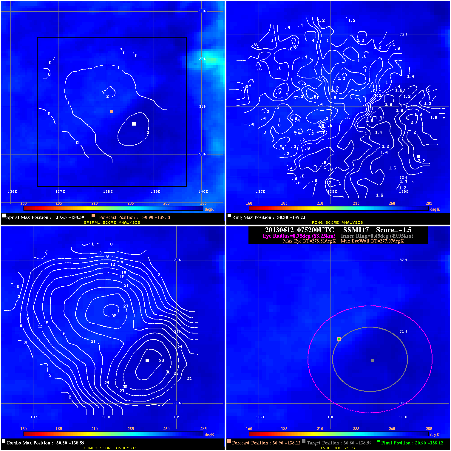
20130612 075200 -1.5 N/A N/A 166.65 1.54 35.0 SSMI17 30.9 -138.1 30.9 -138.1 30.6 -138.6 Analysis Plot
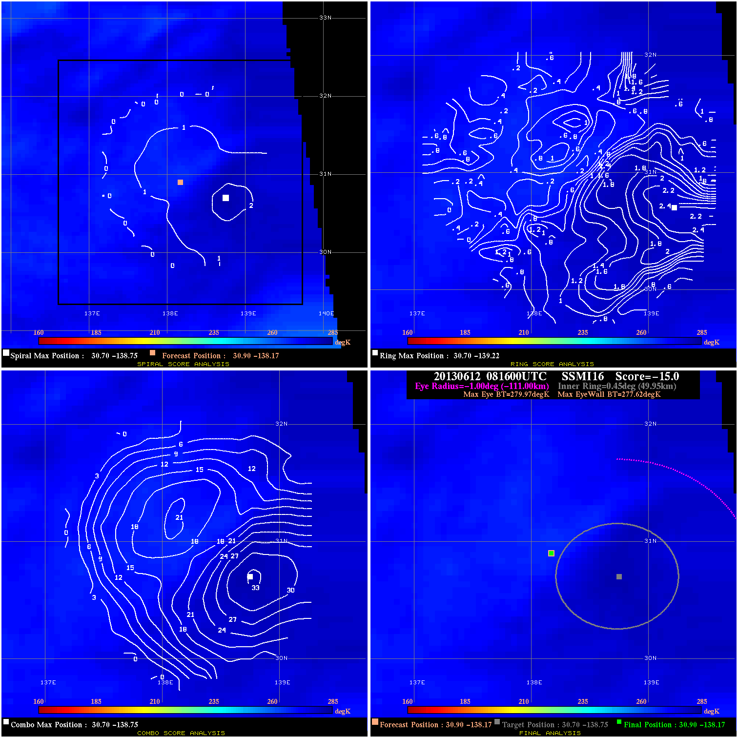
20130612 081600 -15.0 N/A N/A N/A 2.35 35.0 SSMI16 30.9 -138.2 30.9 -138.2 30.7 -138.8 Analysis Plot
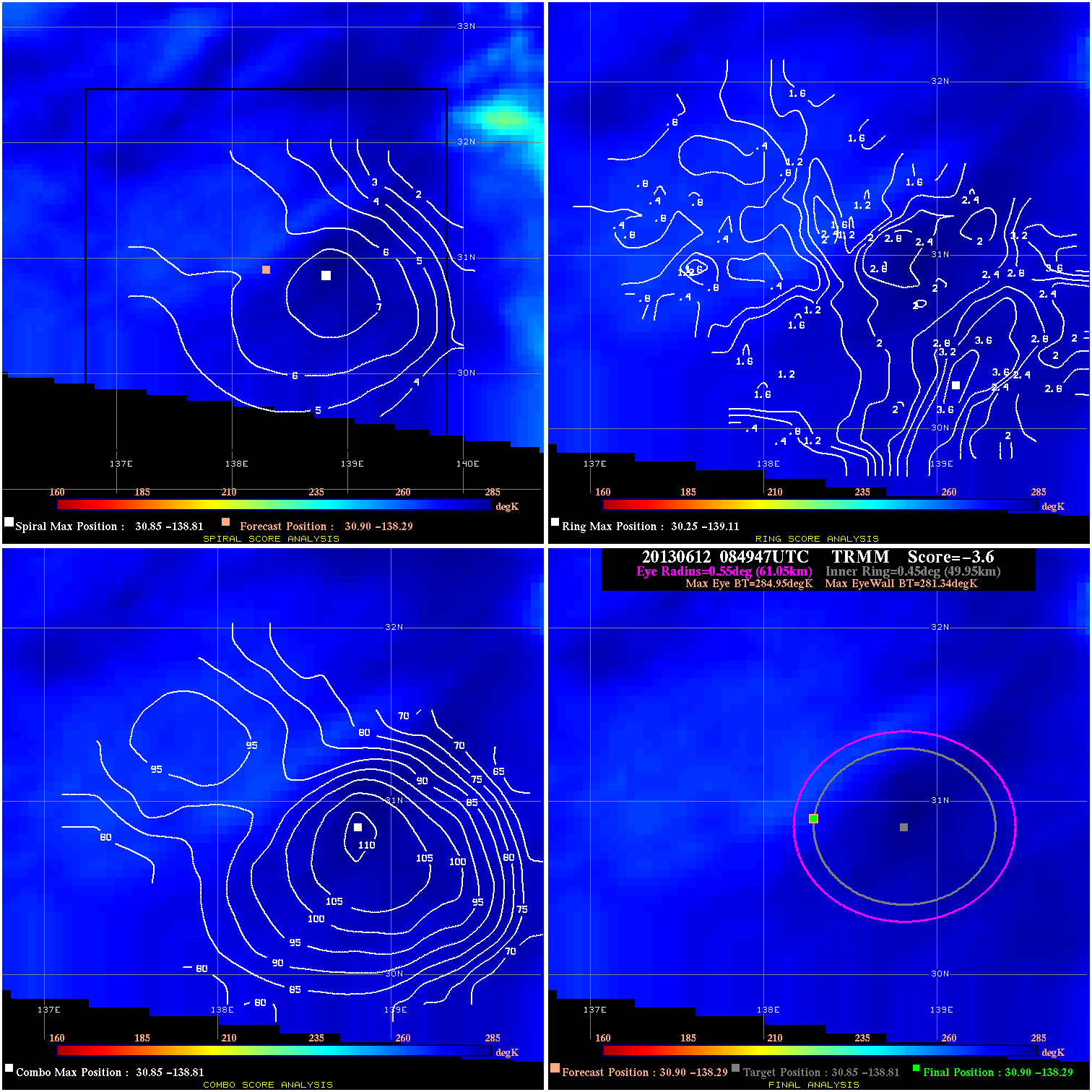
20130612 084947 -3.6 N/A N/A 122.21 3.61 35.0 TRMM 30.9 -138.3 30.9 -138.3 30.9 -138.8 Analysis Plot
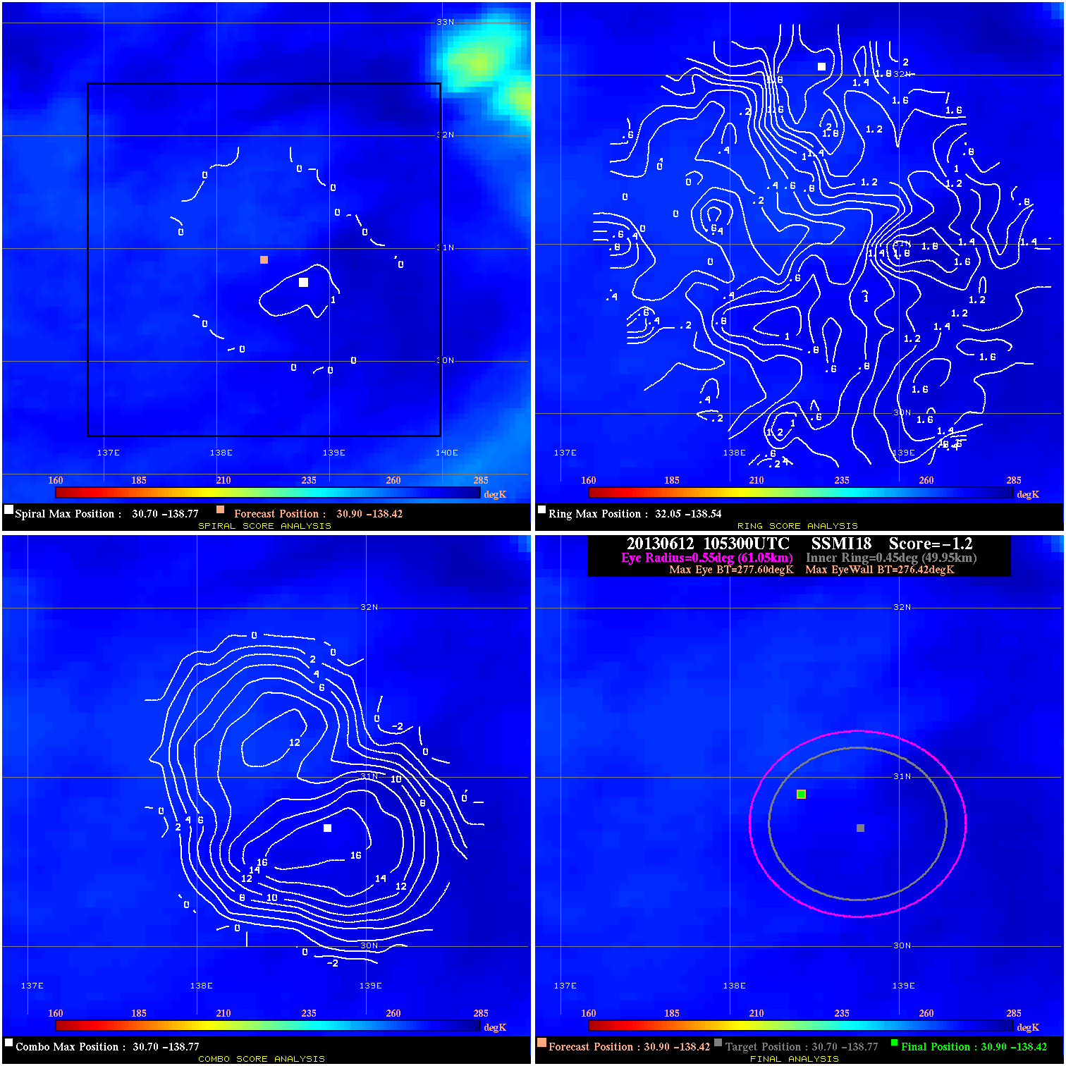
20130612 105300 -1.2 N/A N/A 122.21 1.18 35.0 SSMI18 30.9 -138.4 30.9 -138.4 30.7 -138.8 Analysis Plot
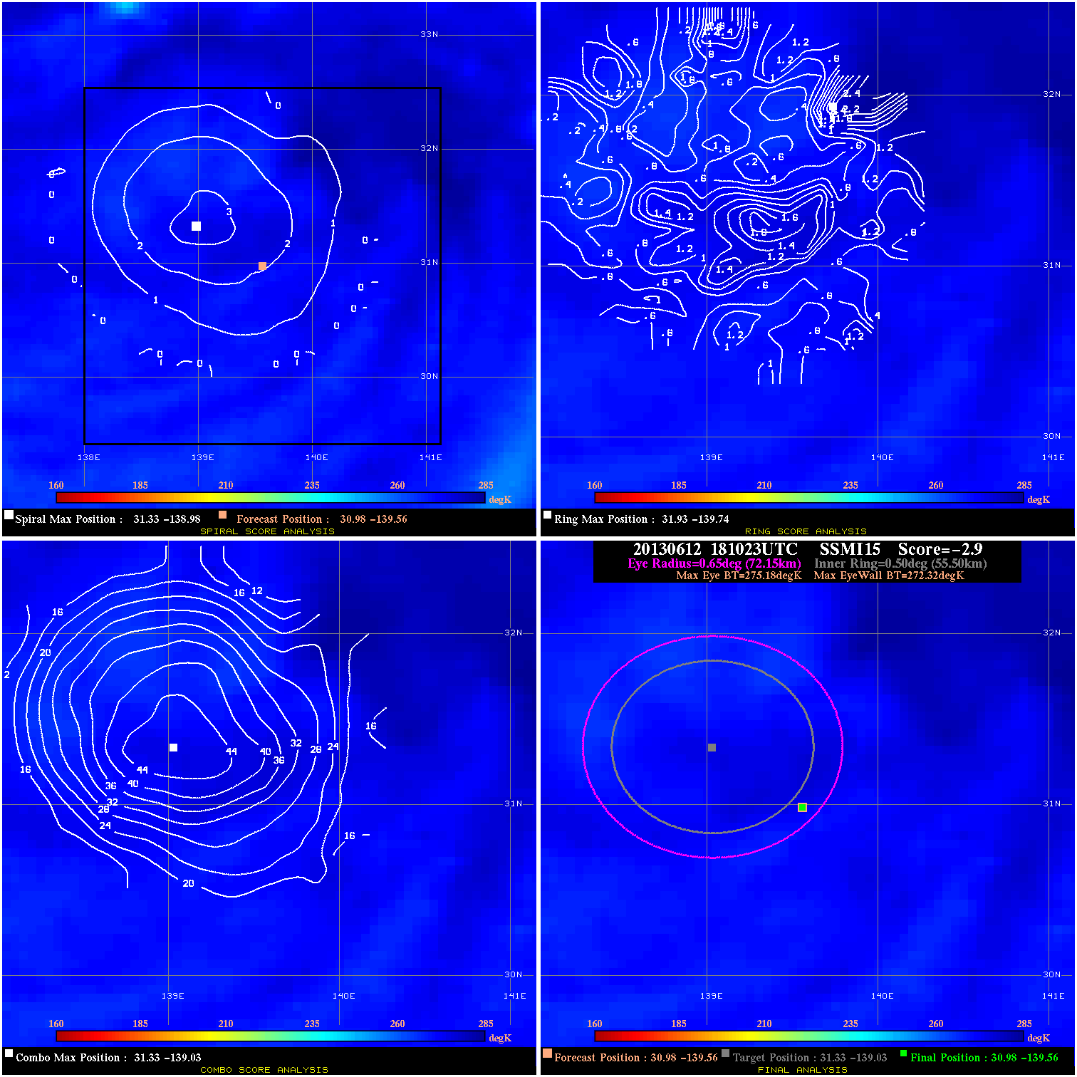
20130612 181023 -2.9 N/A N/A 144.43 2.86 25.0 SSMI15 31.0 -139.6 31.0 -139.6 31.3 -139.0 Analysis Plot
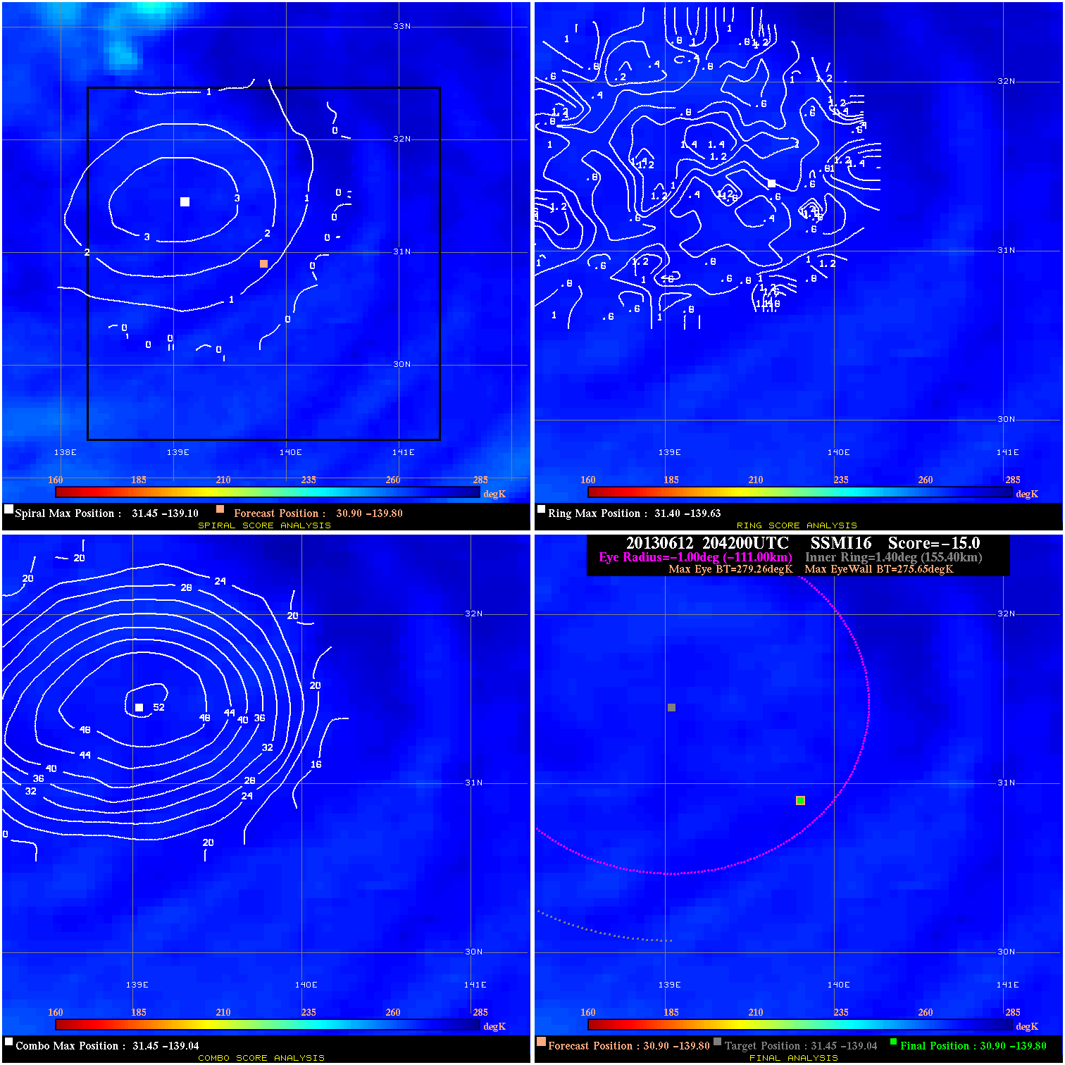
20130612 204200 -15.0 N/A N/A N/A 3.61 25.0 SSMI16 30.9 -139.8 30.9 -139.8 31.4 -139.0 Analysis Plot
|
|
Legend: - Date/Time are determined from PMW imagery at Forecast (initial guess) Lat/Lon position. - Positive/Negative Latitude = North/South Hemisphere; Longitude = Western/Eastern Hemisphere. - "Ring Diam" value indicates the estimated surface eyewall diameter in km (the MI eyewall edge diameter minus 10 km). - "Ring Pct" is the percentage of the "ring" (eyewall inner boundary) that is 1) colder than the "hot spot" (warmest eye pixel) in the eye by 20K, or 2) the percentage that is a) colder than 232K and b) colder than the "hot spot" by 10K, whichever is greater. - Values are red if Ring % <= 65, yellow/brown if Ring % <= 85 and green if Ring % > 85. - "Tb diff" is the difference between the "hot spot" (warmest eye pixel) and the warmest pixel on the eyewall. - Intensity score are listed as negative, and not used, when the JTWC or NHC estimated Vmax is <50 kts in order to rule out weak but highly symmetric TCs. - Error messages in intensity scores: -920 is used when the hottest pixel in the eye is <200K, to prevent false positives; -909 is a failure to process (bad input data). |