Tropical Storm 17W
|
Passive Microwave (PMW) Intensity Information Advanced Dvorak Technique (ADT) Version 8.2.1 |
Overpass Inten Ring Ring Wind Forecast Final Target
Date Time Score Meaning Pct Diam BTdiff Est Sat Lat Lon Lat Lon Lat Lon
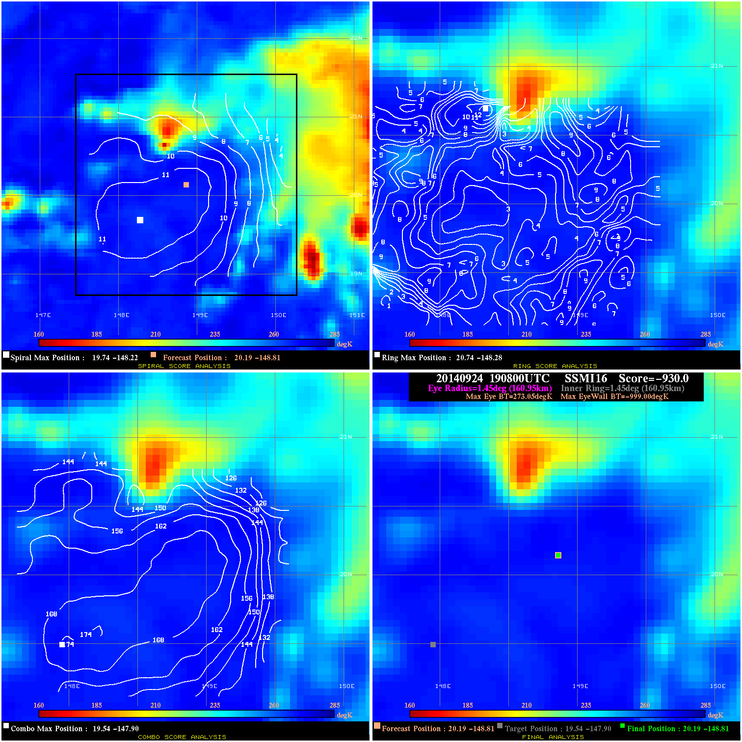
20140924 190800 -930.0 N/A N/A 322.19 1272.0 30.0 SSMI16 20.2 -148.8 20.2 -148.8 19.5 -147.9 Analysis Plot
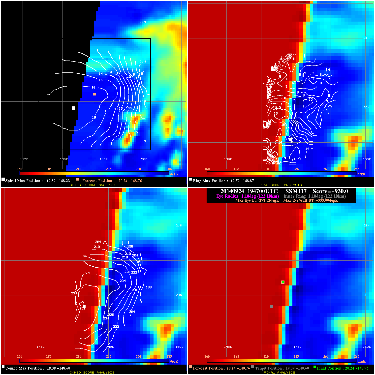
20140924 194700 -930.0 N/A N/A 244.42 1272.0 30.0 SSMI17 20.2 -148.8 20.2 -148.8 19.9 -148.6 Analysis Plot
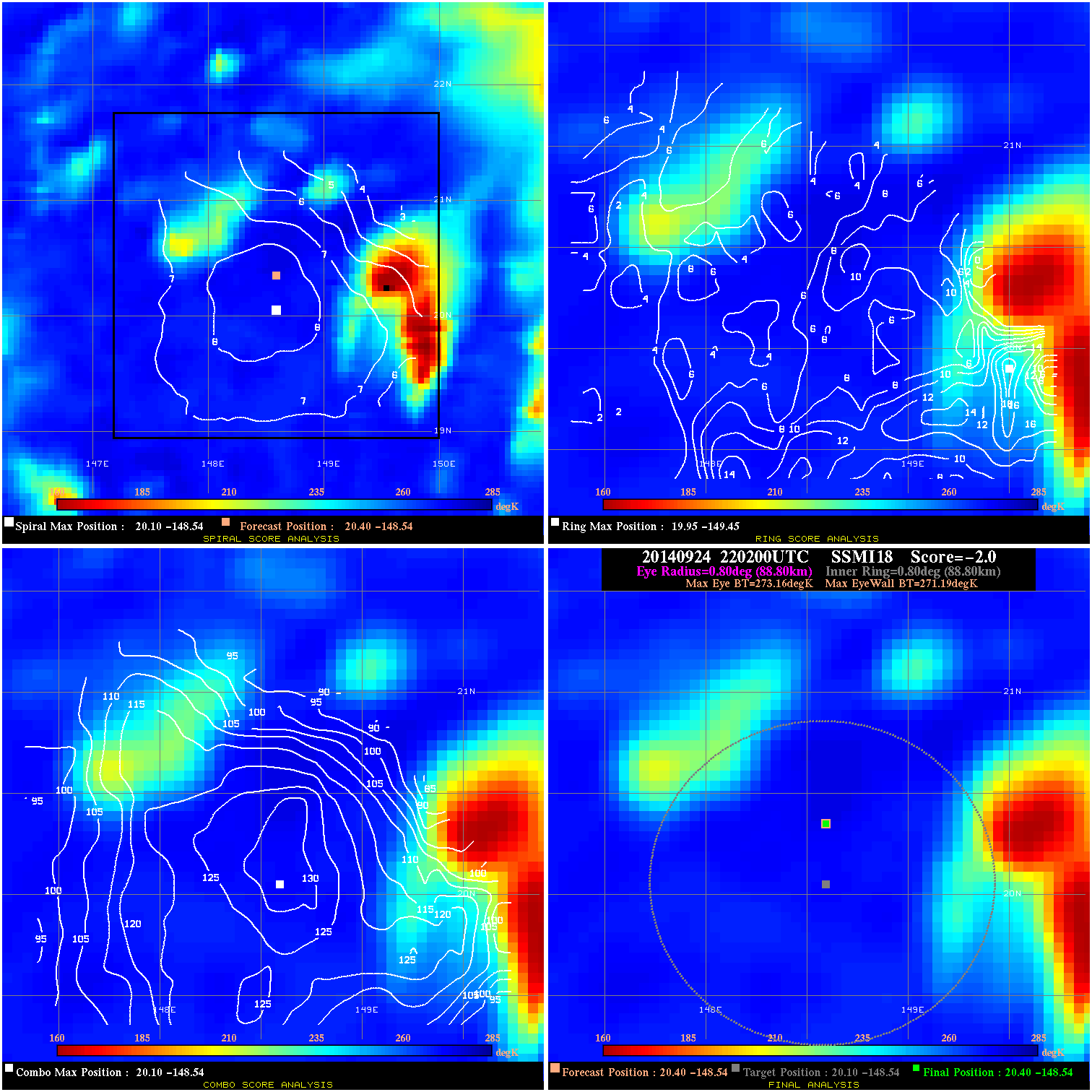
20140924 220200 -2.0 N/A 27.4% 177.76 1.97 30.0 SSMI18 20.4 -148.5 20.4 -148.5 20.1 -148.5 Analysis Plot
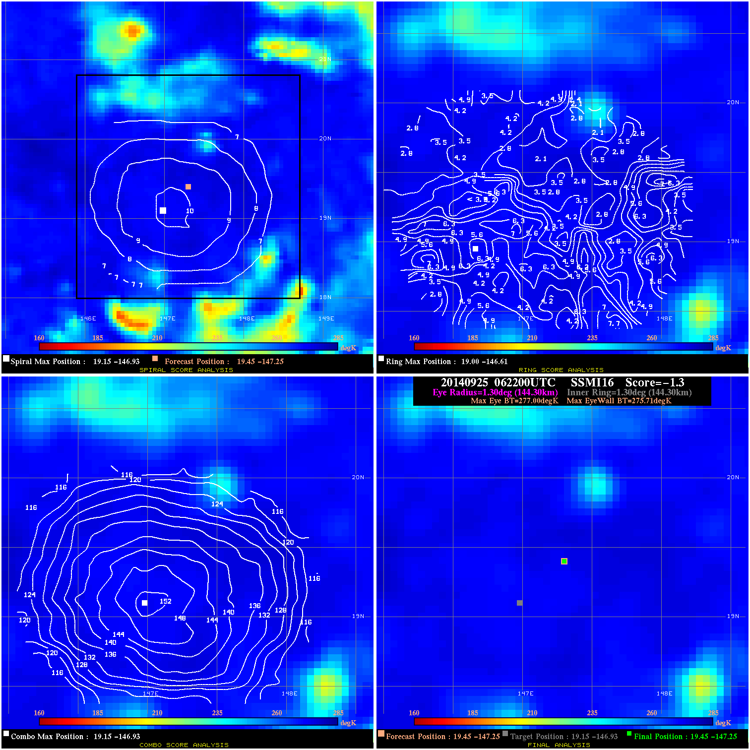
20140925 062200 -1.3 N/A 9.6% 288.86 1.29 30.0 SSMI16 19.5 -147.3 19.5 -147.3 19.1 -146.9 Analysis Plot
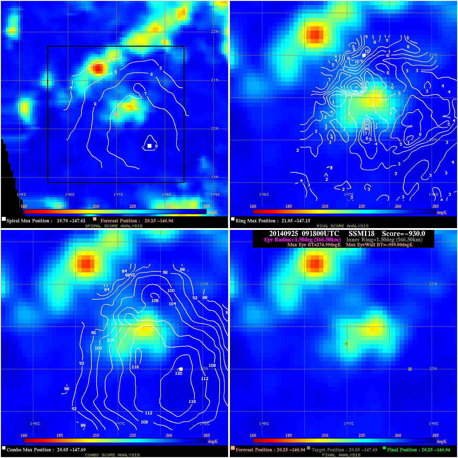
20140925 091800 -930.0 N/A N/A 333.30 1273.9 30.0 SSMI18 20.4 -146.9 20.4 -146.9 20.0 -147.7 Analysis Plot
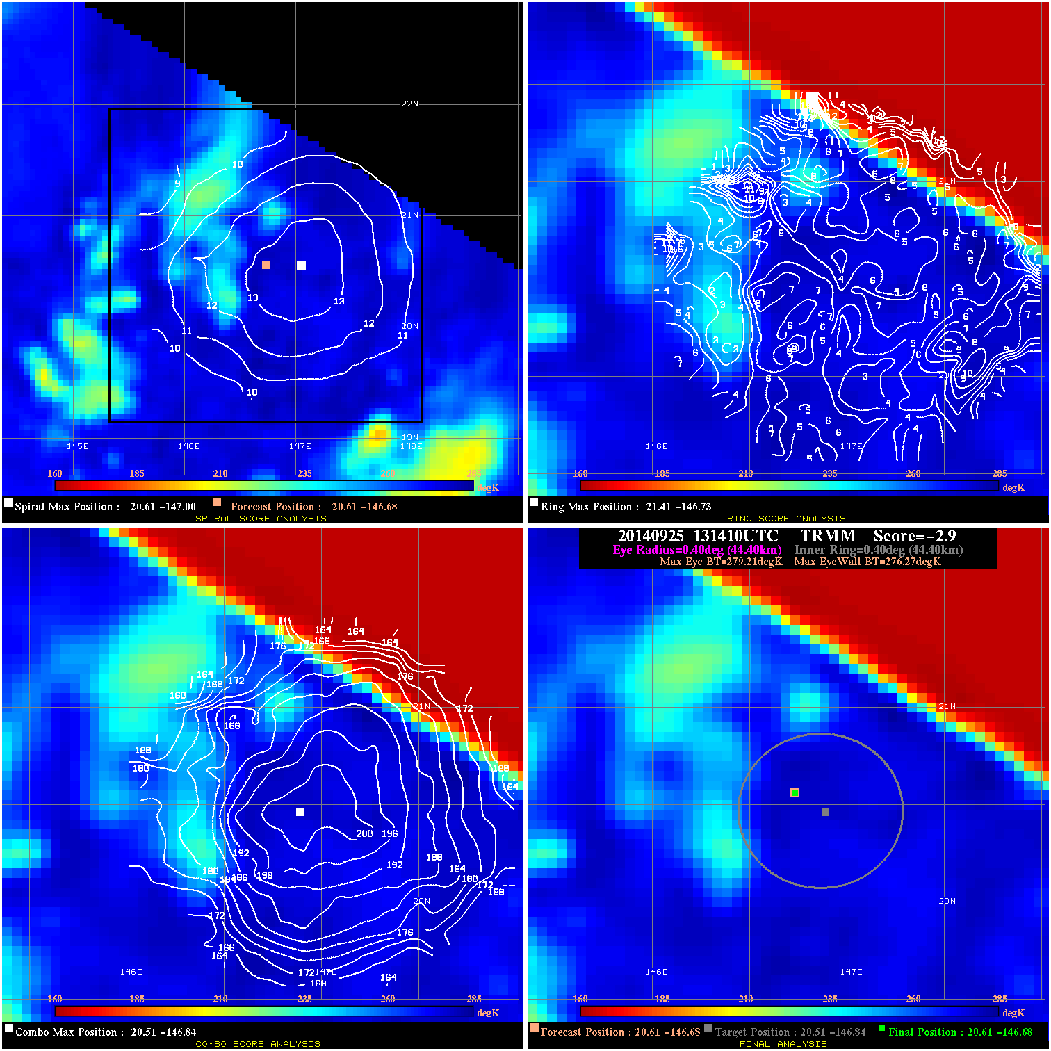
20140925 131410 -2.9 N/A N/A 88.88 2.94 35.0 TRMM 20.6 -146.7 20.6 -146.7 20.5 -146.8 Analysis Plot
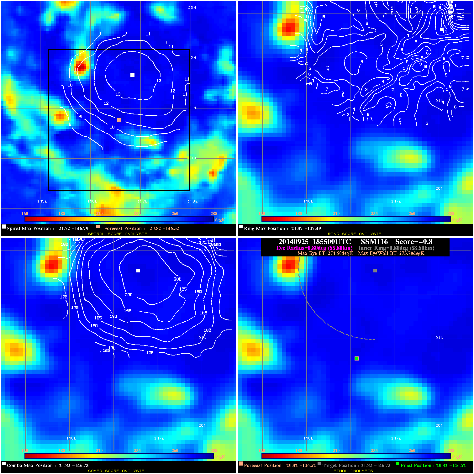
20140925 185500 -0.8 N/A 6.8% 177.76 .80 40.0 SSMI16 20.8 -146.5 20.8 -146.5 21.8 -146.7 Analysis Plot
20140925 215000 -930.0 N/A N/A 322.19 1275.4 40.0 SSMI18 21.1 -146.3 21.1 -146.3 21.8 -146.8 Analysis Plot
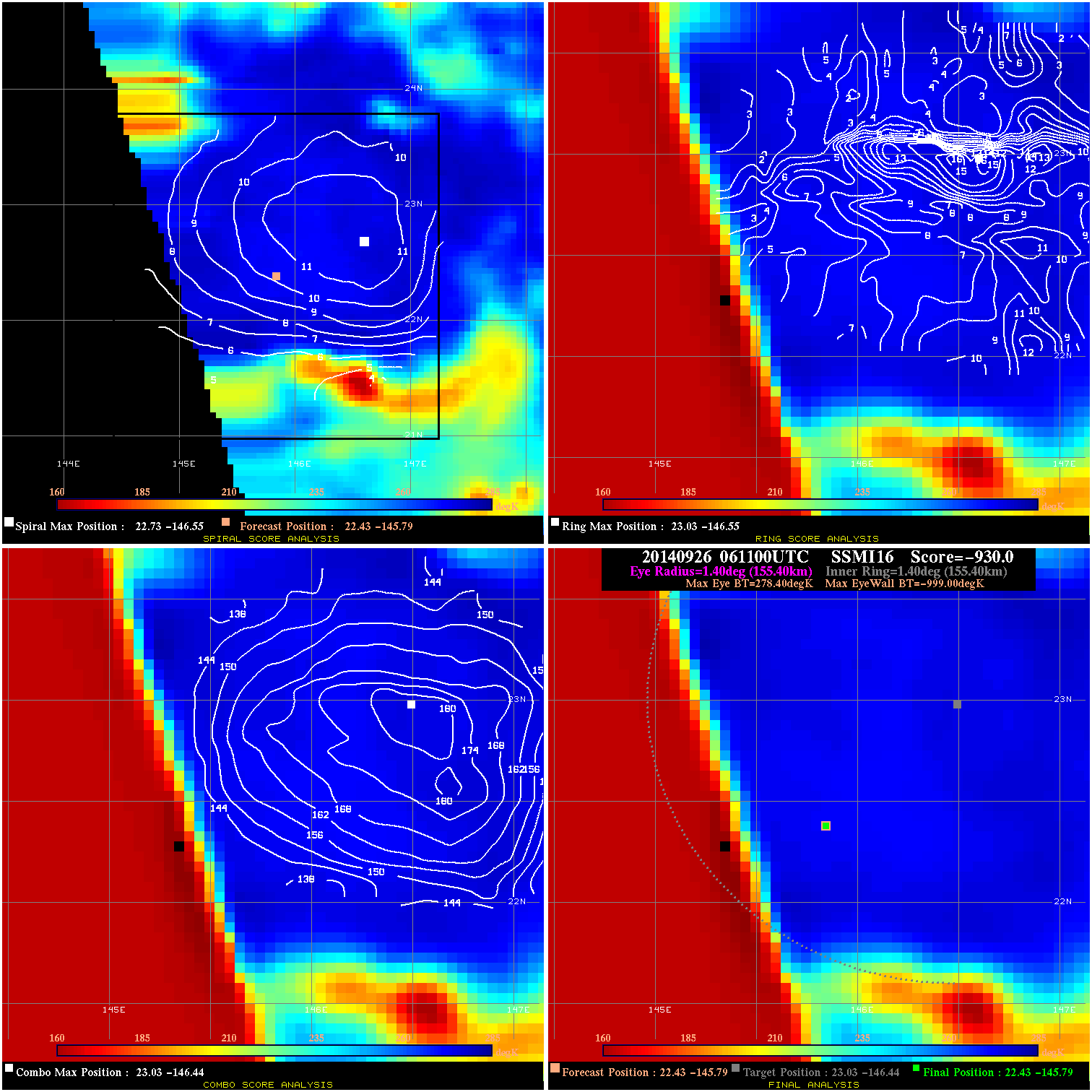
20140926 061100 -930.0 N/A N/A 311.08 1277.4 45.0 SSMI16 22.4 -145.8 22.4 -145.8 23.0 -146.4 Analysis Plot
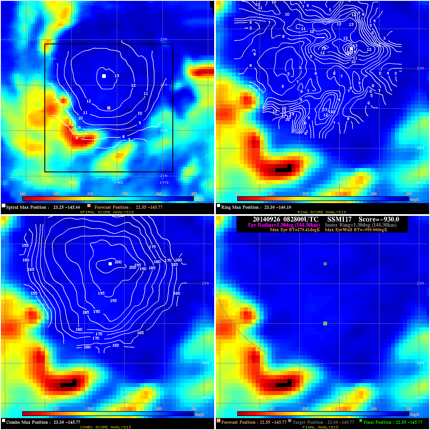
20140926 082800 -930.0 N/A N/A 288.86 1278.4 45.0 SSMI17 22.5 -145.8 22.5 -145.8 23.3 -145.8 Analysis Plot
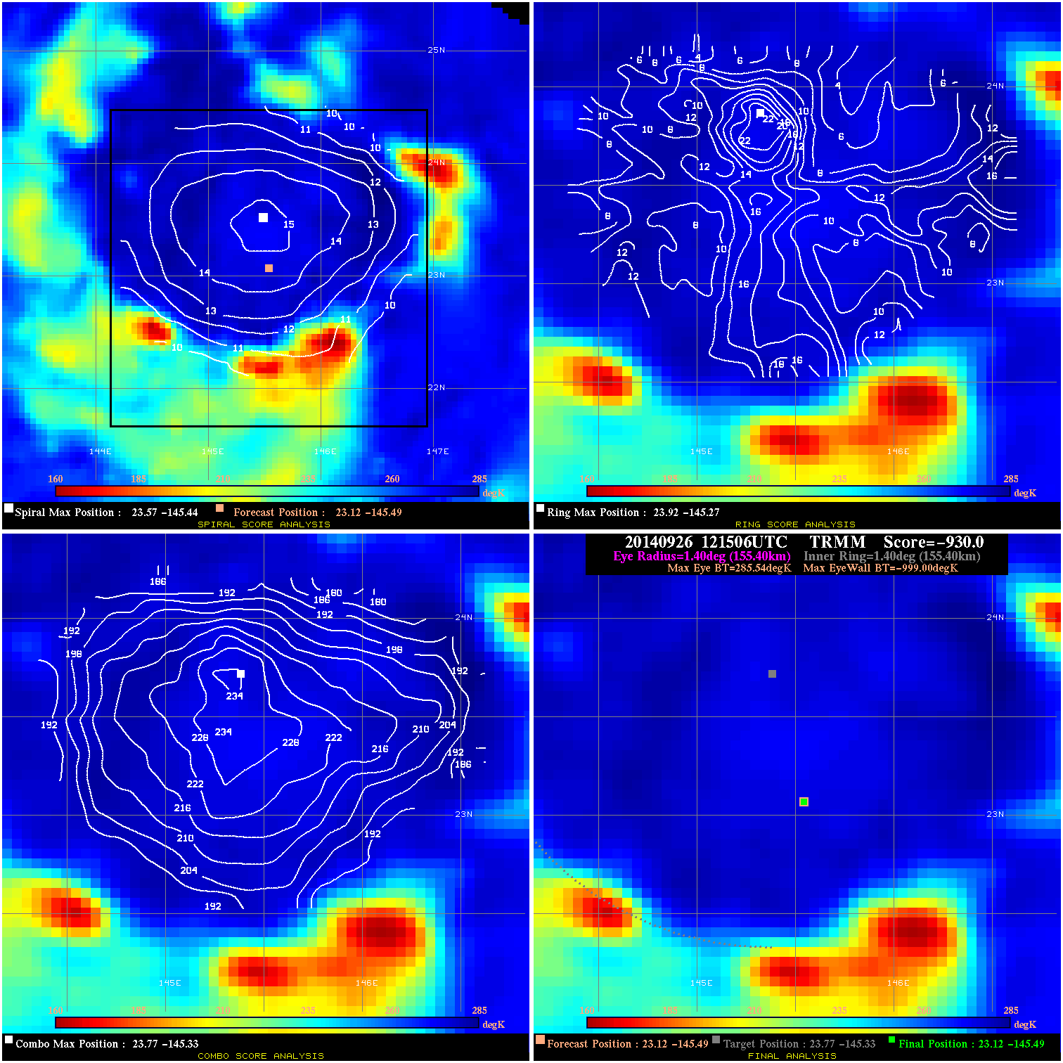
20140926 121506 -930.0 N/A N/A 311.08 1284.5 55.0 TRMM 23.1 -145.5 23.1 -145.5 23.8 -145.3 Analysis Plot
20140926 184200 -930.0 N/A N/A 311.08 1276.5 55.0 SSMI16 24.0 -145.0 24.0 -145.0 24.4 -144.8 Analysis Plot
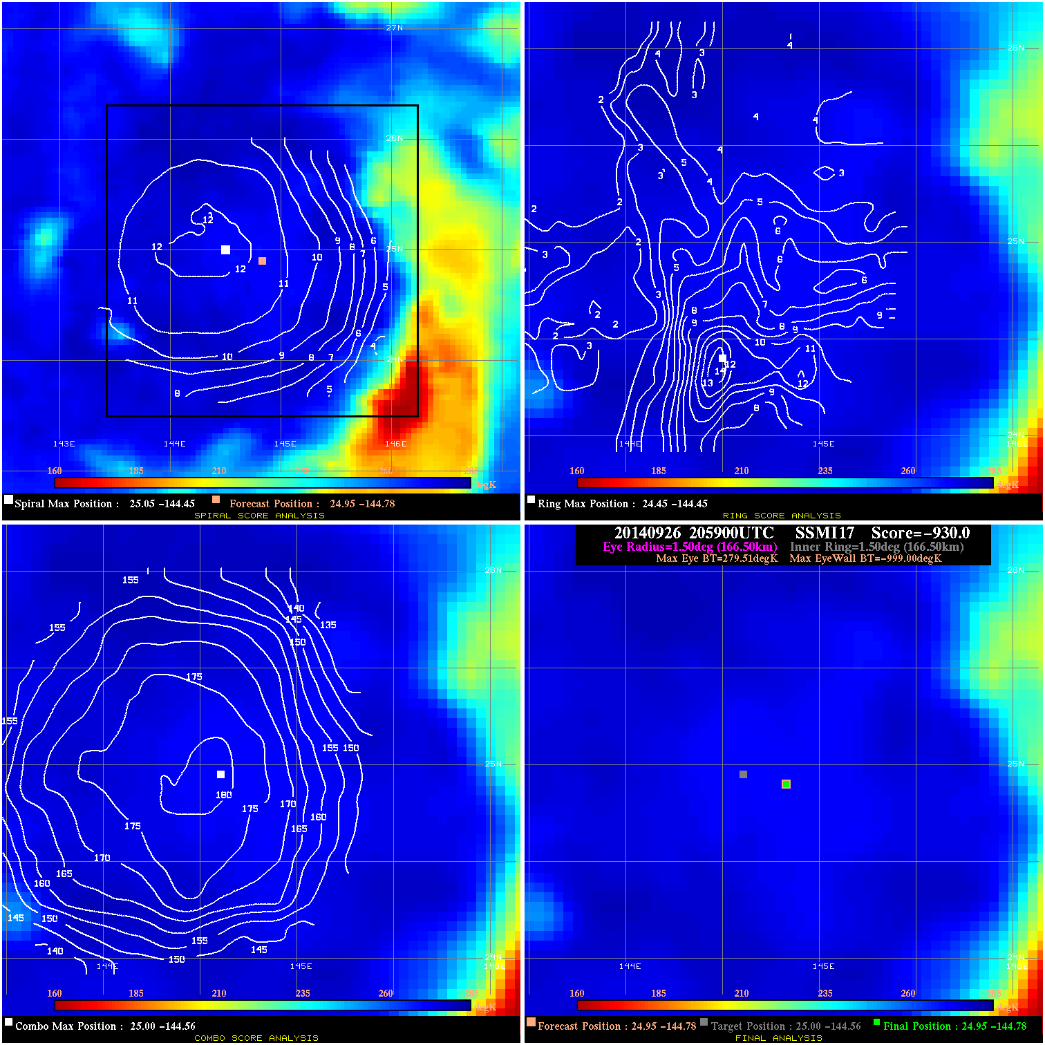
20140926 205900 -930.0 N/A N/A 333.30 1278.5 55.0 SSMI17 25.0 -144.8 25.0 -144.8 25.0 -144.6 Analysis Plot
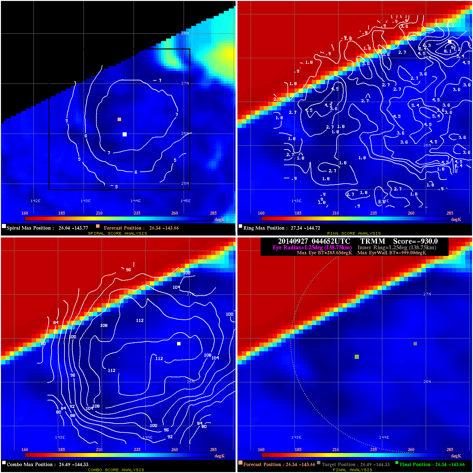
20140927 044652 -930.0 N/A N/A 277.75 1284.6 55.0 TRMM 26.3 -143.7 26.3 -143.7 26.5 -144.3 Analysis Plot
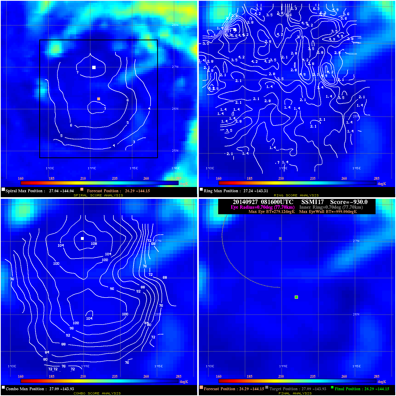
20140927 081600 -930.0 N/A N/A 155.54 1278.1 55.0 SSMI17 26.3 -144.1 26.3 -144.1 27.1 -143.9 Analysis Plot
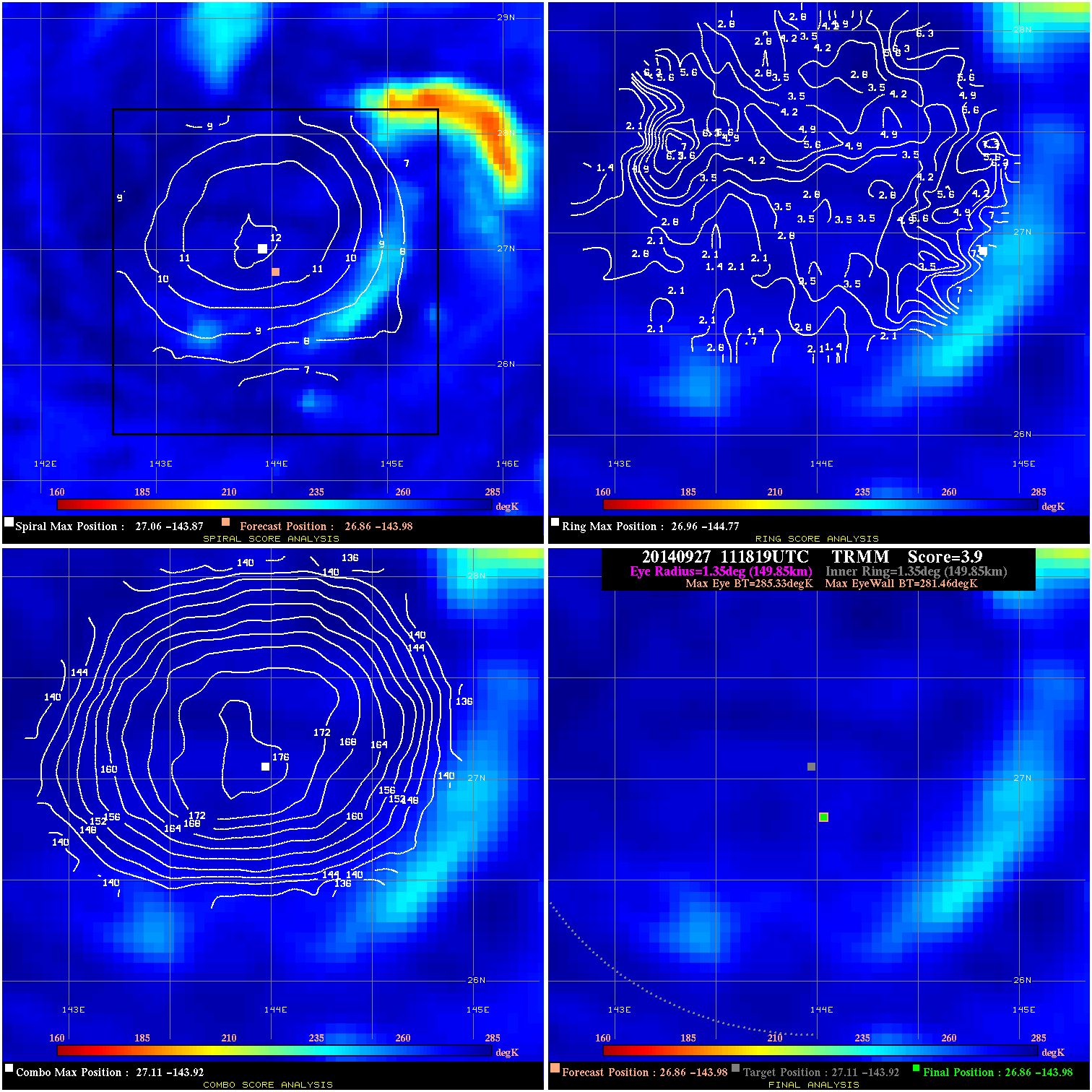
20140927 111819 3.9 N/A 4.1% 299.97 3.87 55.0 TRMM 26.9 -144.0 26.9 -144.0 27.1 -143.9 Analysis Plot
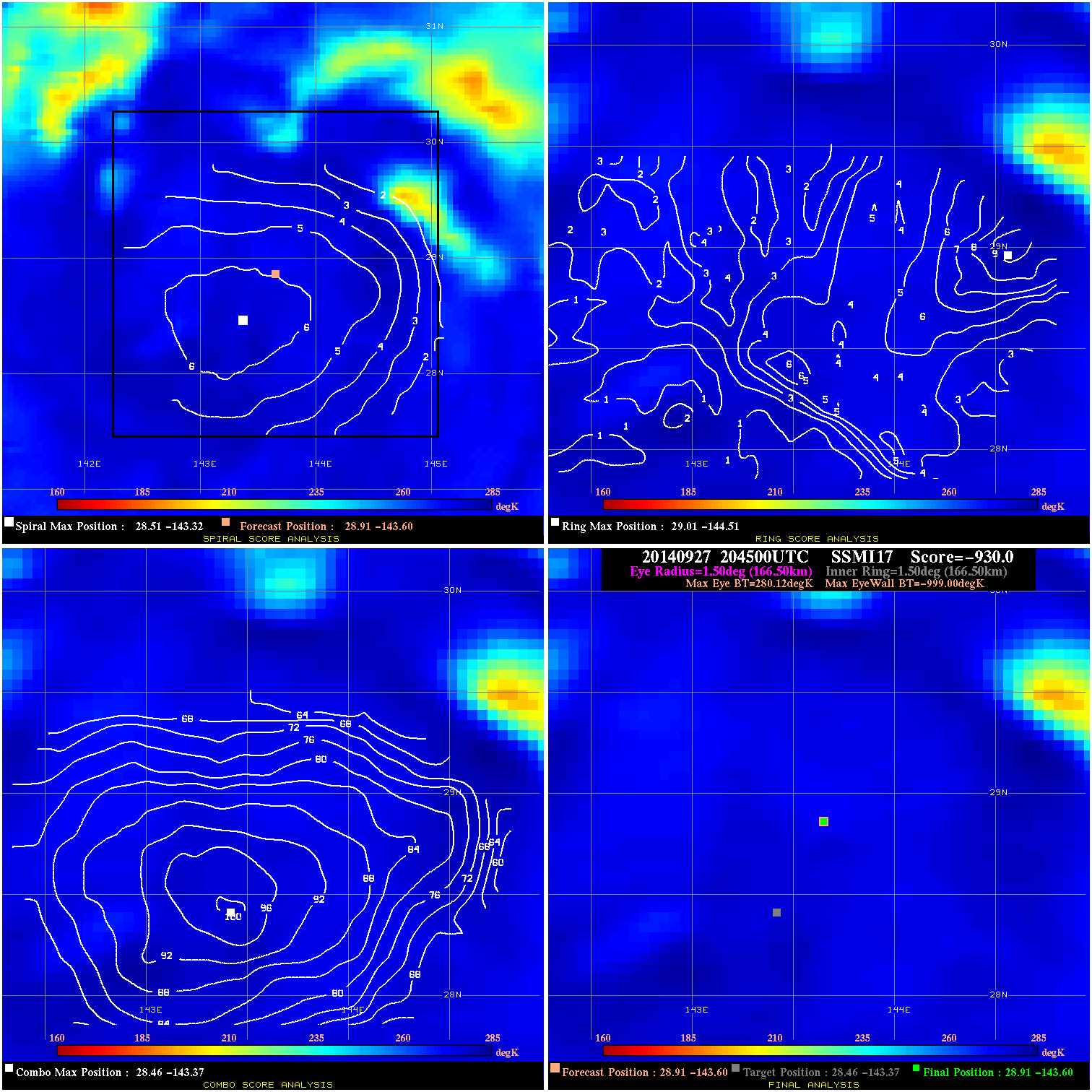
20140927 204500 -930.0 N/A N/A 333.30 1279.1 50.0 SSMI17 28.9 -143.6 28.9 -143.6 28.5 -143.4 Analysis Plot
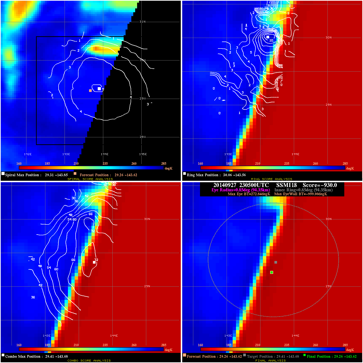
20140927 230500 -930.0 N/A N/A 188.87 1271.8 50.0 SSMI18 29.3 -143.6 29.3 -143.6 29.4 -143.7 Analysis Plot
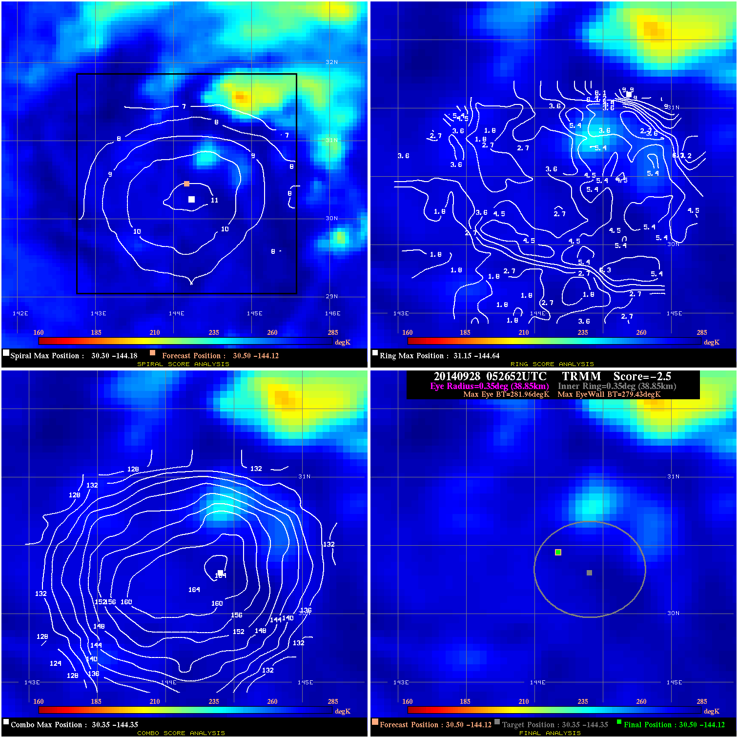
20140928 052652 -2.5 N/A N/A 77.77 2.53 45.0 TRMM 30.5 -144.1 30.5 -144.1 30.4 -144.4 Analysis Plot
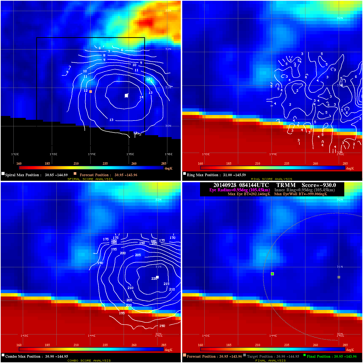
20140928 084144 -930.0 N/A N/A 211.09 1281.1 50.0 TRMM 31.0 -144.0 31.0 -144.0 30.9 -144.9 Analysis Plot
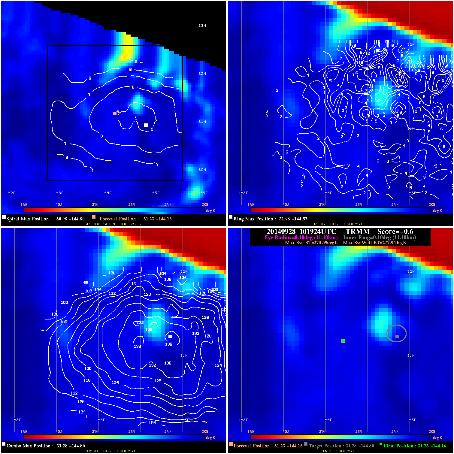
20140928 101924 -0.6 N/A N/A 22.22 .63 50.0 TRMM 31.2 -144.2 31.2 -144.2 31.3 -144.8 Analysis Plot
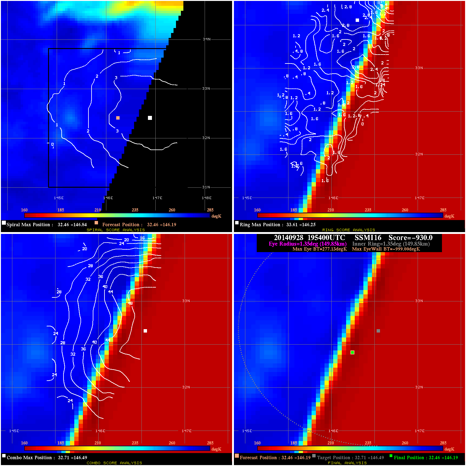
20140928 195400 -930.0 N/A N/A 299.97 1276.1 45.0 SSMI16 32.5 -146.2 32.5 -146.2 32.7 -146.5 Analysis Plot
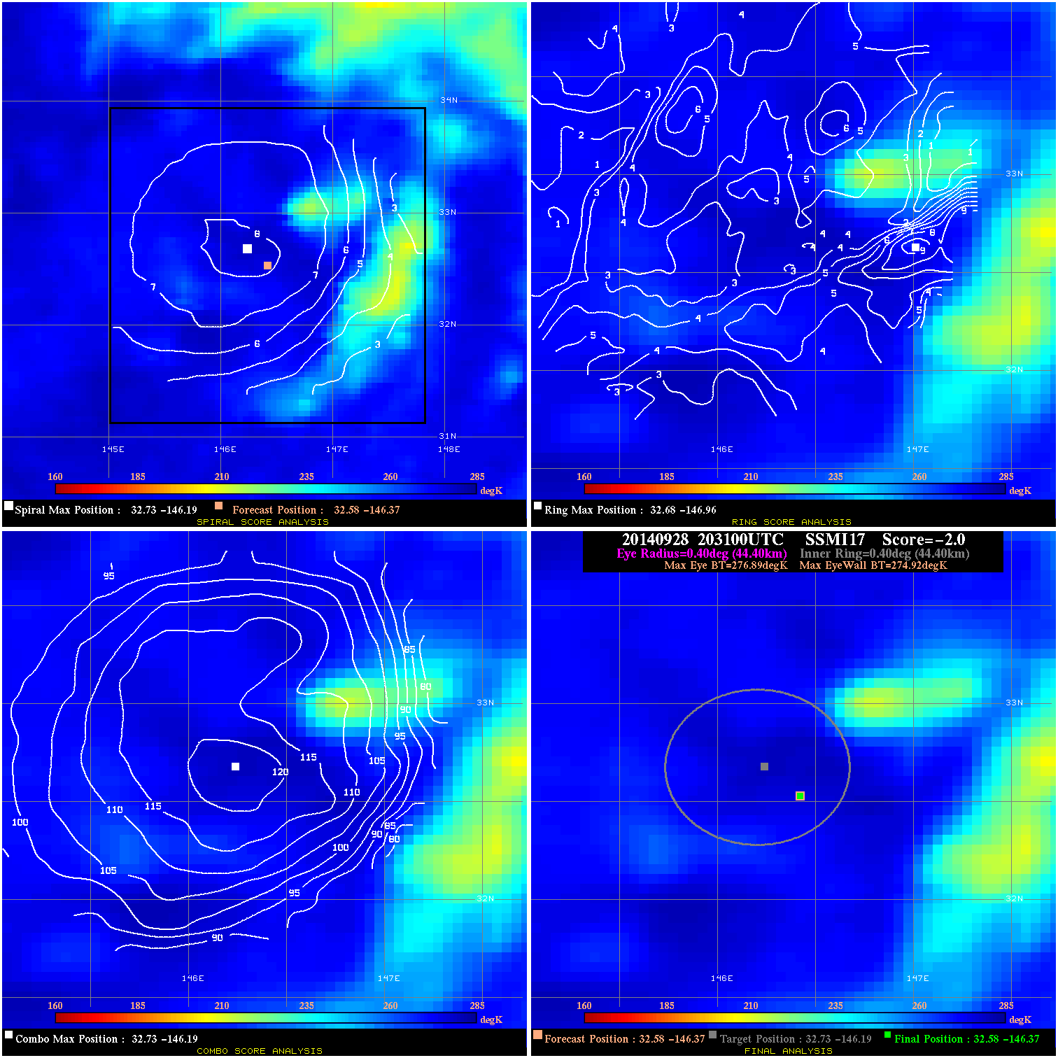
20140928 203100 -2.0 N/A 4.1% 88.88 1.97 45.0 SSMI17 32.6 -146.4 32.6 -146.4 32.7 -146.2 Analysis Plot
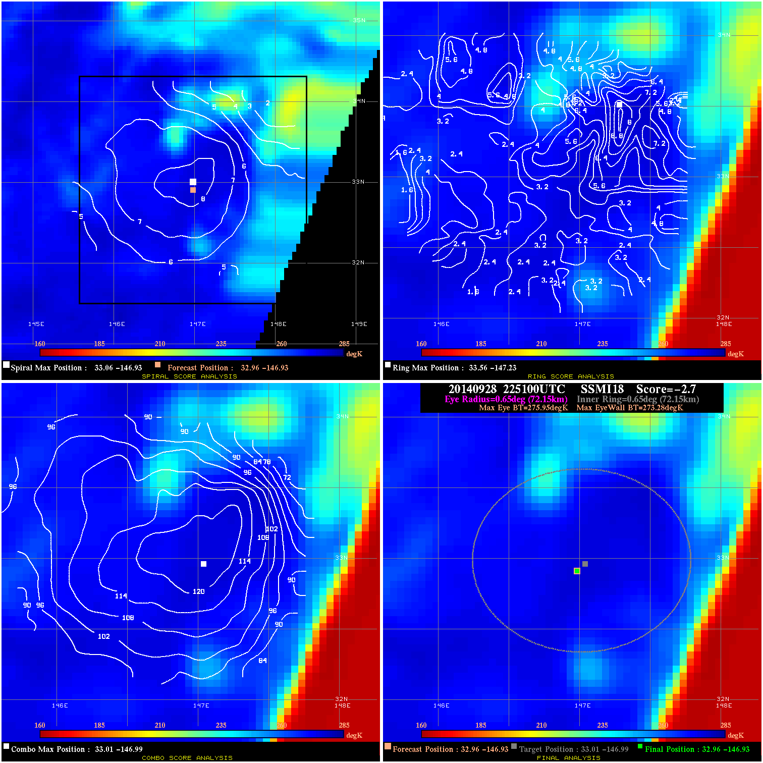
20140928 225100 -2.7 N/A 1.4% 144.43 2.67 45.0 SSMI18 33.0 -146.9 33.0 -146.9 33.0 -147.0 Analysis Plot
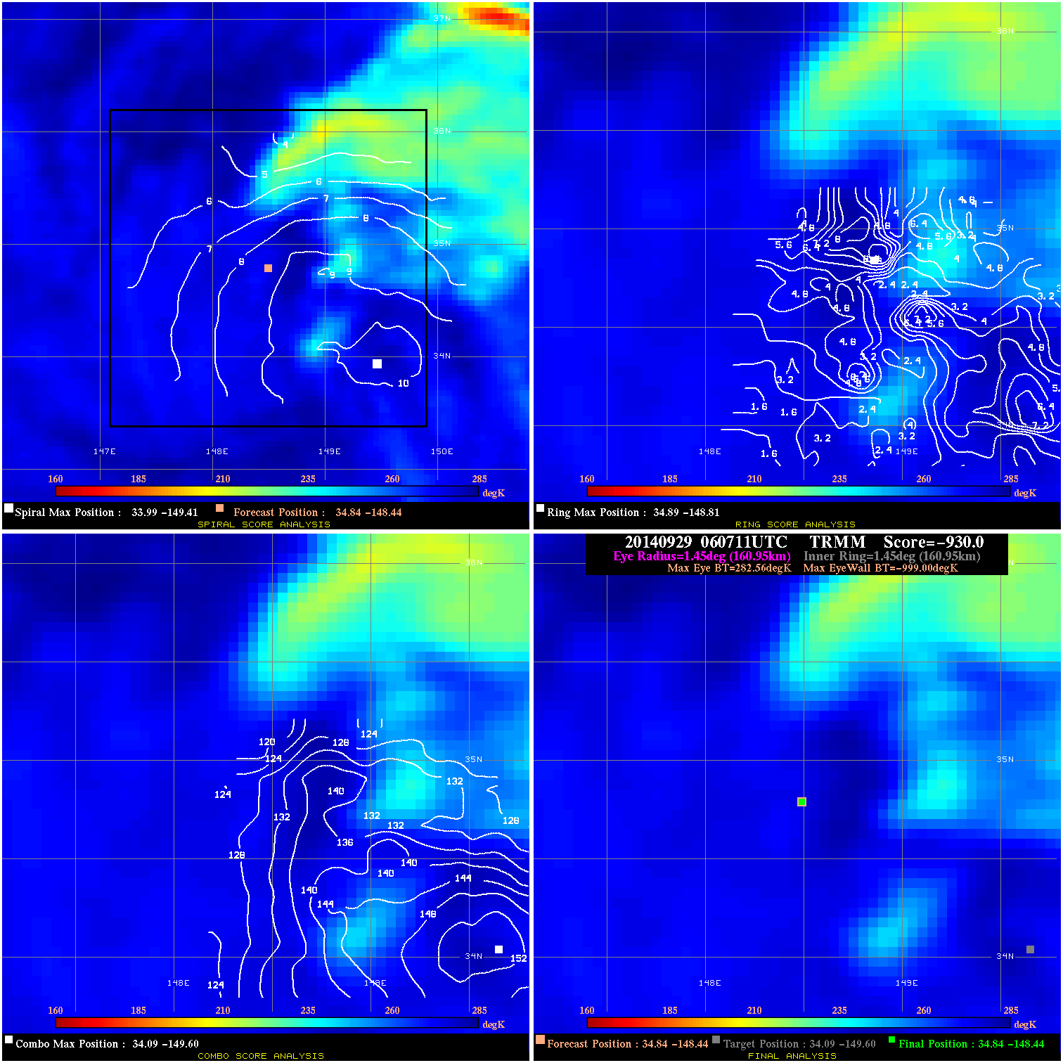
20140929 060711 -930.0 N/A N/A 322.19 1281.5 45.0 TRMM 34.8 -148.4 34.8 -148.4 34.1 -149.6 Analysis Plot
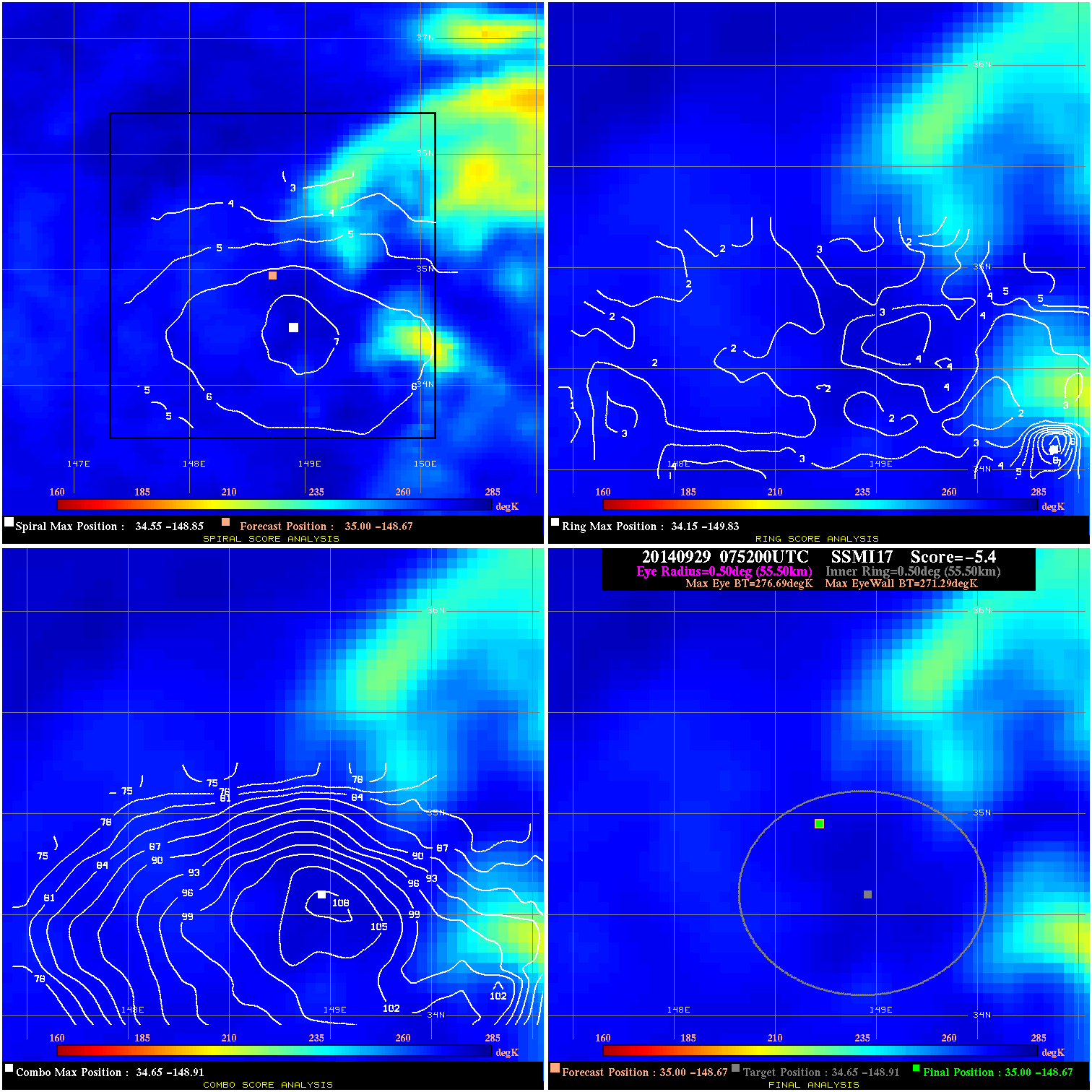
20140929 075200 -5.4 N/A N/A 111.10 5.40 45.0 SSMI17 35.0 -148.7 35.0 -148.7 34.7 -148.9 Analysis Plot
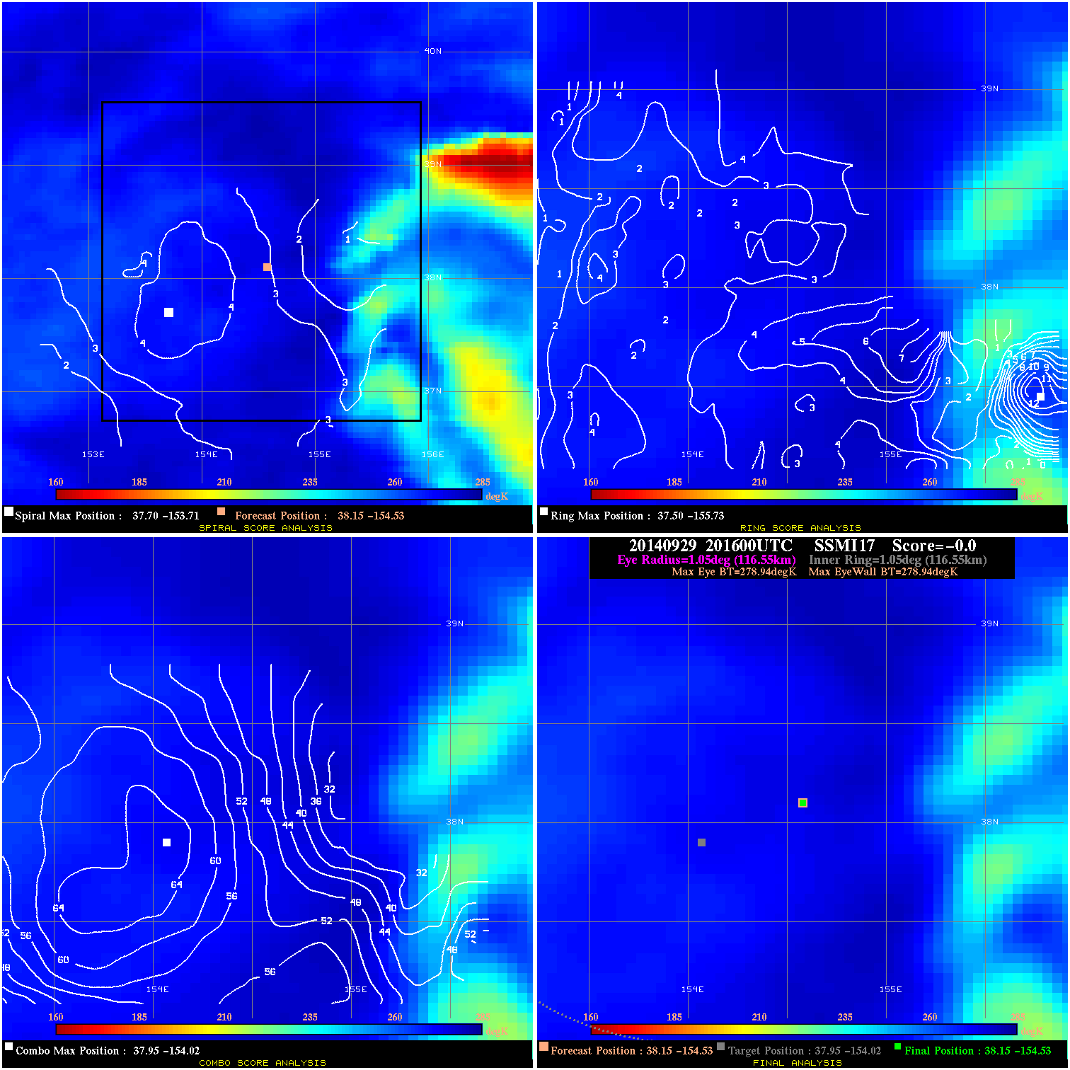
20140929 201600 -0.0 N/A N/A N/A 0.00 45.0 SSMI17 38.2 -154.5 38.2 -154.5 38.0 -154.0 Analysis Plot
|
|
Legend: - Date/Time are determined from PMW imagery at Forecast (initial guess) Lat/Lon position. - Positive/Negative Latitude = North/South Hemisphere; Longitude = Western/Eastern Hemisphere. - "Ring Diam" value indicates the estimated surface eyewall diameter in km (the MI eyewall edge diameter minus 10 km). - "Ring Pct" is the percentage of the "ring" (eyewall inner boundary) that is 1) colder than the "hot spot" (warmest eye pixel) in the eye by 20K, or 2) the percentage that is a) colder than 232K and b) colder than the "hot spot" by 10K, whichever is greater. - Values are red if Ring % <= 65, yellow/brown if Ring % <= 85 and green if Ring % > 85. - "Tb diff" is the difference between the "hot spot" (warmest eye pixel) and the warmest pixel on the eyewall. - Intensity score are listed as negative, and not used, when the JTWC or NHC estimated Vmax is <55 kts in order to rule out weak but highly symmetric TCs. - Error messages in intensity scores: -920 is used when the hottest pixel in the eye is <200K, to prevent false positives; -930 means <85% of eyewall has observations/data. |