Tropical Storm 10P
|
Passive Microwave (PMW) Intensity Information Advanced Dvorak Technique (ADT) Version 8.2.1 |
Overpass Inten Ring Ring Wind Forecast Final Target
Date Time Score Meaning Pct Diam BTdiff Est Sat Lat Lon Lat Lon Lat Lon
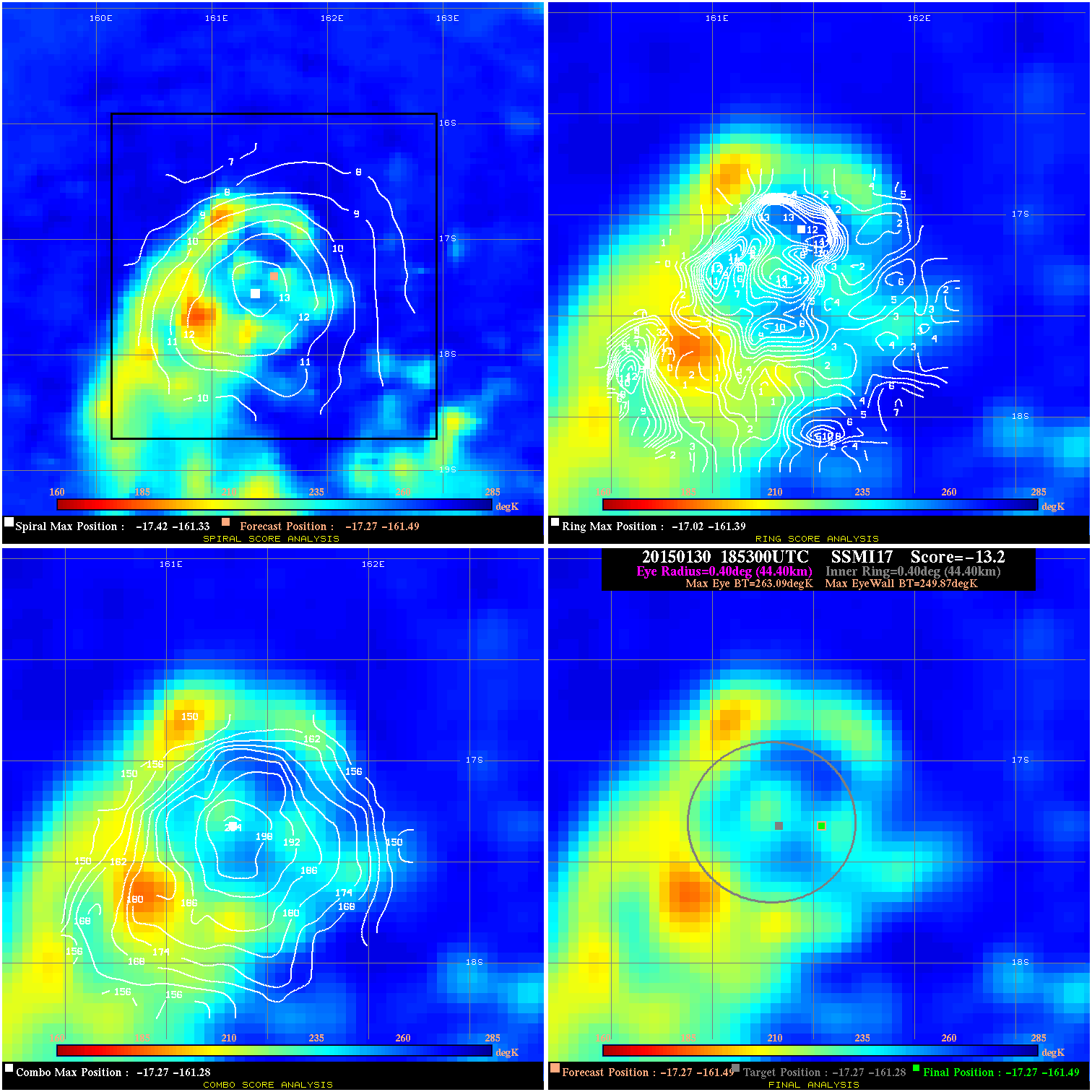
20150130 185300 -13.2 N/A 82.2% 88.88 13.22 35.0 SSMI17 -17.3 -161.5 -17.3 -161.5 -17.3 -161.3 Analysis Plot
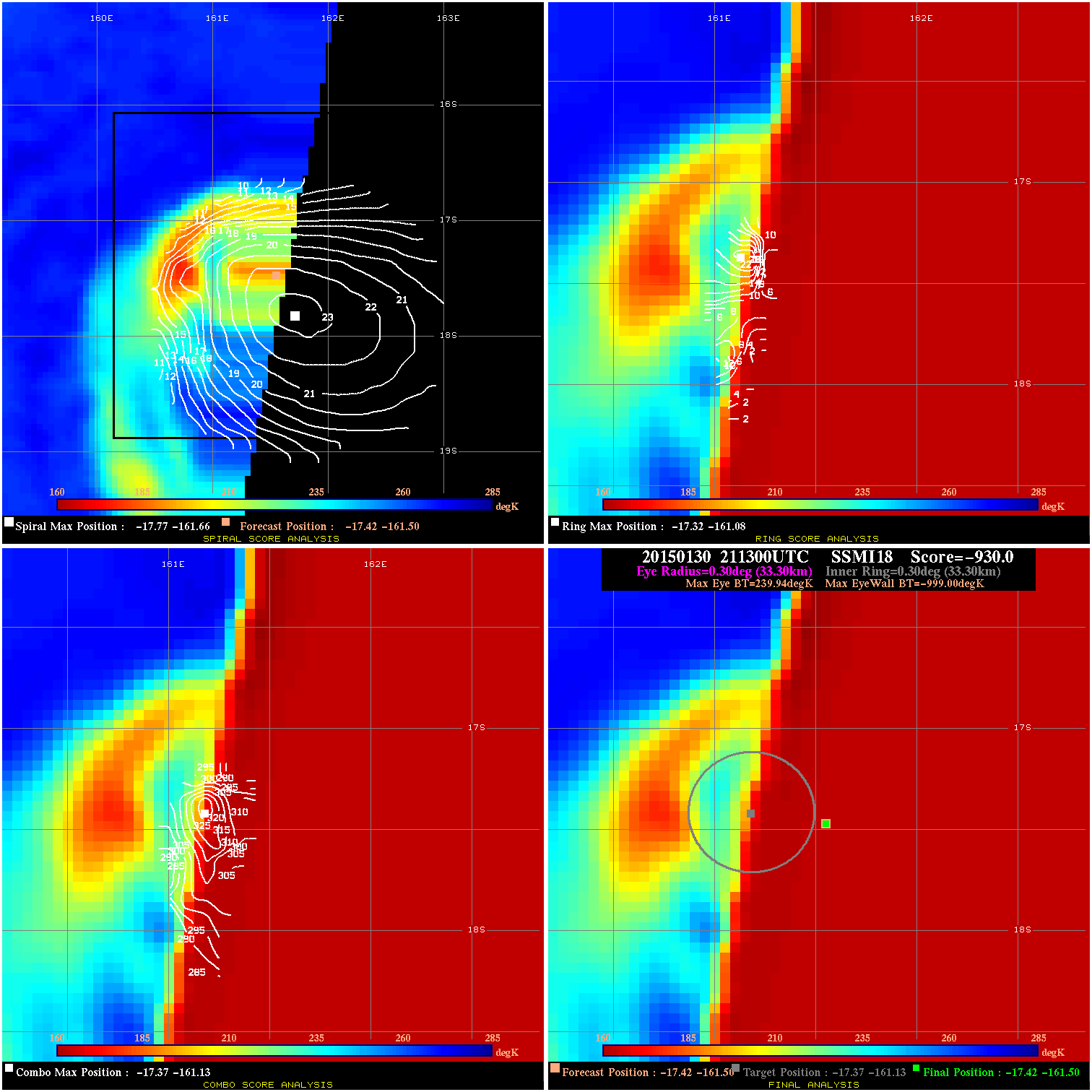
20150130 211300 -930.0 N/A N/A 66.66 1238.9 35.0 SSMI18 -17.4 -161.5 -17.4 -161.5 -17.4 -161.1 Analysis Plot
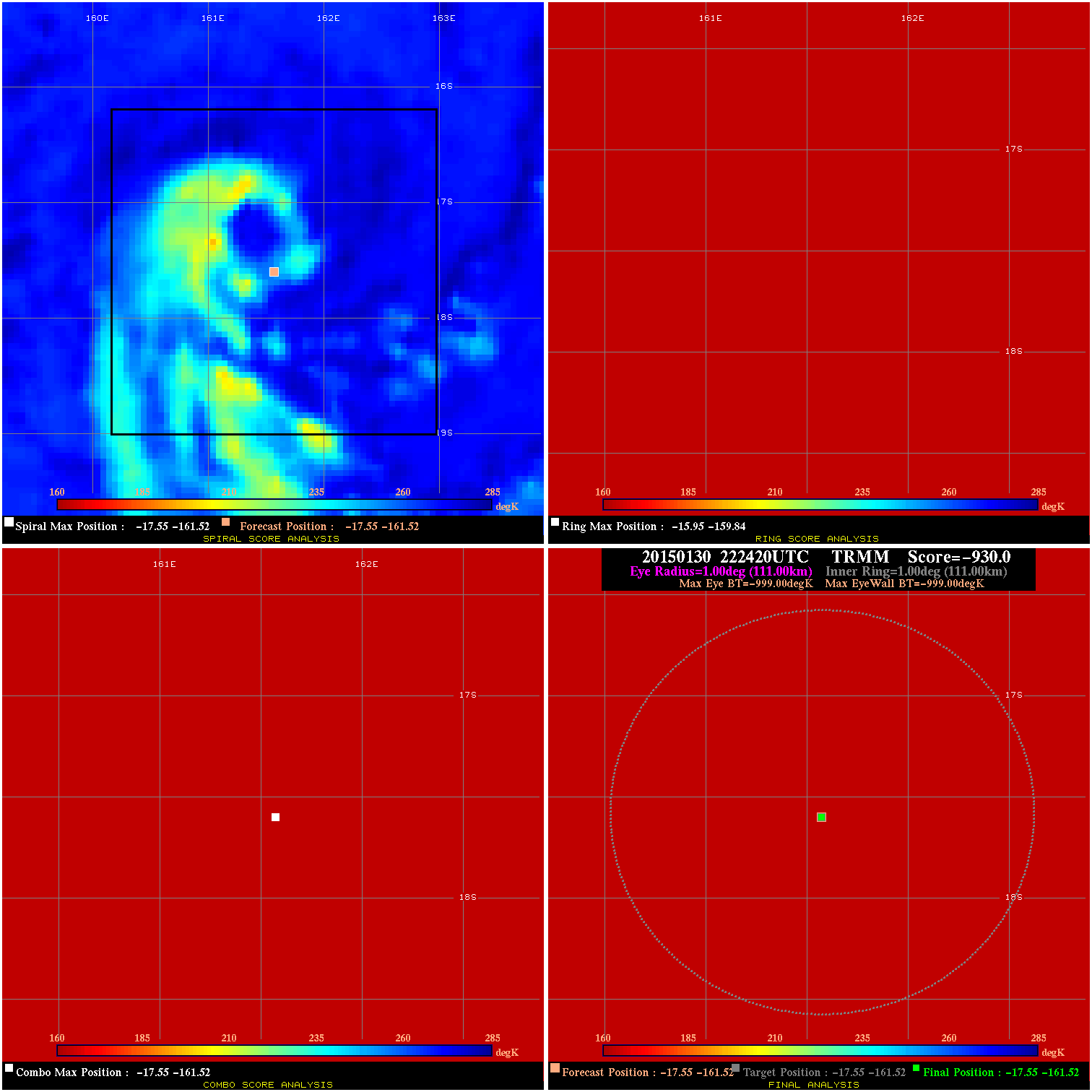
20150130 222420 -0.0 N/A N/A N/A 0.00 35.0 TRMM -17.5 -161.5 -17.5 -161.5 -17.5 -161.5 Analysis Plot
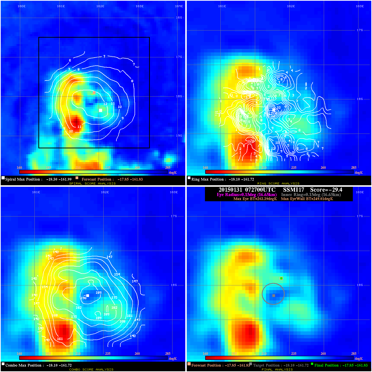
20150131 072700 -29.4 N/A 93.2% 33.33 14.38 45.0 SSMI17 -17.9 -161.8 -17.9 -161.8 -18.1 -161.7 Analysis Plot
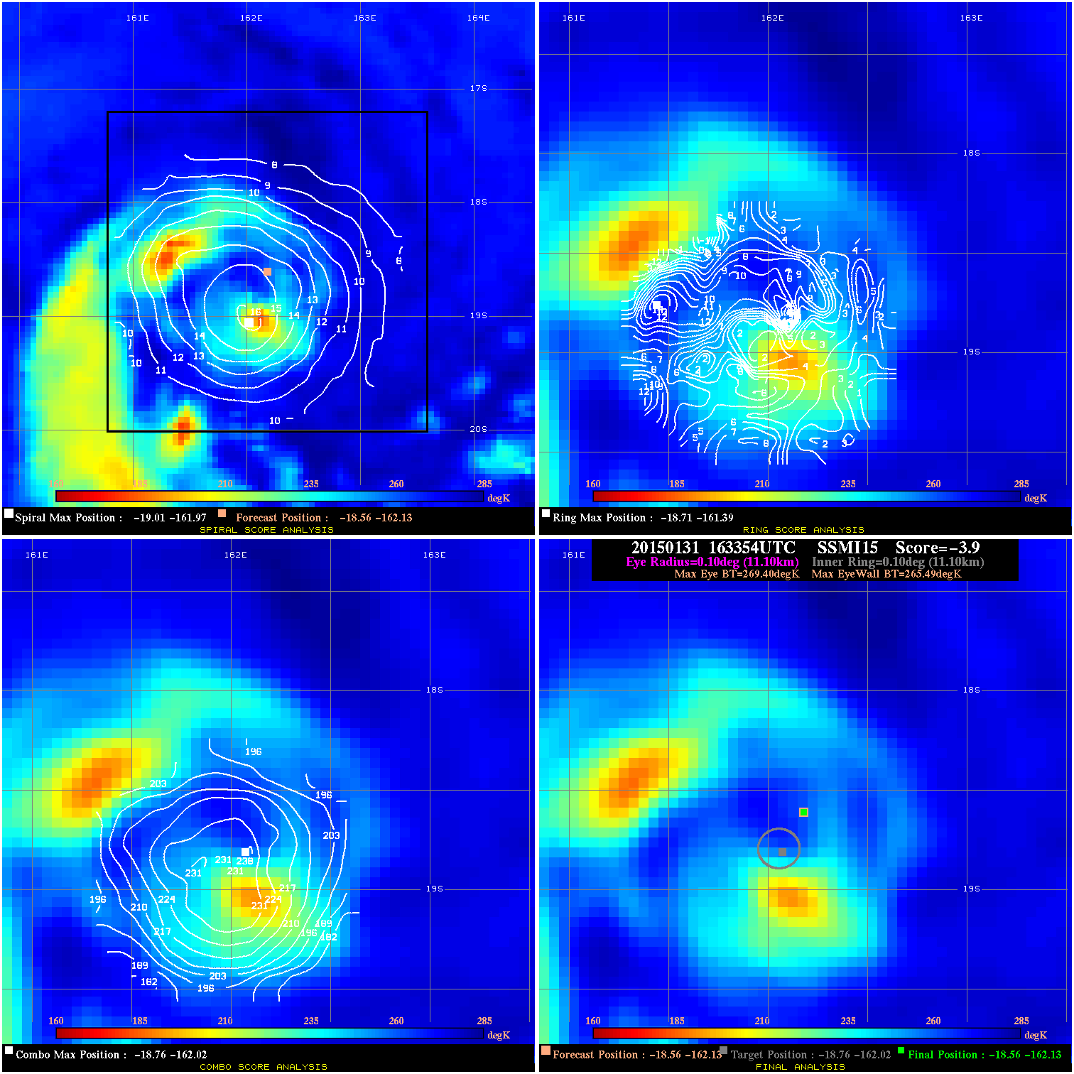
20150131 163354 -3.9 N/A 17.8% 22.22 3.91 45.0 SSMI15 -18.6 -162.1 -18.6 -162.1 -18.8 -162.0 Analysis Plot
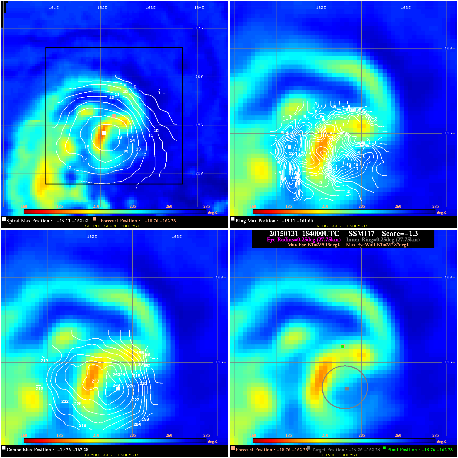
20150131 184000 -1.3 N/A 56.2% 55.55 1.26 45.0 SSMI17 -18.8 -162.2 -18.8 -162.2 -19.3 -162.3 Analysis Plot
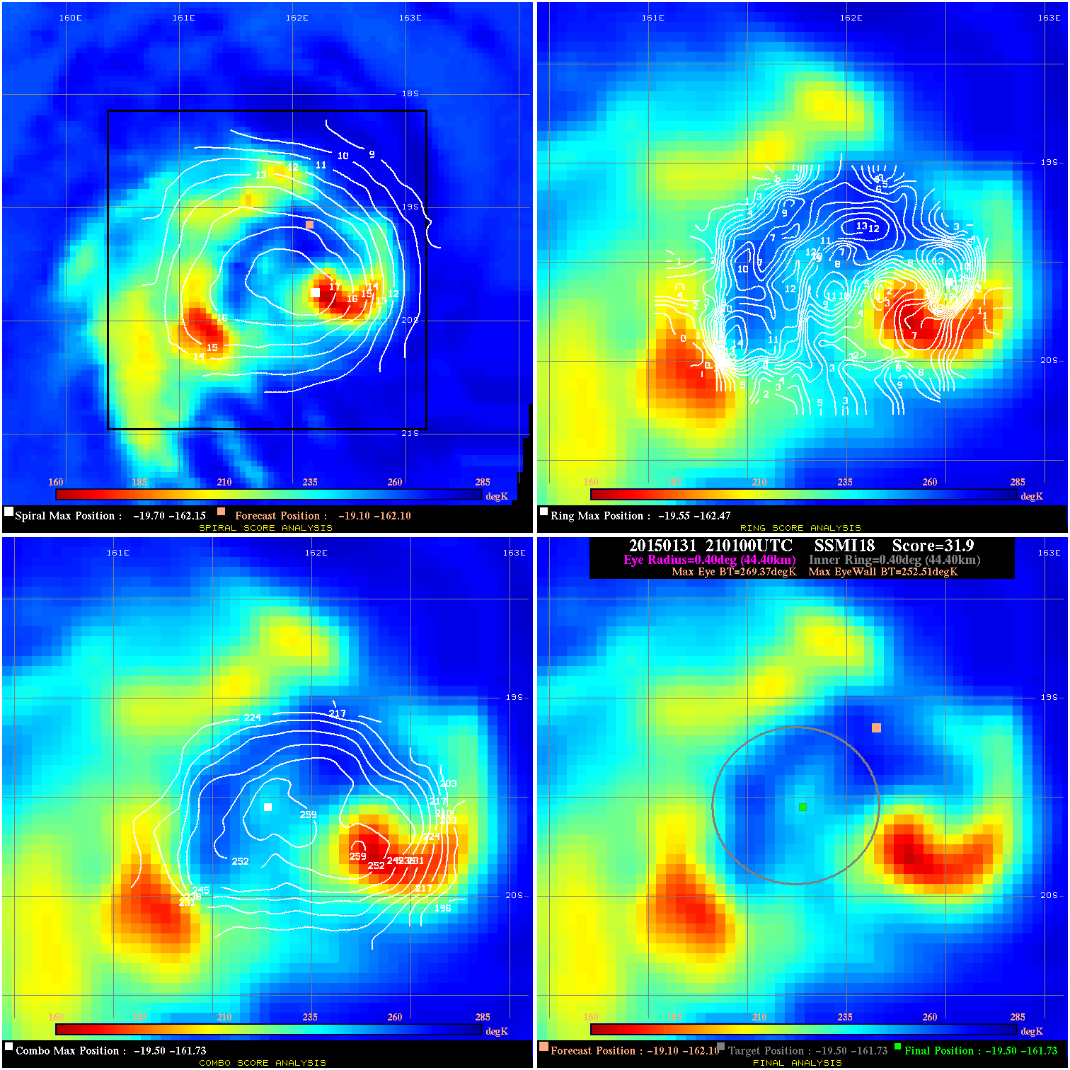
20150131 210100 31.9 >65 kts 93.2% 88.88 16.86 65.0 SSMI18 -19.1 -162.1 -19.5 -161.7 -19.5 -161.7 Analysis Plot
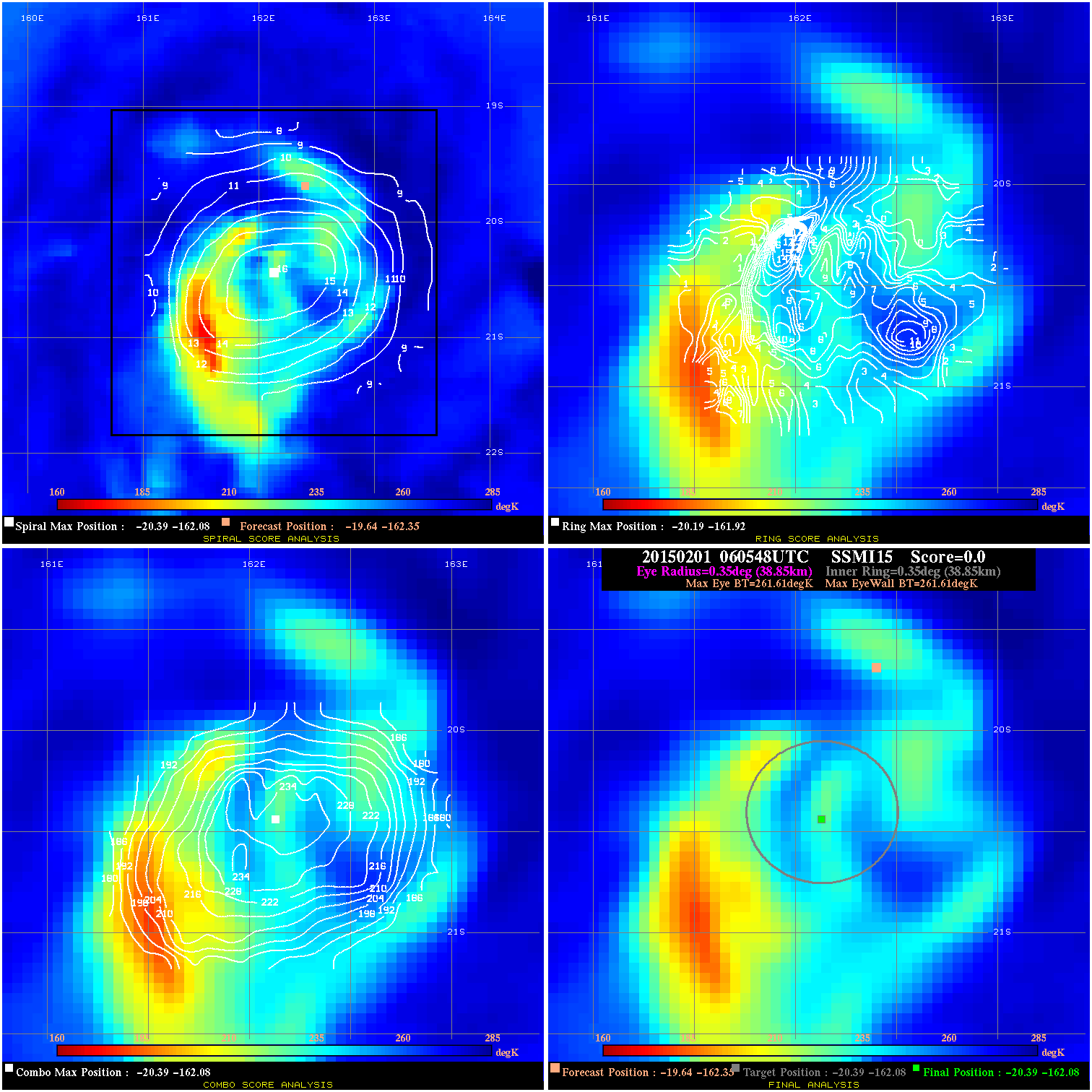
20150201 060548 -0.0 N/A N/A N/A 0.00 65.0 SSMI15 -19.6 -162.4 -20.4 -162.1 -20.4 -162.1 Analysis Plot
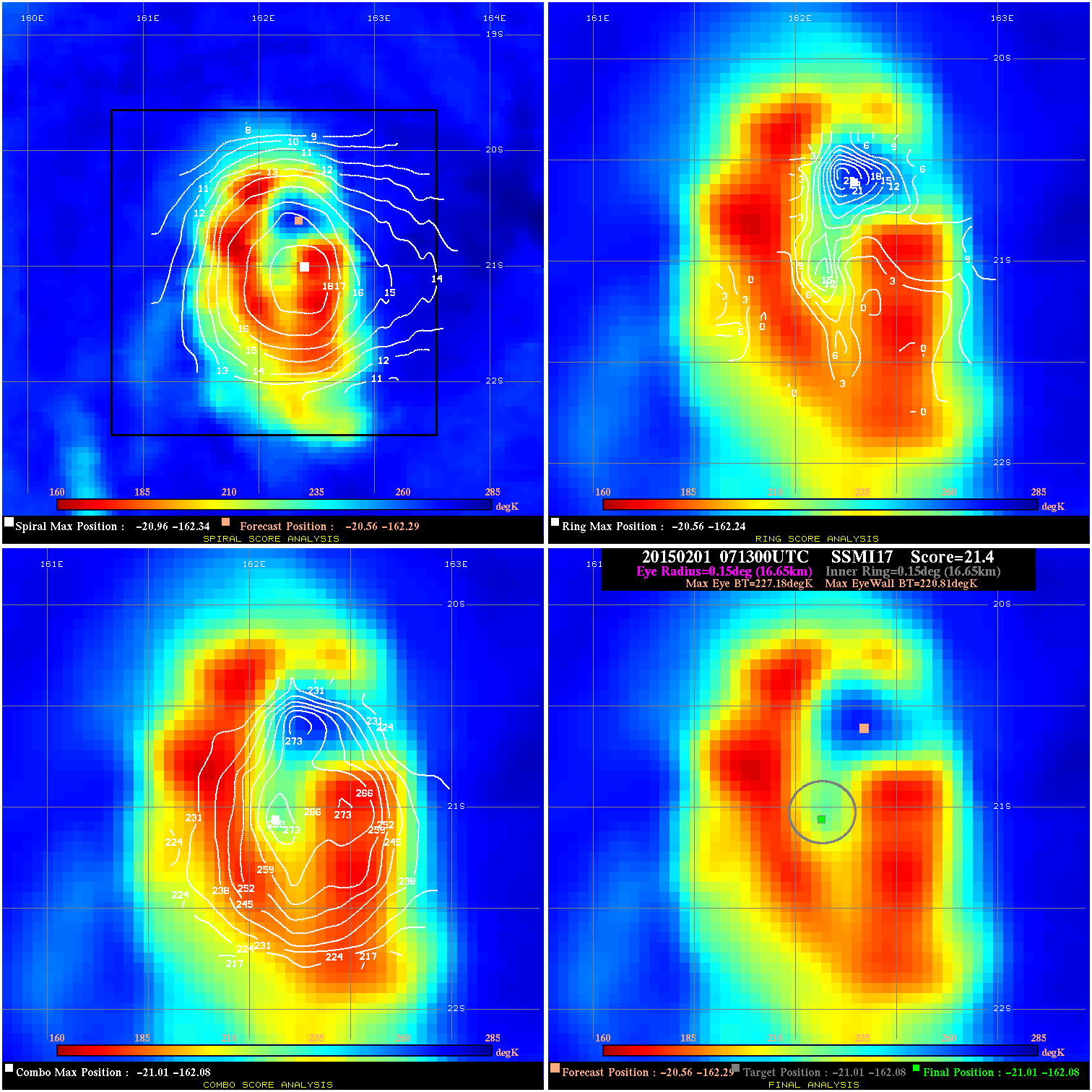
20150201 071300 21.4 >65 kts 100.0% 33.33 6.37 80.0 SSMI17 -20.6 -162.3 -21.0 -162.1 -21.0 -162.1 Analysis Plot
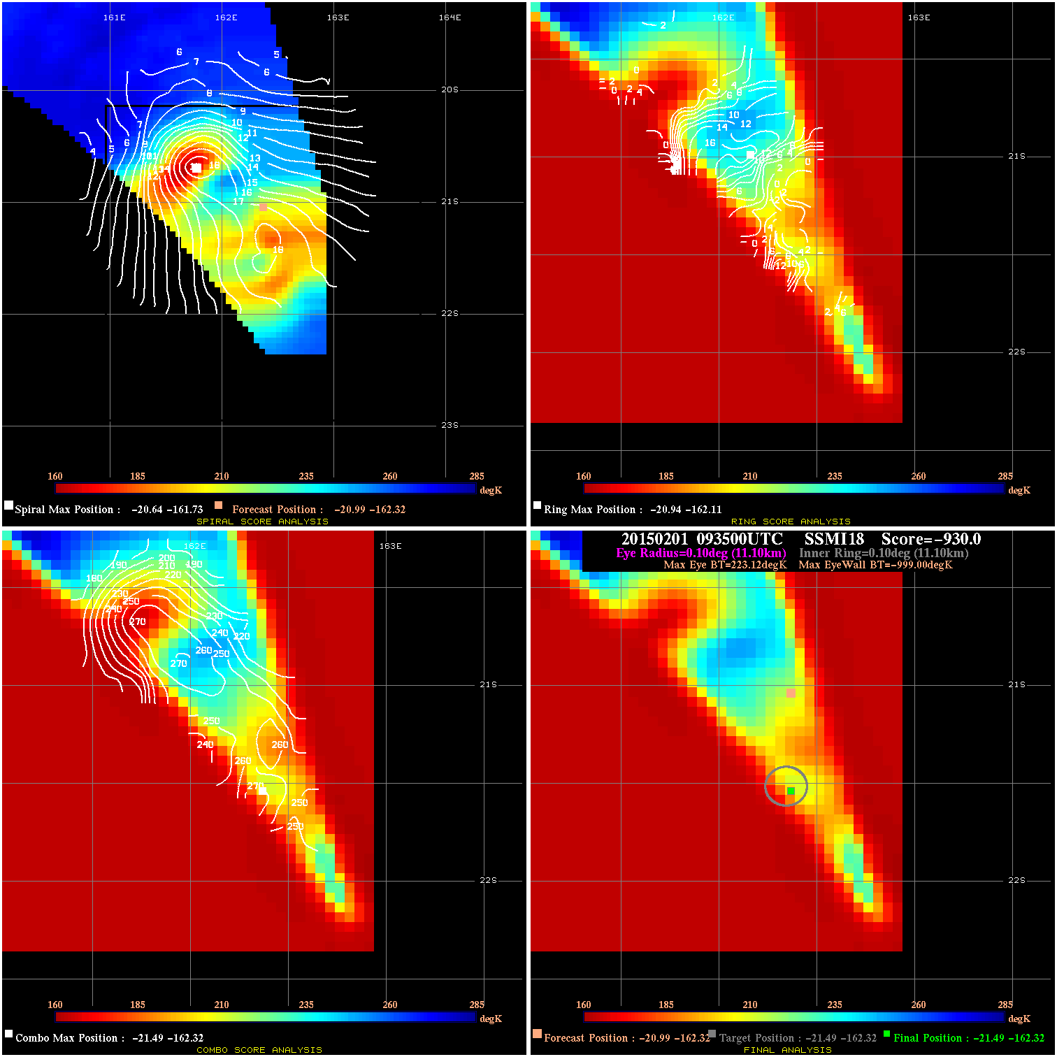
20150201 093500 -930.0 N/A N/A 155.54 1250.4 80.0 SSMI18 -20.8 -162.3 -21.3 -162.3 -21.3 -162.3 Analysis Plot
20150201 093500 -930.0 N/A N/A 22.22 1222.1 80.0 SSMI18 -21.0 -162.3 -21.5 -162.3 -21.5 -162.3 Analysis Plot
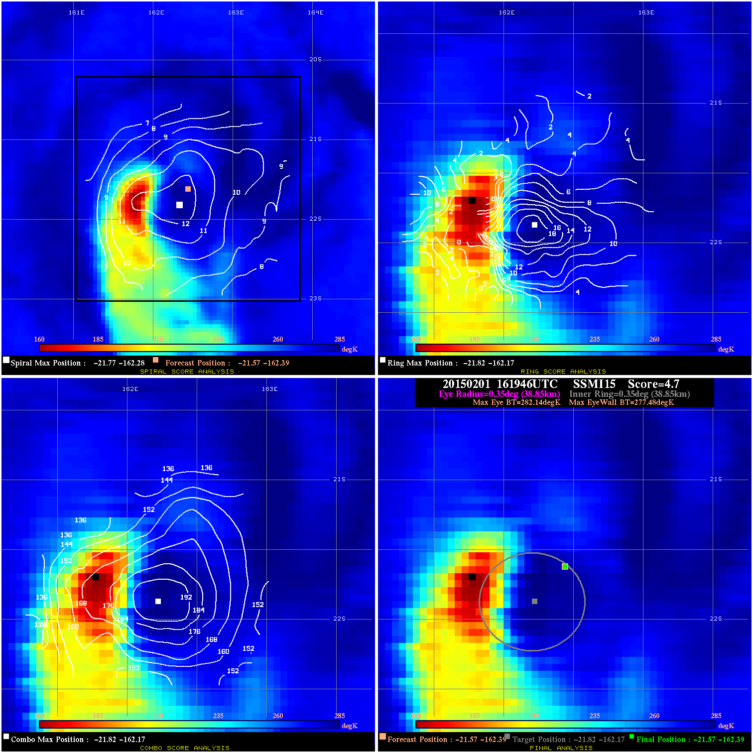
20150201 161946 4.7 N/A 35.6% 77.77 4.66 80.0 SSMI15 -21.6 -162.4 -21.6 -162.4 -21.8 -162.2 Analysis Plot
20150201 182800 -930.0 N/A N/A 222.20 1279.5 70.0 SSMI17 -21.6 -162.4 -21.6 -162.4 -21.6 -162.2 Analysis Plot
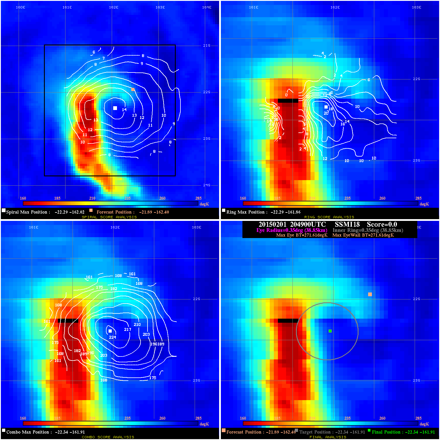
20150201 204900 -0.0 N/A N/A N/A 0.00 70.0 SSMI18 -21.9 -162.4 -22.3 -161.9 -22.3 -161.9 Analysis Plot
20150201 214313 -930.0 N/A N/A 11.11 1254.7 70.0 TRMM -22.1 -162.4 -21.9 -161.8 -21.9 -161.8 Analysis Plot
20150202 070000 -930.0 N/A N/A 222.20 1277.8 65.0 SSMI17 -23.5 -161.9 -23.5 -161.9 -24.3 -161.9 Analysis Plot
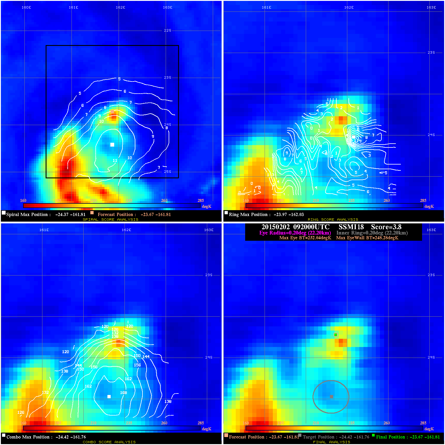
20150202 092000 3.8 N/A 5.5% 44.44 3.76 65.0 SSMI18 -23.7 -161.8 -23.7 -161.8 -24.4 -161.8 Analysis Plot
20150202 160626 16.1 N/A 79.5% 33.33 16.11 65.0 SSMI15 -24.5 -161.6 -25.2 -161.7 -25.2 -161.7 Analysis Plot
20150202 203800 3.7 N/A 35.6% 77.77 3.66 55.0 SSMI18 -26.0 -162.0 -26.0 -162.0 -26.4 -162.0 Analysis Plot
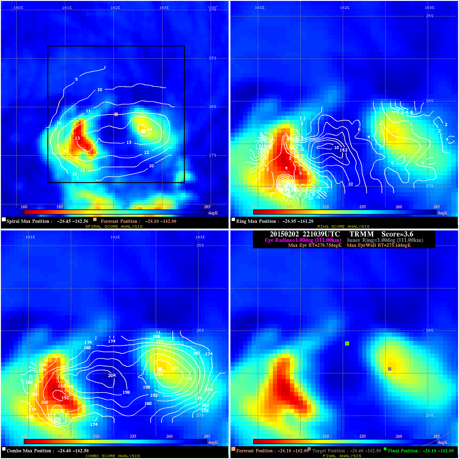
20150202 221039 3.6 N/A 13.7% 222.20 3.61 55.0 TRMM -26.1 -162.0 -26.1 -162.0 -26.4 -162.5 Analysis Plot
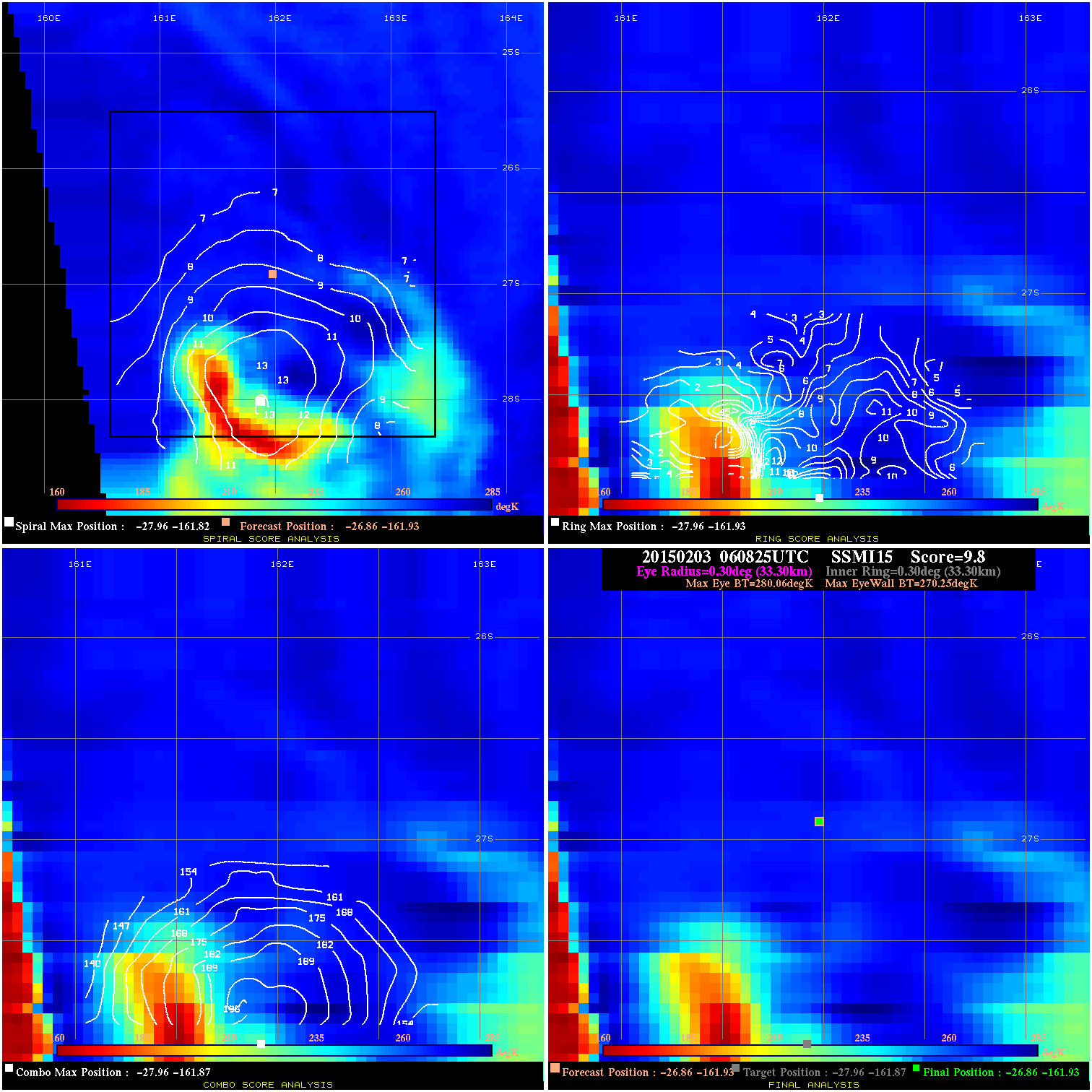
20150203 060825 9.8 N/A 53.4% 66.66 9.81 55.0 SSMI15 -26.9 -161.9 -26.9 -161.9 -28.0 -161.9 Analysis Plot
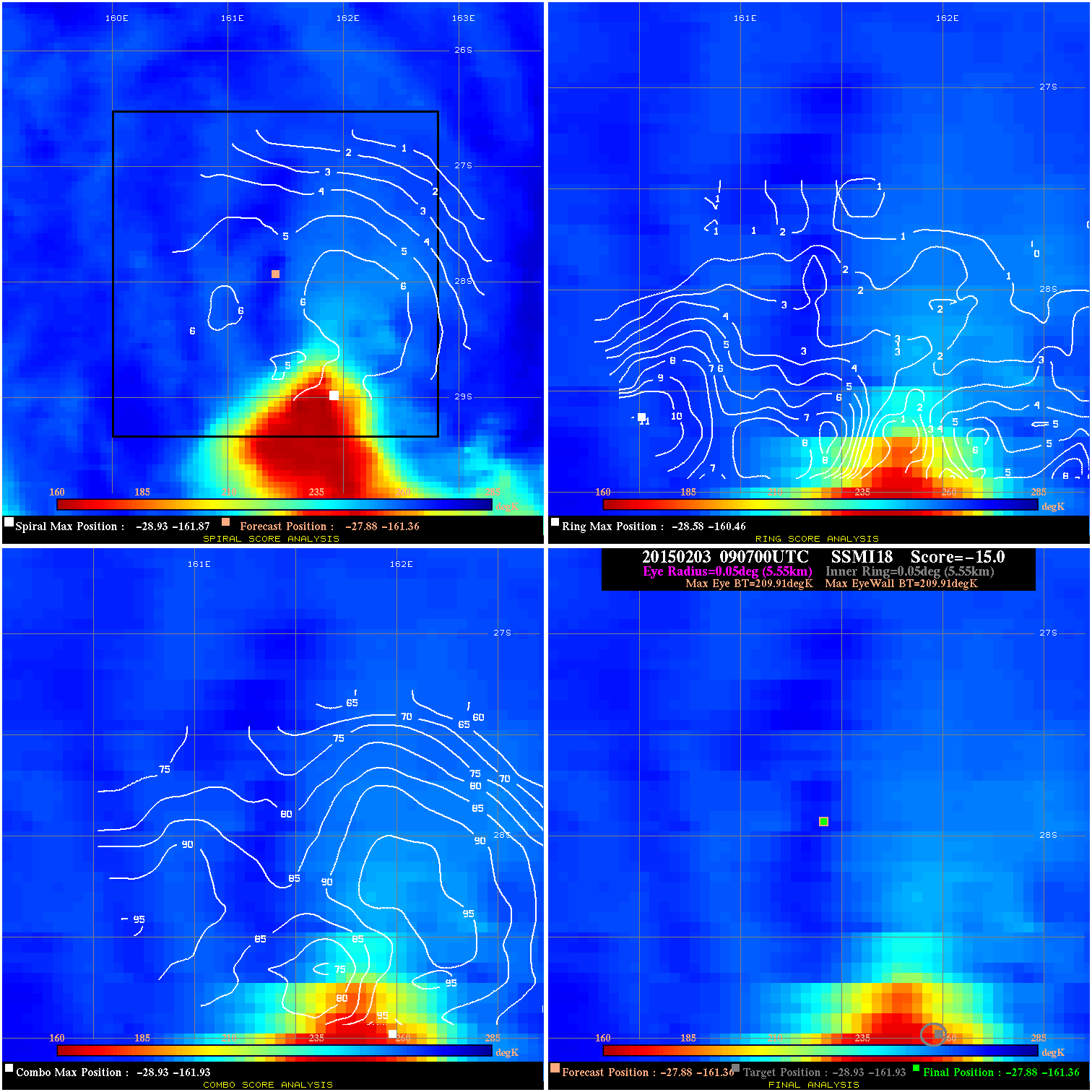
20150203 090700 -0.0 N/A N/A N/A 0.00 40.0 SSMI18 -27.9 -161.4 -27.9 -161.4 -28.9 -161.9 Analysis Plot
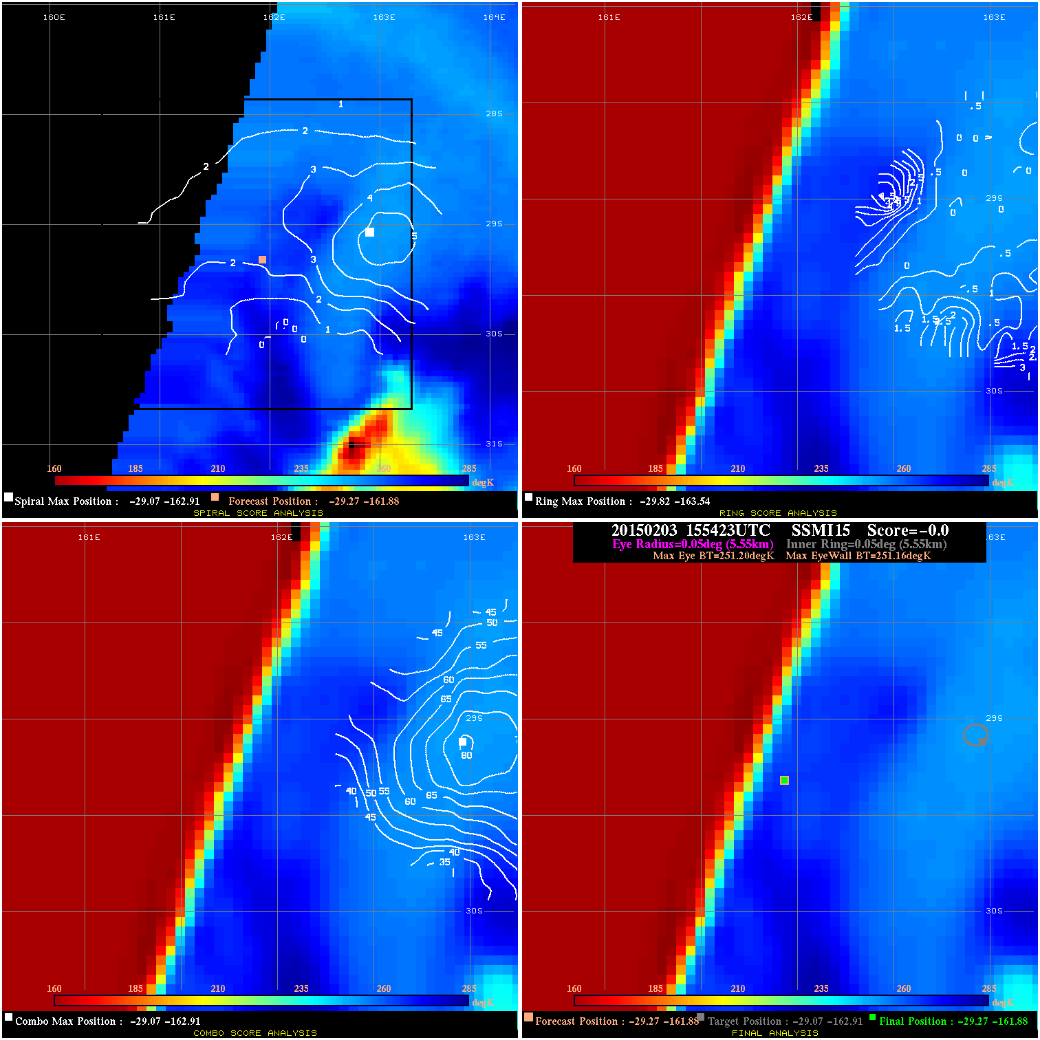
20150203 155423 -0.0 N/A N/A 11.11 .04 40.0 SSMI15 -29.3 -161.9 -29.3 -161.9 -29.1 -162.9 Analysis Plot
|
|
Legend: - Date/Time are determined from PMW imagery at Forecast (initial guess) Lat/Lon position. - Positive/Negative Latitude = North/South Hemisphere; Longitude = Western/Eastern Hemisphere. - "Ring Diam" value indicates the estimated surface eyewall diameter in km (the MI eyewall edge diameter minus 10 km). - "Ring Pct" is the percentage of the "ring" (eyewall inner boundary) that is 1) colder than the "hot spot" (warmest eye pixel) in the eye by 20K, or 2) the percentage that is a) colder than 232K and b) colder than the "hot spot" by 10K, whichever is greater. - Values are red if Ring % <= 65, yellow/brown if Ring % <= 85 and green if Ring % > 85. - "Tb diff" is the difference between the "hot spot" (warmest eye pixel) and the warmest pixel on the eyewall. - Intensity score are listed as negative, and not used, when the JTWC or NHC estimated Vmax is <55 kts in order to rule out weak but highly symmetric TCs. - Error messages in intensity scores: -920 is used when the hottest pixel in the eye is <200K, to prevent false positives; -930 means <85% of eyewall has observations/data. |