Tropical Depression 12E
|
Passive Microwave (PMW) Intensity Information Advanced Dvorak Technique (ADT) Version 8.2.1 |
Overpass Inten Ring Ring Wind Forecast Final Target
Date Time Score Meaning Pct Diam BTdiff Est Sat Lat Lon Lat Lon Lat Lon
20160818 205620 -0.0 N/A N/A N/A 0.00 30.0 AMSR2 17.8 110.1 17.8 110.1 17.8 110.1 Analysis Plot
20160819 010249 -7.3 N/A 5.5% 211.09 7.27 30.0 GMI 18.1 110.4 18.1 110.4 18.4 110.7 Analysis Plot
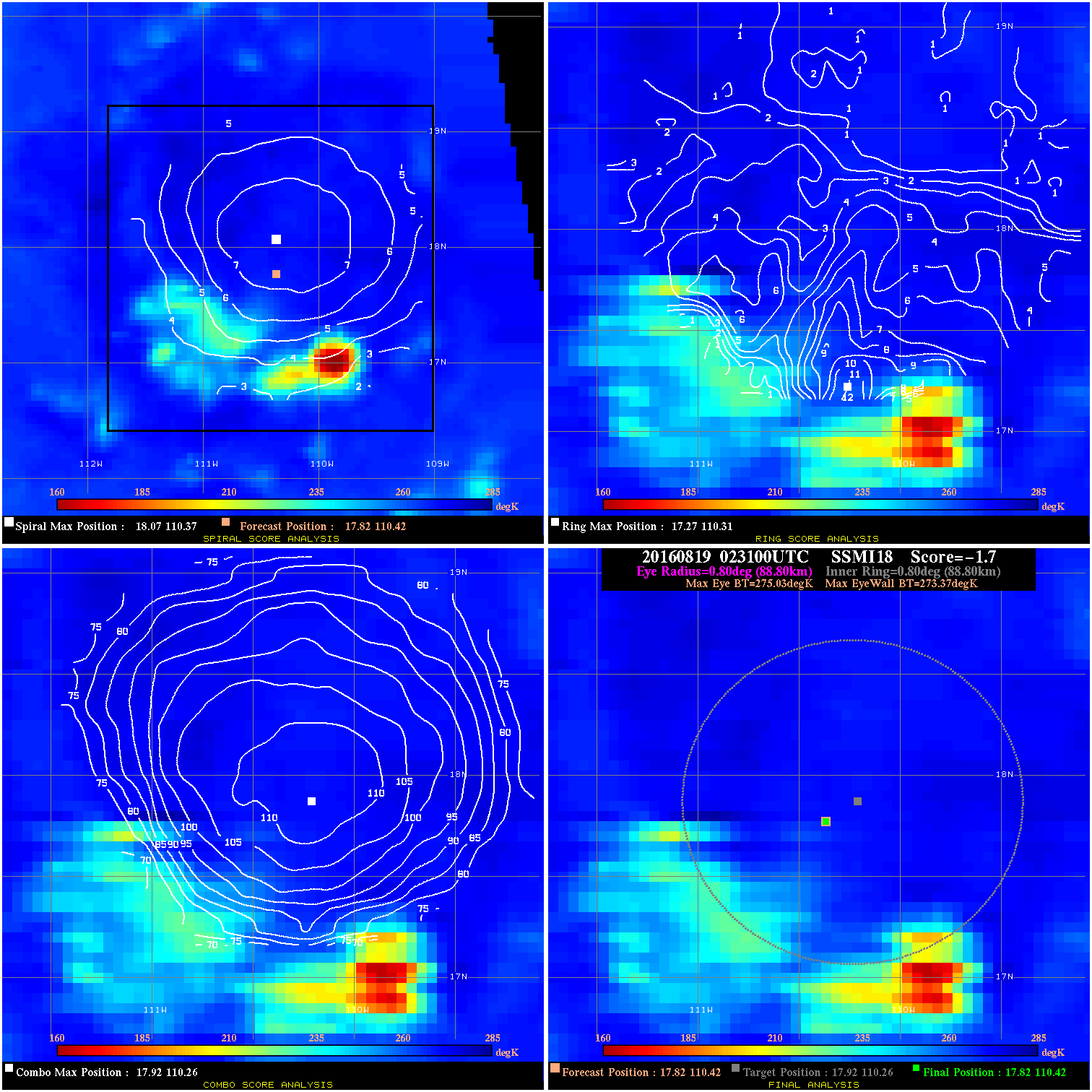
20160819 023100 -1.7 N/A 19.2% 177.76 1.66 30.0 SSMI18 17.8 110.4 17.8 110.4 17.9 110.3 Analysis Plot
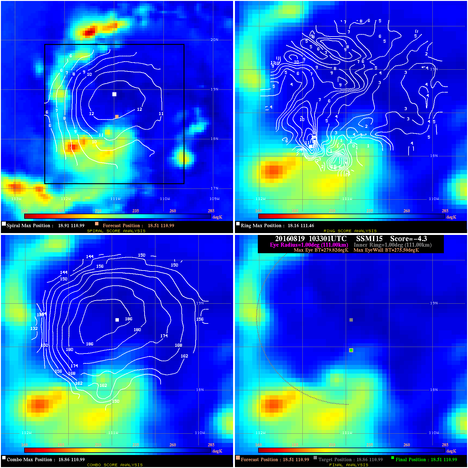
20160819 103301 -4.3 N/A 20.5% 222.20 4.32 35.0 SSMI15 18.5 111.0 18.5 111.0 18.9 111.0 Analysis Plot
20160819 150600 -930.0 N/A N/A N/A 0.00 35.0 SSMI18 19.1 111.5 19.1 111.5 19.7 111.1 Analysis Plot
20160820 020400 -930.0 N/A N/A N/A 0.00 40.0 SSMI17 19.2 112.4 19.2 112.4 19.7 112.5 Analysis Plot
20160820 021800 -0.0 N/A N/A N/A 0.00 40.0 SSMI18 19.2 112.4 19.2 112.4 18.5 113.0 Analysis Plot
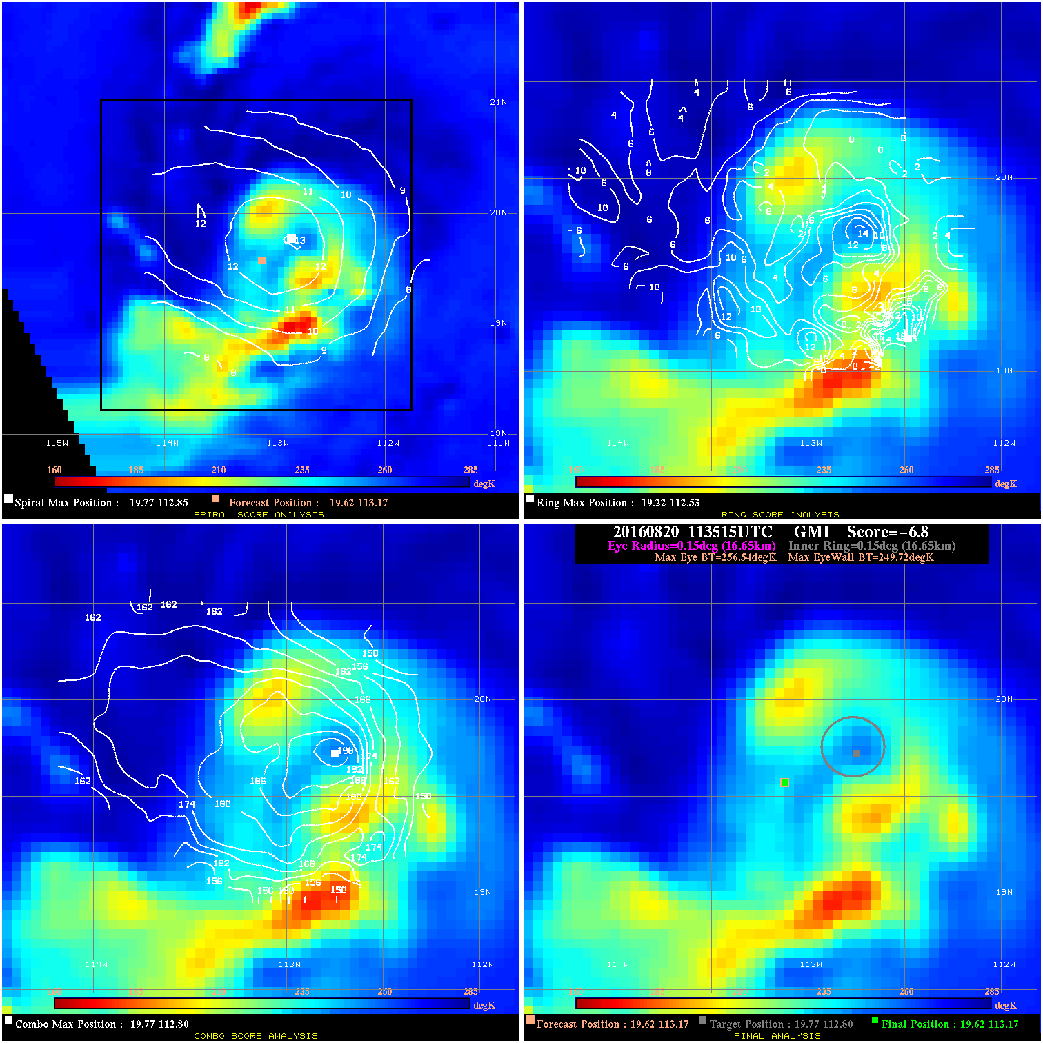
20160820 113515 -6.8 N/A 63.0% 33.33 6.82 45.0 GMI 19.6 113.2 19.6 113.2 19.8 112.8 Analysis Plot
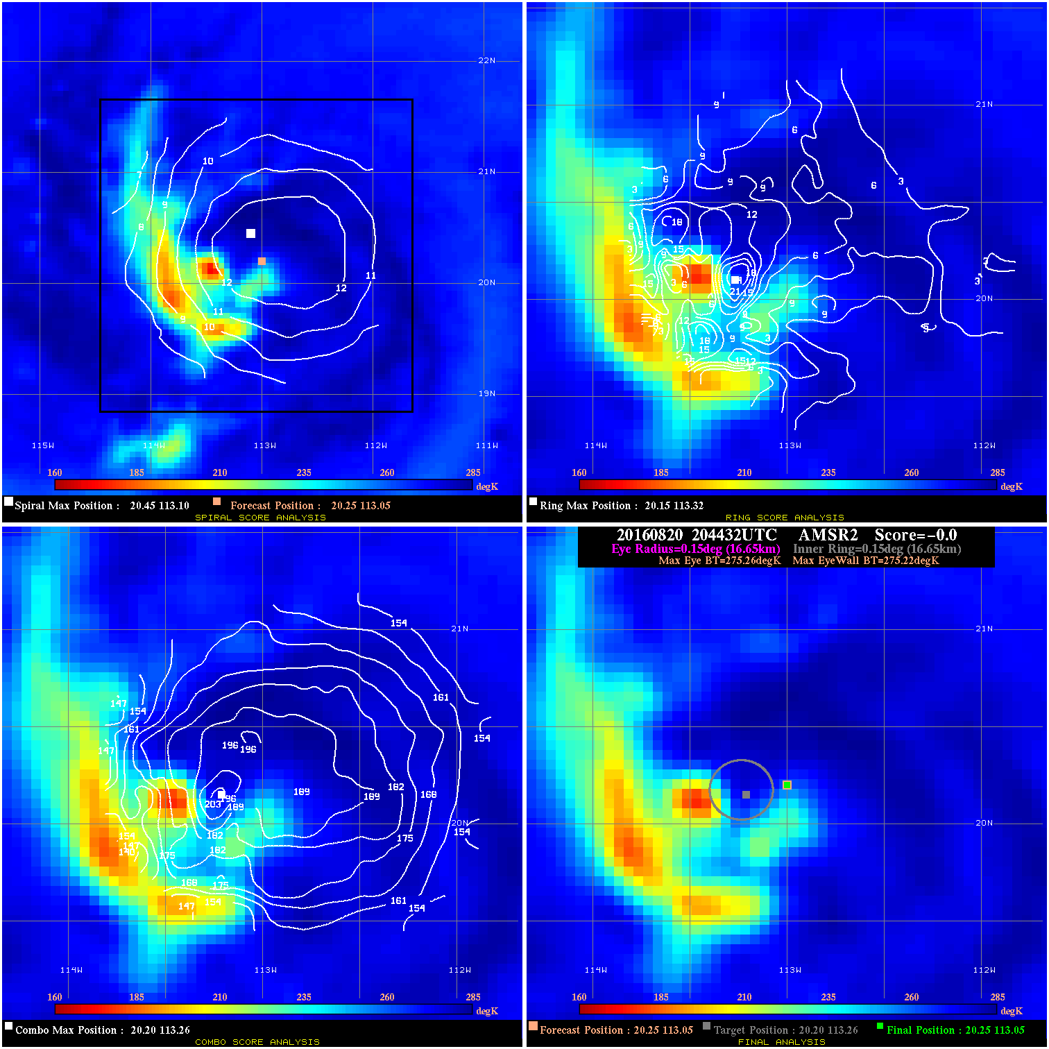
20160820 204432 -0.0 N/A 8.2% 33.33 .04 45.0 AMSR2 20.3 113.1 20.3 113.1 20.2 113.3 Analysis Plot
20160821 005338 -1.5 N/A 20.5% 88.88 1.54 45.0 GMI 20.4 113.3 20.4 113.3 20.5 113.4 Analysis Plot
20160821 020700 -1.0 N/A 23.3% 111.10 1.02 45.0 SSMI18 20.6 113.3 20.6 113.3 20.8 113.6 Analysis Plot
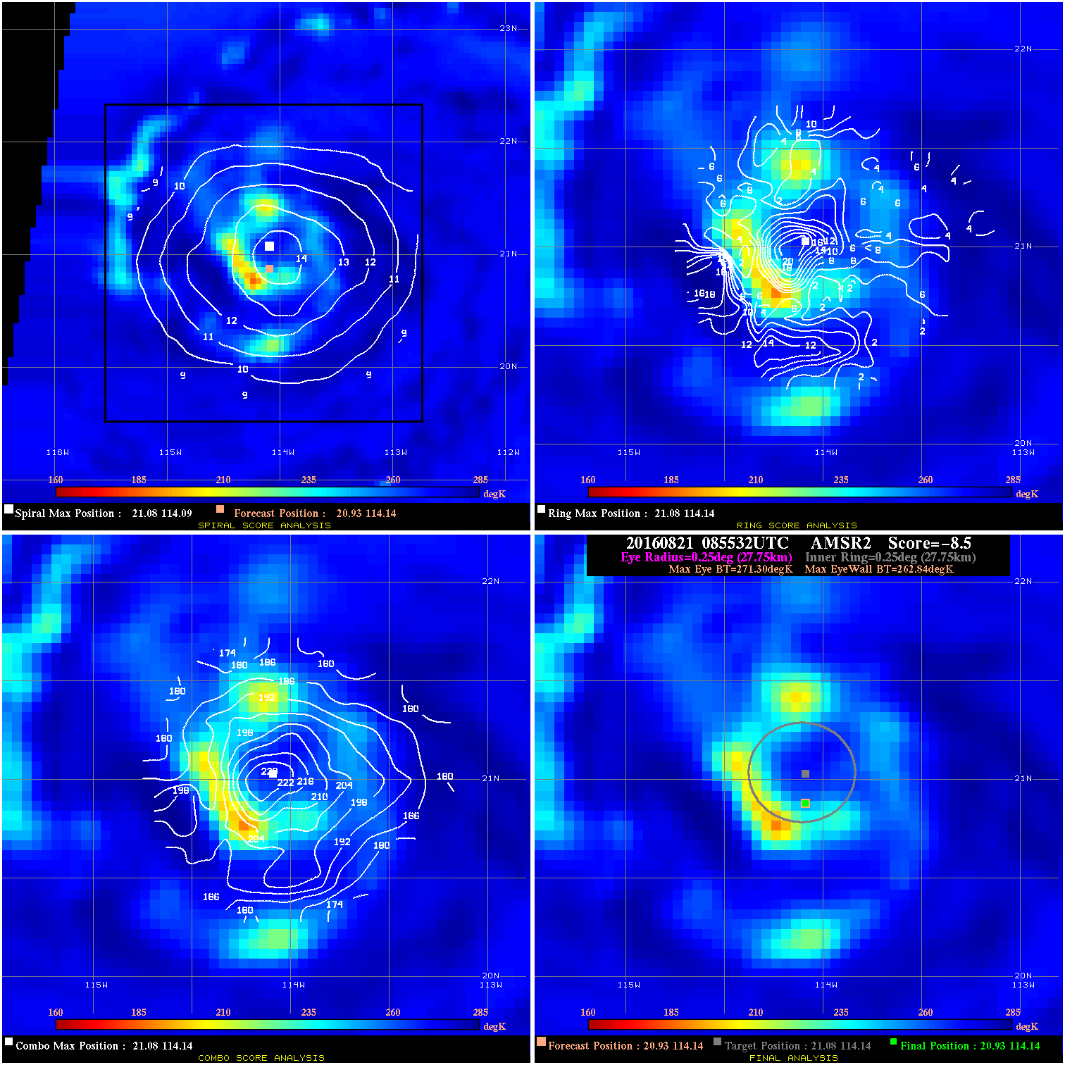
20160821 085532 -8.5 N/A 41.1% 55.55 8.46 35.0 AMSR2 20.9 114.1 20.9 114.1 21.1 114.1 Analysis Plot
20160821 142200 -32.9 N/A 90.4% 66.66 17.89 40.0 SSMI17 21.2 114.6 21.2 114.6 21.4 114.7 Analysis Plot
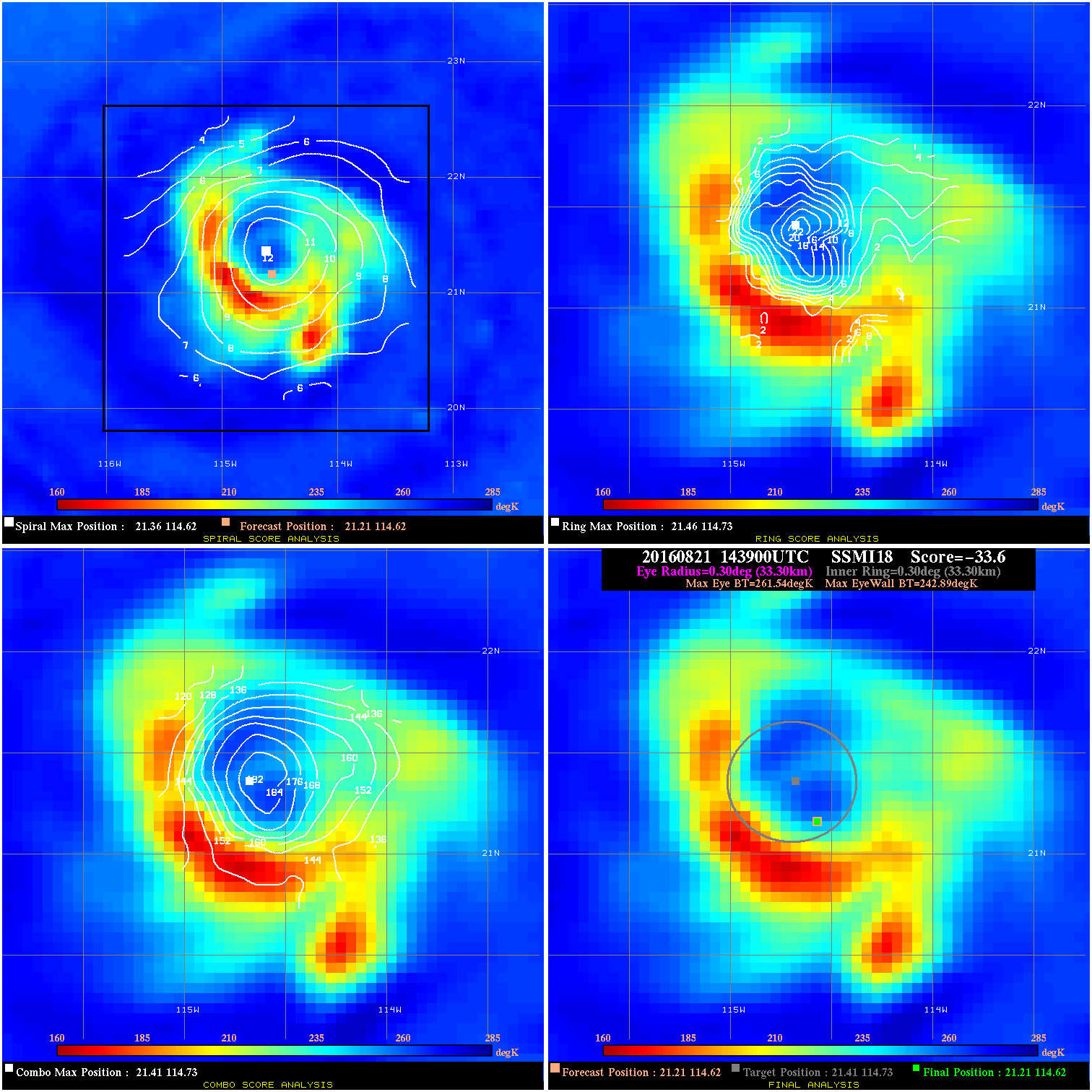
20160821 143900 -33.6 N/A 97.3% 66.66 18.65 40.0 SSMI18 21.2 114.6 21.2 114.6 21.4 114.7 Analysis Plot
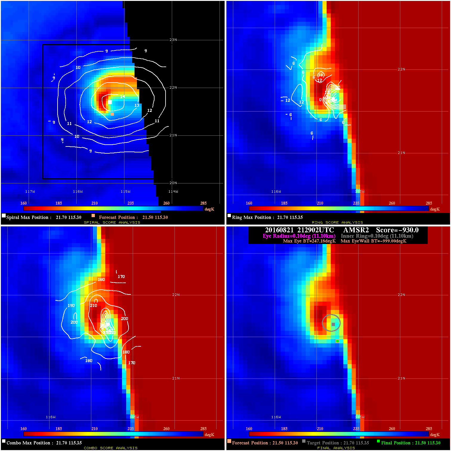
20160821 212902 -930.0 N/A N/A N/A 0.00 45.0 AMSR2 21.5 115.3 21.5 115.3 21.7 115.3 Analysis Plot
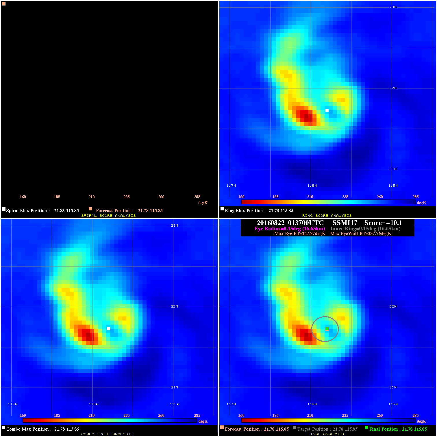
20160822 013700 -10.1 N/A 67.1% 33.33 10.11 45.0 SSMI17 21.8 115.8 21.8 115.8 21.8 115.8 Analysis Plot
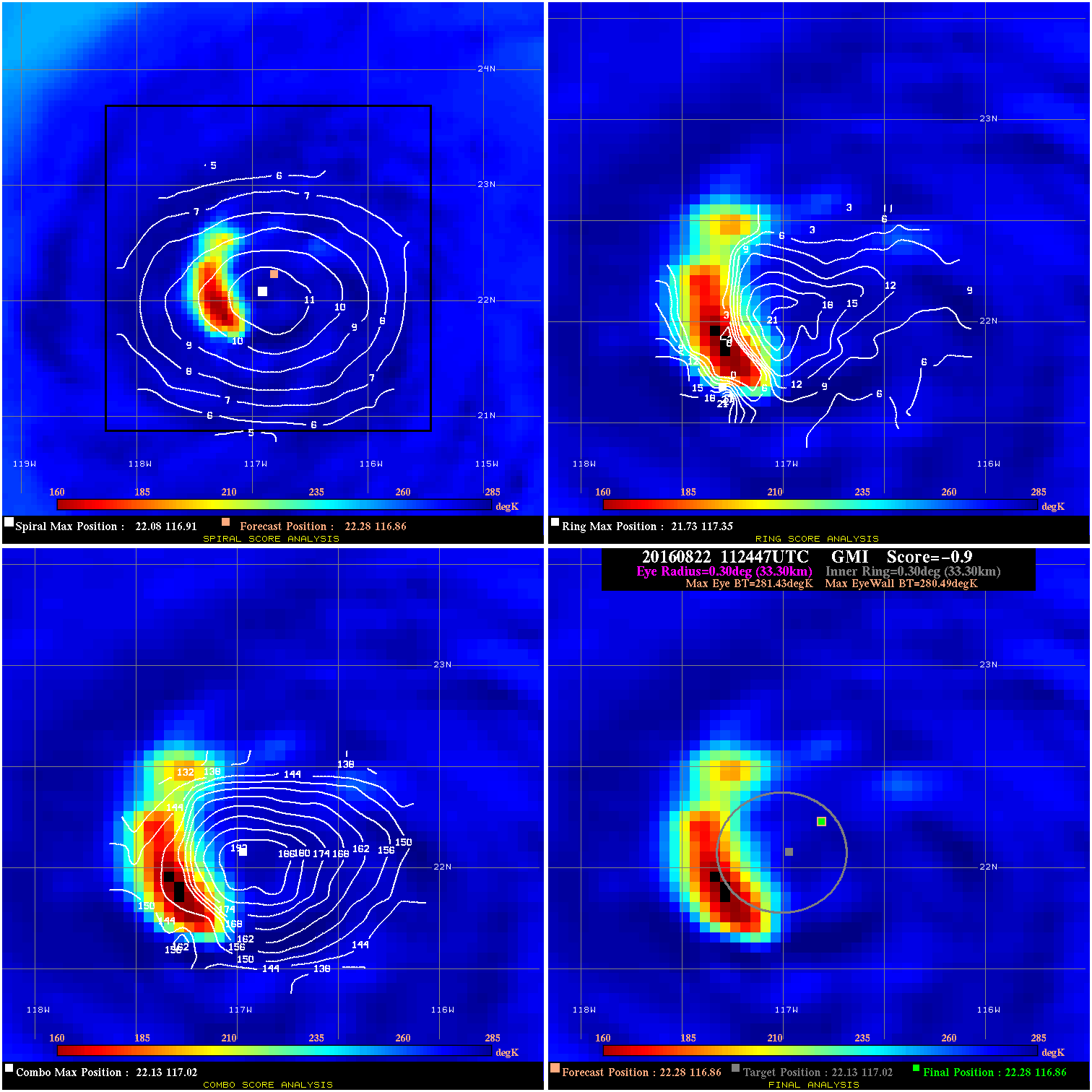
20160822 112447 -0.9 N/A 24.7% 66.66 .94 45.0 GMI 22.3 116.9 22.3 116.9 22.1 117.0 Analysis Plot
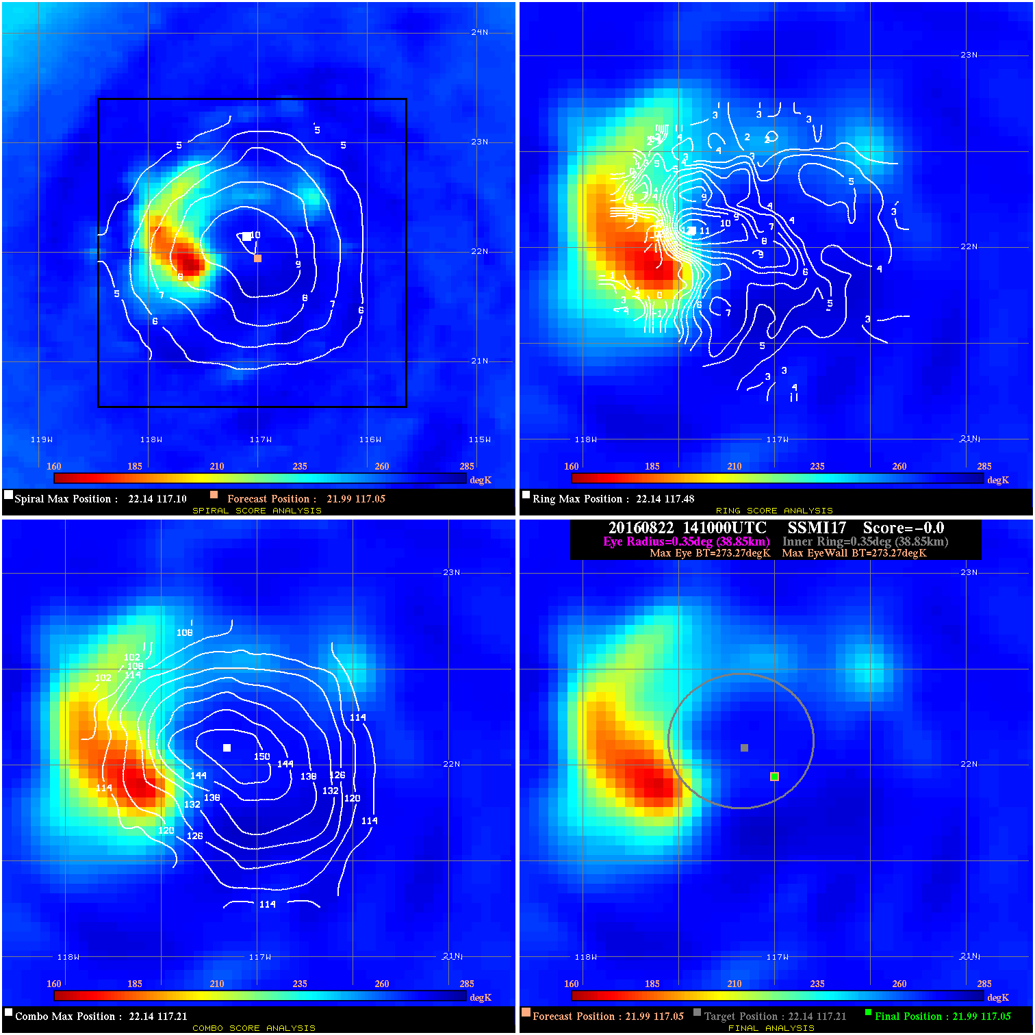
20160822 141000 -0.0 N/A N/A N/A 0.00 40.0 SSMI17 22.0 117.1 22.0 117.1 22.1 117.2 Analysis Plot
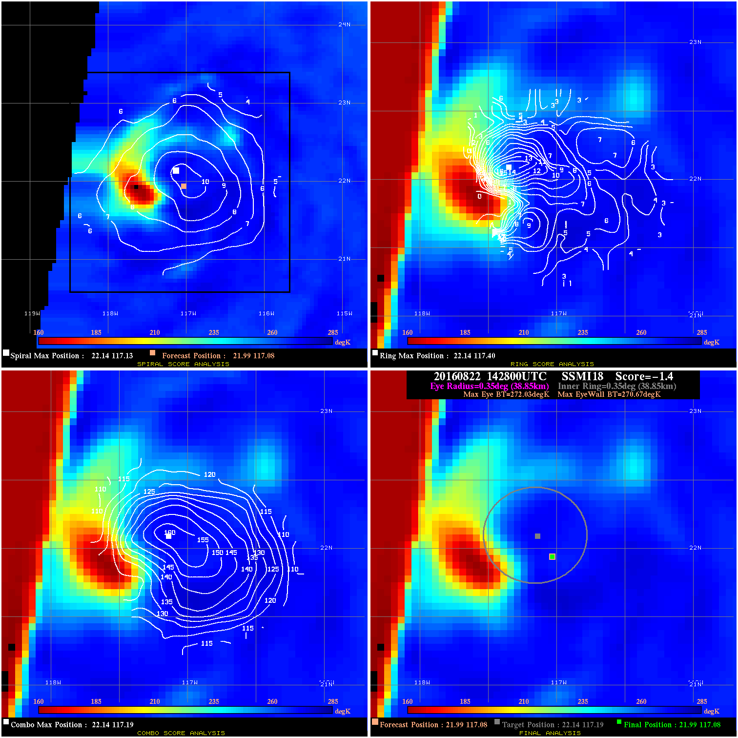
20160822 142800 -1.4 N/A 16.4% 77.77 1.36 40.0 SSMI18 22.0 117.1 22.0 117.1 22.1 117.2 Analysis Plot
20160823 004410 -6.2 N/A 11.0% 88.88 6.25 35.0 GMI 21.9 118.5 21.9 118.5 22.0 118.7 Analysis Plot
20160823 012600 -930.0 N/A N/A N/A 0.00 35.0 SSMI17 22.0 118.7 22.0 118.7 22.2 118.4 Analysis Plot
20160823 105330 -2.5 N/A N/A 155.54 2.53 35.0 SSMI15 22.0 119.6 22.0 119.6 22.5 119.6 Analysis Plot
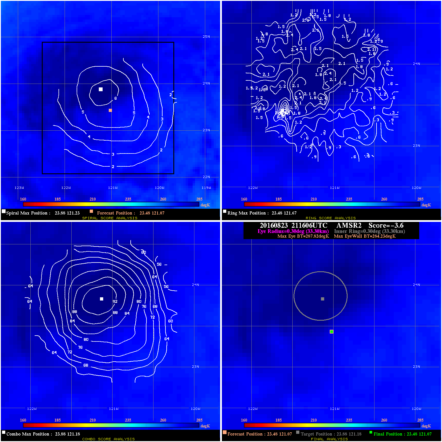
20160823 211606 -3.6 N/A N/A 66.66 3.59 30.0 AMSR2 23.5 121.1 23.5 121.1 23.9 121.2 Analysis Plot
|
|
Legend: - Date/Time are determined from PMW imagery at Forecast (initial guess) Lat/Lon position. - Positive/Negative Latitude = North/South Hemisphere; Longitude = Western/Eastern Hemisphere. - "Ring Diam" value indicates the estimated surface eyewall diameter in km (the MI eyewall edge diameter minus 10 km). - "Ring Pct" is the percentage of the "ring" (eyewall inner boundary) that is 1) colder than the "hot spot" (warmest eye pixel) in the eye by 20K, or 2) the percentage that is a) colder than 232K and b) colder than the "hot spot" by 10K, whichever is greater. - Values are red if Ring % <= 65, yellow/brown if Ring % <= 85 and green if Ring % > 85. - "Tb diff" is the difference between the "hot spot" (warmest eye pixel) and the warmest pixel on the eyewall. - Intensity score are listed as negative, and not used, when the JTWC or NHC estimated Vmax is <55 kts in order to rule out weak but highly symmetric TCs. - Error messages in intensity scores: -920 is used when the hottest pixel in the eye is <200K, to prevent false positives; -930 means <85% of eyewall has observations/data. |