Tropical Depression 29W
|
Passive Microwave (PMW) Intensity Information Advanced Dvorak Technique (ADT) Version 8.2.1 |
Overpass Inten Ring Ring Wind Forecast Final Target
Date Time Score Meaning Pct Diam BTdiff Est Sat Lat Lon Lat Lon Lat Lon
20161124 183547 -930.0 N/A N/A N/A 0.00 30.0 SSMI15 10.7 -124.6 10.7 -124.6 9.4 -124.2 Analysis Plot
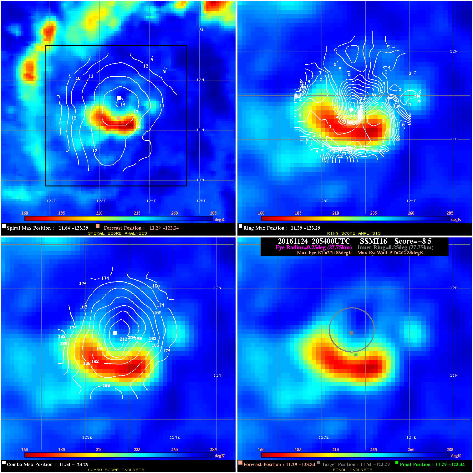
20161124 205400 -8.5 N/A 43.8% 55.55 8.45 35.0 SSMI16 11.3 -123.3 11.3 -123.3 11.5 -123.3 Analysis Plot
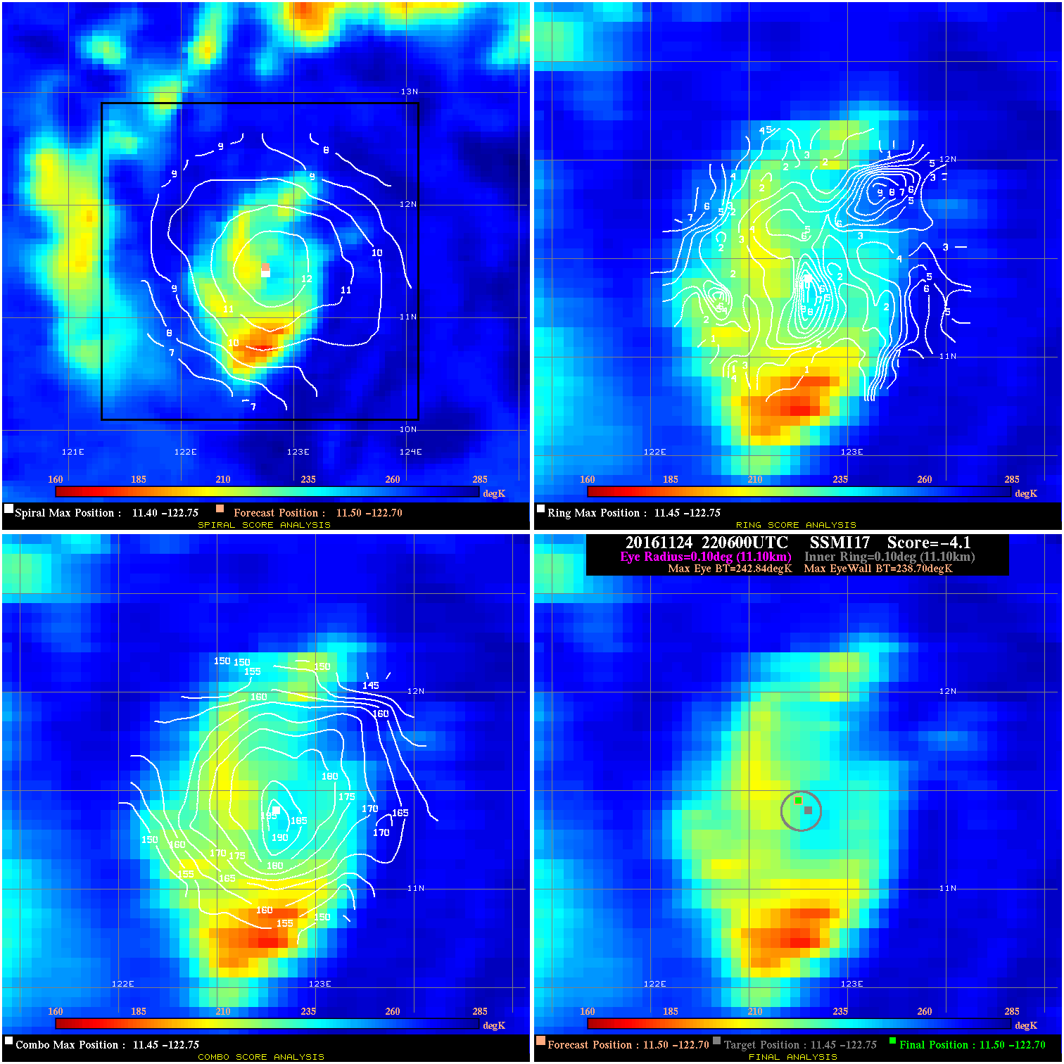
20161124 220600 -4.1 N/A 63.0% 22.22 4.14 35.0 SSMI17 11.5 -122.7 11.5 -122.7 11.4 -122.8 Analysis Plot
20161125 045516 -9.7 N/A 21.9% 66.66 9.73 35.0 GMI 11.8 -121.7 11.8 -121.7 11.4 -121.8 Analysis Plot
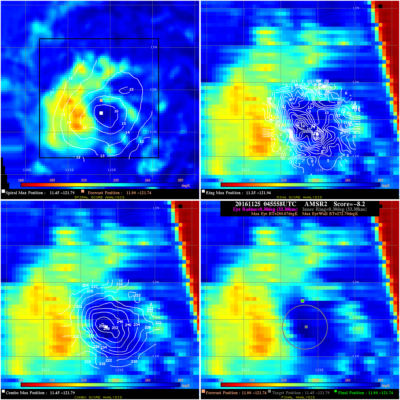
20161125 045558 -8.2 N/A 30.1% 66.66 8.17 35.0 AMSR2 11.8 -121.7 11.8 -121.7 11.4 -121.8 Analysis Plot
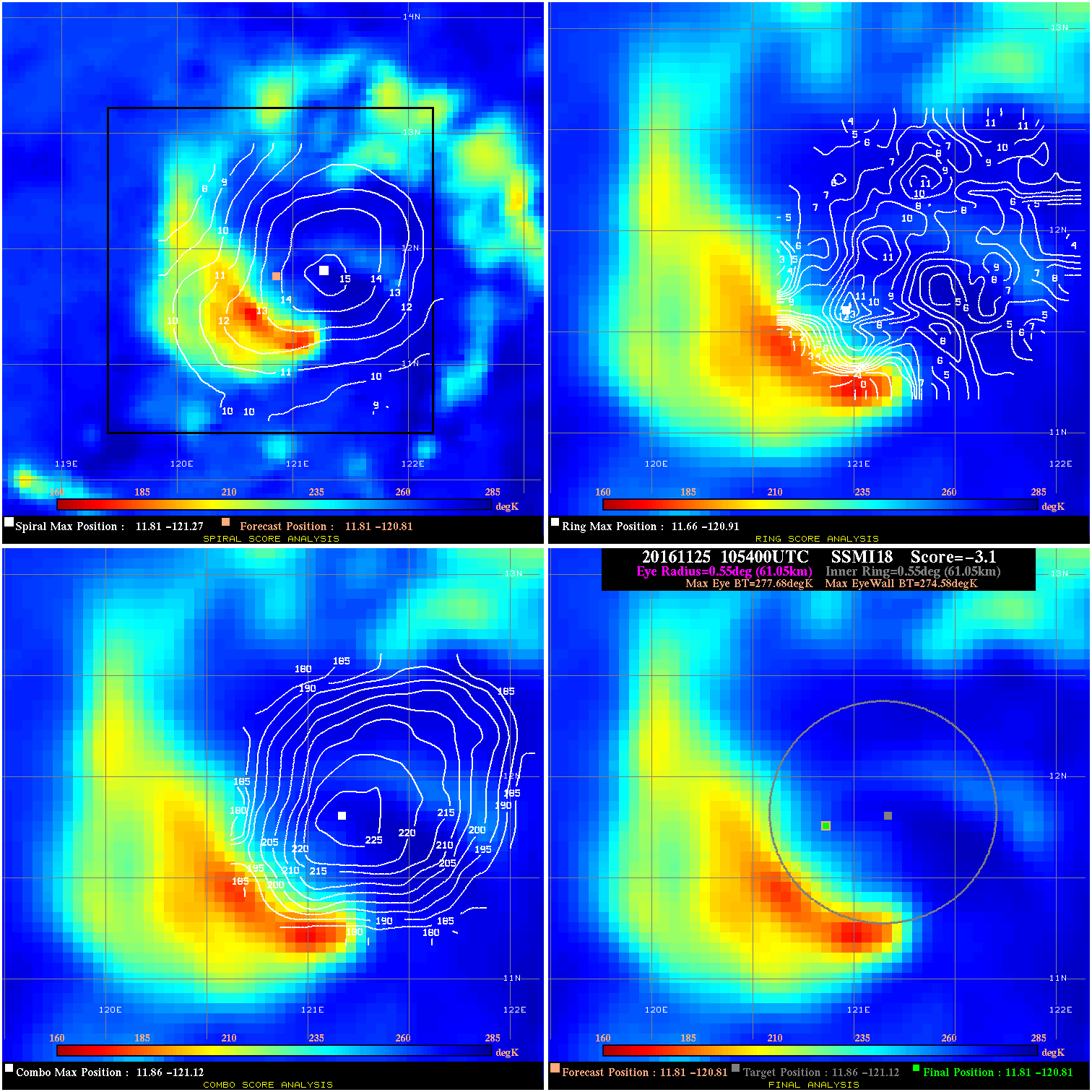
20161125 105400 -3.1 N/A 26.0% 122.21 3.10 40.0 SSMI18 11.8 -120.8 11.8 -120.8 11.9 -121.1 Analysis Plot
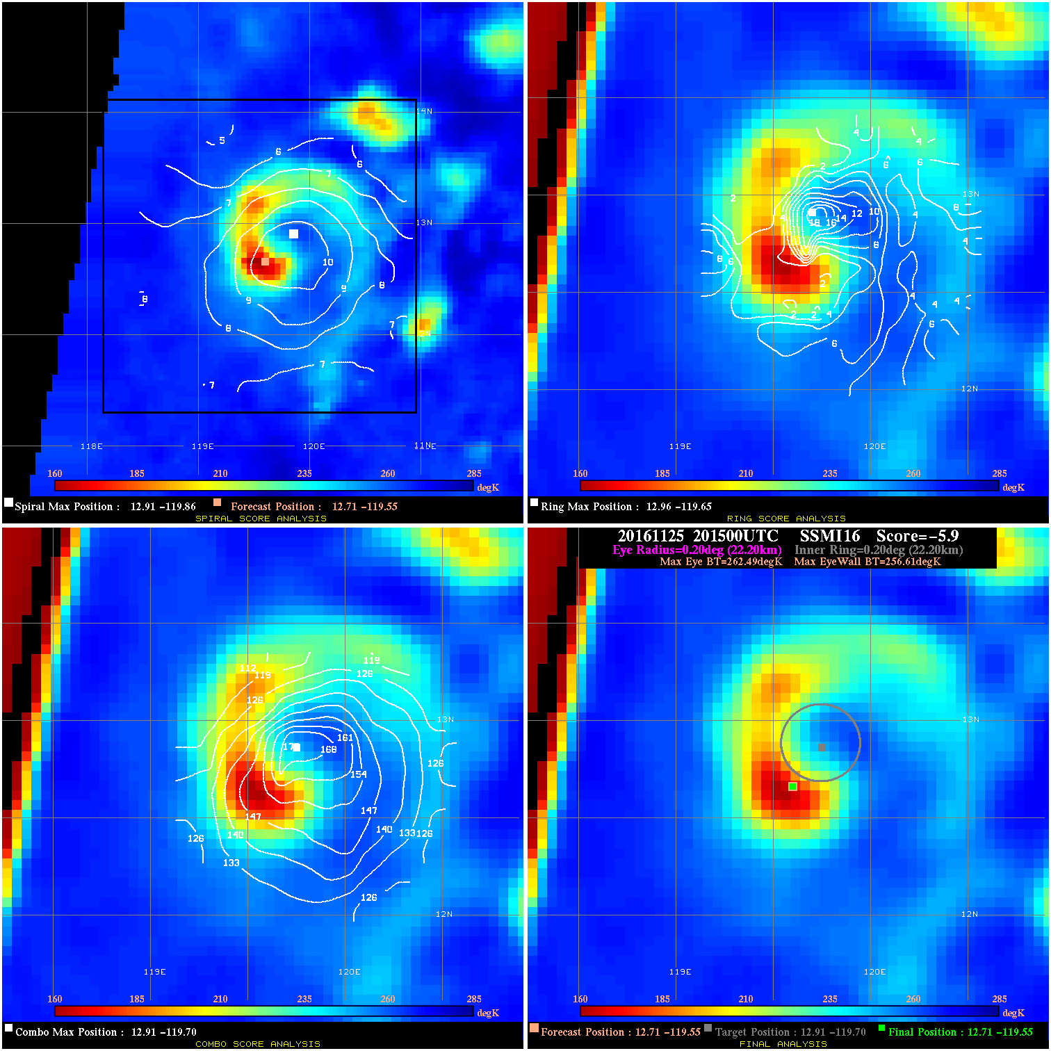
20161125 201500 -5.9 N/A 56.2% 44.44 5.88 45.0 SSMI16 12.7 -119.6 12.7 -119.6 12.9 -119.7 Analysis Plot
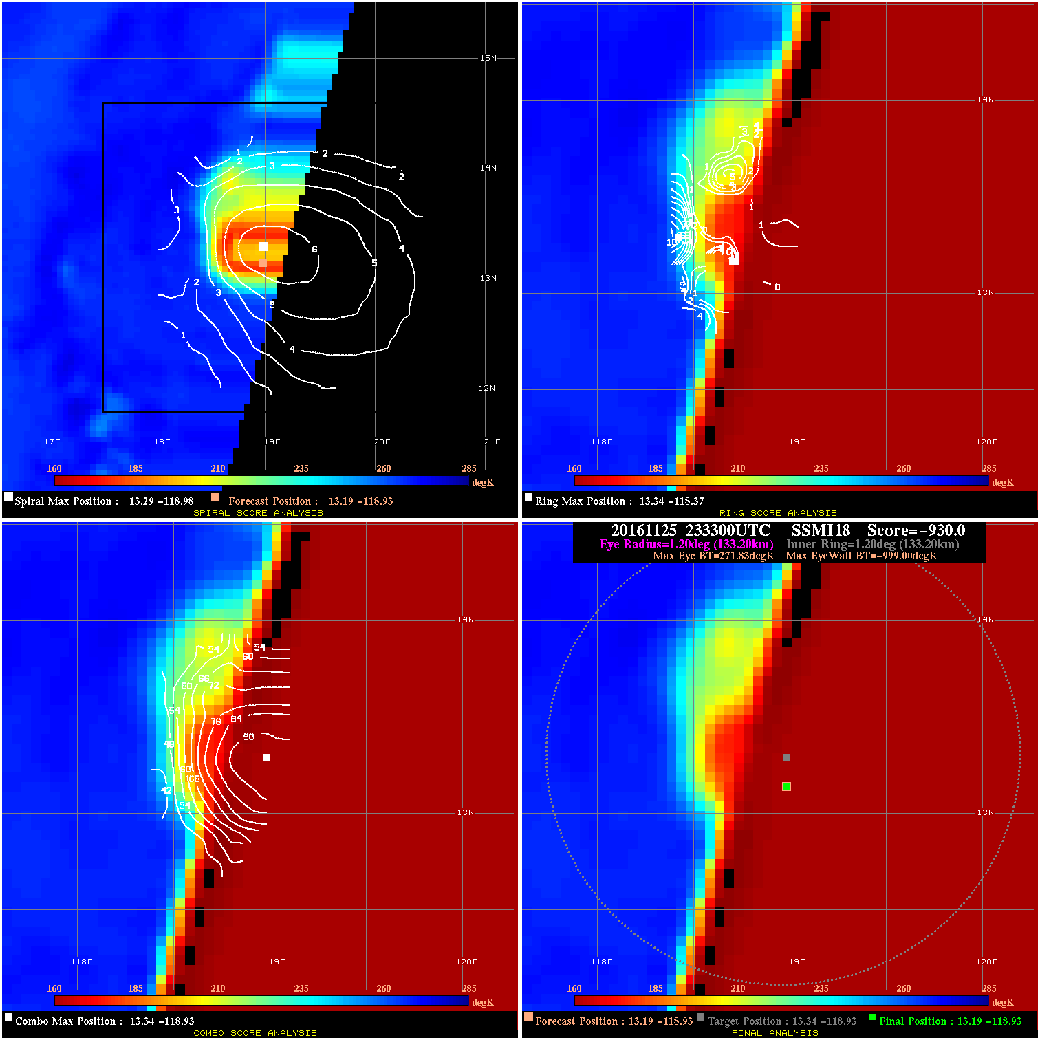
20161125 233300 -930.0 N/A N/A N/A 0.00 45.0 SSMI18 13.2 -118.9 13.2 -118.9 13.3 -118.9 Analysis Plot
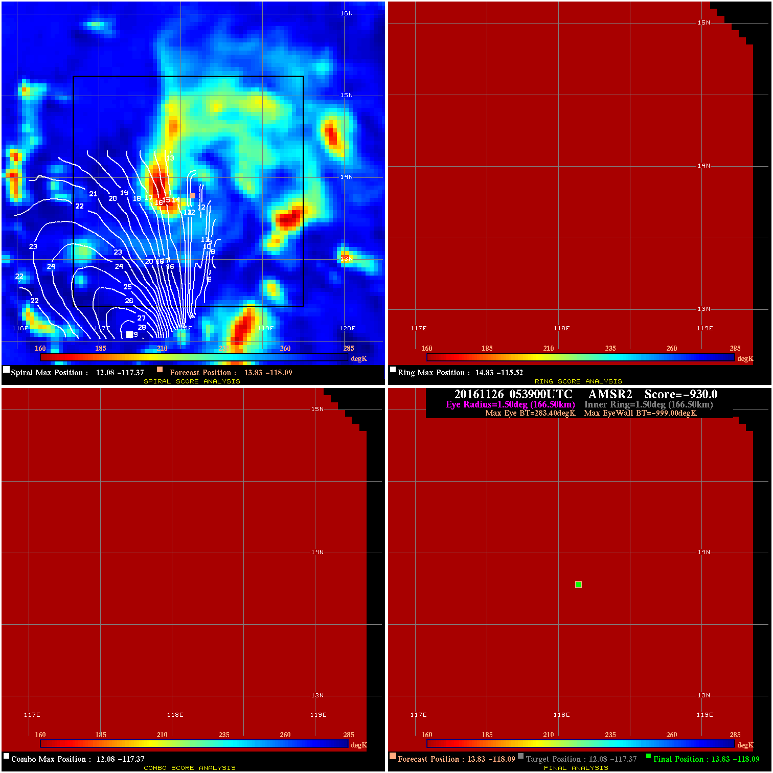
20161126 053900 -930.0 N/A N/A N/A 0.00 50.0 AMSR2 13.8 -118.1 13.8 -118.1 12.1 -117.4 Analysis Plot
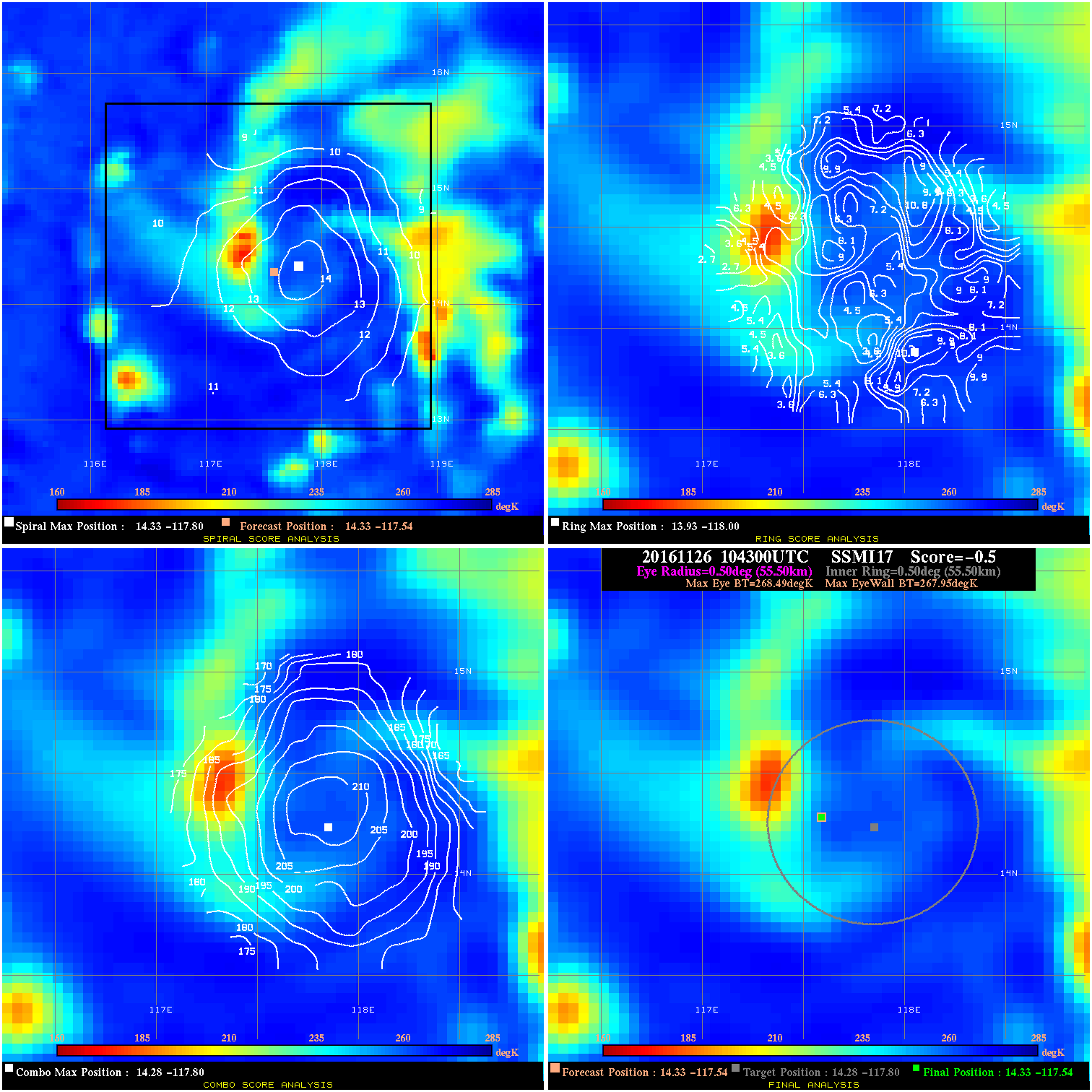
20161126 104300 -0.5 N/A 19.2% 111.10 .54 50.0 SSMI17 14.3 -117.5 14.3 -117.5 14.3 -117.8 Analysis Plot
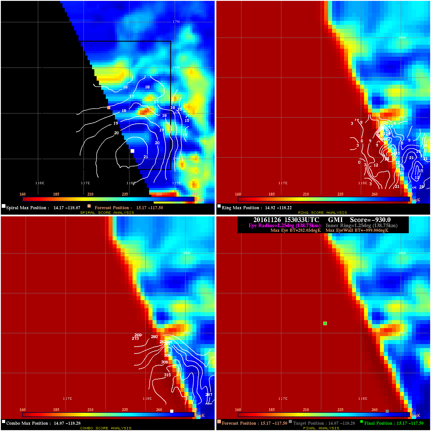
20161126 153033 -930.0 N/A N/A N/A 0.00 50.0 GMI 15.2 -117.5 15.2 -117.5 14.1 -118.3 Analysis Plot
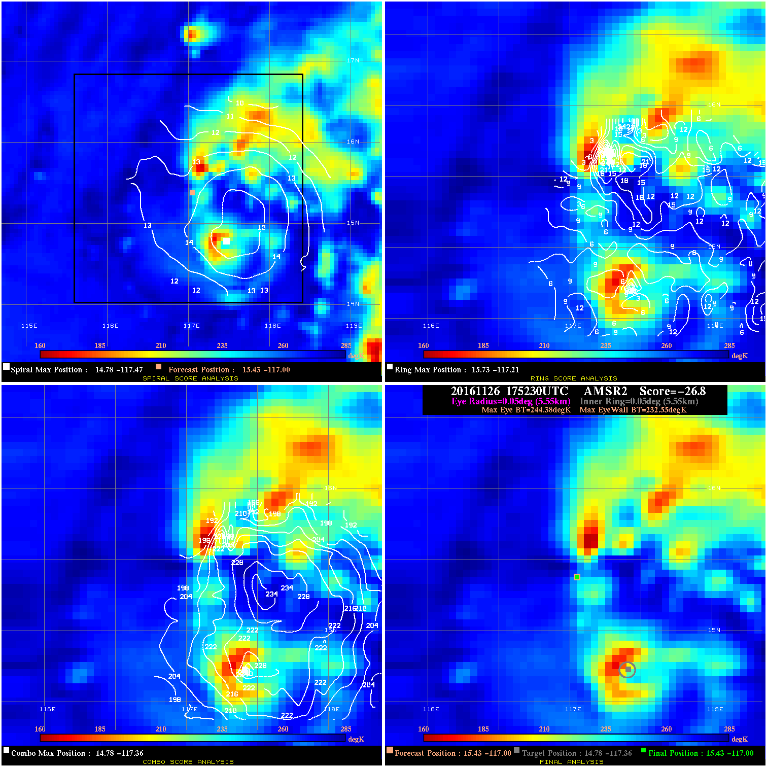
20161126 175230 -26.8 N/A 93.2% 11.11 11.83 45.0 AMSR2 15.4 -117.0 15.4 -117.0 14.8 -117.4 Analysis Plot
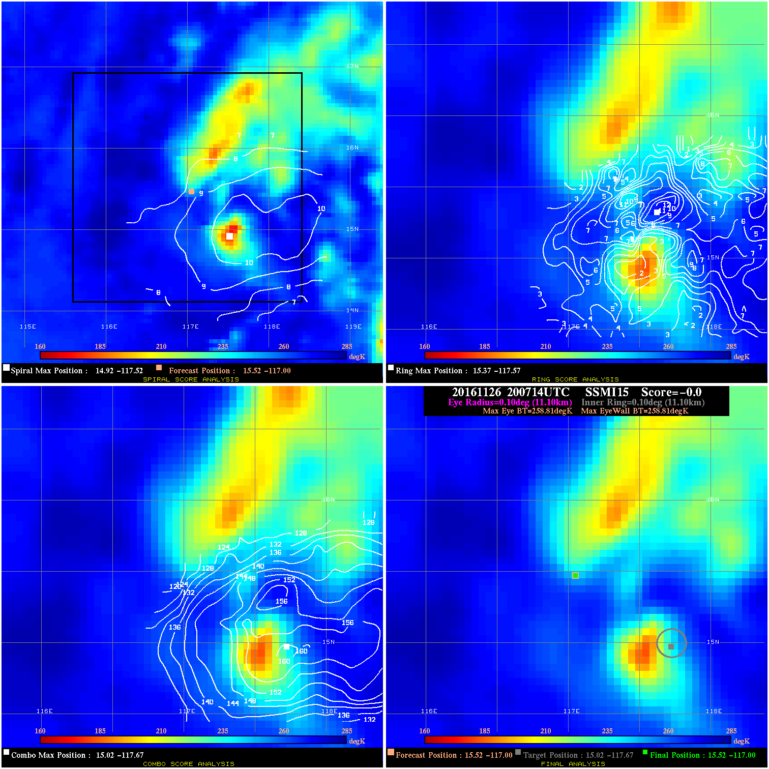
20161126 200714 -0.0 N/A N/A N/A 0.00 45.0 SSMI15 15.5 -117.0 15.5 -117.0 15.0 -117.7 Analysis Plot
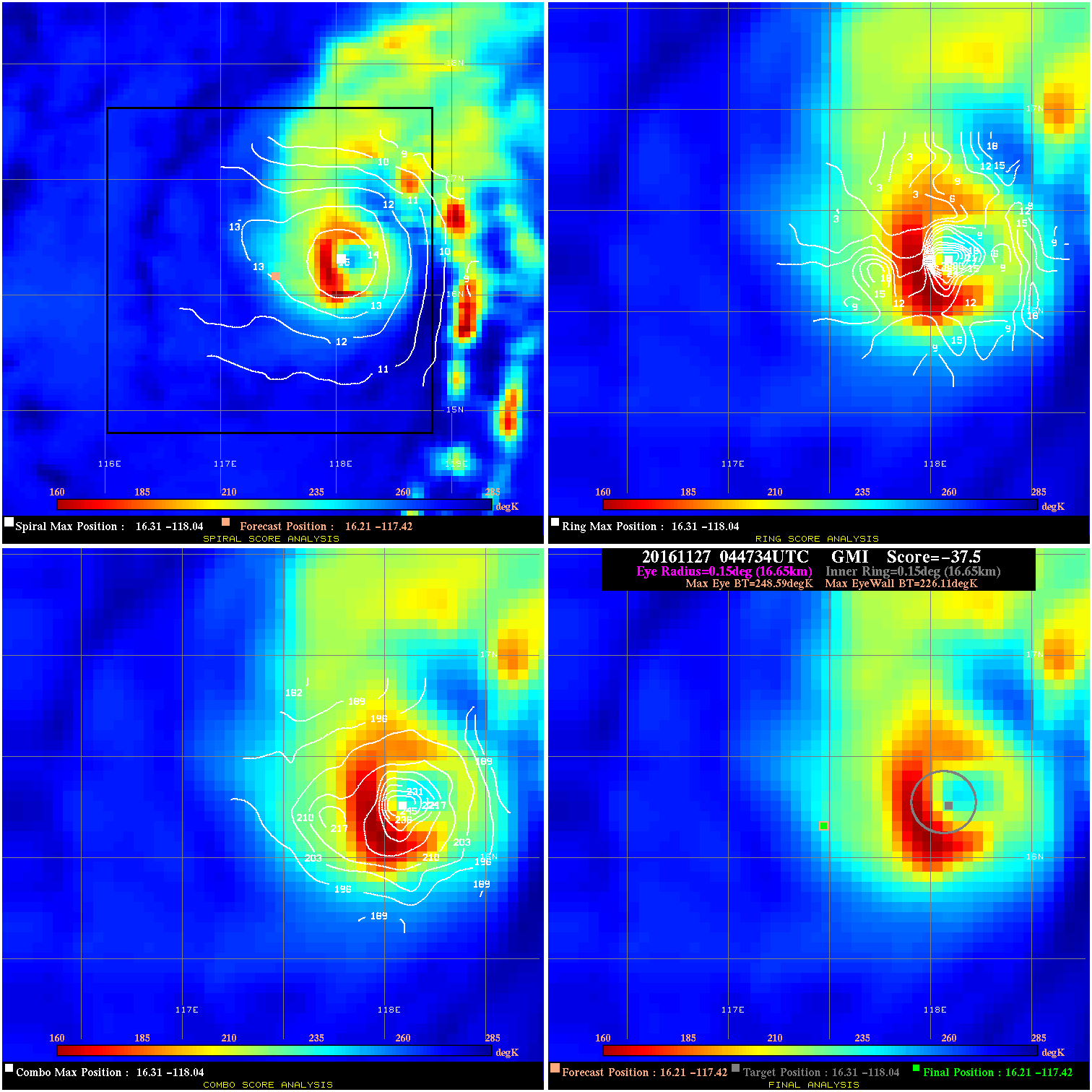
20161127 044734 -37.5 N/A 100.0% 33.33 22.48 45.0 GMI 16.2 -117.4 16.2 -117.4 16.3 -118.0 Analysis Plot
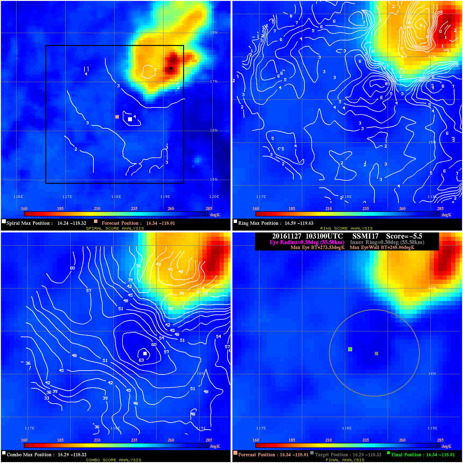
20161127 103100 -5.5 N/A 2.7% 111.10 5.47 45.0 SSMI17 16.3 -118.0 16.3 -118.0 16.3 -118.3 Analysis Plot
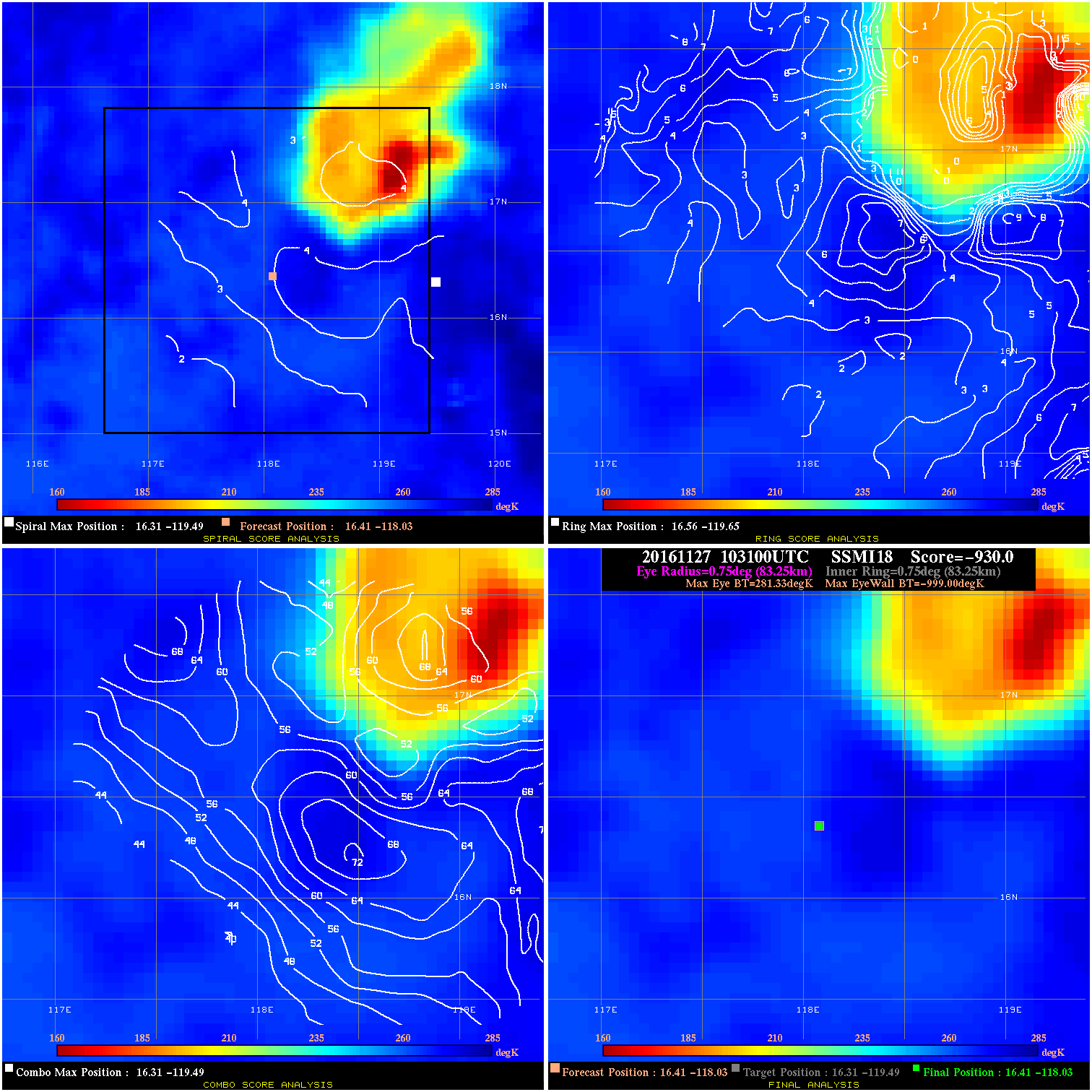
20161127 103100 -930.0 N/A N/A N/A 0.00 45.0 SSMI18 16.4 -118.0 16.4 -118.0 16.3 -119.5 Analysis Plot
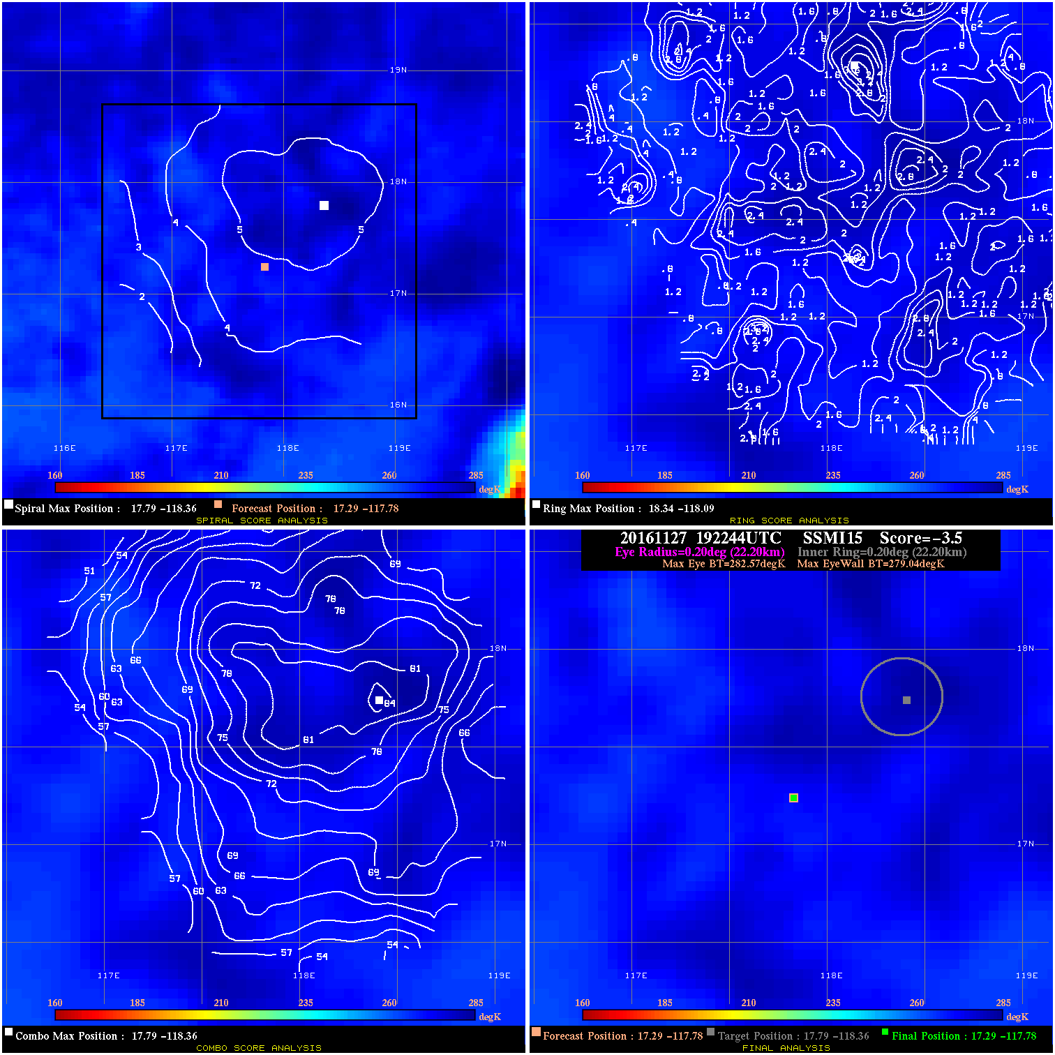
20161127 192244 -3.5 N/A N/A 44.44 3.53 40.0 SSMI15 17.3 -117.8 17.3 -117.8 17.8 -118.4 Analysis Plot
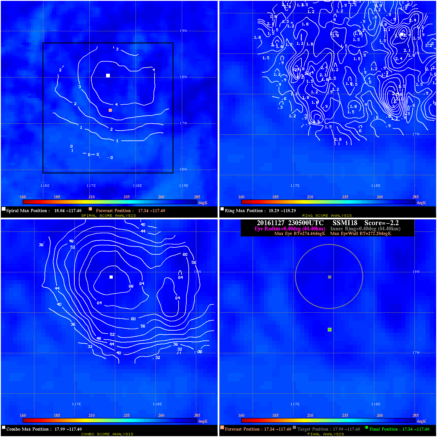
20161127 230500 -2.2 N/A N/A 88.88 2.18 40.0 SSMI18 17.3 -117.4 17.3 -117.4 18.0 -117.4 Analysis Plot
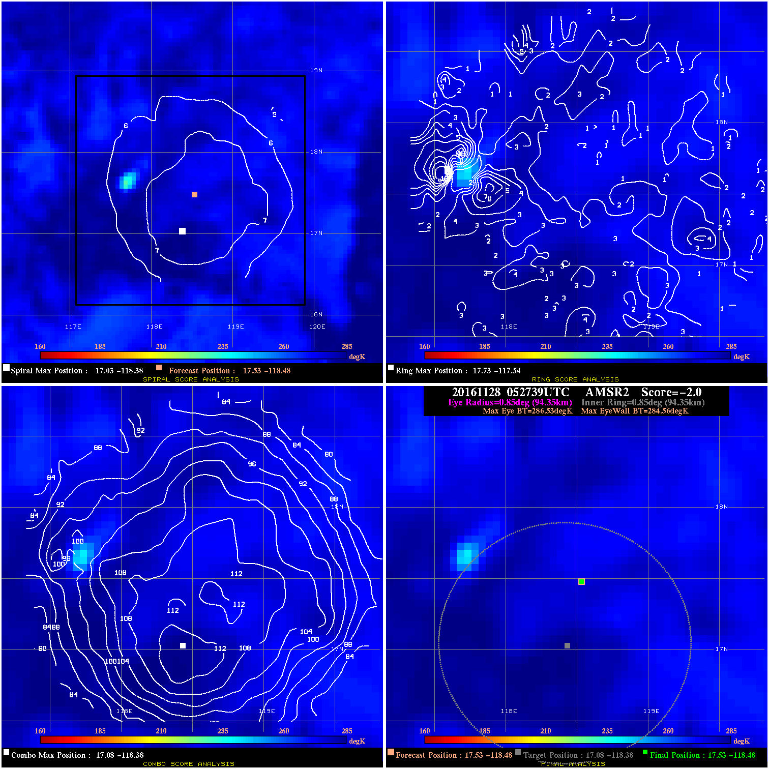
20161128 052739 -2.0 N/A N/A 188.87 1.97 30.0 AMSR2 17.5 -118.5 17.5 -118.5 17.1 -118.4 Analysis Plot
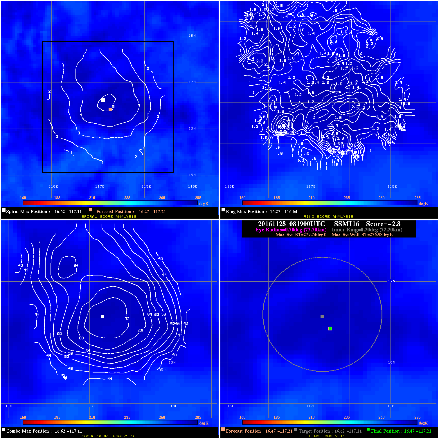
20161128 081900 -2.8 N/A N/A 155.54 2.76 25.0 SSMI16 16.5 -117.2 16.5 -117.2 16.6 -117.1 Analysis Plot
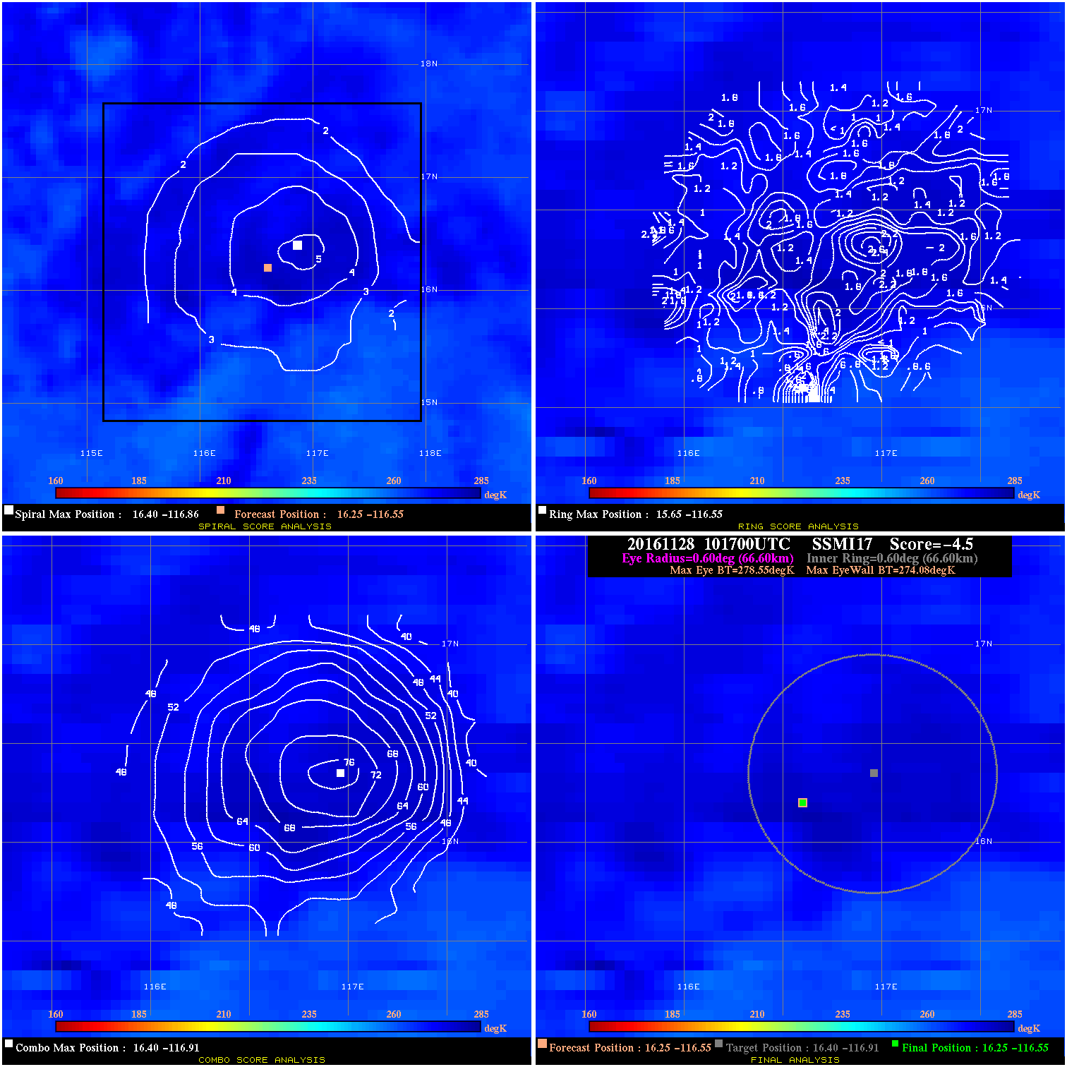
20161128 101700 -4.5 N/A N/A 133.32 4.47 25.0 SSMI17 16.3 -116.6 16.3 -116.6 16.4 -116.9 Analysis Plot
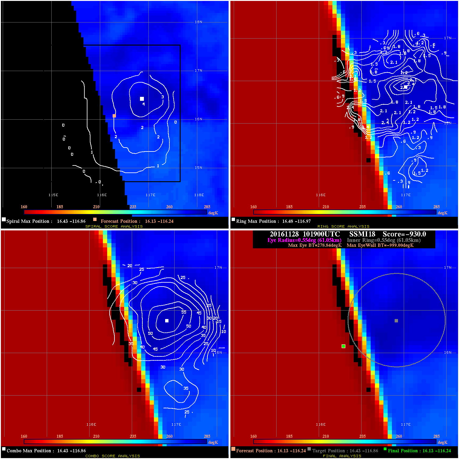
20161128 101900 -930.0 N/A N/A N/A 0.00 25.0 SSMI18 16.1 -116.2 16.1 -116.2 16.4 -116.9 Analysis Plot
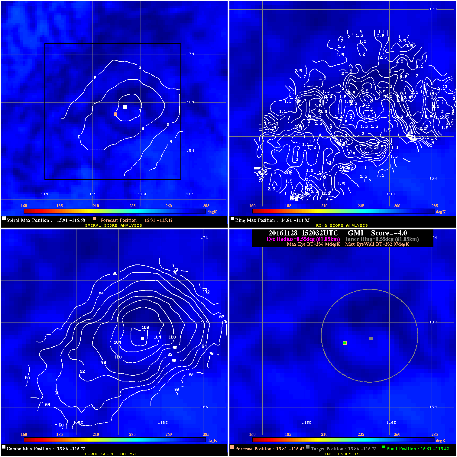
20161128 152032 -4.0 N/A N/A 122.21 3.97 25.0 GMI 15.8 -115.4 15.8 -115.4 15.9 -115.7 Analysis Plot
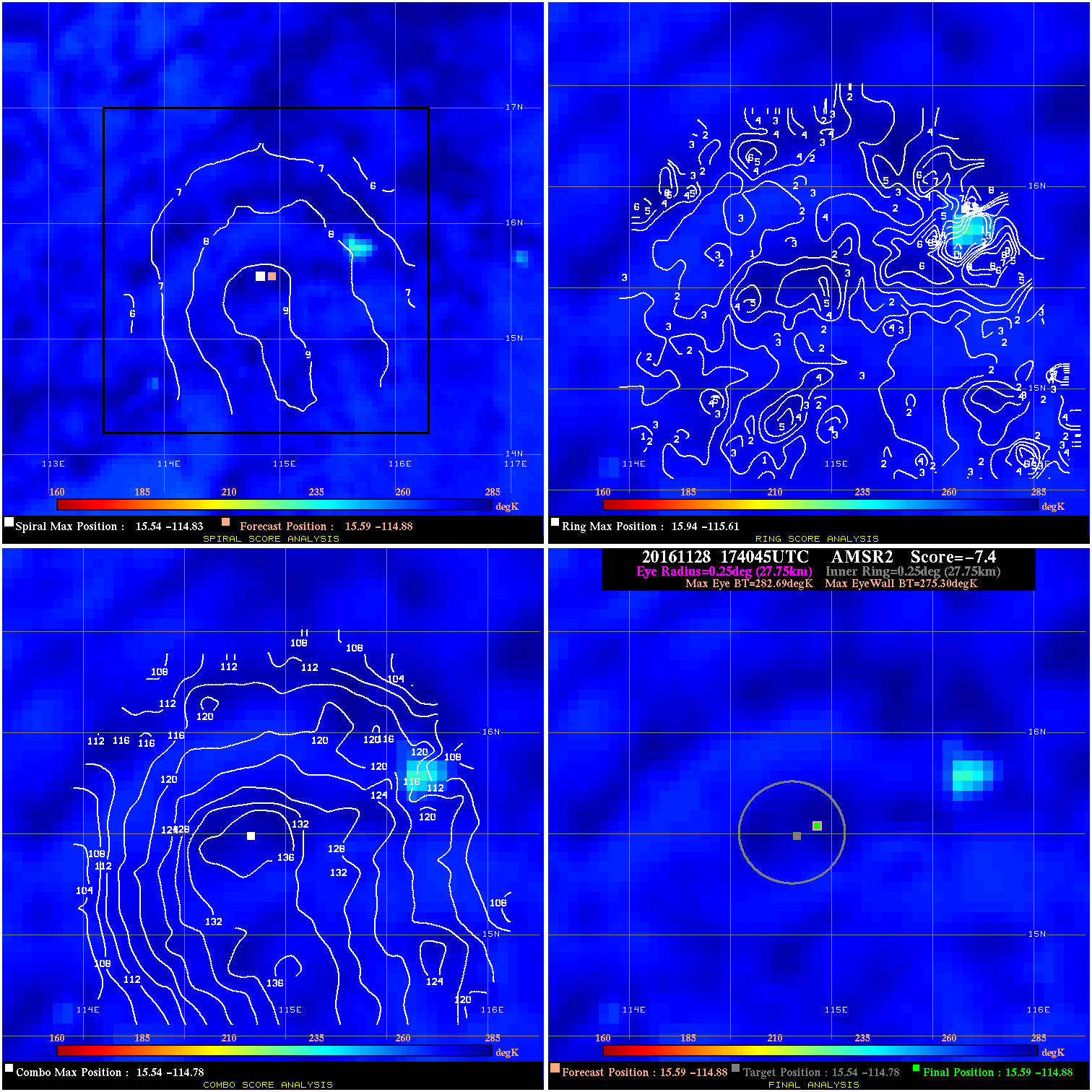
20161128 174045 -7.4 N/A N/A 55.55 7.39 25.0 AMSR2 15.6 -114.9 15.6 -114.9 15.5 -114.8 Analysis Plot
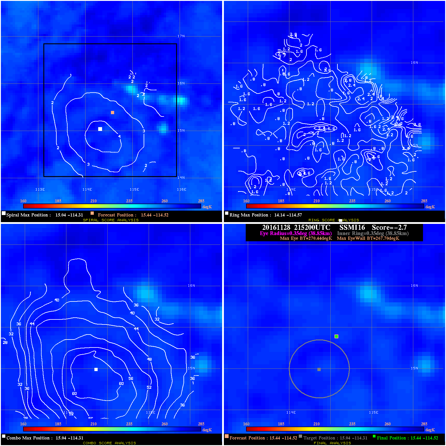
20161128 215200 -2.7 N/A N/A 77.77 2.74 25.0 SSMI16 15.4 -114.5 15.4 -114.5 15.0 -114.3 Analysis Plot
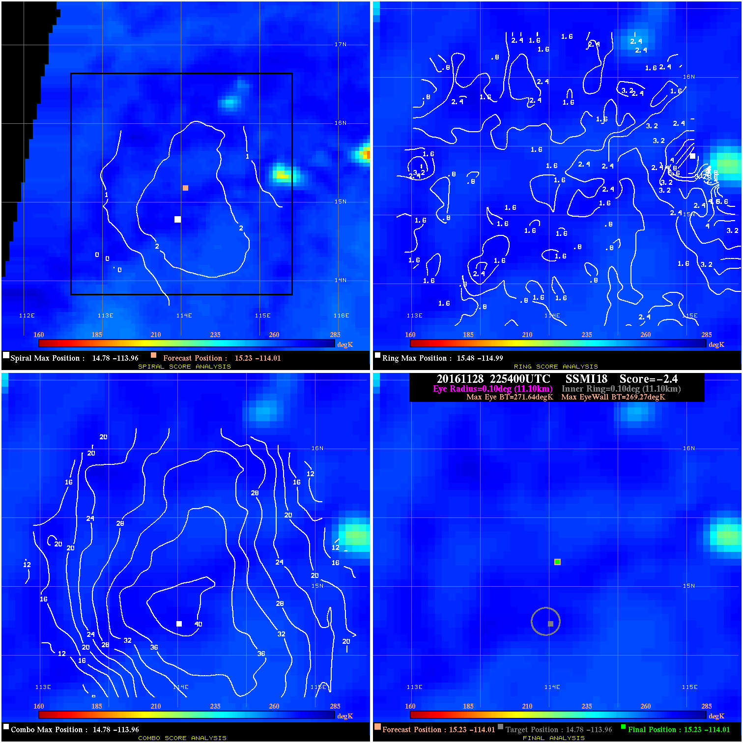
20161128 225400 -2.4 N/A N/A 22.22 2.37 25.0 SSMI18 15.2 -114.0 15.2 -114.0 14.8 -114.0 Analysis Plot
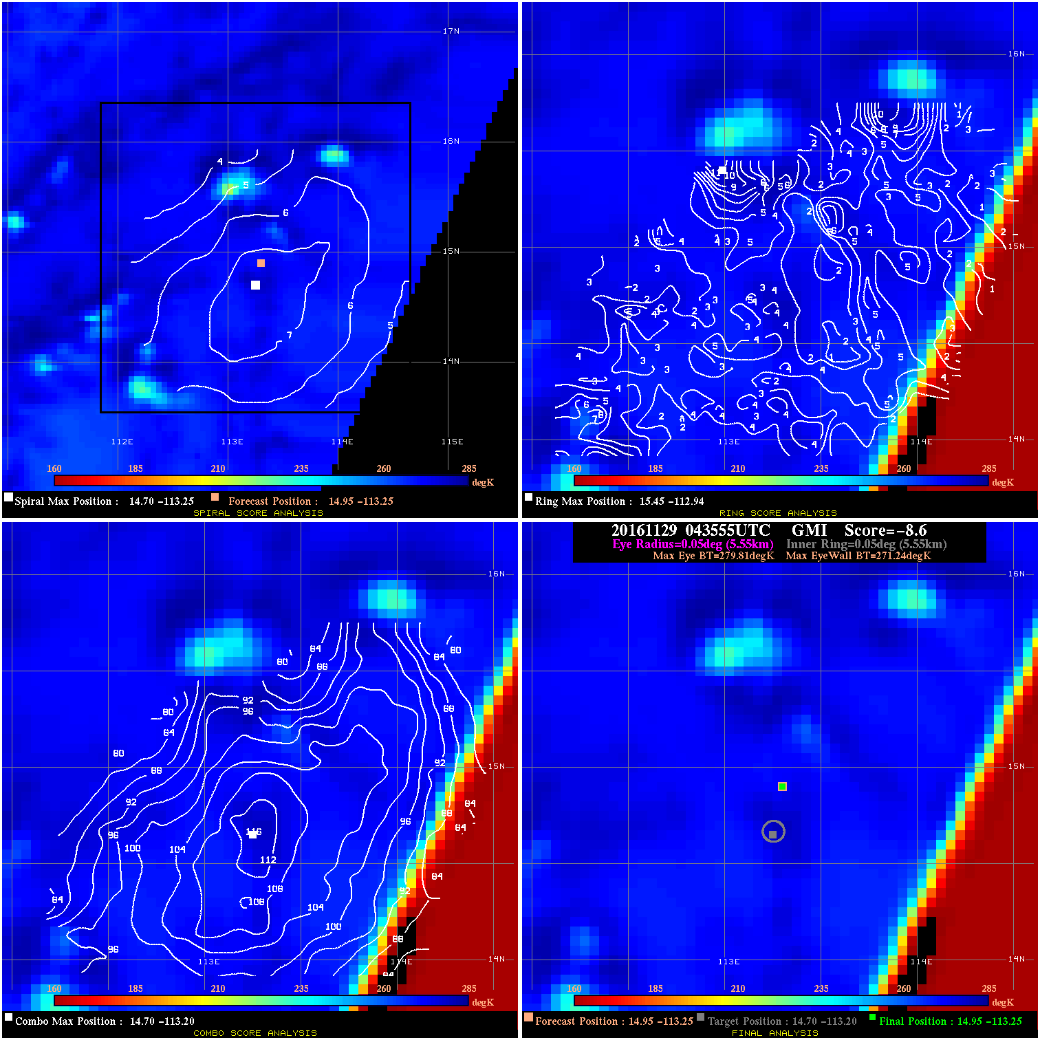
20161129 043555 -8.6 N/A N/A 11.11 8.57 25.0 GMI 14.9 -113.3 14.9 -113.3 14.7 -113.2 Analysis Plot
|
|
Legend: - Date/Time are determined from PMW imagery at Forecast (initial guess) Lat/Lon position. - Positive/Negative Latitude = North/South Hemisphere; Longitude = Western/Eastern Hemisphere. - "Ring Diam" value indicates the estimated surface eyewall diameter in km (the MI eyewall edge diameter minus 10 km). - "Ring Pct" is the percentage of the "ring" (eyewall inner boundary) that is 1) colder than the "hot spot" (warmest eye pixel) in the eye by 20K, or 2) the percentage that is a) colder than 232K and b) colder than the "hot spot" by 10K, whichever is greater. - Values are red if Ring % <= 65, yellow/brown if Ring % <= 85 and green if Ring % > 85. - "Tb diff" is the difference between the "hot spot" (warmest eye pixel) and the warmest pixel on the eyewall. - Intensity score are listed as negative, and not used, when the JTWC or NHC estimated Vmax is <55 kts in order to rule out weak but highly symmetric TCs. - Error messages in intensity scores: -920 is used when the hottest pixel in the eye is <200K, to prevent false positives; -930 means <85% of eyewall has observations/data. |