Tropical Storm 21W
|
Passive Microwave (PMW) Intensity Information Advanced Dvorak Technique (ADT) Version 8.2.1 |
Overpass Inten Ring Ring Wind Forecast Final Target
Date Time Score Meaning Pct Diam BTdiff Est Sat Lat Lon Lat Lon Lat Lon
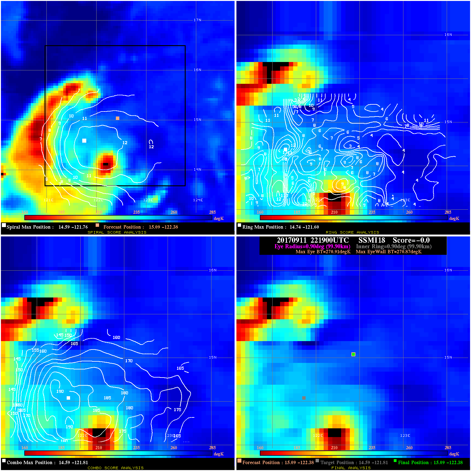
20170911 221900 -0.0 N/A 63.0% 199.98 .04 25.0 SSMI18 15.1 -122.4 15.1 -122.4 14.6 -121.8 Analysis Plot
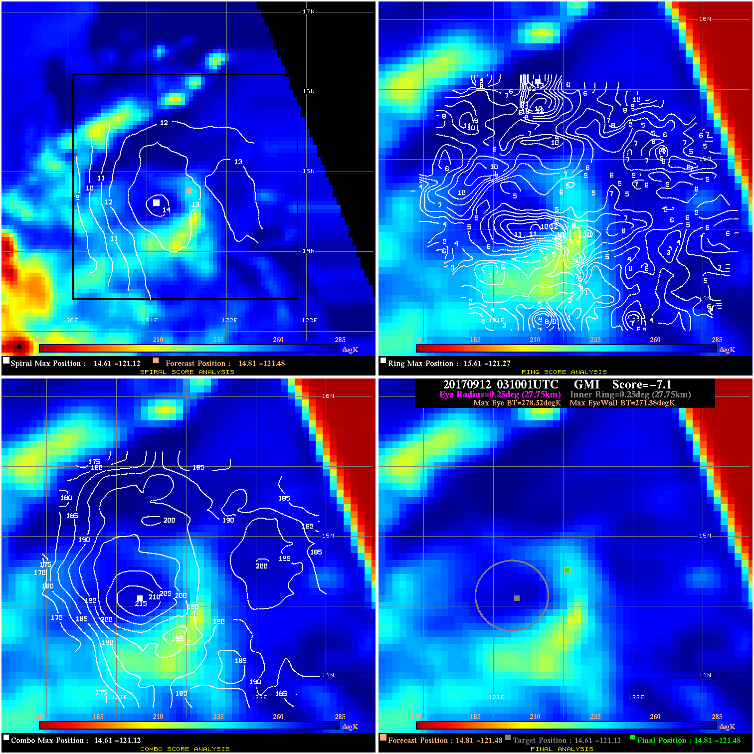
20170912 031001 -7.1 N/A 12.3% 55.55 7.14 25.0 GMI 14.8 -121.5 14.8 -121.5 14.6 -121.1 Analysis Plot
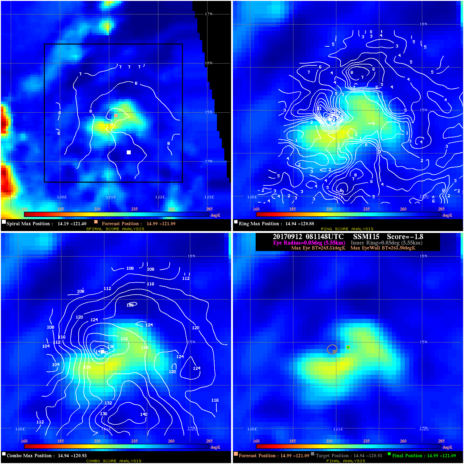
20170912 081148 -1.8 N/A 37.0% 11.11 1.81 25.0 SSMI15 15.0 -121.1 15.0 -121.1 14.9 -120.9 Analysis Plot
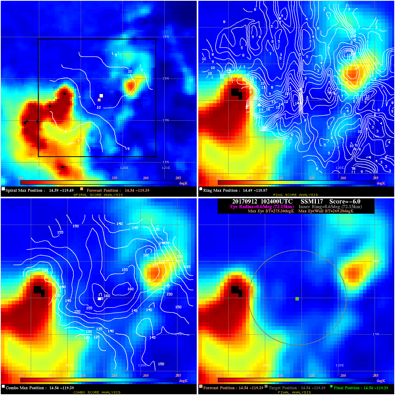
20170912 102400 -6.0 N/A 24.7% 144.43 6.02 25.0 SSMI17 14.5 -119.4 14.5 -119.4 14.5 -119.4 Analysis Plot
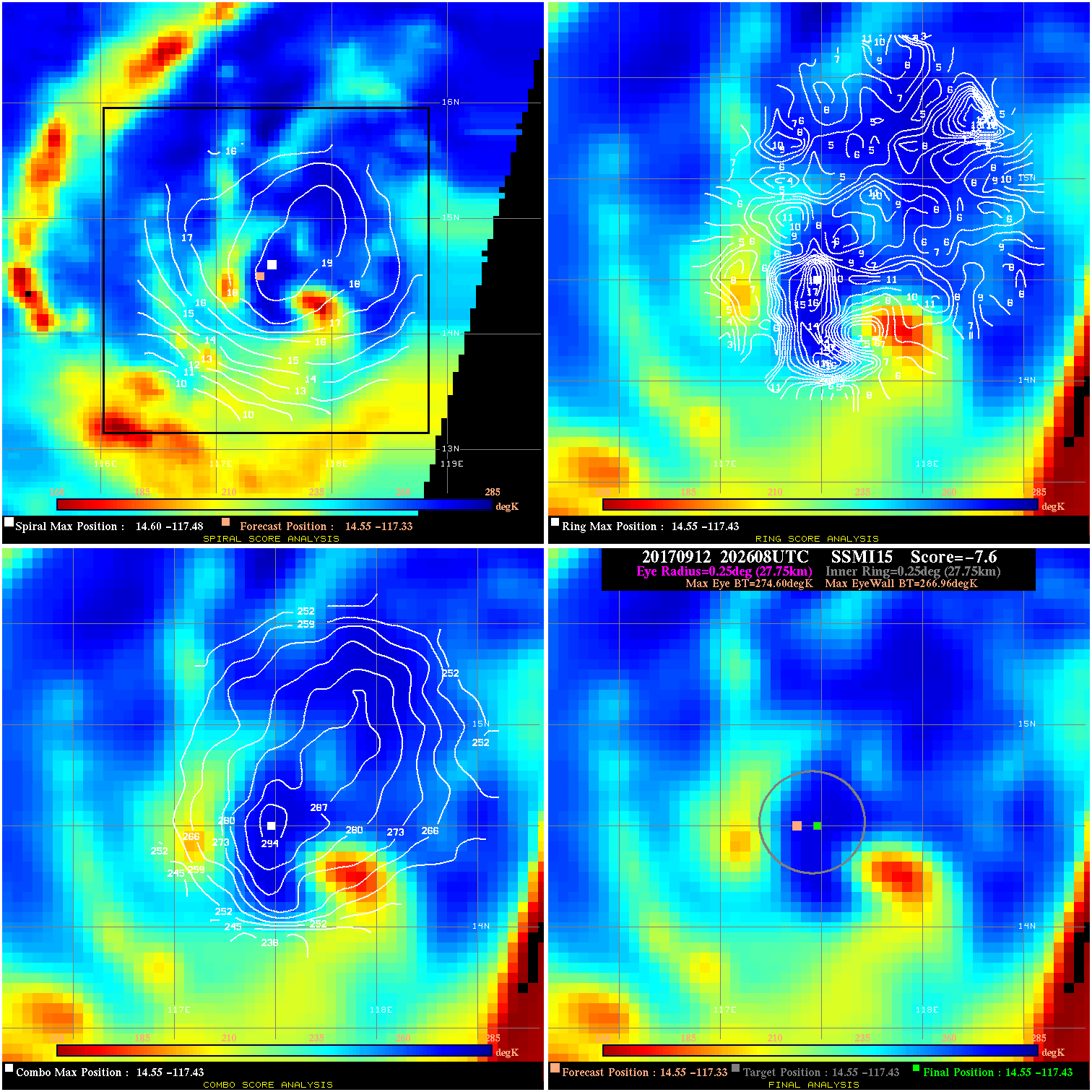
20170912 202608 -7.6 N/A 37.0% 55.55 7.64 35.0 SSMI15 14.6 -117.3 14.6 -117.4 14.6 -117.4 Analysis Plot
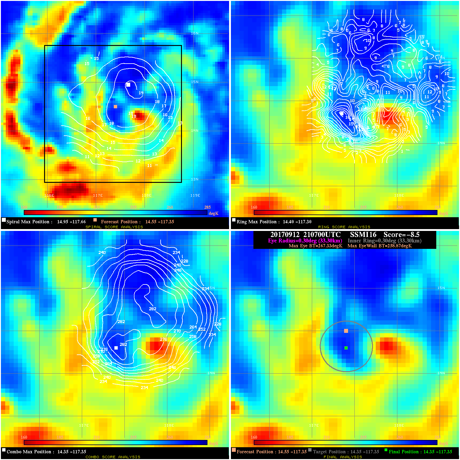
20170912 210700 -8.5 N/A 71.2% 66.66 8.46 35.0 SSMI16 14.6 -117.3 14.4 -117.3 14.4 -117.3 Analysis Plot
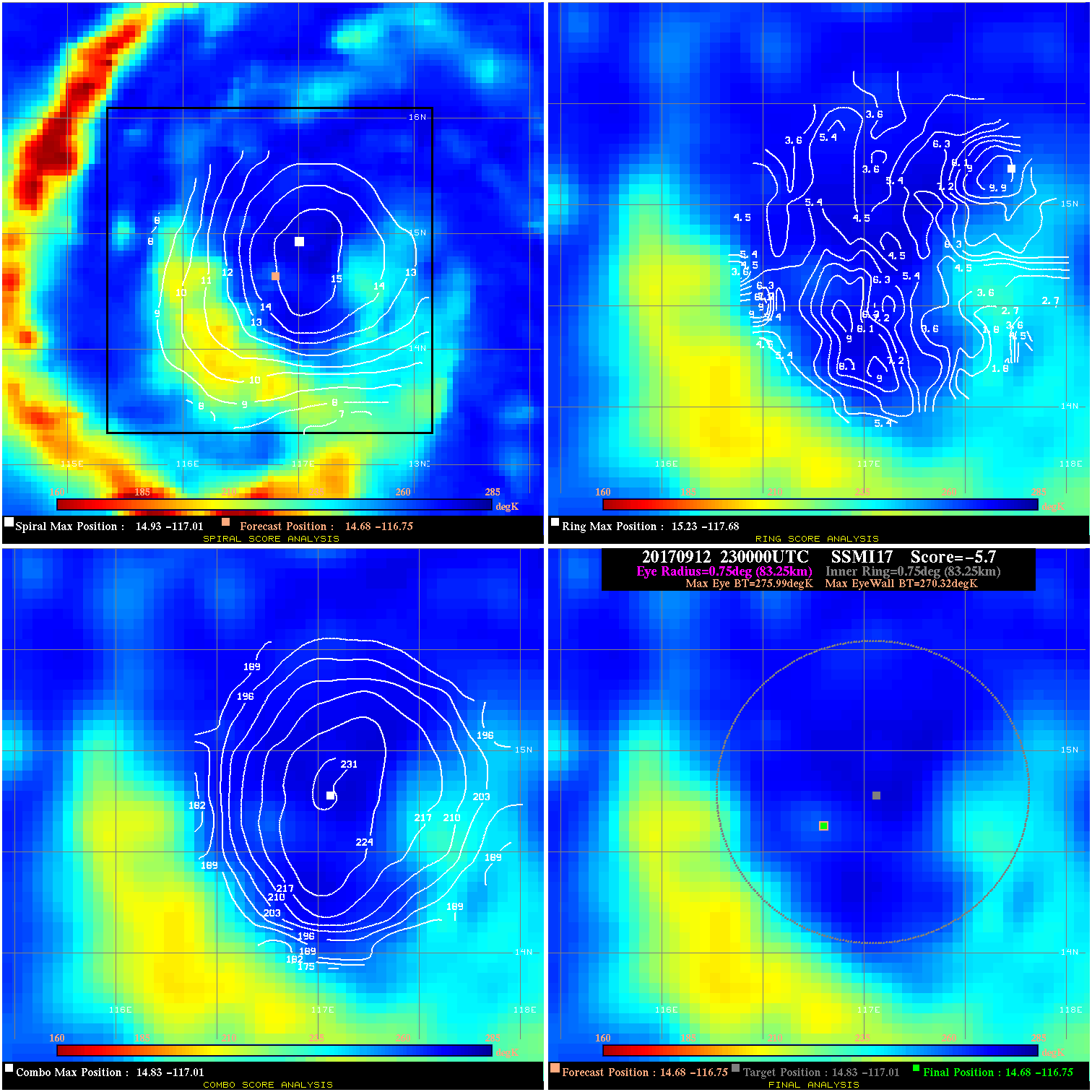
20170912 230000 -5.7 N/A 4.1% 166.65 5.67 35.0 SSMI17 14.7 -116.8 14.7 -116.8 14.8 -117.0 Analysis Plot
20170913 200937 6.2 N/A 23.3% 244.42 6.18 60.0 SSMI15 15.8 -113.2 16.0 -113.1 16.0 -113.1 Analysis Plot
20170913 224700 16.8 N/A 17.8% 122.21 16.82 60.0 SSMI17 16.0 -112.6 16.1 -112.6 16.1 -112.6 Analysis Plot
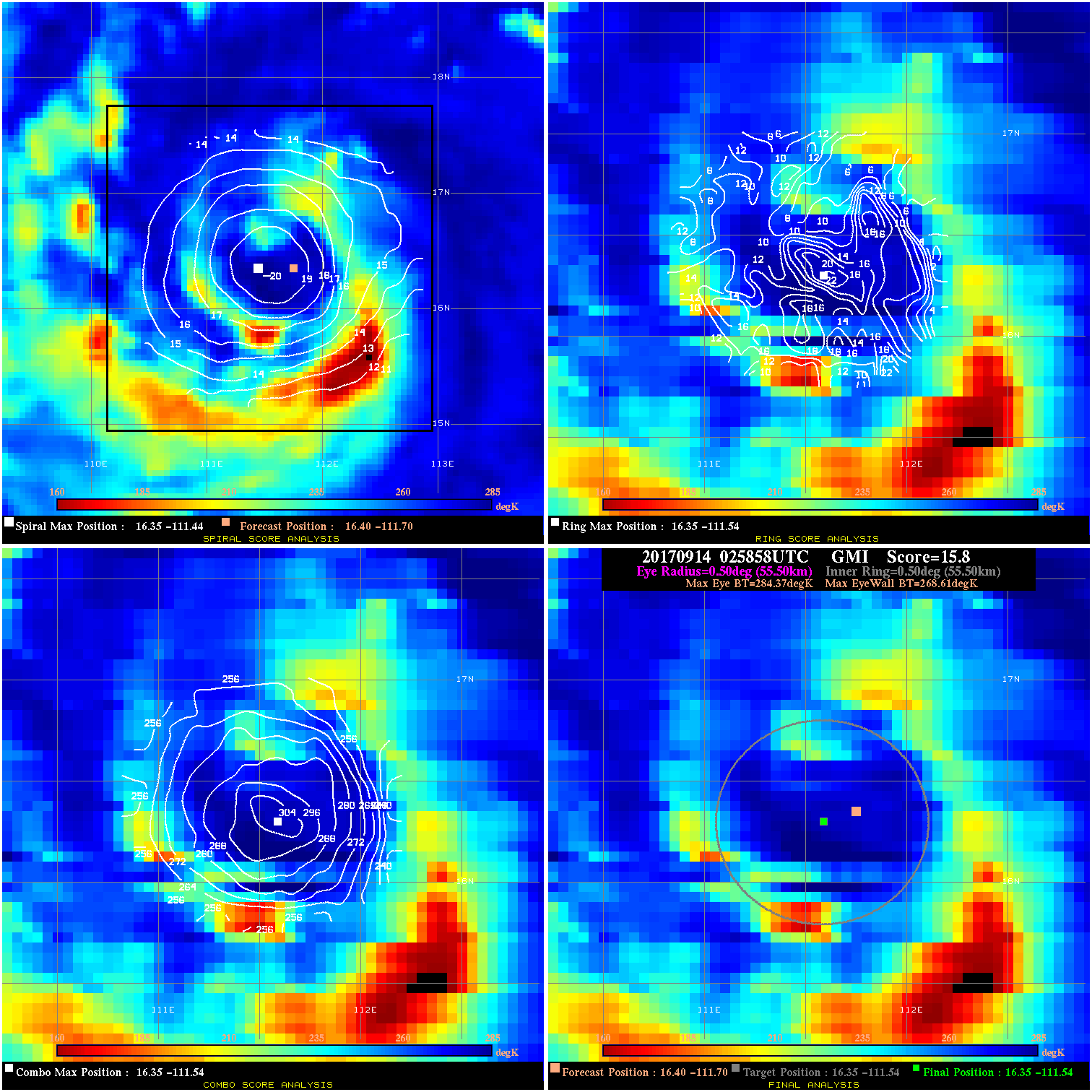
20170914 025858 15.8 N/A 42.5% 111.10 15.76 65.0 GMI 16.4 -111.7 16.4 -111.5 16.4 -111.5 Analysis Plot
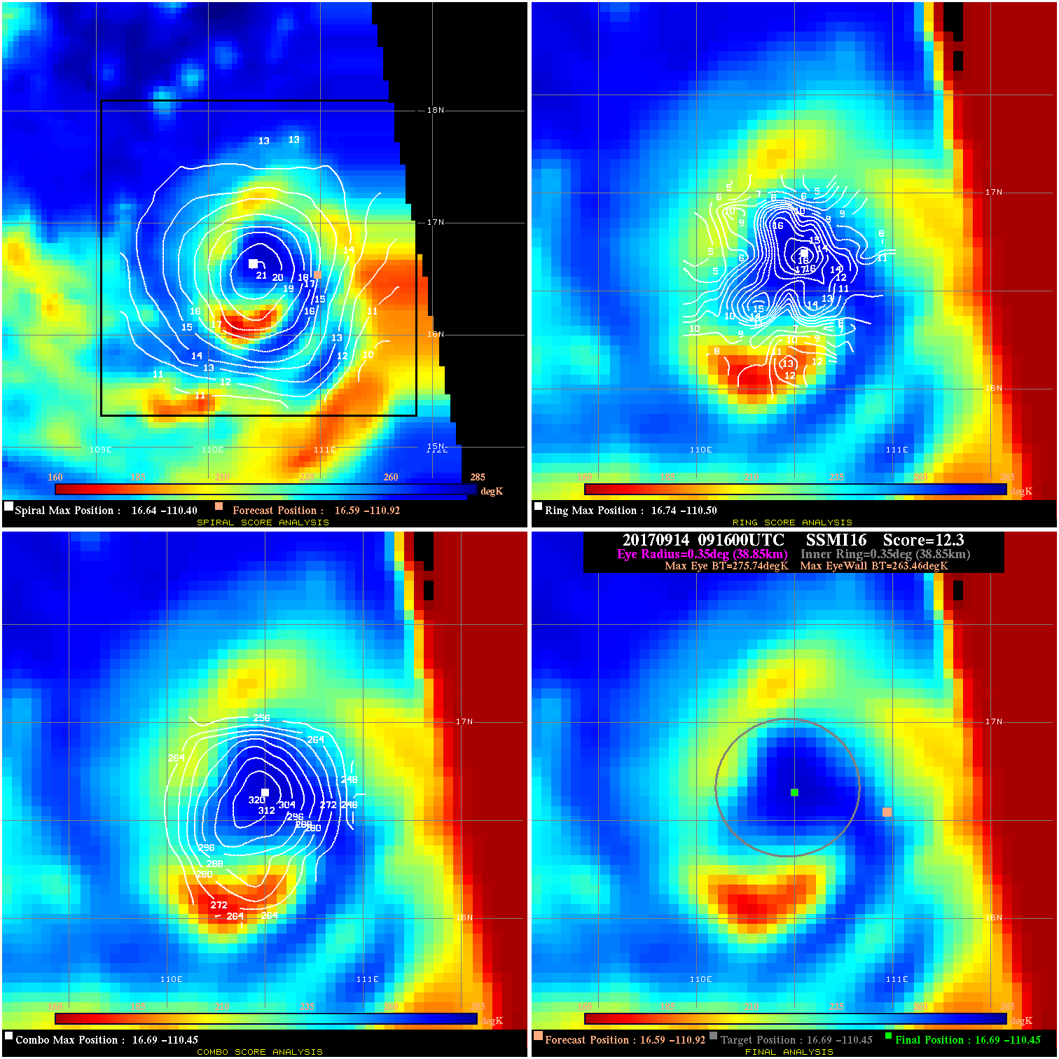
20170914 091600 12.3 N/A 64.4% 77.77 12.28 75.0 SSMI16 16.6 -110.9 16.7 -110.4 16.7 -110.4 Analysis Plot
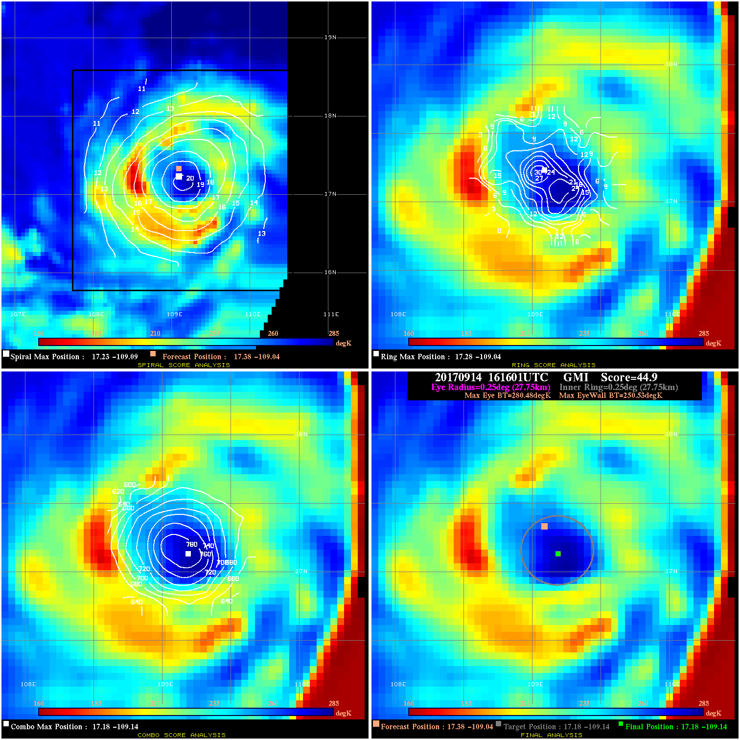
20170914 161601 44.9 >65 kts 100.0% 55.55 29.95 85.0 GMI 17.4 -109.0 17.2 -109.1 17.2 -109.1 Analysis Plot
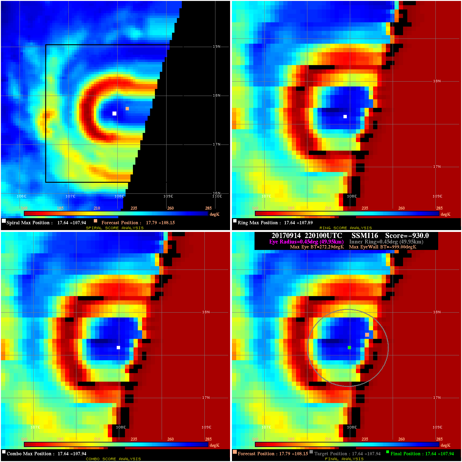
20170914 220100 -930.0 N/A N/A N/A 0.00 90.0 SSMI16 17.8 -108.2 17.6 -107.9 17.6 -107.9 Analysis Plot
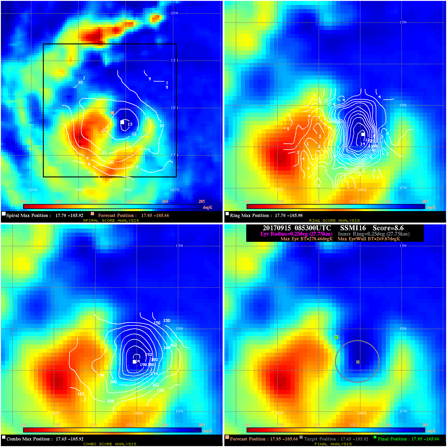
20170915 085300 8.6 N/A 69.9% 55.55 8.59 80.0 SSMI16 18.0 -105.7 18.0 -105.7 17.6 -105.9 Analysis Plot
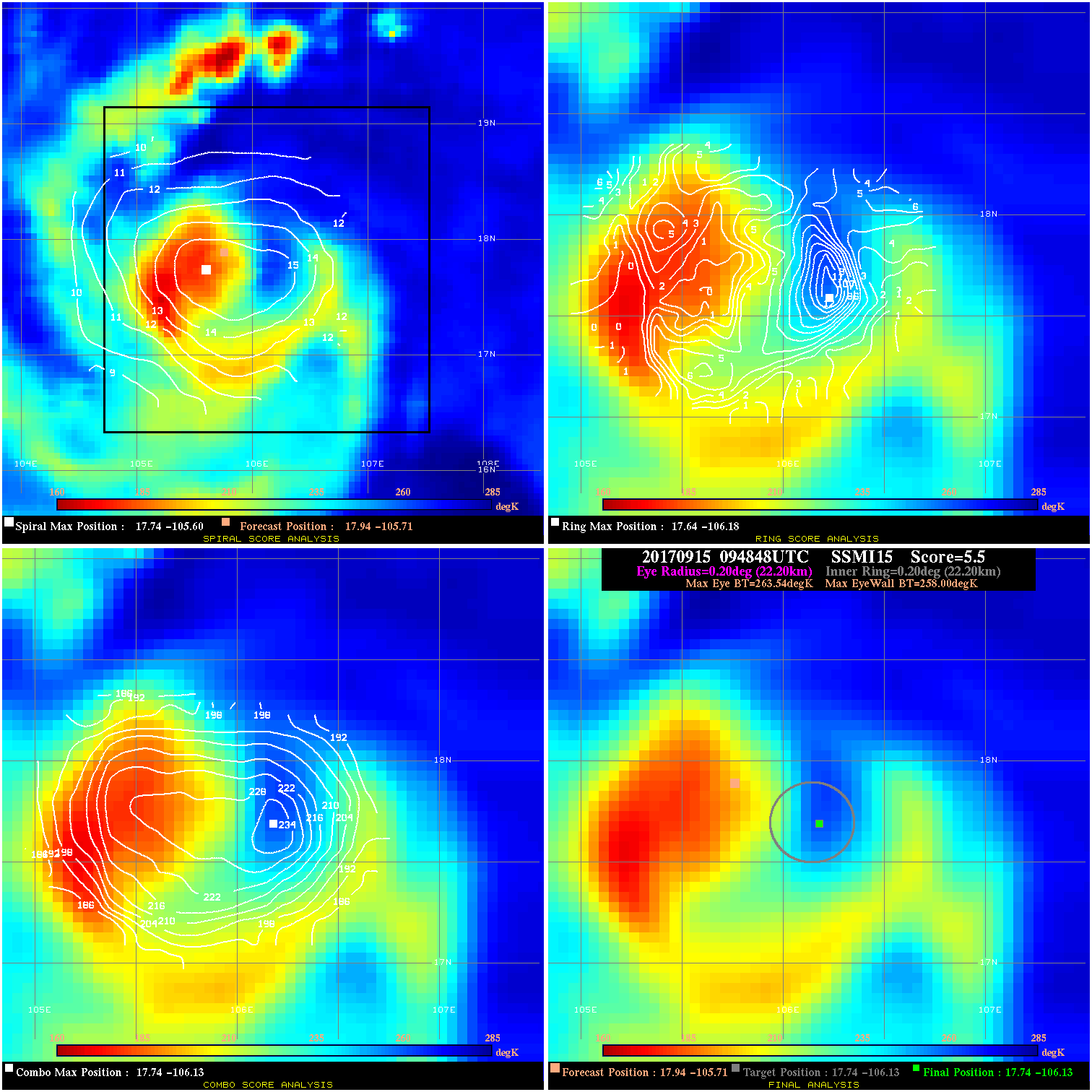
20170915 094848 5.5 N/A 74.0% 44.44 5.54 80.0 SSMI15 17.9 -105.7 17.7 -106.1 17.7 -106.1 Analysis Plot
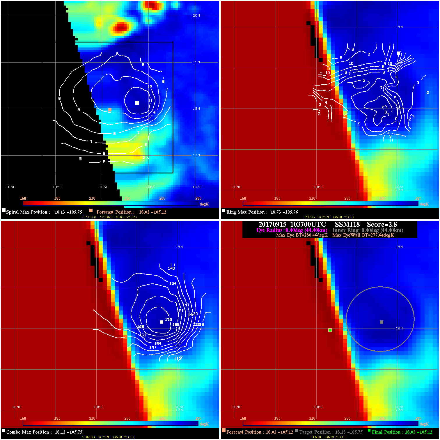
20170915 103700 2.8 N/A N/A 88.88 2.82 80.0 SSMI18 18.0 -105.1 18.0 -105.1 18.1 -105.8 Analysis Plot
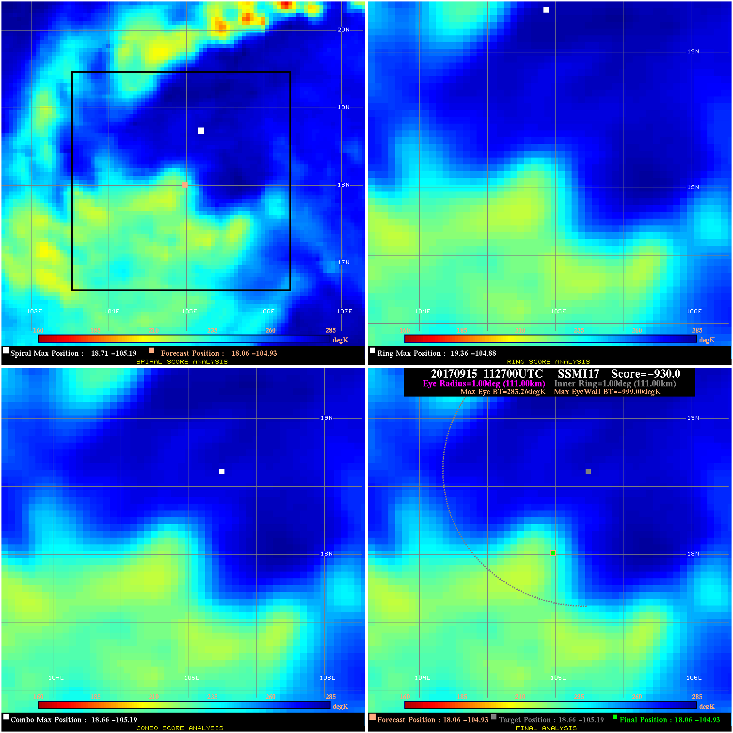
20170915 112700 -930.0 N/A N/A N/A 0.00 80.0 SSMI17 18.1 -104.9 18.1 -104.9 18.7 -105.2 Analysis Plot
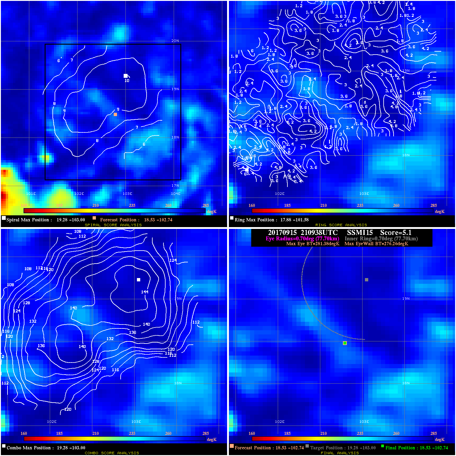
20170915 210938 5.1 N/A N/A 155.54 5.12 80.0 SSMI15 18.5 -102.7 18.5 -102.7 19.3 -103.0 Analysis Plot
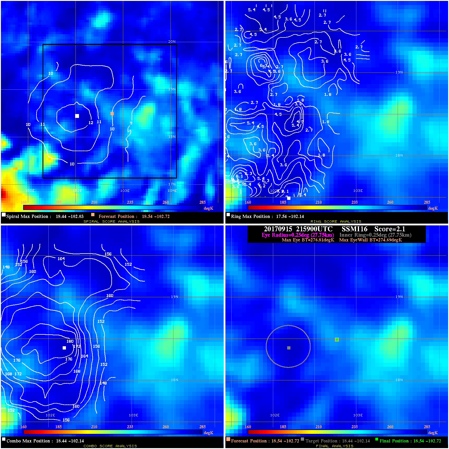
20170915 215900 2.1 N/A N/A 55.55 2.12 80.0 SSMI16 18.5 -102.7 18.5 -102.7 18.4 -102.1 Analysis Plot
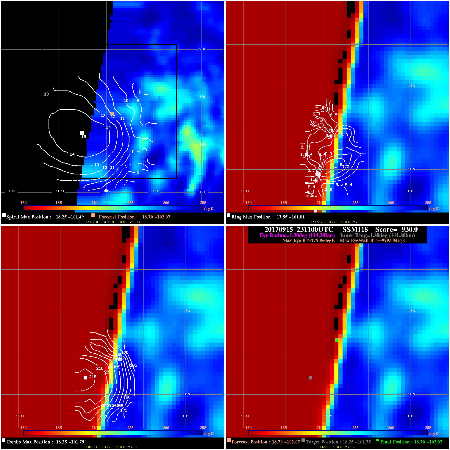
20170915 231100 -930.0 N/A N/A N/A 0.00 80.0 SSMI18 18.7 -102.1 18.7 -102.1 18.3 -101.8 Analysis Plot
20170916 000100 1.1 N/A 2.7% 66.66 1.13 80.0 SSMI17 18.8 -101.9 18.8 -101.9 18.7 -101.0 Analysis Plot
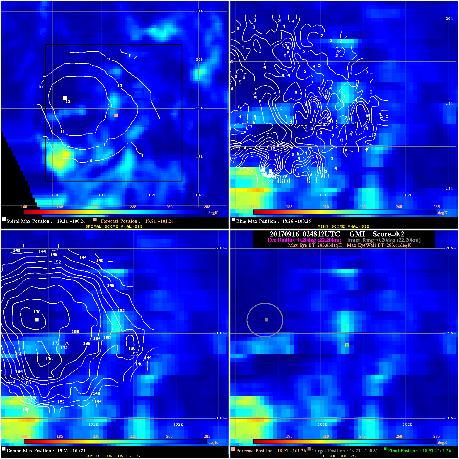
20170916 024812 0.2 N/A N/A 44.44 .22 80.0 GMI 18.9 -101.3 18.9 -101.3 19.2 -100.3 Analysis Plot
|
|
Legend: - Date/Time are determined from PMW imagery at Forecast (initial guess) Lat/Lon position. - Positive/Negative Latitude = North/South Hemisphere; Longitude = Western/Eastern Hemisphere. - "Ring Diam" value indicates the estimated surface eyewall diameter in km (the MI eyewall edge diameter minus 10 km). - "Ring Pct" is the percentage of the "ring" (eyewall inner boundary) that is 1) colder than the "hot spot" (warmest eye pixel) in the eye by 20K, or 2) the percentage that is a) colder than 232K and b) colder than the "hot spot" by 10K, whichever is greater. - Values are red if Ring % <= 65, yellow/brown if Ring % <= 85 and green if Ring % > 85. - "Tb diff" is the difference between the "hot spot" (warmest eye pixel) and the warmest pixel on the eyewall. - Intensity score are listed as negative, and not used, when the JTWC or NHC estimated Vmax is <55 kts in order to rule out weak but highly symmetric TCs. - Error messages in intensity scores: -920 is used when the hottest pixel in the eye is <200K, to prevent false positives; -930 means <85% of eyewall has observations/data. |