Tropical Depression 01A
|
Passive Microwave (PMW) Intensity Information Advanced Dvorak Technique (ADT) Version 8.2.1 |
Overpass Inten Ring Ring Wind Forecast Final Target
Date Time Score Meaning Pct Diam BTdiff Est Sat Lat Lon Lat Lon Lat Lon
20180516 201332 -930.0 N/A N/A N/A 0.00 35.0 GMI 13.2 -49.3 13.2 -49.3 12.9 -48.8 Analysis Plot
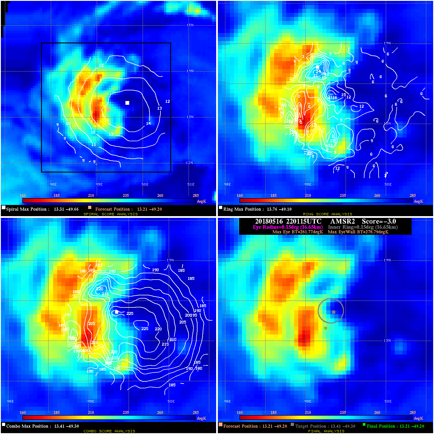
20180516 220115 -3.0 N/A 38.4% 33.33 2.98 35.0 AMSR2 13.2 -49.2 13.2 -49.2 13.4 -49.3 Analysis Plot
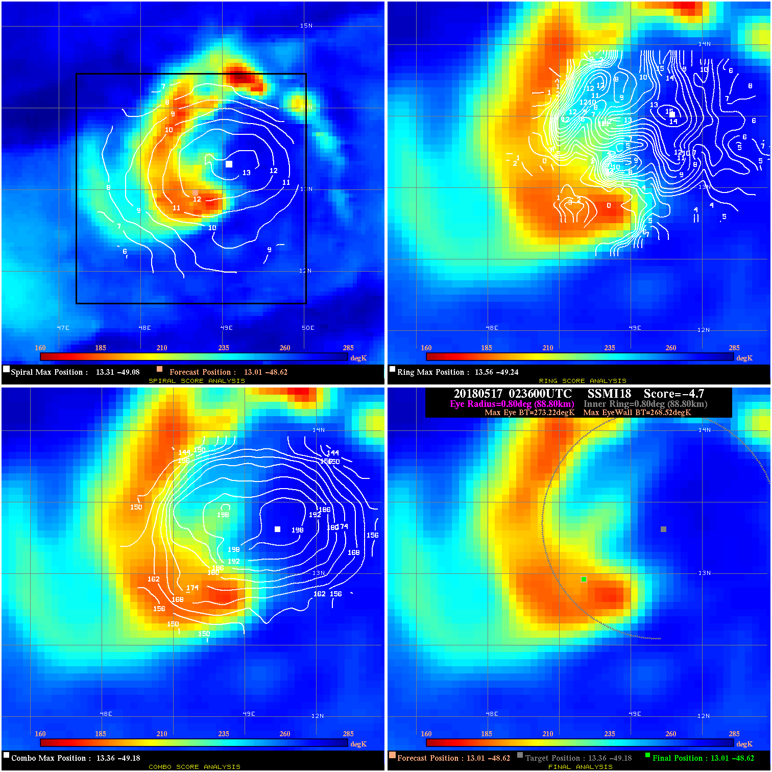
20180517 023600 -4.7 N/A 46.6% 177.76 4.70 40.0 SSMI18 13.0 -48.6 13.0 -48.6 13.4 -49.2 Analysis Plot
20180517 032100 -5.1 N/A 44.6% 222.20 5.11 40.0 SSMI17 13.0 -48.6 13.0 -48.6 13.3 -49.1 Analysis Plot
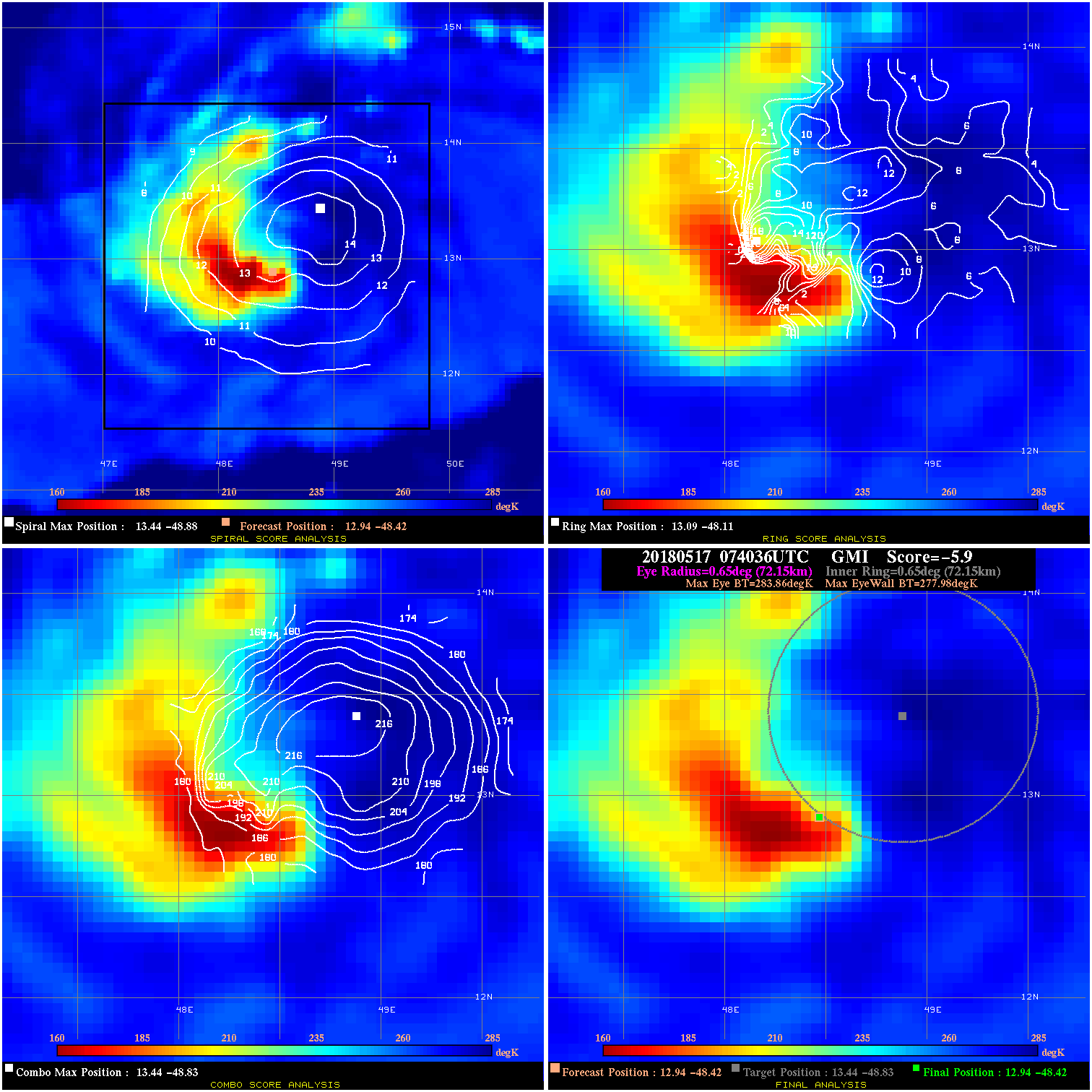
20180517 074036 -5.9 N/A 19.2% 144.43 5.88 40.0 GMI 12.9 -48.4 12.9 -48.4 13.4 -48.8 Analysis Plot
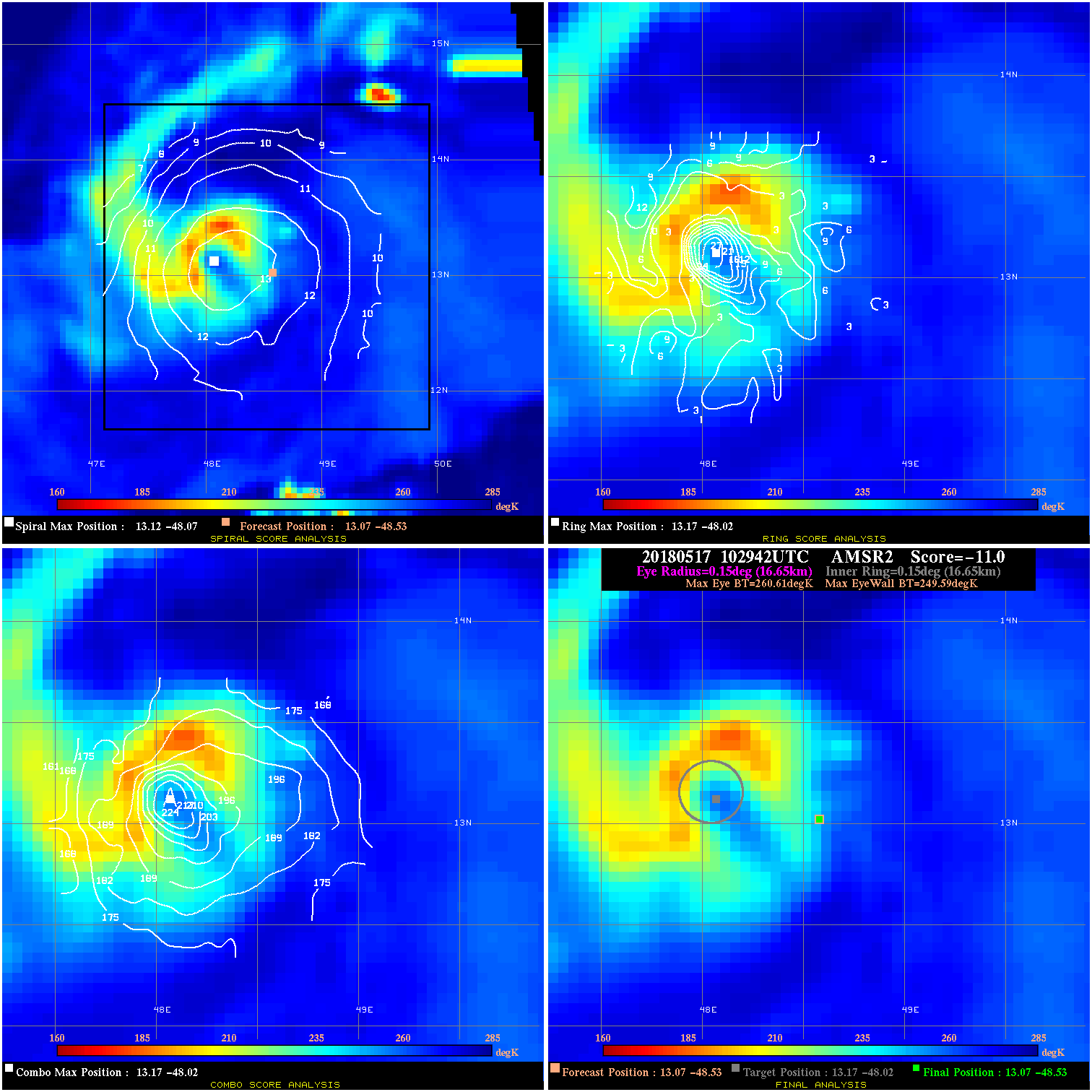
20180517 102942 -11.0 N/A 69.9% 33.33 11.02 40.0 AMSR2 13.1 -48.5 13.1 -48.5 13.2 -48.0 Analysis Plot
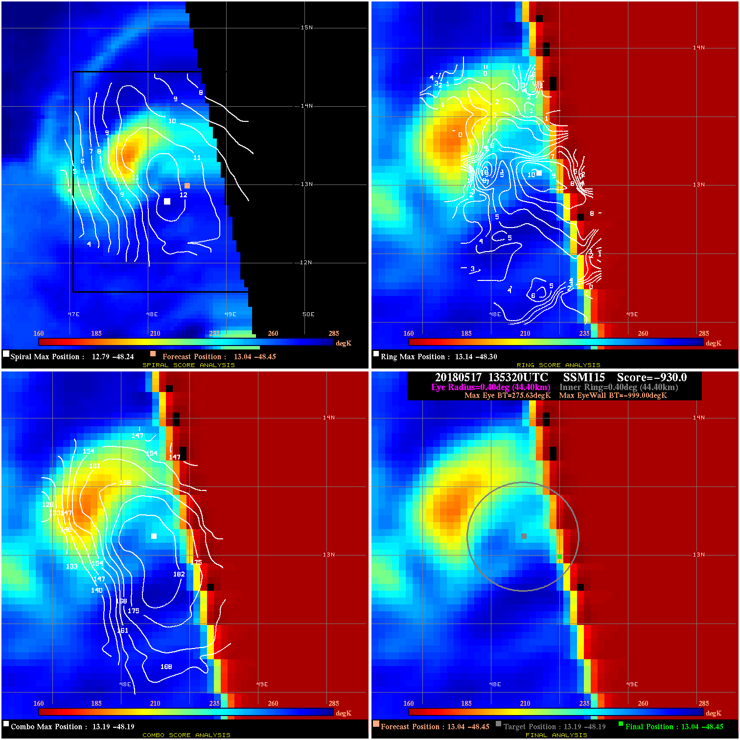
20180517 135320 -930.0 N/A N/A N/A 0.00 40.0 SSMI15 13.0 -48.5 13.0 -48.5 13.2 -48.2 Analysis Plot
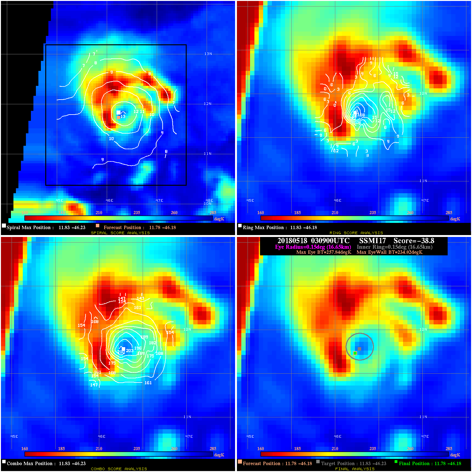
20180518 030900 -38.8 N/A 100.0% 33.33 23.82 45.0 SSMI17 11.8 -46.2 11.8 -46.2 11.8 -46.2 Analysis Plot
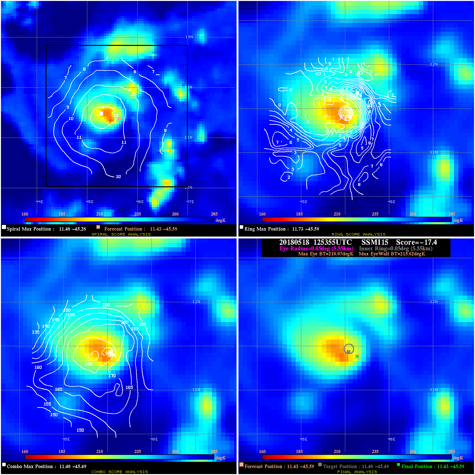
20180518 125355 -17.4 N/A 100.0% 11.11 2.45 50.0 SSMI15 11.4 -45.6 11.4 -45.6 11.5 -45.5 Analysis Plot
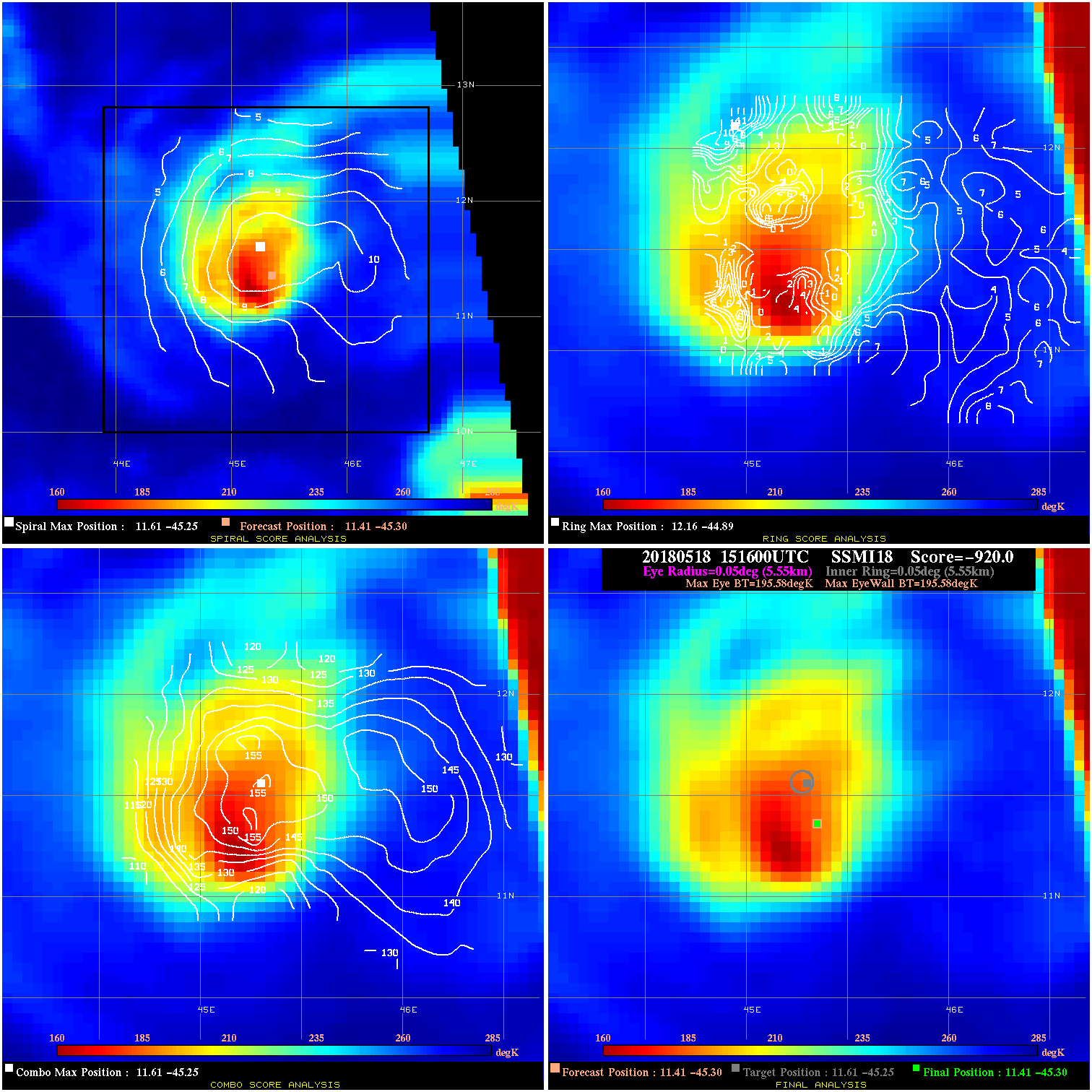
20180518 151600 -0.0 N/A N/A N/A 0.00 50.0 SSMI18 11.4 -45.3 11.4 -45.3 11.6 -45.3 Analysis Plot
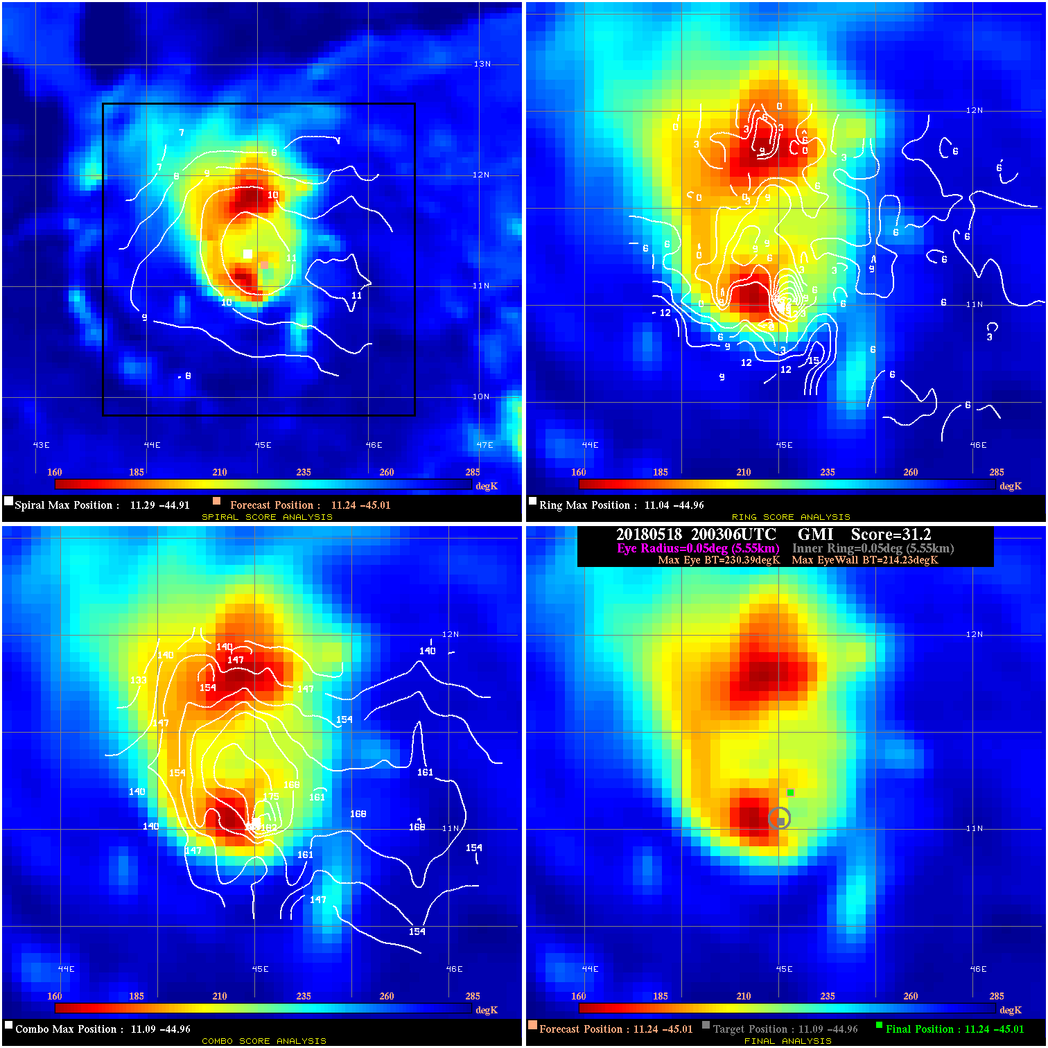
20180518 200306 31.2 >65 kts 100.0% 11.11 16.16 55.0 GMI 11.2 -45.0 11.2 -45.0 11.1 -45.0 Analysis Plot
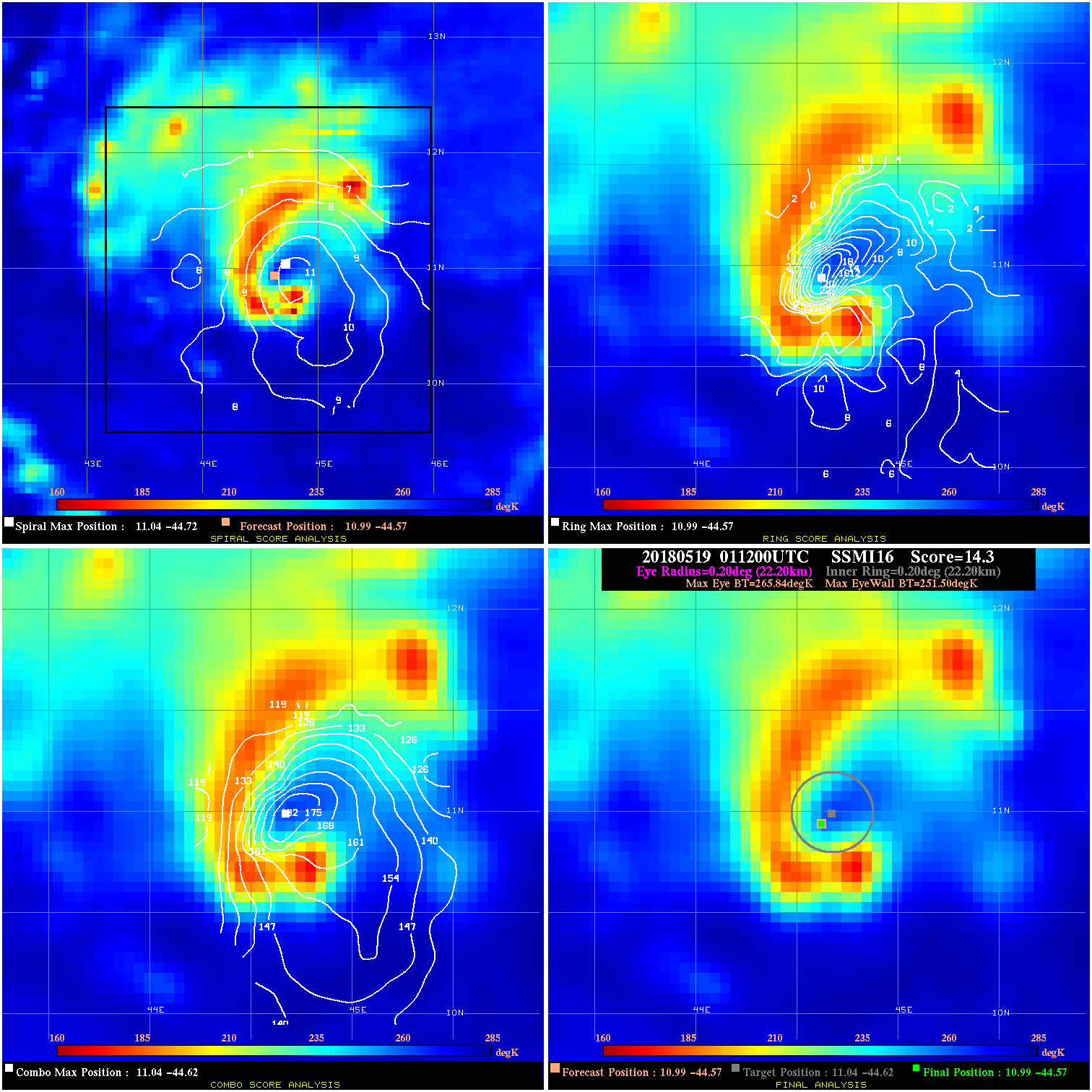
20180519 011200 14.3 N/A 79.5% 44.44 14.34 55.0 SSMI16 11.0 -44.6 11.0 -44.6 11.0 -44.6 Analysis Plot
20180519 073148 -38.5 N/A 100.0% 33.33 23.48 50.0 GMI 10.8 -44.1 10.8 -44.1 10.6 -44.0 Analysis Plot
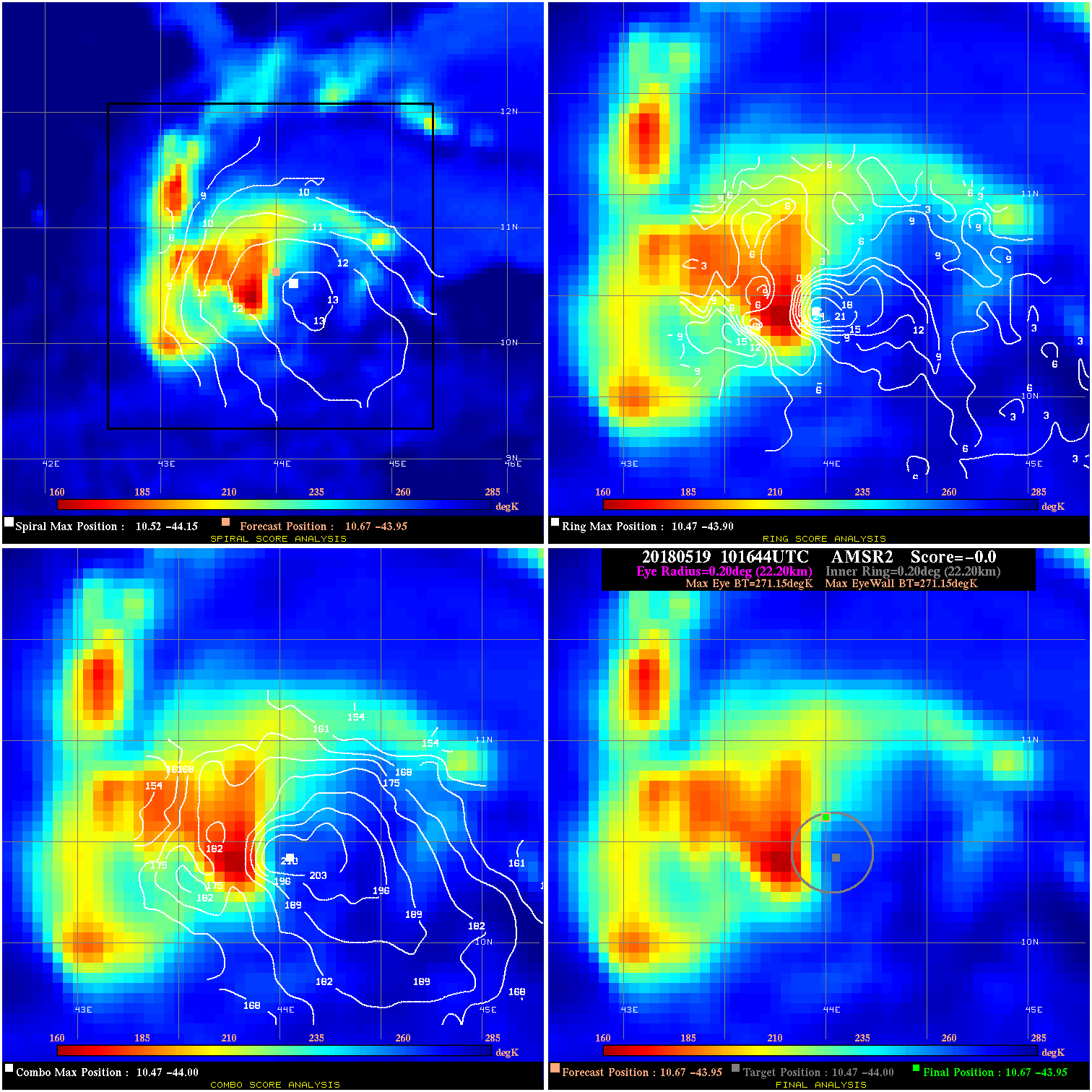
20180519 101644 -0.0 N/A N/A N/A 0.00 50.0 AMSR2 10.7 -44.0 10.7 -44.0 10.5 -44.0 Analysis Plot
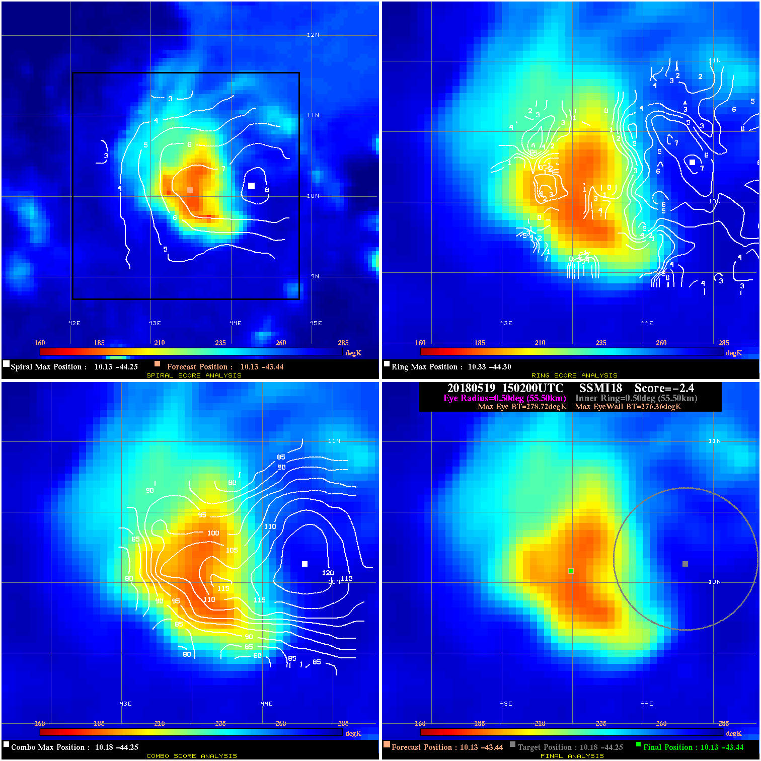
20180519 150200 -2.4 N/A 30.1% 111.10 2.36 50.0 SSMI18 10.1 -43.4 10.1 -43.4 10.2 -44.3 Analysis Plot
20180519 154500 -0.1 N/A 23.3% 44.44 .08 50.0 SSMI17 10.1 -43.4 10.1 -43.4 10.3 -44.0 Analysis Plot
20180519 223242 -42.9 N/A 100.0% 44.44 27.91 50.0 AMSR2 9.6 -42.8 9.6 -42.8 9.9 -43.1 Analysis Plot
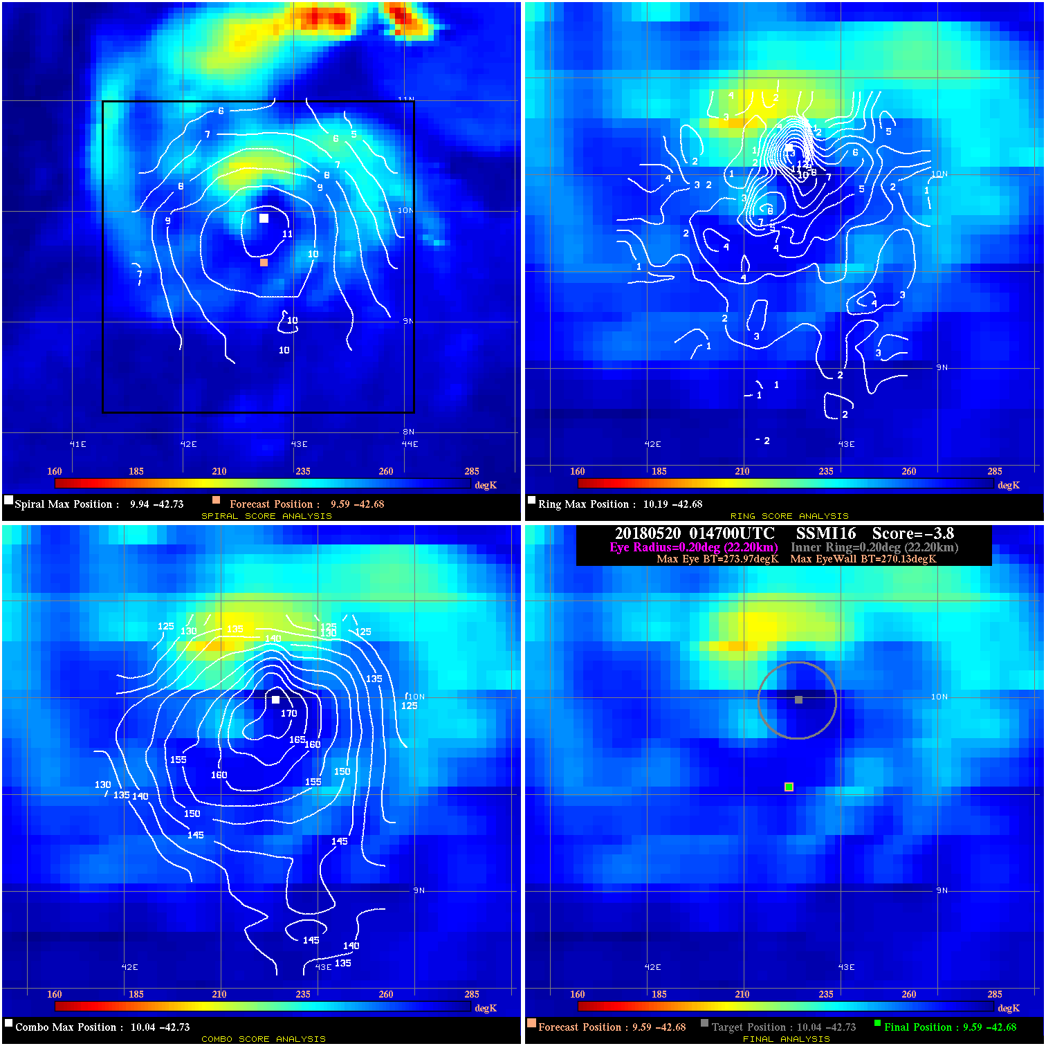
20180520 014700 -3.8 N/A 28.8% 44.44 3.84 50.0 SSMI16 9.6 -42.7 9.6 -42.7 10.0 -42.7 Analysis Plot
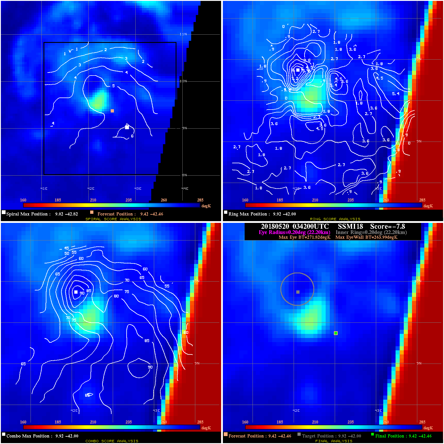
20180520 034200 -7.8 N/A 11.0% 44.44 7.83 50.0 SSMI18 9.4 -42.5 9.4 -42.5 9.9 -42.0 Analysis Plot
|
|
Legend: - Date/Time are determined from PMW imagery at Forecast (initial guess) Lat/Lon position. - Positive/Negative Latitude = North/South Hemisphere; Longitude = Western/Eastern Hemisphere. - "Ring Diam" value indicates the estimated surface eyewall diameter in km (the MI eyewall edge diameter minus 10 km). - "Ring Pct" is the percentage of the "ring" (eyewall inner boundary) that is 1) colder than the "hot spot" (warmest eye pixel) in the eye by 20K, or 2) the percentage that is a) colder than 232K and b) colder than the "hot spot" by 10K, whichever is greater. - Values are red if Ring % <= 65, yellow/brown if Ring % <= 85 and green if Ring % > 85. - "Tb diff" is the difference between the "hot spot" (warmest eye pixel) and the warmest pixel on the eyewall. - Intensity score are listed as negative, and not used, when the JTWC or NHC estimated Vmax is <55 kts in order to rule out weak but highly symmetric TCs. - Error messages in intensity scores: -920 is used when the hottest pixel in the eye is <200K, to prevent false positives; -930 means <85% of eyewall has observations/data. |