Tropical Storm 21S
|
Passive Microwave (PMW) Intensity Information Advanced Dvorak Technique (ADT) Version 8.2.1 |
Overpass Inten Ring Ring Wind Forecast Final Target
Date Time Score Meaning Pct Diam BTdiff Est Sat Lat Lon Lat Lon Lat Lon
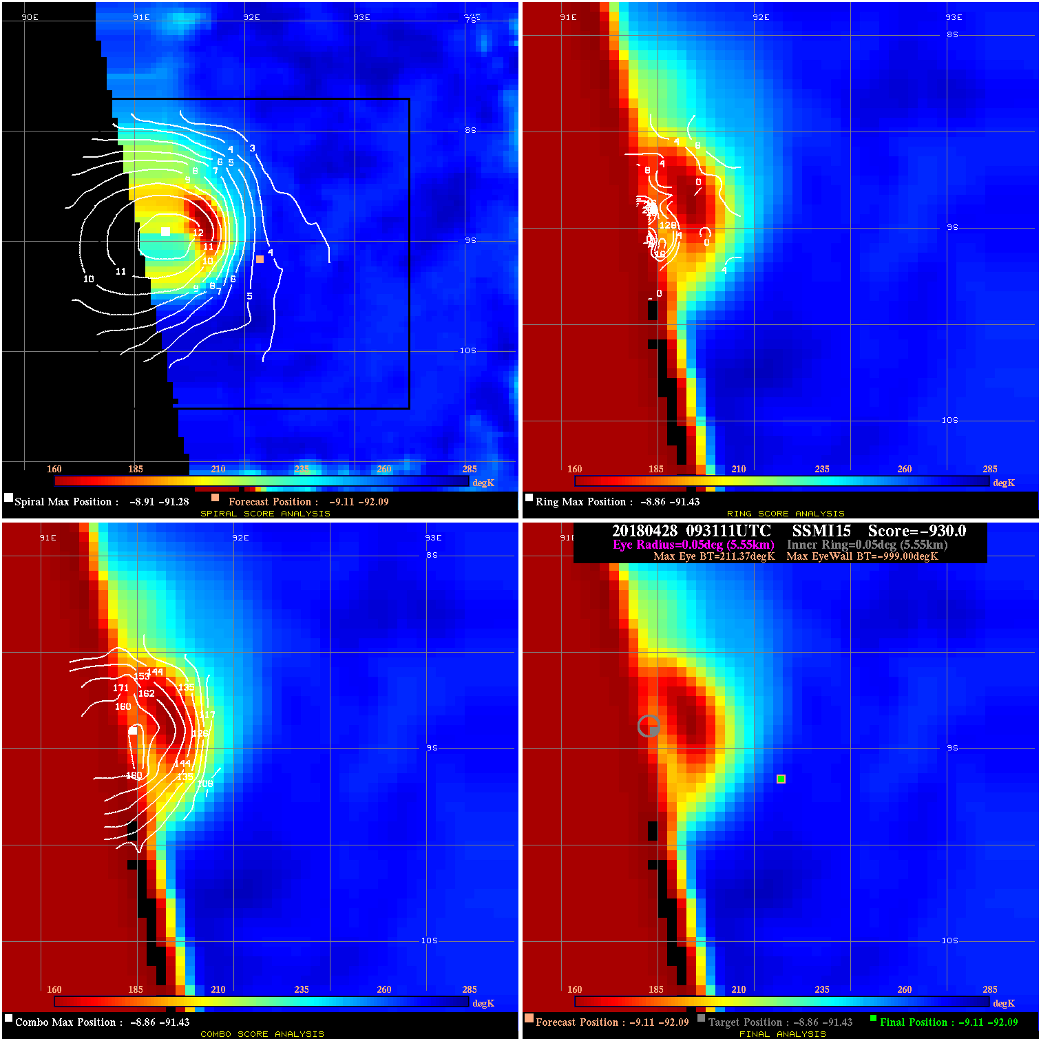
20180428 093111 -930.0 N/A N/A N/A 0.00 35.0 SSMI15 -9.1 -92.1 -9.1 -92.1 -8.9 -91.4 Analysis Plot
20180428 123500 -930.0 N/A N/A N/A 0.00 40.0 SSMI18 -9.6 -90.8 -9.6 -90.8 -9.6 -90.8 Analysis Plot
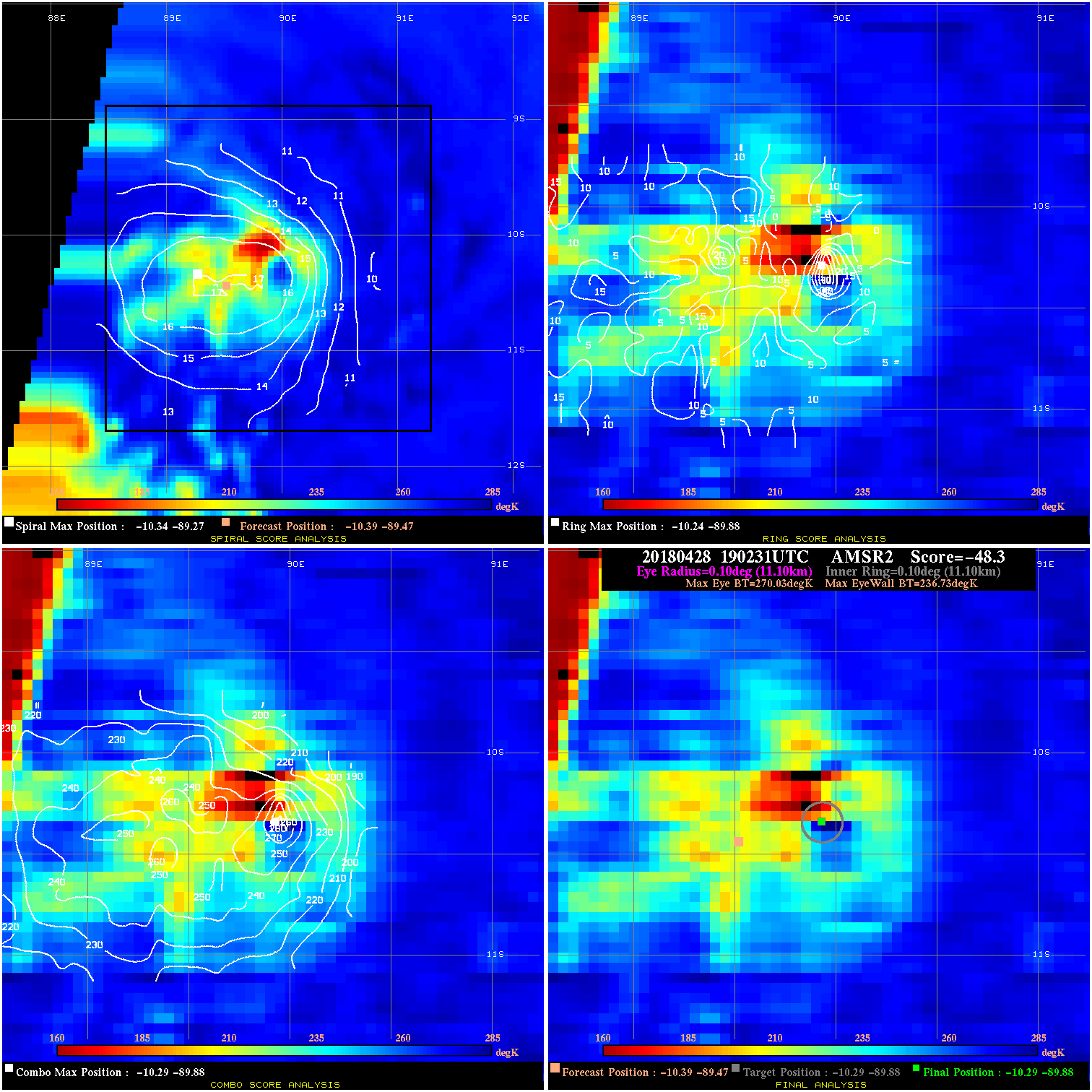
20180428 190231 -48.3 N/A 100.0% 22.22 33.30 45.0 AMSR2 -10.4 -89.5 -10.3 -89.9 -10.3 -89.9 Analysis Plot
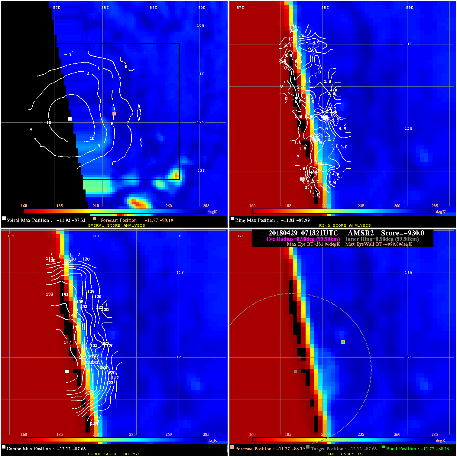
20180429 071821 -930.0 N/A N/A N/A 0.00 45.0 AMSR2 -11.8 -88.2 -11.8 -88.2 -12.1 -87.6 Analysis Plot
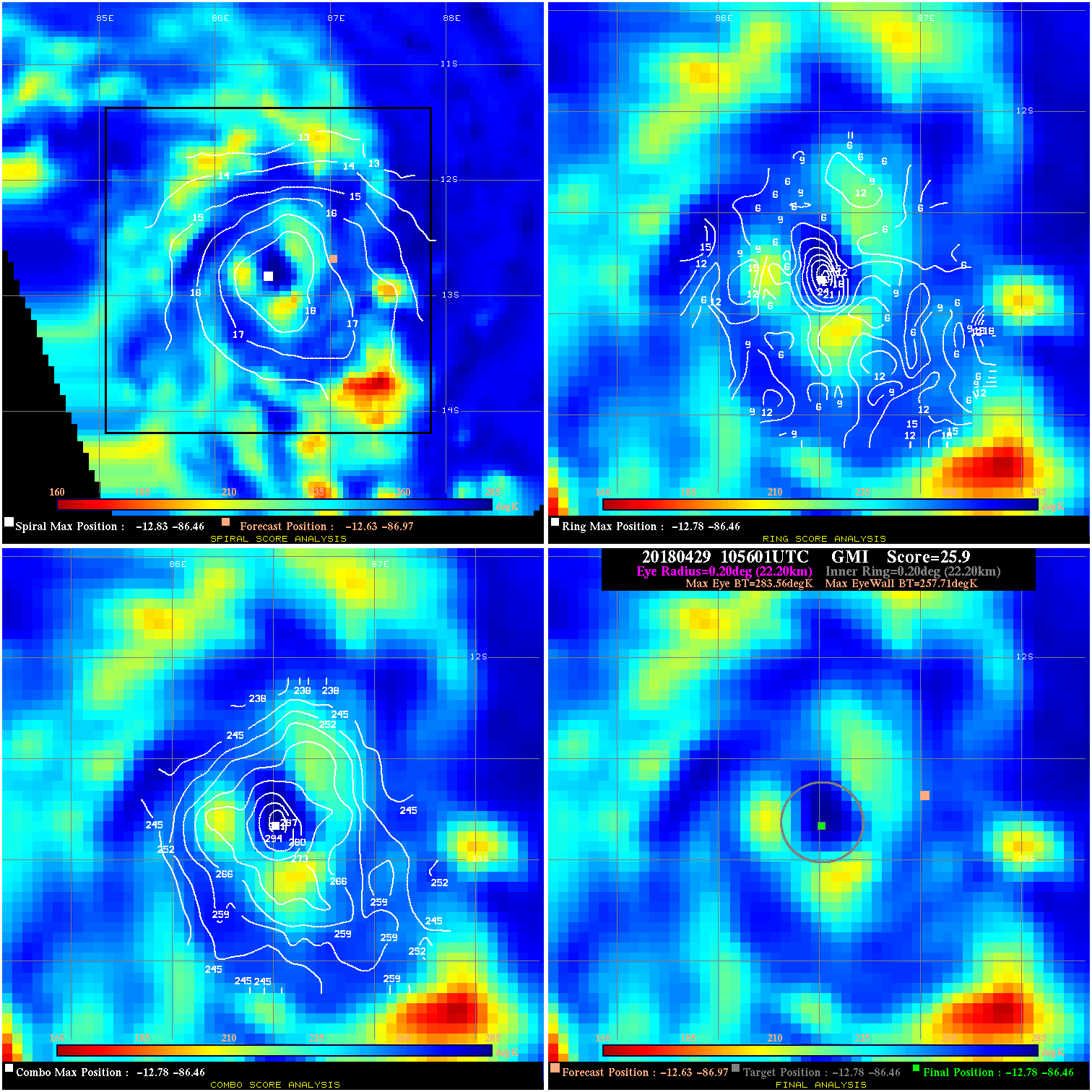
20180429 105601 25.9 >65 kts 37.0% 44.44 25.85 55.0 GMI -12.6 -87.0 -12.8 -86.5 -12.8 -86.5 Analysis Plot
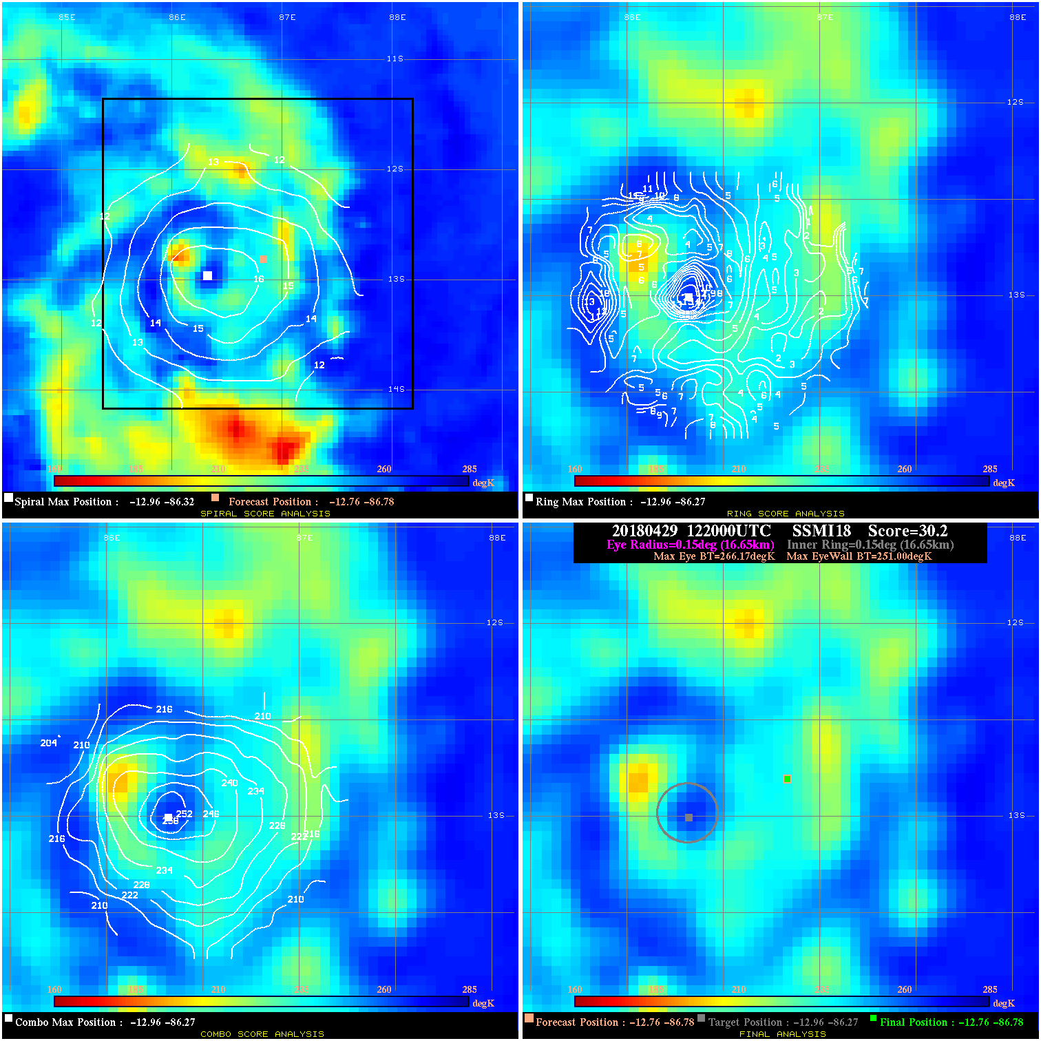
20180429 122000 30.2 >65 kts 86.3% 33.33 15.17 55.0 SSMI18 -12.8 -86.8 -12.8 -86.8 -13.0 -86.3 Analysis Plot
20180429 132100 30.6 >65 kts 90.4% 33.33 15.62 60.0 SSMI17 -12.9 -86.2 -12.8 -86.0 -12.8 -86.0 Analysis Plot
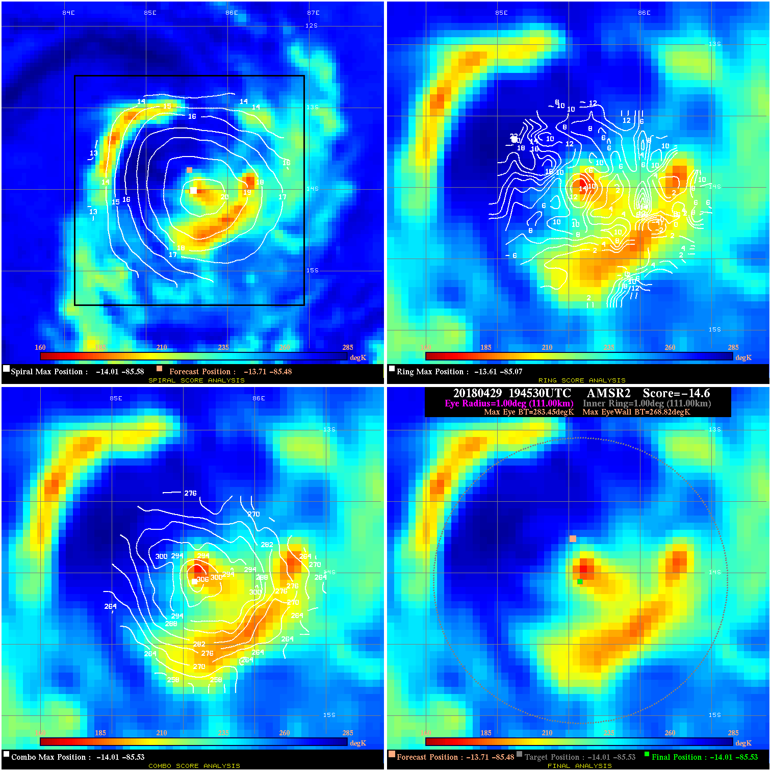
20180429 194530 -14.6 N/A 27.4% 222.20 14.63 45.0 AMSR2 -13.7 -85.5 -14.0 -85.5 -14.0 -85.5 Analysis Plot
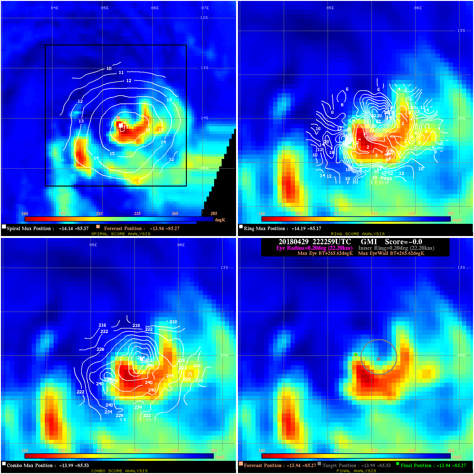
20180429 222259 -0.0 N/A N/A N/A 0.00 45.0 GMI -13.9 -85.3 -13.9 -85.3 -14.0 -85.5 Analysis Plot
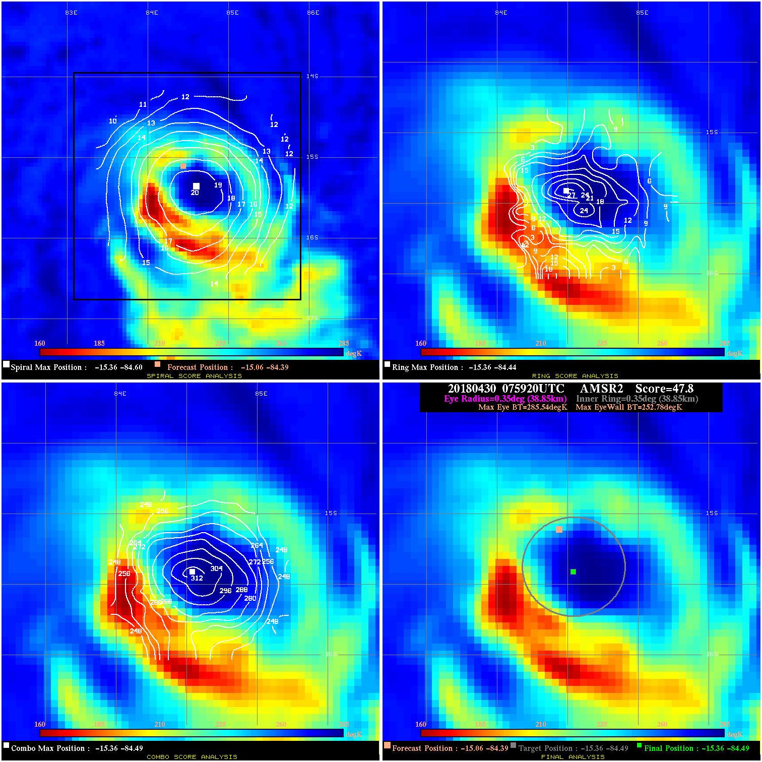
20180430 075920 47.8 >65 kts 100.0% 77.77 32.76 65.0 AMSR2 -15.1 -84.4 -15.4 -84.5 -15.4 -84.5 Analysis Plot
20180430 112357 43.0 >65 kts 100.0% 77.77 28.04 65.0 SSMI15 -15.2 -84.3 -15.6 -84.5 -15.6 -84.5 Analysis Plot
20180430 120700 15.2 N/A 68.5% 66.66 15.24 65.0 SSMI18 -15.5 -84.1 -16.1 -84.6 -16.1 -84.6 Analysis Plot
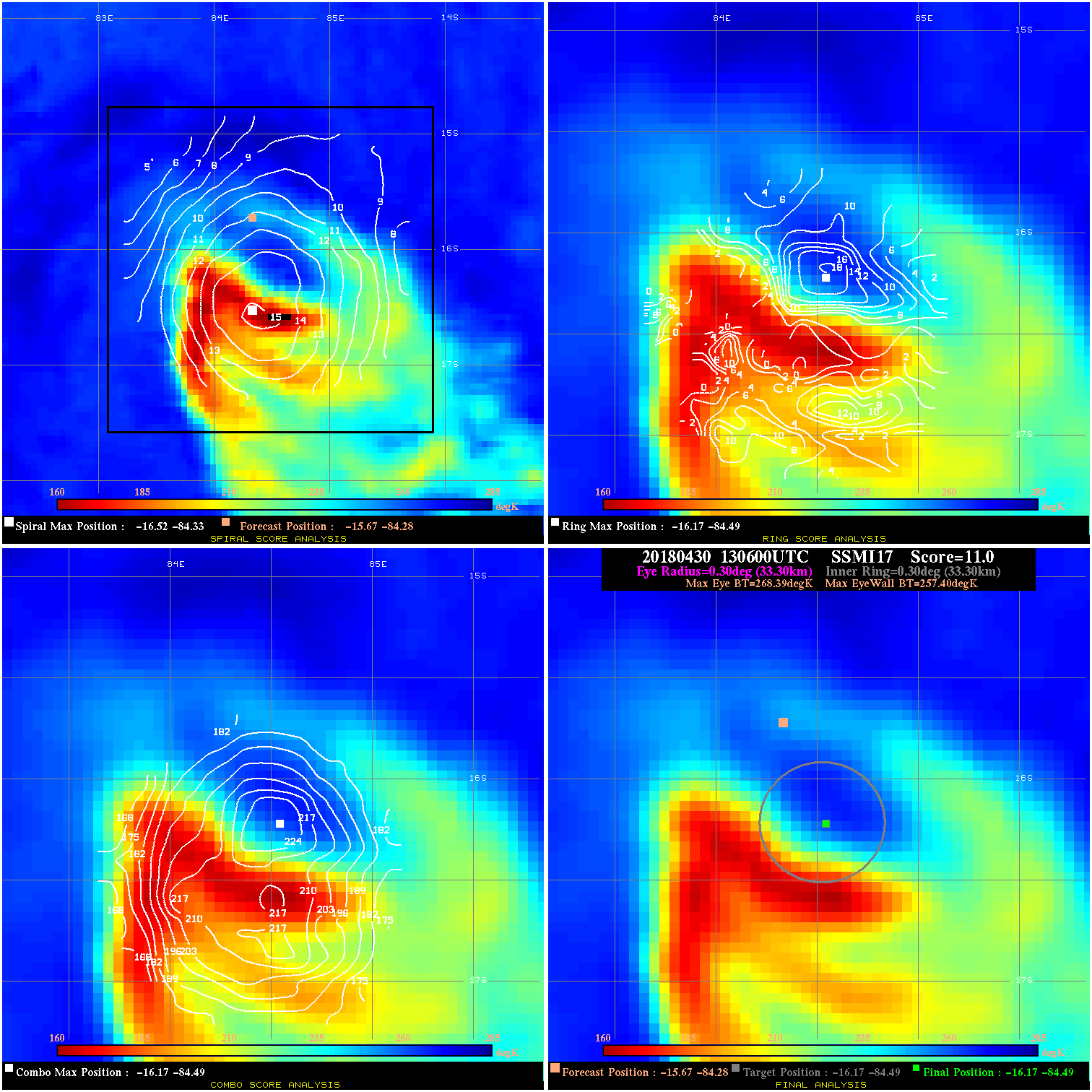
20180430 130600 11.0 N/A 50.7% 66.66 10.99 70.0 SSMI17 -15.7 -84.3 -16.2 -84.5 -16.2 -84.5 Analysis Plot
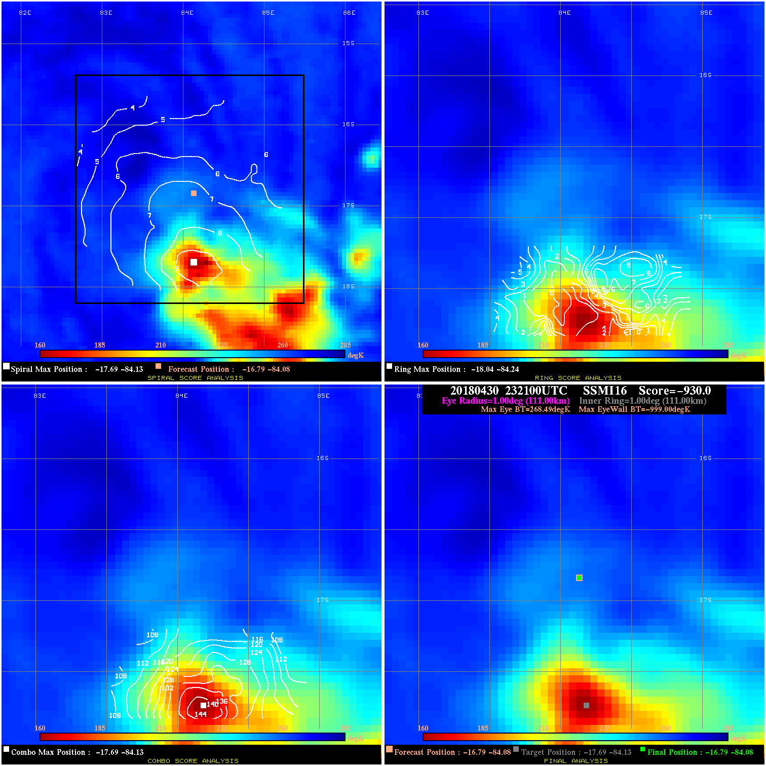
20180430 232100 -930.0 N/A N/A N/A 0.00 70.0 SSMI16 -16.8 -84.1 -16.8 -84.1 -17.7 -84.1 Analysis Plot
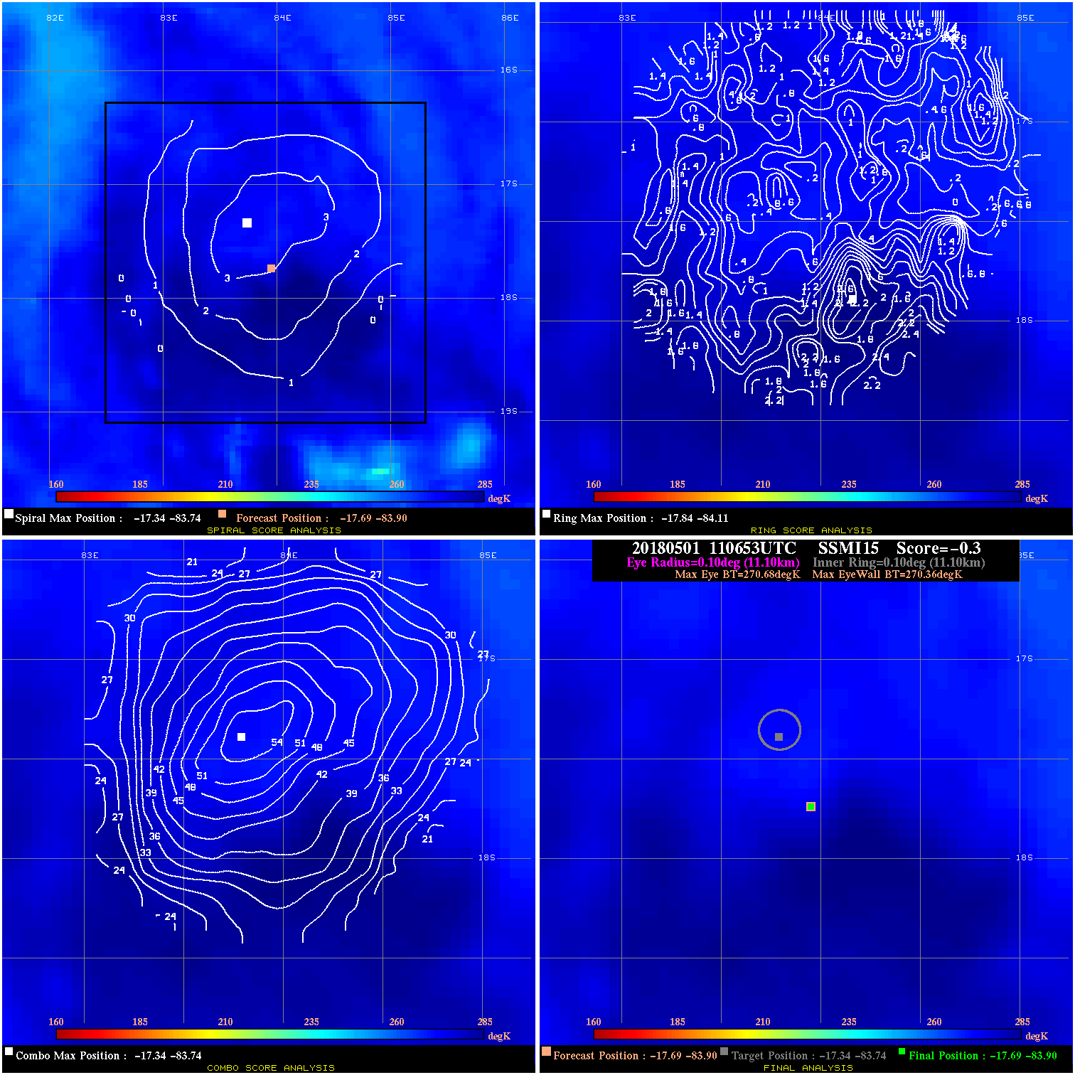
20180501 110653 -0.3 N/A N/A 22.22 .32 50.0 SSMI15 -17.7 -83.9 -17.7 -83.9 -17.3 -83.7 Analysis Plot
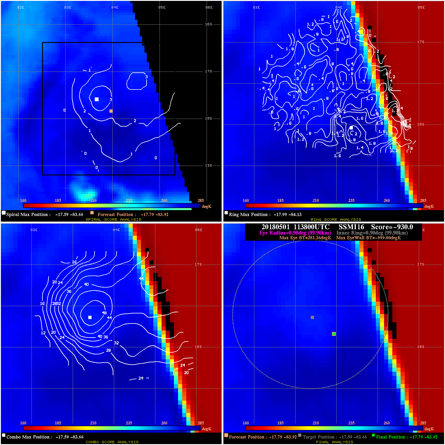
20180501 113800 -930.0 N/A N/A N/A 0.00 50.0 SSMI16 -17.8 -83.9 -17.8 -83.9 -17.6 -83.7 Analysis Plot
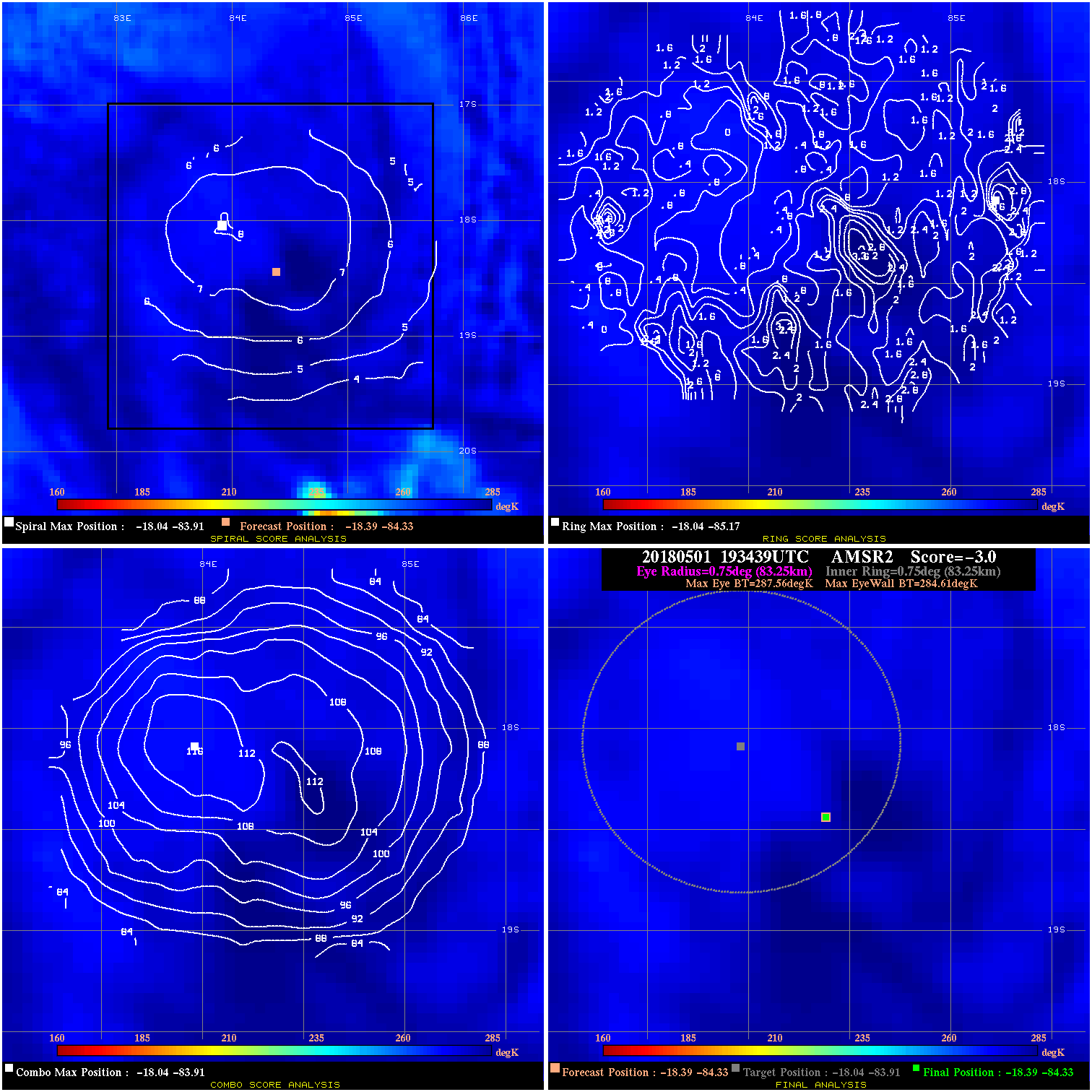
20180501 193439 -3.0 N/A N/A 166.65 2.95 40.0 AMSR2 -18.4 -84.3 -18.4 -84.3 -18.0 -83.9 Analysis Plot
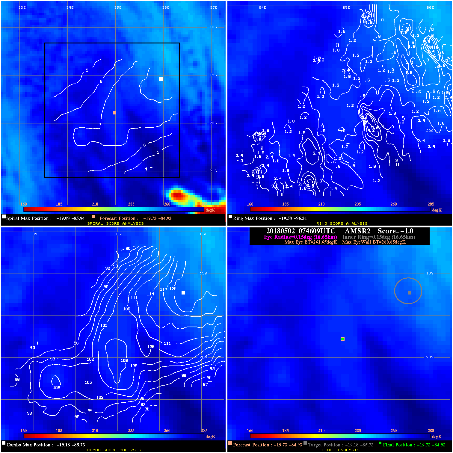
20180502 074609 -1.0 N/A N/A 33.33 1.00 40.0 AMSR2 -19.7 -84.9 -19.7 -84.9 -19.2 -85.7 Analysis Plot
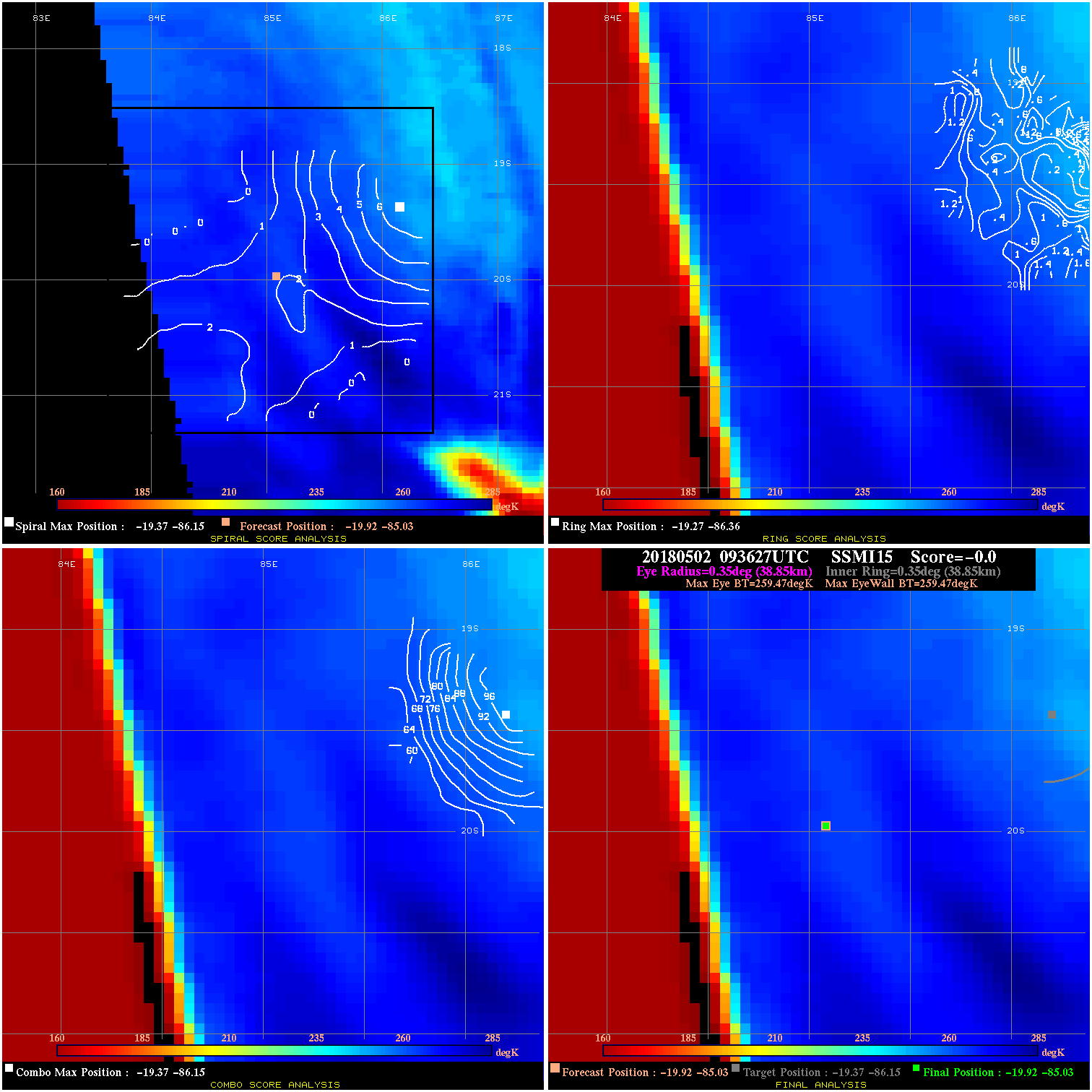
20180502 093627 -0.0 N/A N/A N/A 0.00 40.0 SSMI15 -19.9 -85.0 -19.9 -85.0 -19.4 -86.2 Analysis Plot
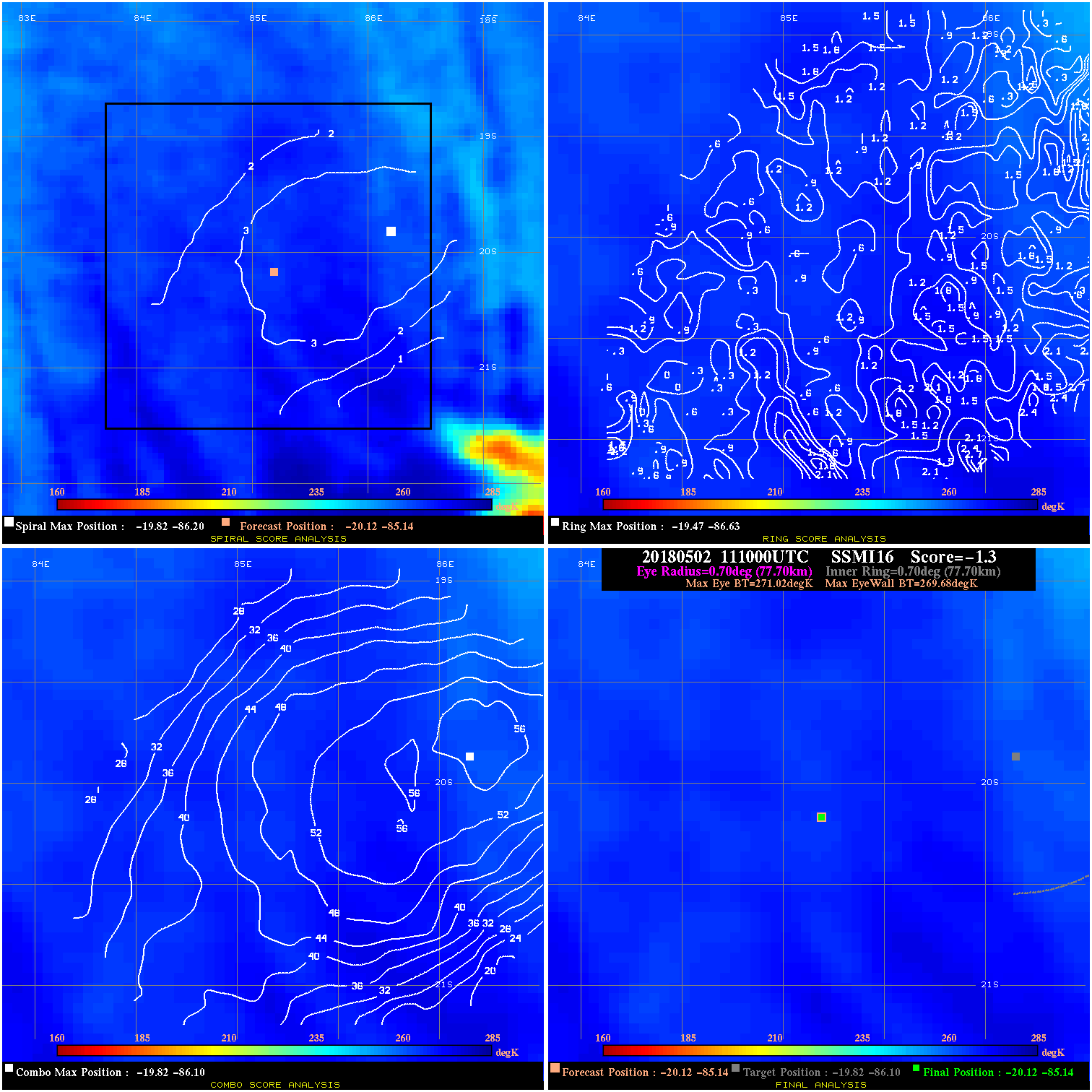
20180502 111000 -1.3 N/A N/A 155.54 1.34 40.0 SSMI16 -20.1 -85.1 -20.1 -85.1 -19.8 -86.1 Analysis Plot
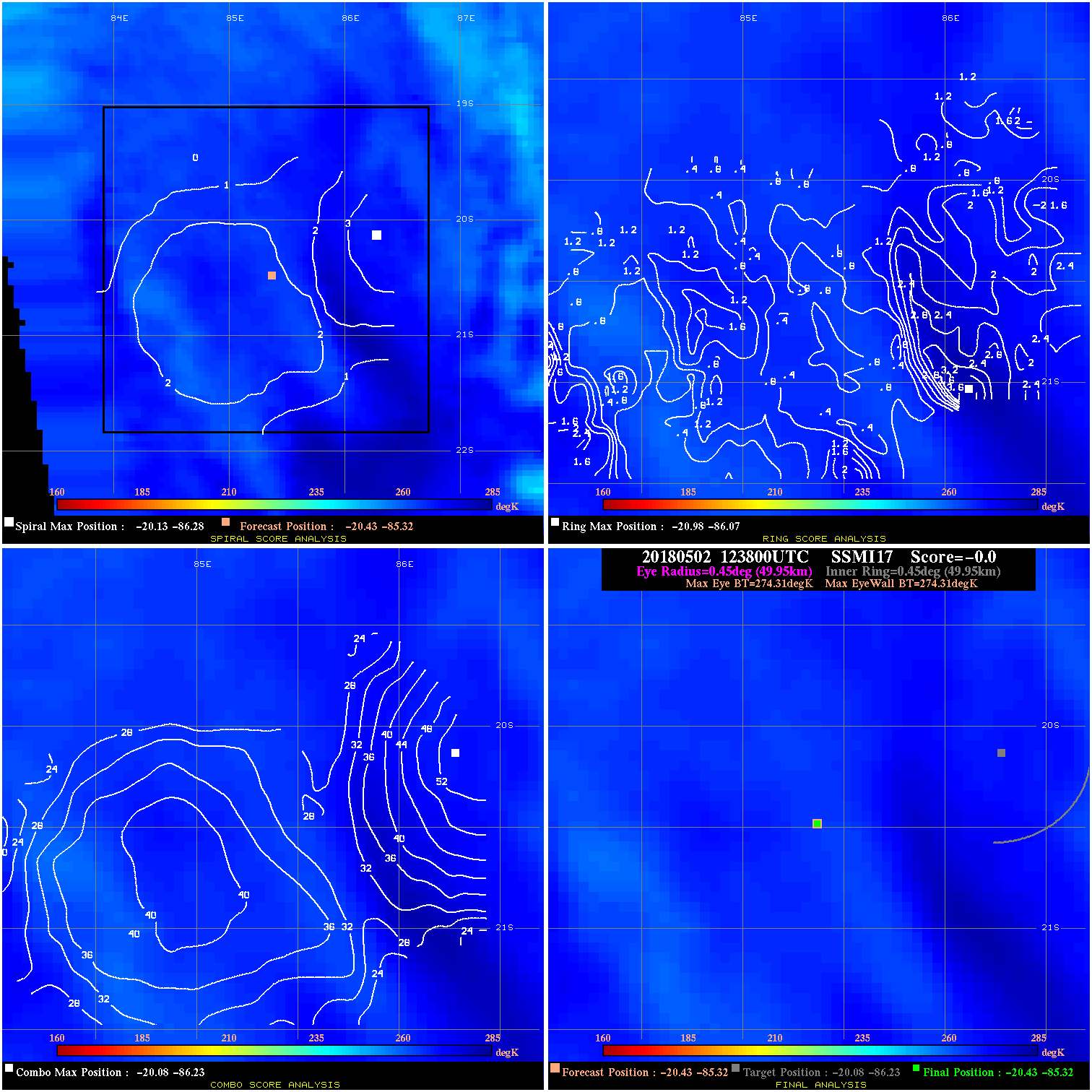
20180502 123800 -0.0 N/A N/A N/A 0.00 40.0 SSMI17 -20.4 -85.3 -20.4 -85.3 -20.1 -86.2 Analysis Plot
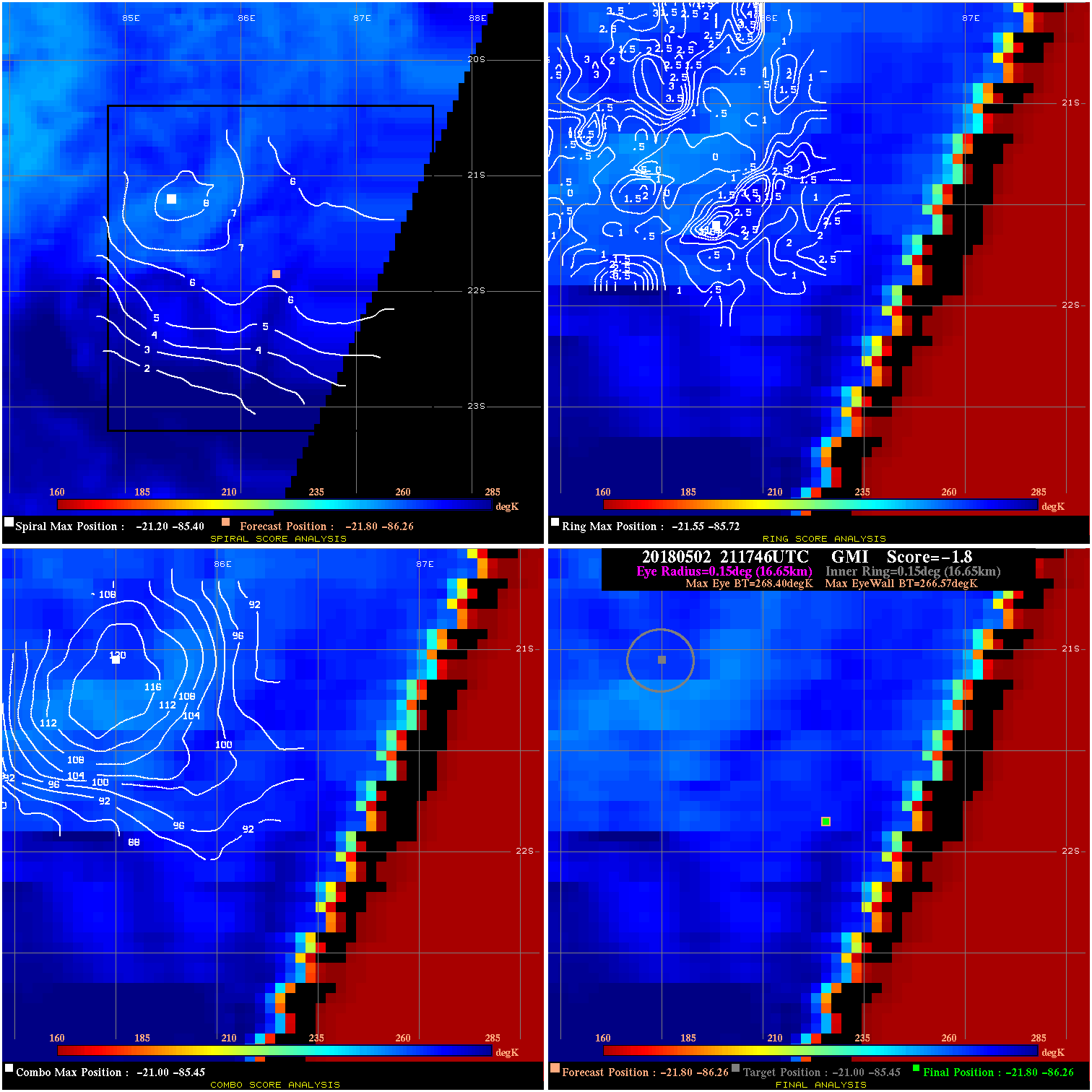
20180502 211746 -1.8 N/A N/A 33.33 1.83 40.0 GMI -21.8 -86.3 -21.8 -86.3 -21.0 -85.4 Analysis Plot
20180502 225500 -1.3 N/A N/A 77.77 1.33 40.0 SSMI16 -21.8 -86.3 -21.8 -86.3 -21.2 -85.5 Analysis Plot
|
|
Legend: - Date/Time are determined from PMW imagery at Forecast (initial guess) Lat/Lon position. - Positive/Negative Latitude = North/South Hemisphere; Longitude = Western/Eastern Hemisphere. - "Ring Diam" value indicates the estimated surface eyewall diameter in km (the MI eyewall edge diameter minus 10 km). - "Ring Pct" is the percentage of the "ring" (eyewall inner boundary) that is 1) colder than the "hot spot" (warmest eye pixel) in the eye by 20K, or 2) the percentage that is a) colder than 232K and b) colder than the "hot spot" by 10K, whichever is greater. - Values are red if Ring % <= 65, yellow/brown if Ring % <= 85 and green if Ring % > 85. - "Tb diff" is the difference between the "hot spot" (warmest eye pixel) and the warmest pixel on the eyewall. - Intensity score are listed as negative, and not used, when the JTWC or NHC estimated Vmax is <55 kts in order to rule out weak but highly symmetric TCs. - Error messages in intensity scores: -920 is used when the hottest pixel in the eye is <200K, to prevent false positives; -930 means <85% of eyewall has observations/data. |