Tropical Depression 01E
|
Passive Microwave (PMW) Intensity Information Hurricane Intensity Estimation (HIE) Algorithm Version 9.0 |
Overpass Inten Ring Ring Wind Forecast Final Target
Date Time Score Meaning Pct Diam BTdiff Est Sat Lat Lon Lat Lon Lat Lon
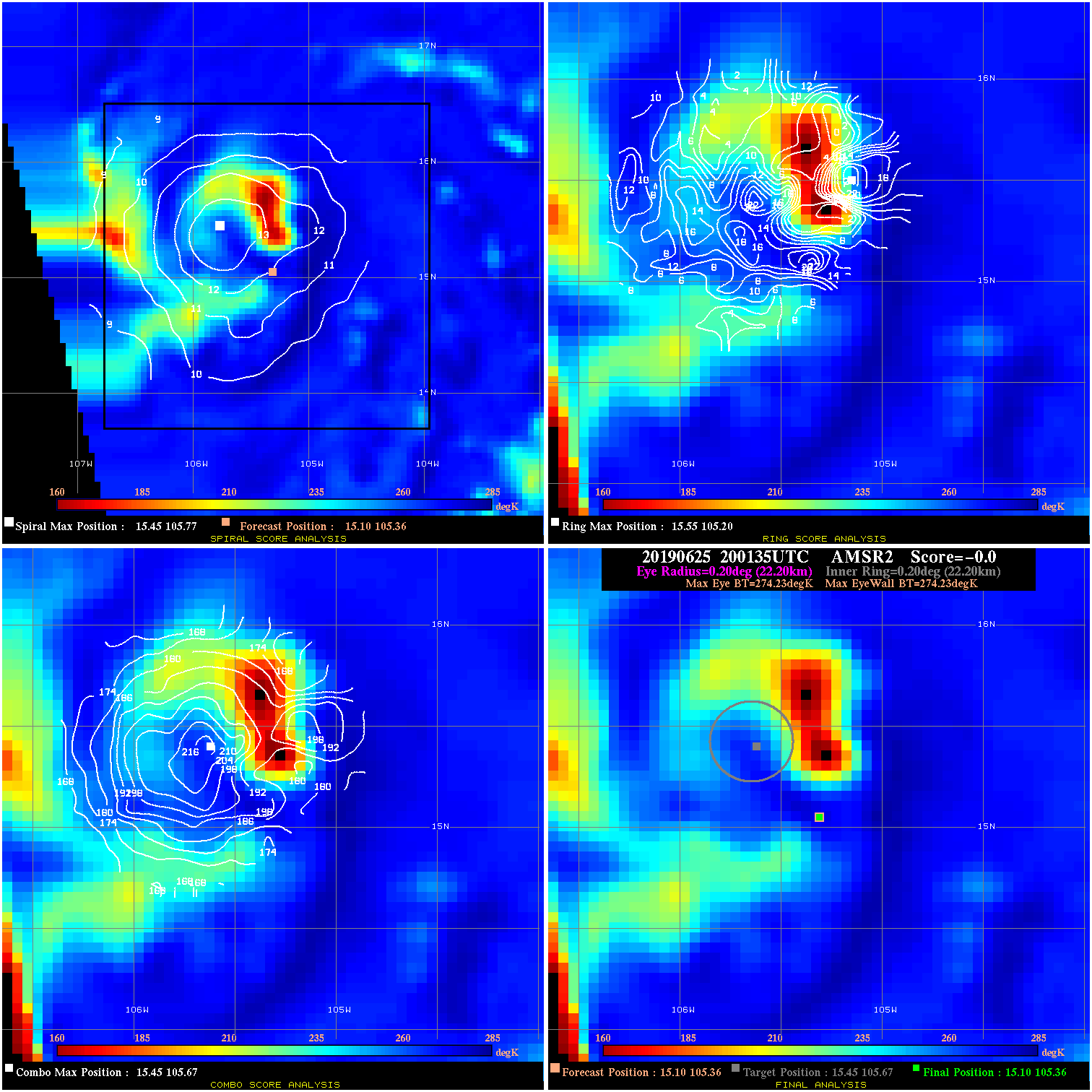
20190625 200135 N/A N/A N/A N/A N/A 25.0 AMSR2 15.1 105.4 15.1 105.4 15.4 105.7 Analysis Plot
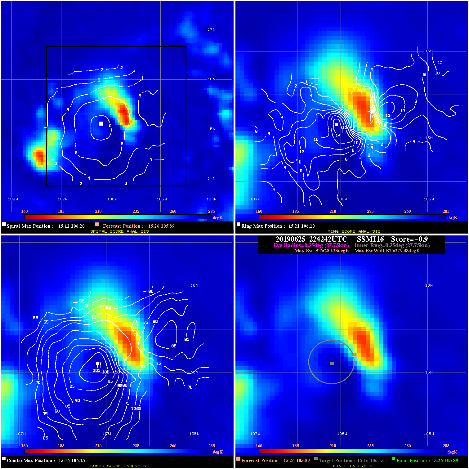
20190625 224242 -0.9 N/A 28.8% 55.55 .90 25.0 SSMI16 15.3 105.9 15.3 105.9 15.2 106.2 Analysis Plot
20190626 020105 -3.1 N/A 13.7% 77.77 3.11 30.0 SSMI17 15.5 106.4 15.5 106.4 15.2 106.9 Analysis Plot
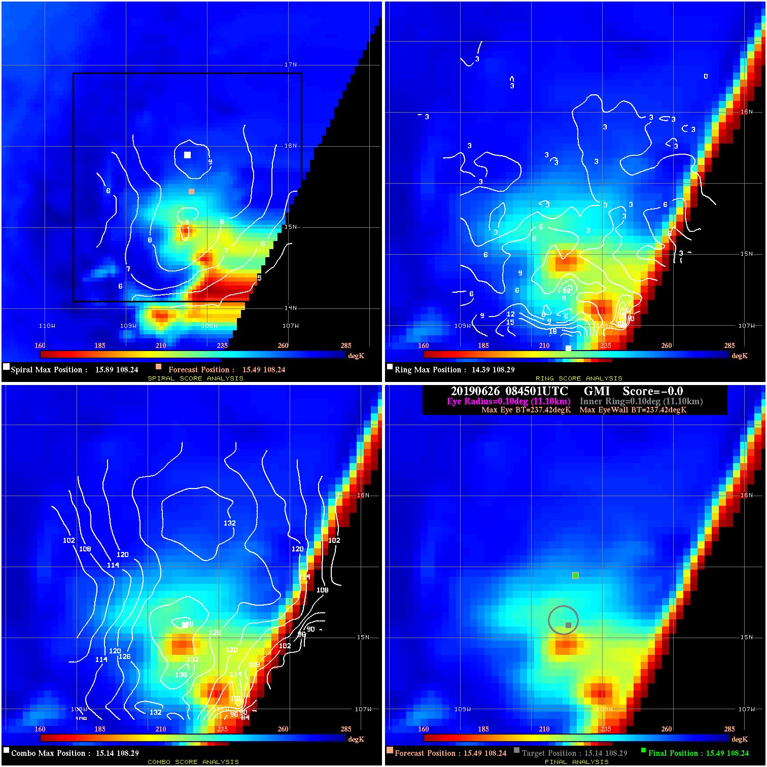
20190626 084501 N/A N/A N/A N/A N/A 30.0 GMI 15.5 108.2 15.5 108.2 15.1 108.3 Analysis Plot
20190626 123401 -6.4 N/A 45.2% 122.21 6.38 30.0 SSMI16 15.6 108.9 15.6 108.9 14.6 108.8 Analysis Plot
20190626 140104 -1.6 N/A 42.5% 99.99 1.62 35.0 SSMI18 14.8 109.0 14.8 109.0 14.2 109.0 Analysis Plot
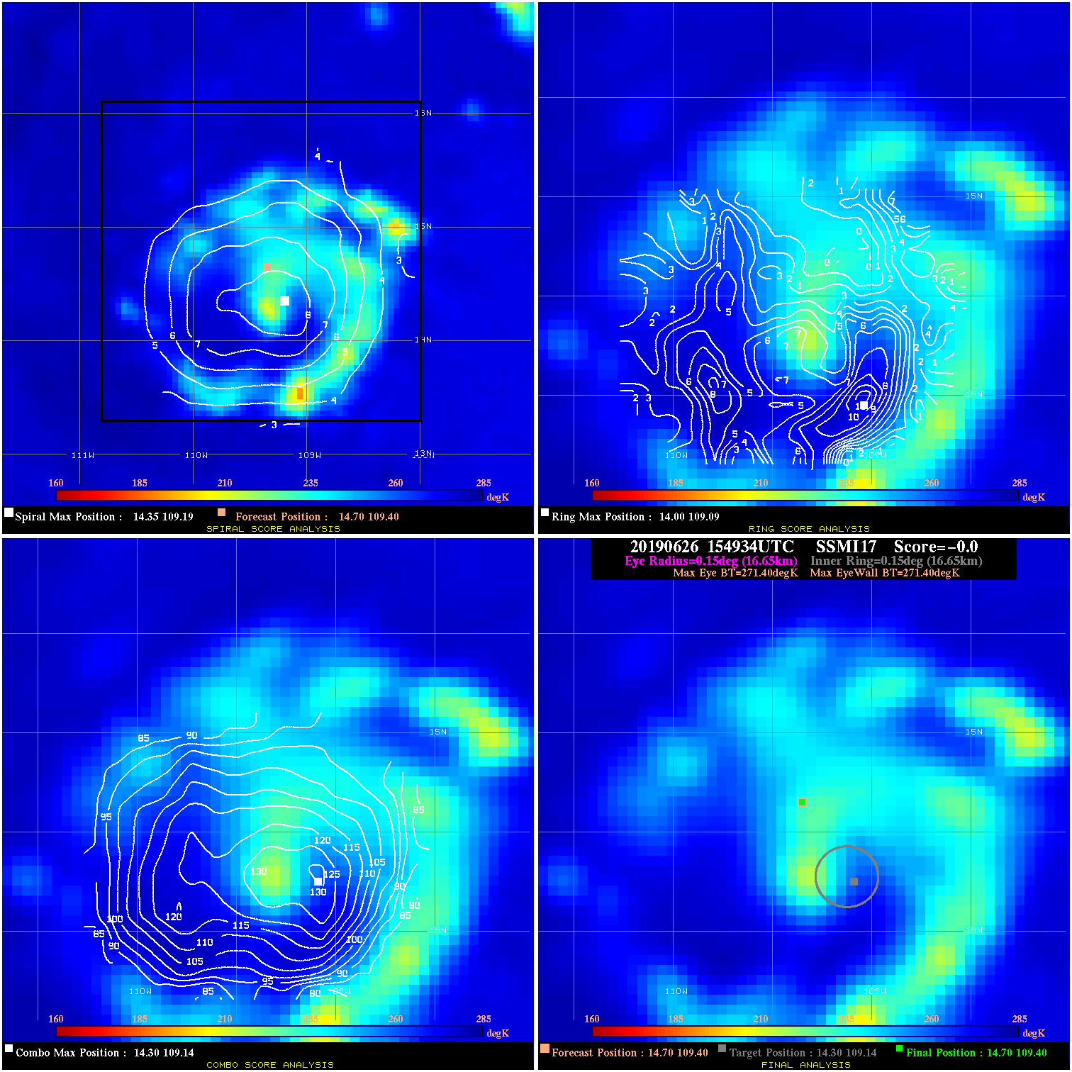
20190626 154934 N/A N/A N/A N/A N/A 35.0 SSMI17 14.7 109.4 14.7 109.4 14.3 109.1 Analysis Plot
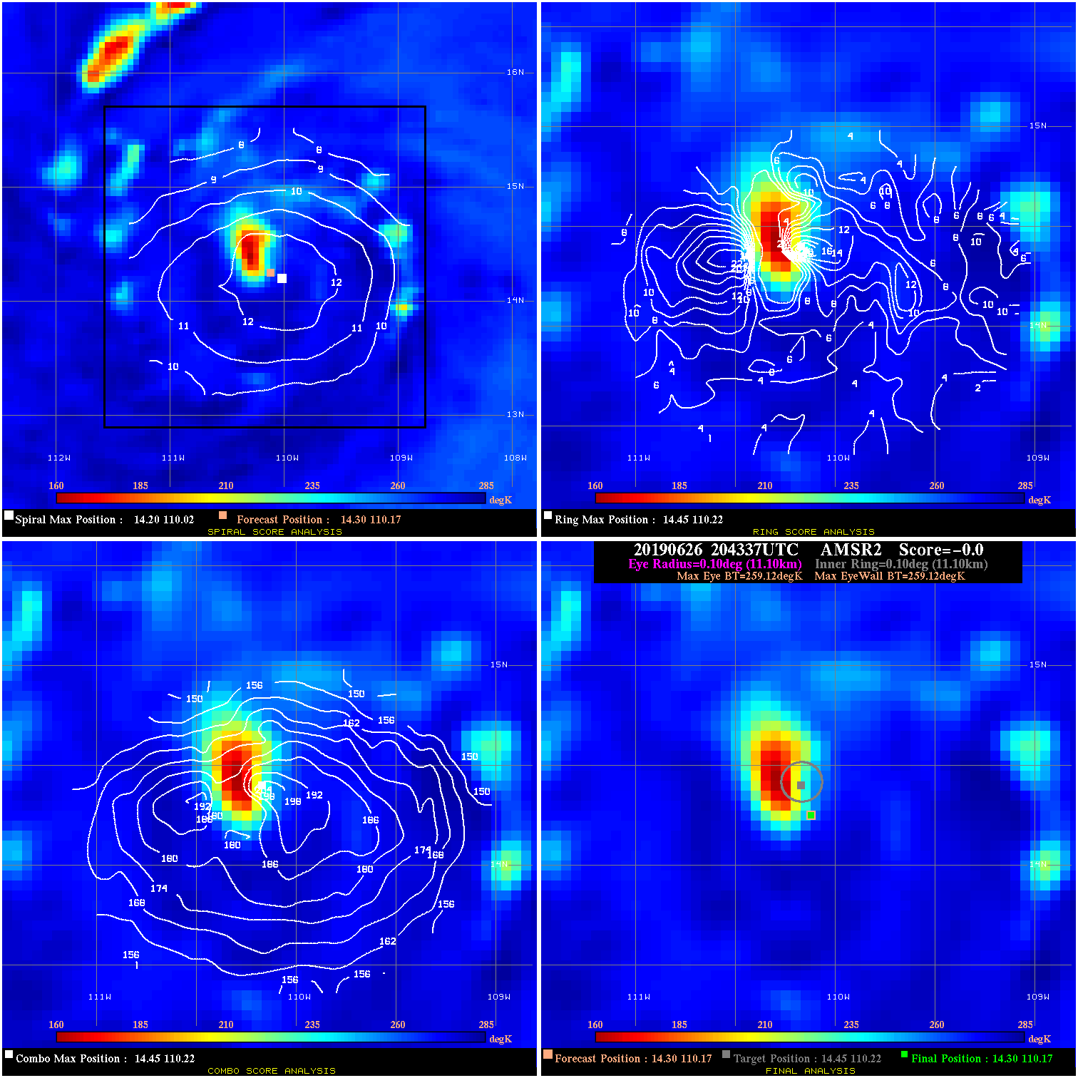
20190626 204337 N/A N/A N/A N/A N/A 40.0 AMSR2 14.3 110.2 14.3 110.2 14.4 110.2 Analysis Plot
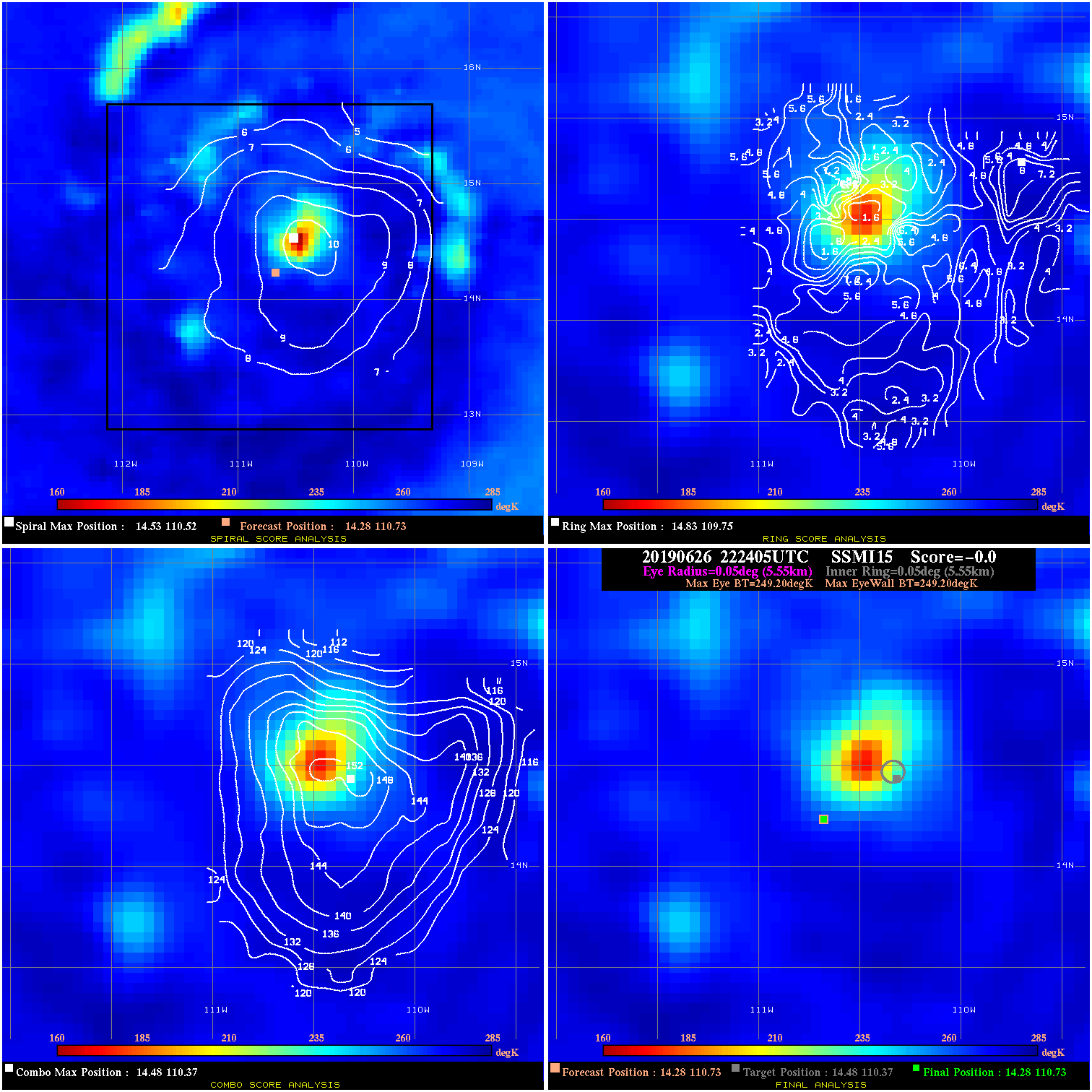
20190626 222405 N/A N/A N/A N/A N/A 40.0 SSMI15 14.3 110.7 14.3 110.7 14.5 110.4 Analysis Plot
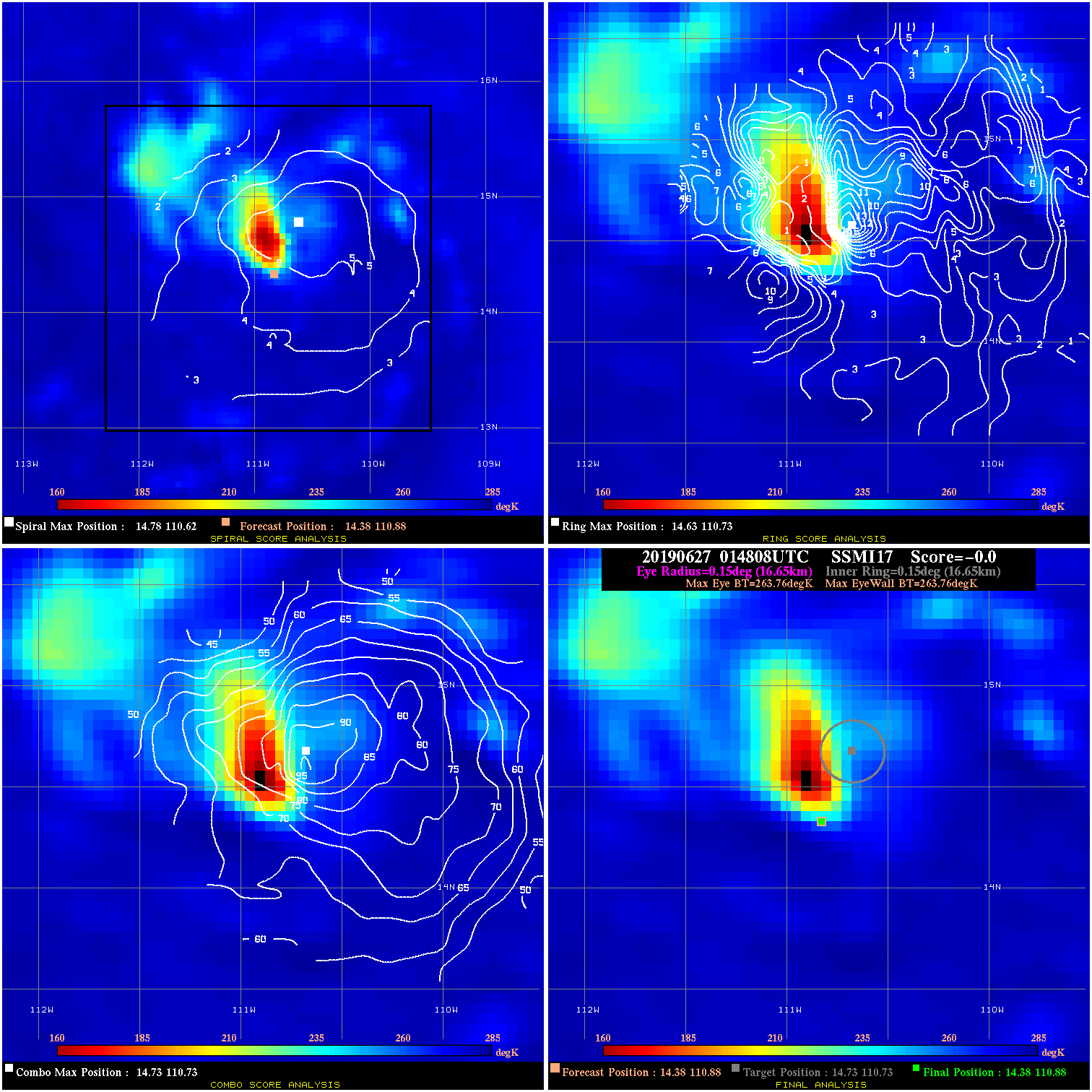
20190627 014808 N/A N/A N/A N/A N/A 45.0 SSMI17 14.4 110.9 14.4 110.9 14.7 110.7 Analysis Plot
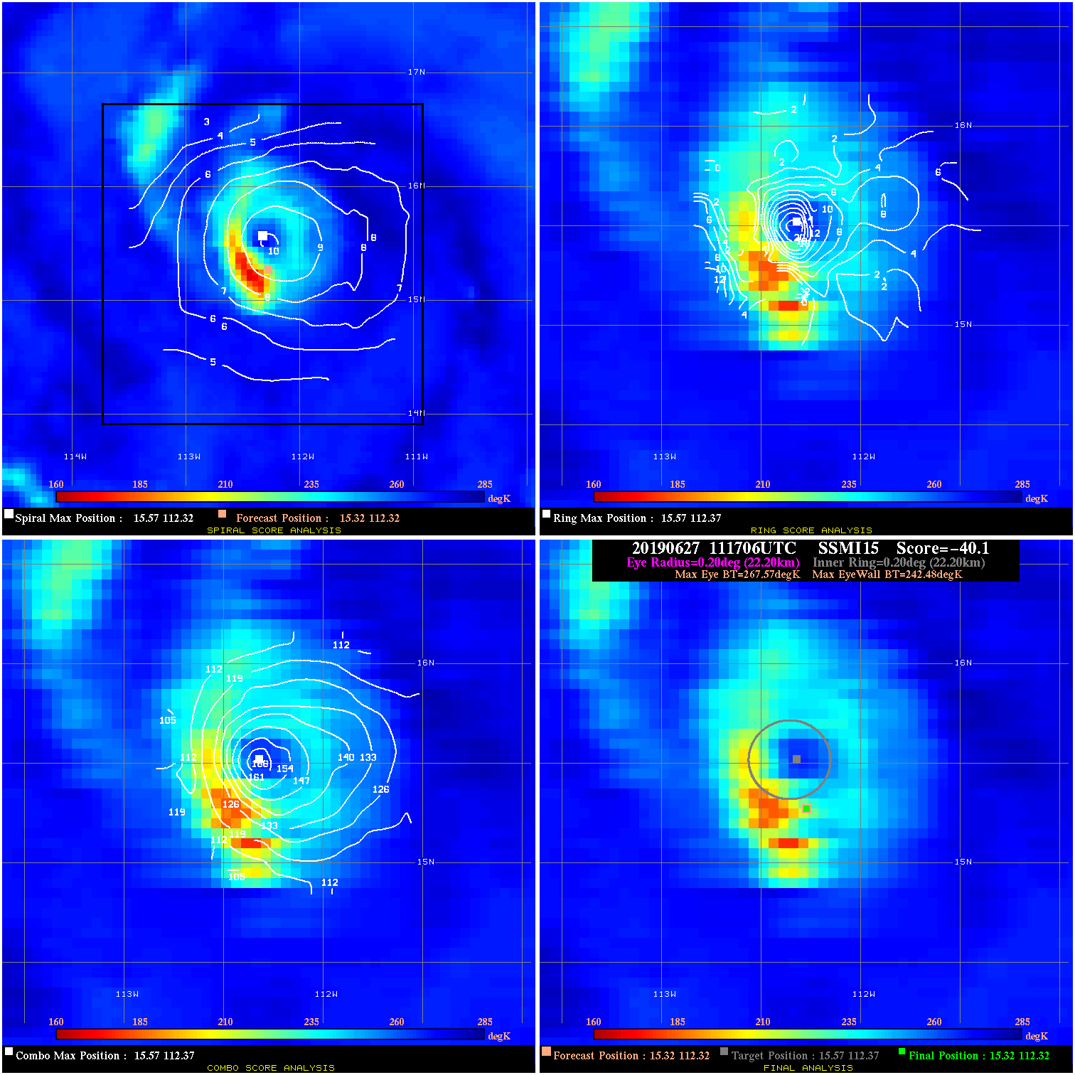
20190627 111706 -40.1 N/A 100.0% 44.44 25.09 50.0 SSMI15 15.3 112.3 15.3 112.3 15.6 112.4 Analysis Plot
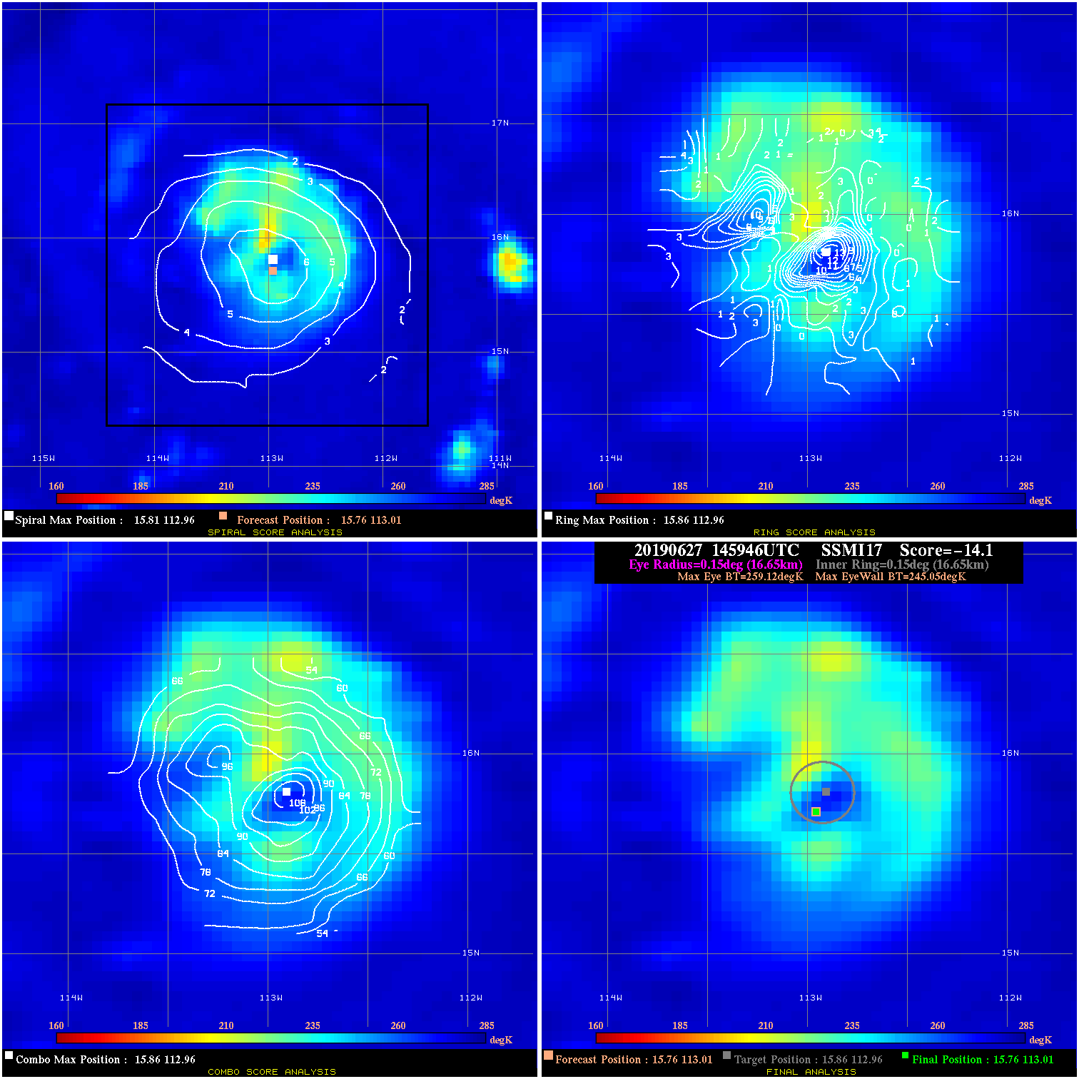
20190627 145946 -14.1 N/A 79.5% 33.33 14.07 50.0 SSMI17 15.8 113.0 15.8 113.0 15.9 113.0 Analysis Plot
20190627 212829 40.6 >65 kts 100.0% 22.22 25.58 55.0 AMSR2 16.6 114.2 16.6 114.2 16.8 114.4 Analysis Plot
20190627 235817 N/A N/A N/A N/A N/A 55.0 SSMI16 16.9 114.6 16.9 114.6 17.0 114.8 Analysis Plot
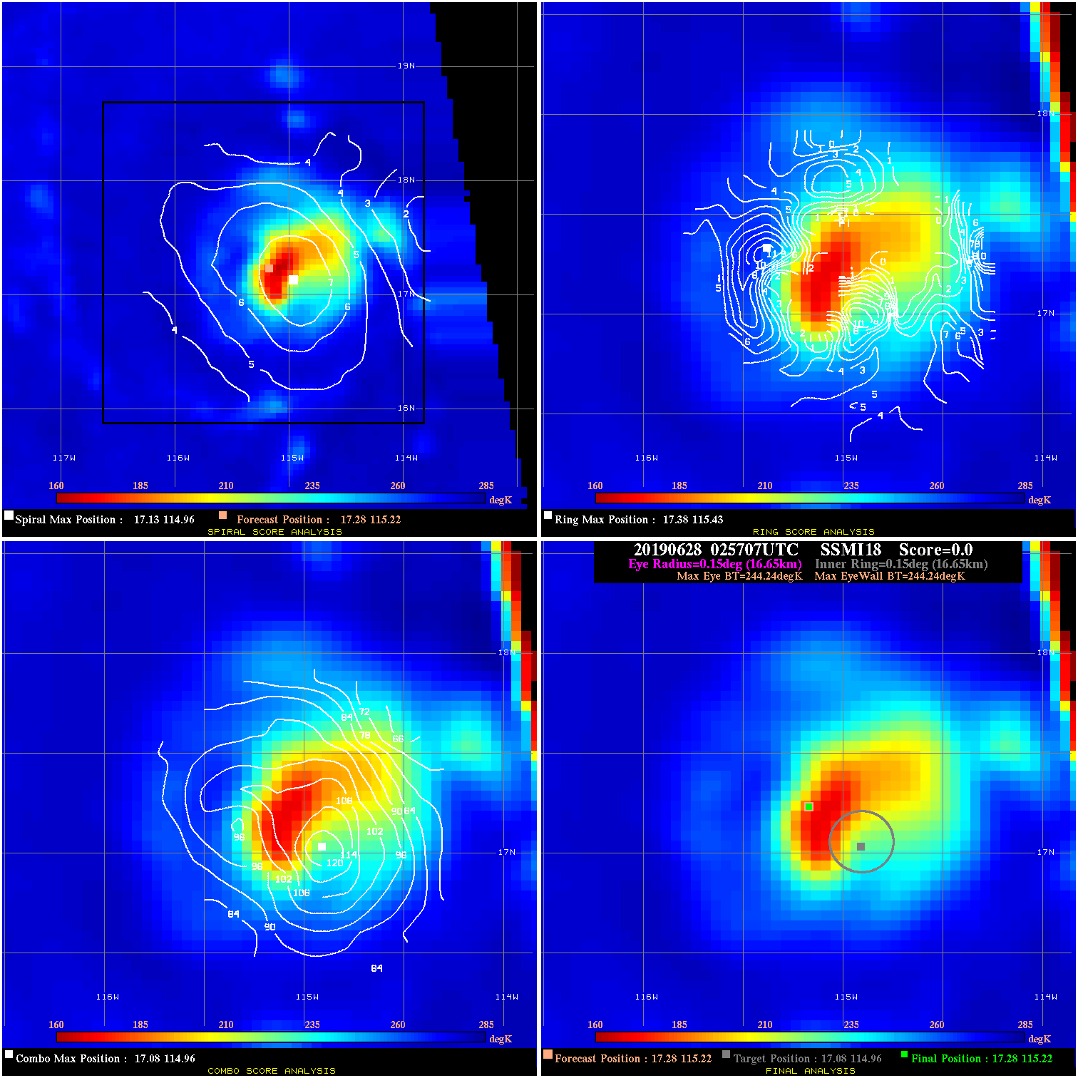
20190628 025707 N/A N/A N/A N/A N/A 65.0 SSMI18 17.3 115.2 17.3 115.2 17.1 115.0 Analysis Plot
20190628 083505 2.0 N/A 63.0% 22.22 2.01 65.0 GMI 17.9 116.2 17.9 116.2 18.2 116.5 Analysis Plot
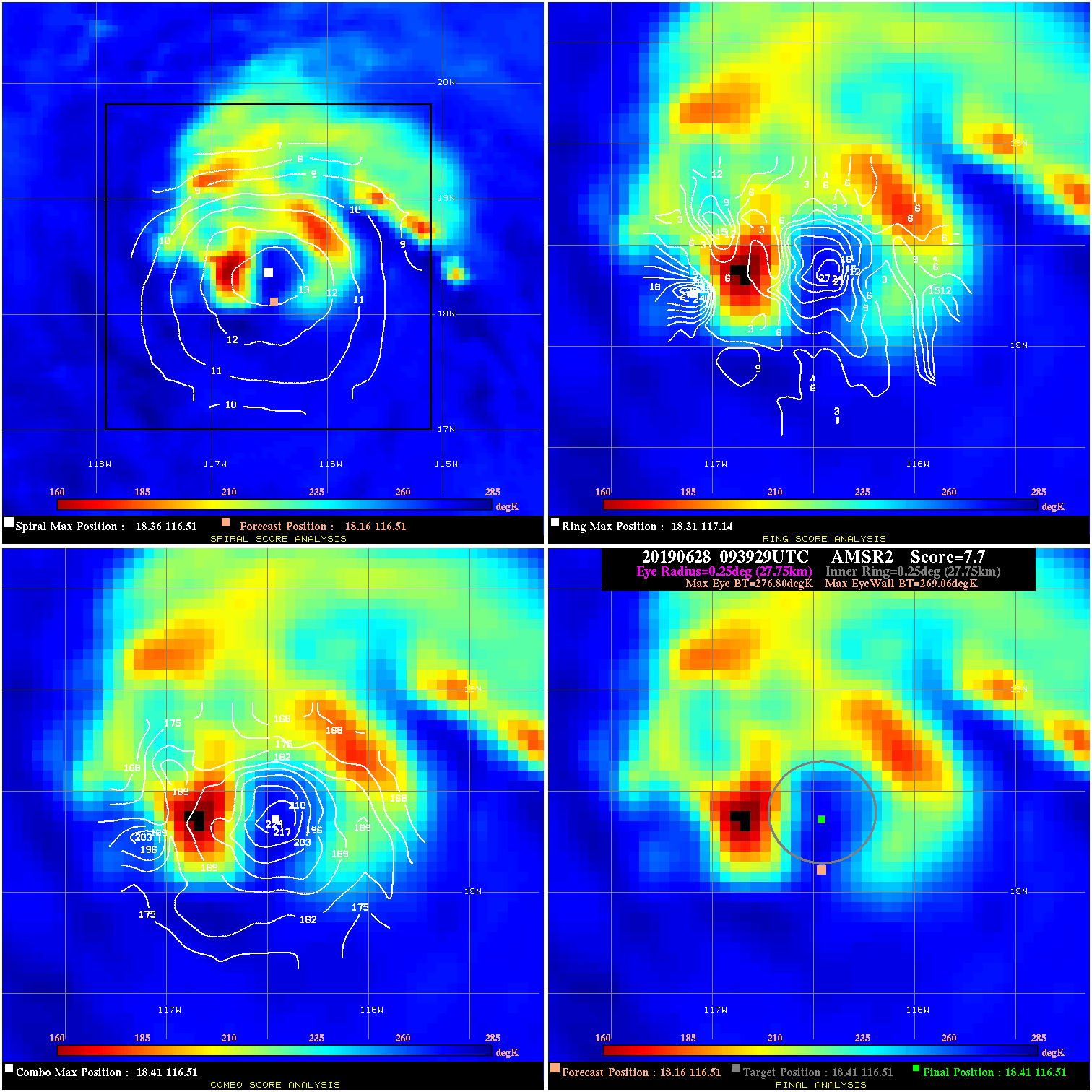
20190628 093929 7.7 N/A 64.4% 55.55 7.74 65.0 AMSR2 18.2 116.5 18.4 116.5 18.4 116.5 Analysis Plot
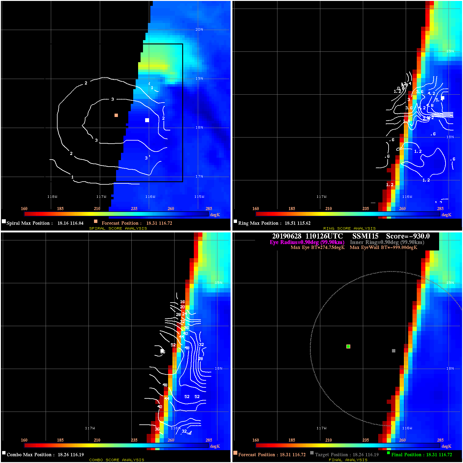
20190628 110126 -930.0 N/A N/A N/A 0.00 65.0 SSMI15 18.3 116.7 18.3 116.7 18.3 116.2 Analysis Plot
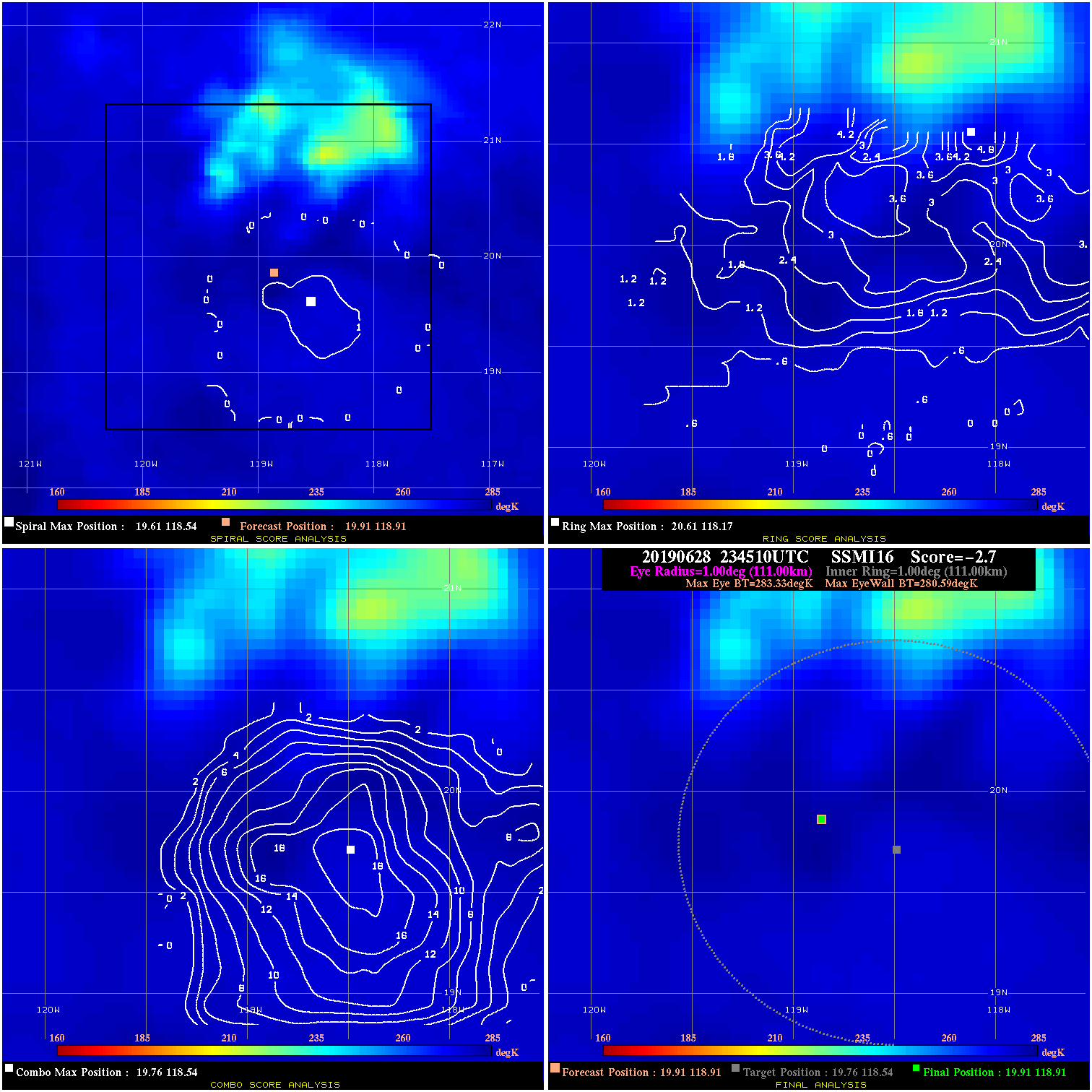
20190628 234510 -2.7 N/A 6.8% 222.20 2.74 50.0 SSMI16 19.9 118.9 19.9 118.9 19.8 118.5 Analysis Plot
20190629 024523 -2.4 N/A 2.7% 222.20 2.41 40.0 SSMI18 20.0 119.1 20.0 119.1 19.9 119.0 Analysis Plot
20190629 030150 -0.8 N/A N/A 33.33 .76 40.0 SSMI17 20.0 119.2 20.0 119.2 20.3 119.5 Analysis Plot
|
|
Legend: - Date/Time are determined from PMW imagery at Forecast (initial guess) Lat/Lon position. - Positive/Negative Latitude = North/South Hemisphere; Longitude = Western/Eastern Hemisphere. - "Ring Diam" value indicates the estimated surface eyewall diameter in km (the MI eyewall edge diameter minus 10 km). - "Ring Pct" is the percentage of the "ring" (eyewall inner boundary) that is 1) colder than the "hot spot" (warmest eye pixel) in the eye by 20K, or 2) the percentage that is a) colder than 232K and b) colder than the "hot spot" by 10K, whichever is greater. - Values are red if Ring % <= 65, yellow/brown if Ring % <= 85 and green if Ring % > 85. - "Tb diff" is the difference between the "hot spot" (warmest eye pixel) and the warmest pixel on the eyewall. - Intensity score are listed as negative, and not used, when the JTWC or NHC estimated Vmax is <55 kts in order to rule out weak but highly symmetric TCs. - Error messages in intensity scores: -920 is used when the hottest pixel in the eye is <200K, to prevent false positives; -930 means <85% of eyewall has observations/data. |