Tropical Storm 03A
|
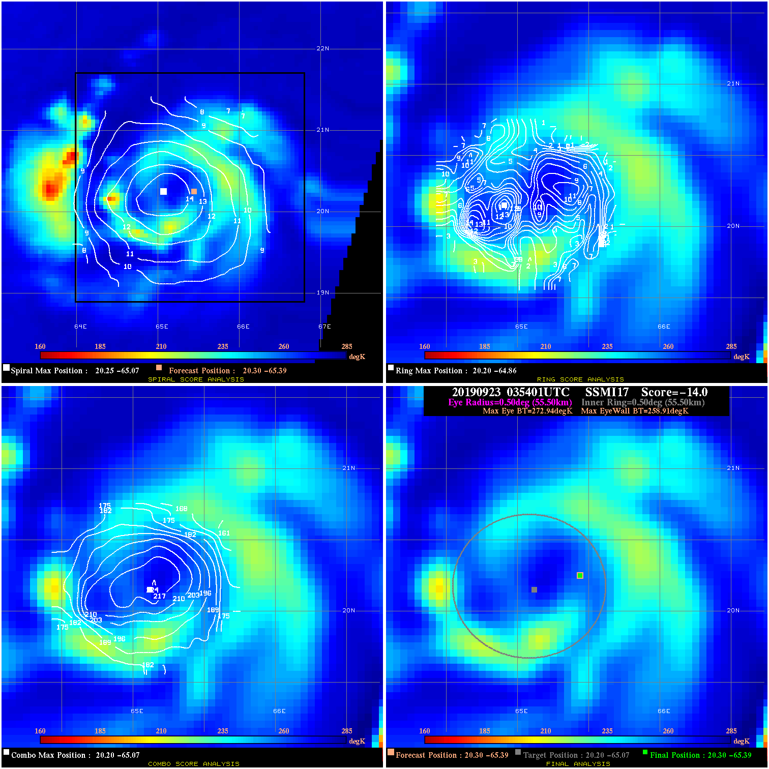
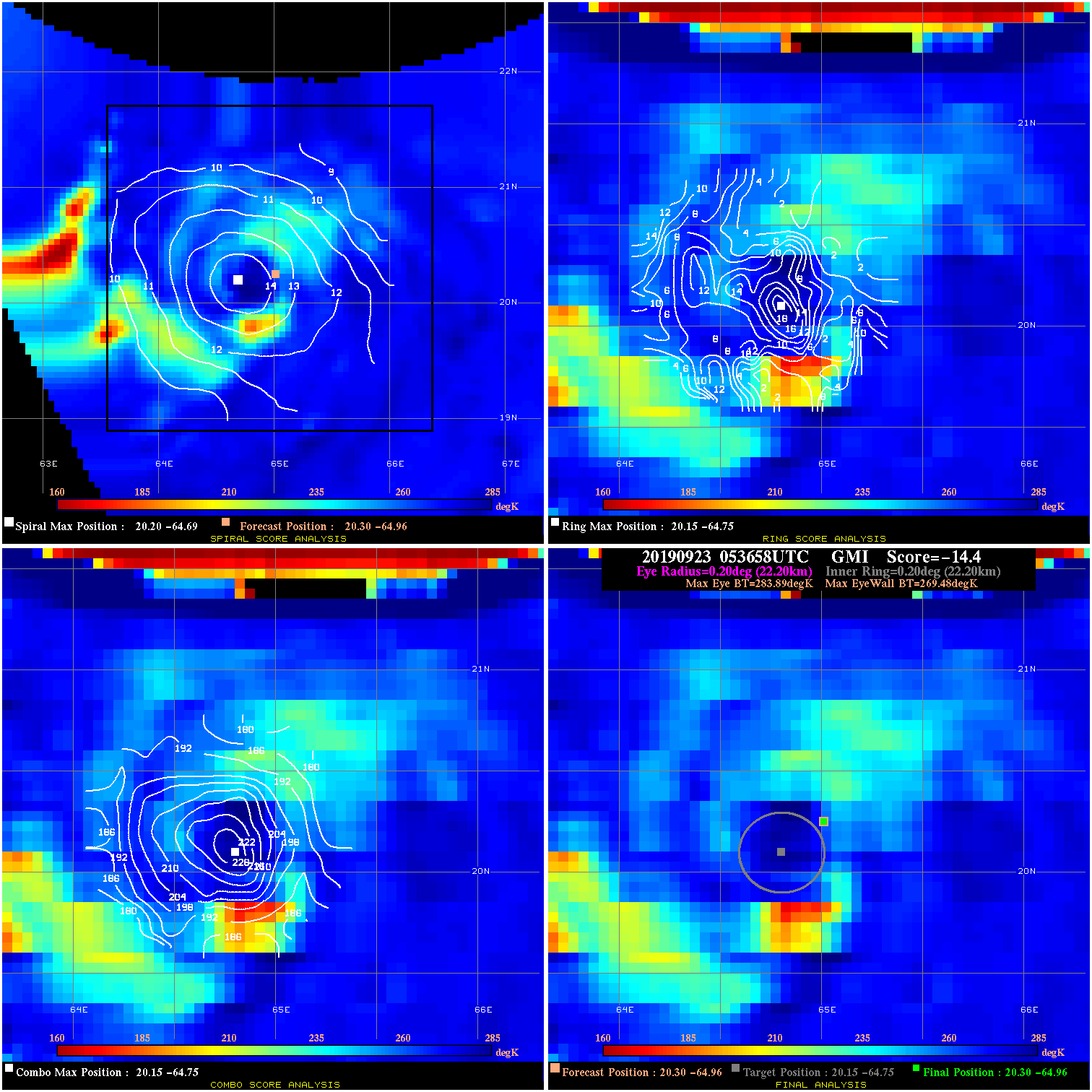
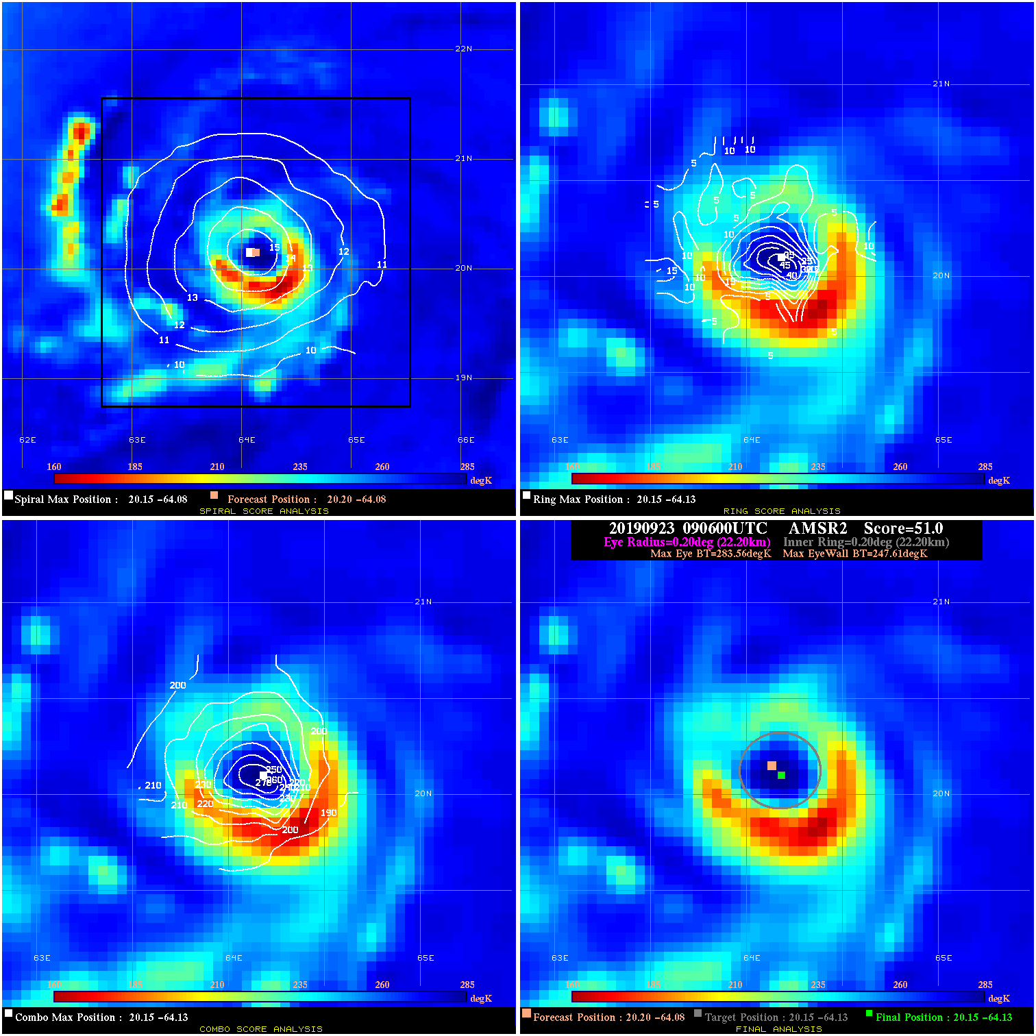
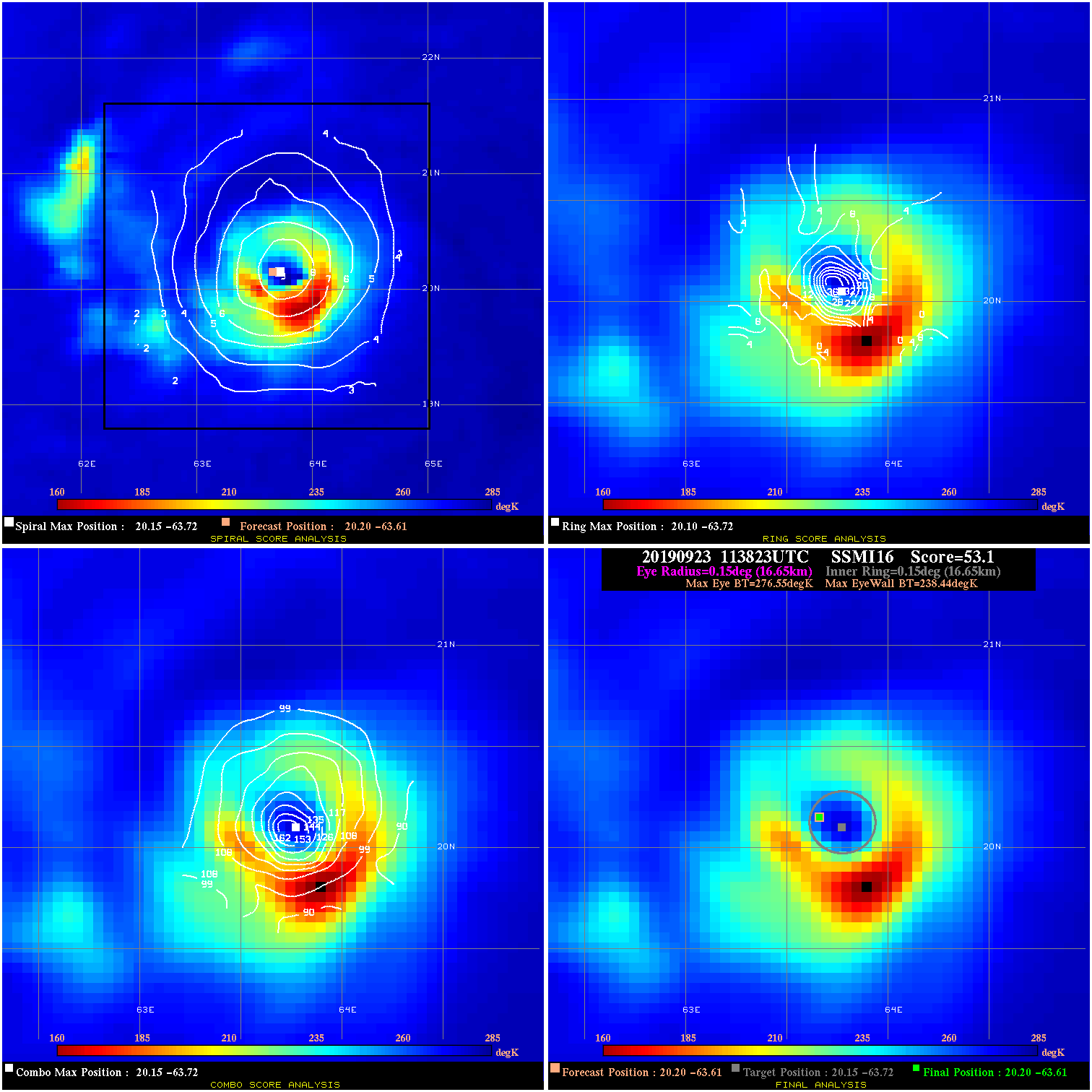
Passive Microwave (PMW) Intensity Information Hurricane Intensity Estimation (HIE) Algorithm Version 9.0 |
Overpass Inten Ring Ring Wind Forecast Final Target
Date Time Score Meaning Pct Diam BTdiff Est Sat Lat Lon Lat Lon Lat Lon
20190923 035401 -14.0 N/A 21.9% 111.10 14.03 45.0 SSMI17 20.3 -65.4 20.3 -65.4 20.2 -65.1 Analysis Plot
20190923 053658 -14.4 N/A 12.3% 44.44 14.41 45.0 GMI 20.3 -65.0 20.3 -65.0 20.1 -64.8 Analysis Plot
20190923 090600 51.0 >65 kts 100.0% 44.44 35.95 55.0 AMSR2 20.2 -64.1 20.1 -64.1 20.1 -64.1 Analysis Plot
20190923 113823 53.1 >65 kts 100.0% 33.33 38.11 55.0 SSMI16 20.2 -63.6 20.2 -63.6 20.1 -63.7 Analysis Plot
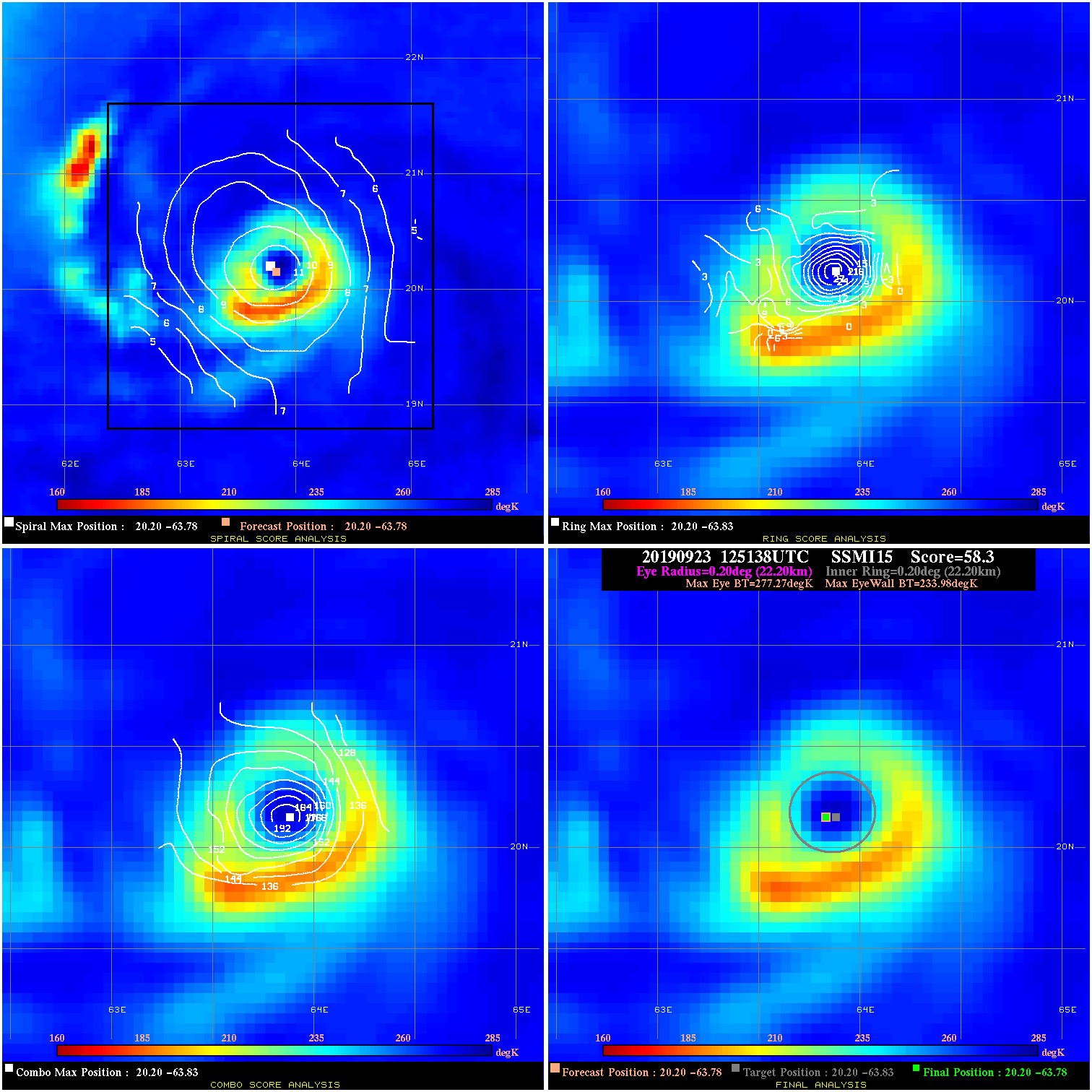
20190923 125138 58.3 >65 kts 100.0% 44.44 43.29 55.0 SSMI15 20.2 -63.8 20.2 -63.8 20.2 -63.8 Analysis Plot
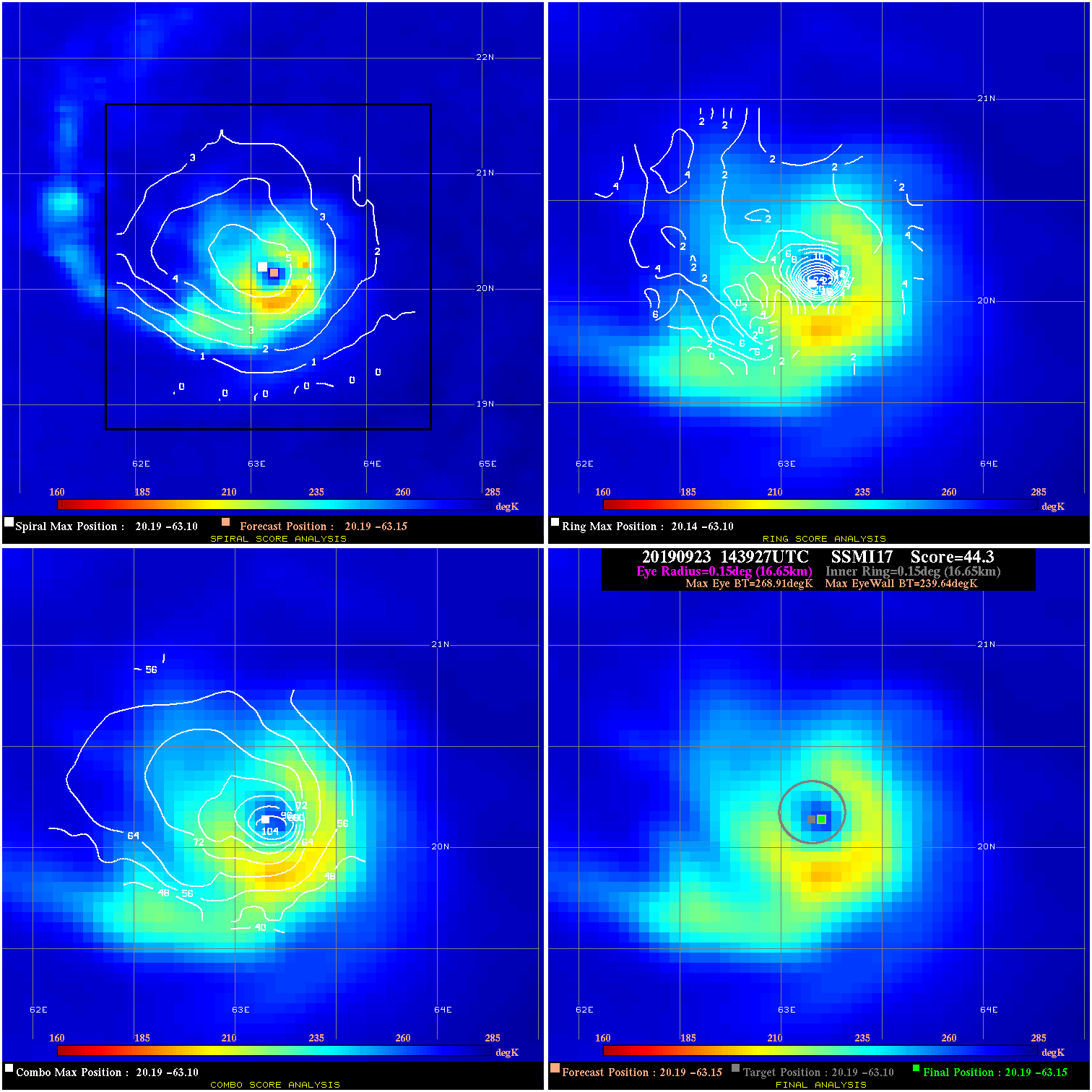
20190923 143927 44.3 >65 kts 100.0% 33.33 29.27 60.0 SSMI17 20.2 -63.2 20.2 -63.2 20.2 -63.1 Analysis Plot
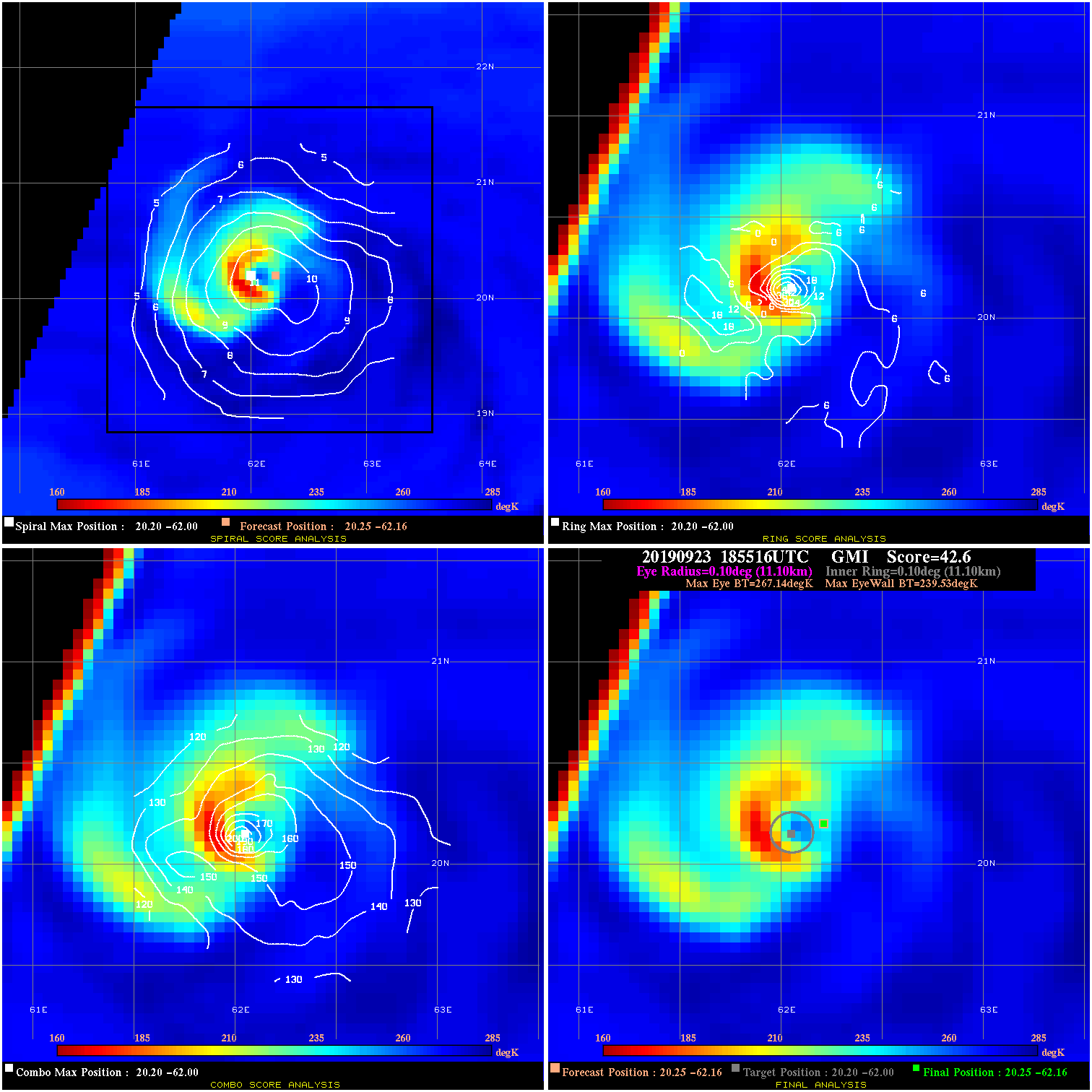
20190923 185516 42.6 >65 kts 100.0% 22.22 27.61 60.0 GMI 20.3 -62.2 20.3 -62.2 20.2 -62.0 Analysis Plot
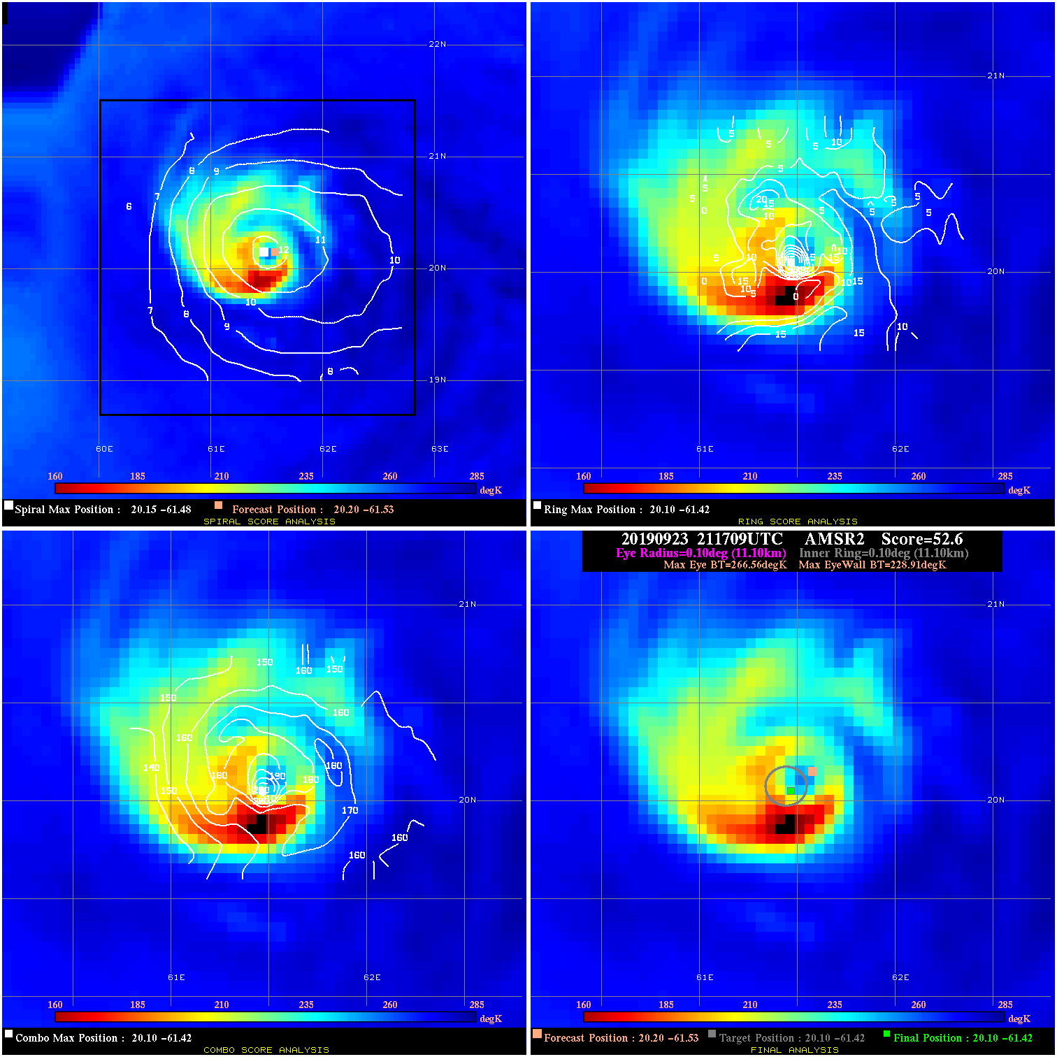
20190923 211709 52.6 >65 kts 100.0% 22.22 37.65 70.0 AMSR2 20.2 -61.5 20.1 -61.4 20.1 -61.4 Analysis Plot
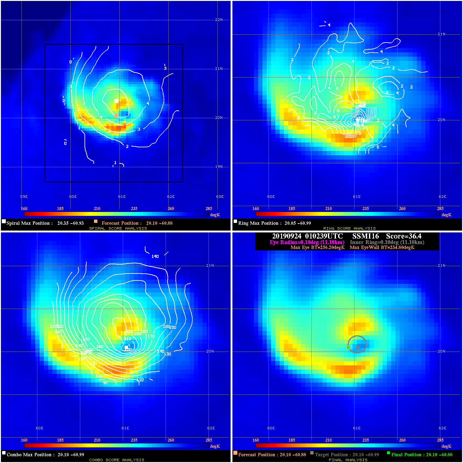
20190924 010239 36.4 >65 kts 100.0% 22.22 21.40 85.0 SSMI16 20.1 -60.9 20.1 -60.9 20.1 -61.0 Analysis Plot
20190924 034346 N/A N/A N/A N/A N/A 85.0 SSMI17 20.1 -60.3 20.1 -60.3 20.3 -60.2 Analysis Plot
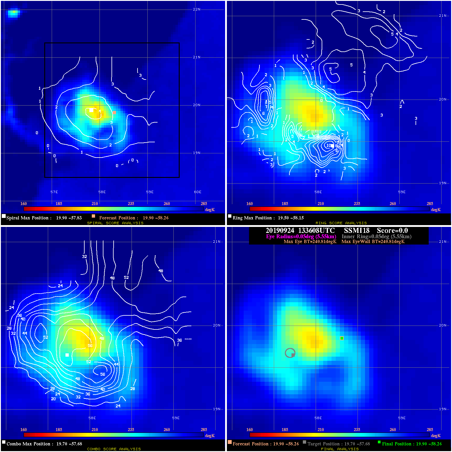
20190924 133608 N/A N/A N/A N/A N/A 75.0 SSMI18 19.9 -58.3 19.9 -58.3 19.7 -57.7 Analysis Plot
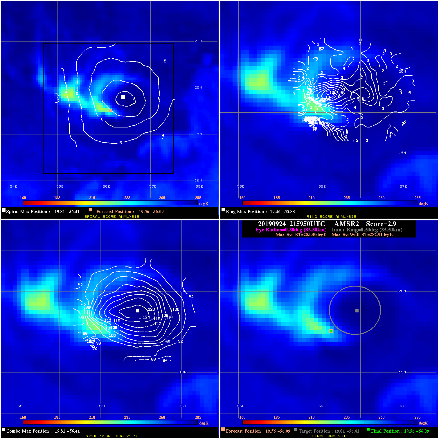
20190924 215950 2.9 N/A 5.5% 66.66 2.89 60.0 AMSR2 19.6 -56.1 19.6 -56.1 19.8 -56.4 Analysis Plot
20190925 025124 3.2 N/A N/A 66.66 3.20 60.0 SSMI18 19.5 -55.4 19.5 -55.4 19.7 -55.6 Analysis Plot
|
|
Legend: - Date/Time are determined from PMW imagery at Forecast (initial guess) Lat/Lon position. - Positive/Negative Latitude = North/South Hemisphere; Longitude = Western/Eastern Hemisphere. - "Ring Diam" value indicates the estimated surface eyewall diameter in km (the MI eyewall edge diameter minus 10 km). - "Ring Pct" is the percentage of the "ring" (eyewall inner boundary) that is 1) colder than the "hot spot" (warmest eye pixel) in the eye by 20K, or 2) the percentage that is a) colder than 232K and b) colder than the "hot spot" by 10K, whichever is greater. - Values are red if Ring % <= 65, yellow/brown if Ring % <= 85 and green if Ring % > 85. - "Tb diff" is the difference between the "hot spot" (warmest eye pixel) and the warmest pixel on the eyewall. - Intensity score are listed as negative, and not used, when the JTWC or NHC estimated Vmax is <55 kts in order to rule out weak but highly symmetric TCs. - Error messages in intensity scores: -920 is used when the hottest pixel in the eye is <200K, to prevent false positives; -930 means <85% of eyewall has observations/data. |