Tropical Depression 09P
|
Passive Microwave (PMW) Intensity Information Hurricane Intensity Estimation (HIE) Algorithm Version 9.0 |
Overpass Inten Ring Ring Wind Forecast Final Target
Date Time Score Meaning Pct Diam BTdiff Est Sat Lat Lon Lat Lon Lat Lon
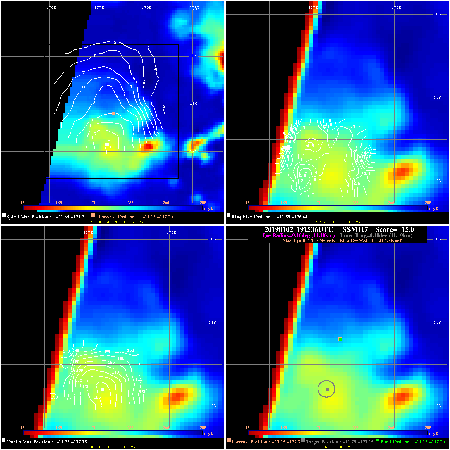
20190102 191536 N/A N/A N/A N/A N/A 35.0 SSMI17 -11.1 -177.3 -11.1 -177.3 -11.8 -177.1 Analysis Plot
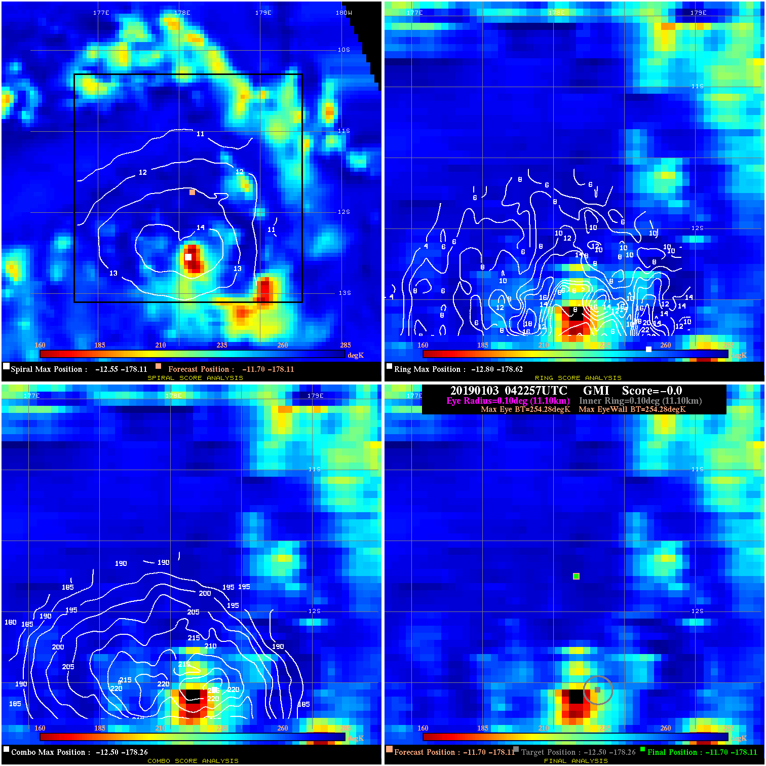
20190103 042257 N/A N/A N/A N/A N/A 35.0 GMI -11.7 -178.1 -11.7 -178.1 -12.5 -178.3 Analysis Plot
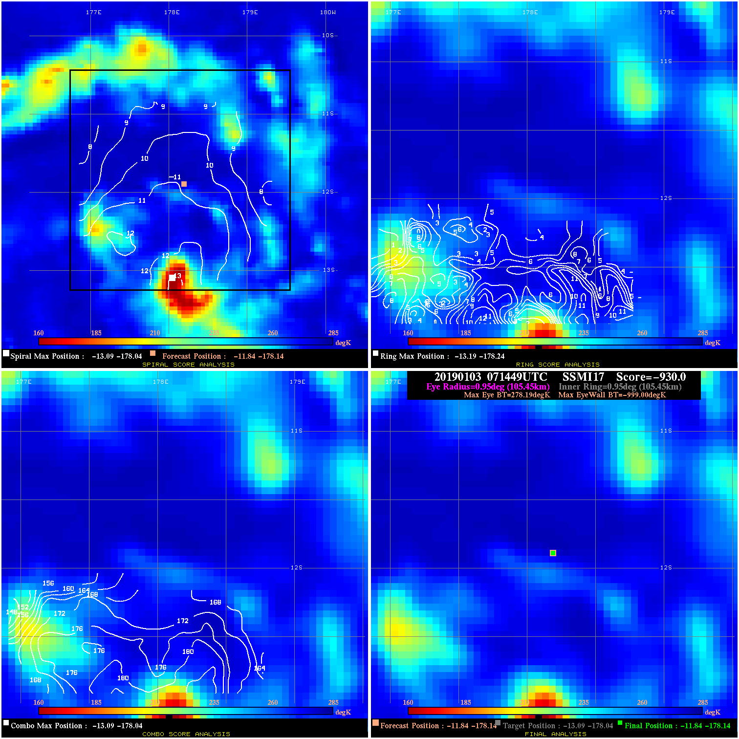
20190103 071449 -930.0 N/A N/A N/A 0.00 35.0 SSMI17 -11.8 -178.1 -11.8 -178.1 -13.1 -178.0 Analysis Plot
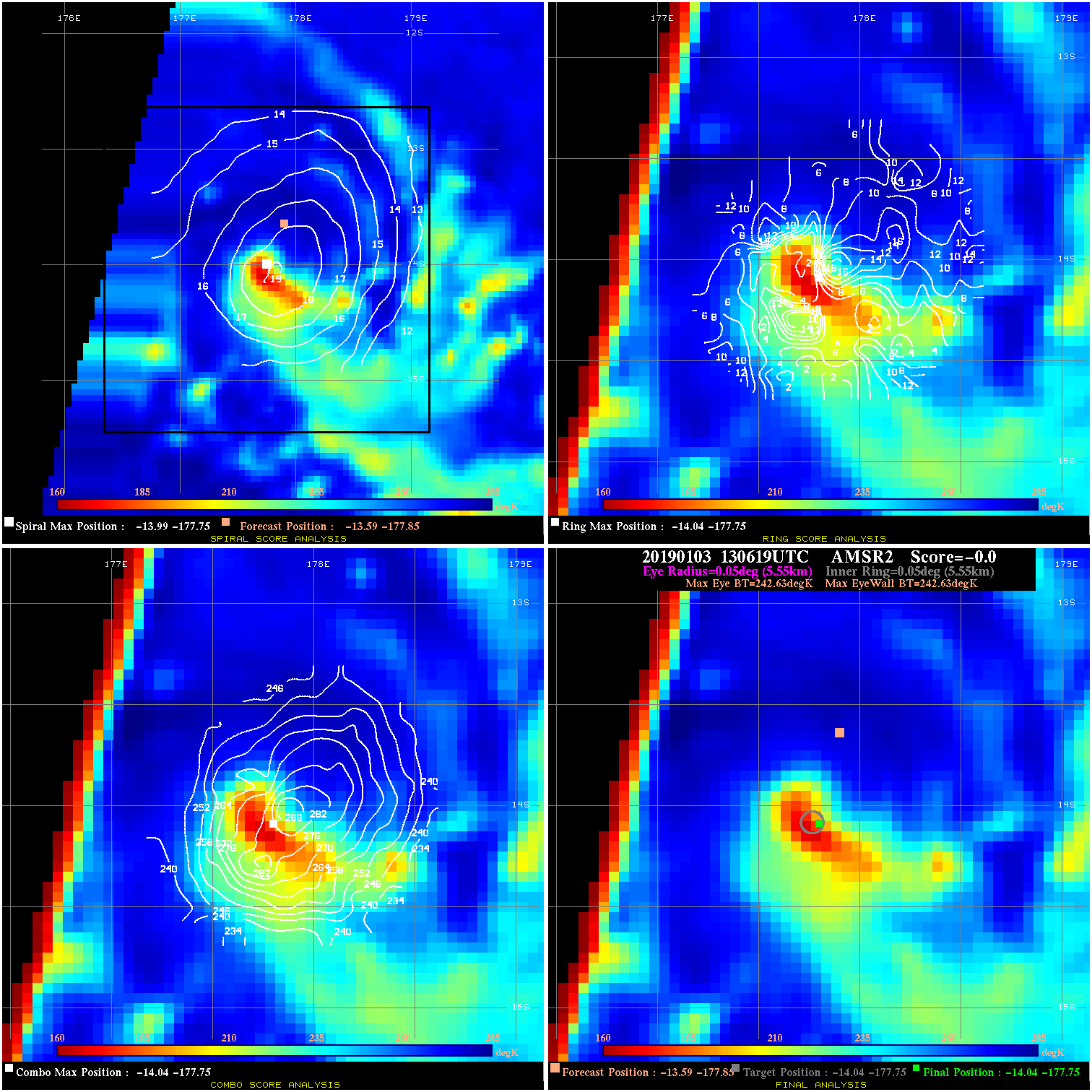
20190103 130619 N/A N/A N/A N/A N/A 40.0 AMSR2 -13.6 -177.9 -14.0 -177.8 -14.0 -177.8 Analysis Plot
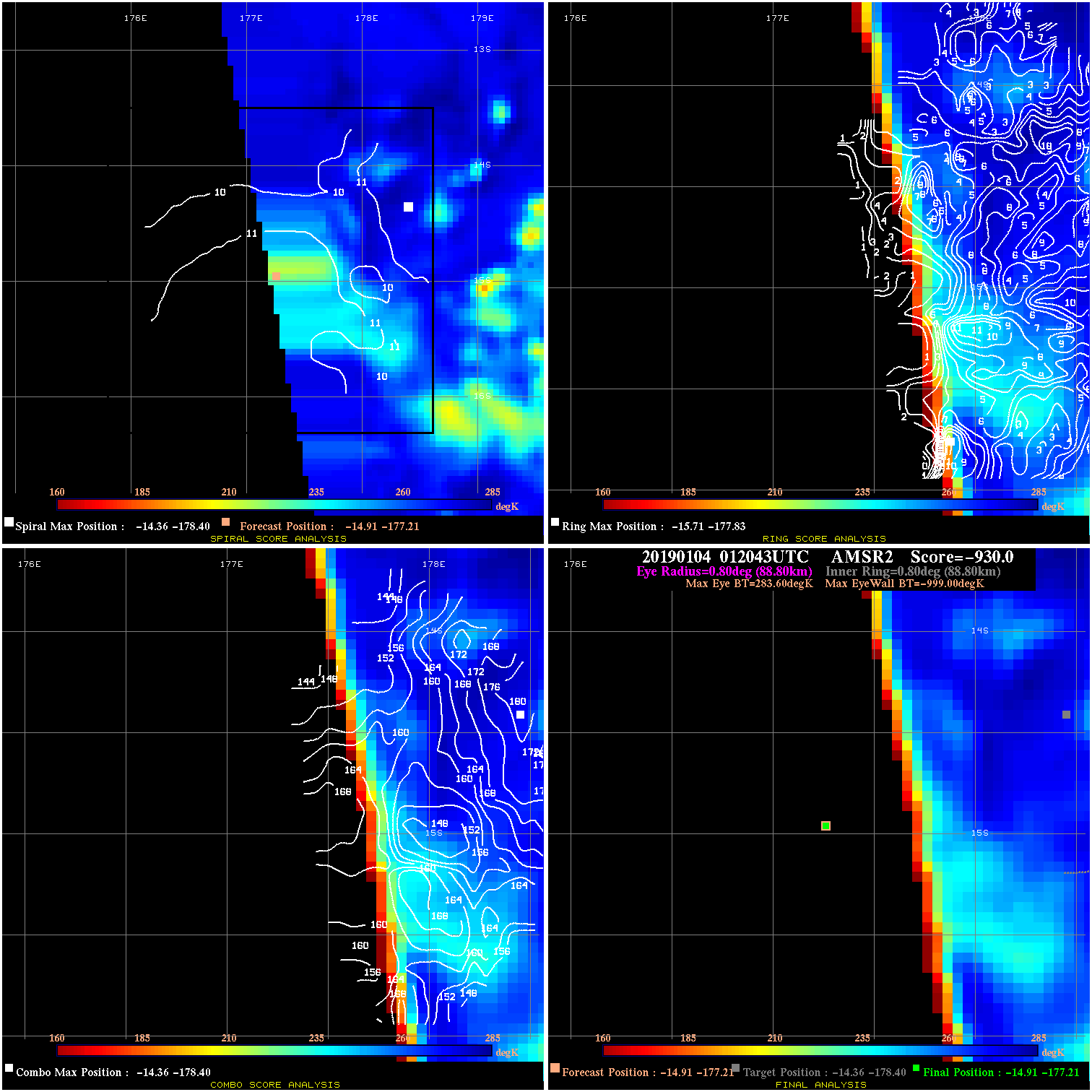
20190104 012043 -930.0 N/A N/A N/A 0.00 50.0 AMSR2 -14.9 -177.2 -14.9 -177.2 -14.4 -178.4 Analysis Plot
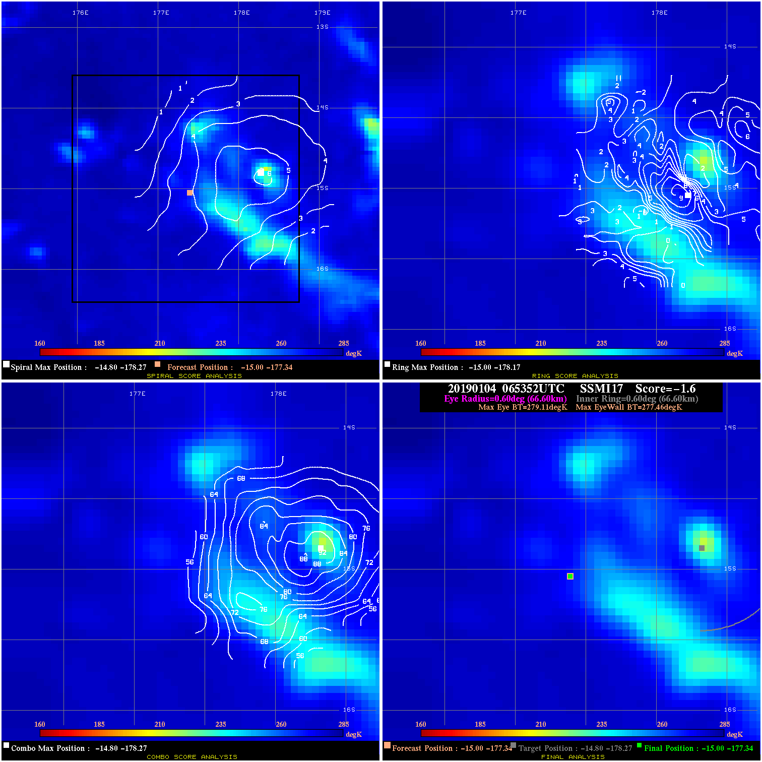
20190104 065352 -1.6 N/A 5.5% 133.32 1.65 50.0 SSMI17 -15.0 -177.3 -15.0 -177.3 -14.8 -178.3 Analysis Plot
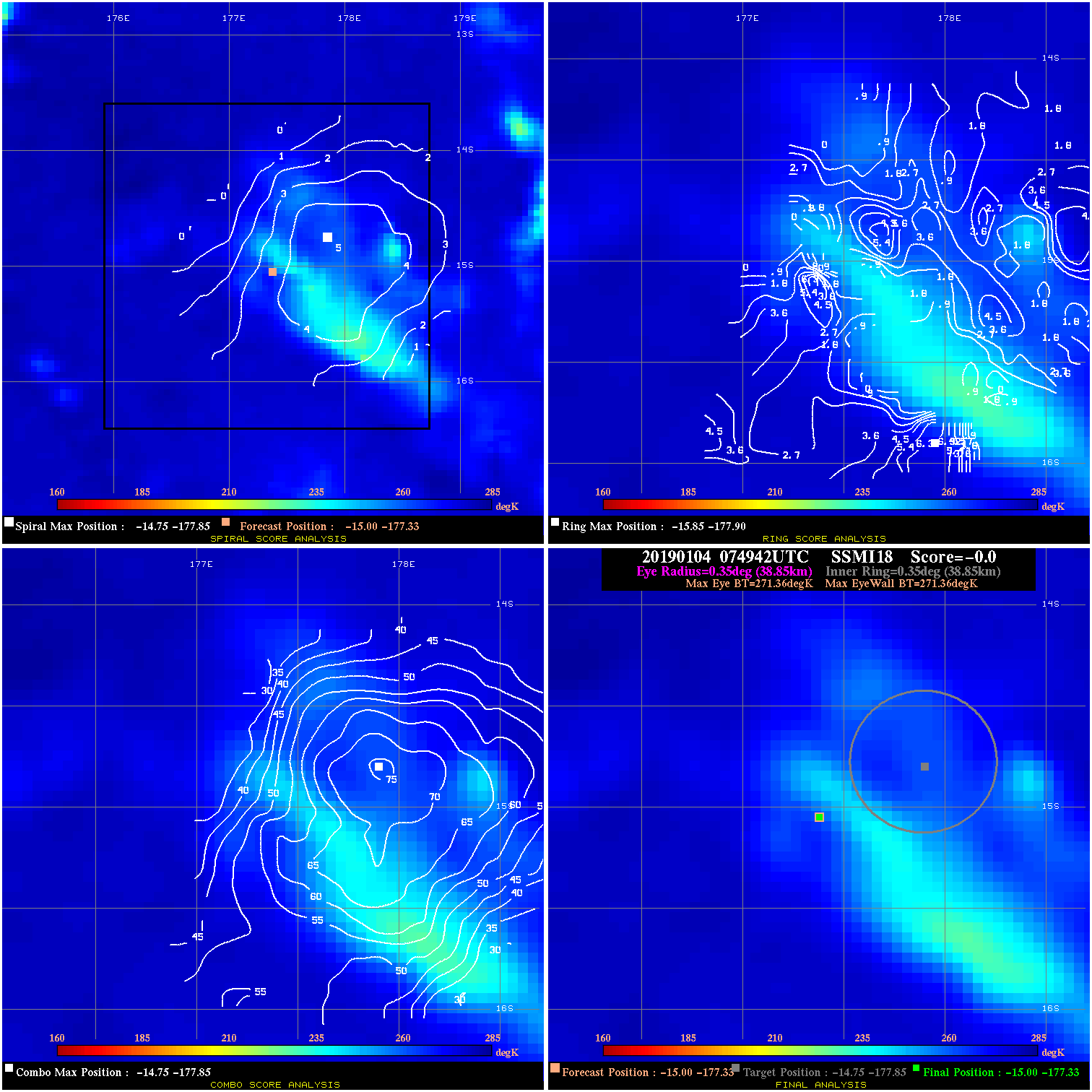
20190104 074942 N/A N/A N/A N/A N/A 50.0 SSMI18 -15.0 -177.3 -15.0 -177.3 -14.8 -177.9 Analysis Plot
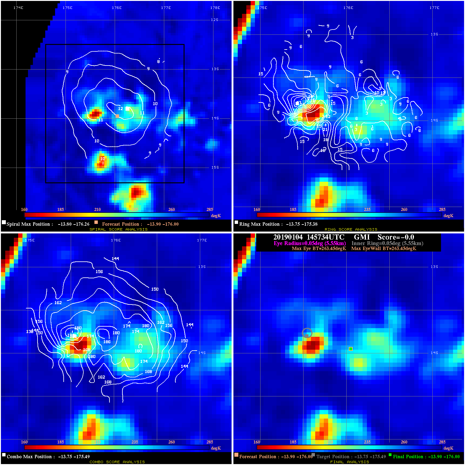
20190104 145734 N/A N/A N/A N/A N/A 40.0 GMI -13.9 -176.0 -13.9 -176.0 -13.8 -175.5 Analysis Plot
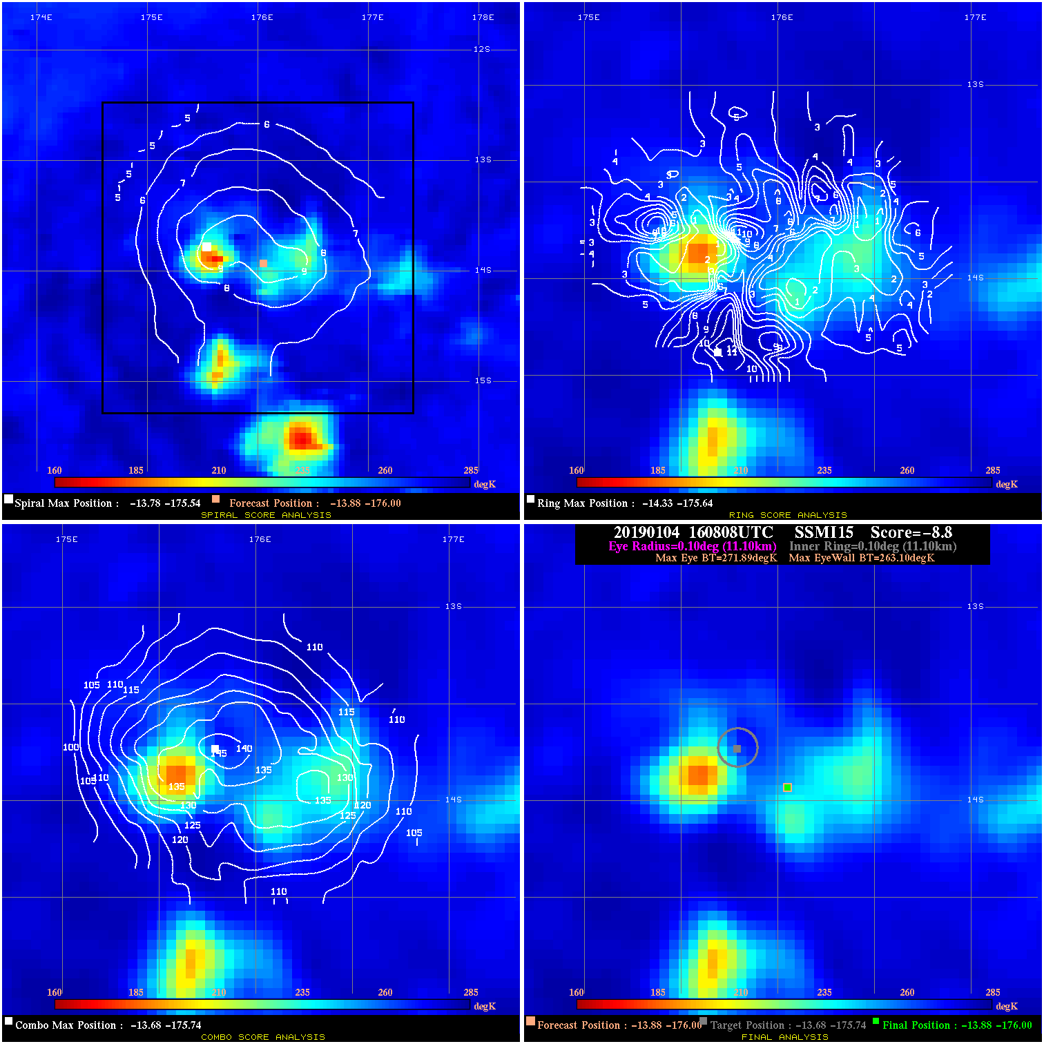
20190104 160808 -8.8 N/A 16.4% 22.22 8.79 40.0 SSMI15 -13.9 -176.0 -13.9 -176.0 -13.7 -175.7 Analysis Plot
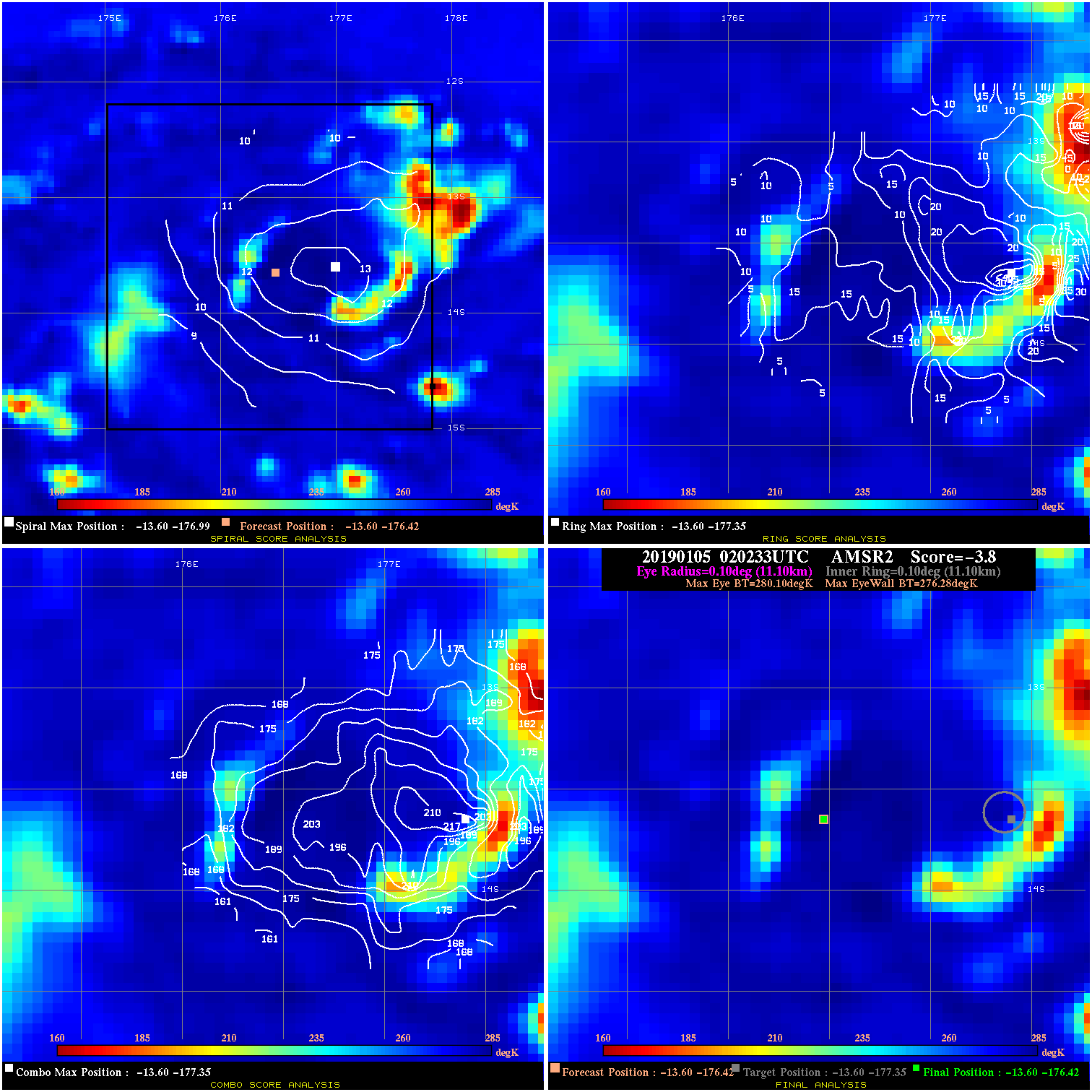
20190105 020233 -3.8 N/A 50.7% 22.22 3.82 30.0 AMSR2 -13.6 -176.4 -13.6 -176.4 -13.6 -177.4 Analysis Plot
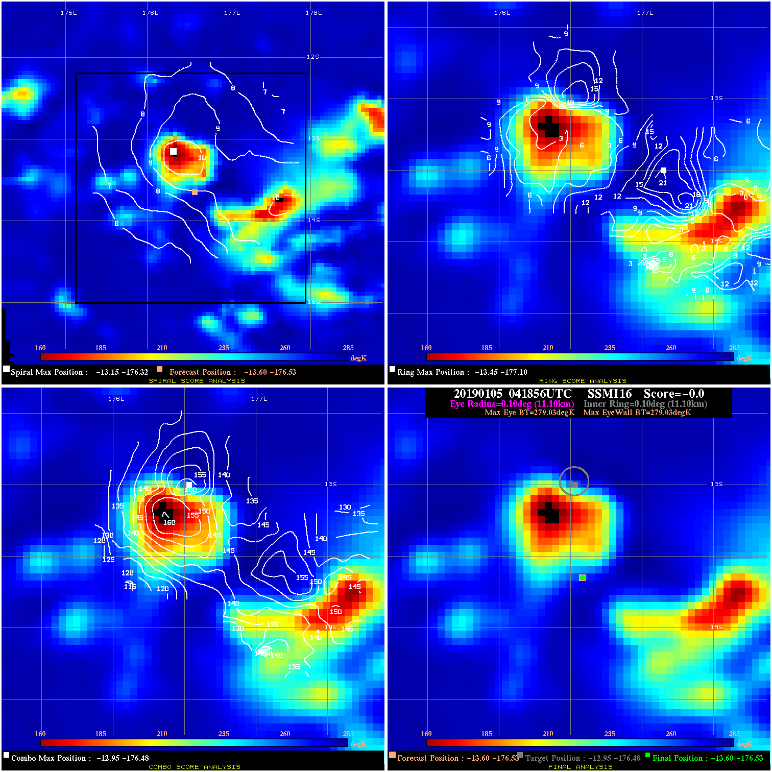
20190105 041856 N/A N/A N/A N/A N/A 30.0 SSMI16 -13.6 -176.5 -13.6 -176.5 -12.9 -176.5 Analysis Plot
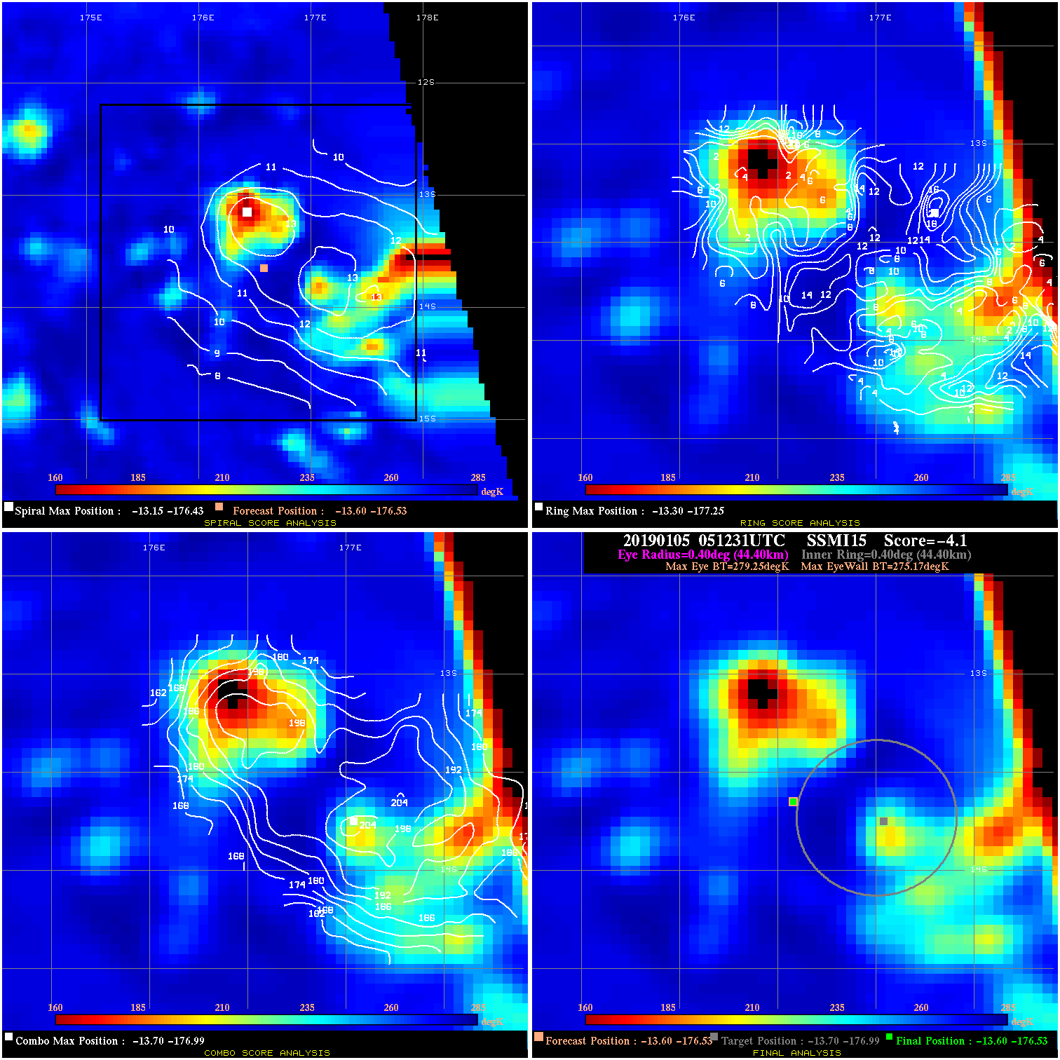
20190105 051231 -4.1 N/A 26.0% 88.88 4.08 30.0 SSMI15 -13.6 -176.5 -13.6 -176.5 -13.7 -177.0 Analysis Plot
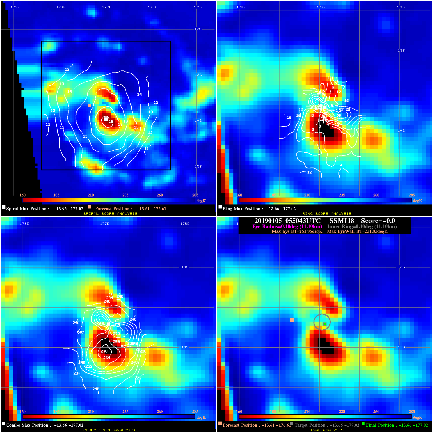
20190105 055043 N/A N/A N/A N/A N/A 30.0 SSMI18 -13.6 -176.6 -13.7 -177.0 -13.7 -177.0 Analysis Plot
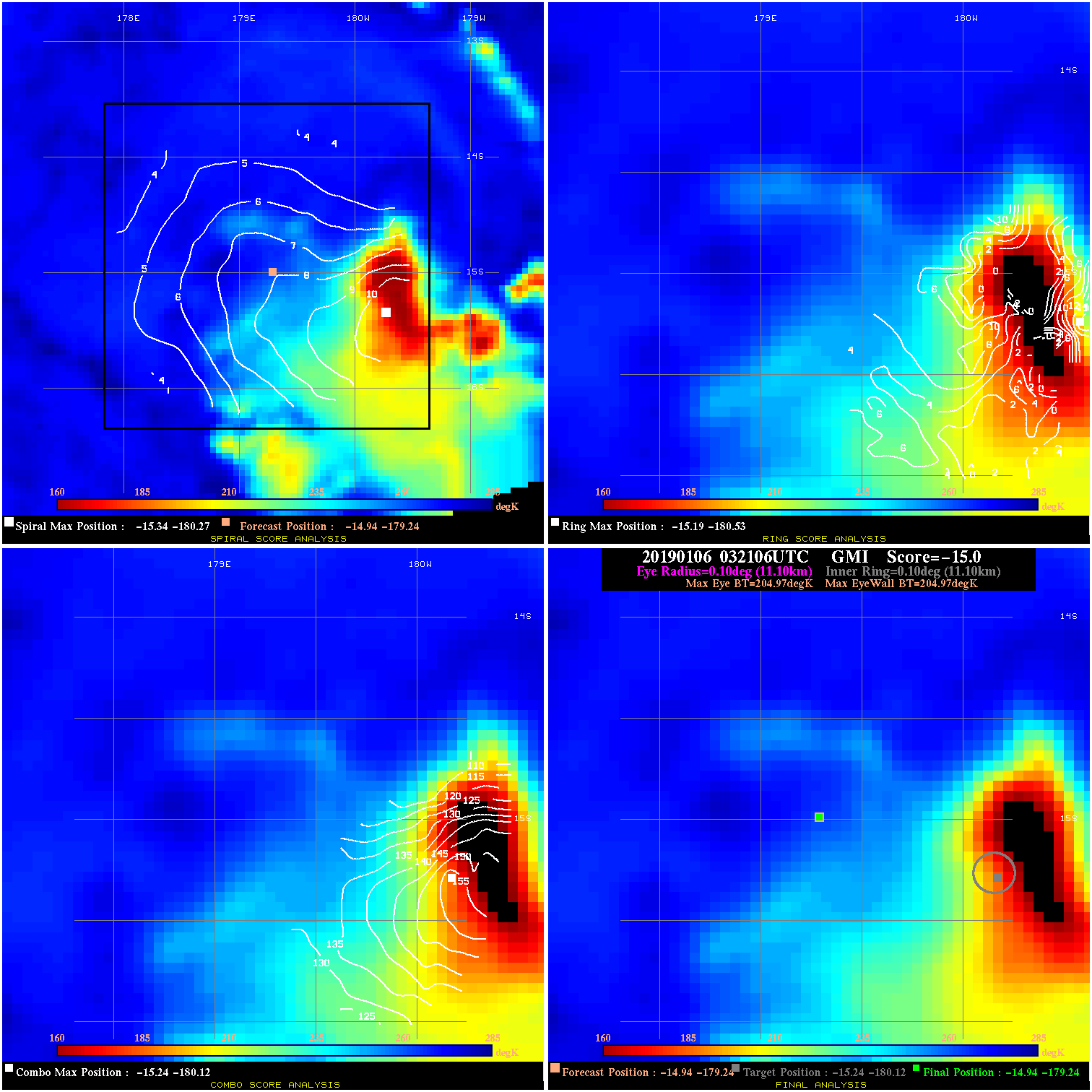
20190106 032106 N/A N/A N/A N/A N/A 35.0 GMI -14.9 -179.2 -14.9 -179.2 -15.2 -180.1 Analysis Plot
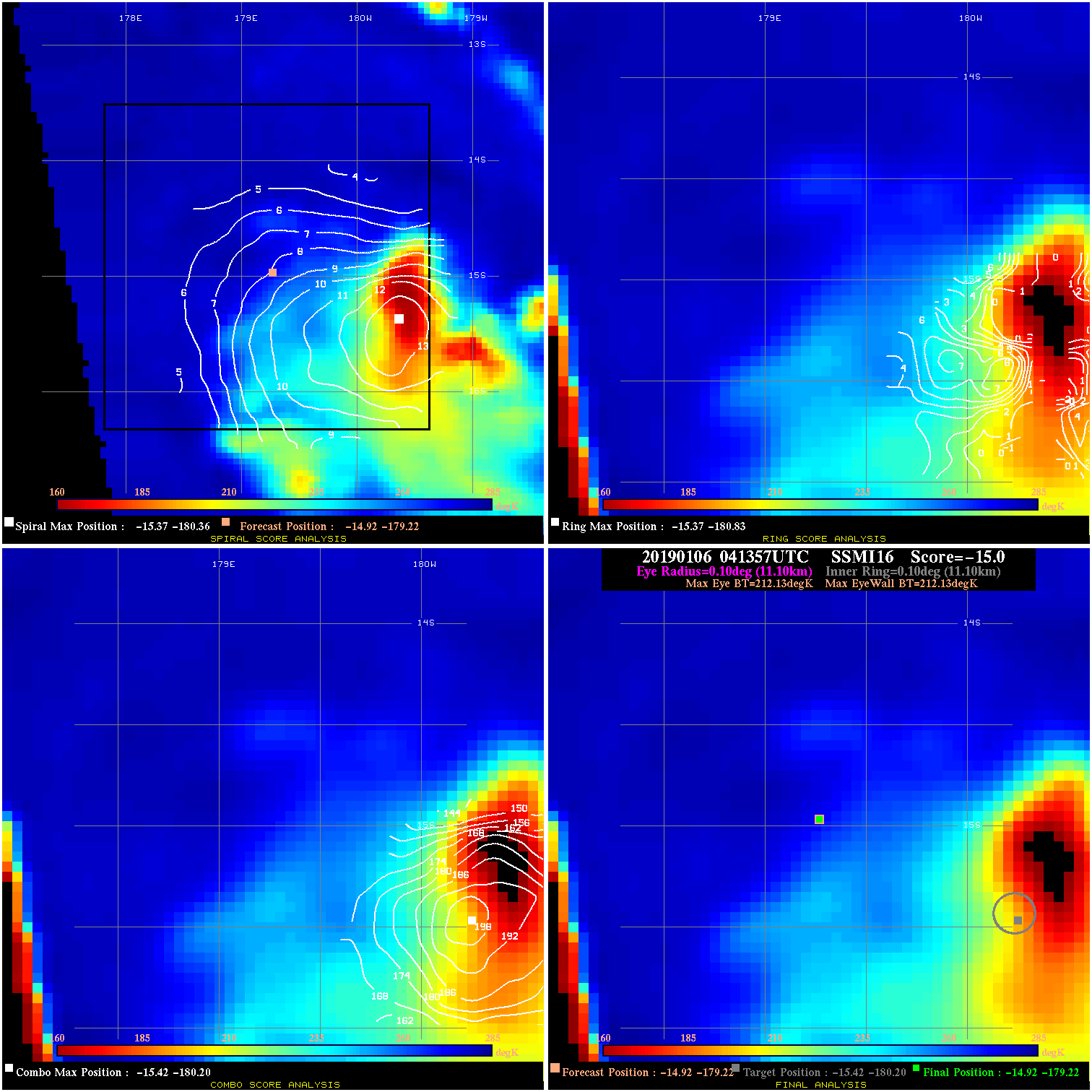
20190106 041357 N/A N/A N/A N/A N/A 35.0 SSMI16 -14.9 -179.2 -14.9 -179.2 -15.4 -180.2 Analysis Plot
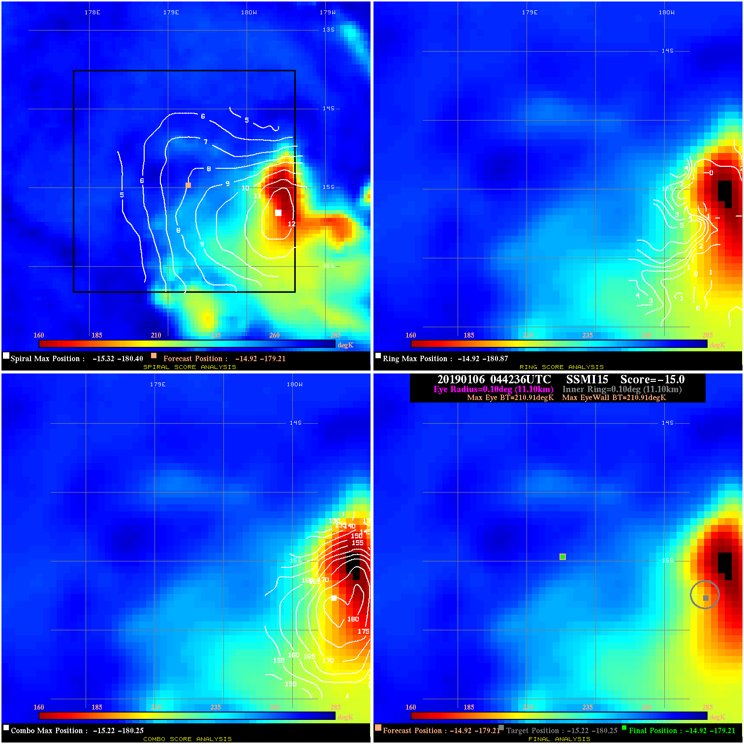
20190106 044236 N/A N/A N/A N/A N/A 35.0 SSMI15 -14.9 -179.2 -14.9 -179.2 -15.2 -180.3 Analysis Plot
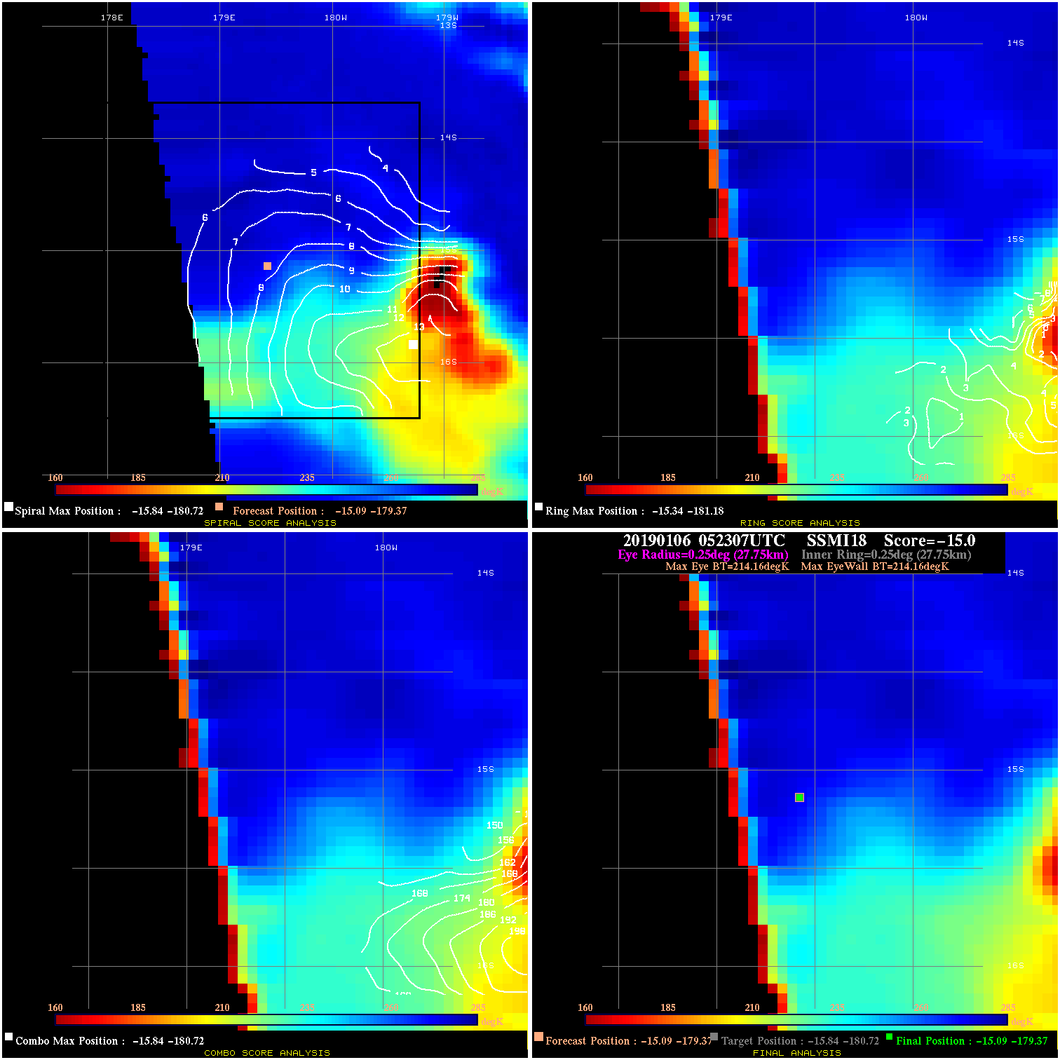
20190106 052307 N/A N/A N/A N/A N/A 35.0 SSMI18 -15.1 -179.4 -15.1 -179.4 -15.8 -180.7 Analysis Plot
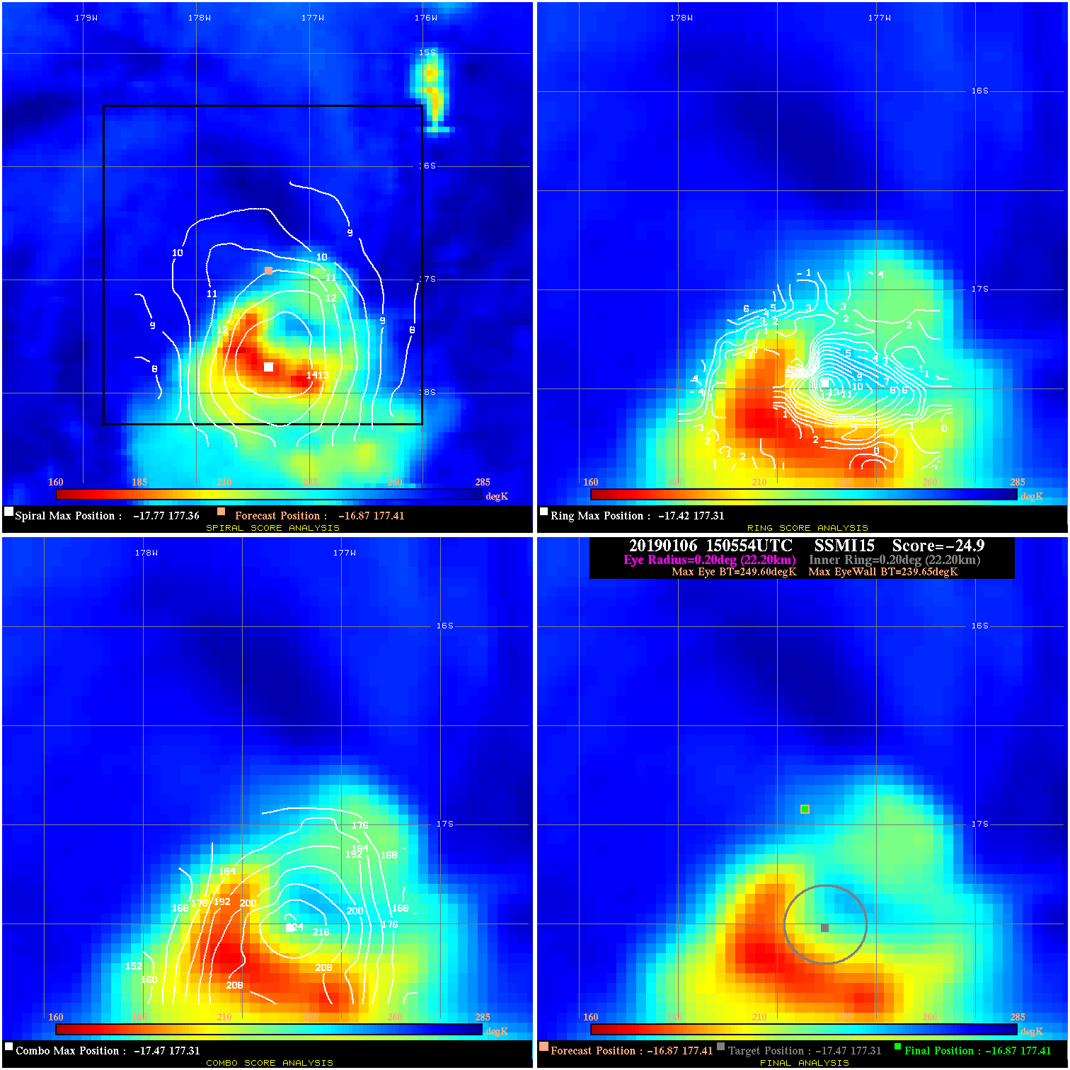
20190106 150554 -24.9 N/A 86.3% 44.44 9.95 45.0 SSMI15 -16.9 177.4 -16.9 177.4 -17.5 177.3 Analysis Plot
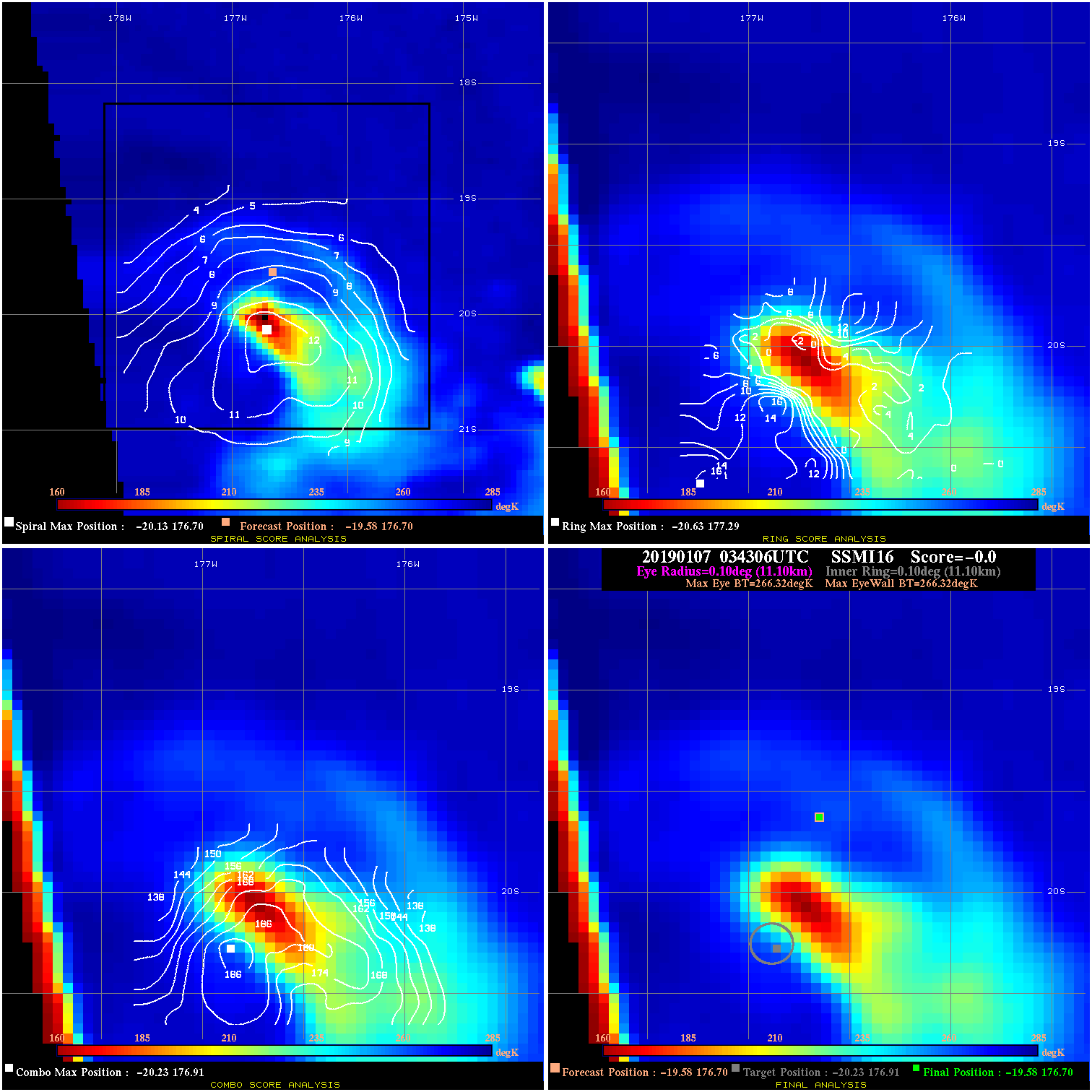
20190107 034306 N/A N/A N/A N/A N/A 45.0 SSMI16 -19.6 176.7 -19.6 176.7 -20.2 176.9 Analysis Plot
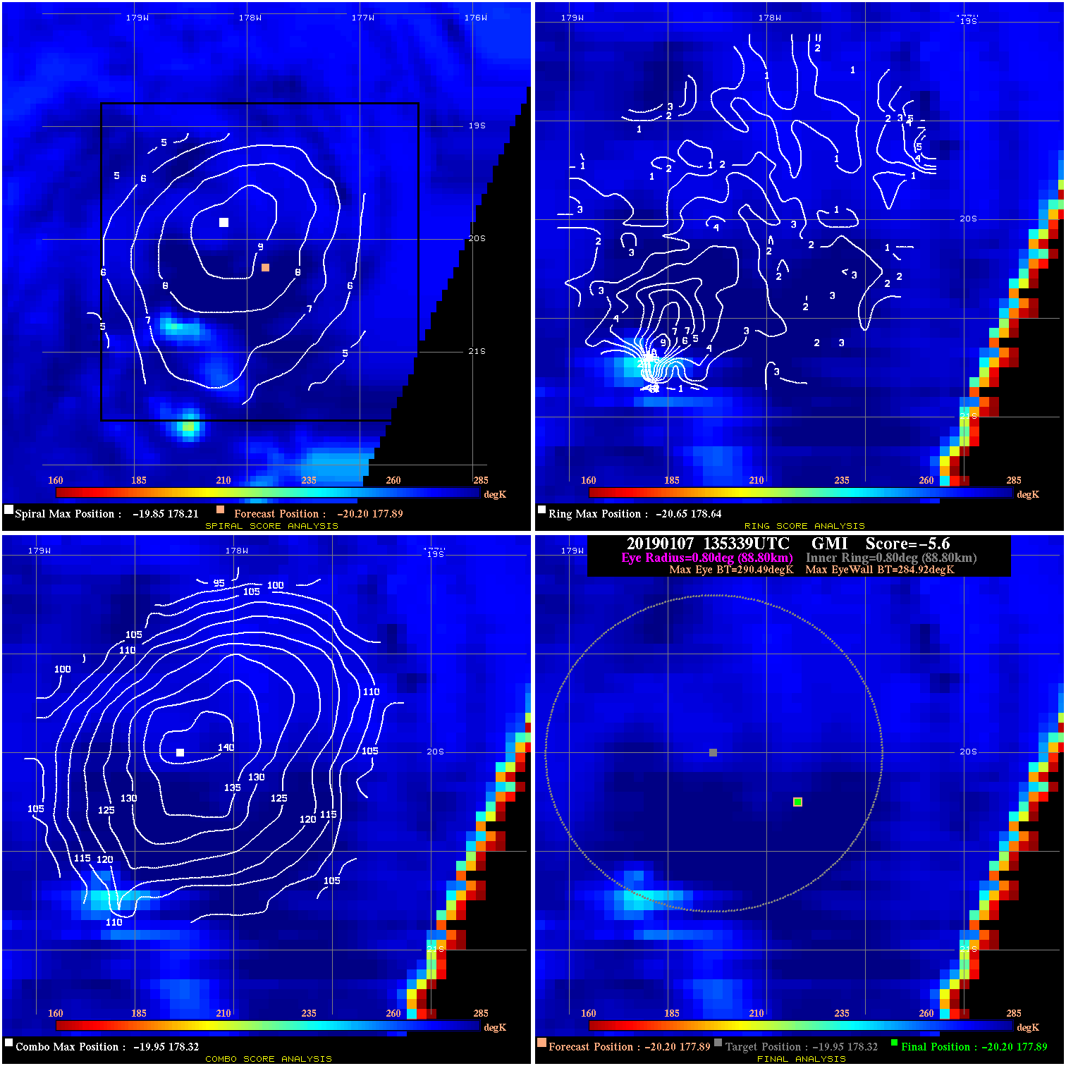
20190107 135339 -5.6 N/A N/A 177.76 5.57 40.0 GMI -20.2 177.9 -20.2 177.9 -20.0 178.3 Analysis Plot
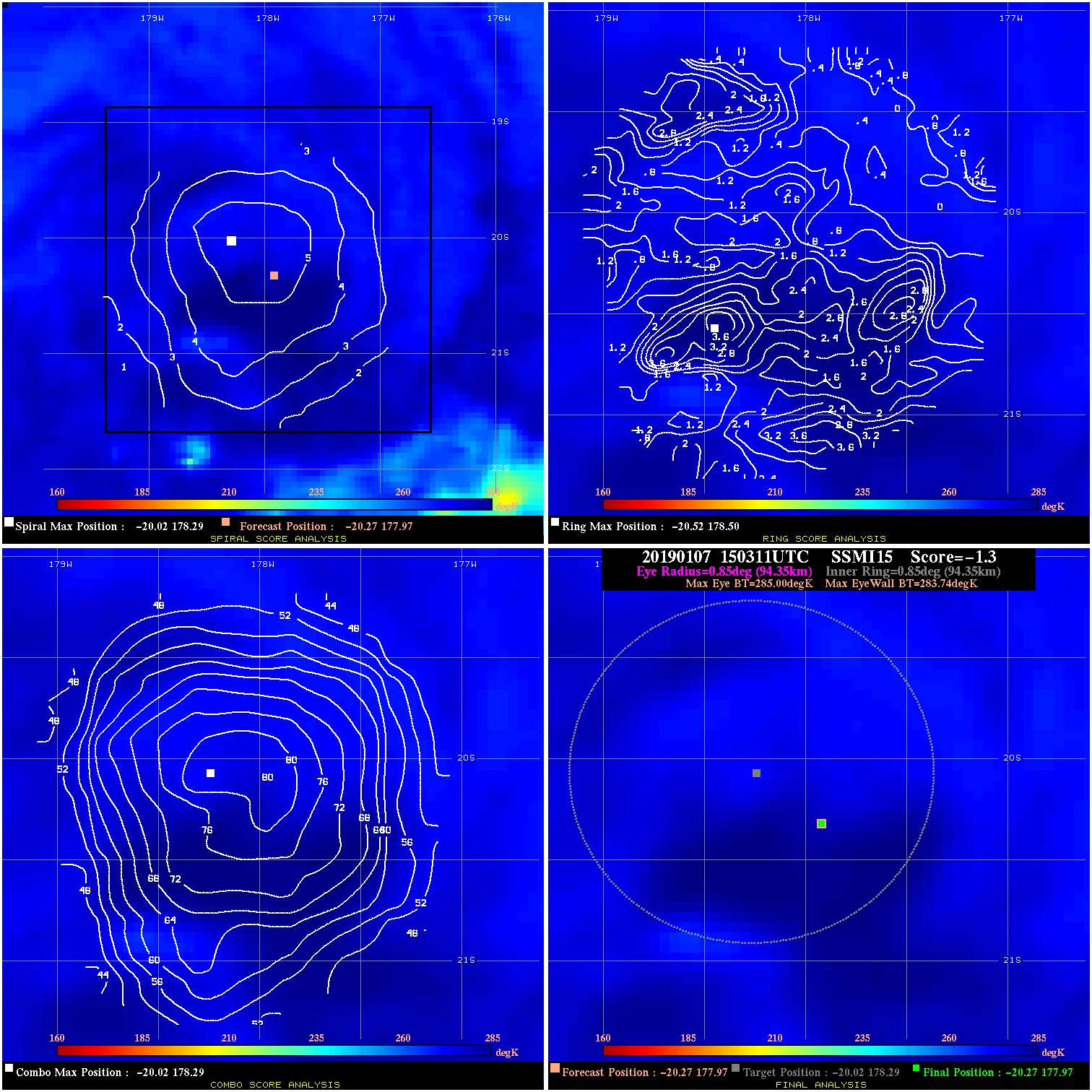
20190107 150311 -1.3 N/A N/A 188.87 1.26 40.0 SSMI15 -20.3 178.0 -20.3 178.0 -20.0 178.3 Analysis Plot
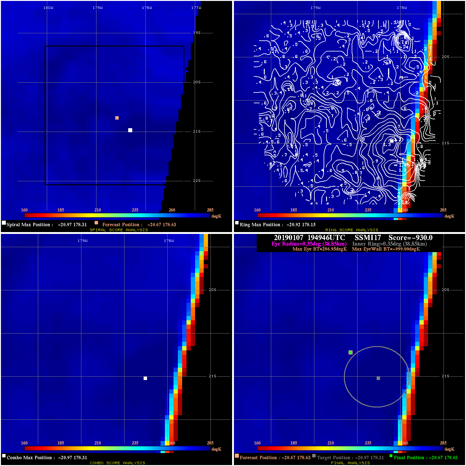
20190107 194946 -930.0 N/A N/A N/A 0.00 30.0 SSMI17 -20.7 178.6 -20.7 178.6 -21.0 178.3 Analysis Plot
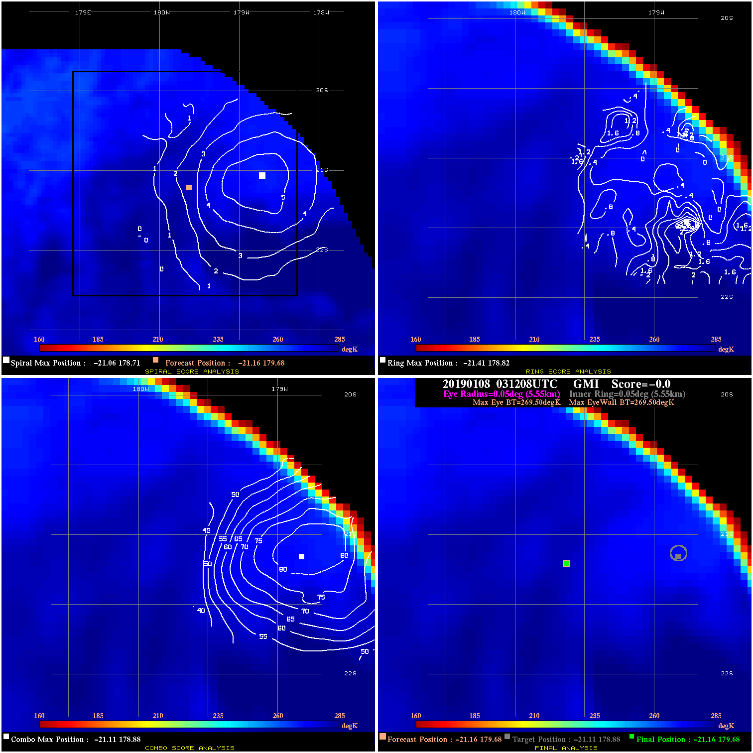
20190108 031208 N/A N/A N/A N/A N/A 30.0 GMI -21.2 179.7 -21.2 179.7 -21.1 178.9 Analysis Plot
|
|
Legend: - Date/Time are determined from PMW imagery at Forecast (initial guess) Lat/Lon position. - Positive/Negative Latitude = North/South Hemisphere; Longitude = Western/Eastern Hemisphere. - "Ring Diam" value indicates the estimated surface eyewall diameter in km (the MI eyewall edge diameter minus 10 km). - "Ring Pct" is the percentage of the "ring" (eyewall inner boundary) that is 1) colder than the "hot spot" (warmest eye pixel) in the eye by 20K, or 2) the percentage that is a) colder than 232K and b) colder than the "hot spot" by 10K, whichever is greater. - Values are red if Ring % <= 65, yellow/brown if Ring % <= 85 and green if Ring % > 85. - "Tb diff" is the difference between the "hot spot" (warmest eye pixel) and the warmest pixel on the eyewall. - Intensity score are listed as negative, and not used, when the JTWC or NHC estimated Vmax is <55 kts in order to rule out weak but highly symmetric TCs. - Error messages in intensity scores: -920 is used when the hottest pixel in the eye is <200K, to prevent false positives; -930 means <85% of eyewall has observations/data. |