Tropical Storm 24S
|
Passive Microwave (PMW) Intensity Information Hurricane Intensity Estimation (HIE) Algorithm Version 9.0 |
Overpass Inten Ring Ring Wind Forecast Final Target
Date Time Score Meaning Pct Diam BTdiff Est Sat Lat Lon Lat Lon Lat Lon
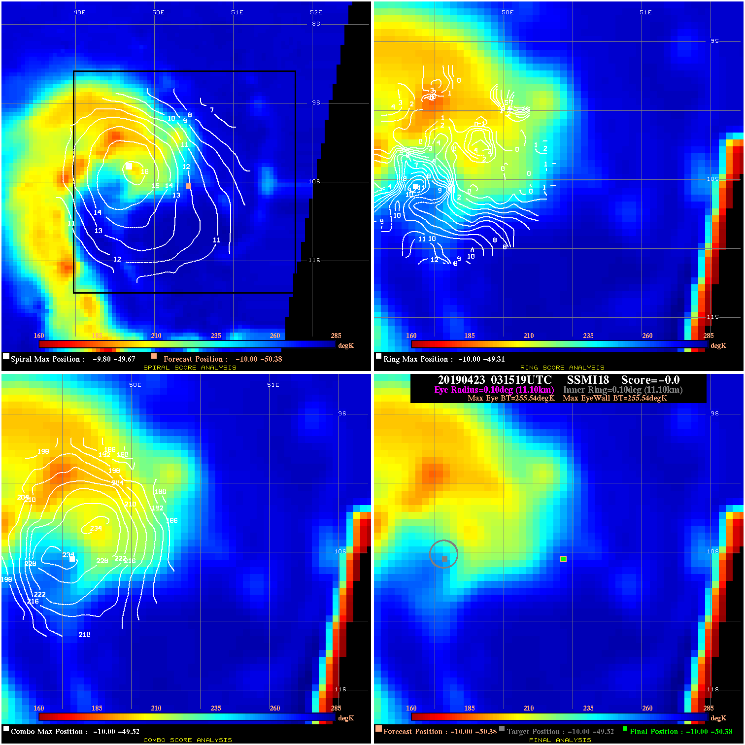
20190423 031519 N/A N/A N/A N/A N/A 30.0 SSMI18 -10.0 -50.4 -10.0 -50.4 -10.0 -49.5 Analysis Plot
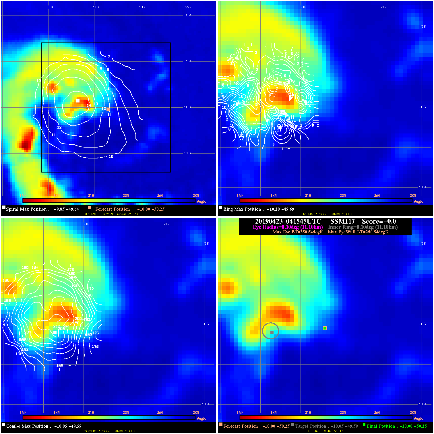
20190423 041545 N/A N/A N/A N/A N/A 30.0 SSMI17 -10.0 -50.3 -10.0 -50.3 -10.1 -49.6 Analysis Plot
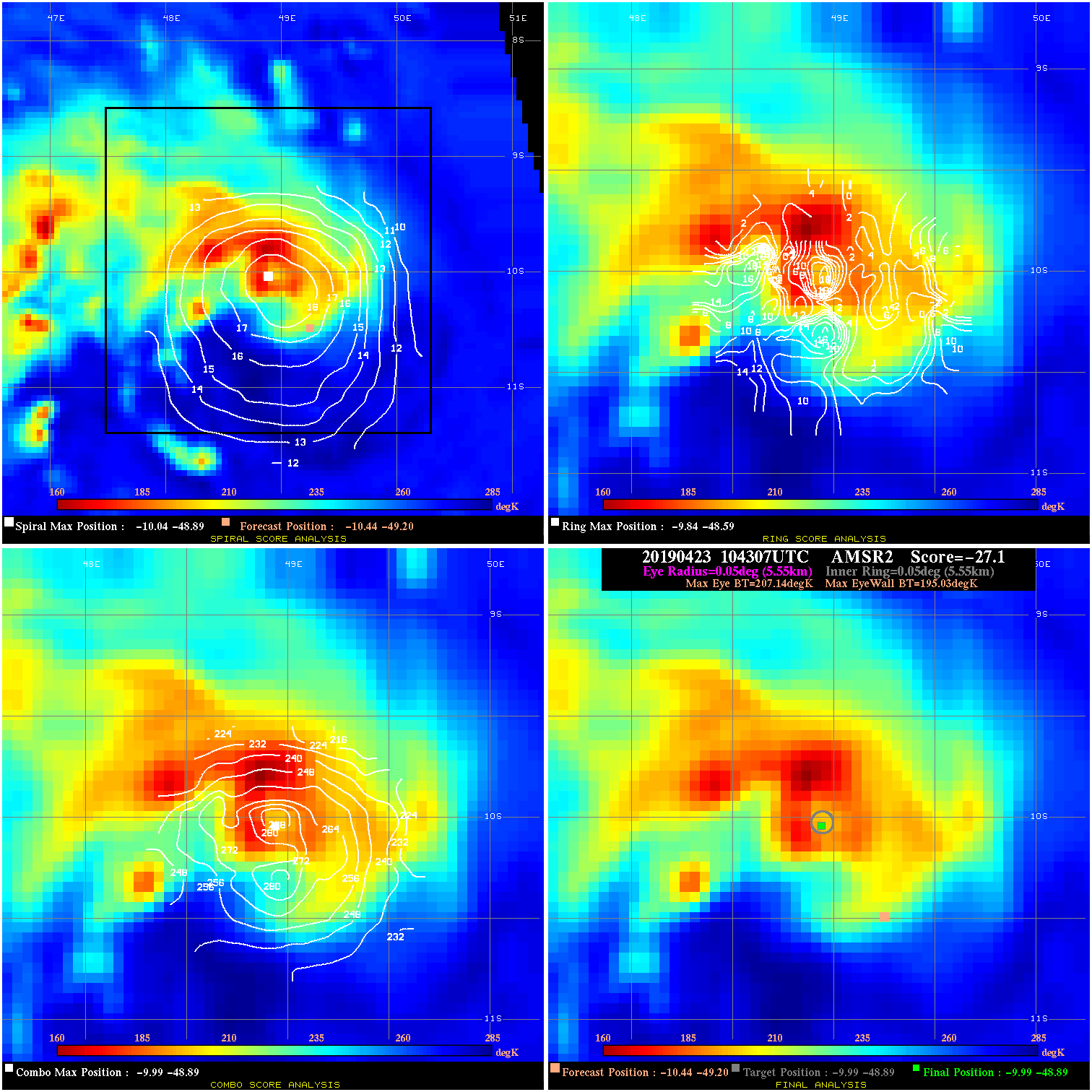
20190423 104307 -27.1 N/A 100.0% 11.11 12.11 35.0 AMSR2 -10.4 -49.2 -10.0 -48.9 -10.0 -48.9 Analysis Plot
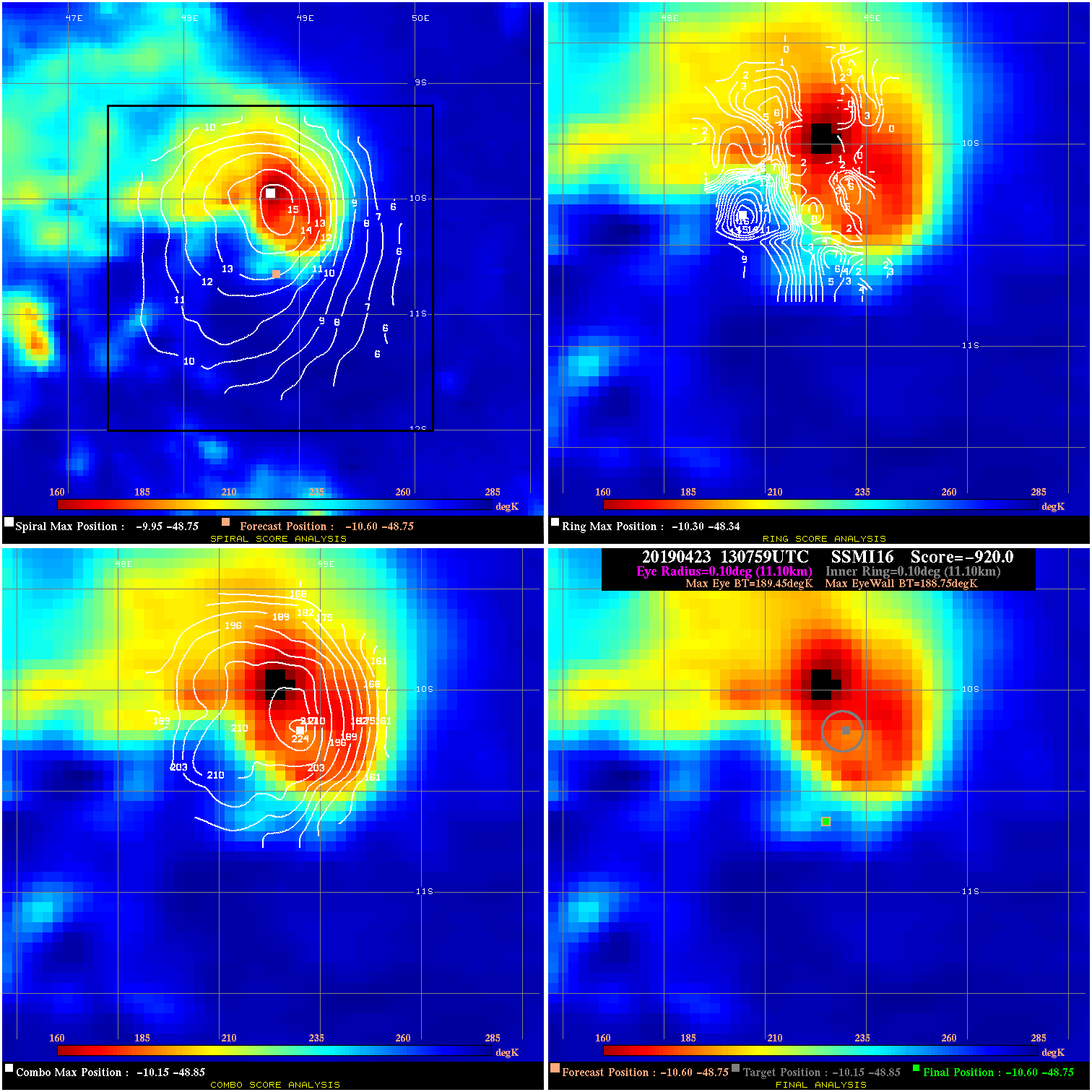
20190423 130759 -920.0 N/A 100.0% 22.22 .70 45.0 SSMI16 -10.6 -48.8 -10.6 -48.8 -10.1 -48.8 Analysis Plot
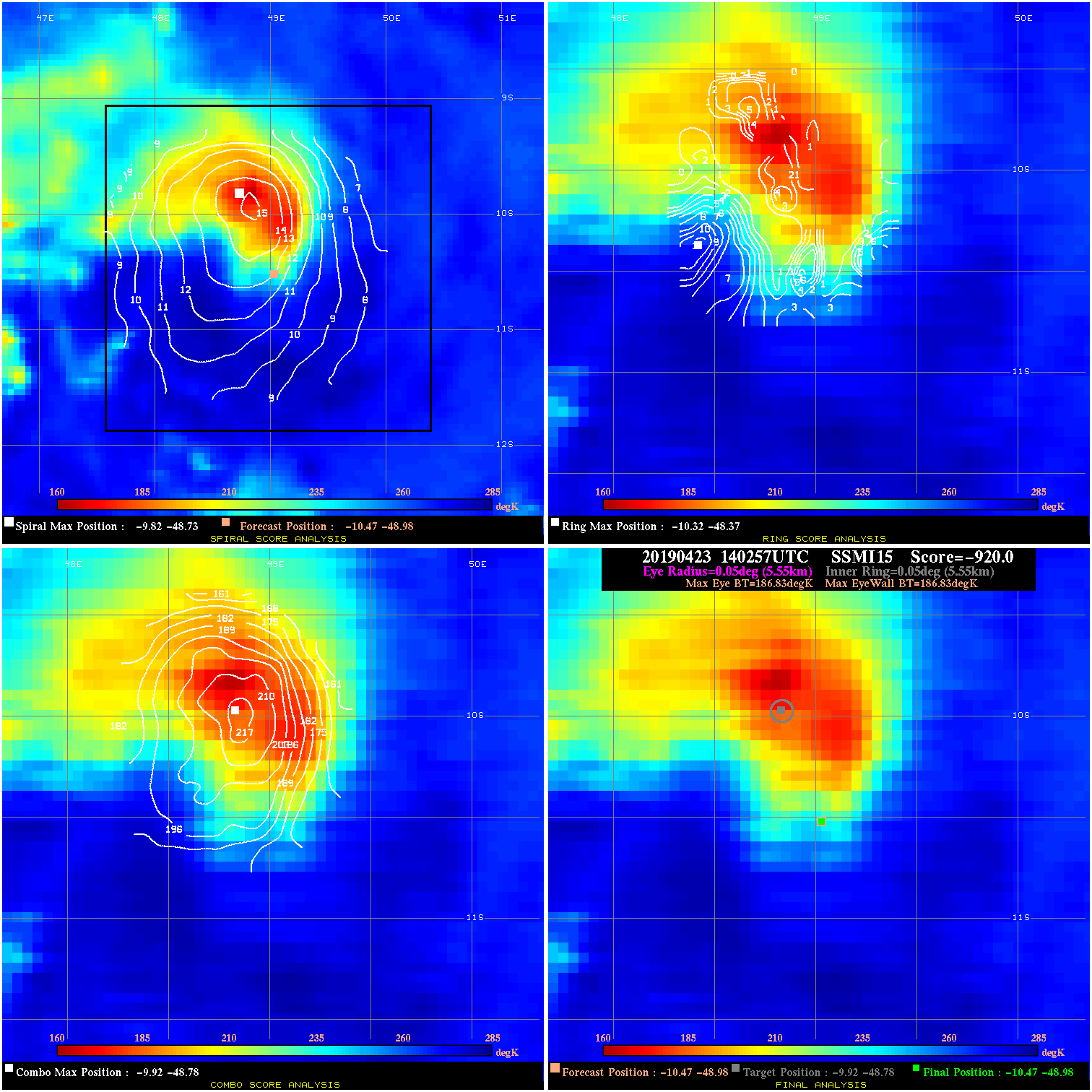
20190423 140257 N/A N/A N/A N/A N/A 35.0 SSMI15 -10.5 -49.0 -10.5 -49.0 -9.9 -48.8 Analysis Plot
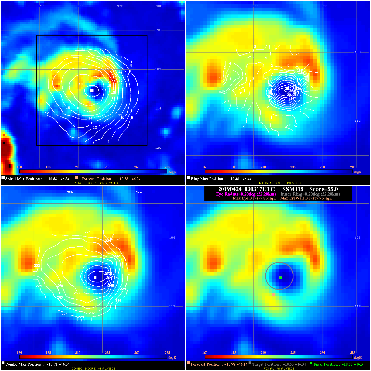
20190424 030317 55.0 >65 kts 100.0% 44.44 40.04 65.0 SSMI18 -10.8 -46.2 -10.5 -46.3 -10.5 -46.3 Analysis Plot
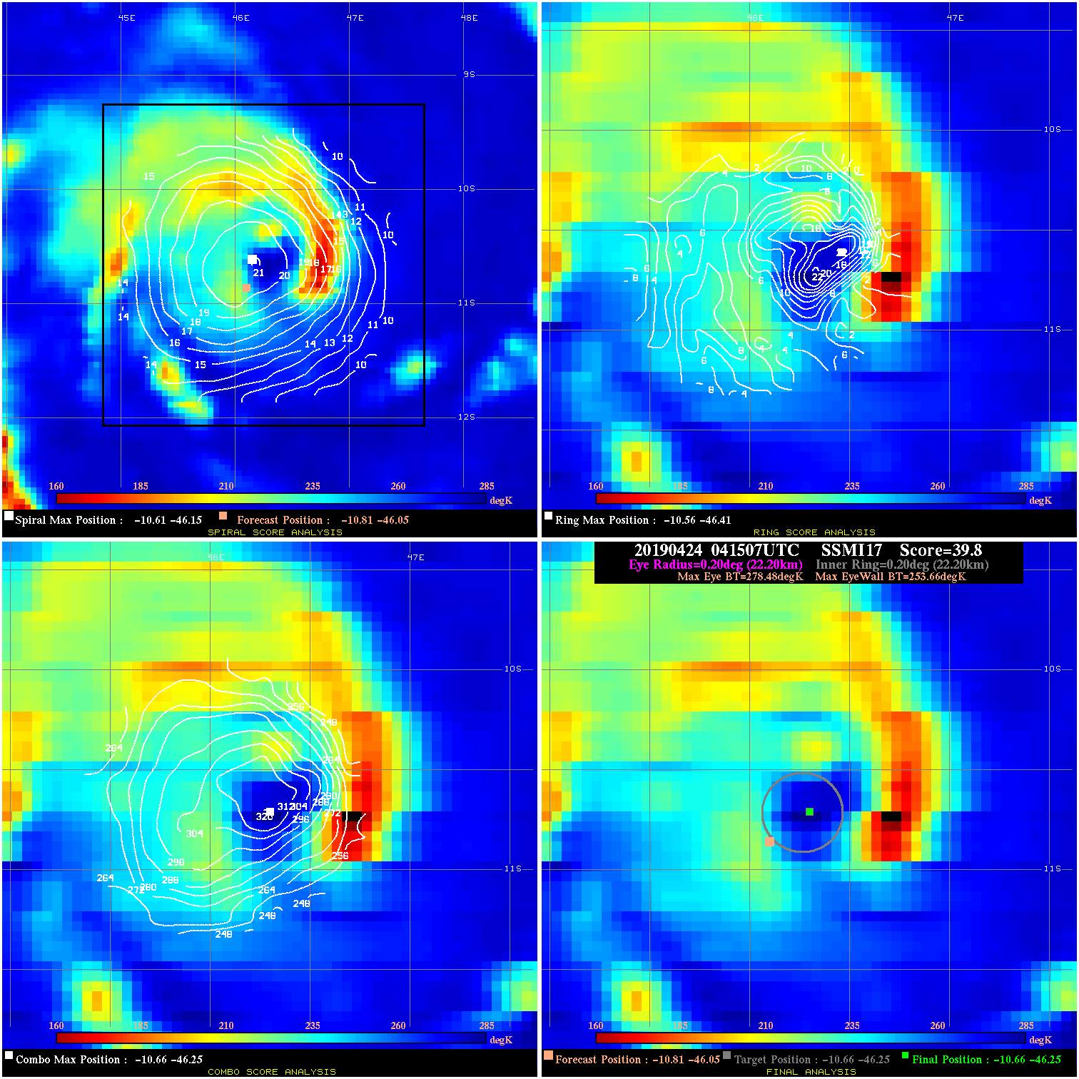
20190424 041507 39.8 >65 kts 100.0% 44.44 24.82 65.0 SSMI17 -10.8 -46.0 -10.7 -46.3 -10.7 -46.3 Analysis Plot
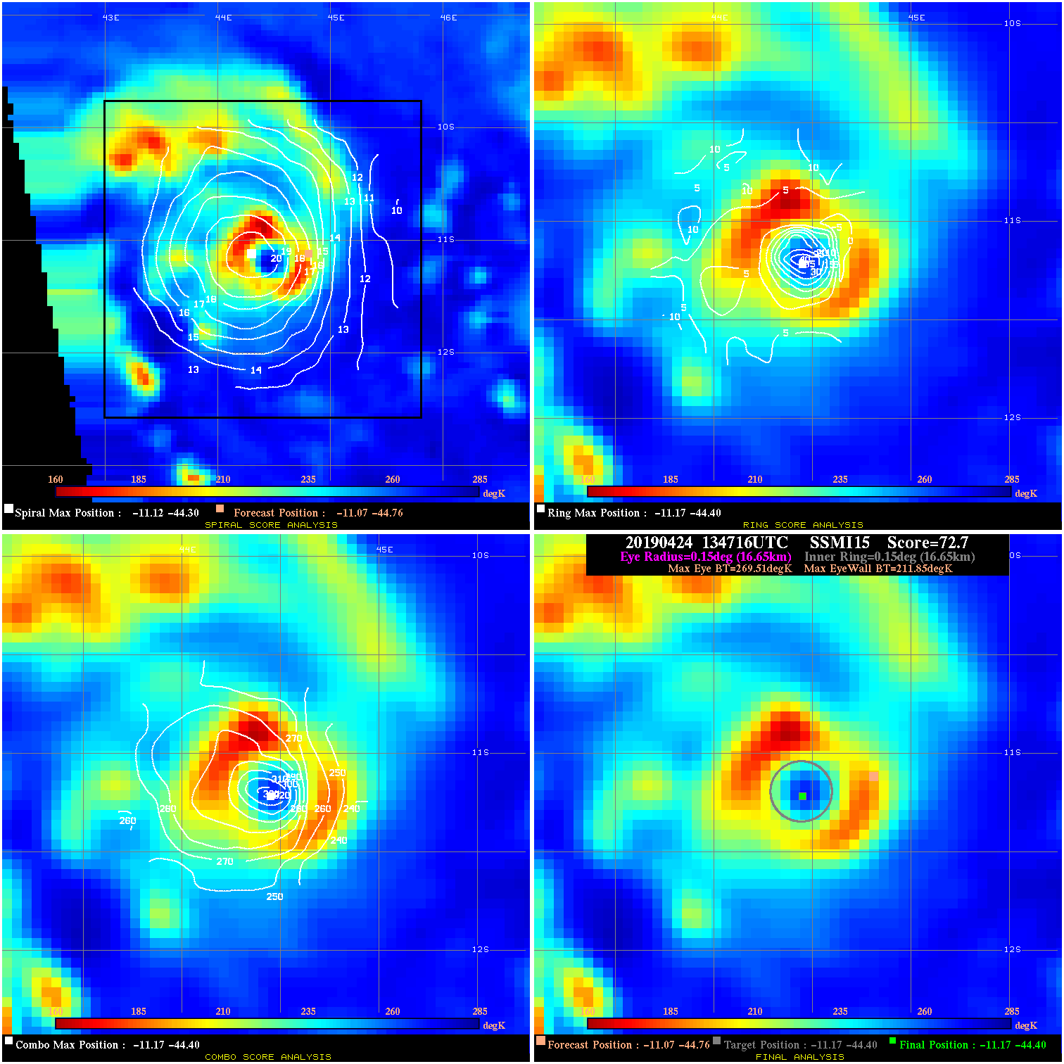
20190424 134716 72.7 >85 kts 100.0% 33.33 57.66 70.0 SSMI15 -11.1 -44.8 -11.2 -44.4 -11.2 -44.4 Analysis Plot
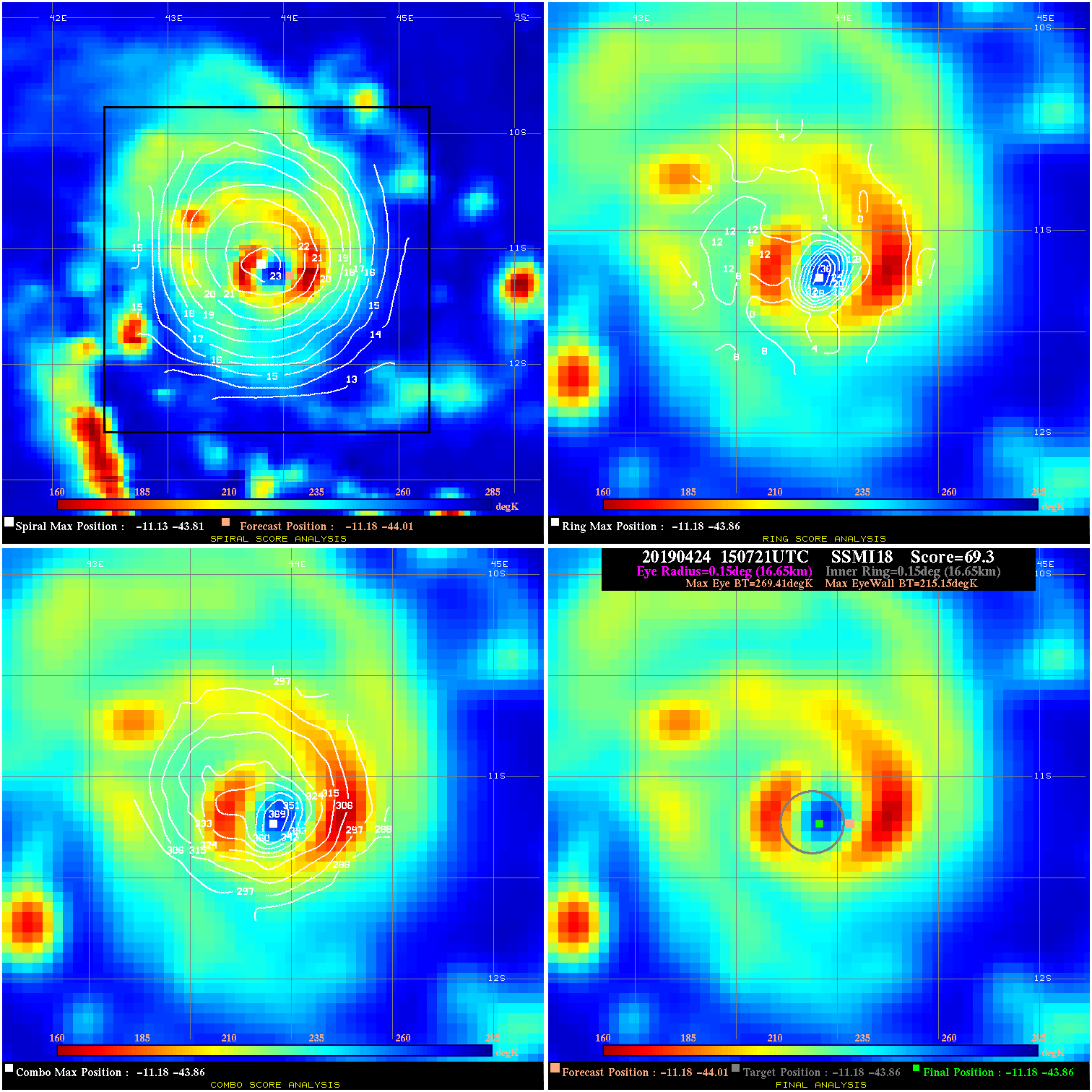
20190424 150721 69.3 >85 kts 100.0% 33.33 54.26 75.0 SSMI18 -11.2 -44.0 -11.2 -43.9 -11.2 -43.9 Analysis Plot
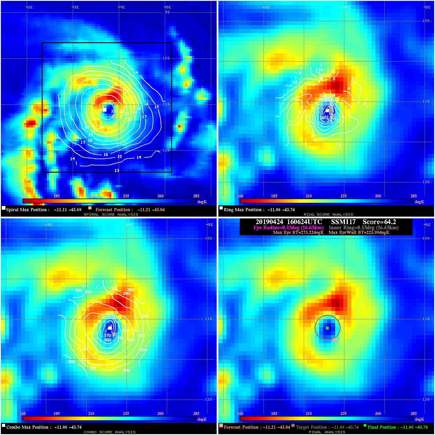
20190424 160624 64.2 >85 kts 100.0% 33.33 49.23 75.0 SSMI17 -11.2 -43.8 -11.1 -43.7 -11.1 -43.7 Analysis Plot
20190425 103058 57.5 >65 kts 100.0% 22.22 42.53 125.0 AMSR2 -11.7 -41.4 -11.9 -41.1 -11.9 -41.1 Analysis Plot
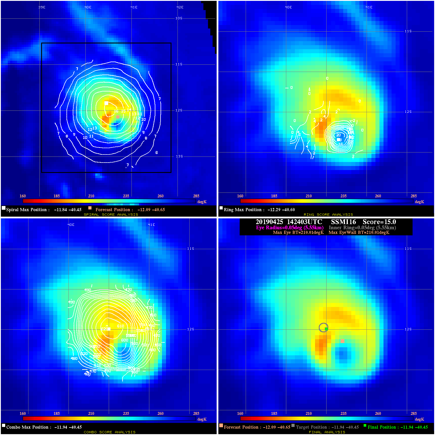
20190425 142403 N/A N/A N/A N/A N/A 120.0 SSMI16 -12.1 -40.7 -11.9 -40.5 -11.9 -40.5 Analysis Plot
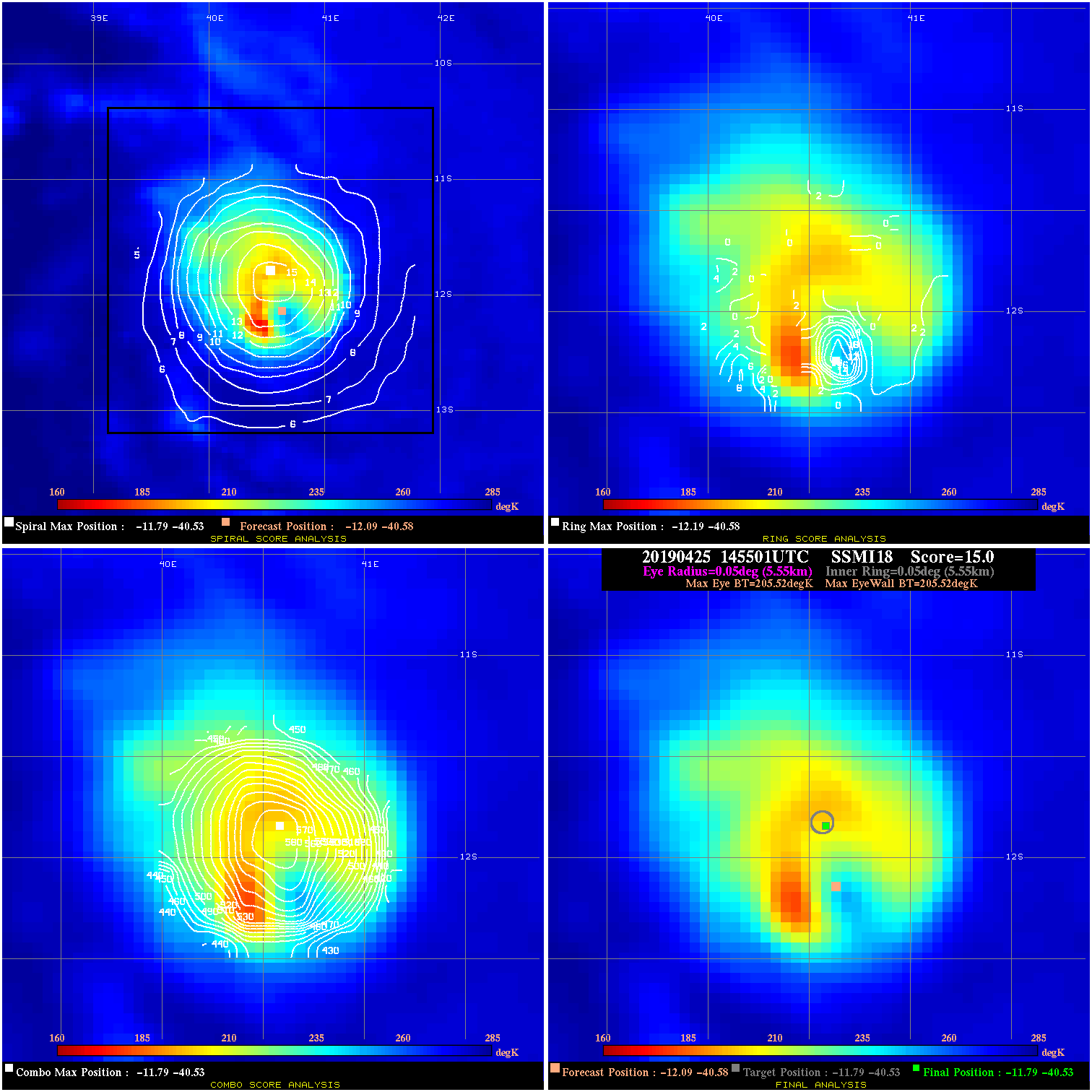
20190425 145501 N/A N/A N/A N/A N/A 120.0 SSMI18 -12.1 -40.6 -11.8 -40.5 -11.8 -40.5 Analysis Plot
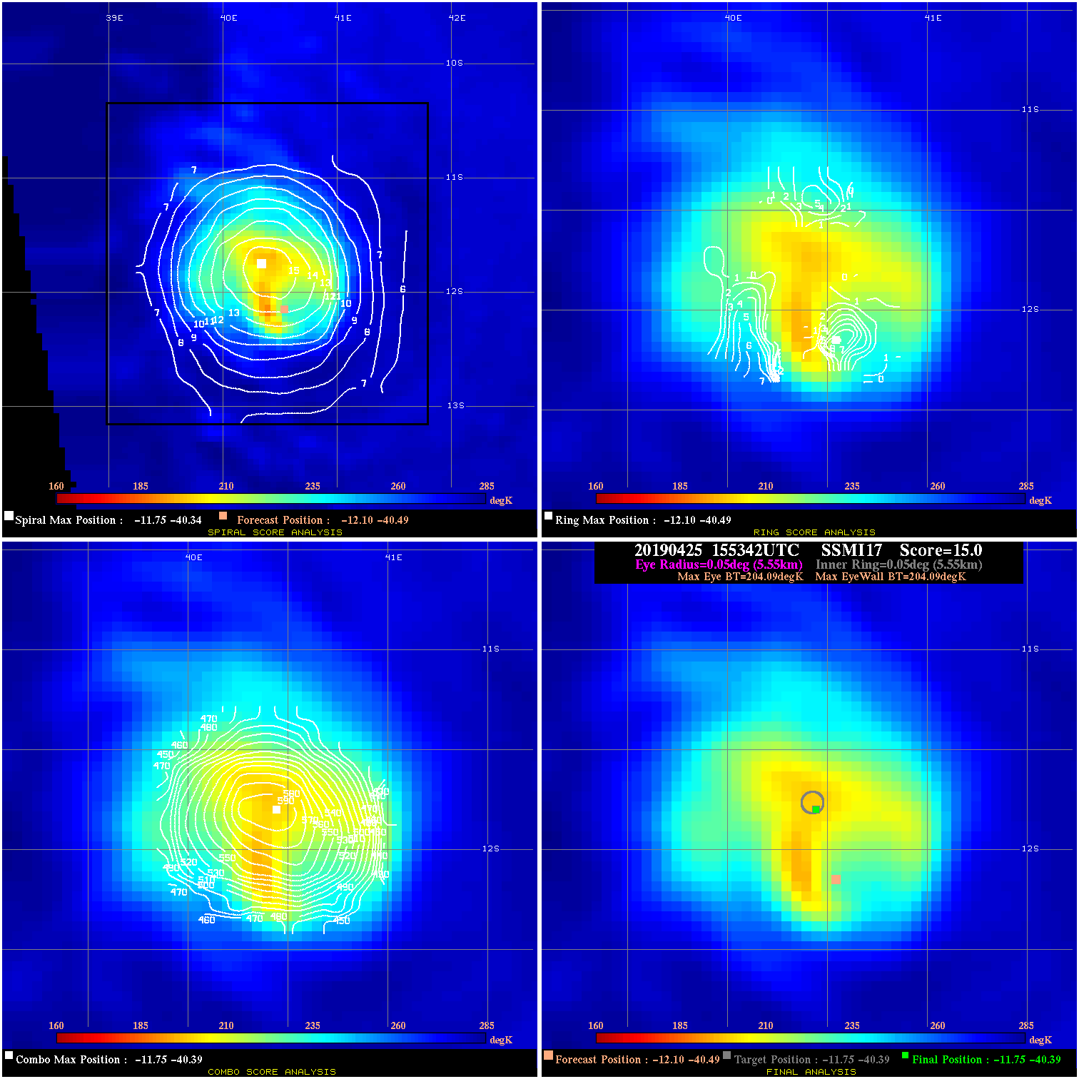
20190425 155342 N/A N/A N/A N/A N/A 120.0 SSMI17 -12.1 -40.5 -11.8 -40.4 -11.8 -40.4 Analysis Plot
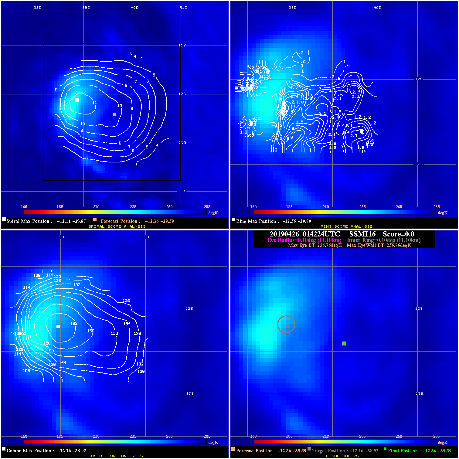
20190426 014224 N/A N/A N/A N/A N/A 75.0 SSMI16 -12.4 -39.6 -12.4 -39.6 -12.2 -38.9 Analysis Plot
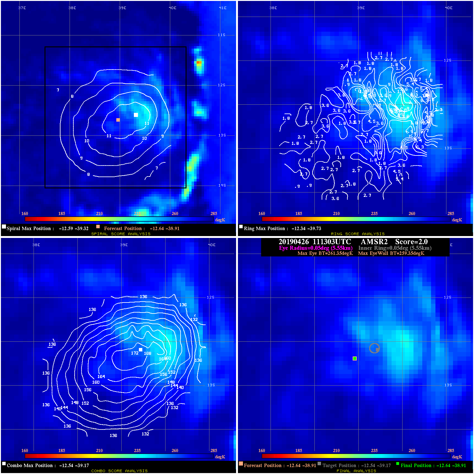
20190426 111303 2.0 N/A N/A 11.11 2.00 75.0 AMSR2 -12.6 -38.9 -12.6 -38.9 -12.5 -39.2 Analysis Plot
|
|
Legend: - Date/Time are determined from PMW imagery at Forecast (initial guess) Lat/Lon position. - Positive/Negative Latitude = North/South Hemisphere; Longitude = Western/Eastern Hemisphere. - "Ring Diam" value indicates the estimated surface eyewall diameter in km (the MI eyewall edge diameter minus 10 km). - "Ring Pct" is the percentage of the "ring" (eyewall inner boundary) that is 1) colder than the "hot spot" (warmest eye pixel) in the eye by 20K, or 2) the percentage that is a) colder than 232K and b) colder than the "hot spot" by 10K, whichever is greater. - Values are red if Ring % <= 65, yellow/brown if Ring % <= 85 and green if Ring % > 85. - "Tb diff" is the difference between the "hot spot" (warmest eye pixel) and the warmest pixel on the eyewall. - Intensity score are listed as negative, and not used, when the JTWC or NHC estimated Vmax is <55 kts in order to rule out weak but highly symmetric TCs. - Error messages in intensity scores: -920 is used when the hottest pixel in the eye is <200K, to prevent false positives; -930 means <85% of eyewall has observations/data. |