Tropical Storm 06S
|
Passive Microwave (PMW) Intensity Information Hurricane Intensity Estimation (HIE) Algorithm Version 9.0 |
Overpass Inten Ring Ring Wind Forecast Final Target
Date Time Score Meaning Pct Diam BTdiff Est Sat Lat Lon Lat Lon Lat Lon
20200105 205344 N/A N/A N/A N/A N/A 35.0 SSMI16 -16.1 -121.3 -16.1 -121.3 -16.0 -121.4 Analysis Plot
20200105 213851 -3.3 N/A 57.5% 33.33 3.30 35.0 SSMI18 -16.2 -121.3 -16.2 -121.3 -16.1 -121.7 Analysis Plot
20200106 053307 -14.5 N/A 38.4% 77.77 14.47 35.0 AMSR2 -16.2 -121.9 -16.2 -121.9 -17.2 -122.3 Analysis Plot
20200106 091324 -930.0 N/A N/A N/A 0.00 35.0 SSMI16 -16.4 -122.0 -16.4 -122.0 -17.7 -122.4 Analysis Plot
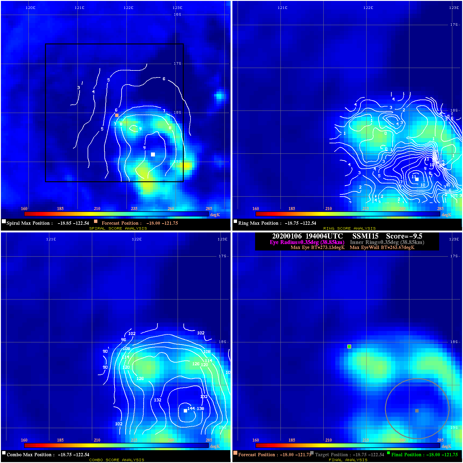
20200106 194004 -9.5 N/A 34.2% 77.77 9.46 50.0 SSMI15 -18.0 -121.8 -18.0 -121.8 -18.8 -122.5 Analysis Plot
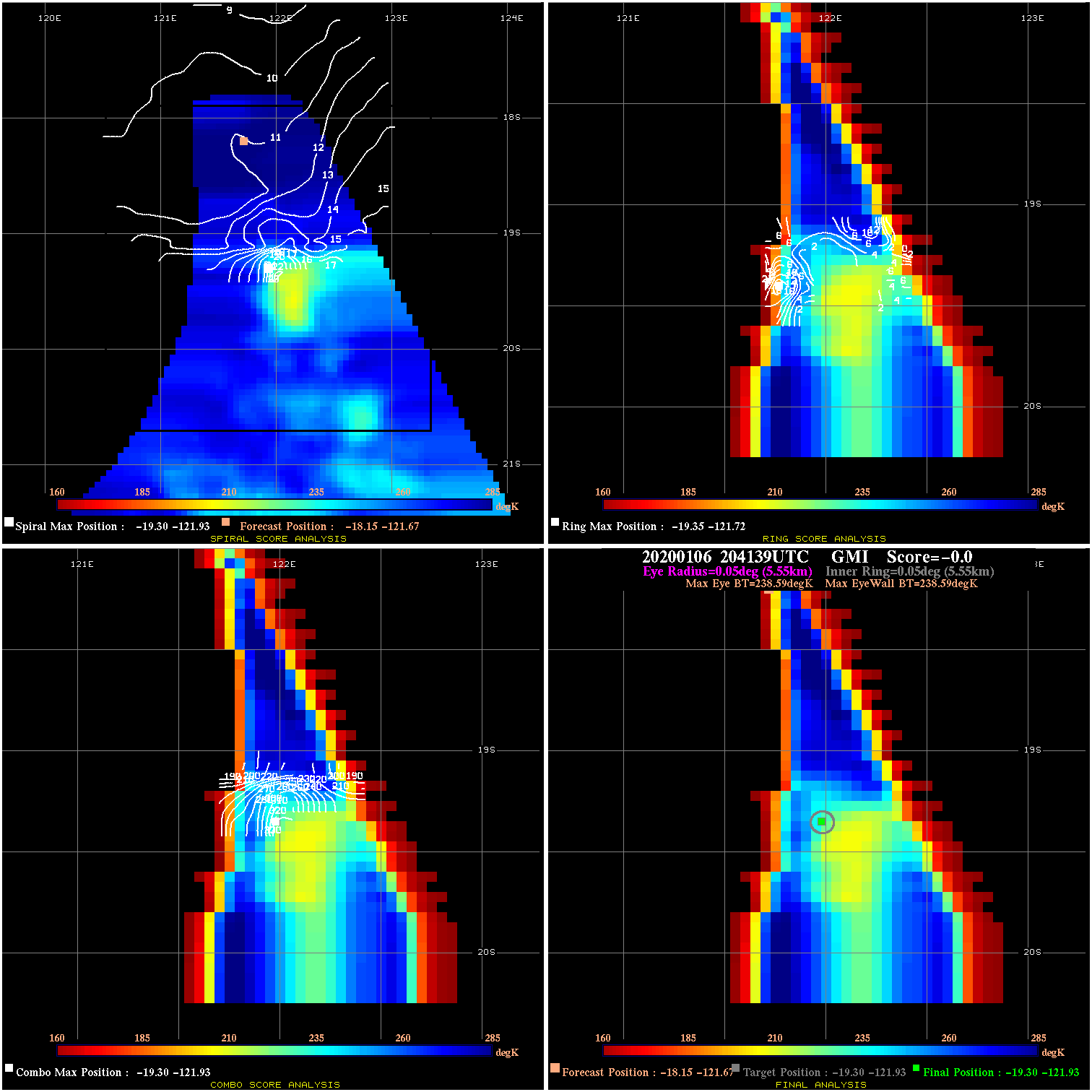
20200106 204139 N/A N/A N/A N/A N/A 50.0 GMI -18.1 -121.7 -19.3 -121.9 -19.3 -121.9 Analysis Plot
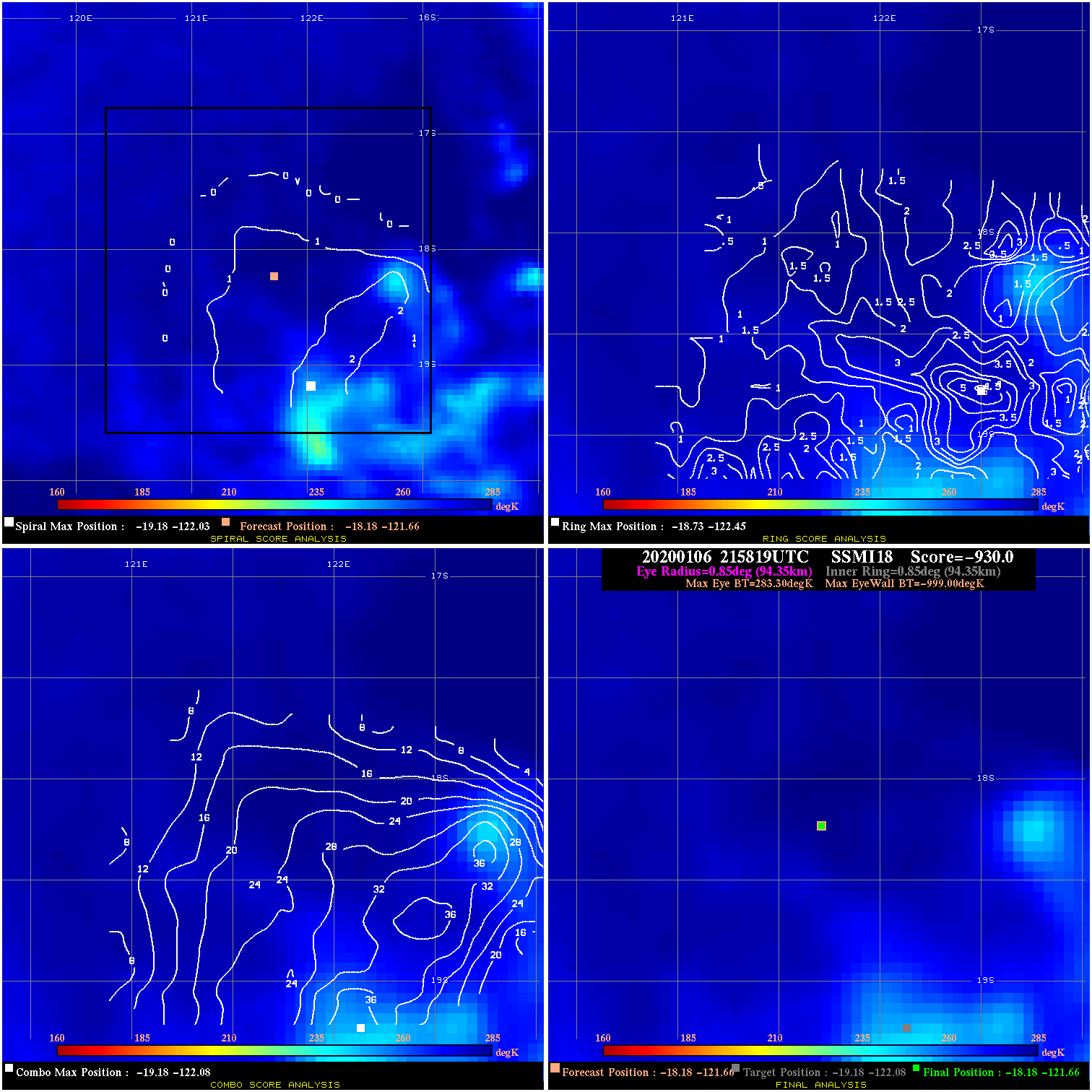
20200106 215819 -930.0 N/A N/A N/A 0.00 50.0 SSMI18 -18.2 -121.7 -18.2 -121.7 -19.2 -122.1 Analysis Plot
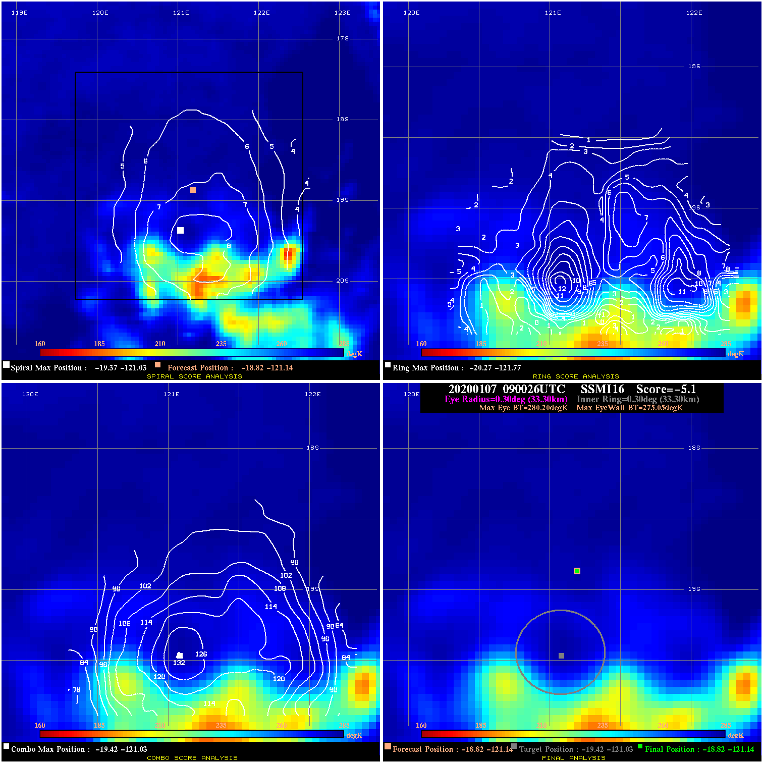
20200107 090026 -5.1 N/A 1.4% 66.66 5.15 35.0 SSMI16 -18.8 -121.1 -18.8 -121.1 -19.4 -121.0 Analysis Plot
20200107 100755 N/A N/A N/A N/A N/A 35.0 SSMI18 -18.9 -121.1 -18.9 -121.1 -20.0 -121.2 Analysis Plot
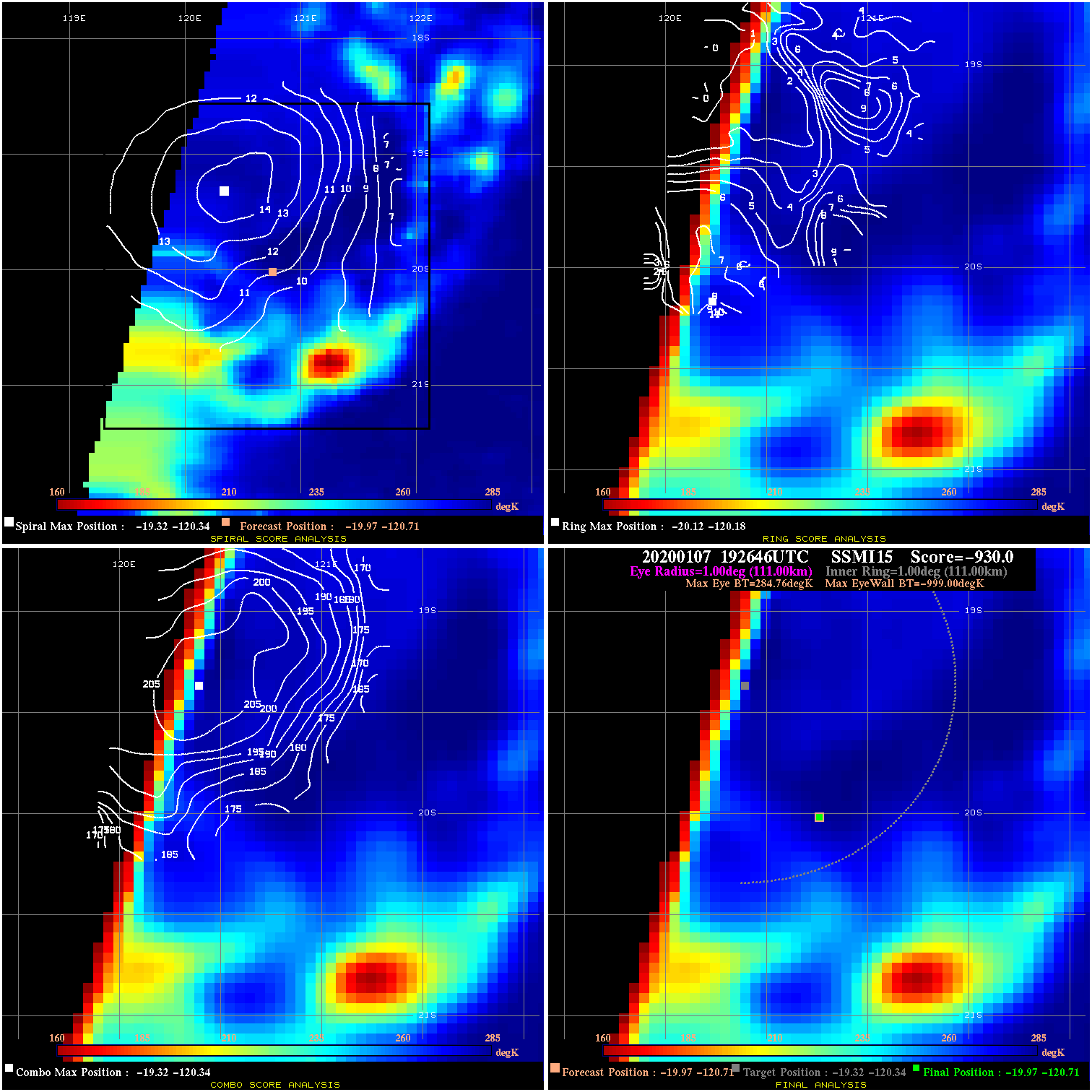
20200107 192646 -930.0 N/A N/A N/A 0.00 35.0 SSMI15 -20.0 -120.7 -20.0 -120.7 -19.3 -120.3 Analysis Plot
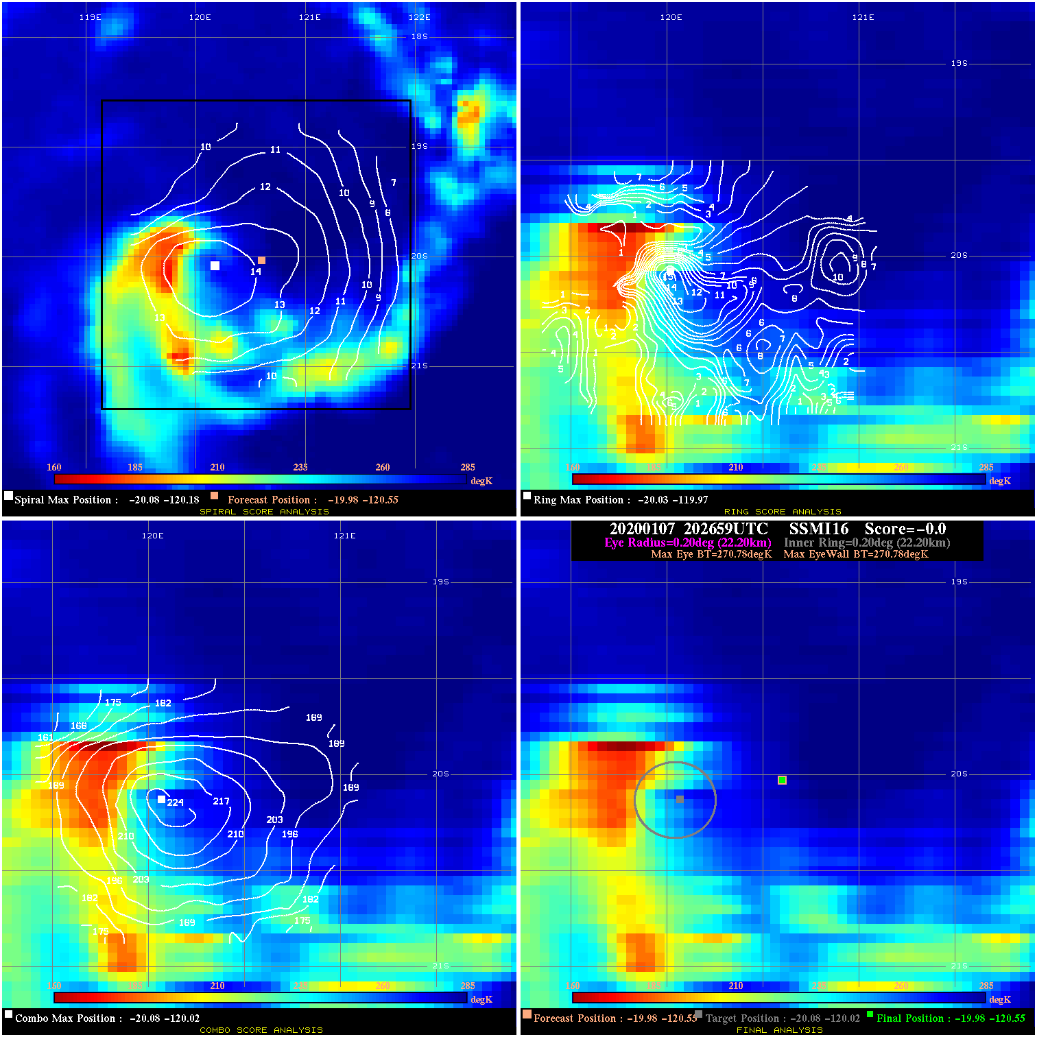
20200107 202659 N/A N/A N/A N/A N/A 35.0 SSMI16 -20.0 -120.6 -20.0 -120.6 -20.1 -120.0 Analysis Plot
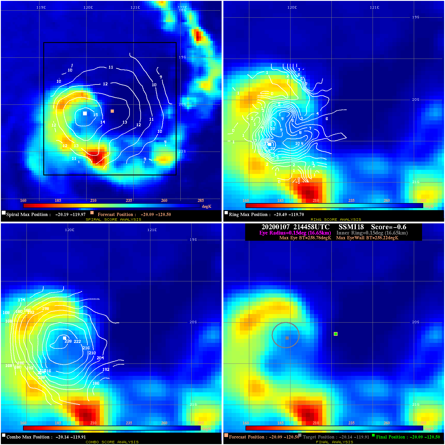
20200107 214458 -0.6 N/A 8.2% 33.33 .56 35.0 SSMI18 -20.1 -120.5 -20.1 -120.5 -20.1 -119.9 Analysis Plot
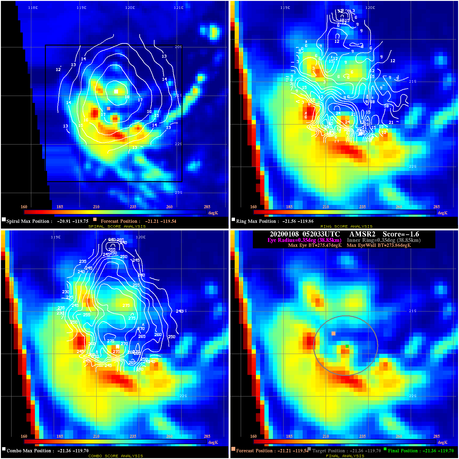
20200108 052033 -1.6 N/A 49.3% 77.77 1.61 35.0 AMSR2 -21.2 -119.5 -21.4 -119.7 -21.4 -119.7 Analysis Plot
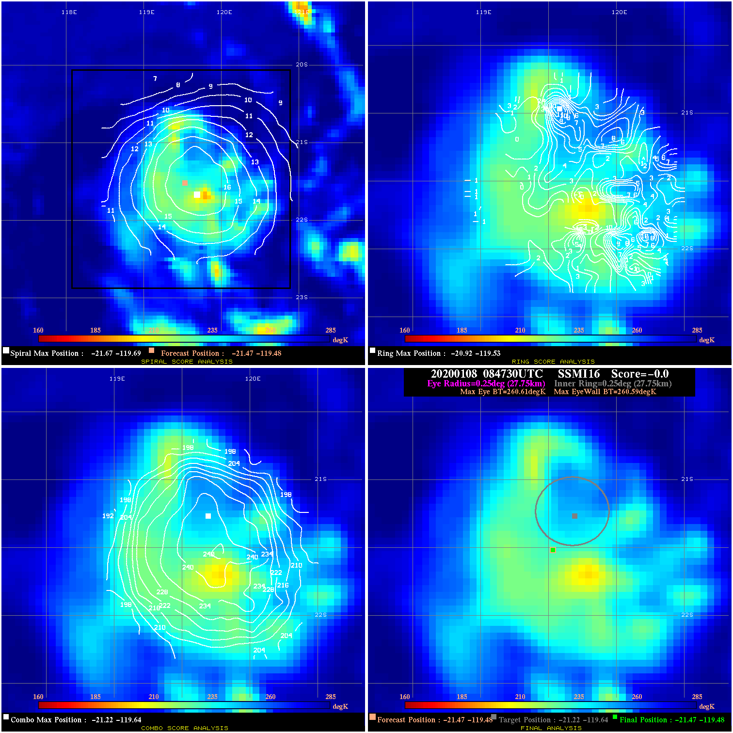
20200108 084730 -0.0 N/A 35.6% 55.55 .02 35.0 SSMI16 -21.5 -119.5 -21.5 -119.5 -21.2 -119.6 Analysis Plot
20200108 090710 -3.1 N/A 75.3% 22.22 3.10 35.0 SSMI15 -21.0 -119.9 -21.0 -119.9 -21.5 -119.6 Analysis Plot
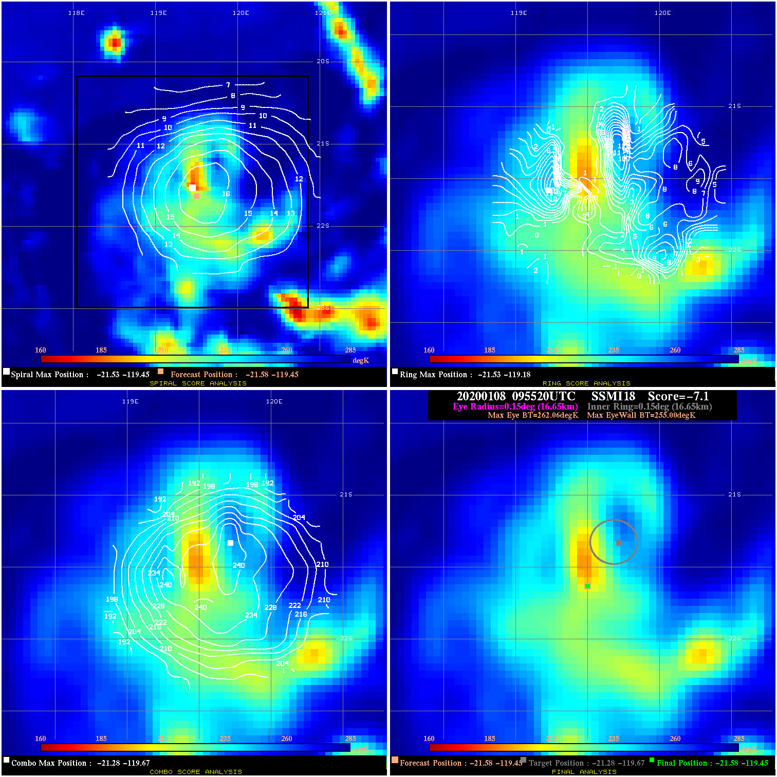
20200108 095520 -7.1 N/A 28.8% 33.33 7.06 35.0 SSMI18 -21.6 -119.4 -21.6 -119.4 -21.3 -119.7 Analysis Plot
|
|
Legend: - Date/Time are determined from PMW imagery at Forecast (initial guess) Lat/Lon position. - Positive/Negative Latitude = North/South Hemisphere; Longitude = Western/Eastern Hemisphere. - "Ring Diam" value indicates the estimated surface eyewall diameter in km (the MI eyewall edge diameter minus 10 km). - "Ring Pct" is the percentage of the "ring" (eyewall inner boundary) that is 1) colder than the "hot spot" (warmest eye pixel) in the eye by 20K, or 2) the percentage that is a) colder than 232K and b) colder than the "hot spot" by 10K, whichever is greater. - Values are red if Ring % <= 65, yellow/brown if Ring % <= 85 and green if Ring % > 85. - "Tb diff" is the difference between the "hot spot" (warmest eye pixel) and the warmest pixel on the eyewall. - Intensity score are listed as negative, and not used, when the JTWC or NHC estimated Vmax is <55 kts in order to rule out weak but highly symmetric TCs. - Error messages in intensity scores: -920 is used when the hottest pixel in the eye is <200K, to prevent false positives; -930 means <85% of eyewall has observations/data. |