Tropical Depression 16E
|
Passive Microwave (PMW) Intensity Information Hurricane Intensity Estimation (HIE) Algorithm Version 9.0 |
Overpass Inten Ring Ring Wind Forecast Final Target
Date Time Score Meaning Pct Diam BTdiff Est Sat Lat Lon Lat Lon Lat Lon
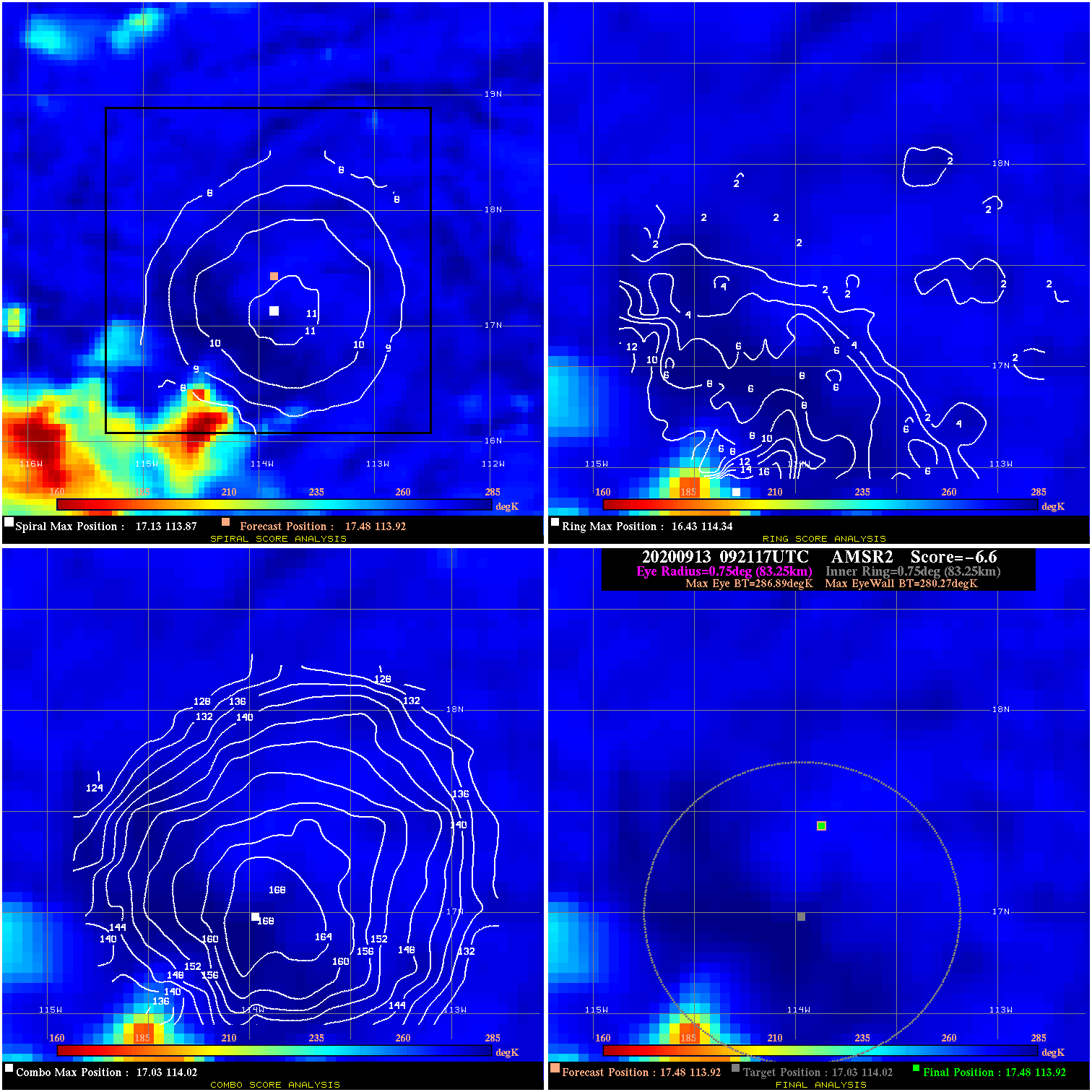
20200913 092117 -6.6 N/A 6.8% 166.65 6.62 35.0 AMSR2 17.5 113.9 17.5 113.9 17.0 114.0 Analysis Plot
20200913 114525 -7.0 N/A 5.5% 211.09 7.00 35.0 SSMI15 17.7 114.2 17.7 114.2 17.5 114.1 Analysis Plot
20200913 134251 -2.1 N/A 8.2% 222.20 2.07 35.0 SSMI16 17.7 114.3 17.7 114.3 18.0 114.6 Analysis Plot
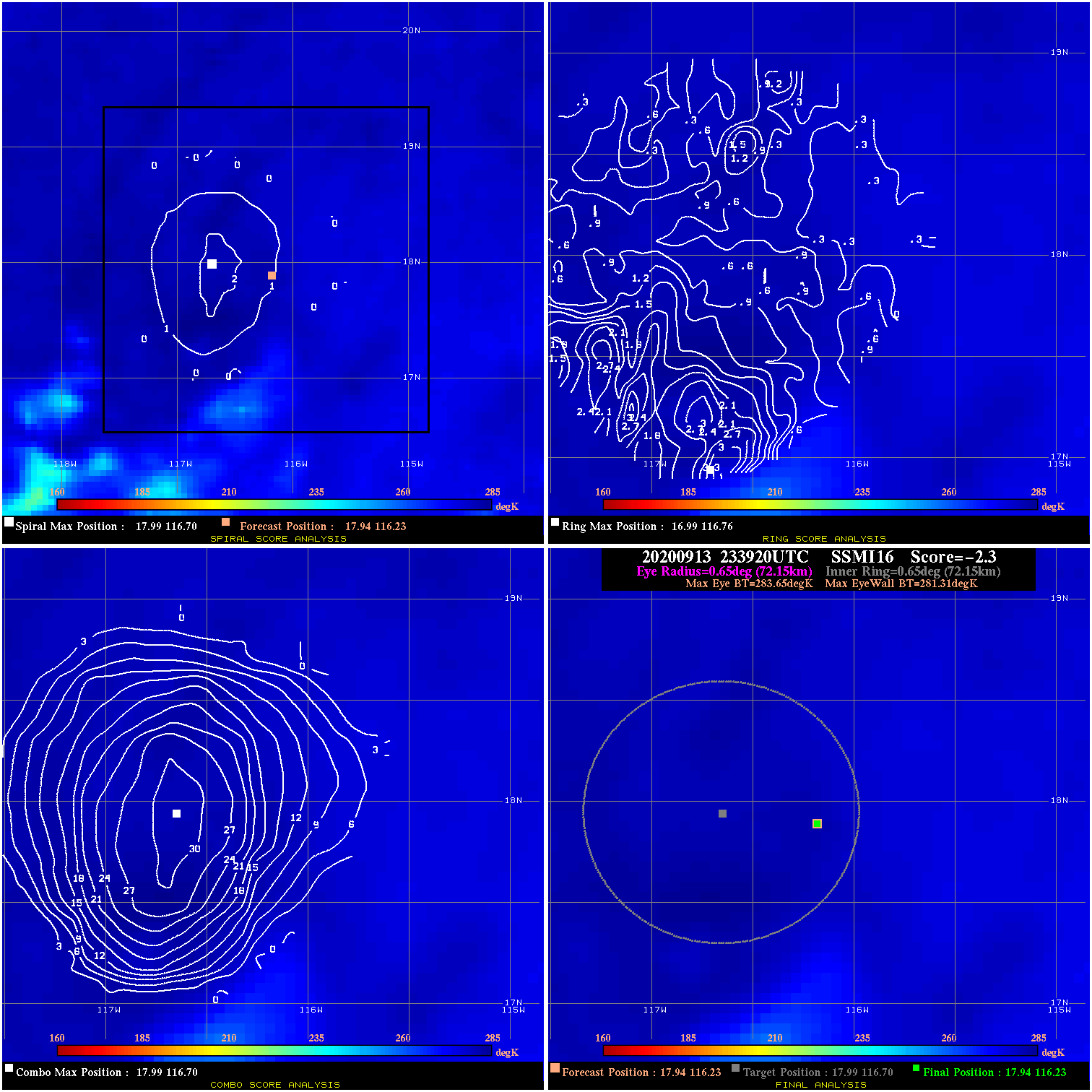
20200913 233920 -2.3 N/A N/A 144.43 2.34 40.0 SSMI16 17.9 116.2 17.9 116.2 18.0 116.7 Analysis Plot
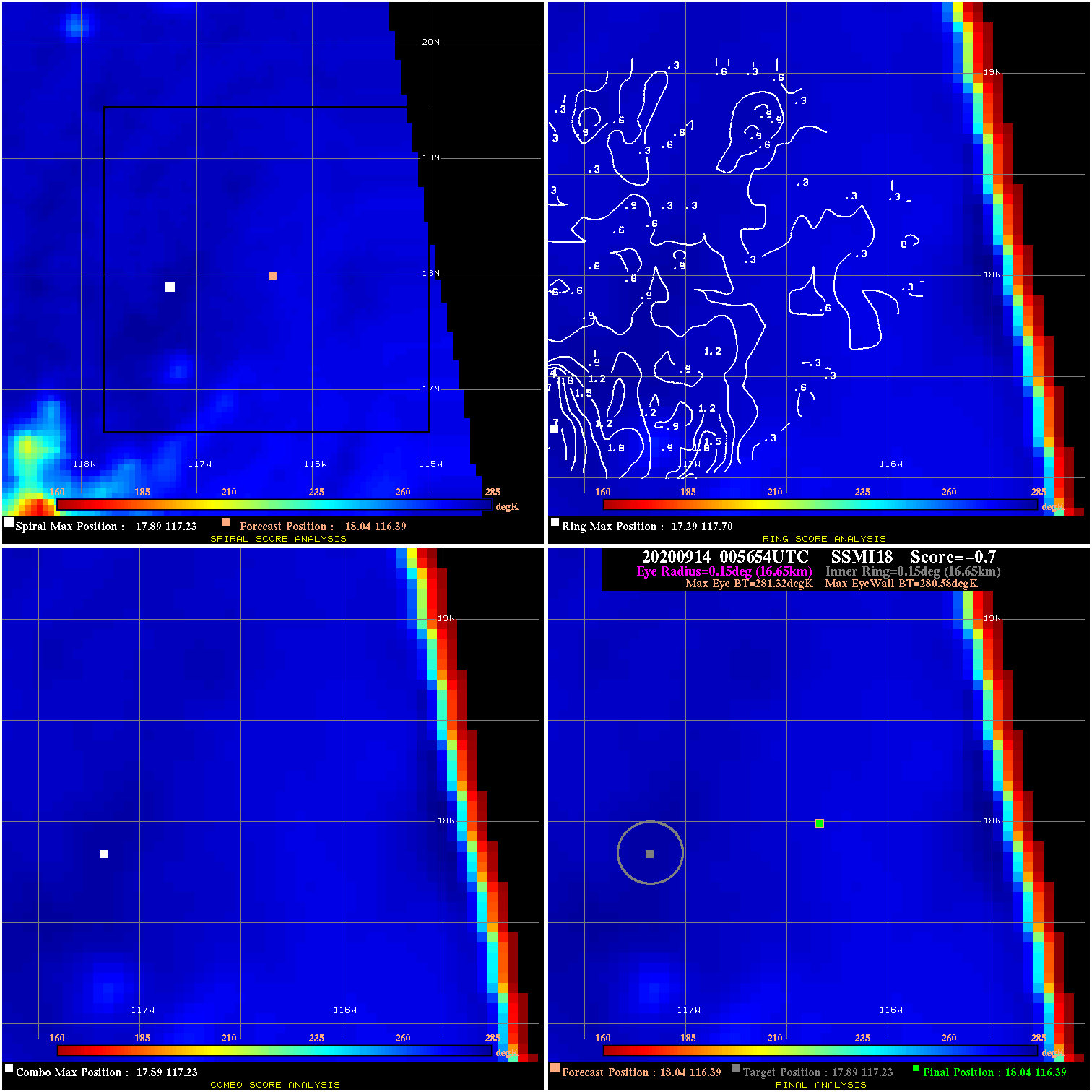
20200914 005654 -0.7 N/A N/A 33.33 .74 40.0 SSMI18 18.0 116.4 18.0 116.4 17.9 117.2 Analysis Plot
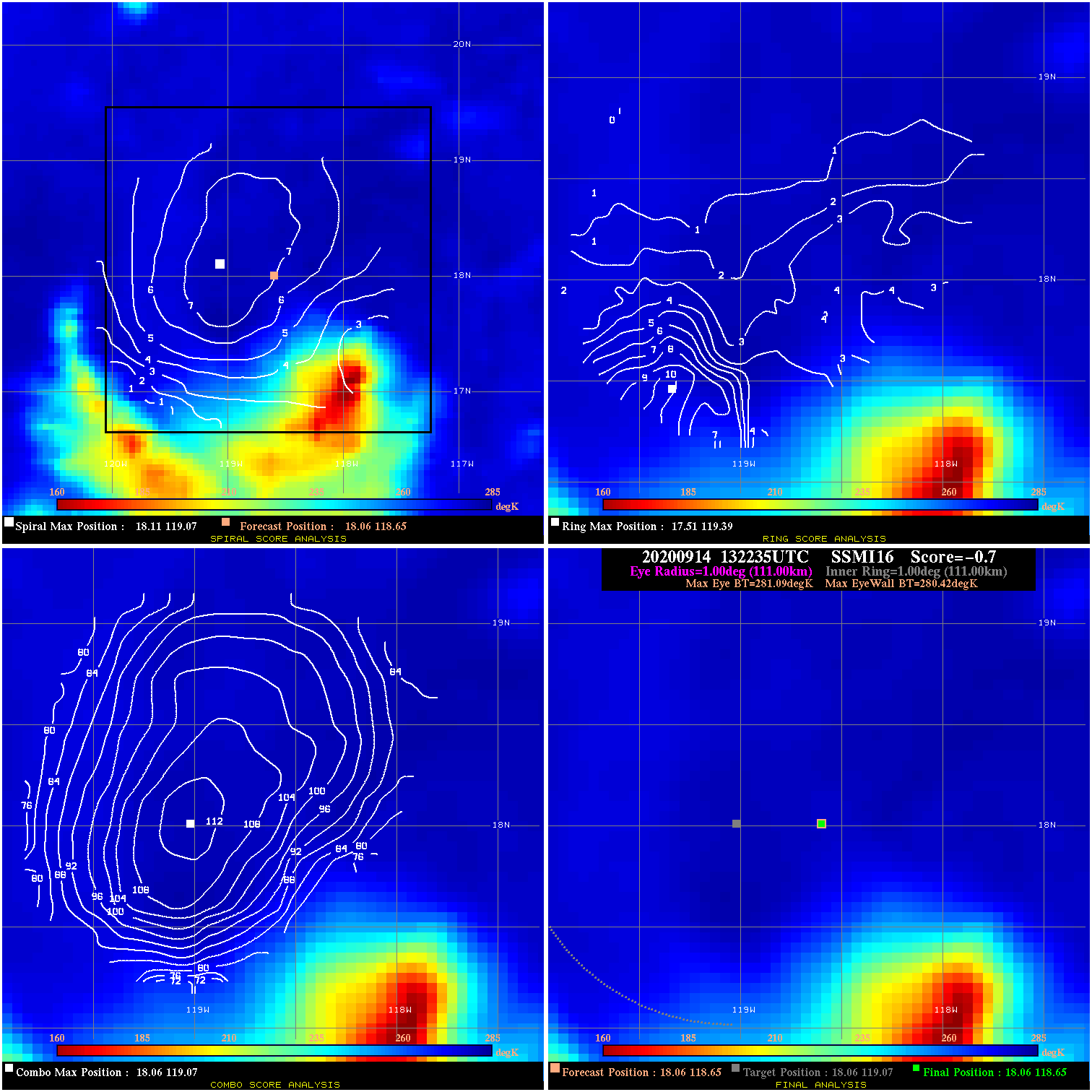
20200914 132235 -0.7 N/A 5.5% 222.20 .67 40.0 SSMI16 18.1 118.7 18.1 118.7 18.1 119.1 Analysis Plot
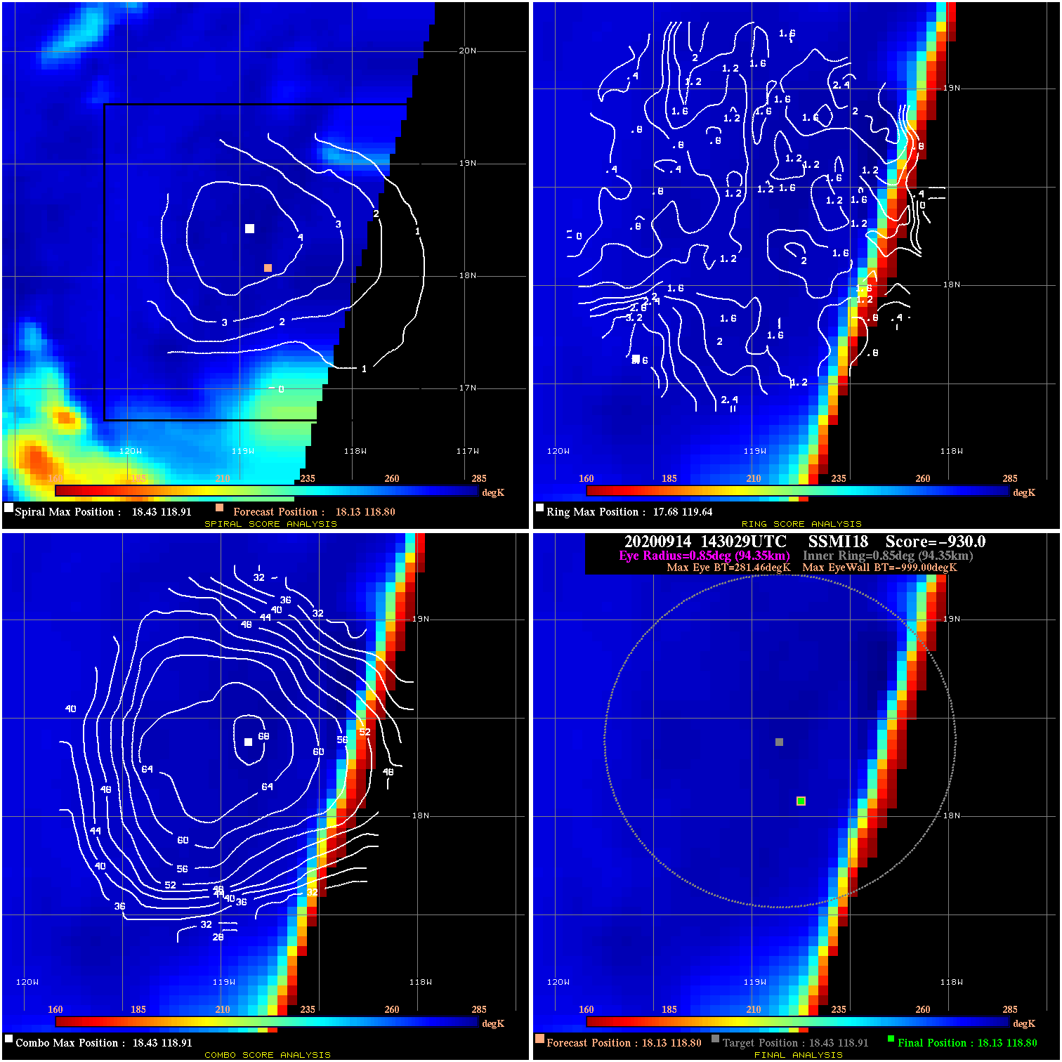
20200914 143029 -930.0 N/A N/A N/A 0.00 40.0 SSMI18 18.1 118.8 18.1 118.8 18.4 118.9 Analysis Plot
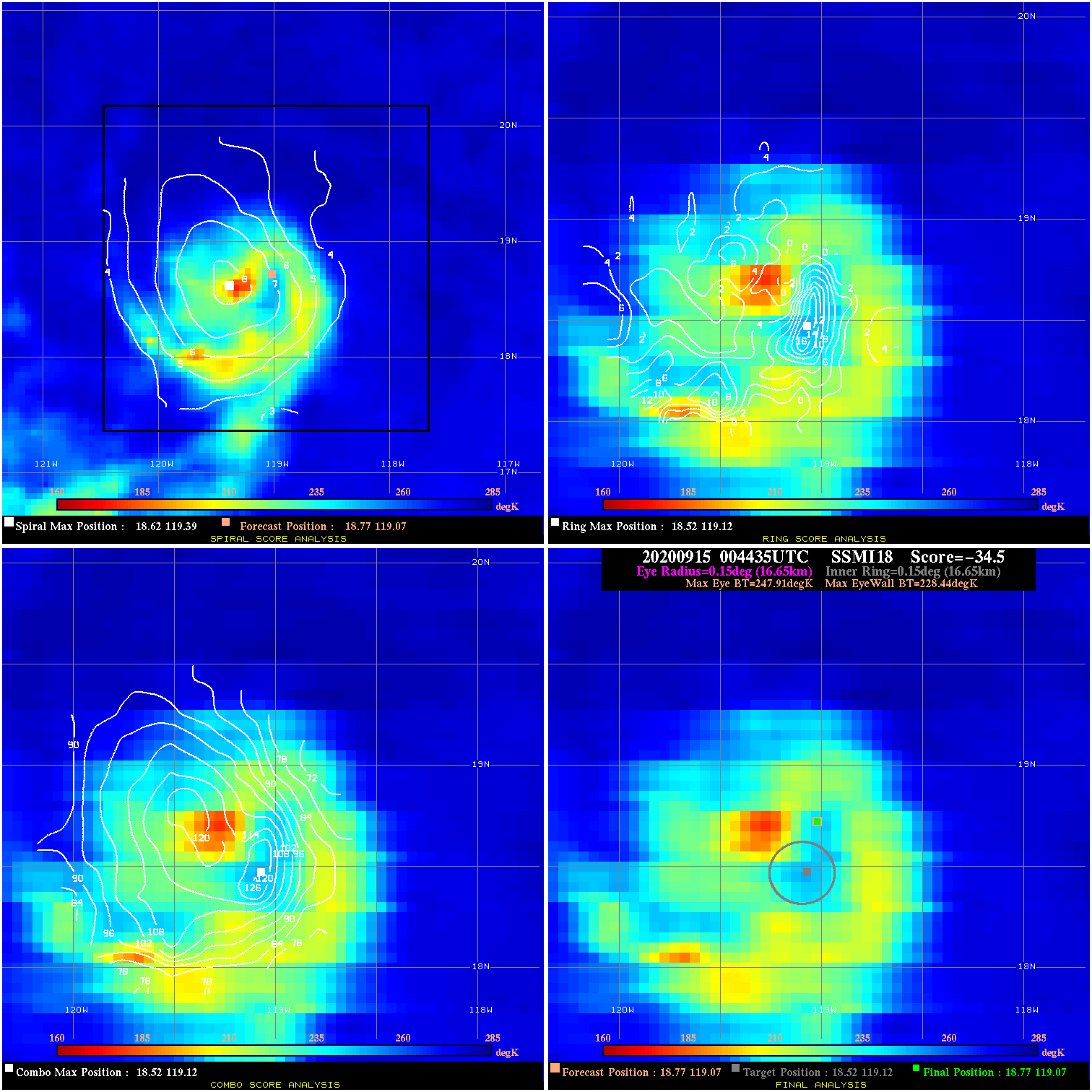
20200915 004435 -34.5 N/A 100.0% 33.33 19.47 40.0 SSMI18 18.8 119.1 18.8 119.1 18.5 119.1 Analysis Plot
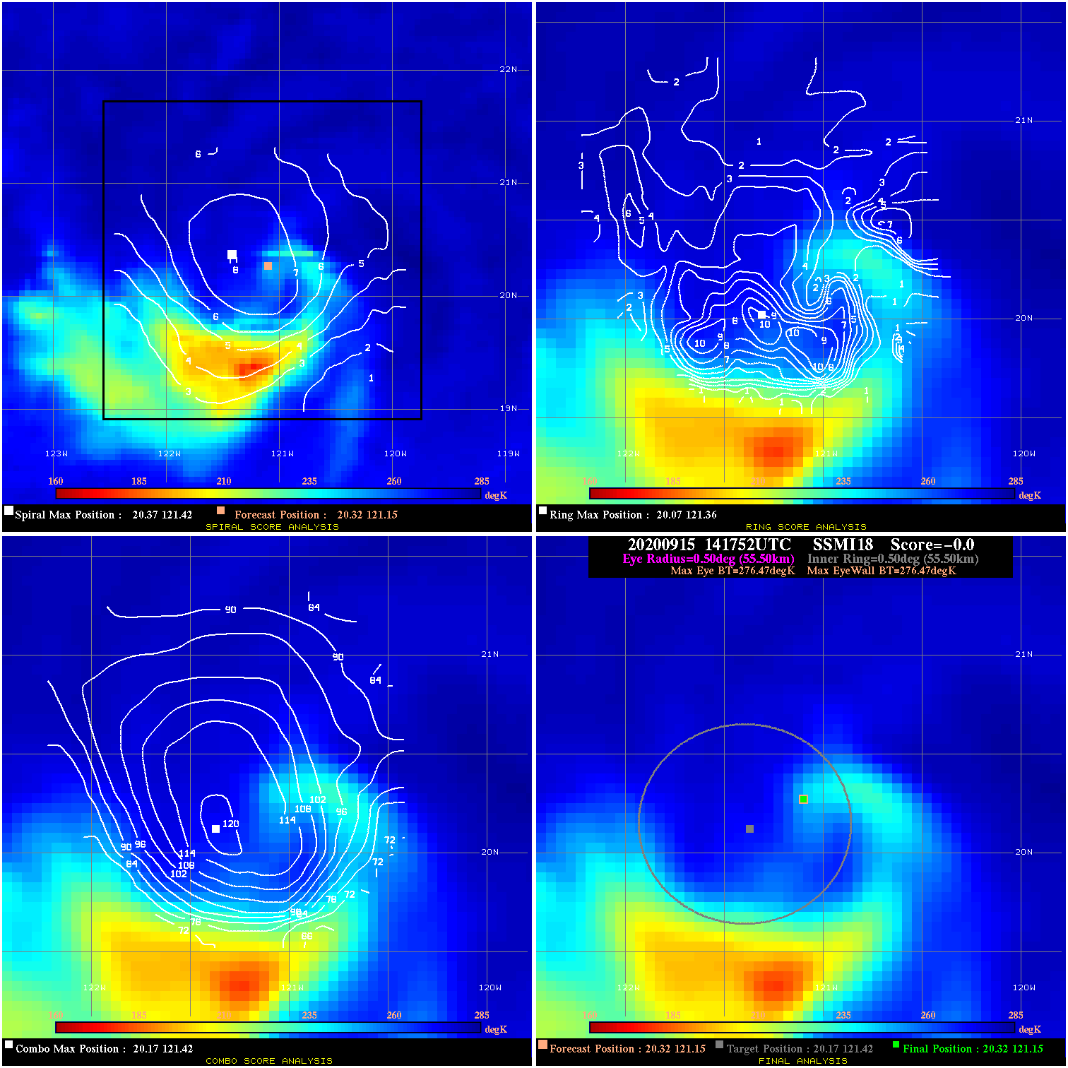
20200915 141752 N/A N/A N/A N/A N/A 50.0 SSMI18 20.3 121.2 20.3 121.2 20.2 121.4 Analysis Plot
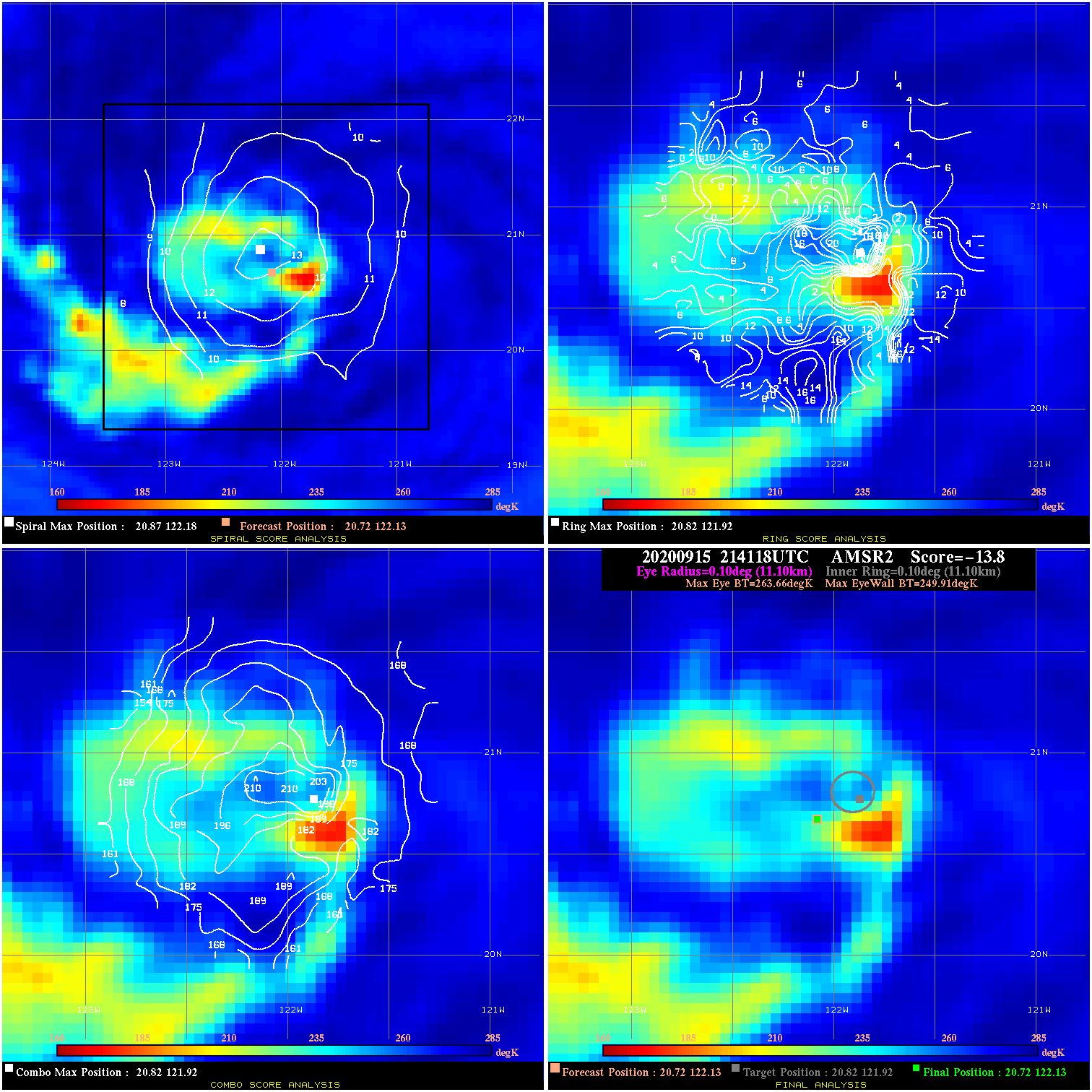
20200915 214118 -13.8 N/A 72.6% 22.22 13.75 50.0 AMSR2 20.7 122.1 20.7 122.1 20.8 121.9 Analysis Plot
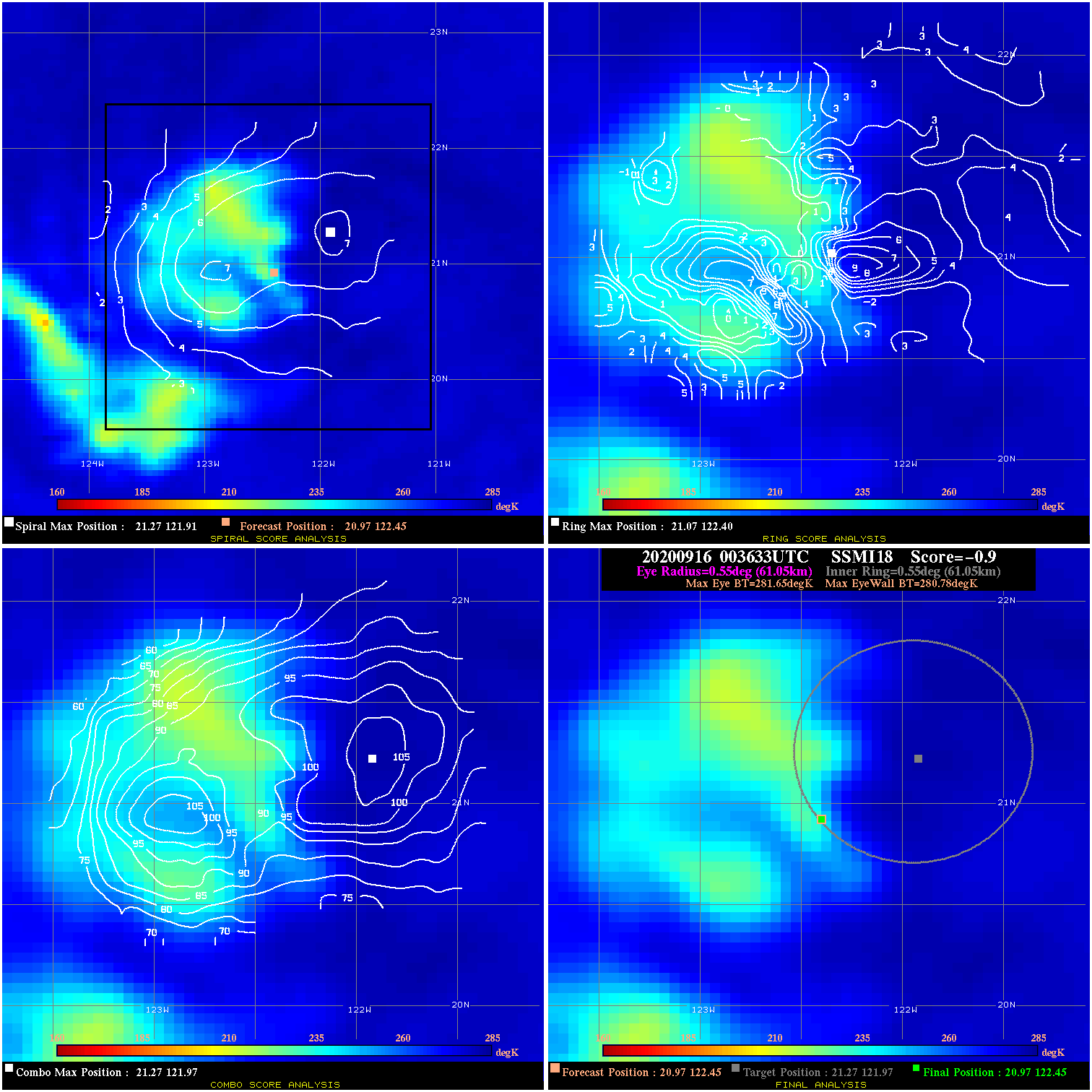
20200916 003633 -0.9 N/A 15.1% 122.21 .87 50.0 SSMI18 21.0 122.4 21.0 122.4 21.3 122.0 Analysis Plot
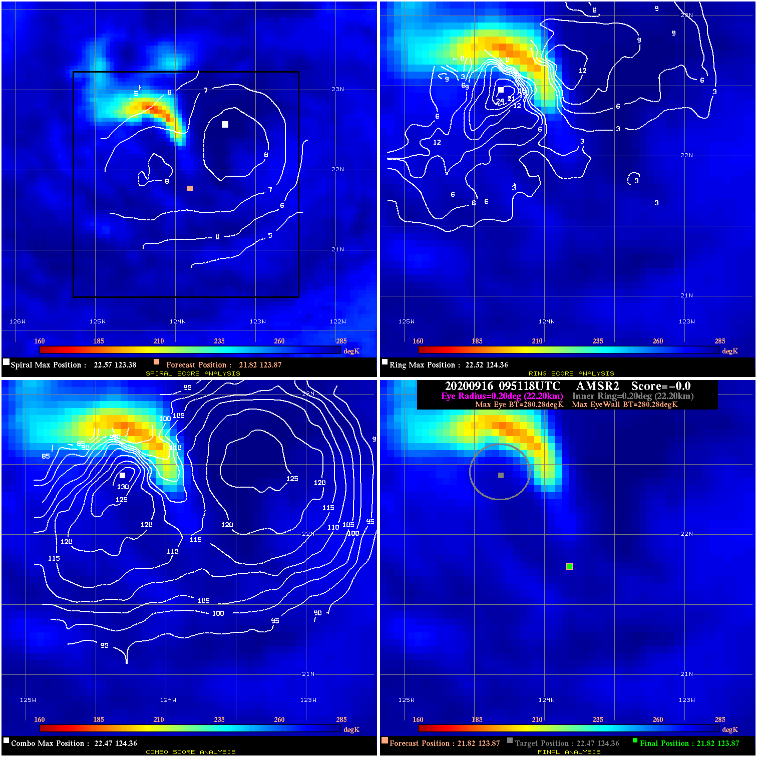
20200916 095118 N/A N/A N/A N/A N/A 40.0 AMSR2 21.8 123.9 21.8 123.9 22.5 124.4 Analysis Plot
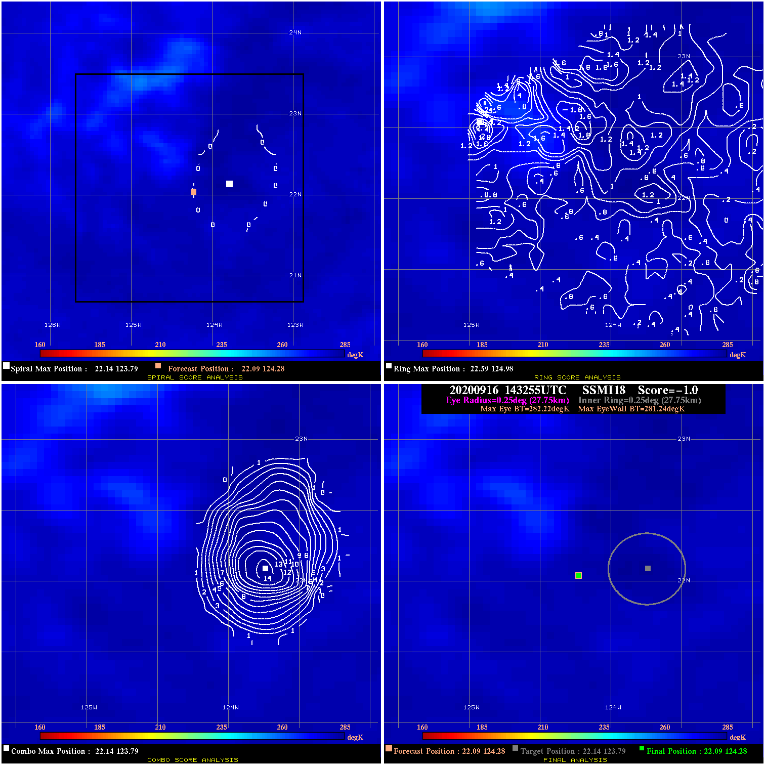
20200916 143255 -1.0 N/A N/A 55.55 .98 40.0 SSMI18 22.1 124.3 22.1 124.3 22.1 123.8 Analysis Plot
|
|
Legend: - Date/Time are determined from PMW imagery at Forecast (initial guess) Lat/Lon position. - Positive/Negative Latitude = North/South Hemisphere; Longitude = Western/Eastern Hemisphere. - "Ring Diam" value indicates the estimated surface eyewall diameter in km (the MI eyewall edge diameter minus 10 km). - "Ring Pct" is the percentage of the "ring" (eyewall inner boundary) that is 1) colder than the "hot spot" (warmest eye pixel) in the eye by 20K, or 2) the percentage that is a) colder than 232K and b) colder than the "hot spot" by 10K, whichever is greater. - Values are red if Ring % <= 65, yellow/brown if Ring % <= 85 and green if Ring % > 85. - "Tb diff" is the difference between the "hot spot" (warmest eye pixel) and the warmest pixel on the eyewall. - Intensity score are listed as negative, and not used, when the JTWC or NHC estimated Vmax is <55 kts in order to rule out weak but highly symmetric TCs. - Error messages in intensity scores: -920 is used when the hottest pixel in the eye is <200K, to prevent false positives; -930 means <85% of eyewall has observations/data. |