Tropical Storm 18E
|
Passive Microwave (PMW) Intensity Information Hurricane Intensity Estimation (HIE) Algorithm Version 9.0 |
Overpass Inten Ring Ring Wind Forecast Final Target
Date Time Score Meaning Pct Diam BTdiff Est Sat Lat Lon Lat Lon Lat Lon
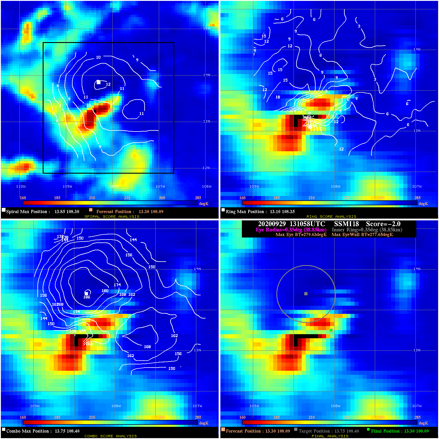
20200929 131058 -2.0 N/A 17.8% 77.77 1.98 30.0 SSMI18 13.3 108.1 13.3 108.1 13.8 108.4 Analysis Plot
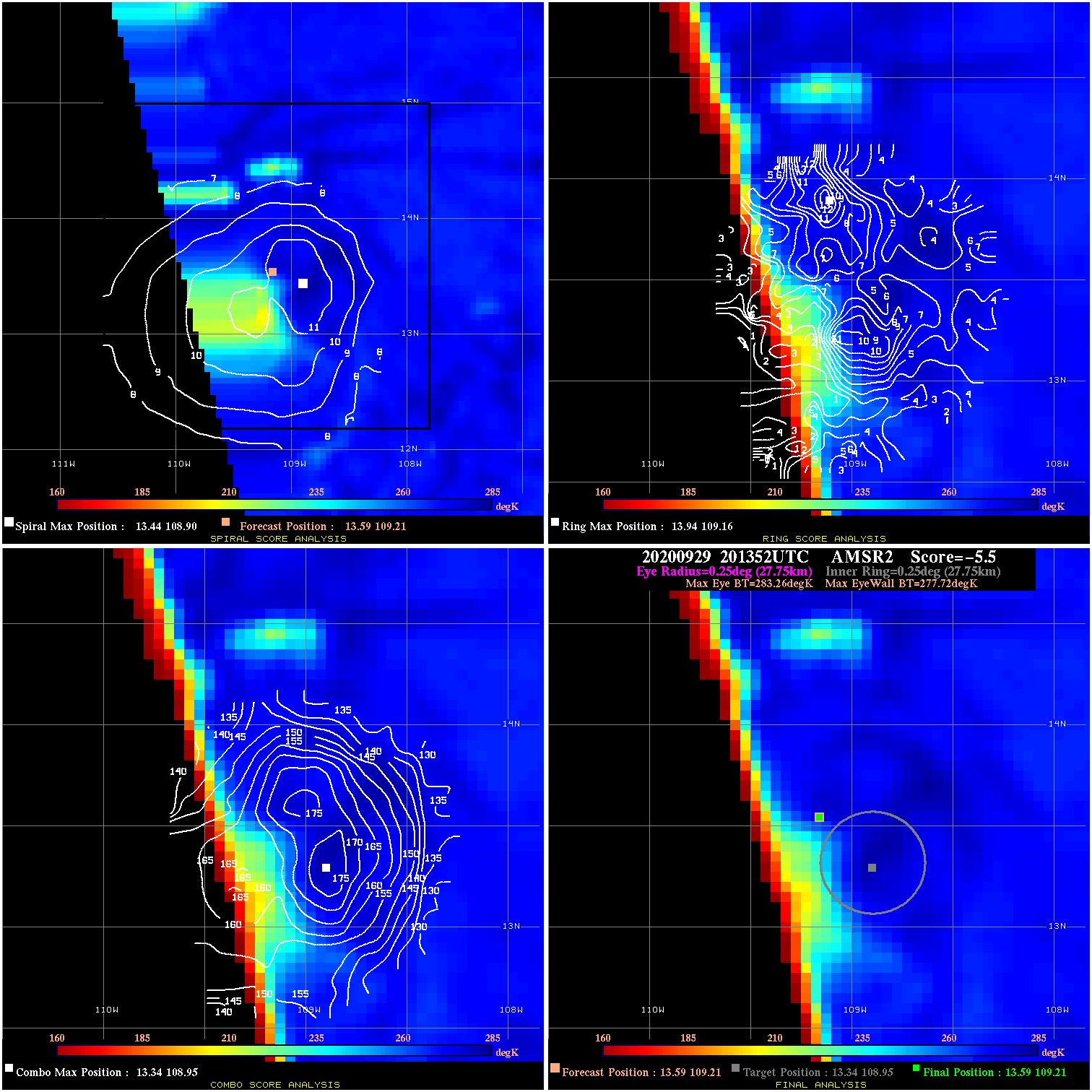
20200929 201352 -5.5 N/A N/A 55.55 5.54 35.0 AMSR2 13.6 109.2 13.6 109.2 13.3 108.9 Analysis Plot
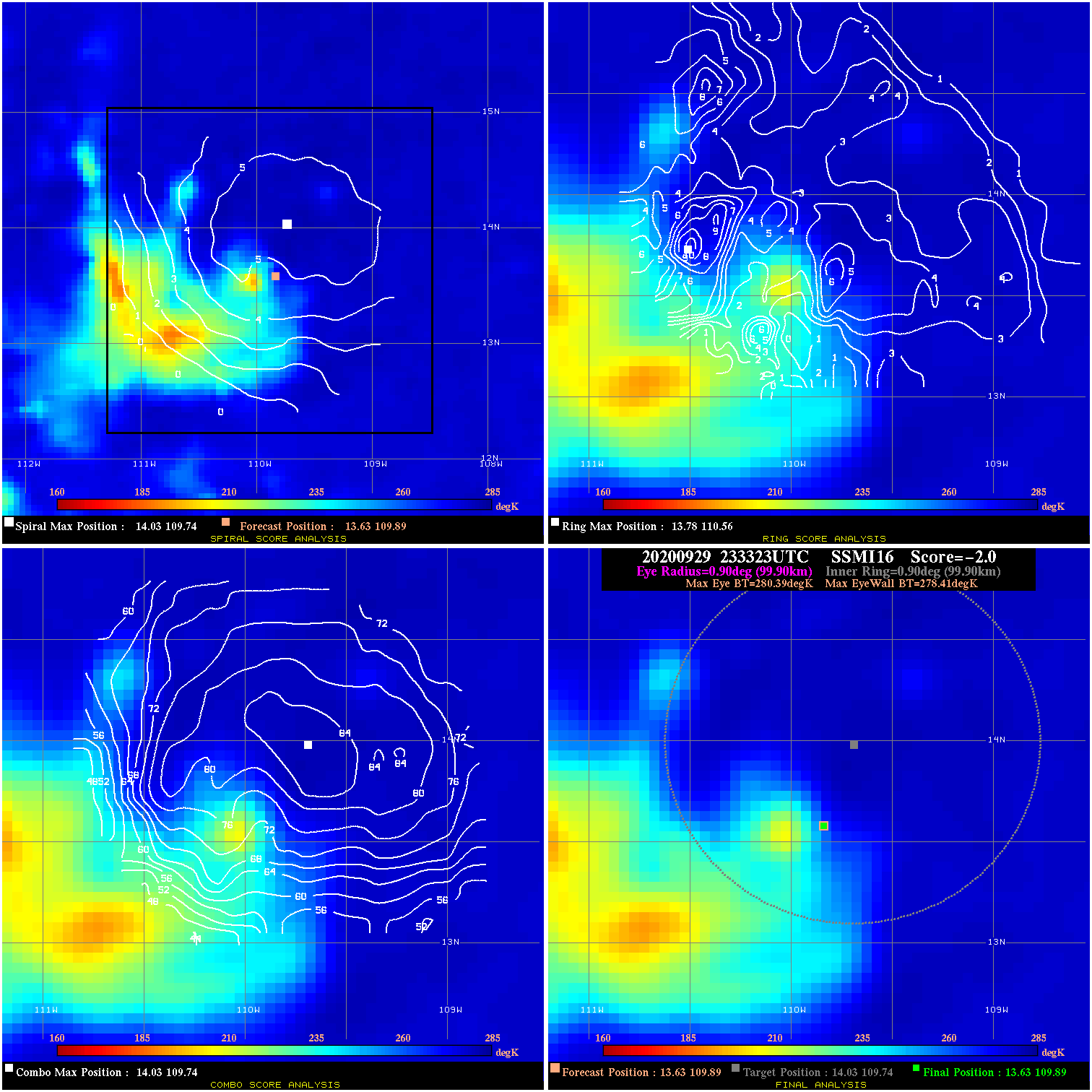
20200929 233323 -2.0 N/A 11.0% 199.98 1.98 35.0 SSMI16 13.6 109.9 13.6 109.9 14.0 109.7 Analysis Plot
20200930 132414 -1.6 N/A 31.2% 222.20 1.62 45.0 SSMI16 14.2 113.4 14.2 113.4 14.7 113.8 Analysis Plot
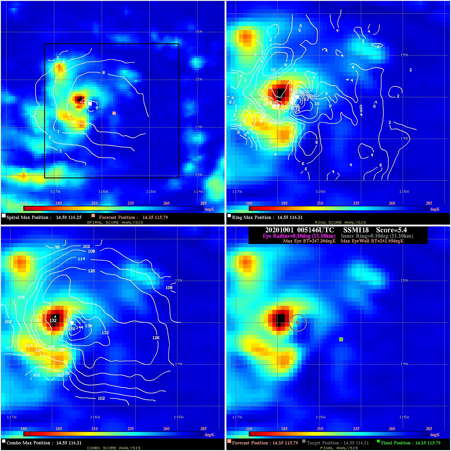
20201001 005146 5.4 N/A 45.2% 22.22 5.43 65.0 SSMI18 14.4 115.8 14.4 115.8 14.6 116.3 Analysis Plot
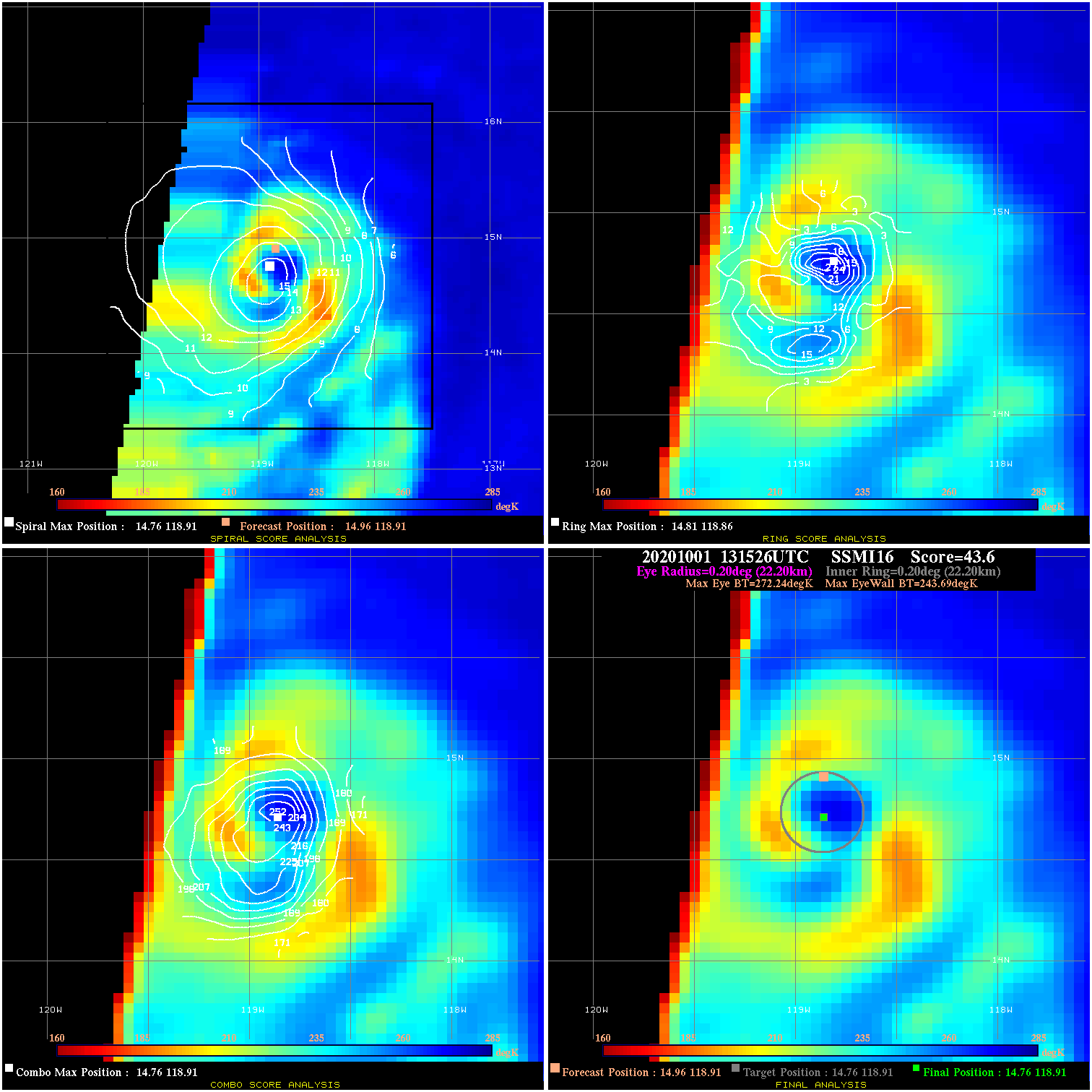
20201001 131526 43.6 >65 kts 100.0% 44.44 28.55 80.0 SSMI16 15.0 118.9 14.8 118.9 14.8 118.9 Analysis Plot
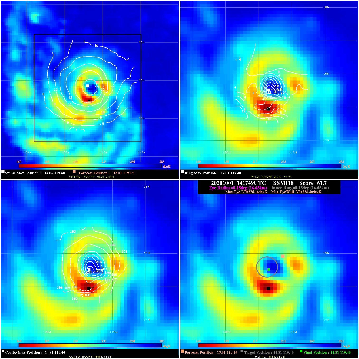
20201001 141749 61.7 >85 kts 100.0% 33.33 46.74 80.0 SSMI18 15.0 119.2 14.8 119.4 14.8 119.4 Analysis Plot
20201002 002220 -930.0 N/A N/A N/A 0.00 90.0 SSMI18 15.3 121.4 15.3 121.4 15.1 121.6 Analysis Plot
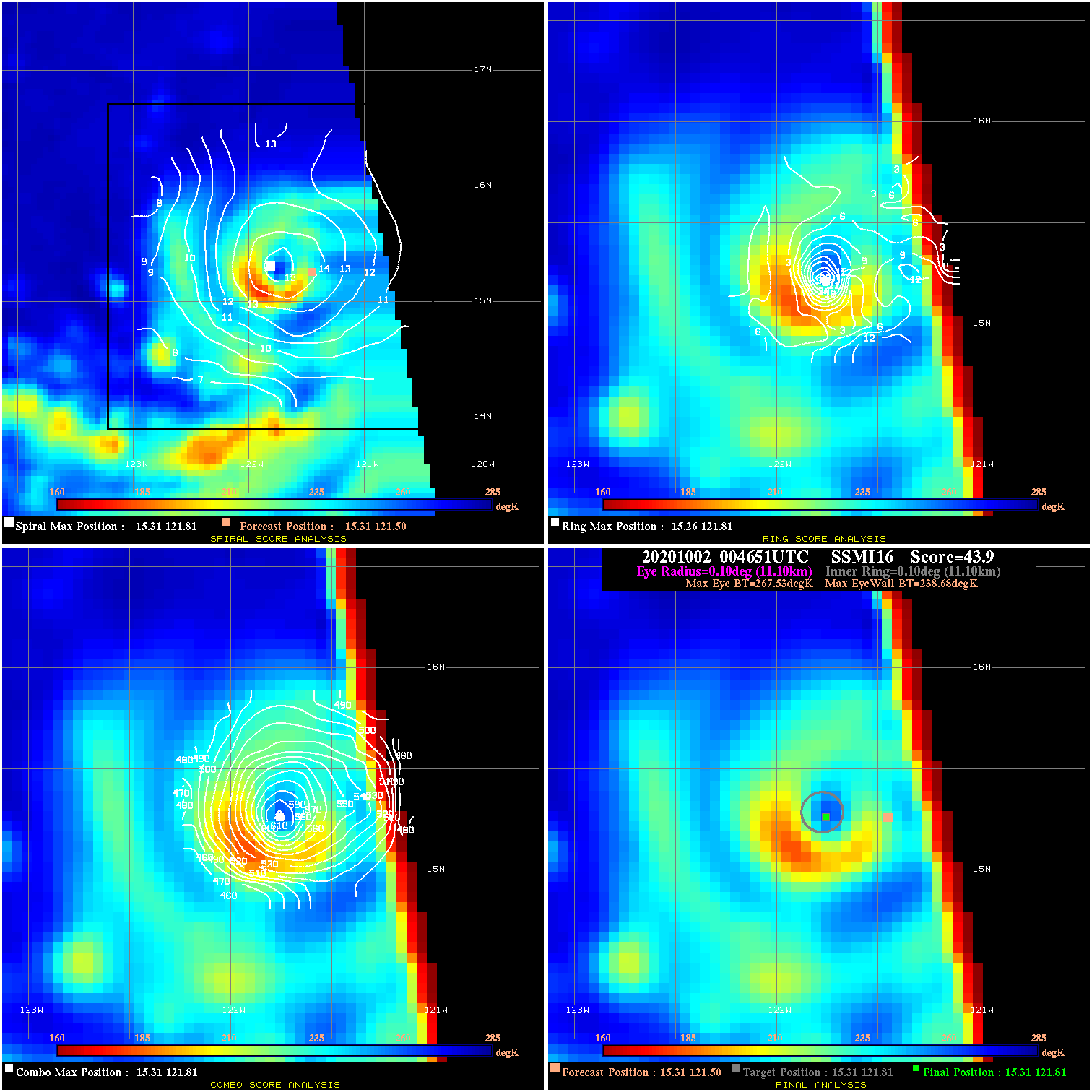
20201002 004651 43.9 >65 kts 100.0% 22.22 28.85 90.0 SSMI16 15.3 121.5 15.3 121.8 15.3 121.8 Analysis Plot
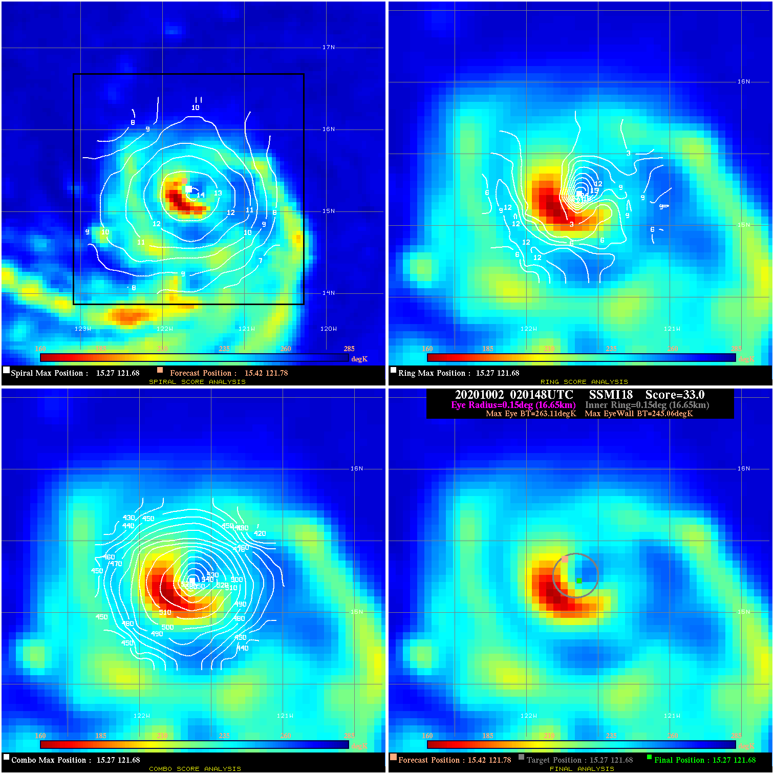
20201002 020148 33.0 >65 kts 90.4% 33.33 18.05 90.0 SSMI18 15.4 121.8 15.3 121.7 15.3 121.7 Analysis Plot
20201002 140607 40.0 >65 kts 100.0% 55.55 25.00 115.0 SSMI18 16.6 124.0 16.4 124.0 16.4 124.0 Analysis Plot
20201003 003346 57.3 >65 kts 100.0% 55.55 42.29 115.0 SSMI16 17.1 125.3 17.1 125.5 17.1 125.5 Analysis Plot
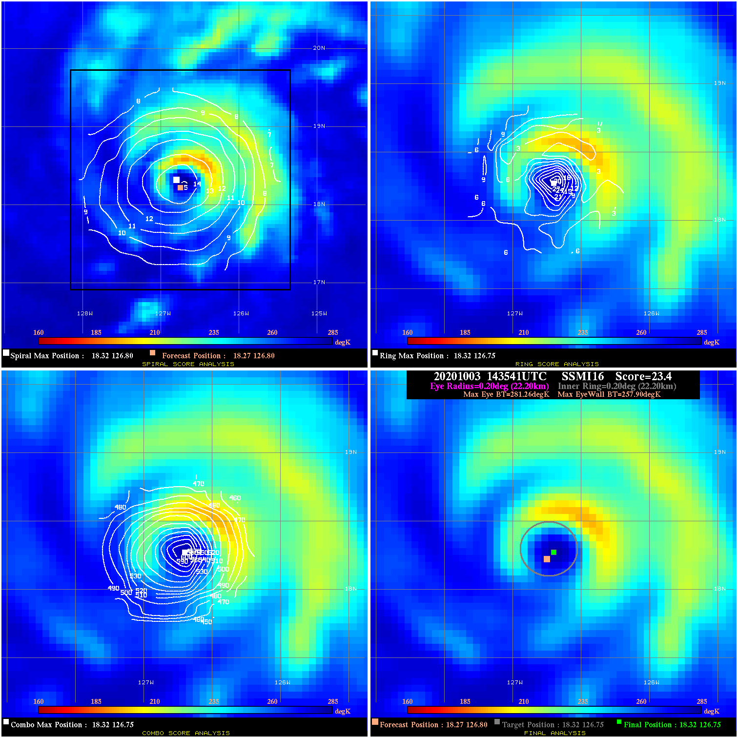
20201003 143541 23.4 >65 kts 69.9% 44.44 23.36 115.0 SSMI16 18.3 126.8 18.3 126.8 18.3 126.8 Analysis Plot
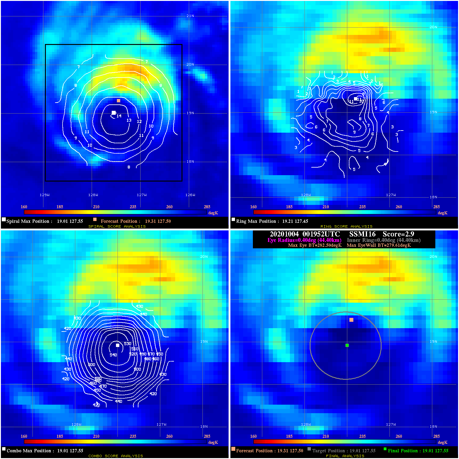
20201004 001952 2.9 N/A 31.5% 88.88 2.89 110.0 SSMI16 19.3 127.5 19.0 127.6 19.0 127.6 Analysis Plot
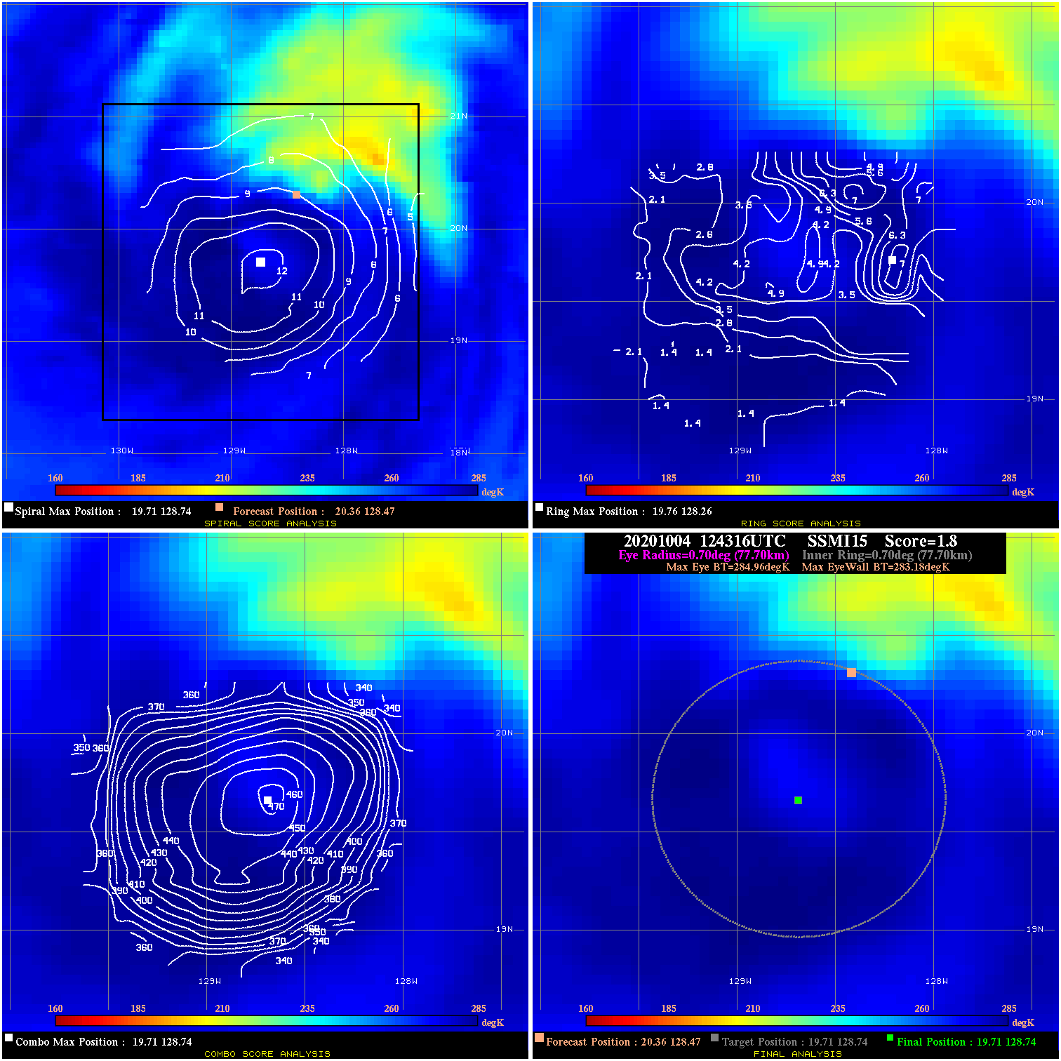
20201004 124316 1.8 N/A 11.0% 155.54 1.78 90.0 SSMI15 20.4 128.5 19.7 128.7 19.7 128.7 Analysis Plot
20201004 142239 3.4 N/A 11.0% 155.54 3.37 90.0 SSMI16 20.4 128.5 19.8 128.6 19.8 128.6 Analysis Plot
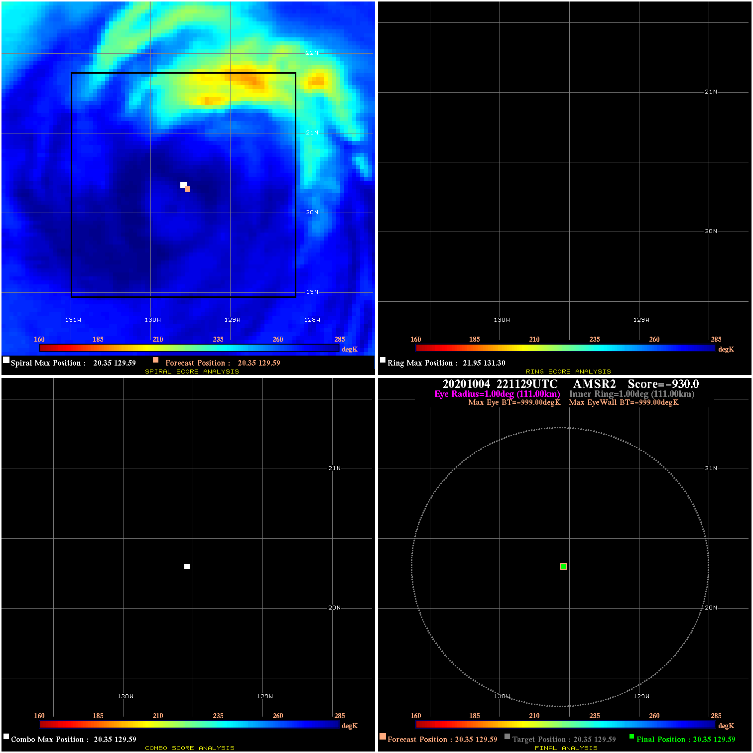
20201004 221129 N/A N/A N/A N/A N/A 70.0 AMSR2 20.4 129.6 20.4 129.6 20.4 129.6 Analysis Plot
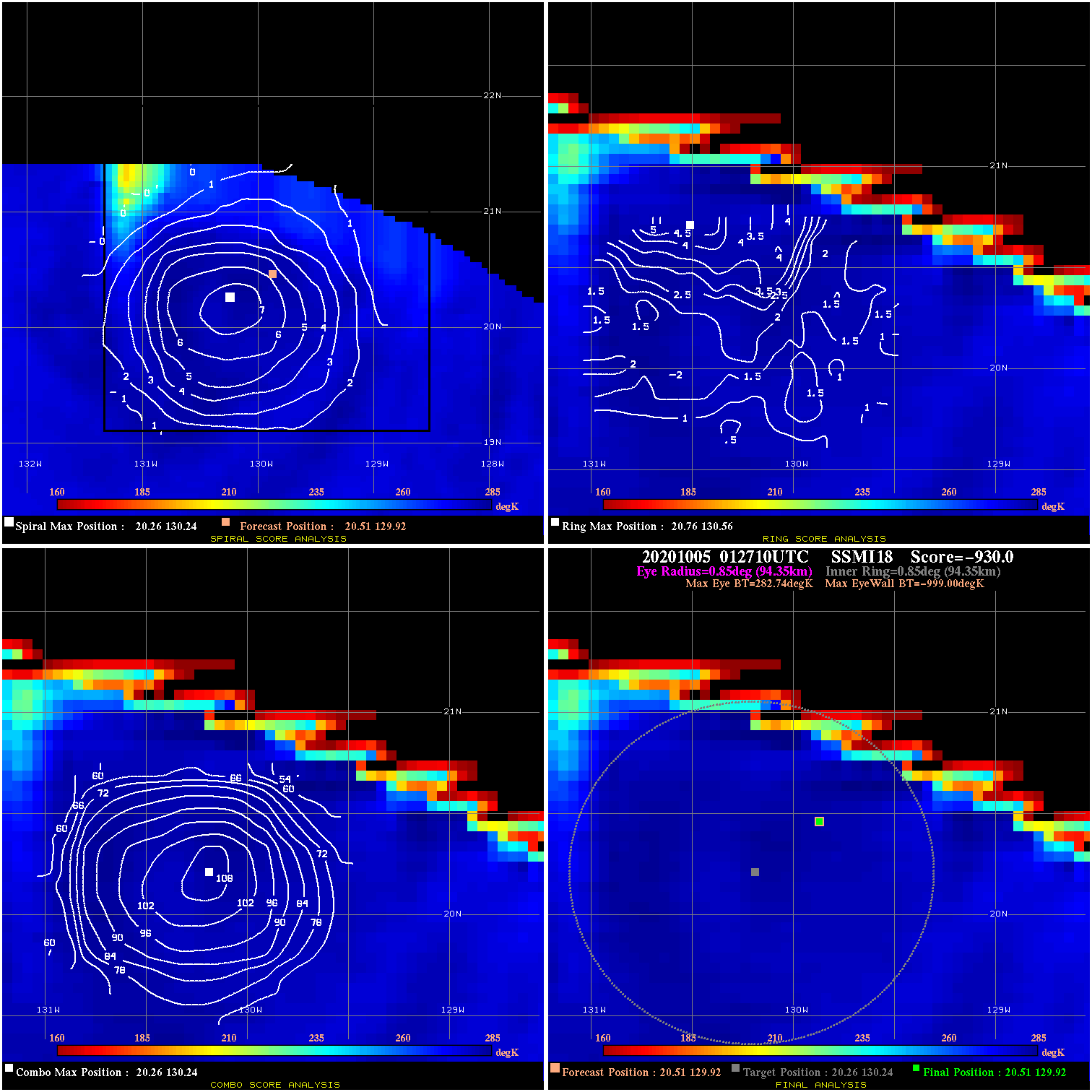
20201005 012710 -930.0 N/A N/A N/A 0.00 70.0 SSMI18 20.5 129.9 20.5 129.9 20.3 130.2 Analysis Plot
20201005 030250 1.7 N/A N/A 188.87 1.67 60.0 SSMI18 20.5 130.0 20.5 130.0 20.3 130.2 Analysis Plot
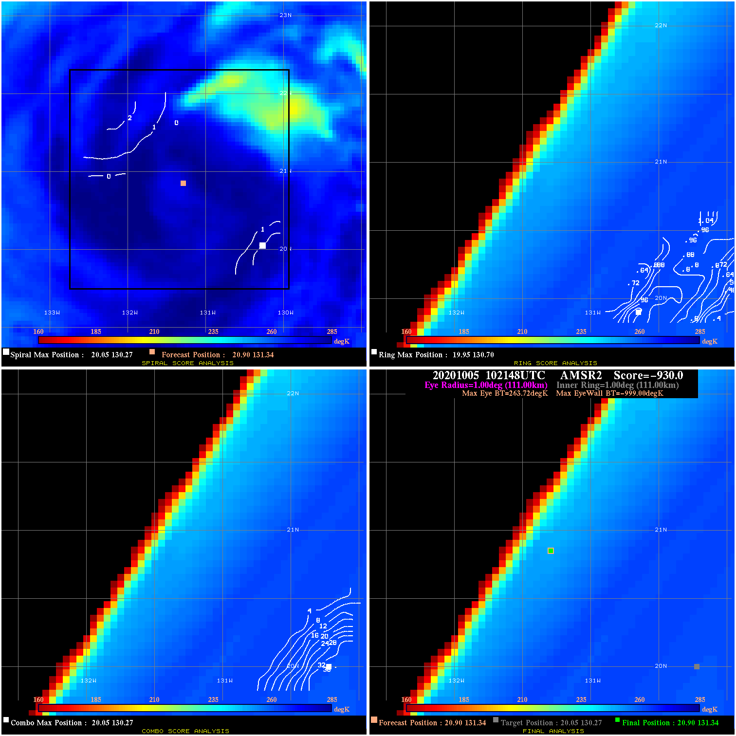
20201005 102148 -930.0 N/A N/A N/A 0.00 55.0 AMSR2 20.9 131.3 20.9 131.3 20.0 130.3 Analysis Plot
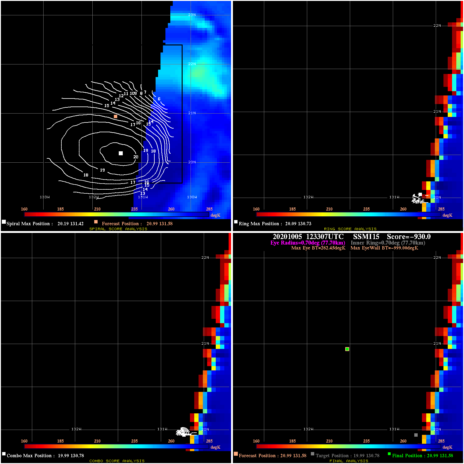
20201005 123307 -930.0 N/A N/A N/A 0.00 55.0 SSMI15 21.0 131.6 21.0 131.6 20.0 130.8 Analysis Plot
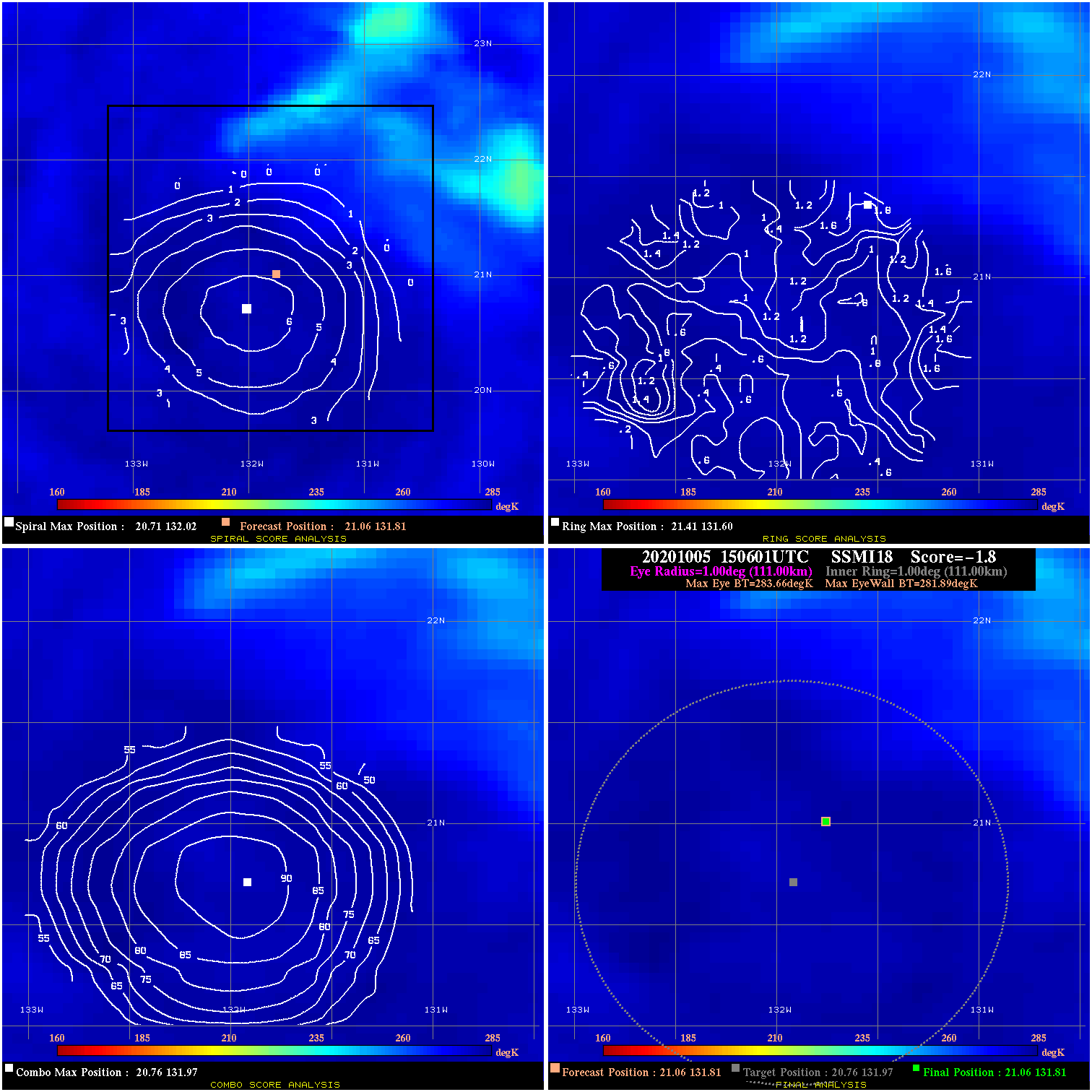
20201005 150601 -1.8 N/A N/A 222.20 1.77 50.0 SSMI18 21.1 131.8 21.1 131.8 20.8 132.0 Analysis Plot
20201005 172542 -930.0 N/A N/A N/A 0.00 50.0 GMI 21.2 132.2 21.2 132.2 21.0 132.3 Analysis Plot
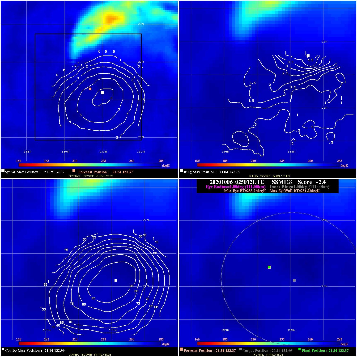
20201006 025012 -2.4 N/A N/A 222.20 2.44 40.0 SSMI18 21.3 133.4 21.3 133.4 21.1 133.0 Analysis Plot
20201006 110448 -3.2 N/A N/A 11.11 3.17 40.0 AMSR2 21.9 134.6 21.9 134.6 22.0 134.7 Analysis Plot
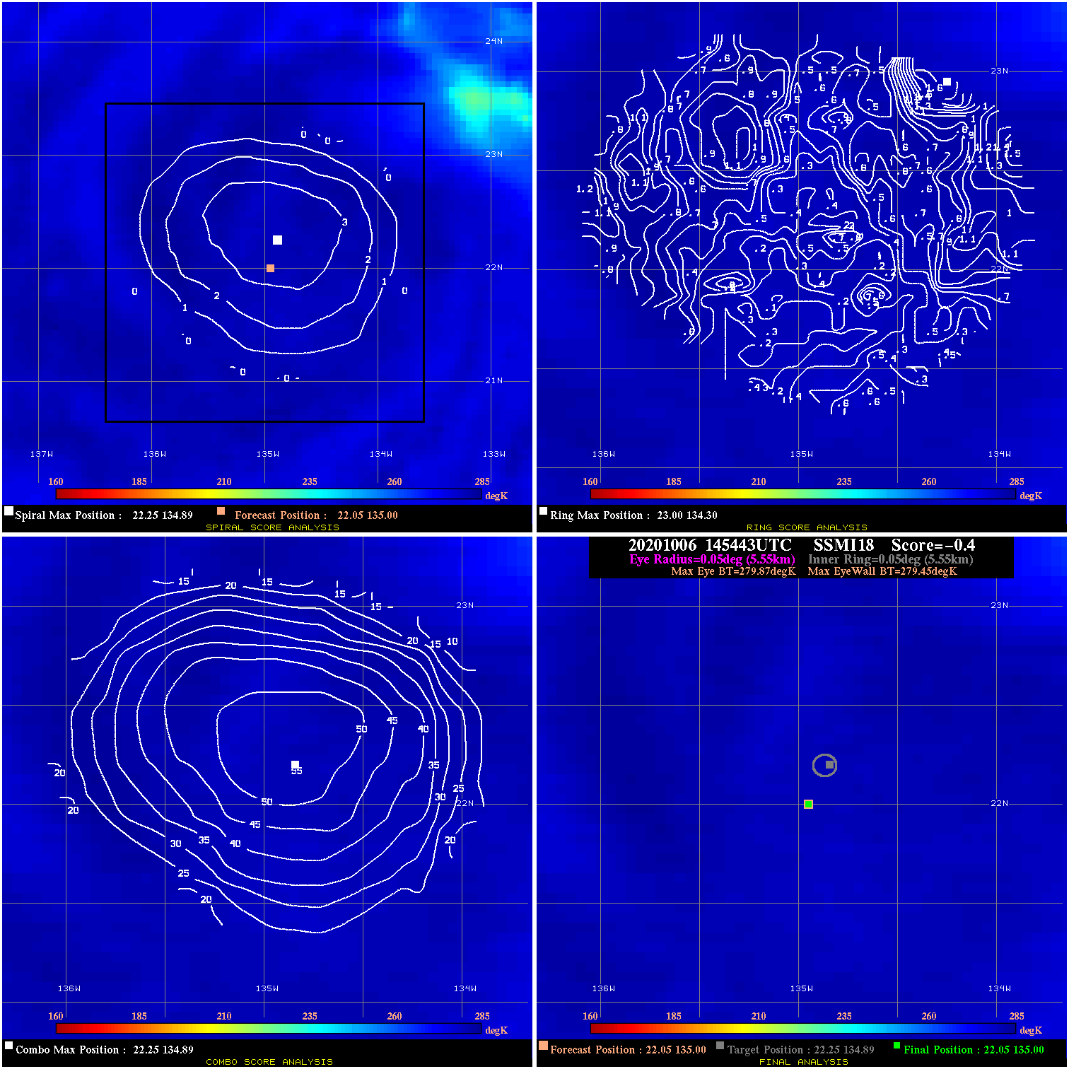
20201006 145443 -0.4 N/A N/A 11.11 .42 40.0 SSMI18 22.0 135.0 22.0 135.0 22.3 134.9 Analysis Plot
|
|
Legend: - Date/Time are determined from PMW imagery at Forecast (initial guess) Lat/Lon position. - Positive/Negative Latitude = North/South Hemisphere; Longitude = Western/Eastern Hemisphere. - "Ring Diam" value indicates the estimated surface eyewall diameter in km (the MI eyewall edge diameter minus 10 km). - "Ring Pct" is the percentage of the "ring" (eyewall inner boundary) that is 1) colder than the "hot spot" (warmest eye pixel) in the eye by 20K, or 2) the percentage that is a) colder than 232K and b) colder than the "hot spot" by 10K, whichever is greater. - Values are red if Ring % <= 65, yellow/brown if Ring % <= 85 and green if Ring % > 85. - "Tb diff" is the difference between the "hot spot" (warmest eye pixel) and the warmest pixel on the eyewall. - Intensity score are listed as negative, and not used, when the JTWC or NHC estimated Vmax is <55 kts in order to rule out weak but highly symmetric TCs. - Error messages in intensity scores: -920 is used when the hottest pixel in the eye is <200K, to prevent false positives; -930 means <85% of eyewall has observations/data. |