Tropical Depression 14E
|
Passive Microwave (PMW) Intensity Information Hurricane Intensity Estimation (HIE) Algorithm Version 9.0 |
Overpass Inten Ring Ring Wind Forecast Final Target
Date Time Score Meaning Pct Diam BTdiff Est Sat Lat Lon Lat Lon Lat Lon
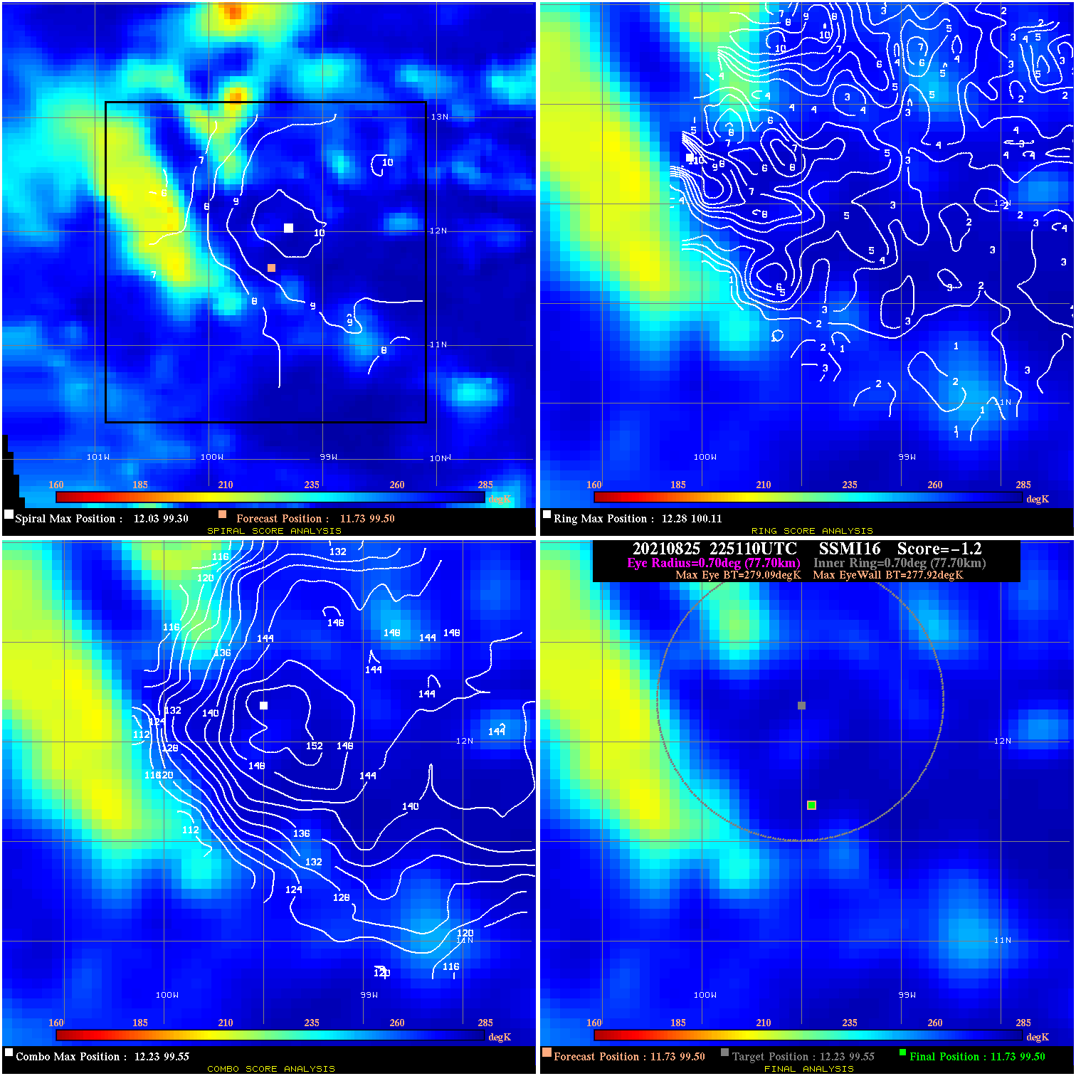
20210825 225110 -1.2 N/A 28.8% 155.54 1.17 30.0 SSMI16 11.7 99.5 11.7 99.5 12.2 99.6 Analysis Plot
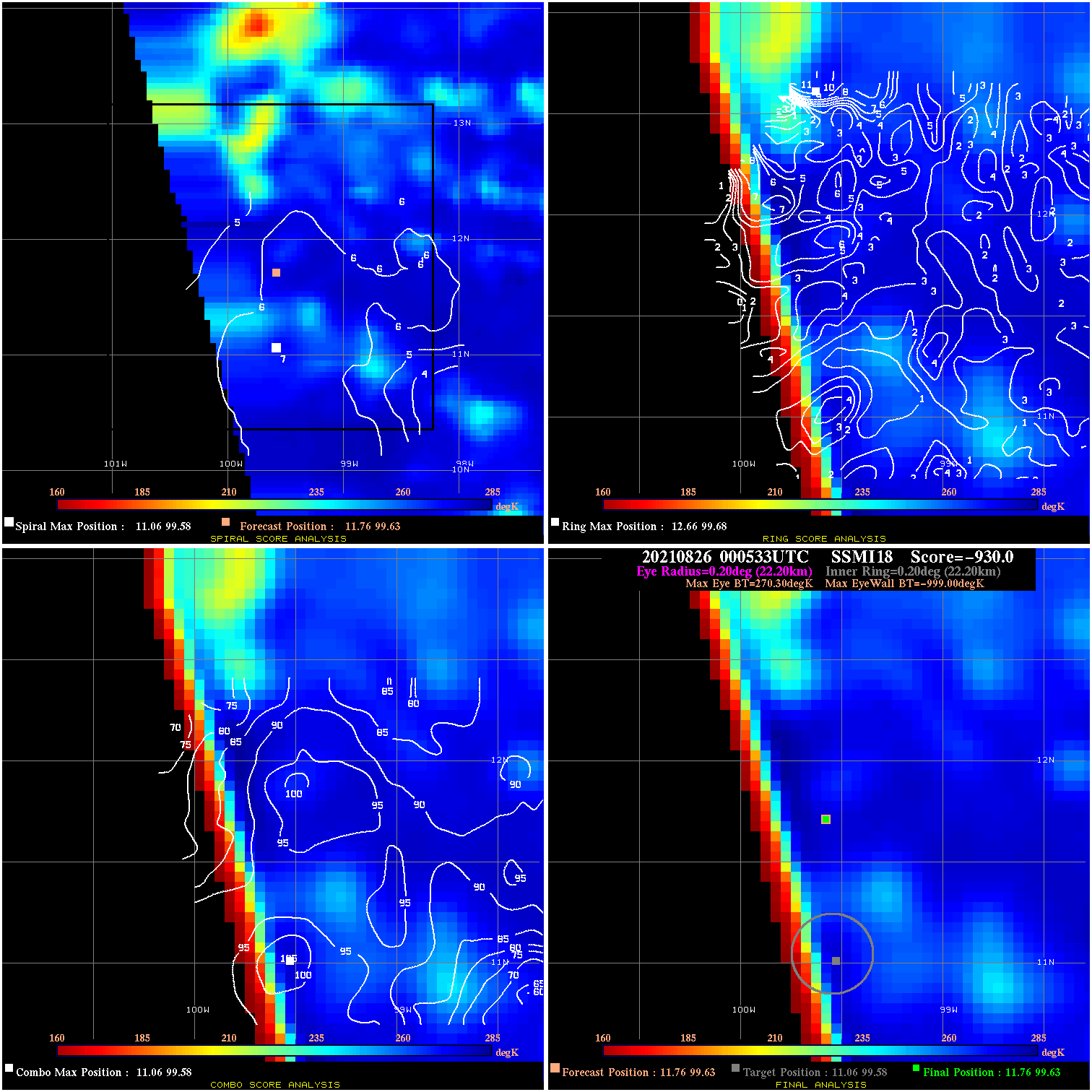
20210826 000533 -930.0 N/A N/A N/A 0.00 30.0 SSMI18 11.8 99.6 11.8 99.6 11.1 99.6 Analysis Plot
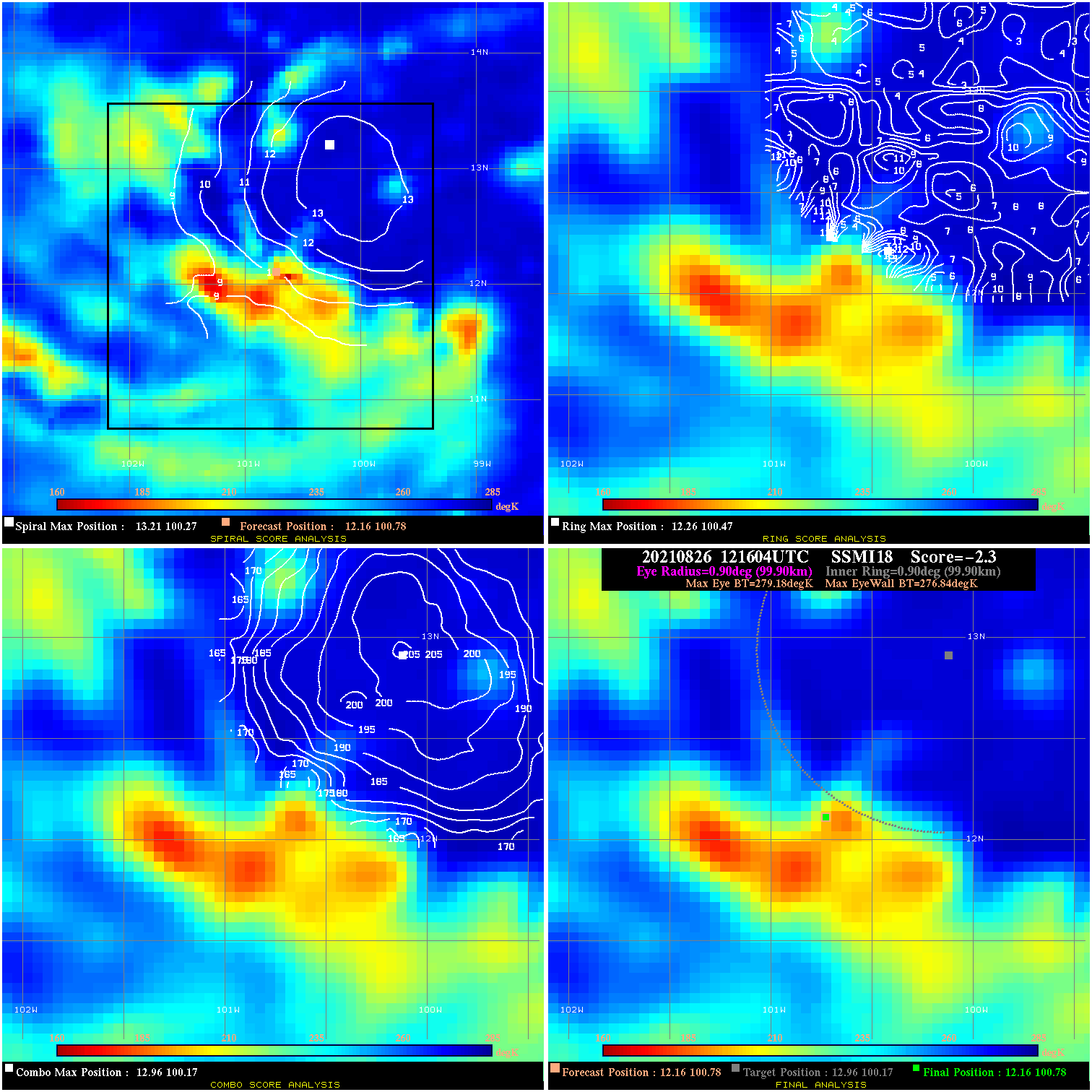
20210826 121604 -2.3 N/A 12.3% 199.98 2.34 30.0 SSMI18 12.2 100.8 12.2 100.8 13.0 100.2 Analysis Plot
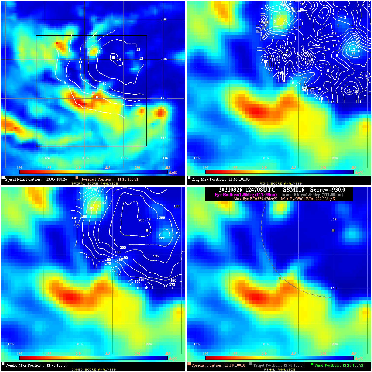
20210826 124708 -930.0 N/A N/A N/A 0.00 30.0 SSMI16 12.2 100.8 12.2 100.8 12.9 100.1 Analysis Plot
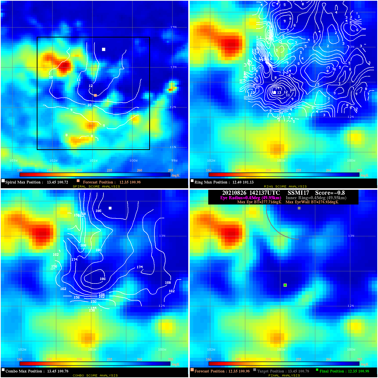
20210826 142137 -0.8 N/A 9.6% 99.99 .78 30.0 SSMI17 12.4 101.0 12.4 101.0 13.4 100.8 Analysis Plot
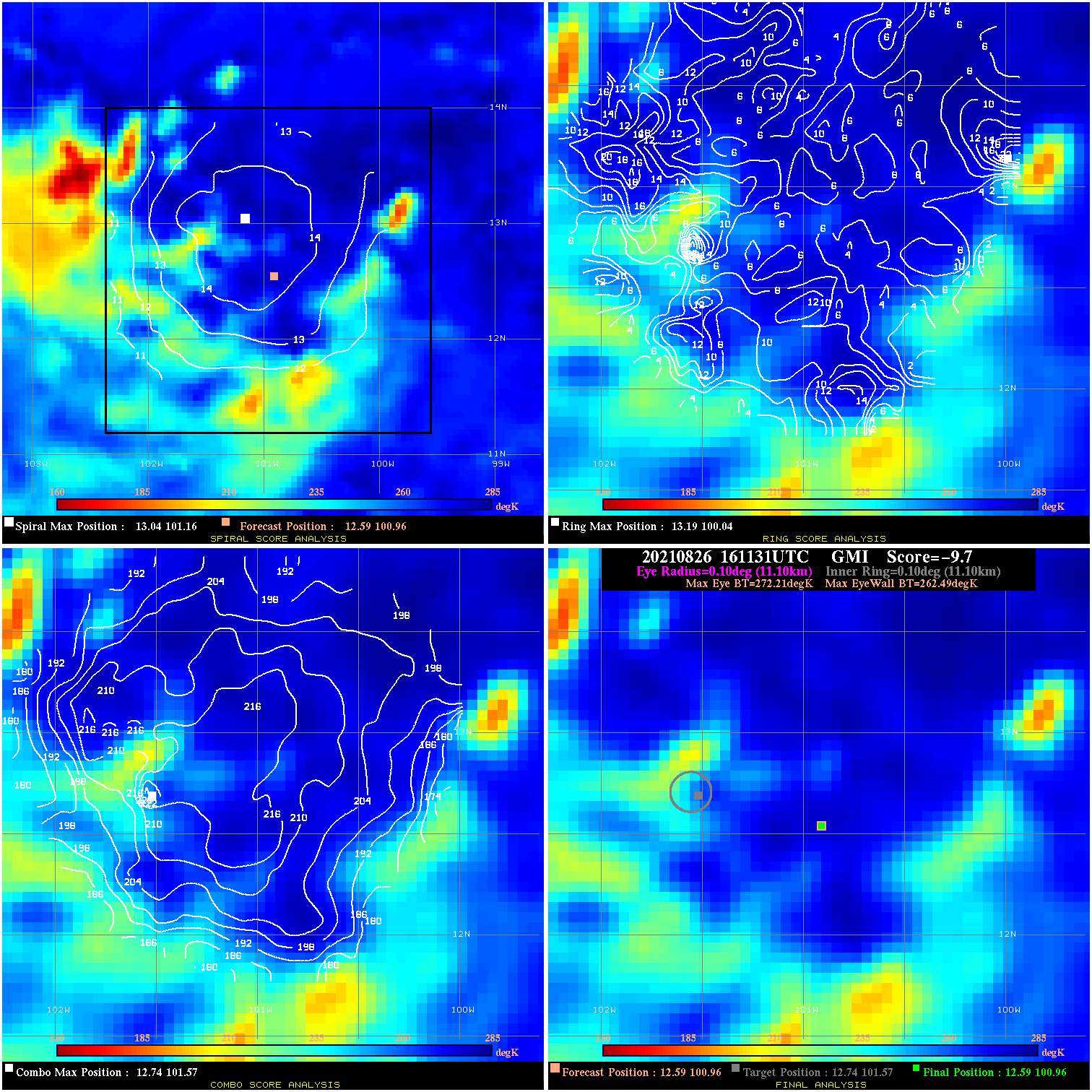
20210826 161131 -9.7 N/A 30.1% 22.22 9.72 35.0 GMI 12.6 101.0 12.6 101.0 12.7 101.6 Analysis Plot
20210826 195341 -4.1 N/A 24.7% 44.44 4.13 35.0 AMSR2 12.8 101.4 12.8 101.4 13.5 101.6 Analysis Plot
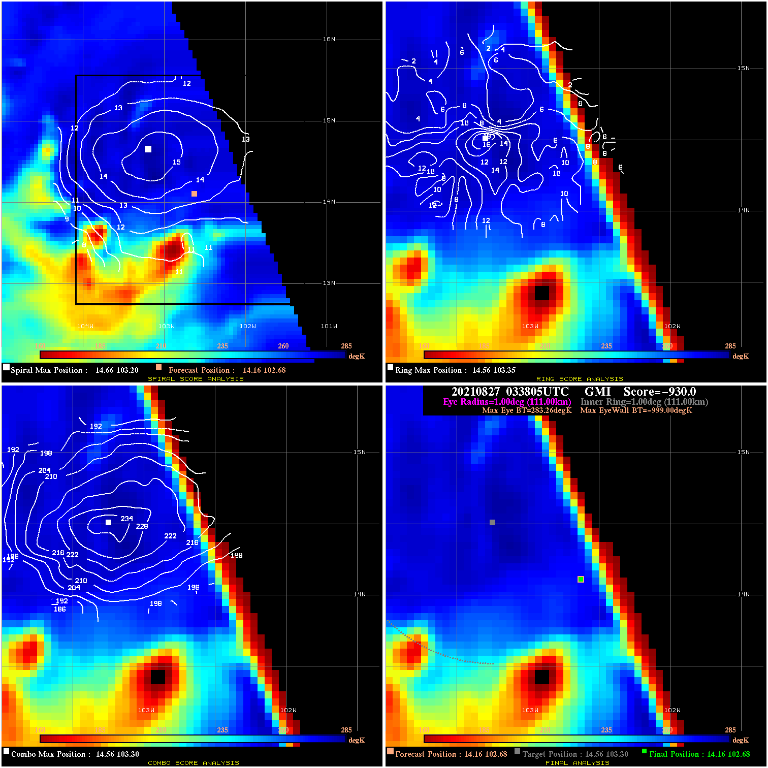
20210827 033805 -930.0 N/A N/A N/A 0.00 40.0 GMI 14.2 102.7 14.2 102.7 14.6 103.3 Analysis Plot
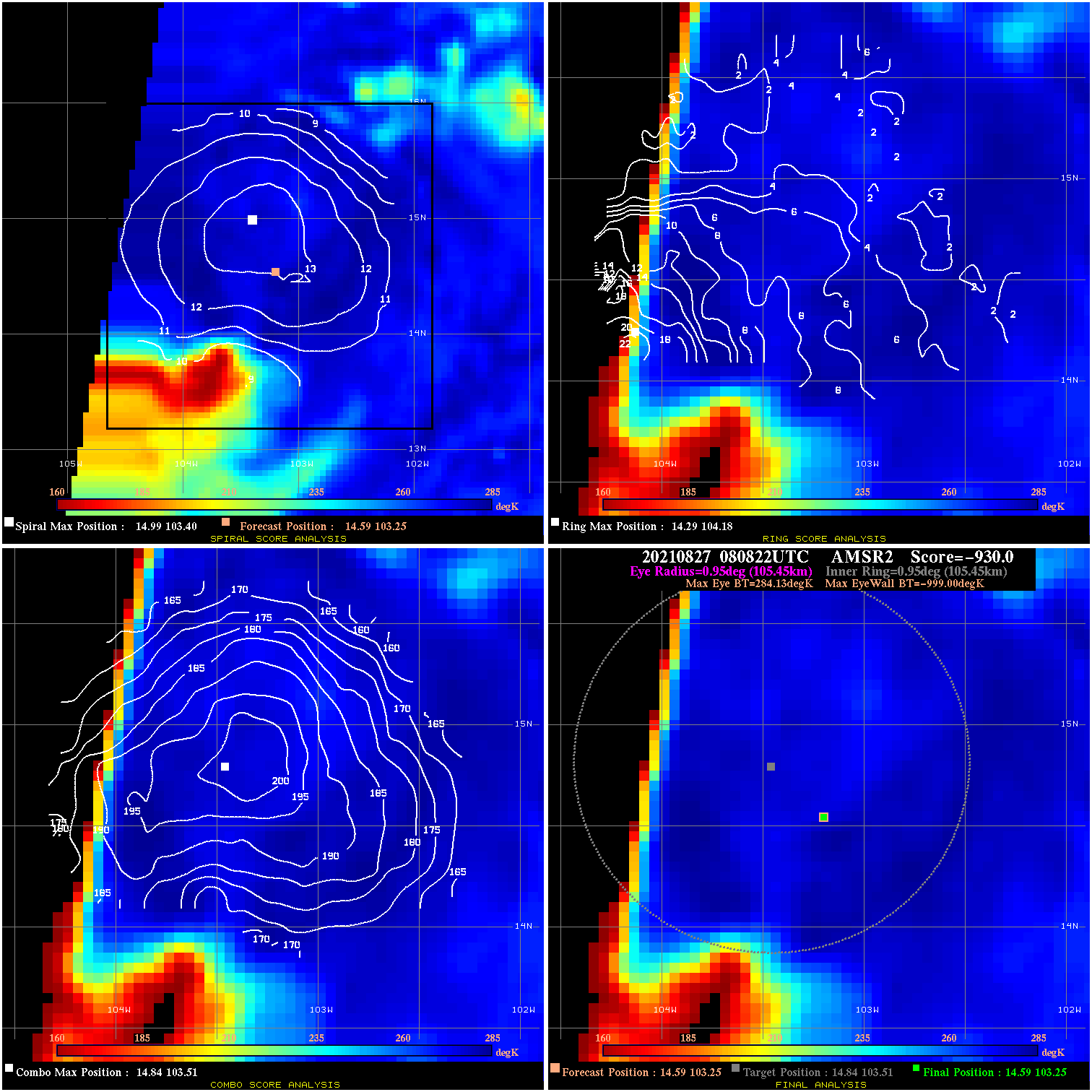
20210827 080822 -930.0 N/A N/A N/A 0.00 40.0 AMSR2 14.6 103.3 14.6 103.3 14.8 103.5 Analysis Plot
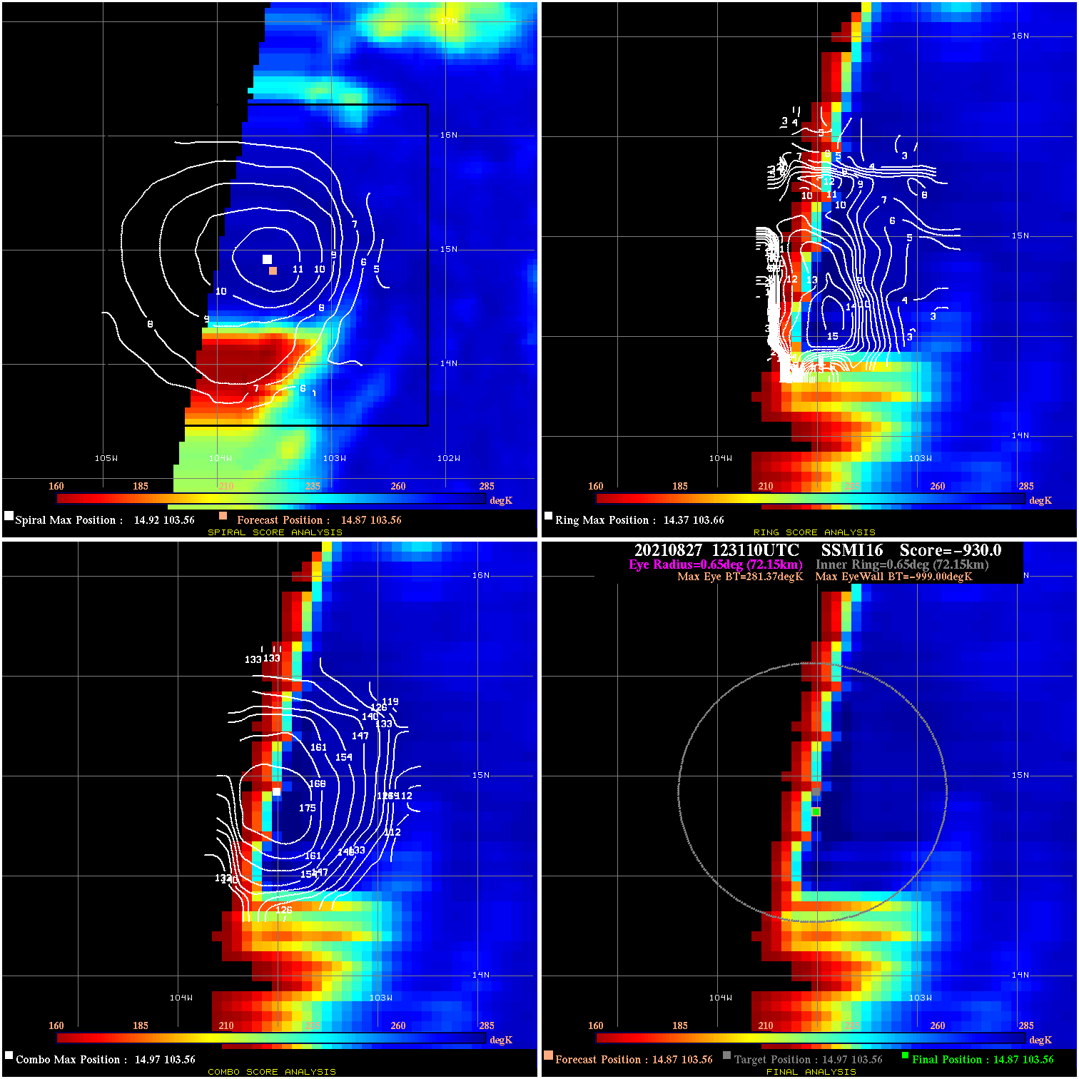
20210827 123110 -930.0 N/A N/A N/A 0.00 40.0 SSMI16 14.9 103.6 14.9 103.6 15.0 103.6 Analysis Plot
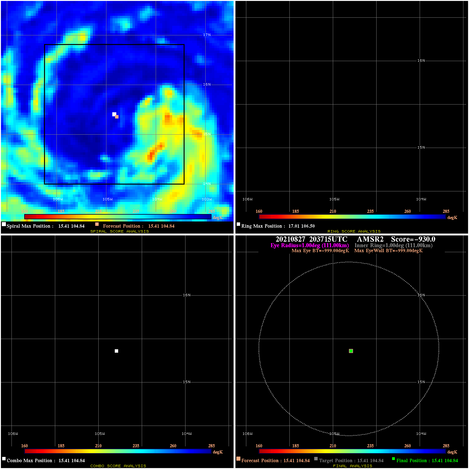
20210827 203715 N/A N/A N/A N/A N/A 55.0 AMSR2 15.4 104.8 15.4 104.8 15.4 104.8 Analysis Plot
20210828 012227 3.5 N/A N/A 55.55 3.54 55.0 SSMI18 15.9 105.2 15.9 105.2 16.0 104.8 Analysis Plot
20210828 032752 1.8 N/A N/A 111.10 1.85 55.0 SSMI17 16.2 105.1 16.2 105.1 16.2 105.1 Analysis Plot
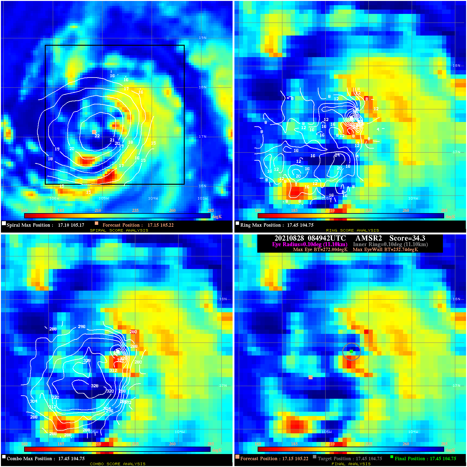
20210828 084942 34.3 >65 kts 94.5% 22.22 19.26 65.0 AMSR2 17.1 105.2 17.5 104.8 17.5 104.8 Analysis Plot
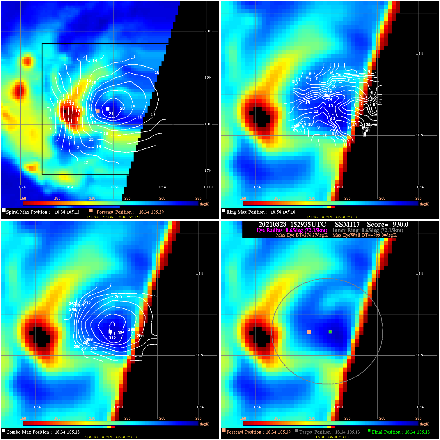
20210828 152935 -930.0 N/A N/A N/A 0.00 70.0 SSMI17 18.3 105.4 18.3 105.1 18.3 105.1 Analysis Plot
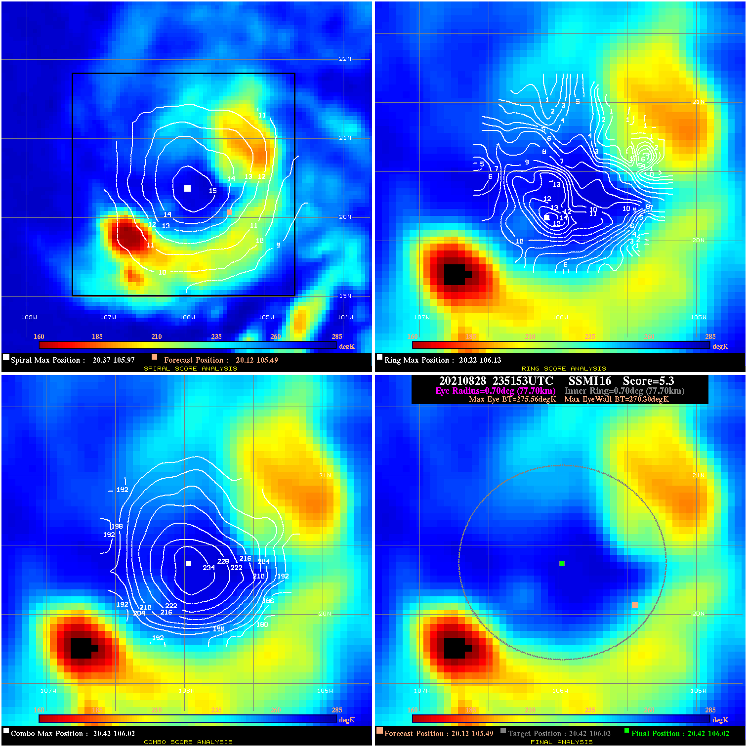
20210828 235153 5.3 N/A 63.0% 155.54 5.26 75.0 SSMI16 20.1 105.5 20.4 106.0 20.4 106.0 Analysis Plot
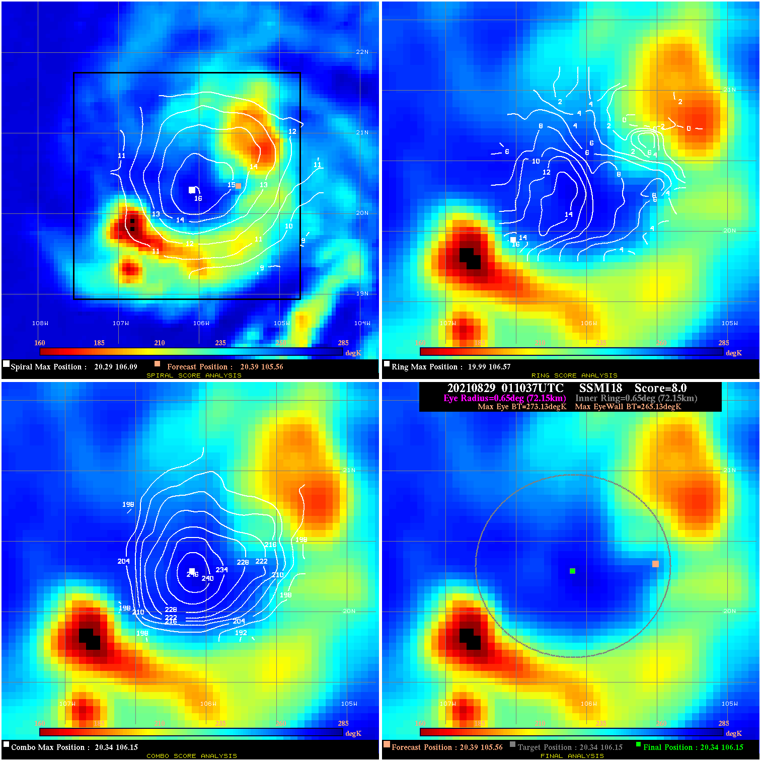
20210829 011037 8.0 N/A 68.5% 144.43 8.00 75.0 SSMI18 20.4 105.6 20.3 106.2 20.3 106.2 Analysis Plot
20210829 031328 14.5 N/A 56.2% 122.21 14.45 65.0 SSMI17 21.2 105.5 20.9 105.6 20.9 105.6 Analysis Plot
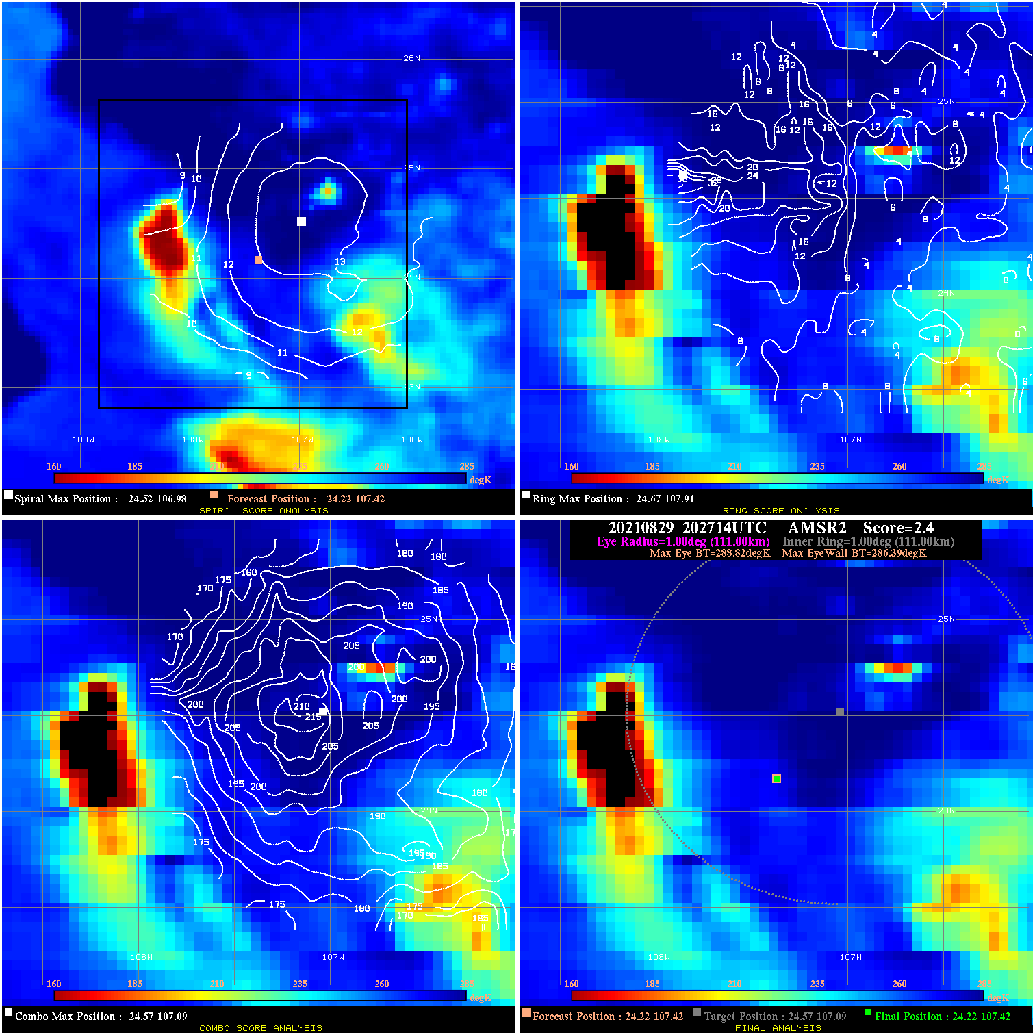
20210829 202714 2.4 N/A 24.7% 222.20 2.43 55.0 AMSR2 24.2 107.4 24.2 107.4 24.6 107.1 Analysis Plot
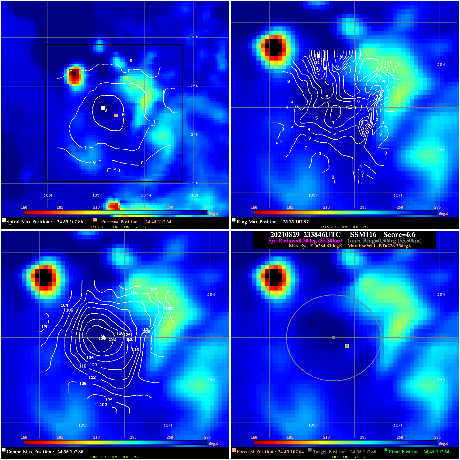
20210829 233846 6.6 N/A 1.4% 111.10 6.56 55.0 SSMI16 24.5 107.6 24.5 107.6 24.5 107.8 Analysis Plot
20210830 011919 -930.0 N/A N/A N/A 0.00 65.0 SSMI17 23.8 106.9 23.8 106.9 23.3 107.3 Analysis Plot
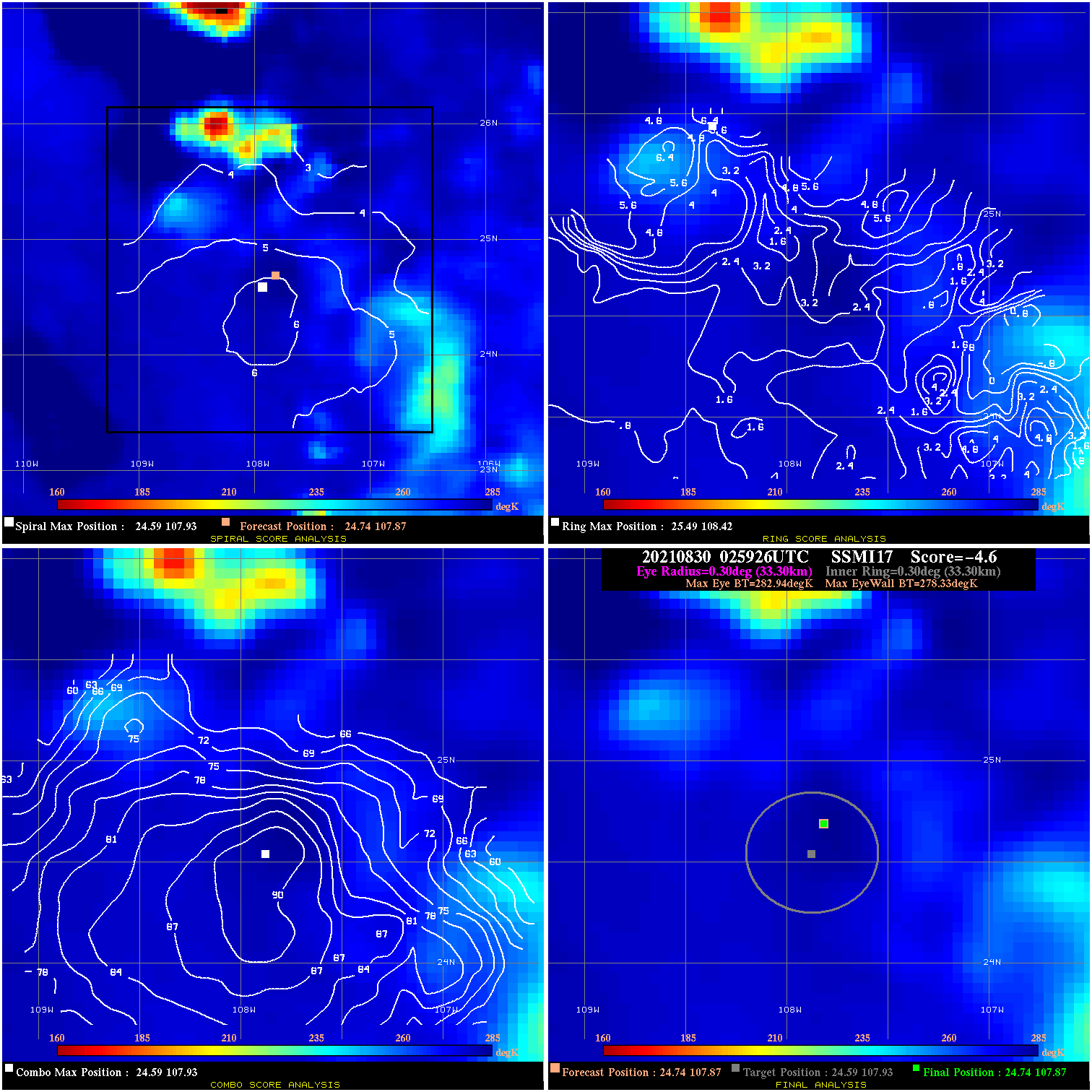
20210830 025926 -4.6 N/A N/A 66.66 4.61 40.0 SSMI17 24.7 107.9 24.7 107.9 24.6 107.9 Analysis Plot
|
|
Legend: - Date/Time are determined from PMW imagery at Forecast (initial guess) Lat/Lon position. - Positive/Negative Latitude = North/South Hemisphere; Longitude = Western/Eastern Hemisphere. - "Ring Diam" value indicates the estimated surface eyewall diameter in km (the MI eyewall edge diameter minus 10 km). - "Ring Pct" is the percentage of the "ring" (eyewall inner boundary) that is 1) colder than the "hot spot" (warmest eye pixel) in the eye by 20K, or 2) the percentage that is a) colder than 232K and b) colder than the "hot spot" by 10K, whichever is greater. - Values are red if Ring % <= 65, yellow/brown if Ring % <= 85 and green if Ring % > 85. - "Tb diff" is the difference between the "hot spot" (warmest eye pixel) and the warmest pixel on the eyewall. - Intensity score are listed as negative, and not used, when the JTWC or NHC estimated Vmax is <55 kts in order to rule out weak but highly symmetric TCs. - Error messages in intensity scores: -920 is used when the hottest pixel in the eye is <200K, to prevent false positives; -930 means <85% of eyewall has observations/data. |