Tropical Depression 22W
|
Passive Microwave (PMW) Intensity Information Hurricane Intensity Estimation (HIE) Algorithm Version 9.0 |
Overpass Inten Ring Ring Wind Forecast Final Target
Date Time Score Meaning Pct Diam BTdiff Est Sat Lat Lon Lat Lon Lat Lon
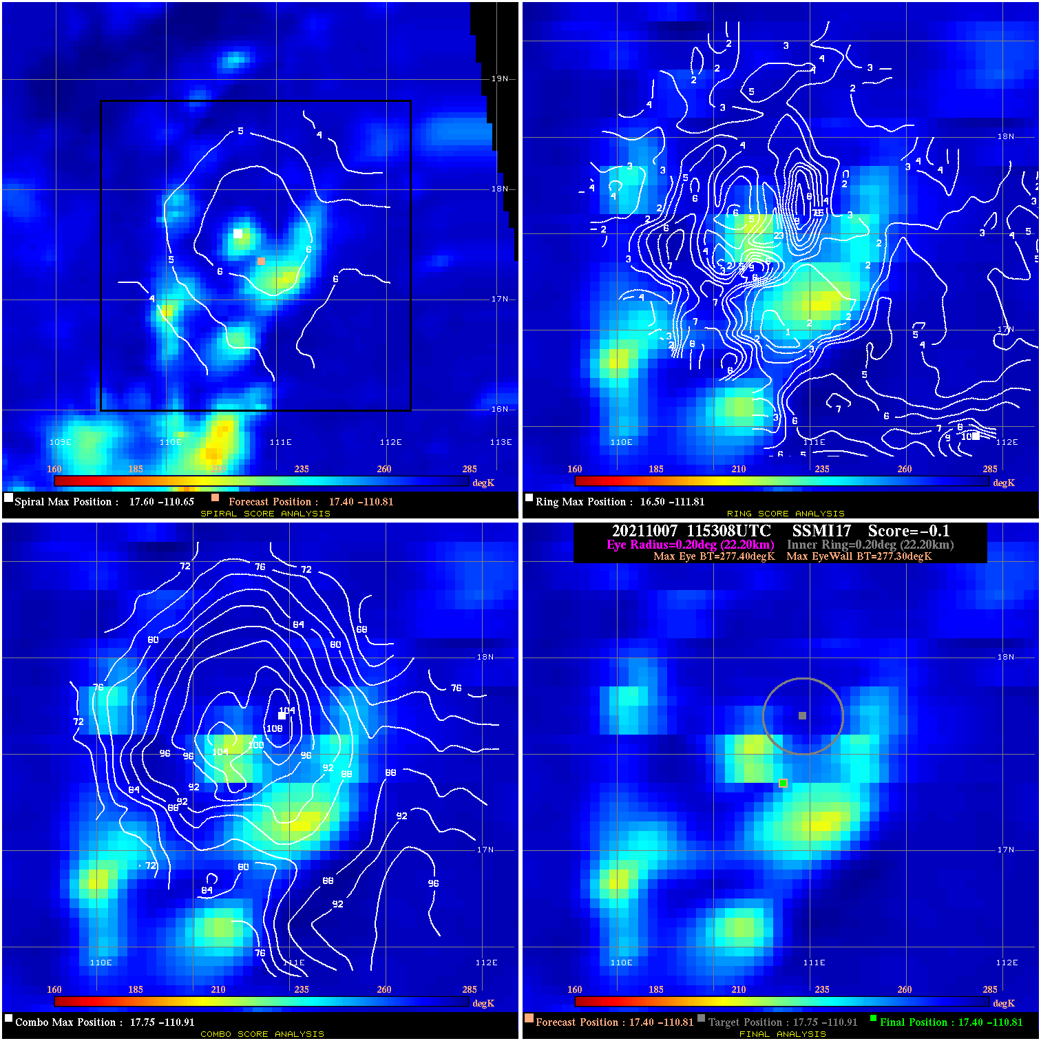
20211007 115308 -0.1 N/A 5.5% 44.44 .10 30.0 SSMI17 17.4 -110.8 17.4 -110.8 17.8 -110.9 Analysis Plot
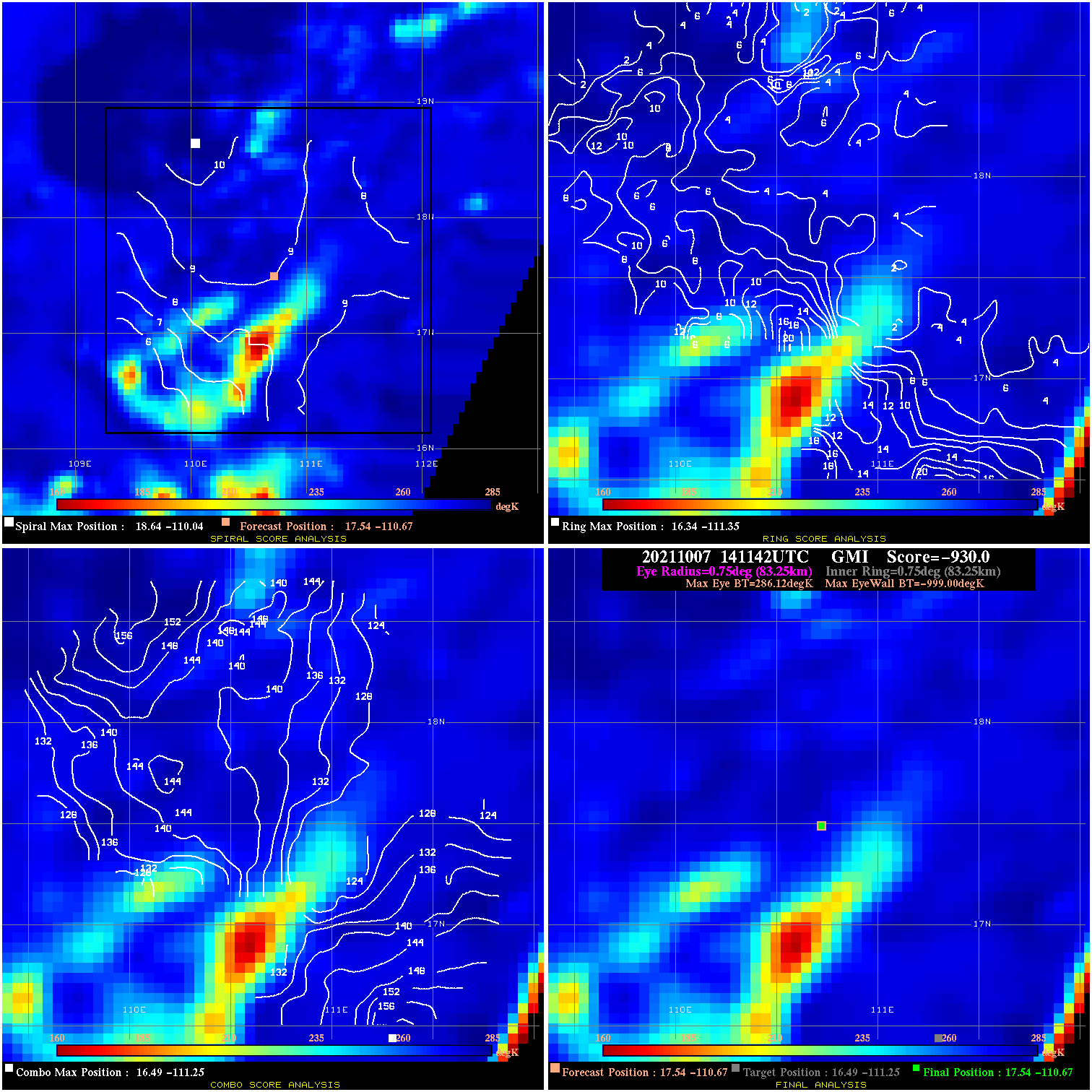
20211007 141142 -930.0 N/A N/A N/A 0.00 30.0 GMI 17.5 -110.7 17.5 -110.7 16.5 -111.3 Analysis Plot
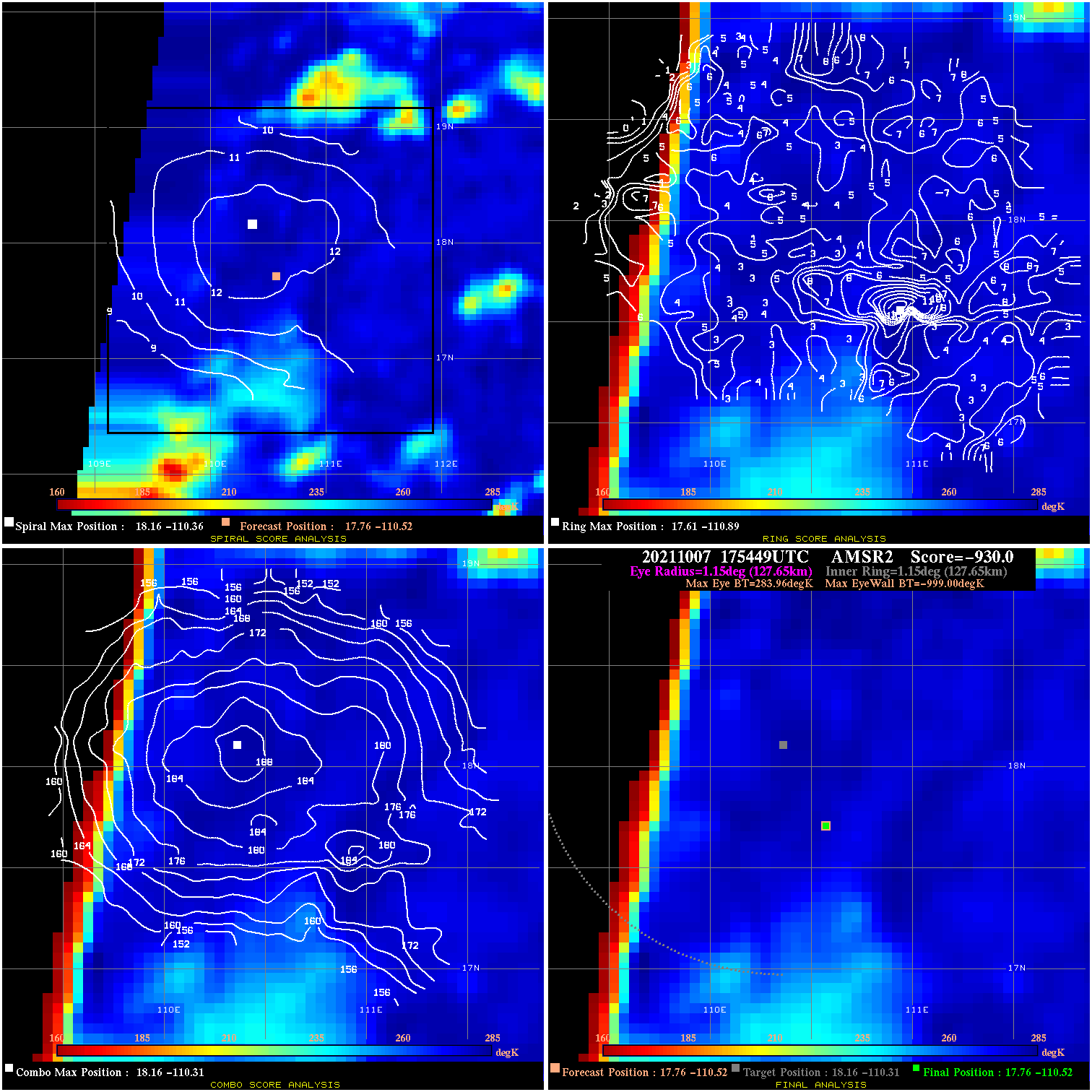
20211007 175449 -930.0 N/A N/A N/A 0.00 30.0 AMSR2 17.8 -110.5 17.8 -110.5 18.2 -110.3 Analysis Plot
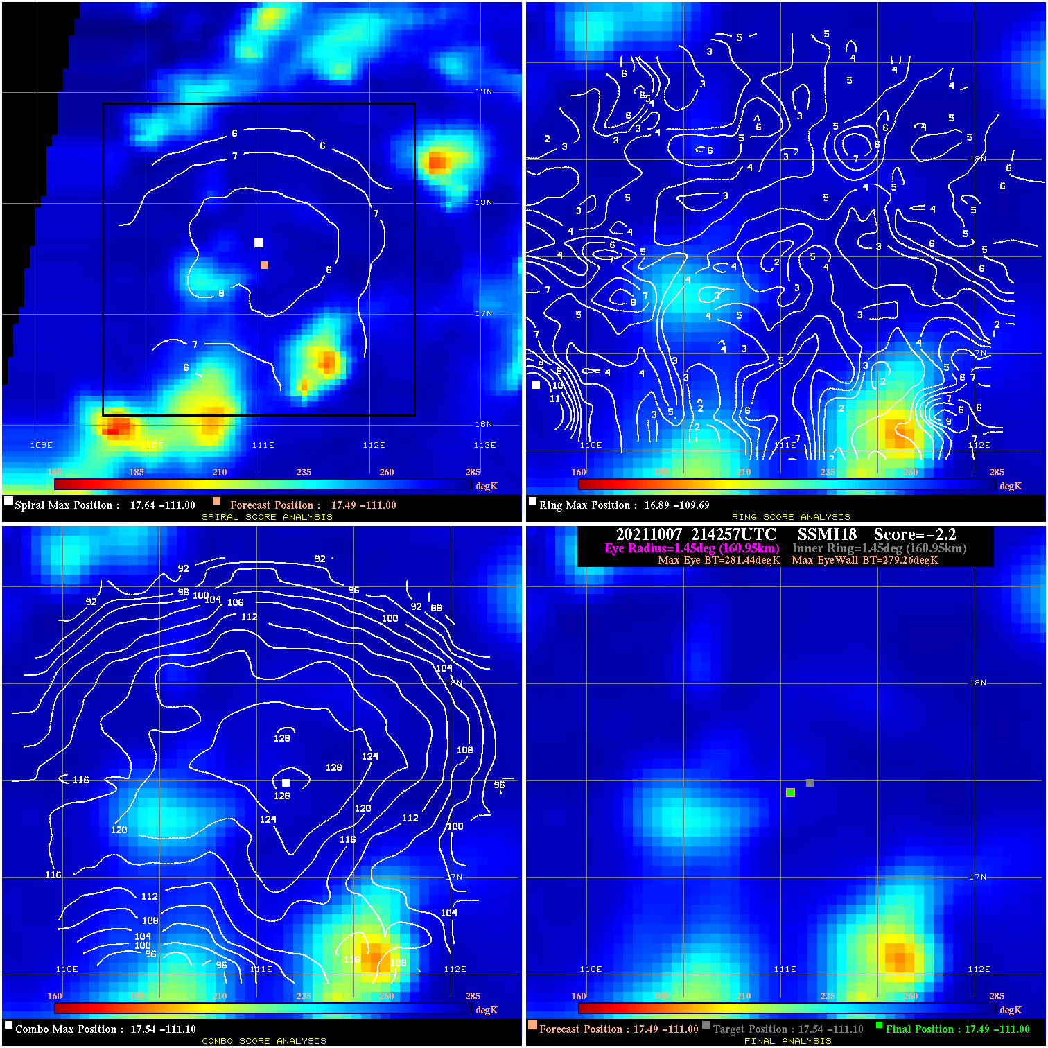
20211007 214257 -2.2 N/A 11.9% 322.19 2.18 30.0 SSMI18 17.5 -111.0 17.5 -111.0 17.5 -111.1 Analysis Plot
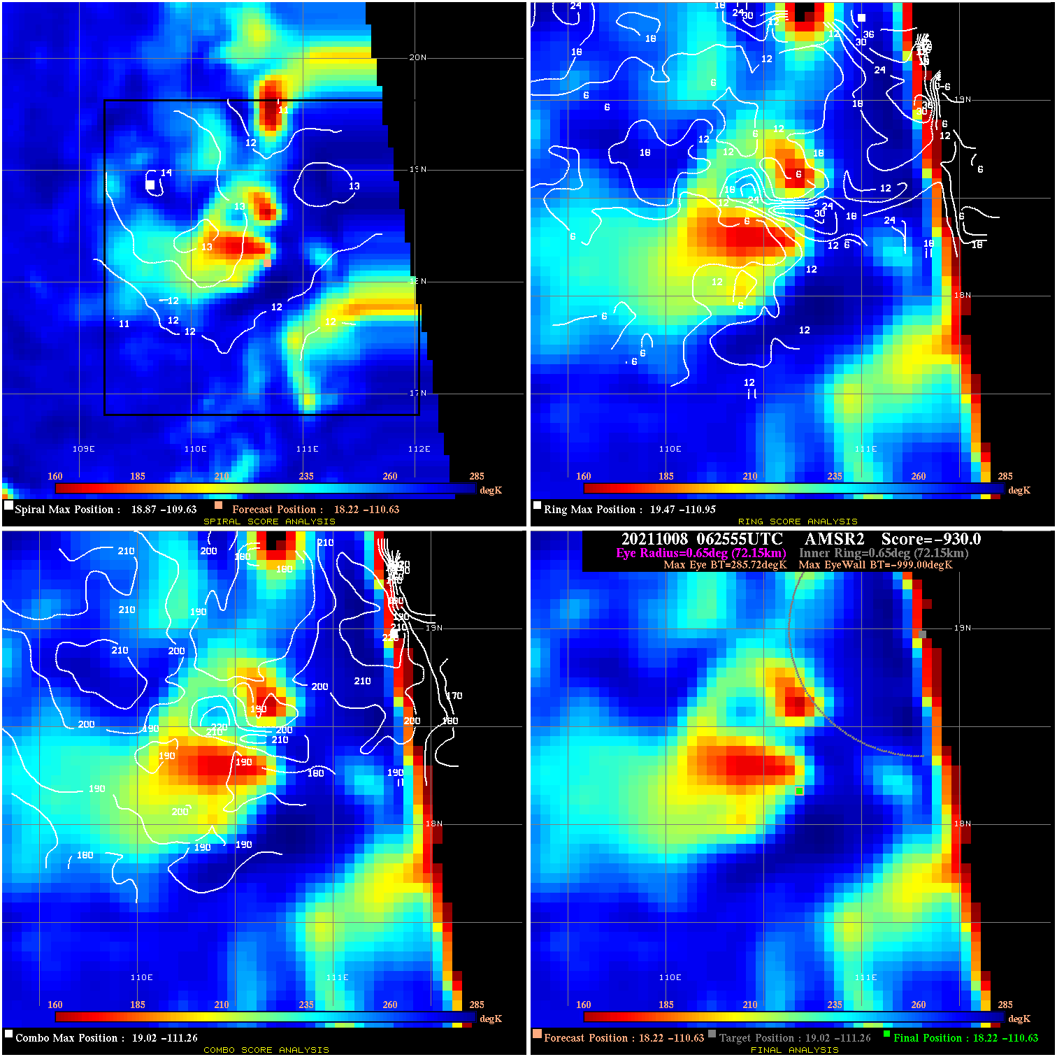
20211008 062555 -930.0 N/A N/A N/A 0.00 35.0 AMSR2 18.2 -110.6 18.2 -110.6 19.0 -111.3 Analysis Plot
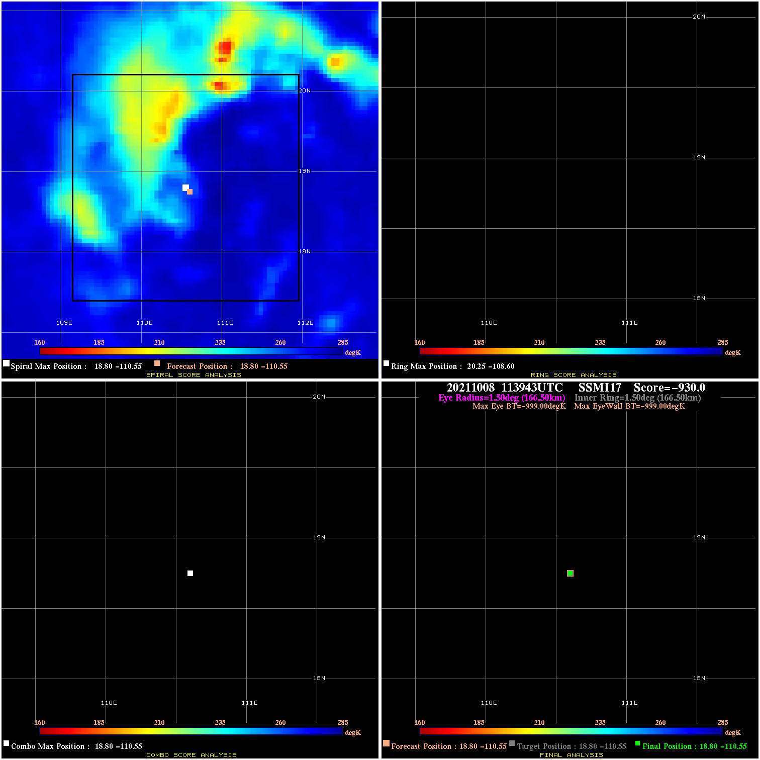
20211008 113943 N/A N/A N/A N/A N/A 35.0 SSMI17 18.8 -110.6 18.8 -110.6 18.8 -110.6 Analysis Plot
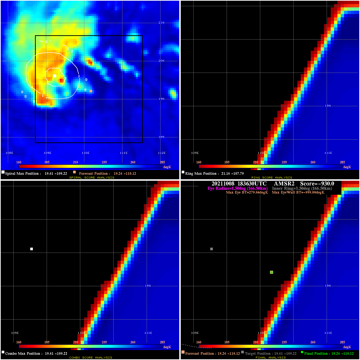
20211008 183630 -930.0 N/A N/A N/A 0.00 40.0 AMSR2 19.3 -110.1 19.3 -110.1 19.6 -109.2 Analysis Plot
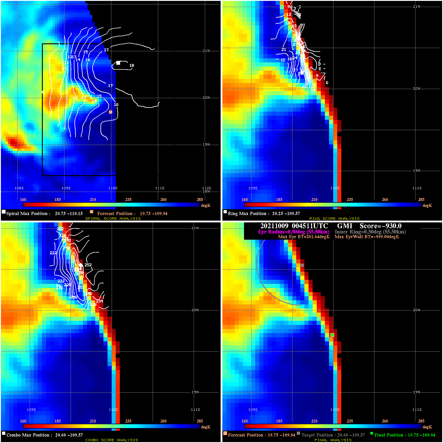
20211009 004511 -930.0 N/A N/A N/A 0.00 35.0 GMI 19.8 -109.9 19.8 -109.9 20.6 -109.6 Analysis Plot
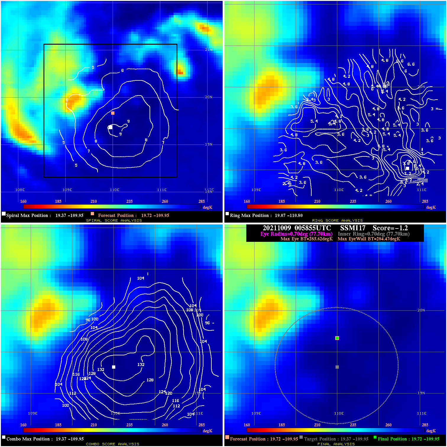
20211009 005855 -1.2 N/A 12.3% 155.54 1.15 35.0 SSMI17 19.7 -109.9 19.7 -109.9 19.4 -109.9 Analysis Plot
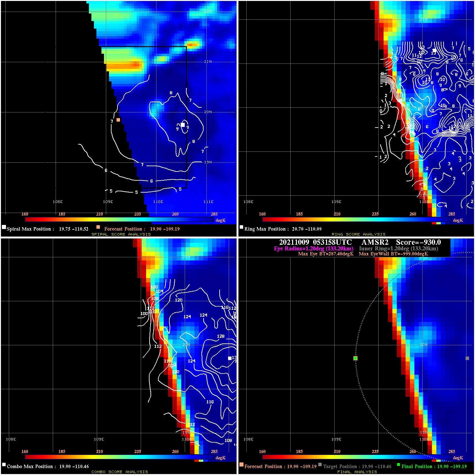
20211009 053158 -930.0 N/A N/A N/A 0.00 35.0 AMSR2 19.9 -109.2 19.9 -109.2 19.9 -110.5 Analysis Plot
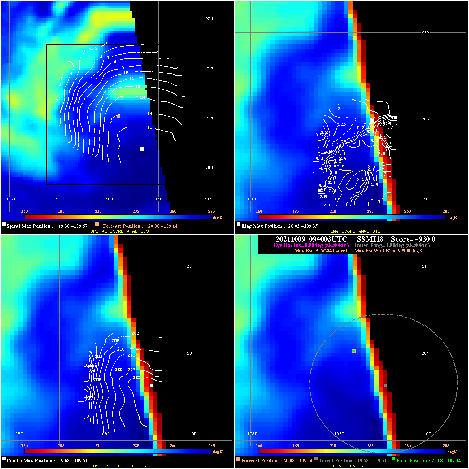
20211009 094003 -930.0 N/A N/A N/A 0.00 35.0 SSMI18 20.1 -109.1 20.1 -109.1 19.7 -109.5 Analysis Plot
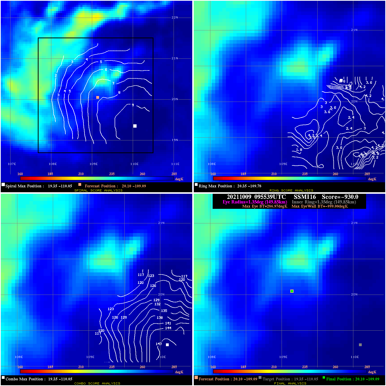
20211009 095539 -930.0 N/A N/A N/A 0.00 35.0 SSMI16 20.1 -109.1 20.1 -109.1 19.4 -110.1 Analysis Plot
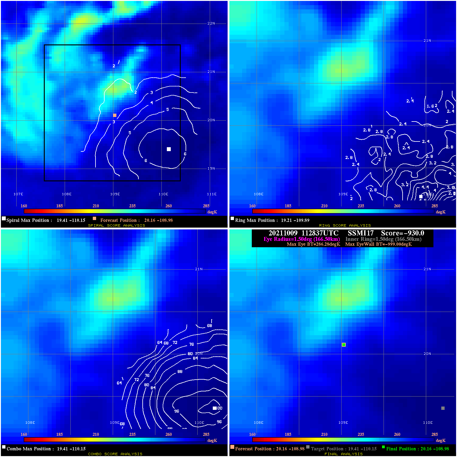
20211009 112837 -930.0 N/A N/A N/A 0.00 35.0 SSMI17 20.2 -109.0 20.2 -109.0 19.4 -110.2 Analysis Plot
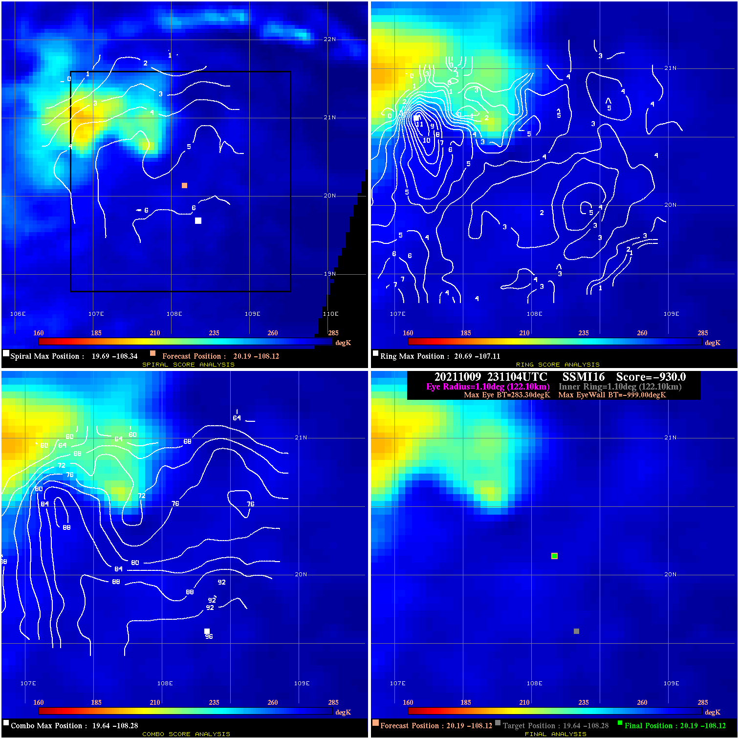
20211009 231104 -930.0 N/A N/A N/A 0.00 35.0 SSMI16 20.2 -108.1 20.2 -108.1 19.6 -108.3 Analysis Plot
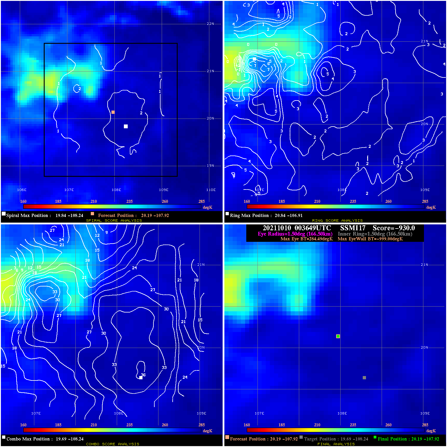
20211010 003649 -930.0 N/A N/A N/A 0.00 35.0 SSMI17 20.2 -107.9 20.2 -107.9 19.7 -108.2 Analysis Plot
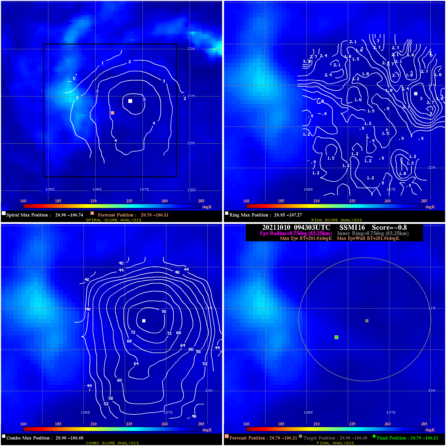
20211010 094303 -0.8 N/A N/A 166.65 .80 25.0 SSMI16 20.7 -106.3 20.7 -106.3 20.9 -106.7 Analysis Plot
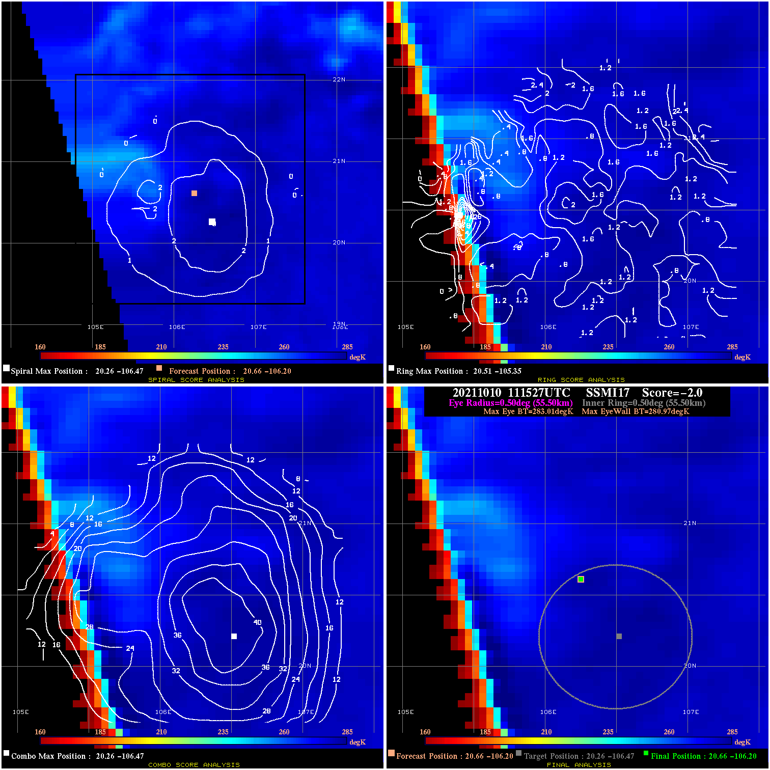
20211010 111527 -2.0 N/A N/A 111.10 2.04 25.0 SSMI17 20.7 -106.2 20.7 -106.2 20.3 -106.5 Analysis Plot
20211010 230016 N/A N/A N/A N/A N/A 25.0 SSMI16 20.3 -105.2 20.3 -105.2 20.0 -104.3 Analysis Plot
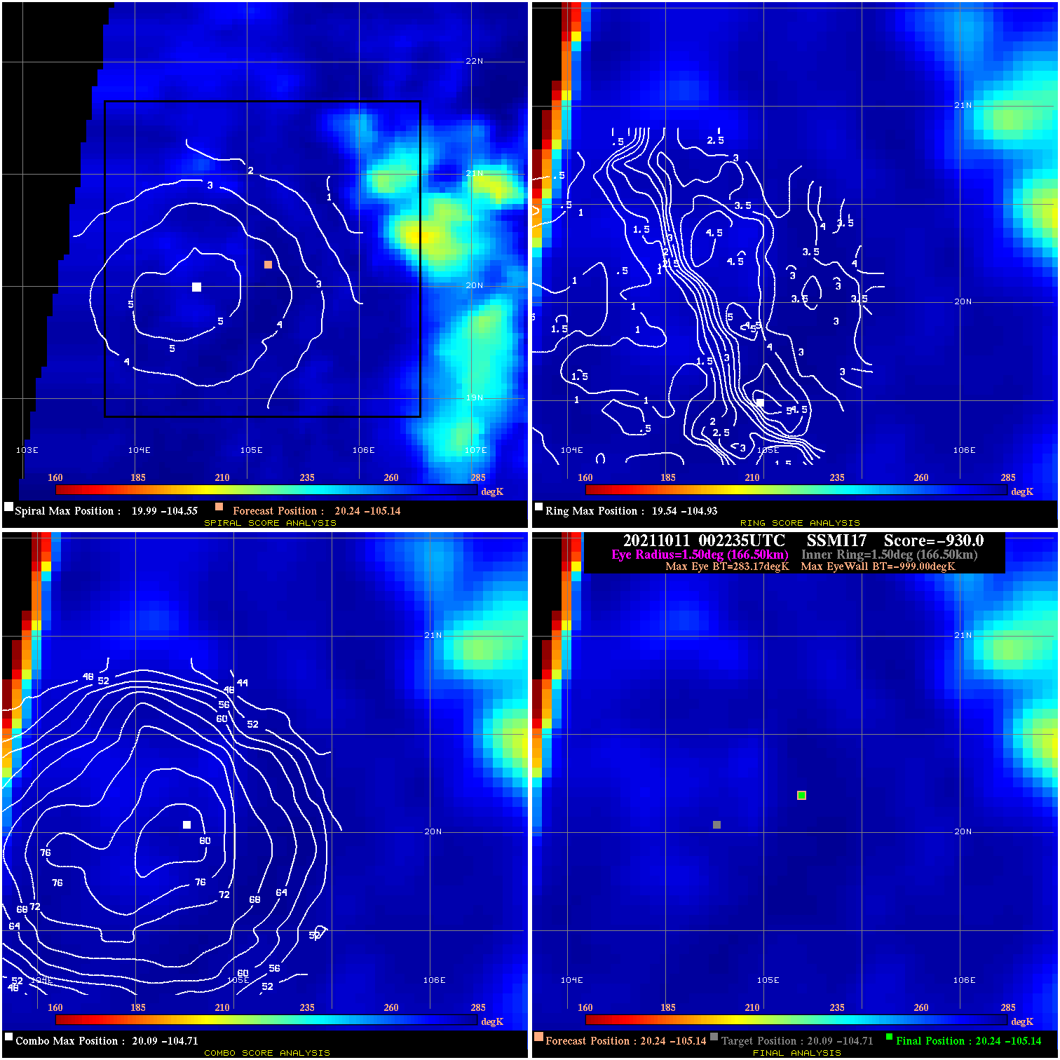
20211011 002235 -930.0 N/A N/A N/A 0.00 25.0 SSMI17 20.2 -105.1 20.2 -105.1 20.1 -104.7 Analysis Plot
|
|
Legend: - Date/Time are determined from PMW imagery at Forecast (initial guess) Lat/Lon position. - Positive/Negative Latitude = North/South Hemisphere; Longitude = Western/Eastern Hemisphere. - "Ring Diam" value indicates the estimated surface eyewall diameter in km (the MI eyewall edge diameter minus 10 km). - "Ring Pct" is the percentage of the "ring" (eyewall inner boundary) that is 1) colder than the "hot spot" (warmest eye pixel) in the eye by 20K, or 2) the percentage that is a) colder than 232K and b) colder than the "hot spot" by 10K, whichever is greater. - Values are red if Ring % <= 65, yellow/brown if Ring % <= 85 and green if Ring % > 85. - "Tb diff" is the difference between the "hot spot" (warmest eye pixel) and the warmest pixel on the eyewall. - Intensity score are listed as negative, and not used, when the JTWC or NHC estimated Vmax is <55 kts in order to rule out weak but highly symmetric TCs. - Error messages in intensity scores: -920 is used when the hottest pixel in the eye is <200K, to prevent false positives; -930 means <85% of eyewall has observations/data. |