|
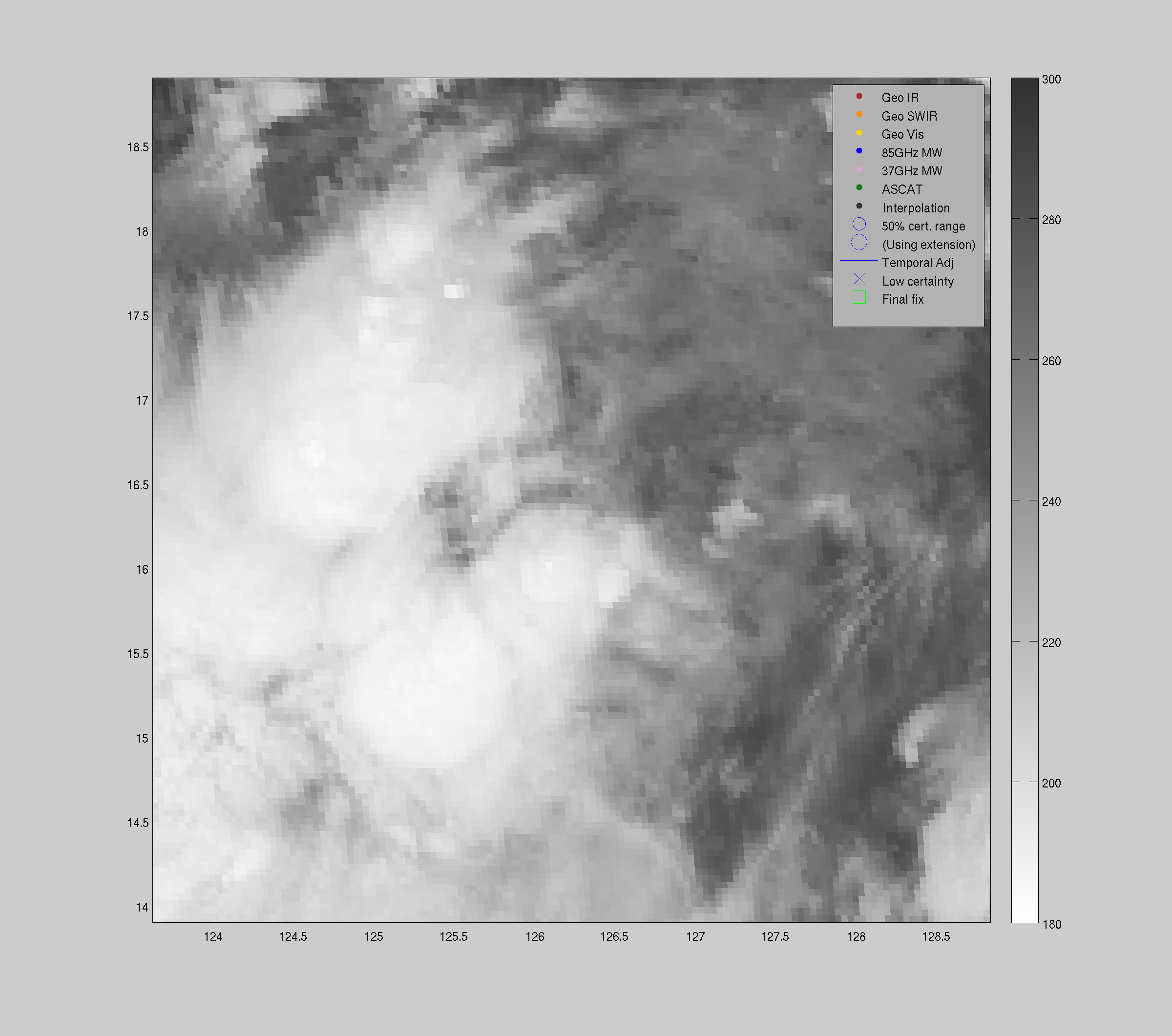
| Geo IR |
85-92GHz |
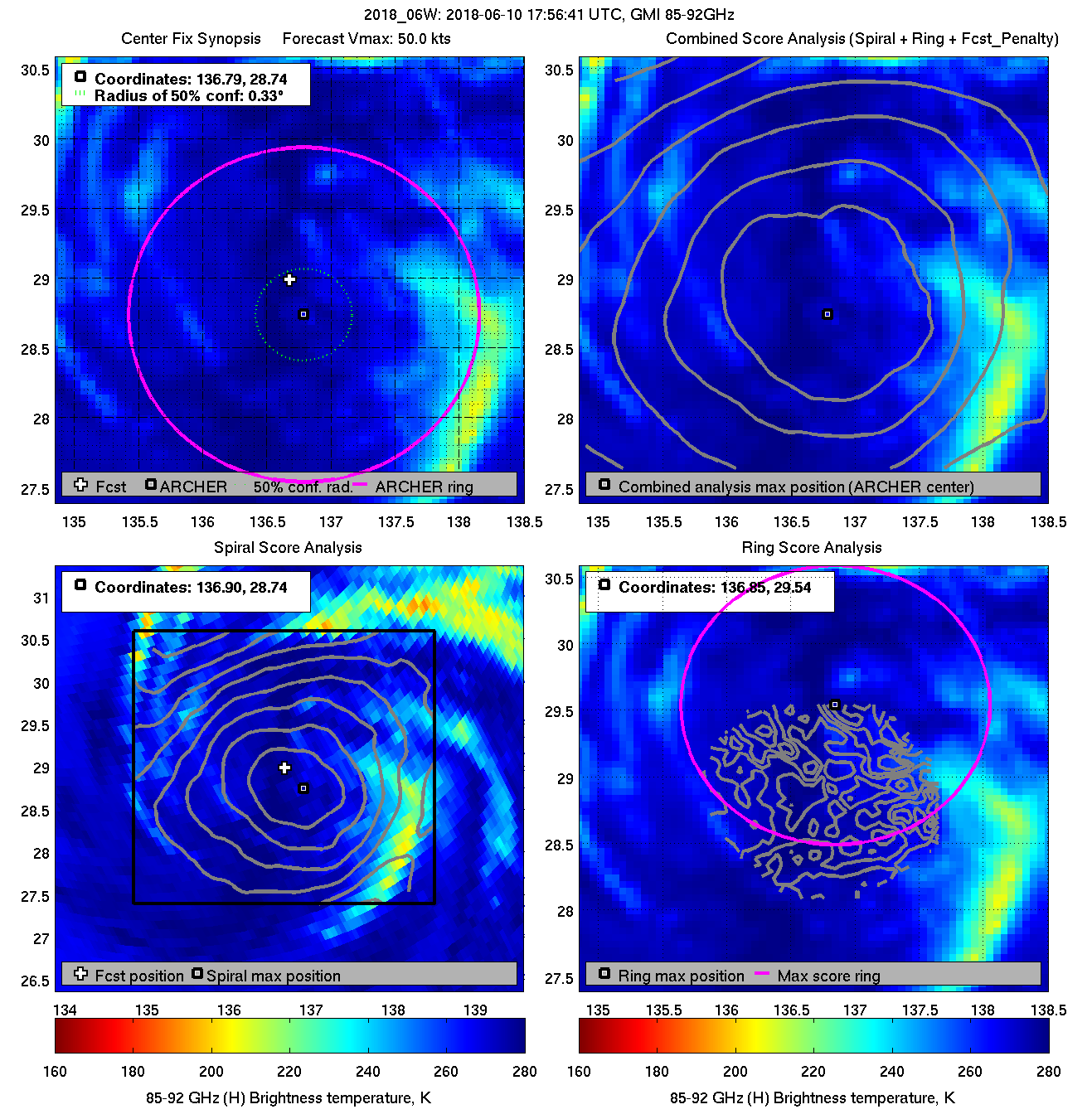
| Date/Time_(UTC) |
Source |
Sensor |
Vmax(kts) |
ARCHER Lat |
Lon |
Geo-ref Lat |
Lon |
50% cert. rad. |
95% cert. rad. |
Eye diam (deg) |
% cert. of eye |
|
|
|
|
 |
 |
|
|
|
 |
 |
|
|
|
 |
 |
|
|
|
 |
 |
|
|
|
 |
 |
|
|
|
 |
 |
|
|
|
 |
 |
|
|
|
 |
 |
|
|
|
 |
 |
|
|
|
 |
 |
|
|
|
 |
 |
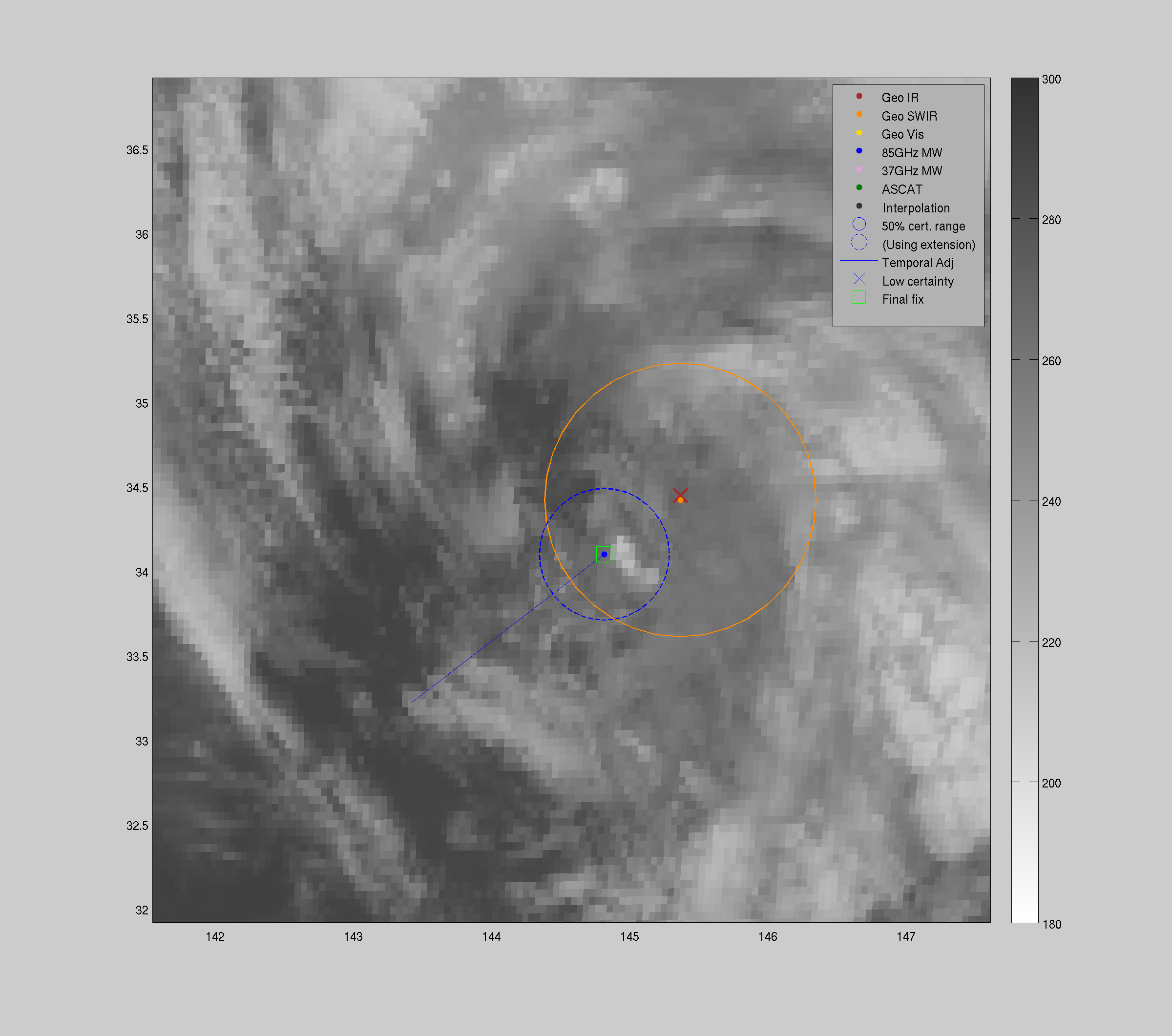
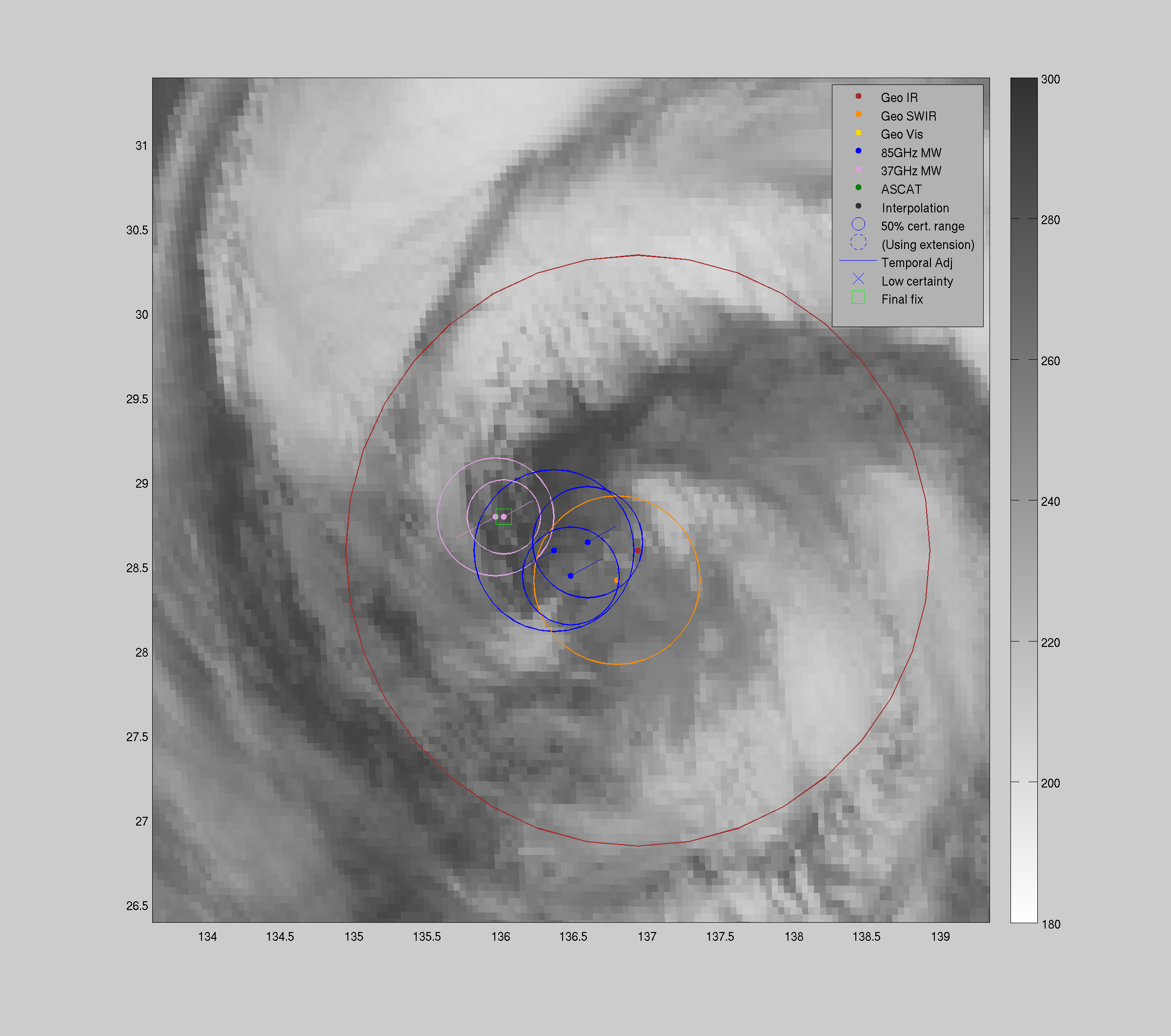
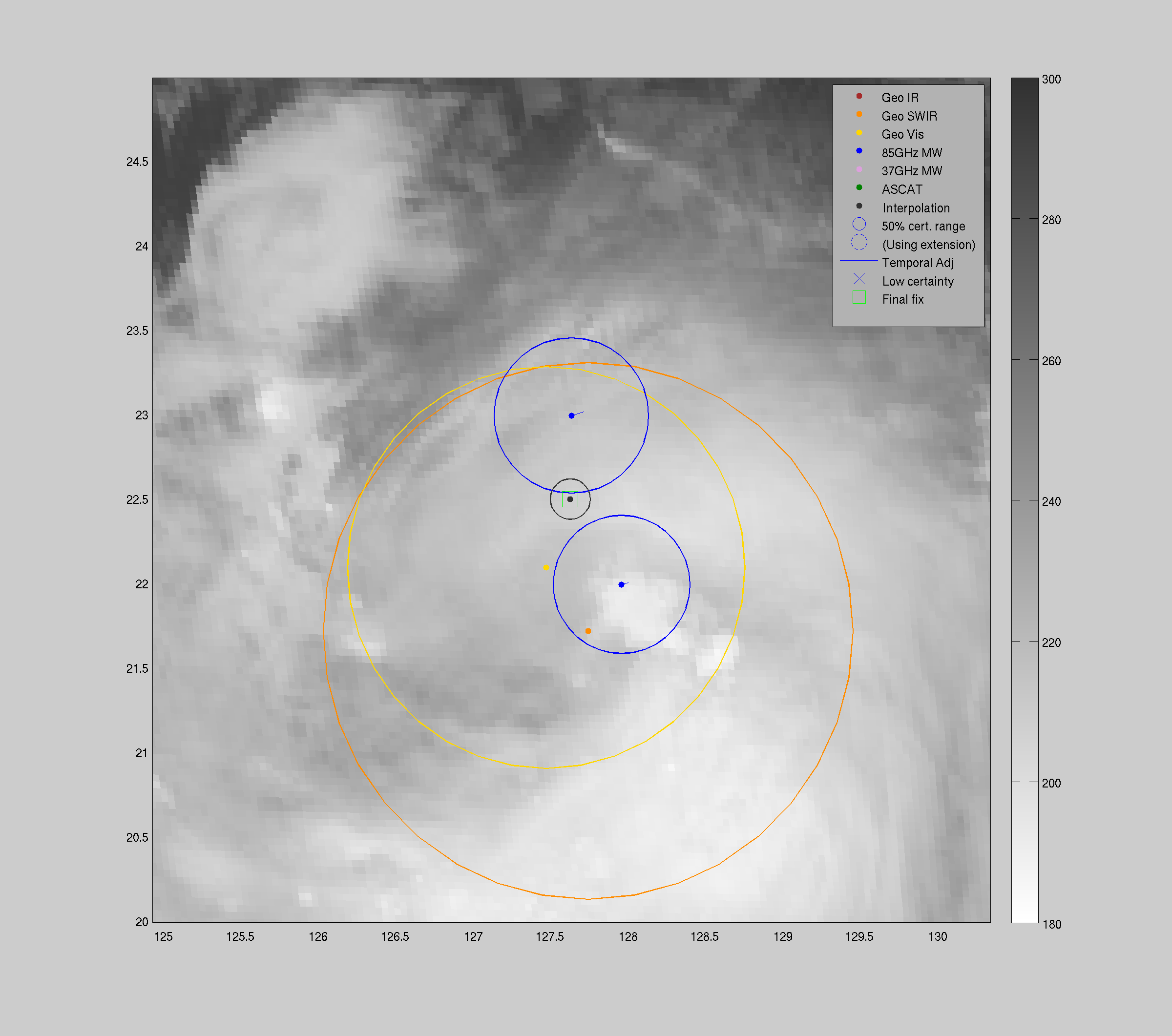
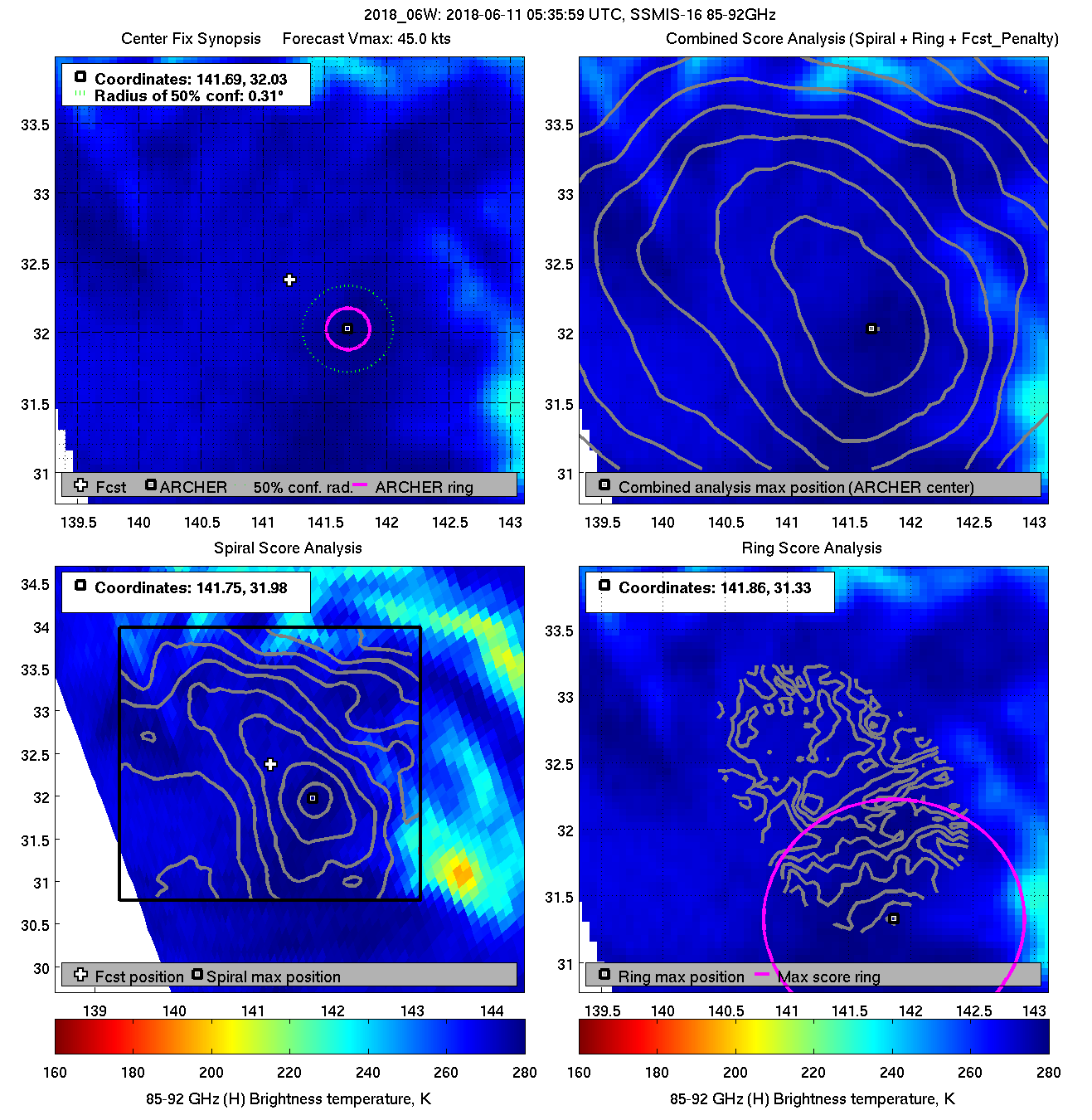
| 20180611 05:35:59 |
SSMIS-16 |
85-92GHz |
45.0 |
32.08 |
141.63 |
32.04 |
141.58 |
0.31 |
0.89 |
5.00 |
5.0 |
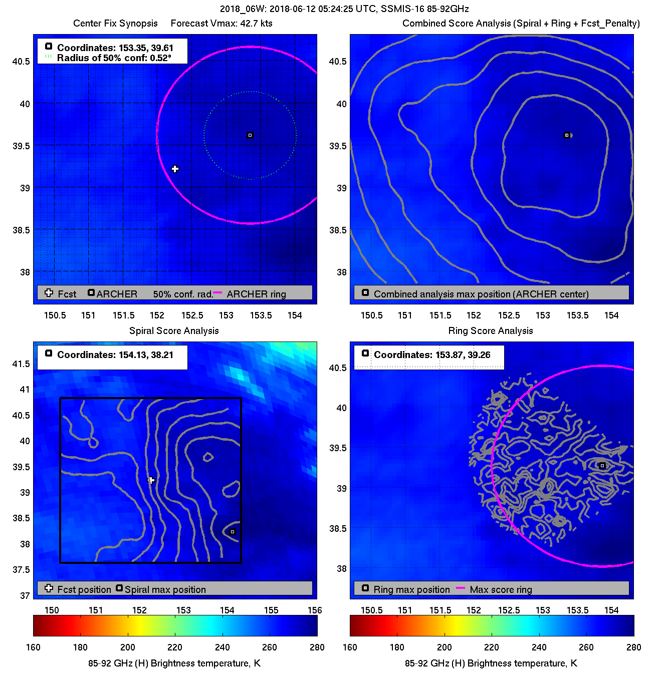
| 20180611 05:17:18 |
SSMI-15 |
85-92GHz |
45.0 |
31.98 |
141.48 |
32.05 |
141.58 |
0.45 |
1.28 |
4.80 |
1.2 |
|
|
|
 |
 |
|
|
|
 |
 |
|
|
|
 |
 |
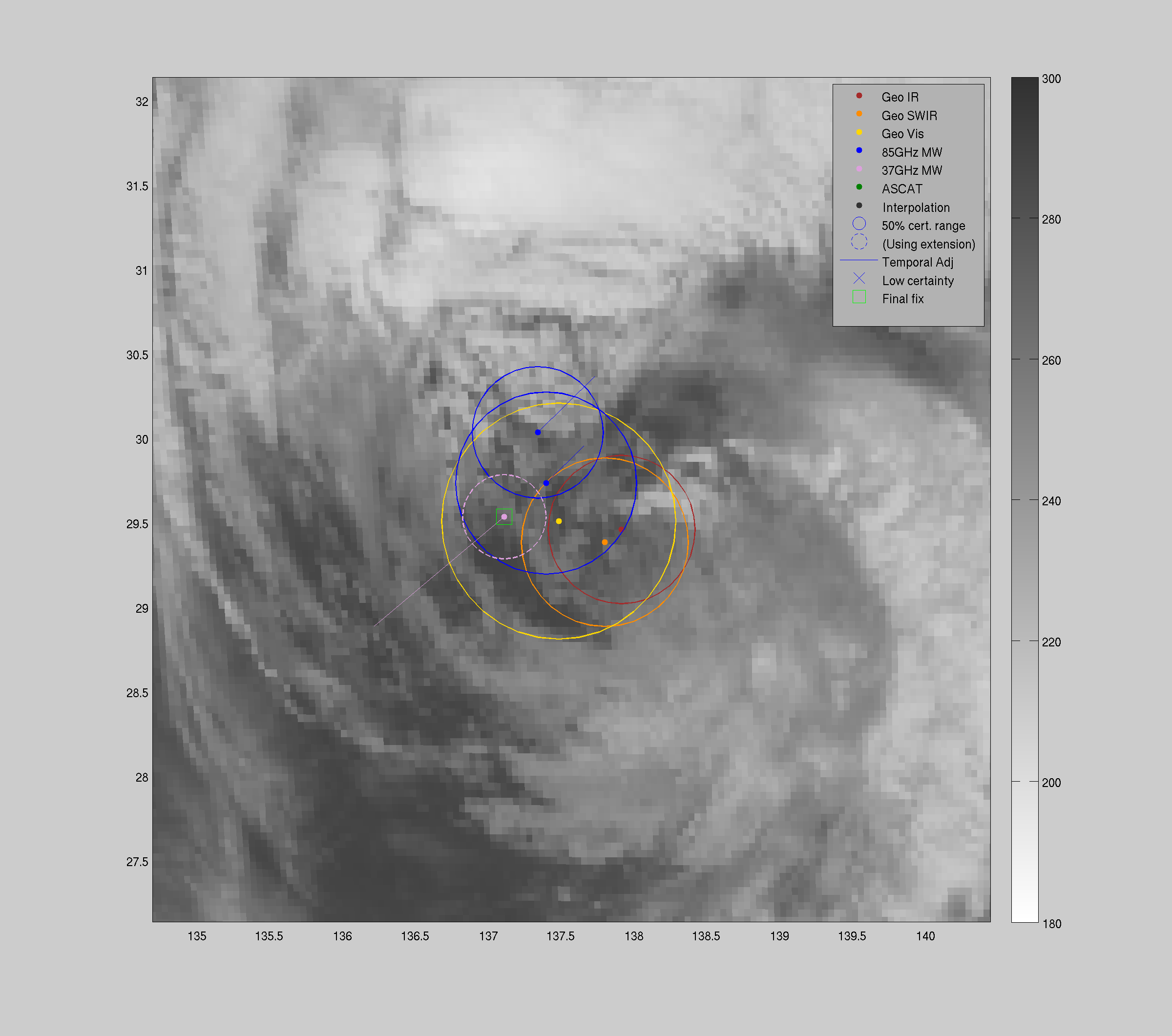
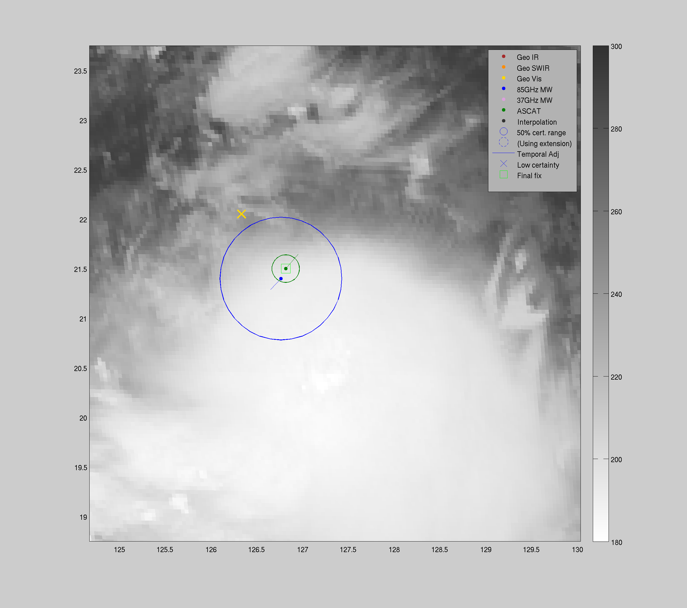
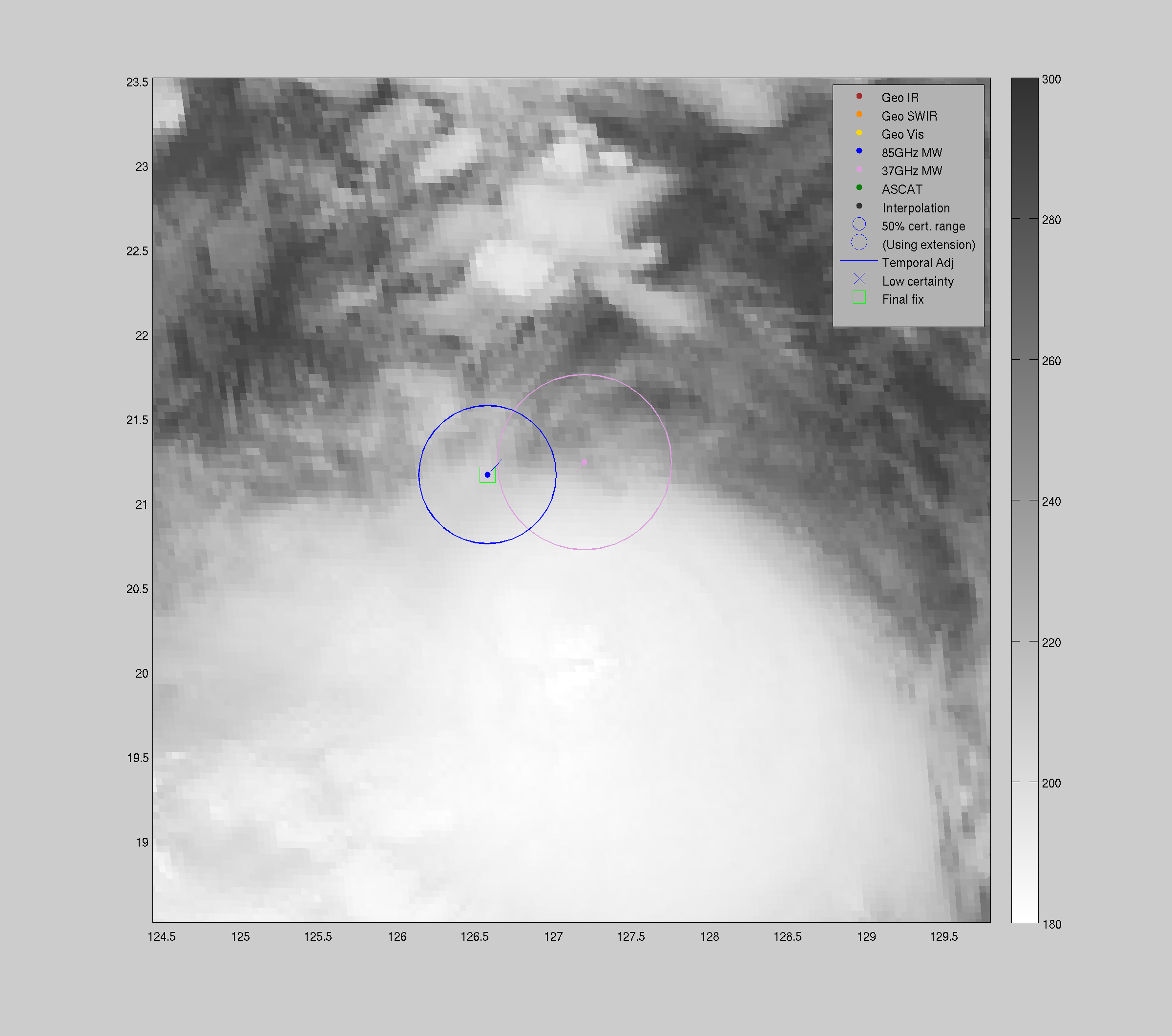
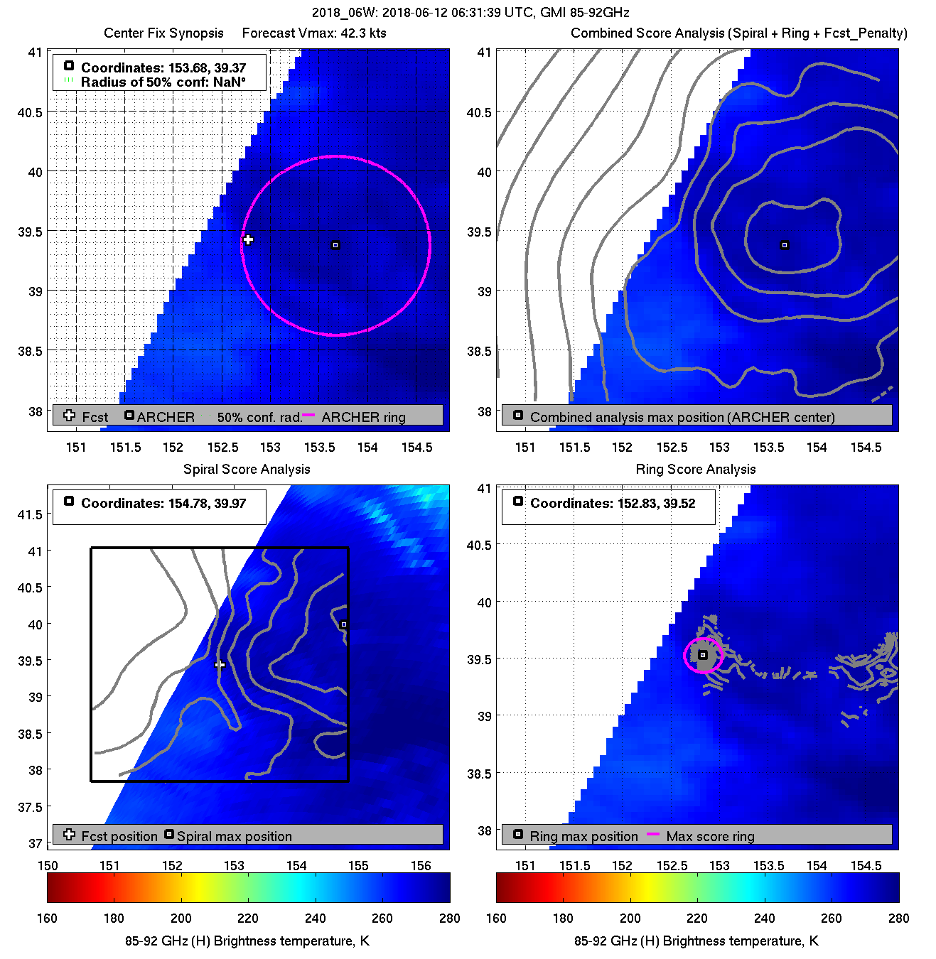
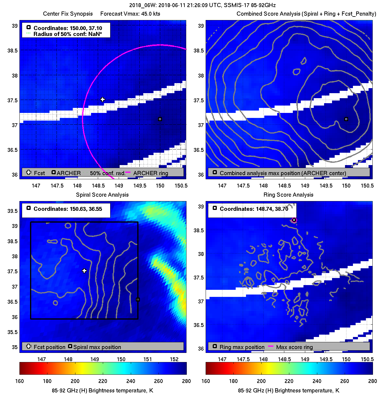
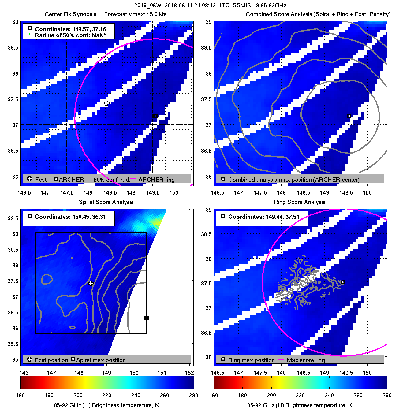
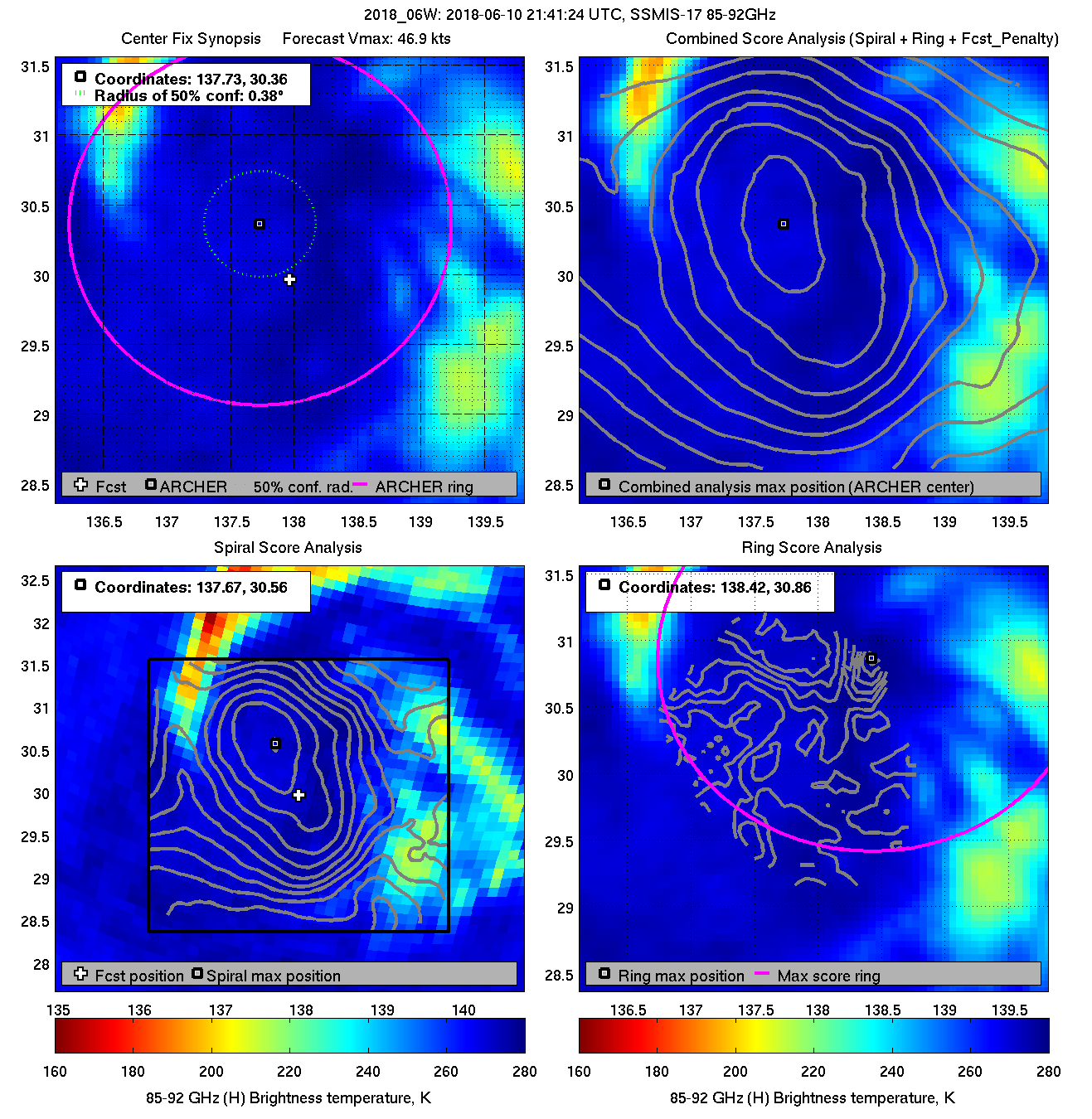
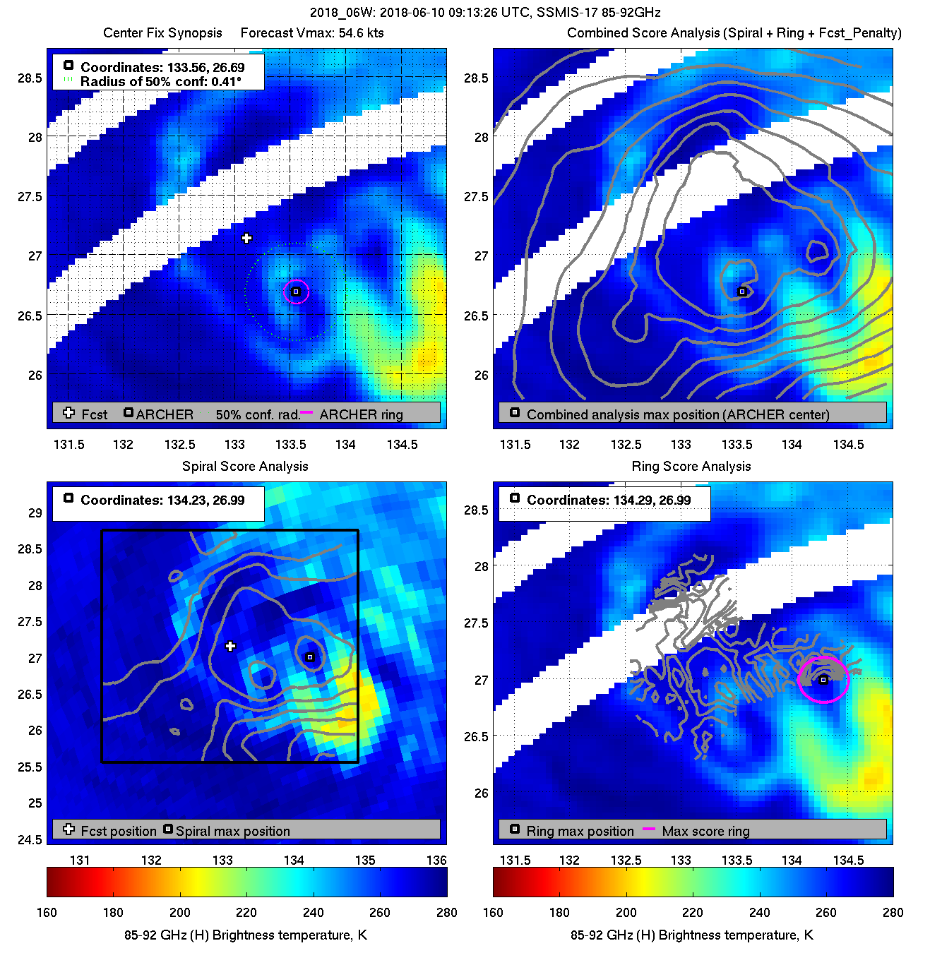
| 20180610 21:41:24 |
SSMIS-17 |
85-92GHz |
46.9 |
30.31 |
137.73 |
29.99 |
137.34 |
0.38 |
1.08 |
2.60 |
3.6 |
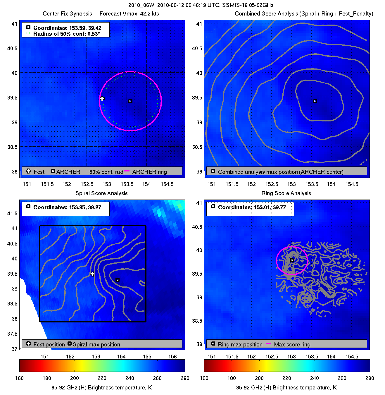
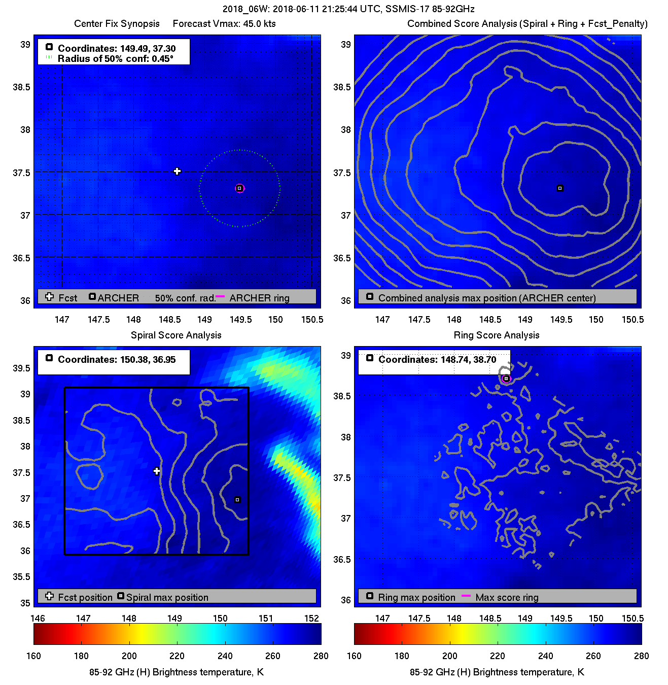
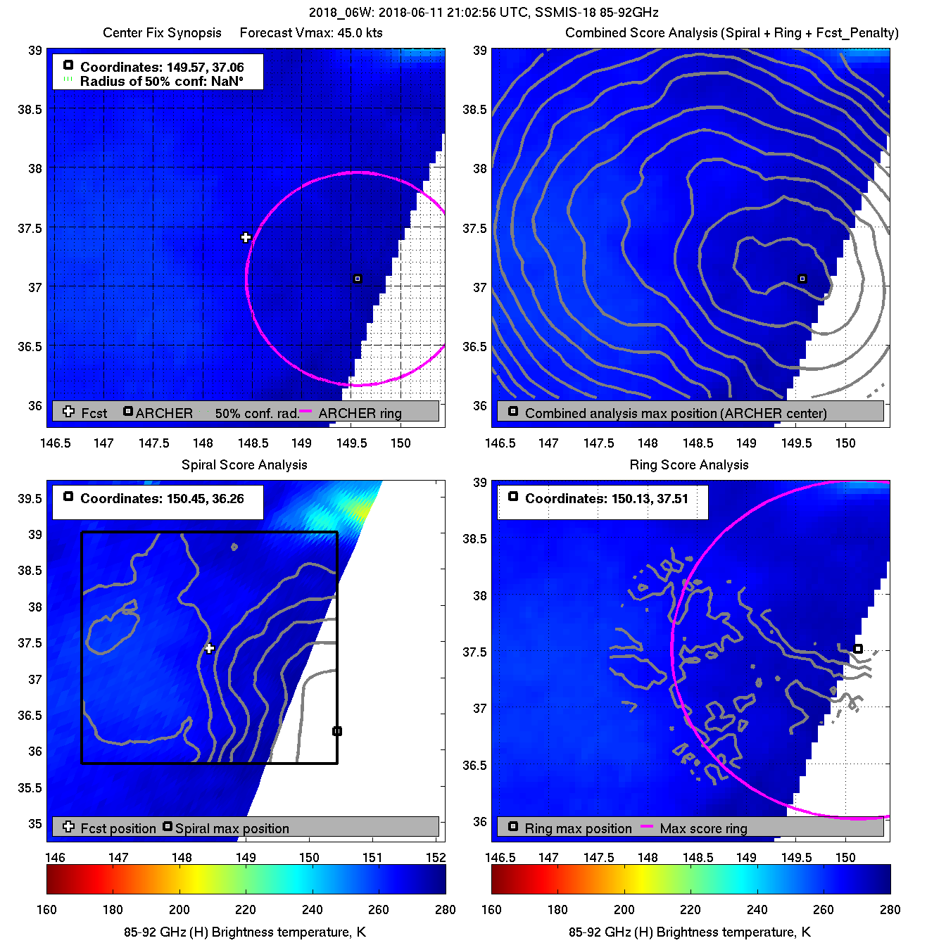
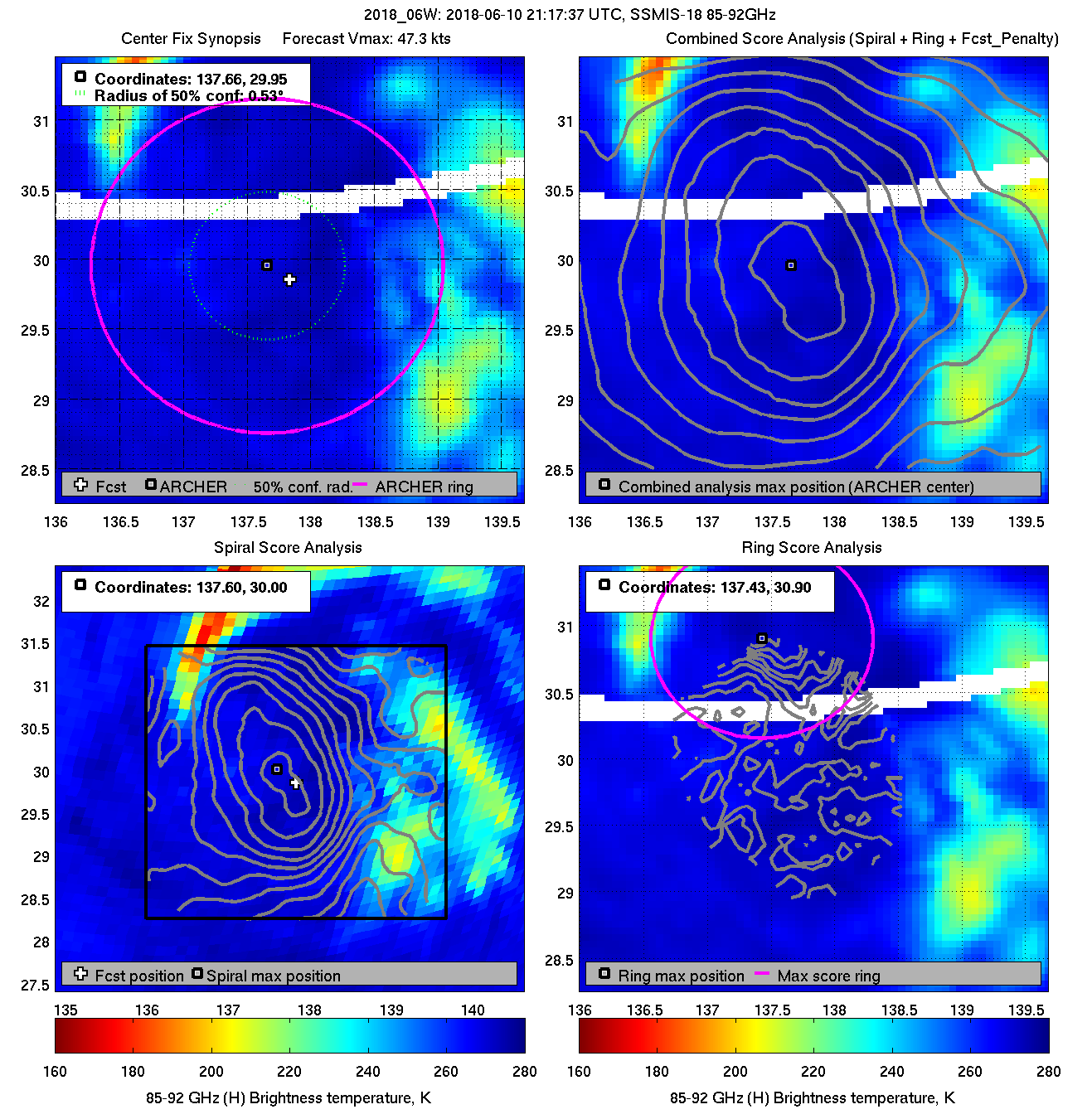
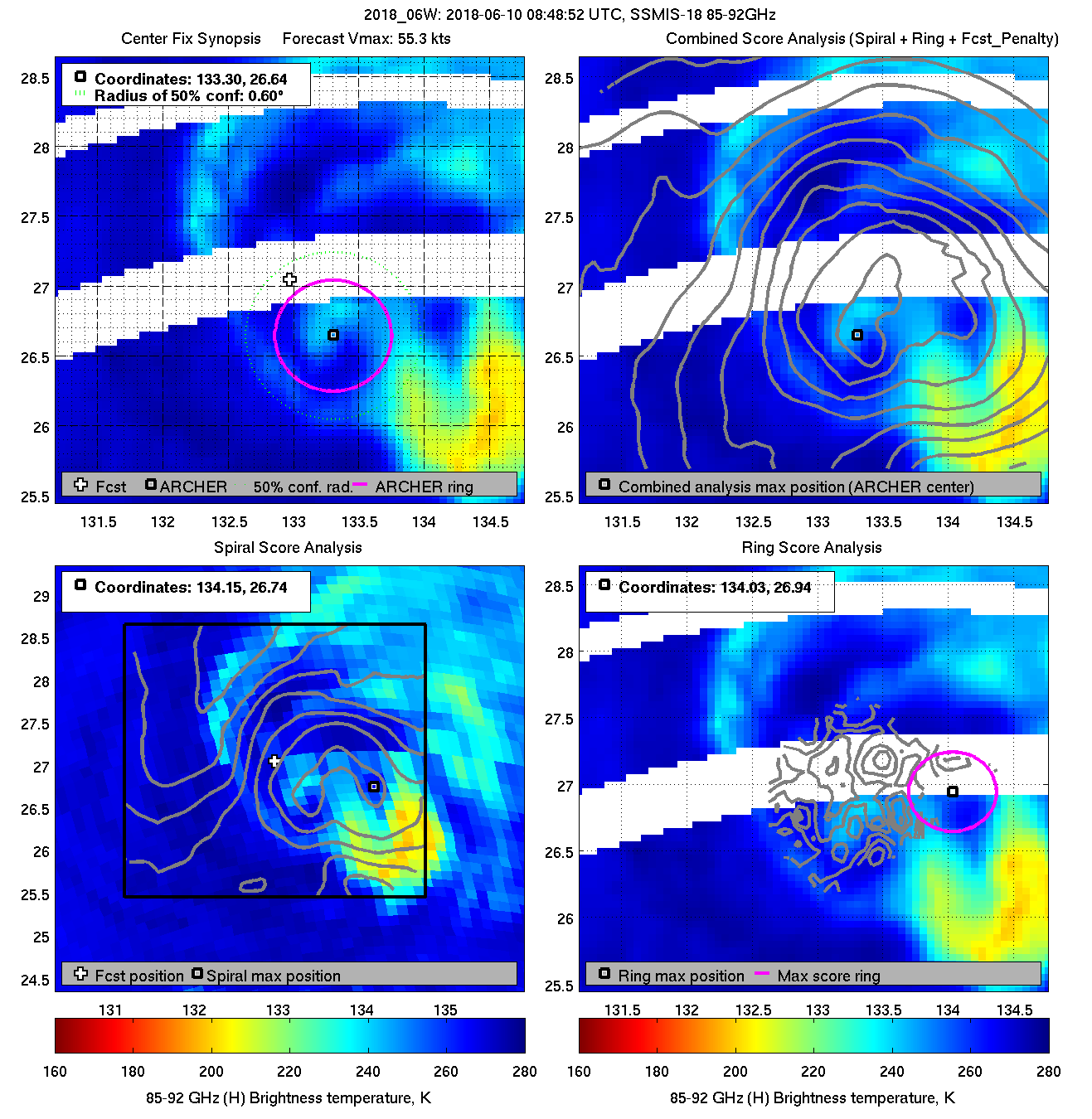
| 20180610 21:17:37 |
SSMIS-18 |
85-92GHz |
47.3 |
29.95 |
137.66 |
29.74 |
137.40 |
0.45 |
1.27 |
2.40 |
2.4 |
|
|
|
 |
 |
|
|
|
 |
 |
|
|
|
 |
 |
|
|
|
 |
 |
|
|
|
 |
 |
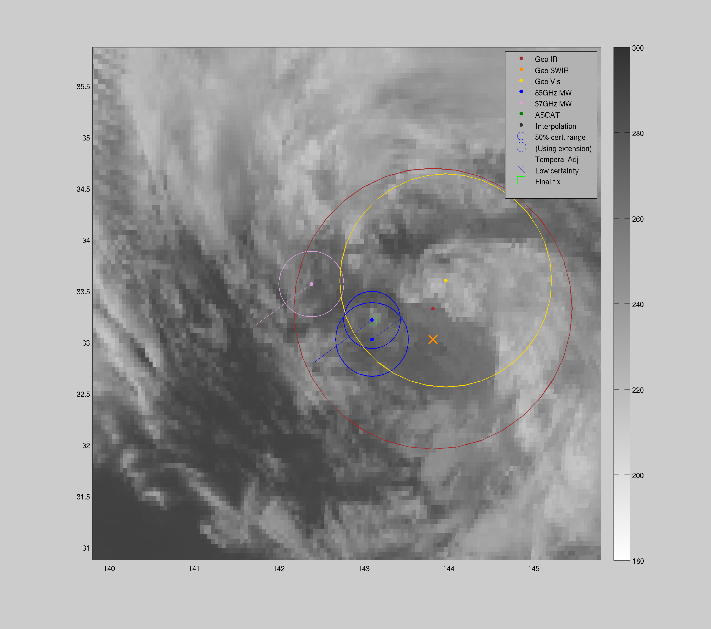
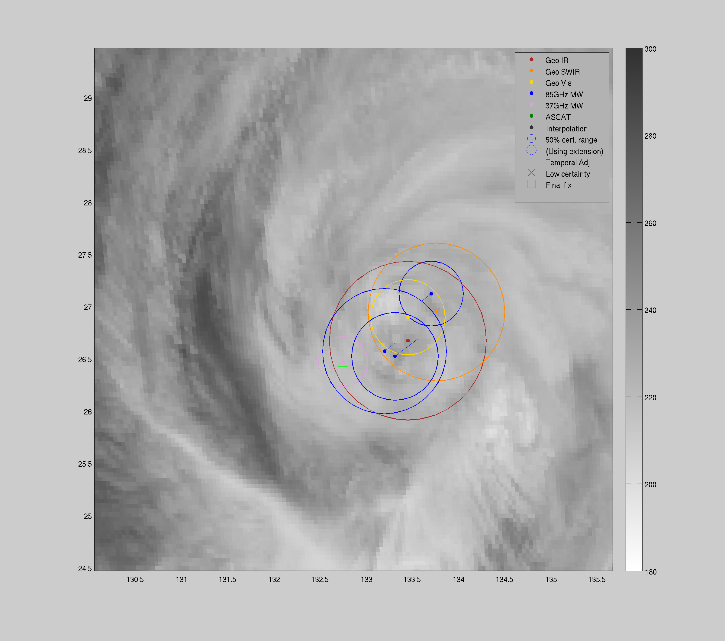
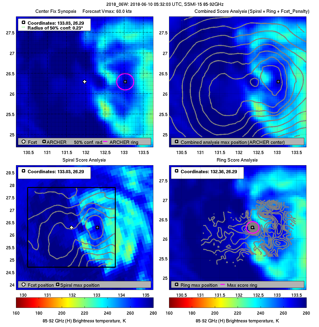
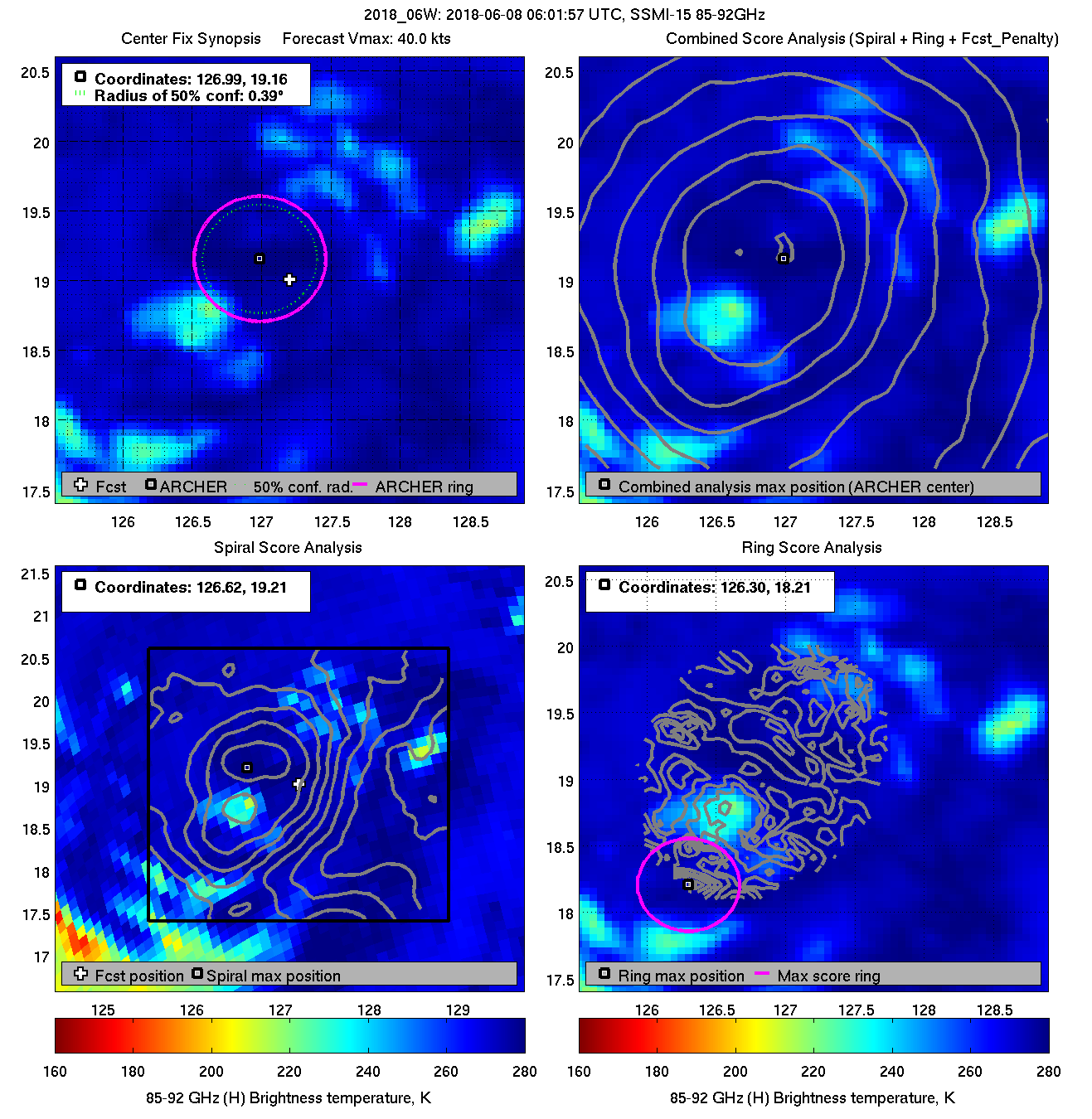
| 20180610 05:32:03 * |
SSMI-15 |
85-92GHz |
60.0 |
26.29 |
133.03 |
26.28 |
133.02 |
0.23 |
0.66 |
0.40 |
30.3 |
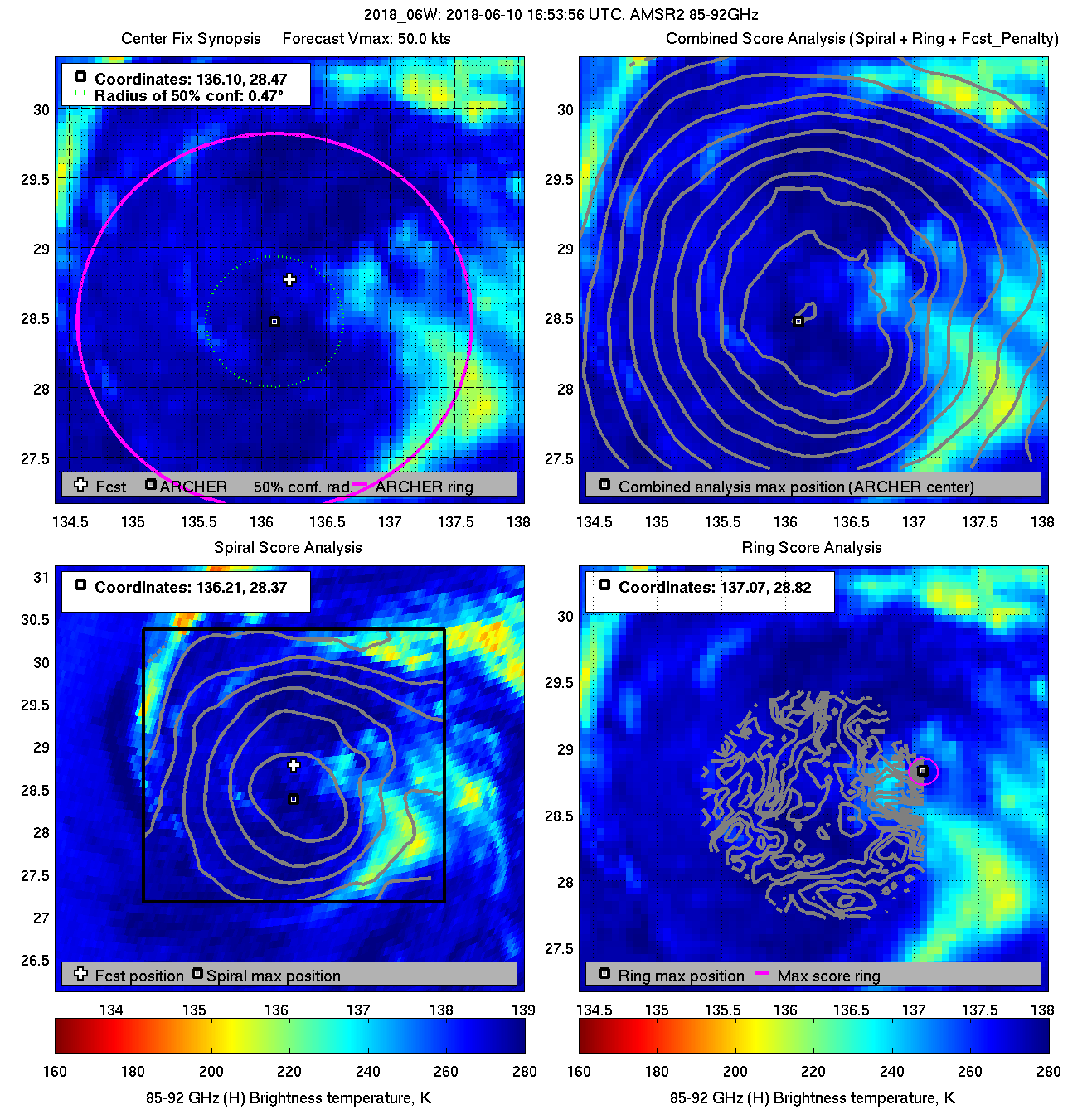
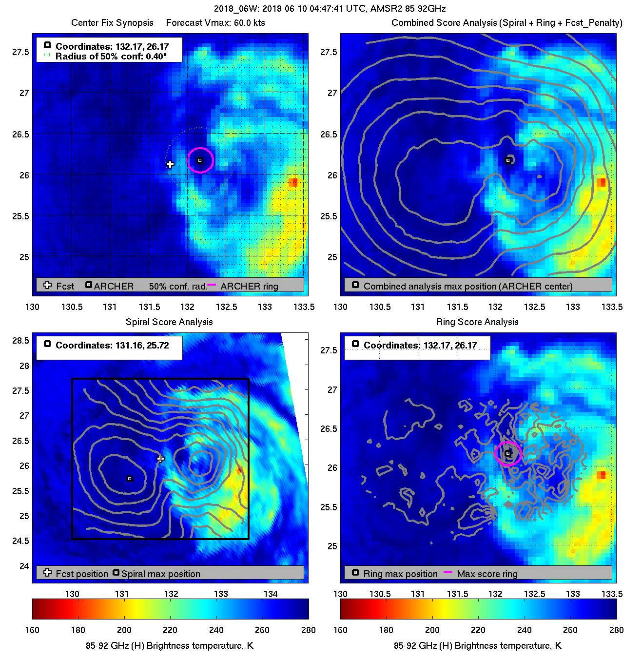
| 20180610 04:47:41 |
AMSR2 |
85-92GHz |
60.0 |
26.17 |
132.17 |
26.33 |
132.34 |
0.45 |
1.28 |
0.30 |
8.2 |
|
|
|
 |
 |
|
|
|
 |
 |
|
|
|
 |
 |
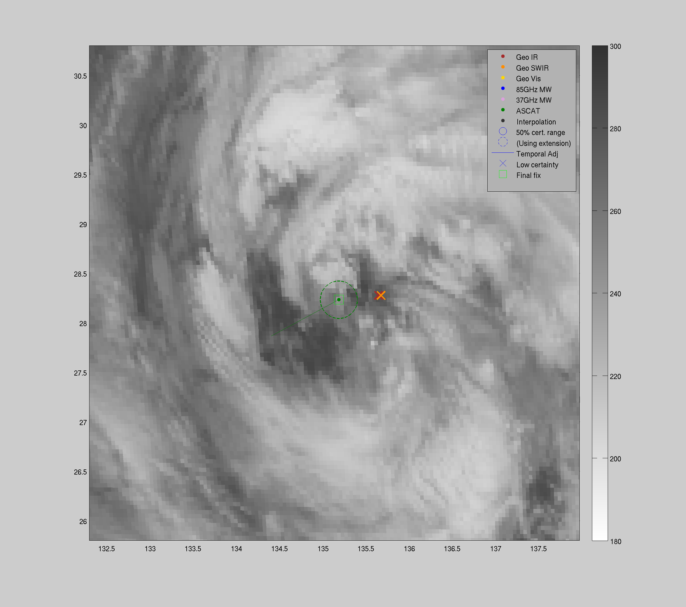
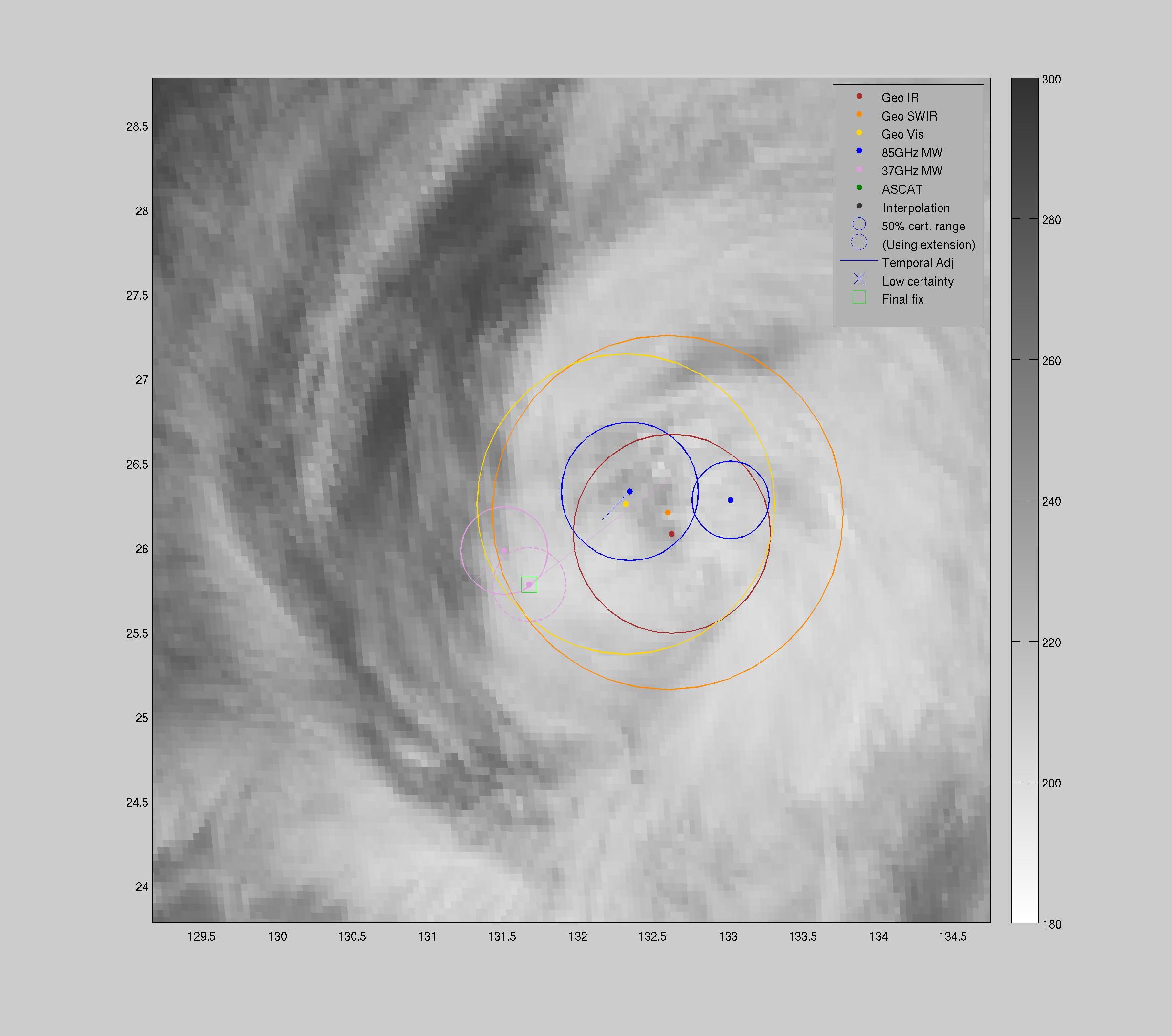
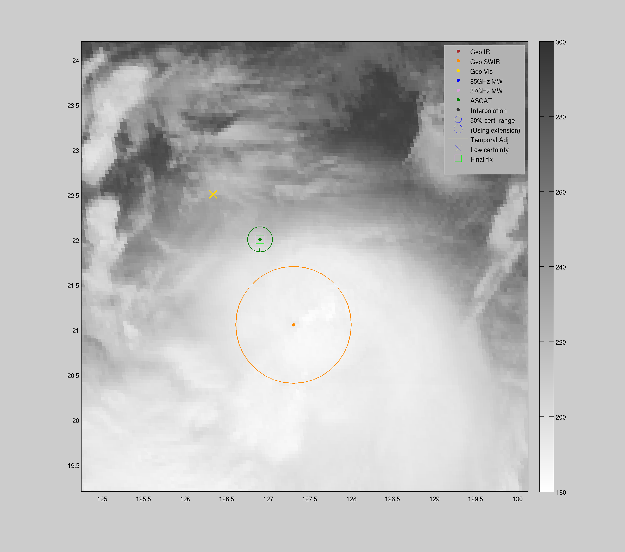
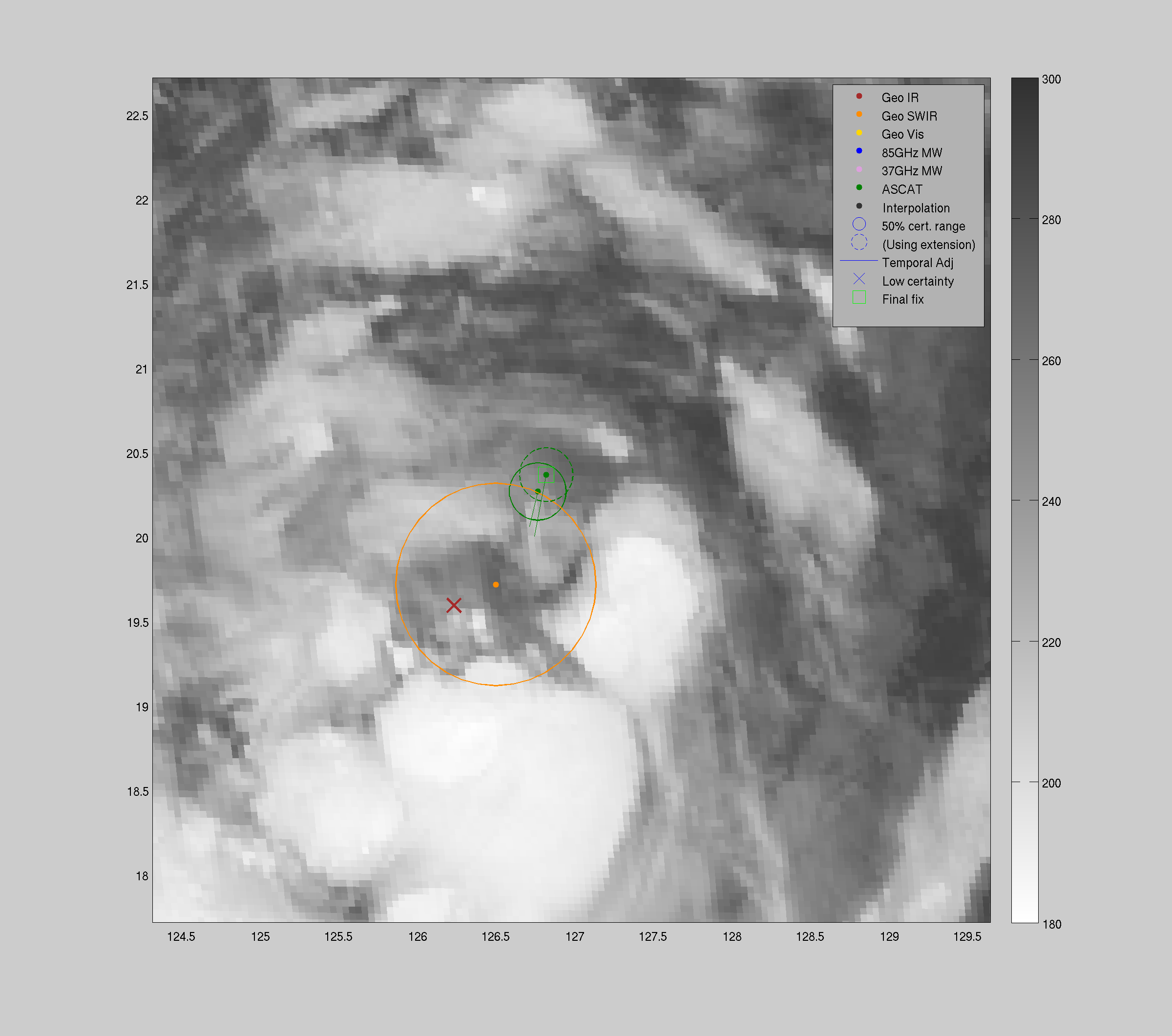
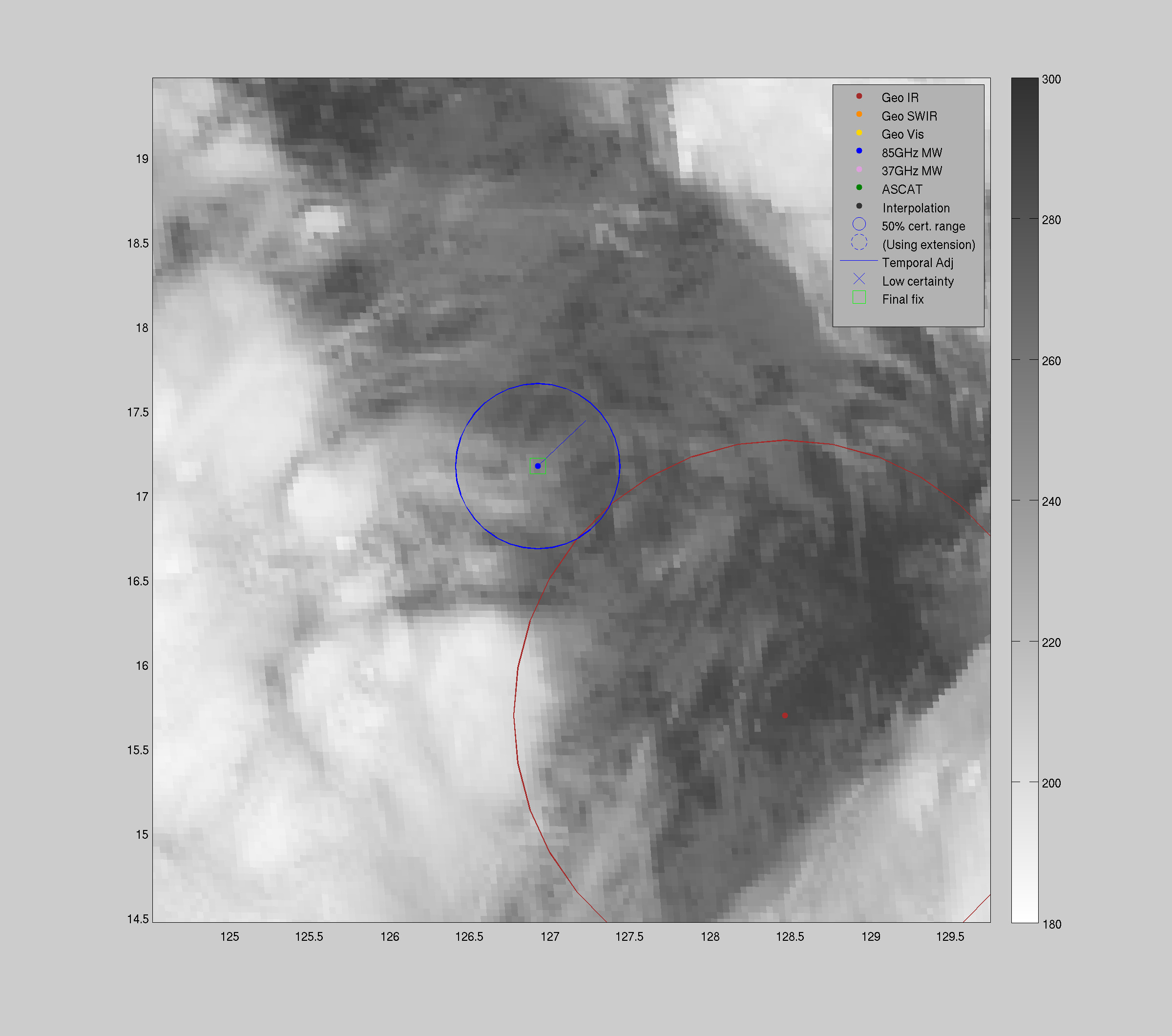
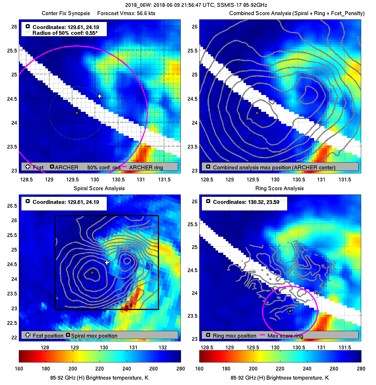
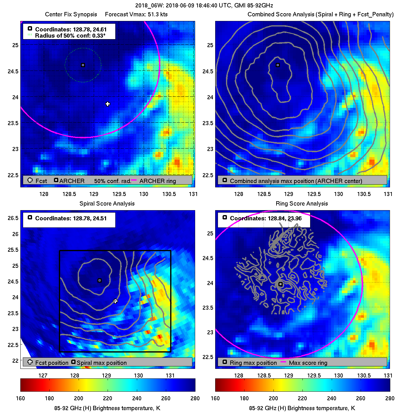
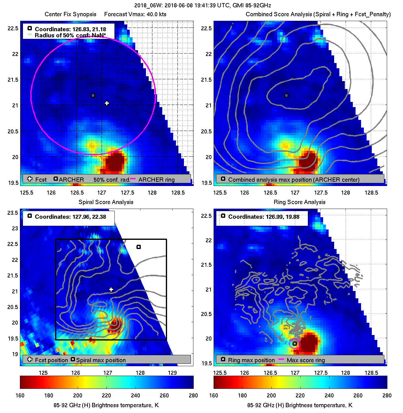
| 20180609 21:56:47 |
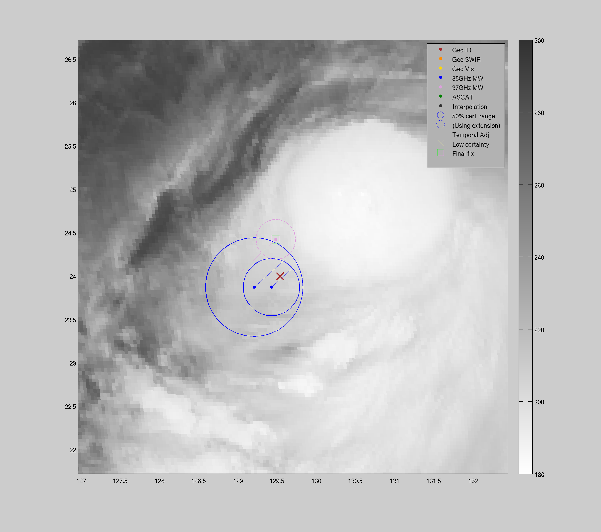
SSMIS-17 |
85-92GHz |
56.6 |
24.54 |
130.81 |
24.22 |
130.40 |
0.38 |
1.07 |
0.70 |
9.6 |
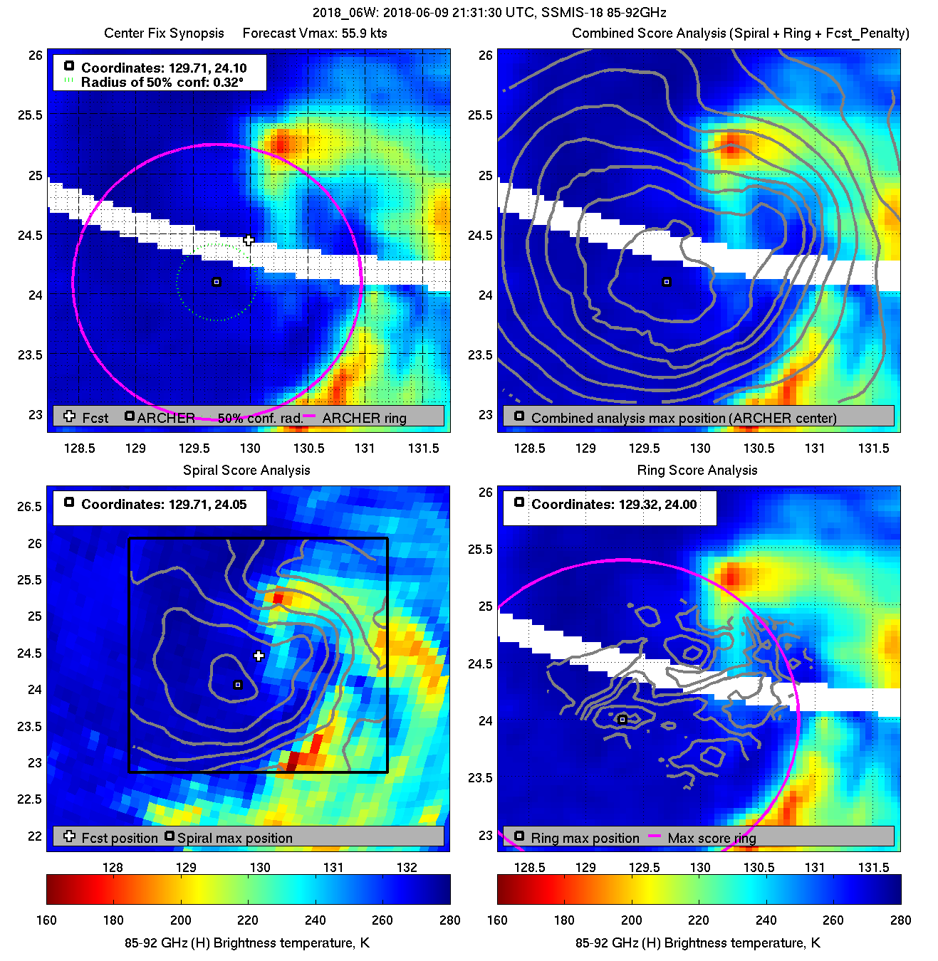
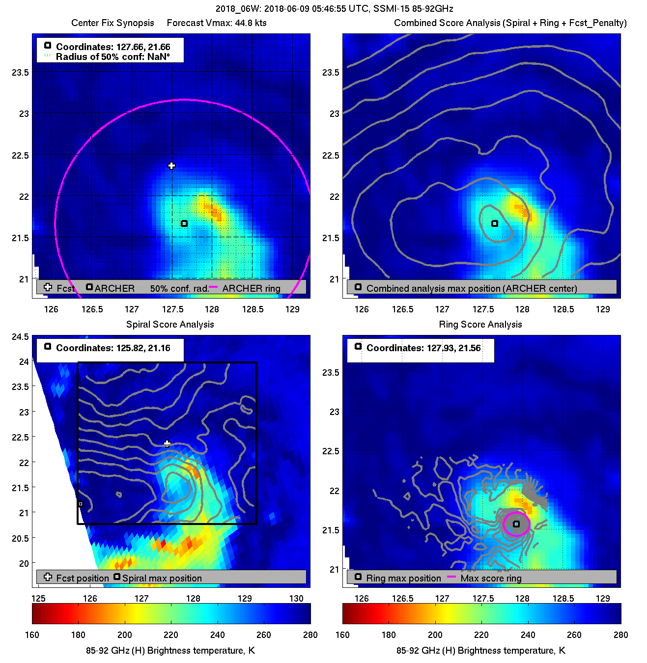
| 20180609 21:31:30 |
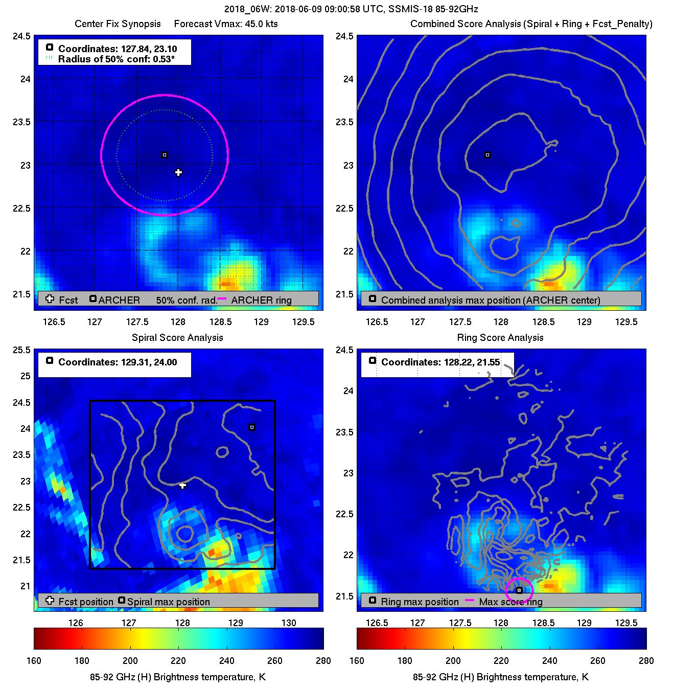
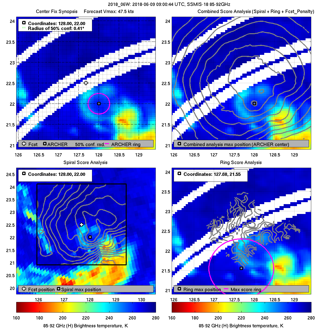
SSMIS-18 |
85-92GHz |
55.9 |
24.15 |
129.82 |
23.92 |
129.53 |
0.48 |
1.36 |
2.20 |
4.1 |
|
|
|
 |
 |
|
|
|
 |
 |
|
|
|
 |
 |
|
|
|
 |
 |
|
|
|
 |
 |
|
|
|
 |
 |
|
|
|
 |
 |
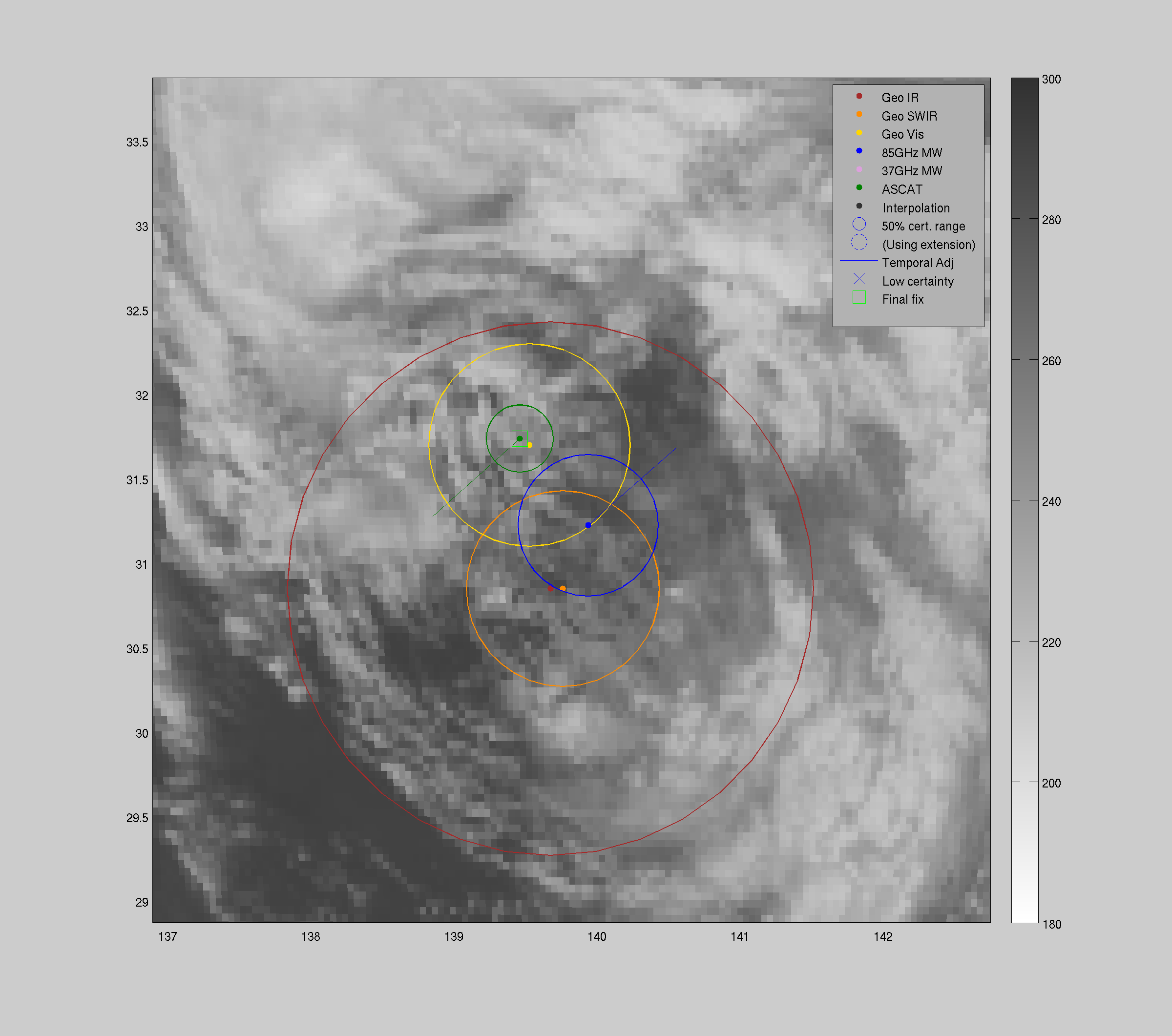
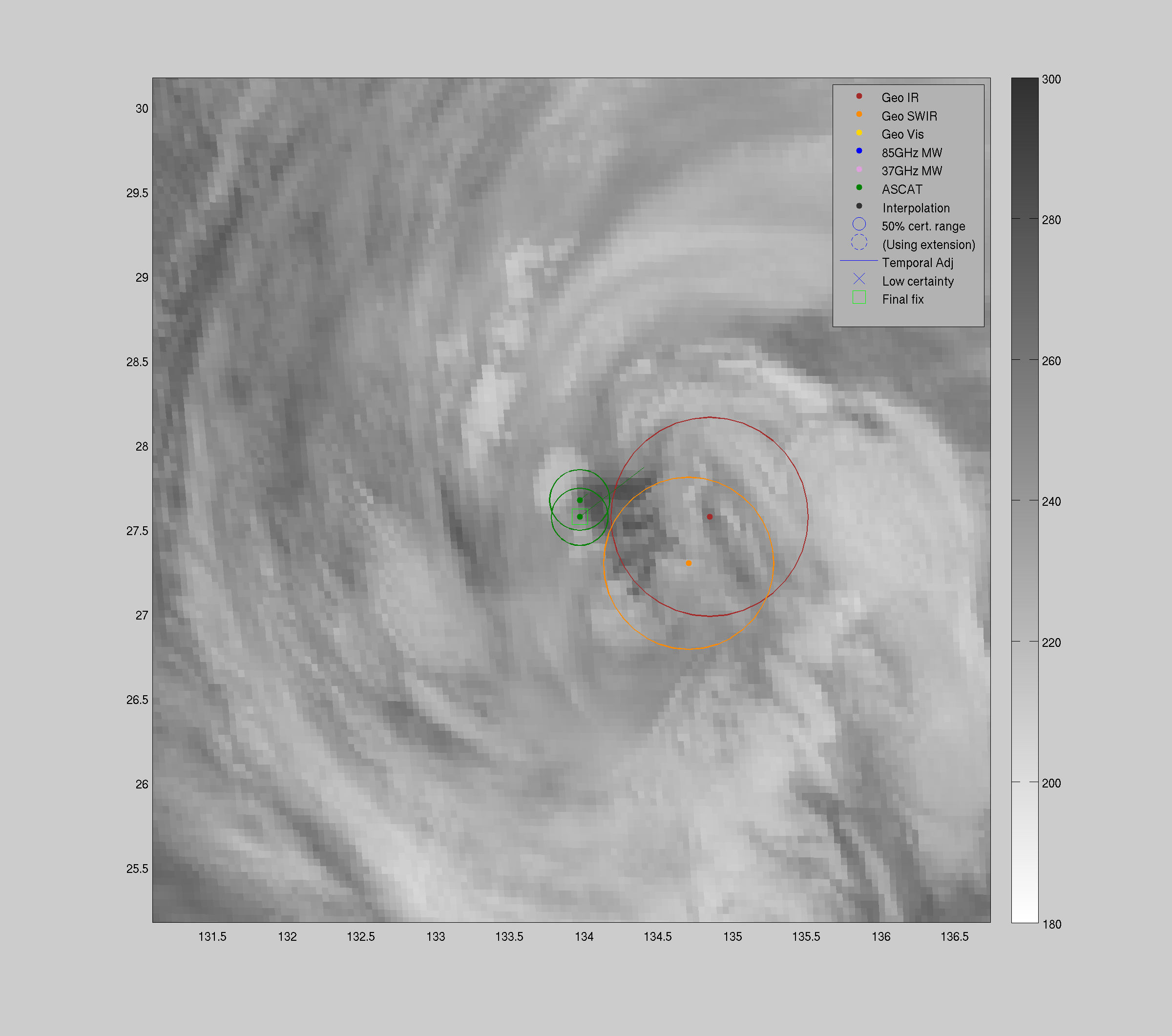
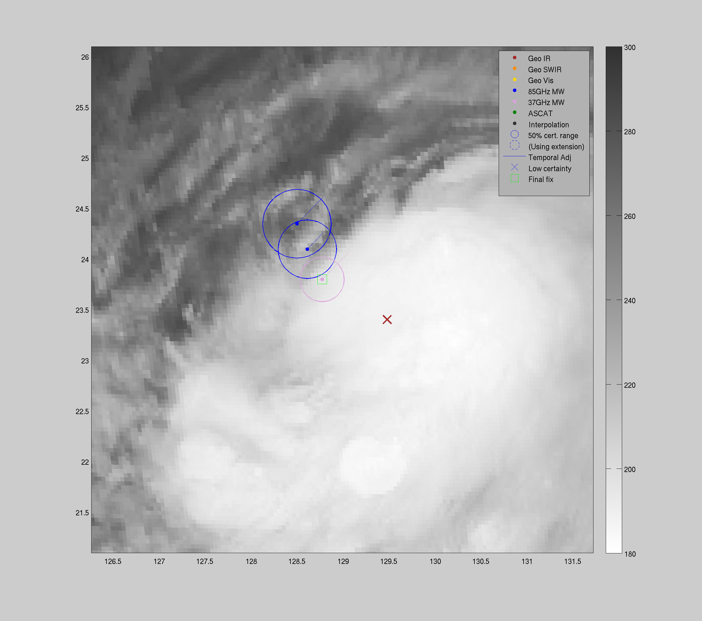
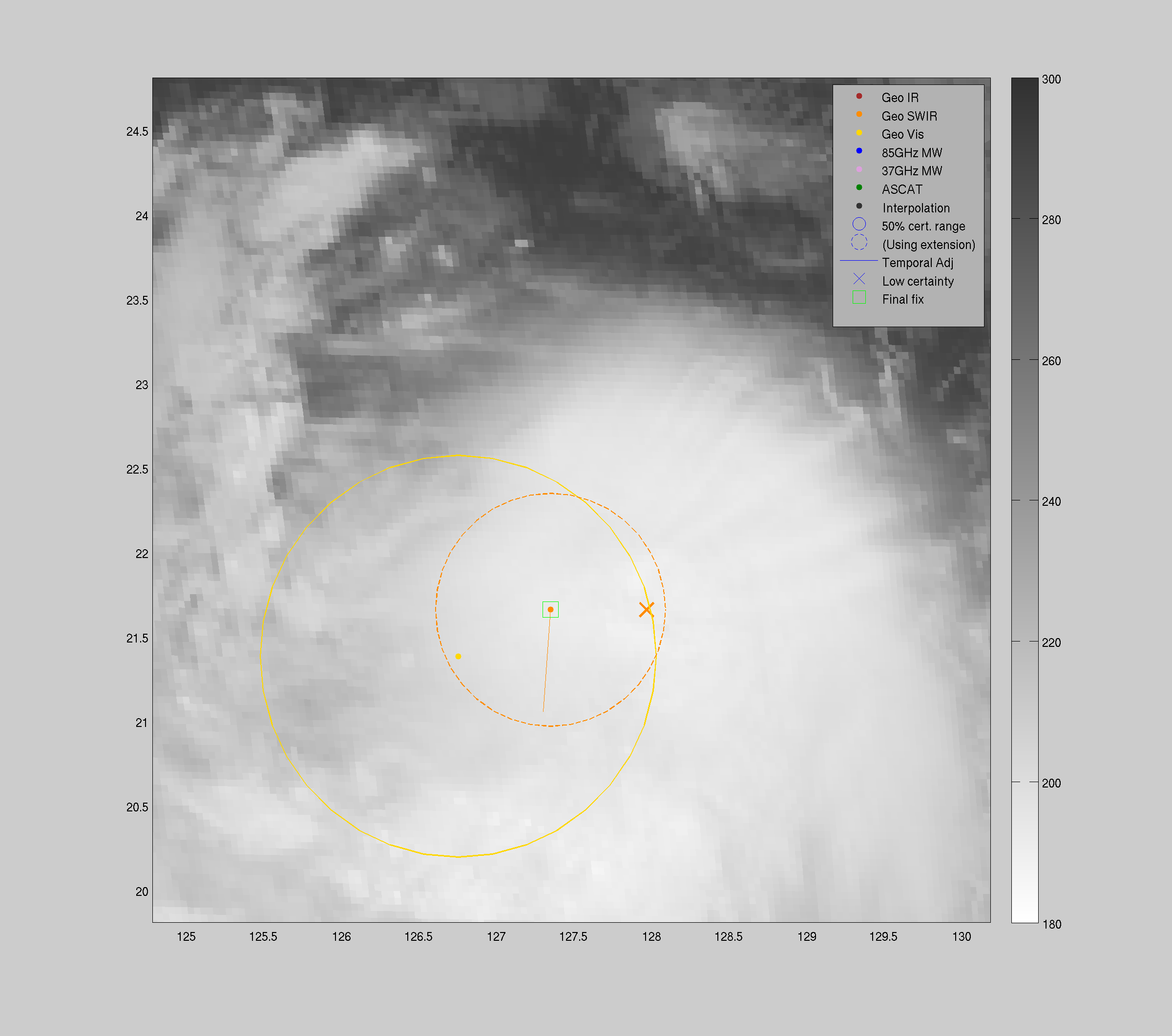
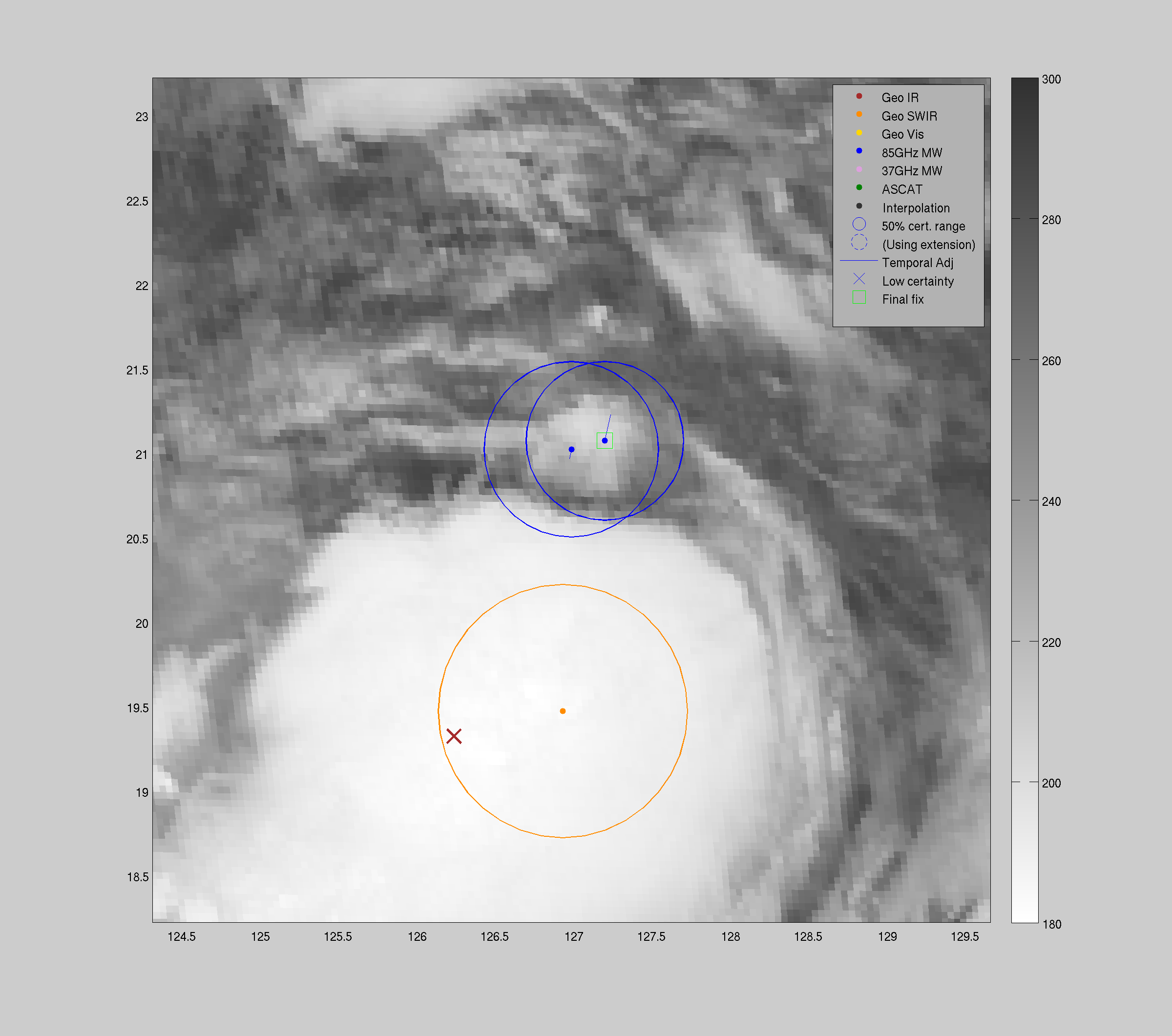
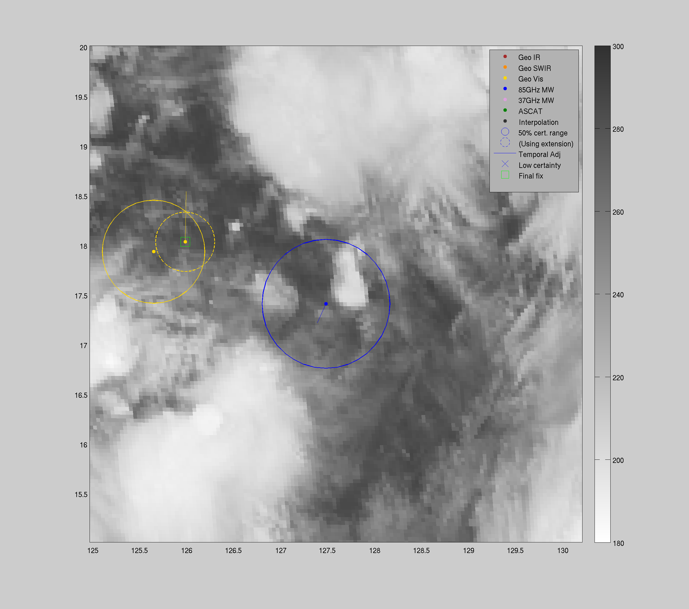
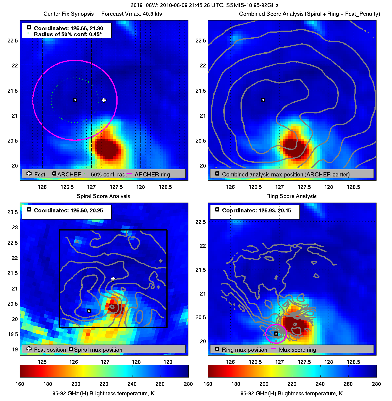
| 20180608 22:11:15 |
SSMIS-17 |
85-92GHz |
41.3 |
21.90 |
127.44 |
22.01 |
127.53 |
0.55 |
1.57 |
2.60 |
1.1 |
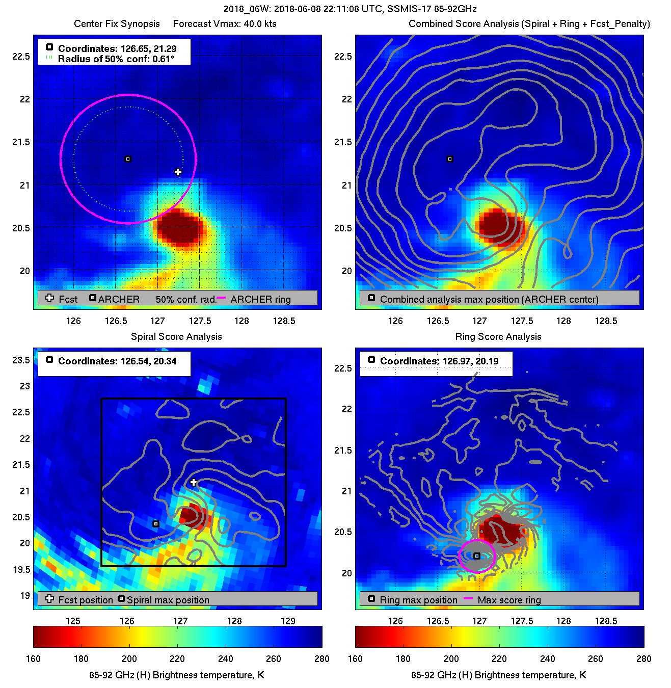
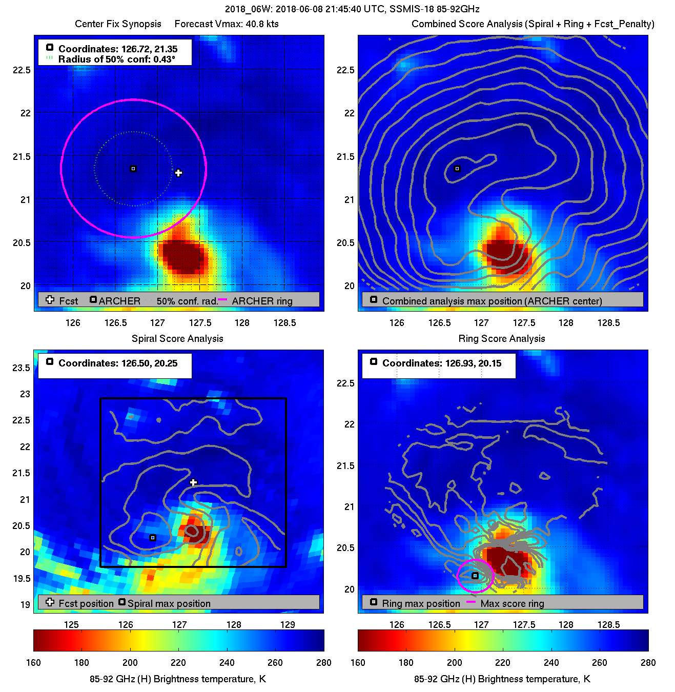
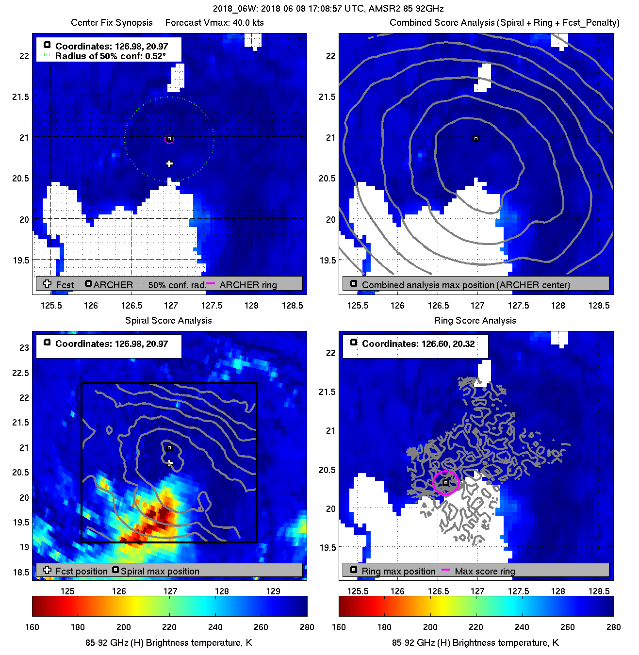
| 20180608 22:11:08 |
SSMIS-17 |
85-92GHz |
40.0 |
21.29 |
126.65 |
21.40 |
126.73 |
0.63 |
1.77 |
1.50 |
0.1 |
|
|
|
 |
 |
|
|
|
 |
 |
|
|
|
 |
 |
|
|
|
 |
 |
|
|
|
 |
 |
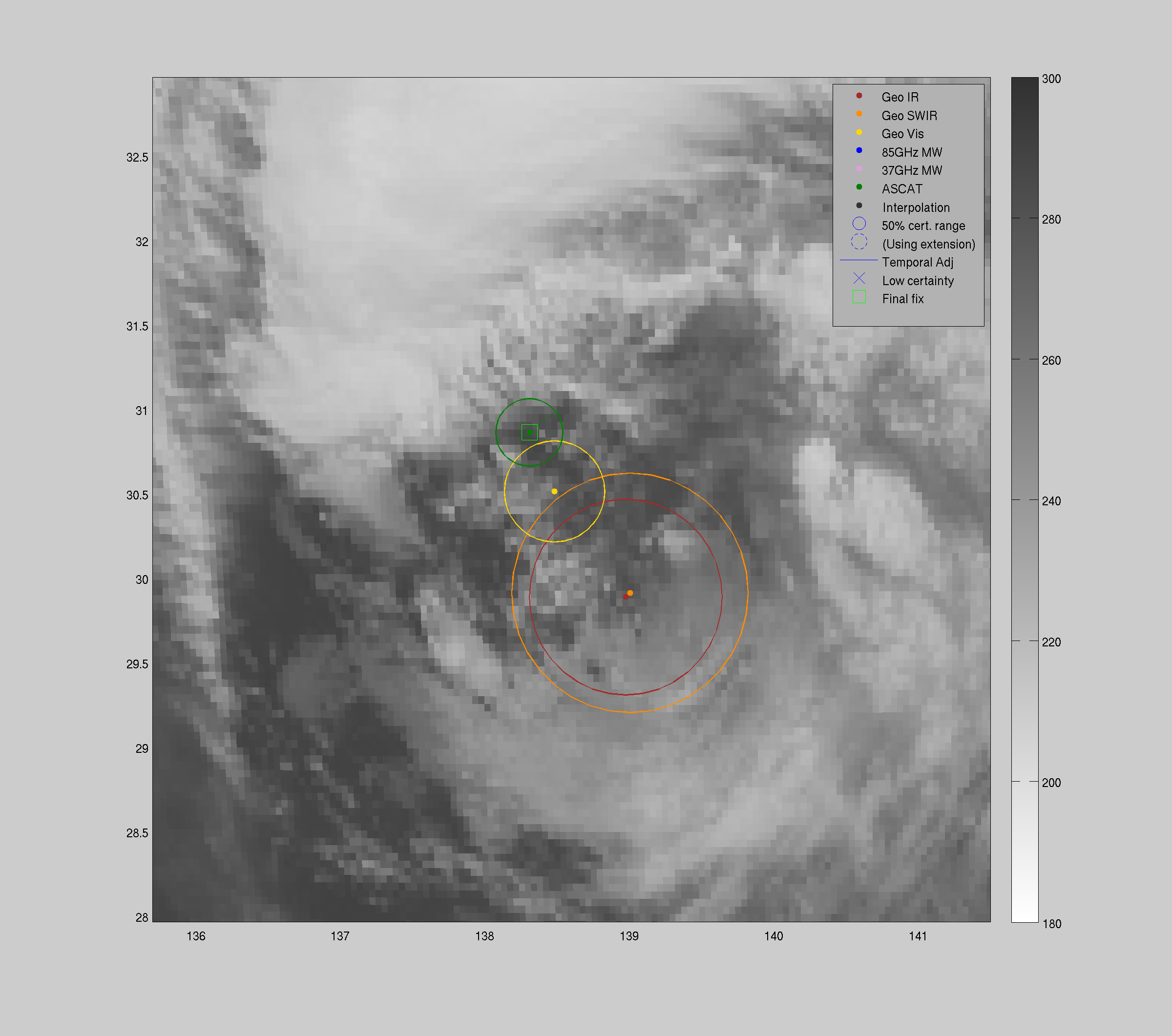
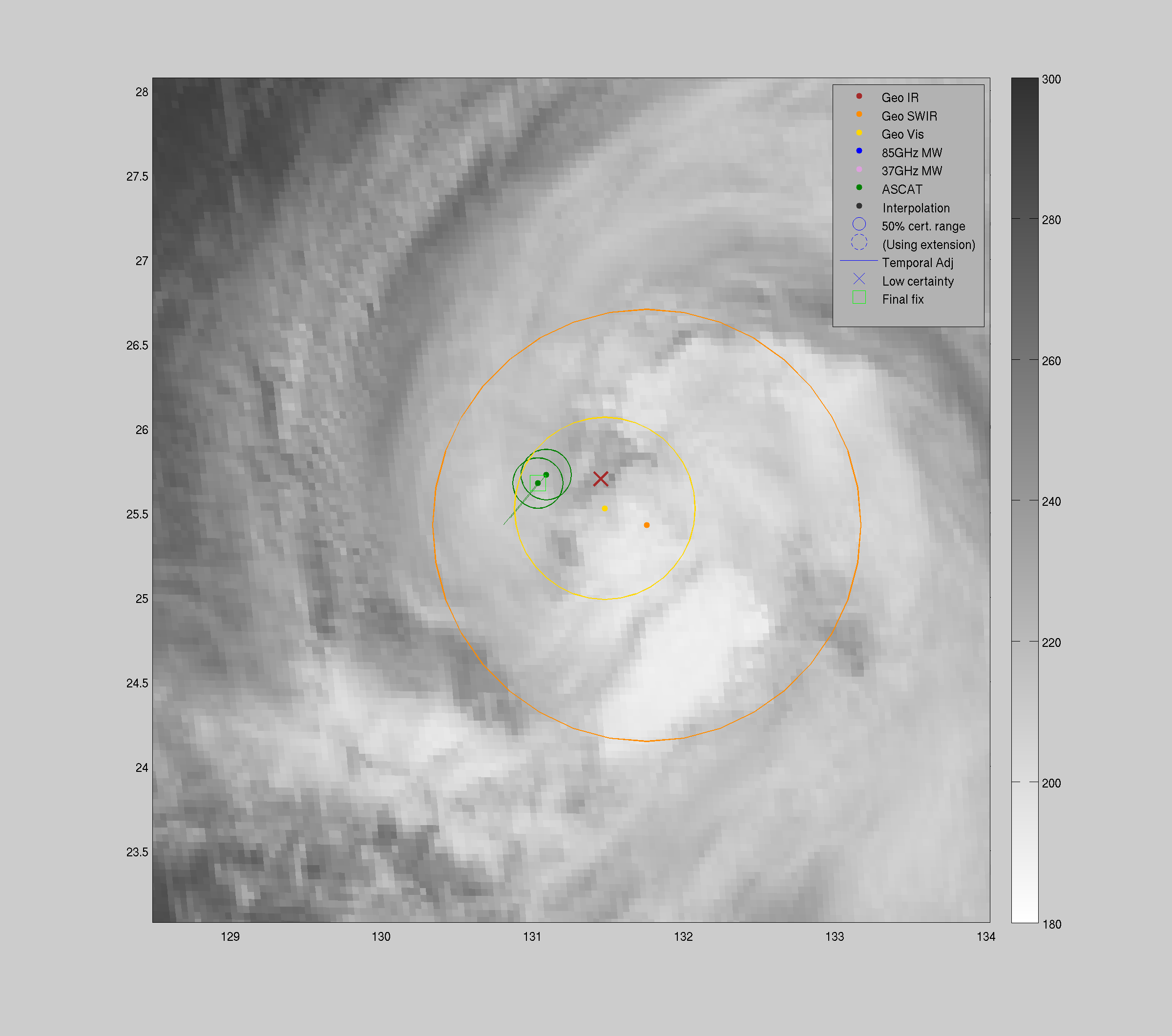
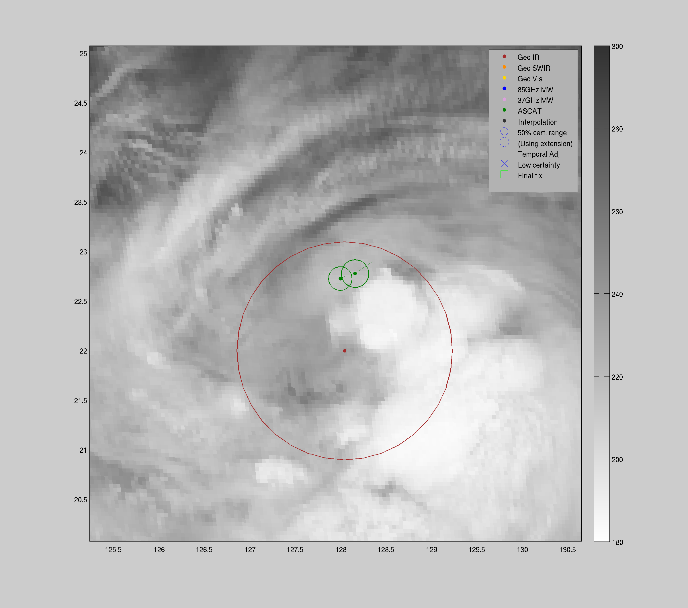
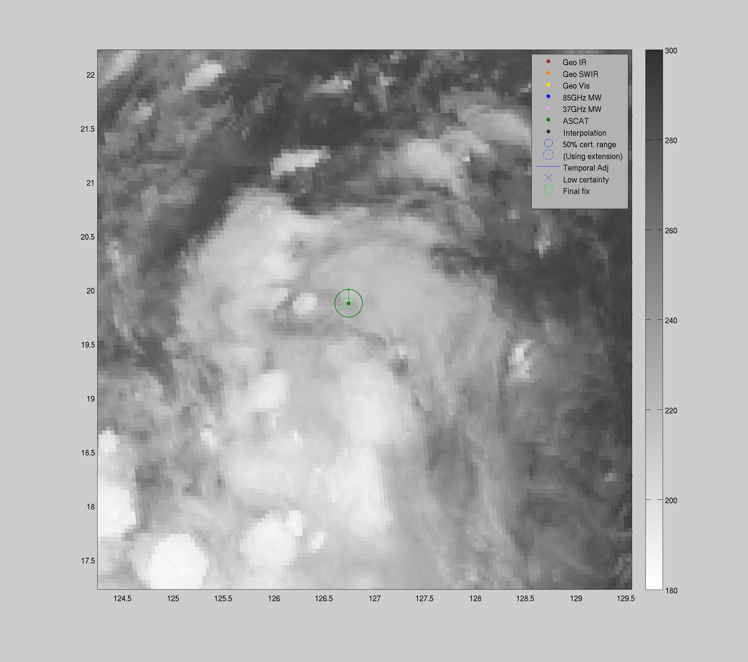
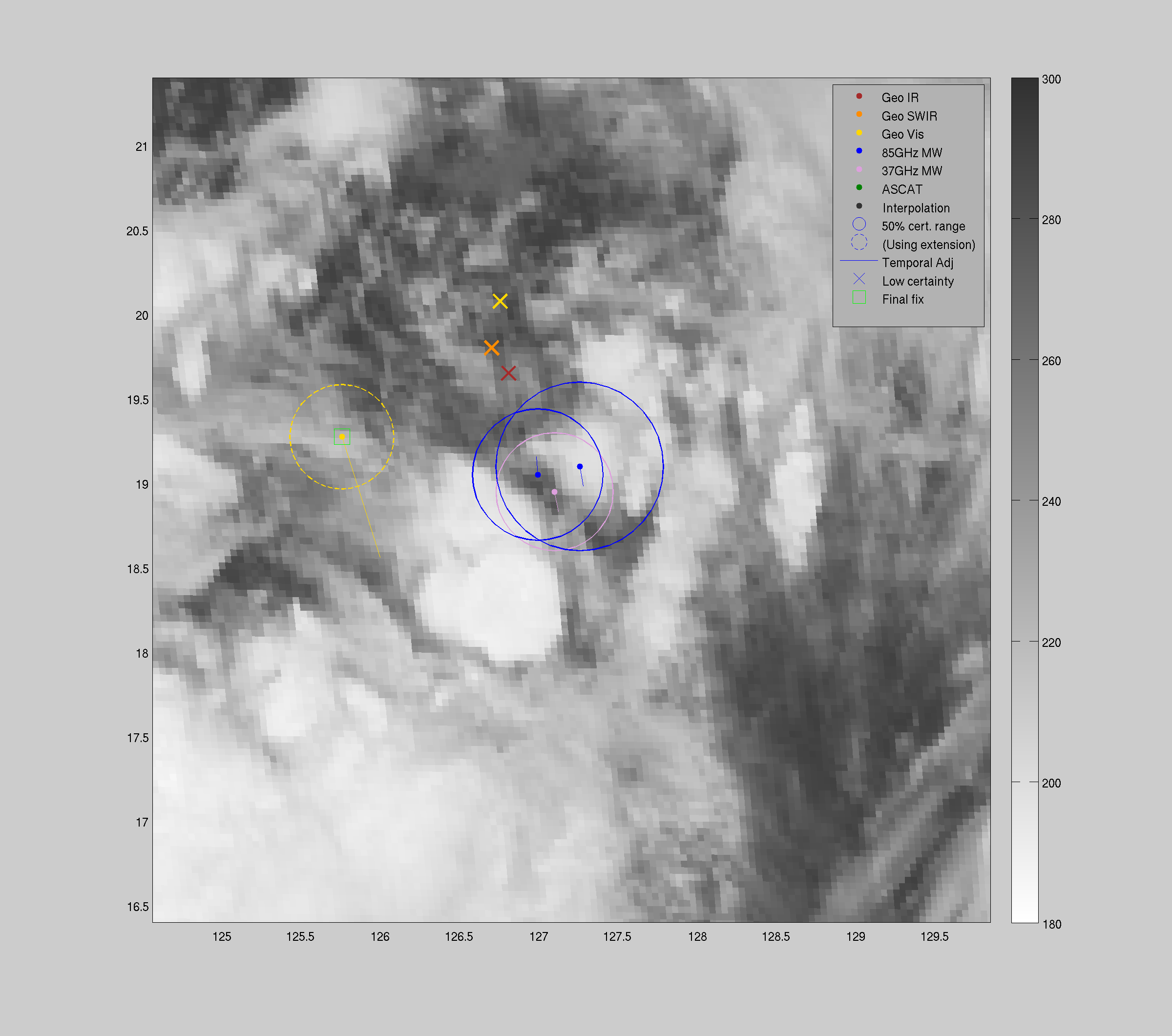
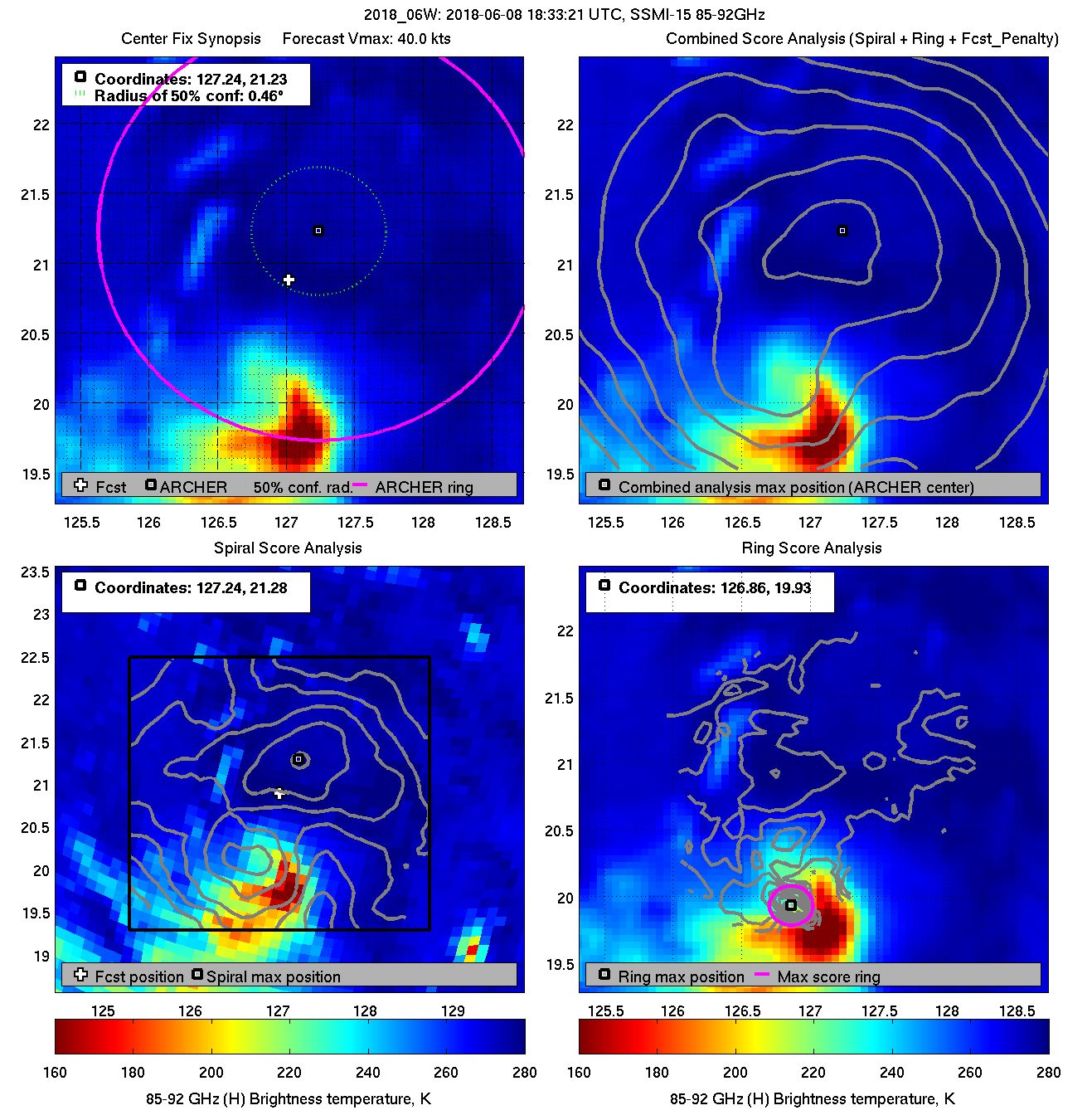
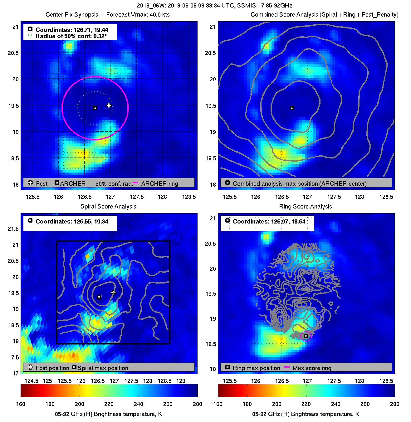
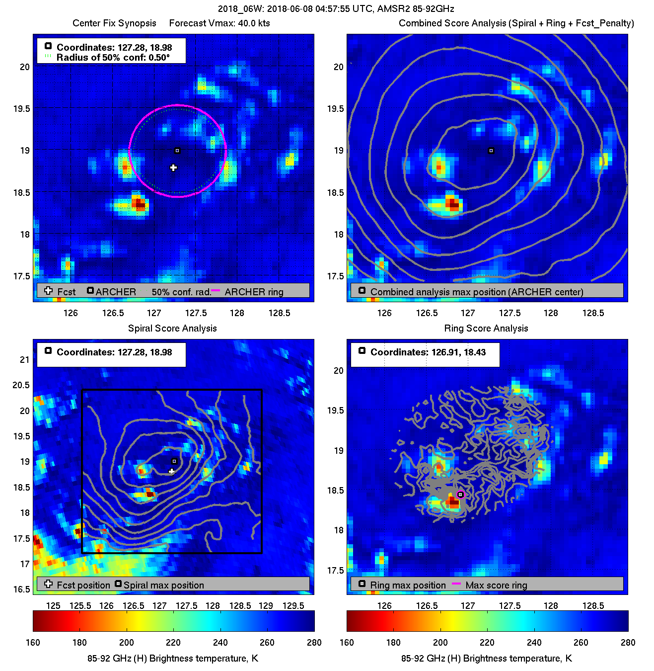
| 20180608 09:38:34 * |
SSMIS-17 |
85-92GHz |
40.0 |
19.44 |
126.71 |
19.30 |
126.77 |
0.32 |
0.90 |
1.20 |
6.5 |
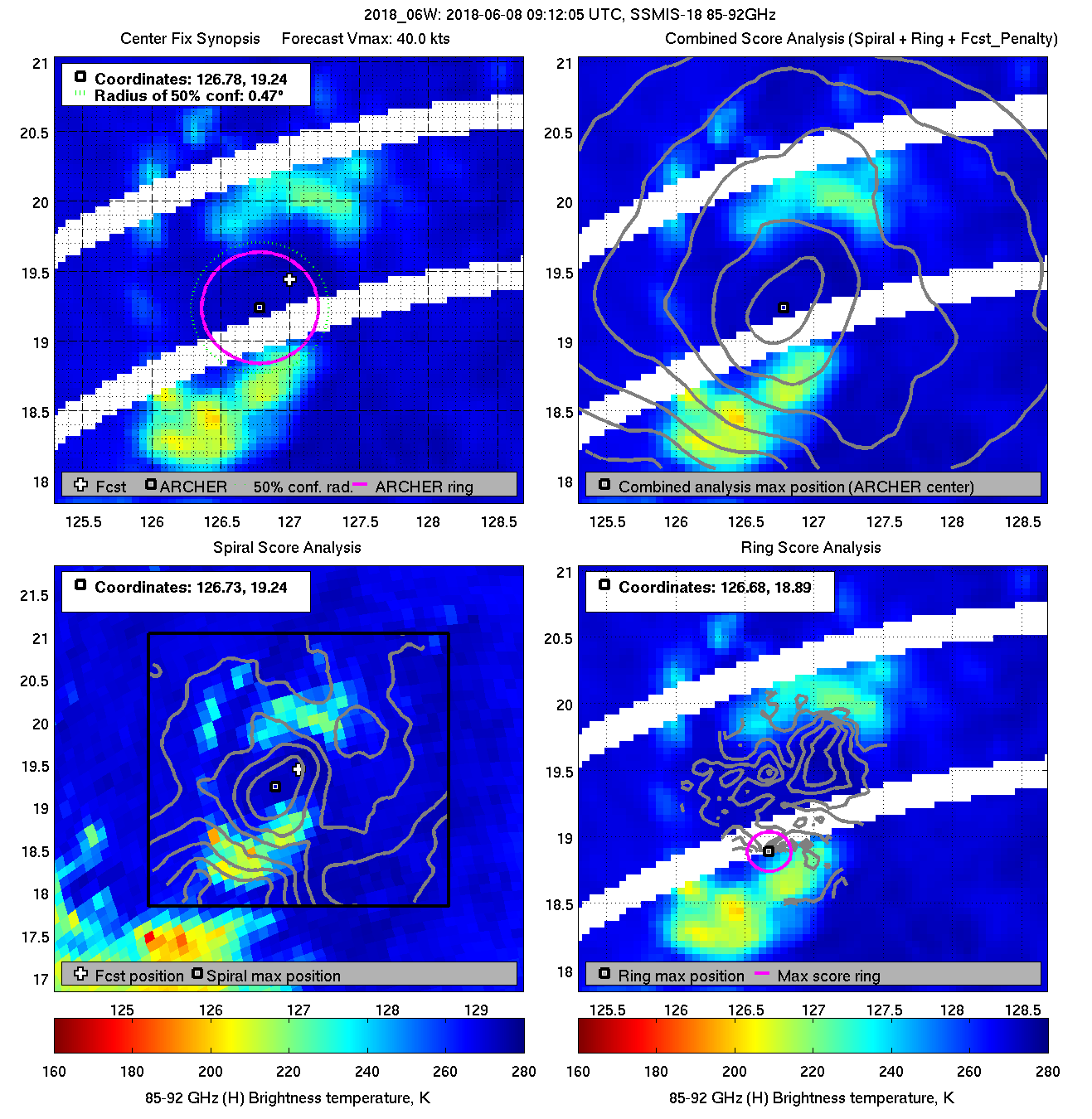
| 20180608 09:12:05 |
SSMIS-18 |
85-92GHz |
40.0 |
19.24 |
126.78 |
19.15 |
126.83 |
0.48 |
1.36 |
5.00 |
0.0 |
|
|
|
 |
 |
|
|
|
 |
 |
|
|
|
 |
 |
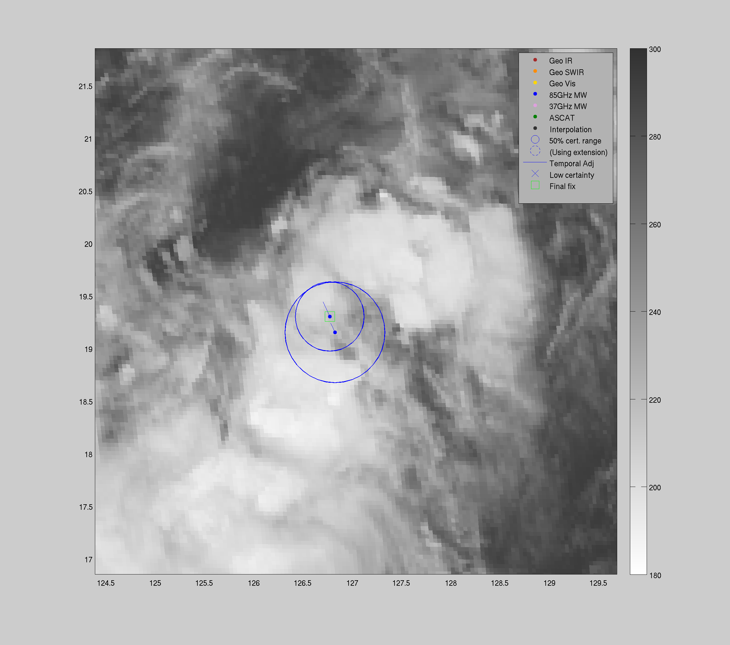
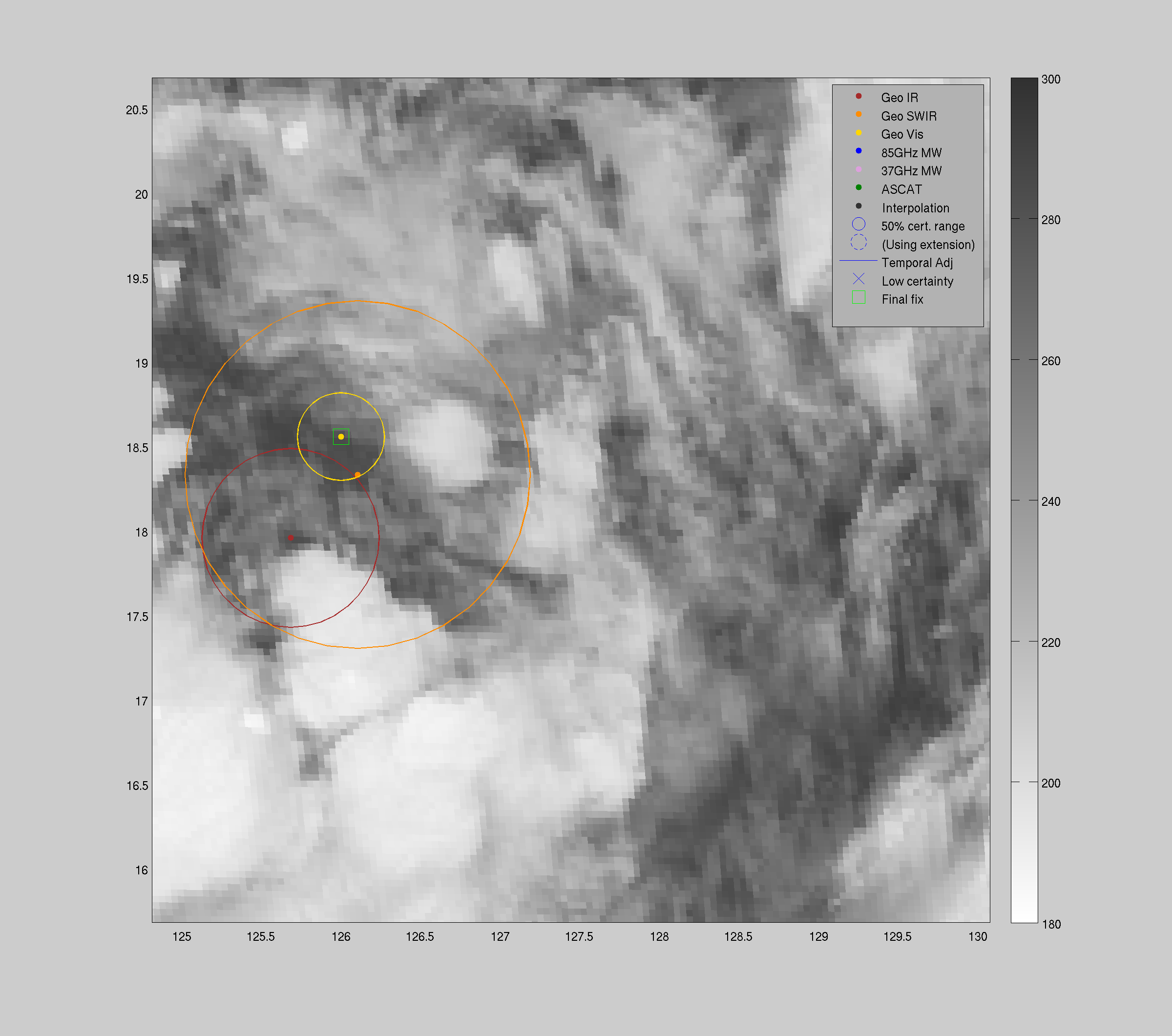
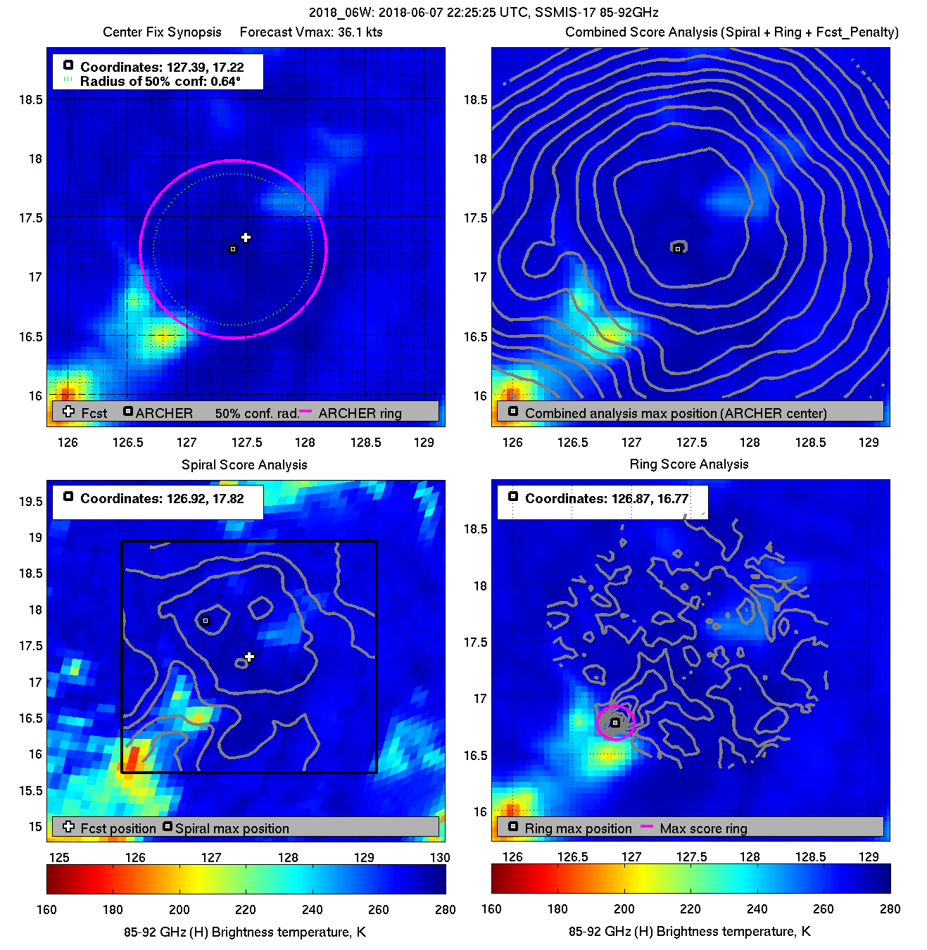
| 20180607 22:25:25 |
SSMIS-17 |
85-92GHz |
36.1 |
17.22 |
127.39 |
17.44 |
127.48 |
0.63 |
1.79 |
1.50 |
0.0 |
|
|
|
 |
 |
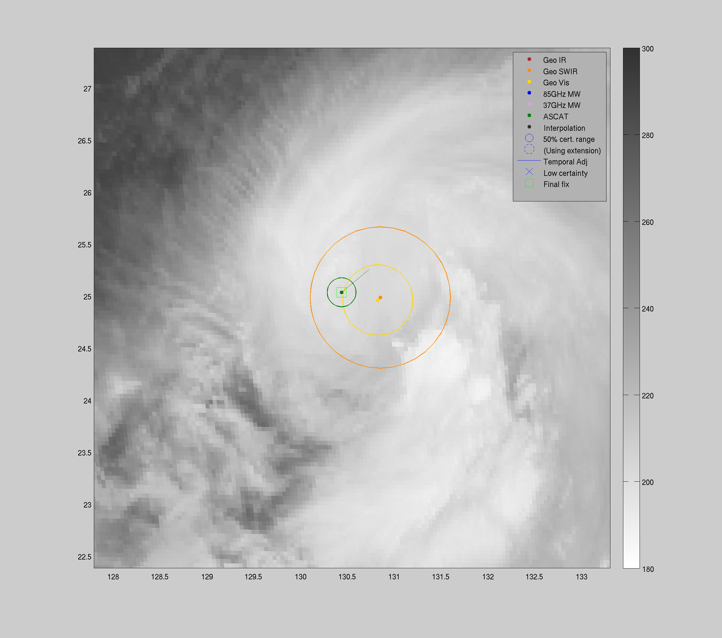
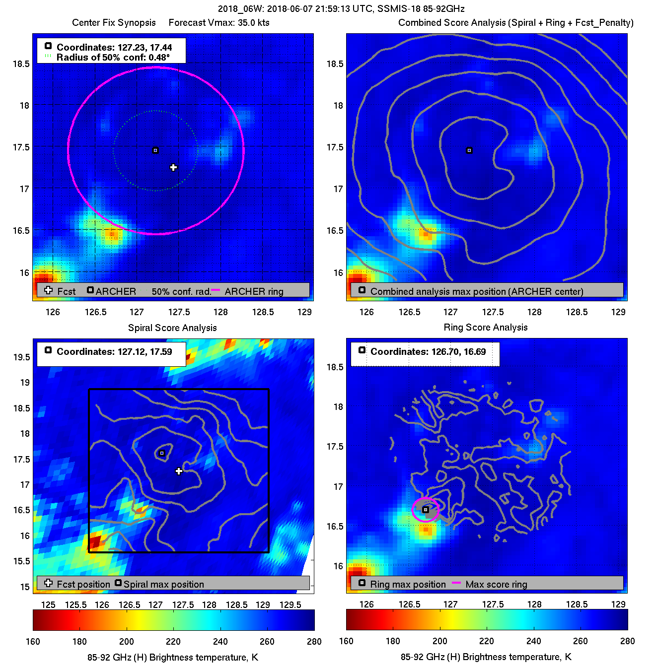
| 20180607 21:59:13 * |
SSMIS-18 |
85-92GHz |
35.0 |
17.44 |
127.23 |
17.17 |
126.93 |
0.48 |
1.35 |
2.00 |
1.2 |
|
|
|
 |
 |
|


