|
| Geo IR |
85-92GHz |
| Date/Time_(UTC) |
Source |
Sensor |
Vmax(kts) |
ARCHER Lat |
Lon |
Geo-ref Lat |
Lon |
50% cert. rad. |
95% cert. rad. |
Eye diam (deg) |
% cert. of eye |
|
|
|
|
 |
 |
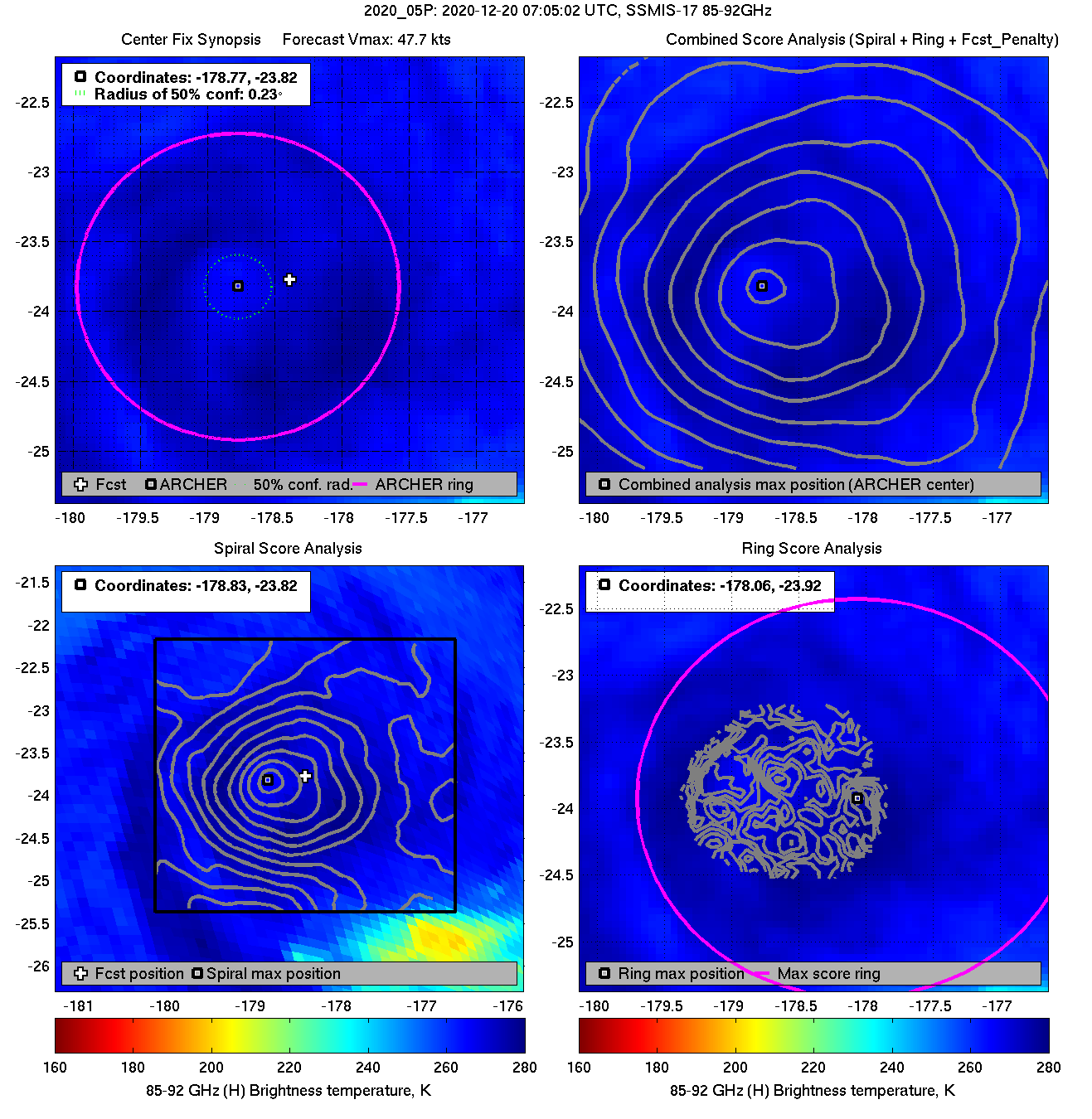
| 20201220 07:05:02 * |
SSMIS-17 |
85-92GHz |
47.7 |
-23.82 |
-178.77 |
-23.75 |
-178.72 |
0.23 |
0.65 |
2.20 |
3.8 |
|
|
|
 |
 |
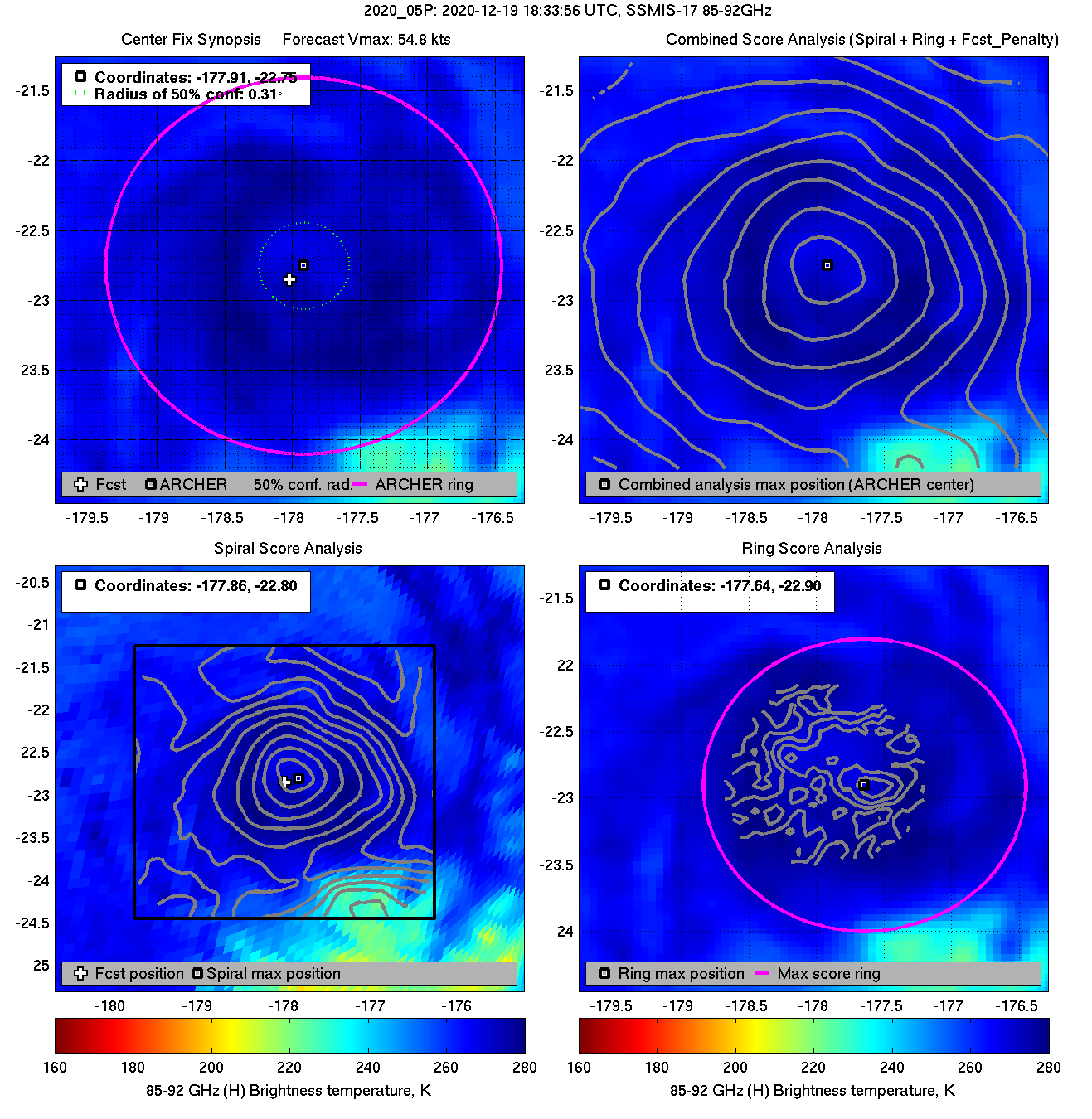
| 20201219 18:33:56 * |
SSMIS-17 |
85-92GHz |
54.8 |
-22.75 |
-177.91 |
-22.70 |
-177.90 |
0.31 |
0.88 |
2.70 |
5.3 |
|
|
|
 |
 |
|
|
|
 |
 |
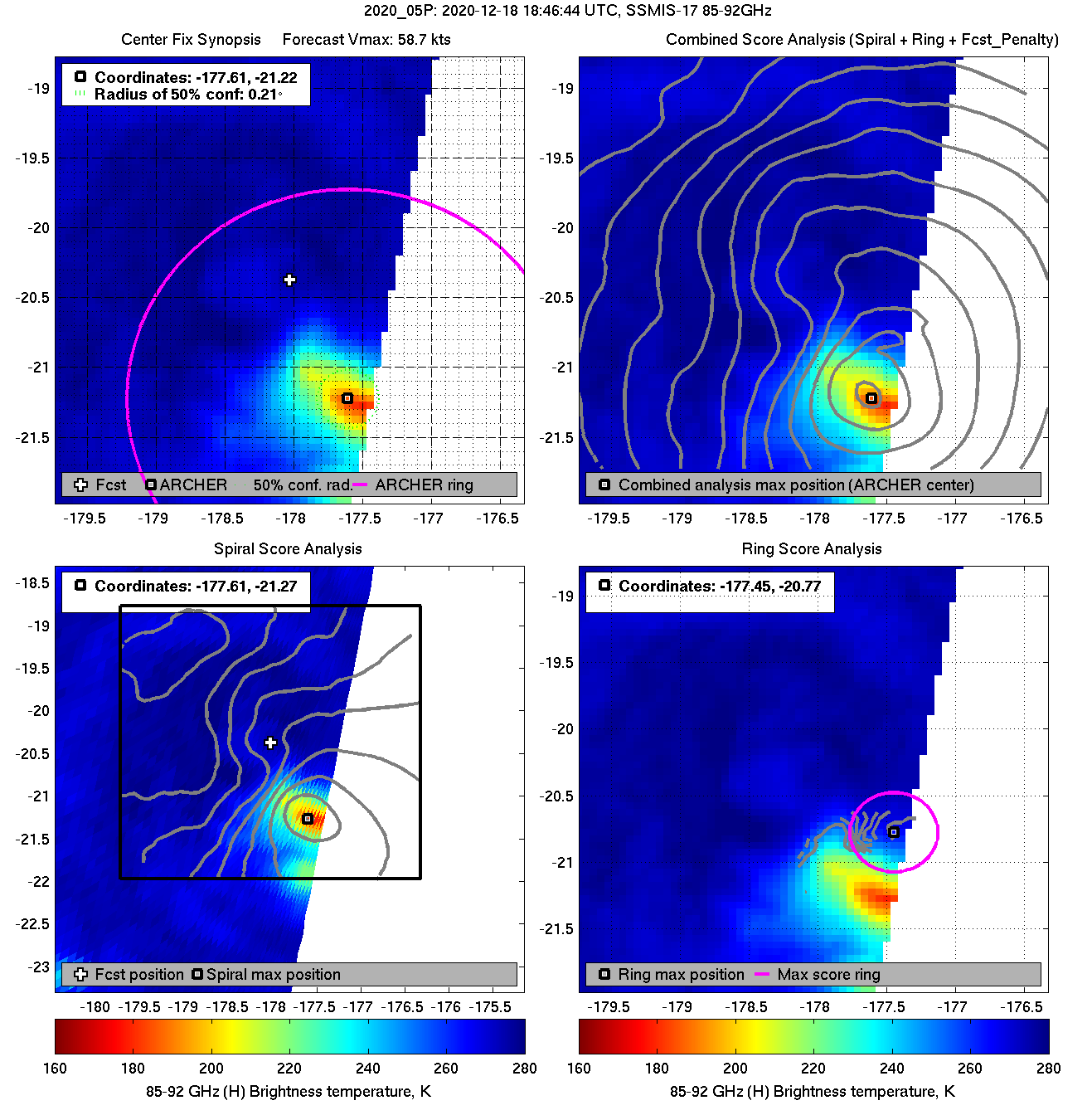
| 20201218 18:46:44 * |
SSMIS-17 |
85-92GHz |
58.7 |
-21.22 |
-177.61 |
-21.15 |
-177.57 |
0.21 |
0.59 |
3.00 |
0.0 |
|
|
|
 |
 |
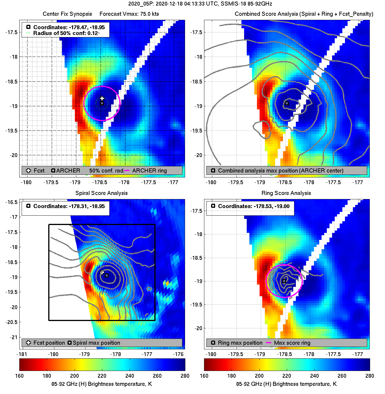
| 20201218 04:13:33 * |
SSMIS-18 |
85-92GHz |
75.0 |
-18.95 |
-178.47 |
-18.77 |
-178.60 |
0.12 |
0.34 |
0.70 |
100.0 |
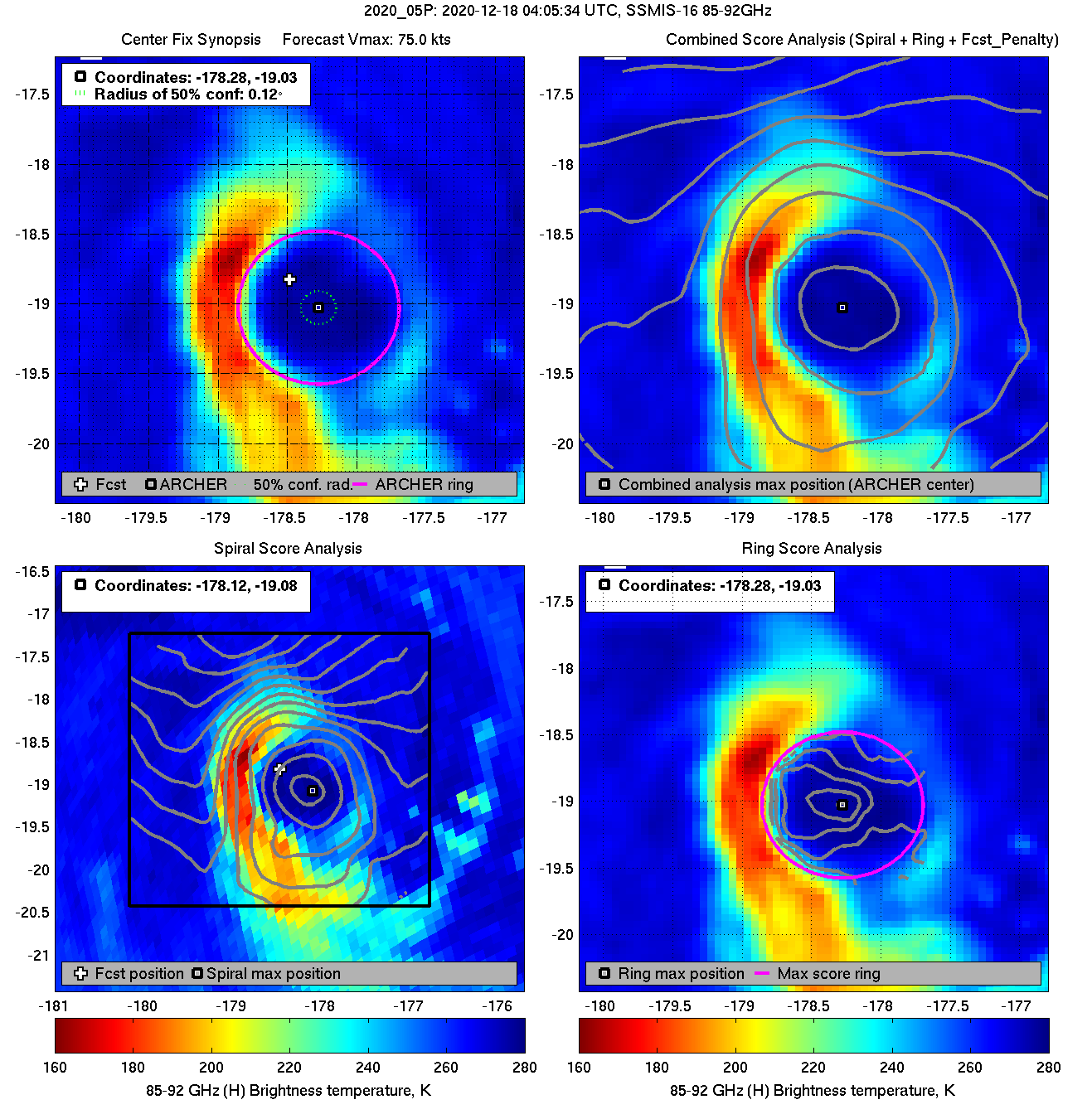
| 20201218 04:05:34 |
SSMIS-16 |
85-92GHz |
75.0 |
-19.03 |
-178.28 |
-18.87 |
-178.39 |
0.12 |
0.35 |
1.10 |
100.0 |
|
|
|
 |
 |
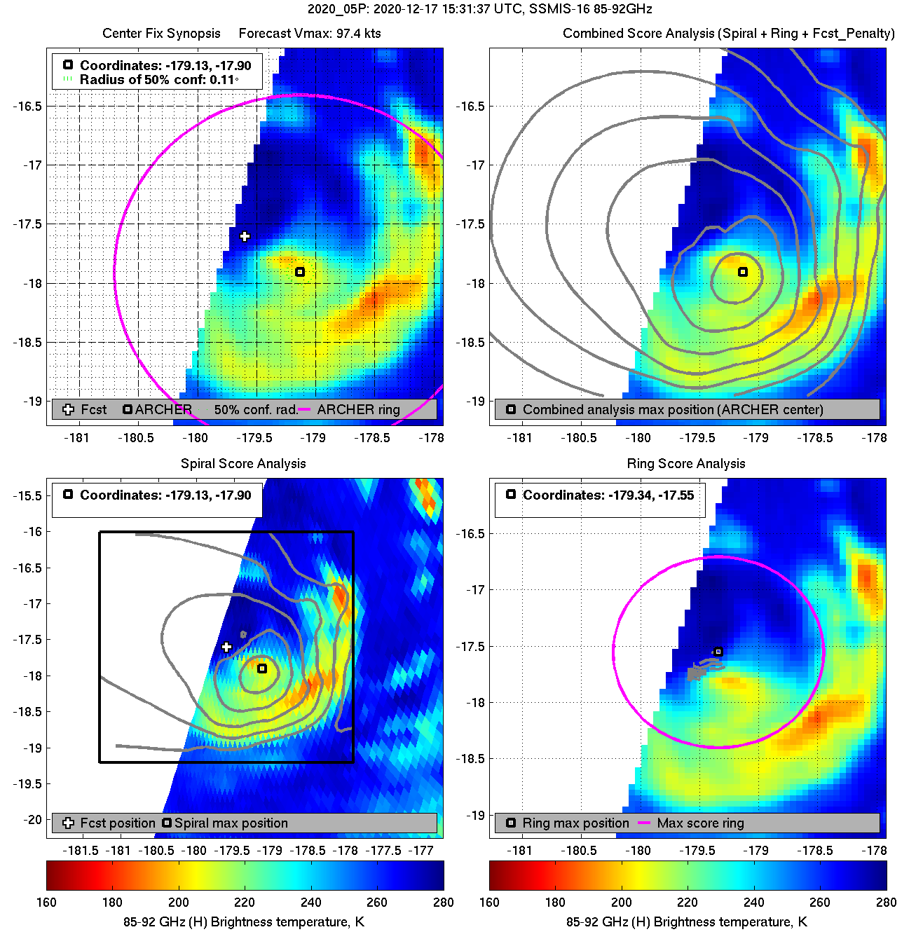
| 20201217 15:31:37 * |
SSMIS-16 |
85-92GHz |
97.4 |
-17.90 |
-179.13 |
-17.84 |
-179.17 |
0.11 |
0.31 |
3.00 |
0.0 |
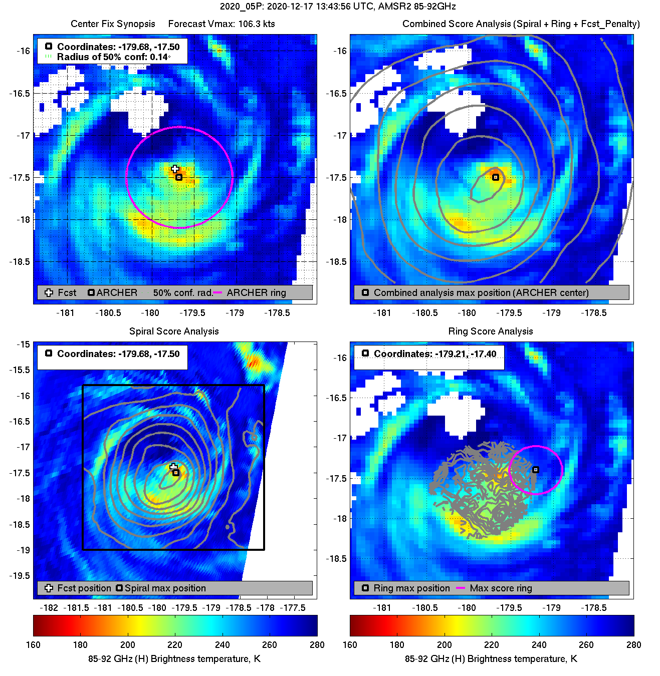
| 20201217 13:43:56 * |
AMSR2 |
85-92GHz |
106.3 |
-17.50 |
-179.68 |
-17.66 |
-179.58 |
0.14 |
0.40 |
1.20 |
23.6 |
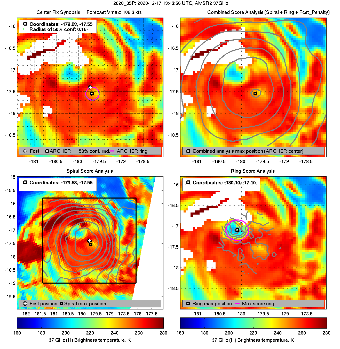
| 20201217 13:43:56 |
AMSR2 |
37GHz |
106.3 |
-17.55 |
-179.68 |
-17.71 |
-179.58 |
0.16 |
0.44 |
0.30 |
*** |
|
|
|
 |
 |
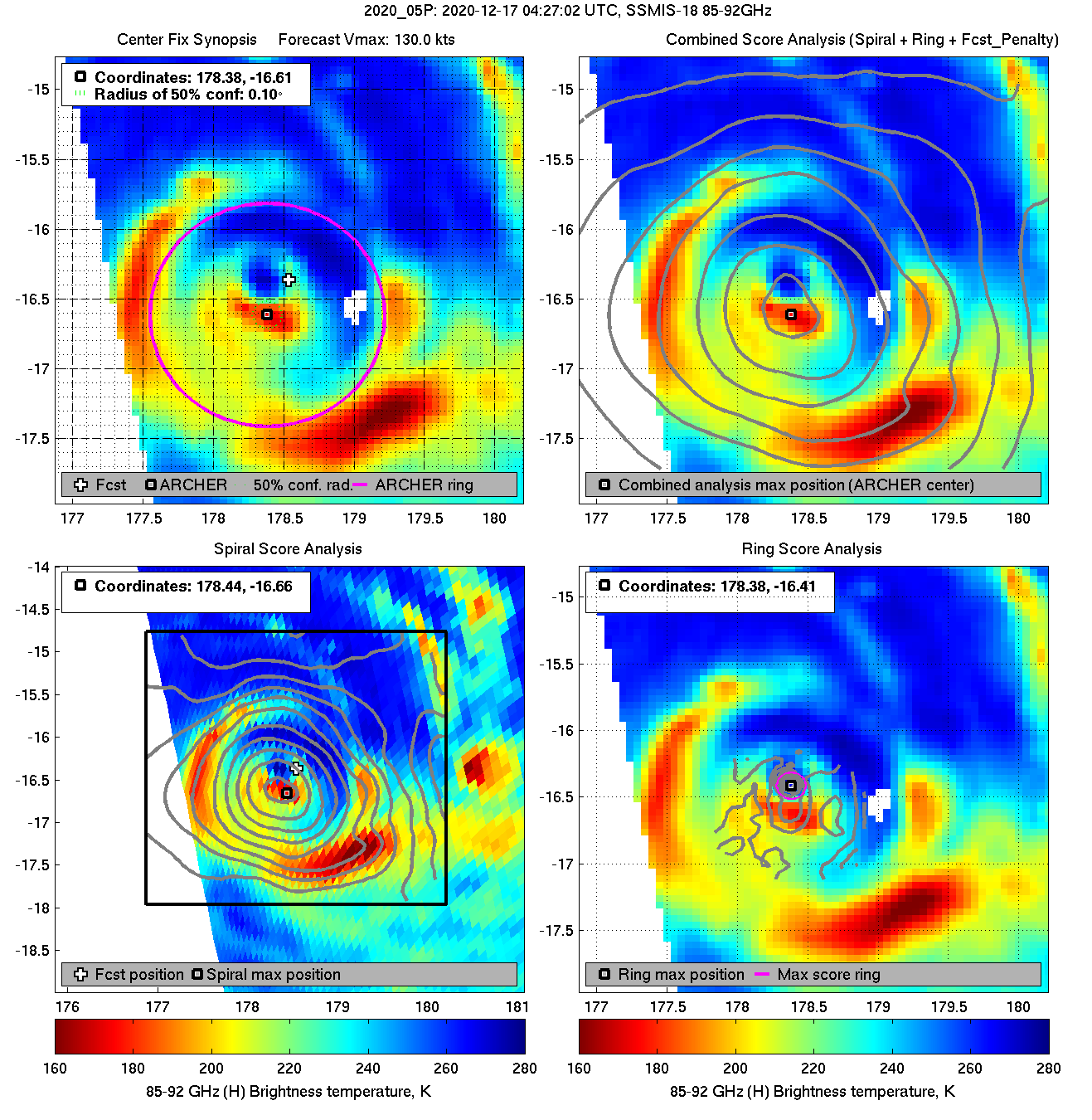
| 20201217 04:27:02 * |
SSMIS-18 |
85-92GHz |
130.0 |
-16.61 |
178.38 |
-16.71 |
178.59 |
0.10 |
0.28 |
1.60 |
100.0 |
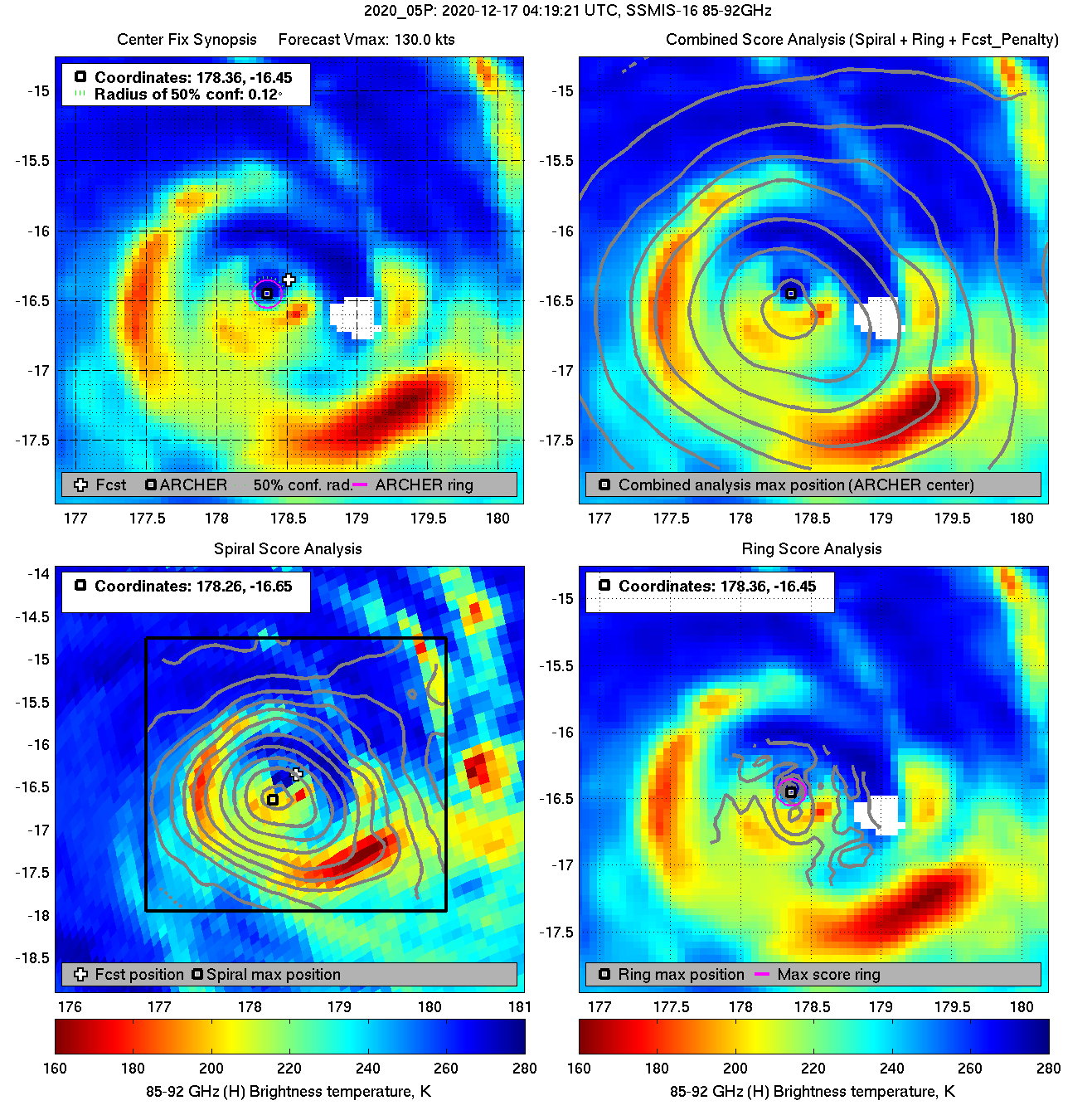
| 20201217 04:19:21 |
SSMIS-16 |
85-92GHz |
130.0 |
-16.45 |
178.36 |
-16.56 |
178.59 |
0.12 |
0.35 |
0.20 |
97.9 |
|
|
|
 |
 |
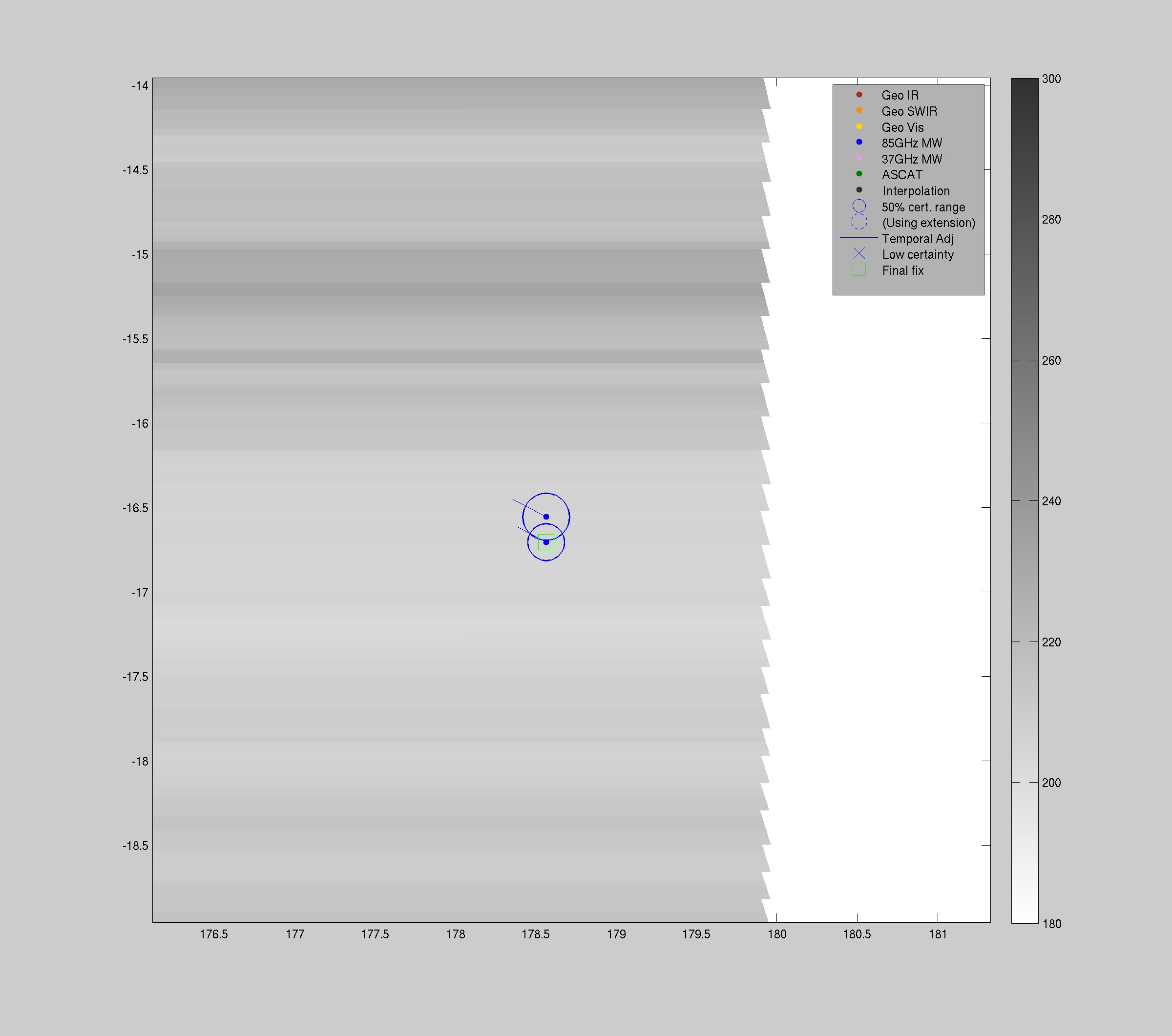
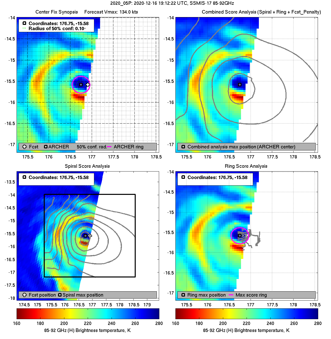
| 20201216 19:12:22 * |
SSMIS-17 |
85-92GHz |
134.0 |
-15.58 |
176.75 |
-15.69 |
176.96 |
0.10 |
0.27 |
0.40 |
100.0 |
|
|
|
 |
 |
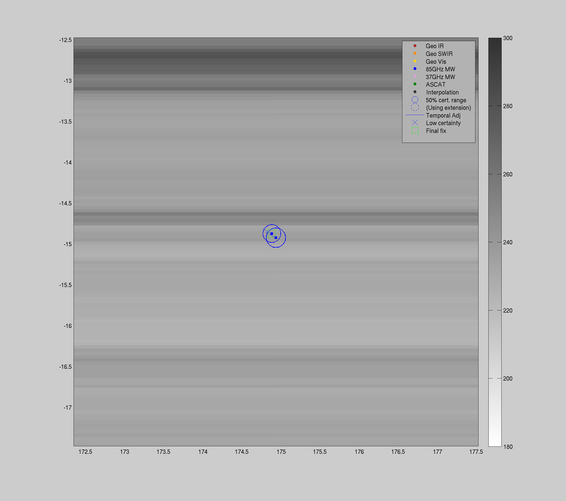
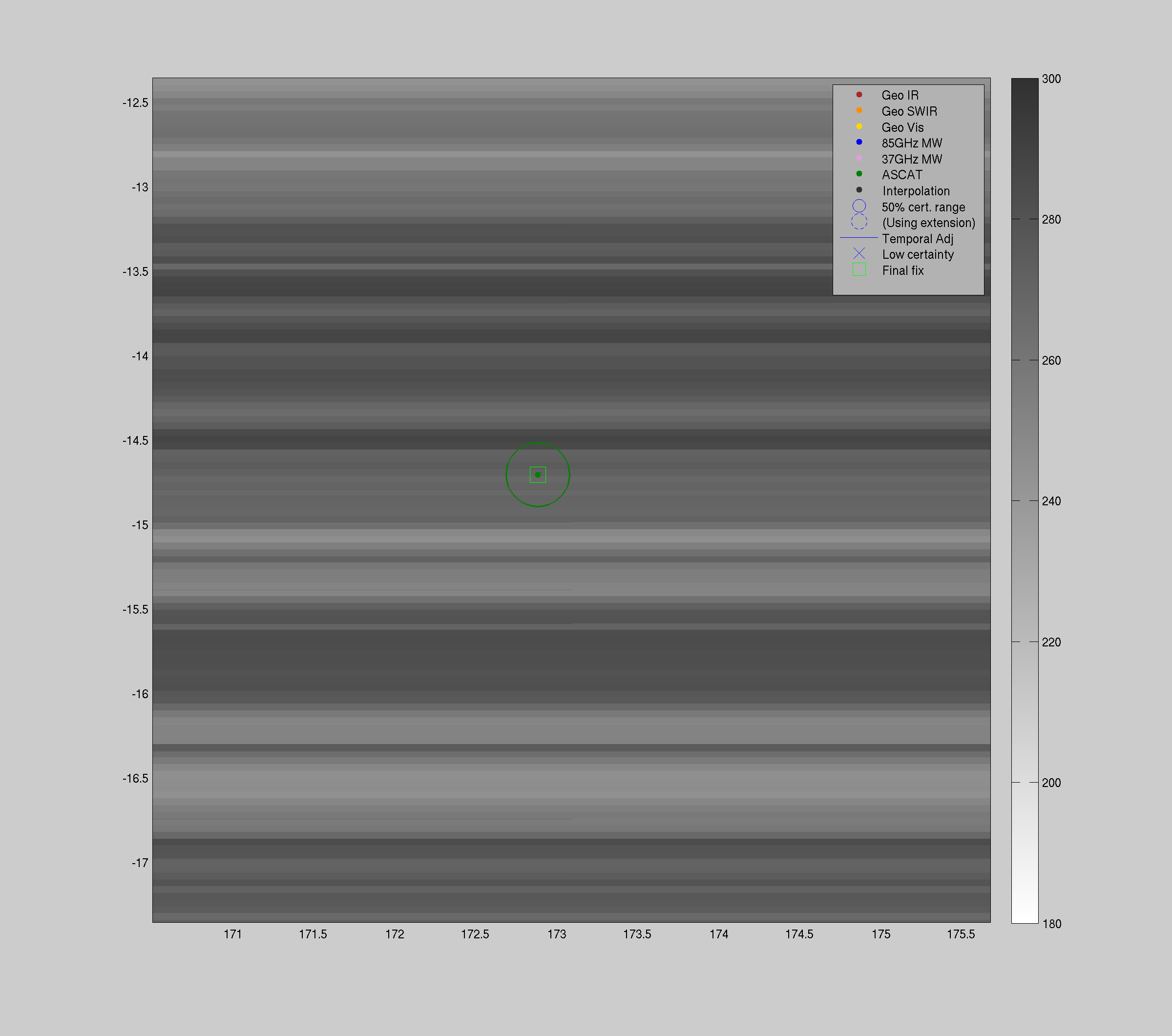
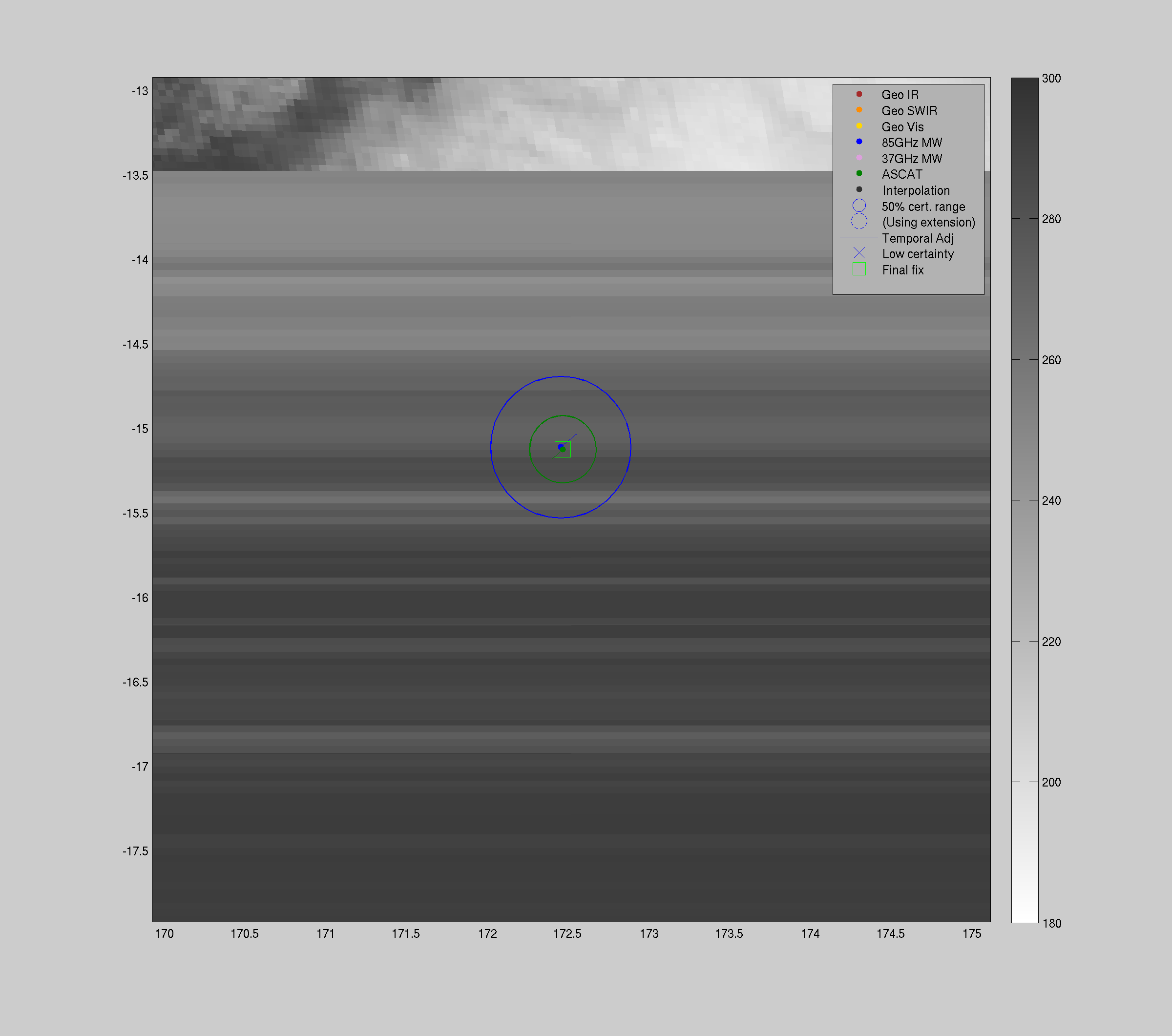
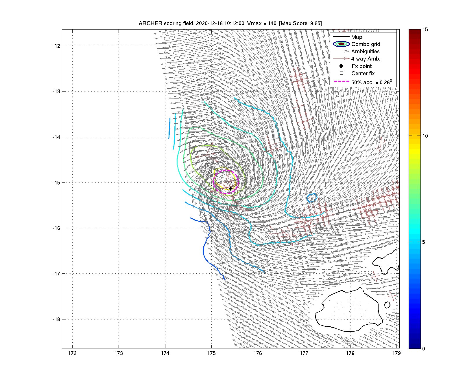
| 20201216 10:12:00 * |
Metop-B |
ASCAT |
140.0 |
-14.98 |
175.31 |
-15.03 |
175.45 |
0.26 |
0.75 |
*** |
*** |
|
|
|
 |
 |
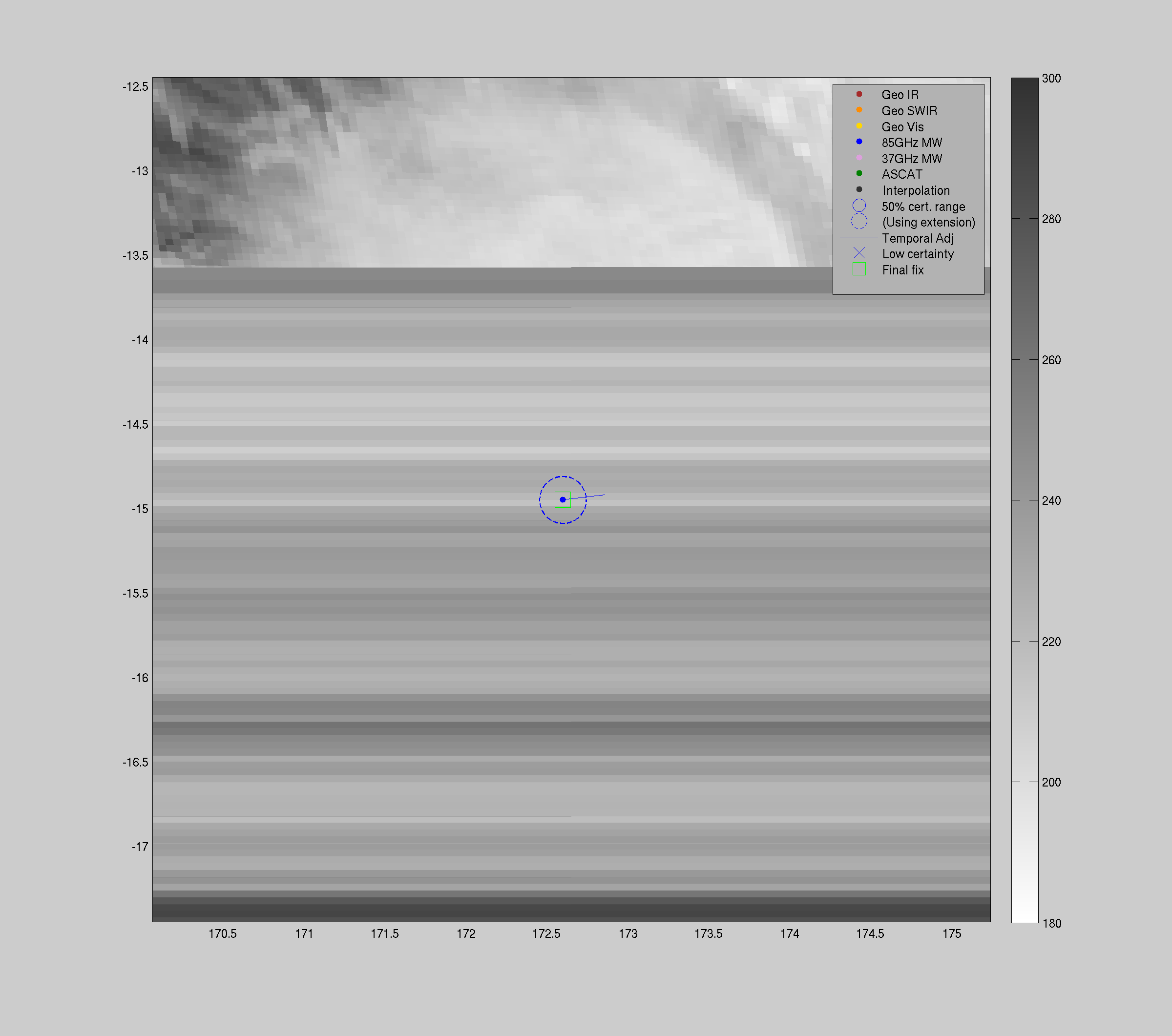
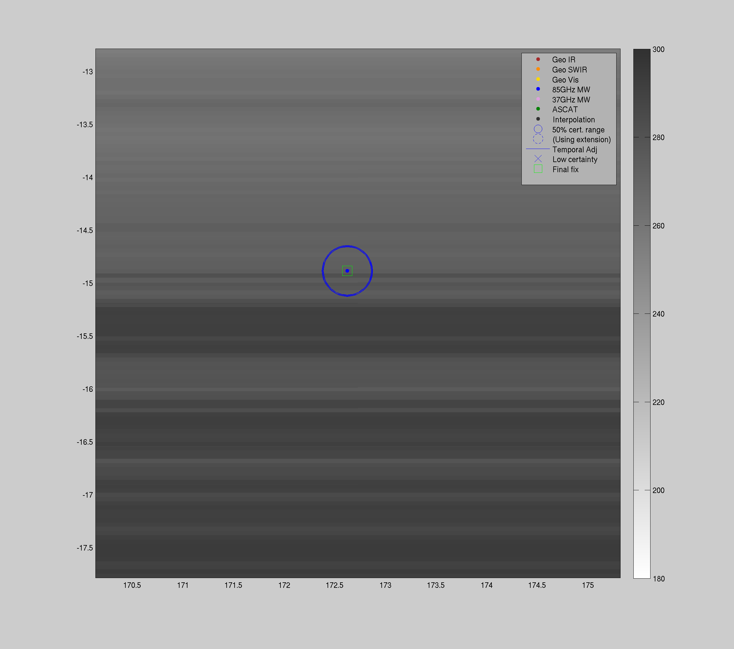
| 20201216 04:40:14 * |
SSMIS-18 |
85-92GHz |
140.0 |
-14.81 |
174.77 |
-14.87 |
174.88 |
0.10 |
0.29 |
0.40 |
100.0 |
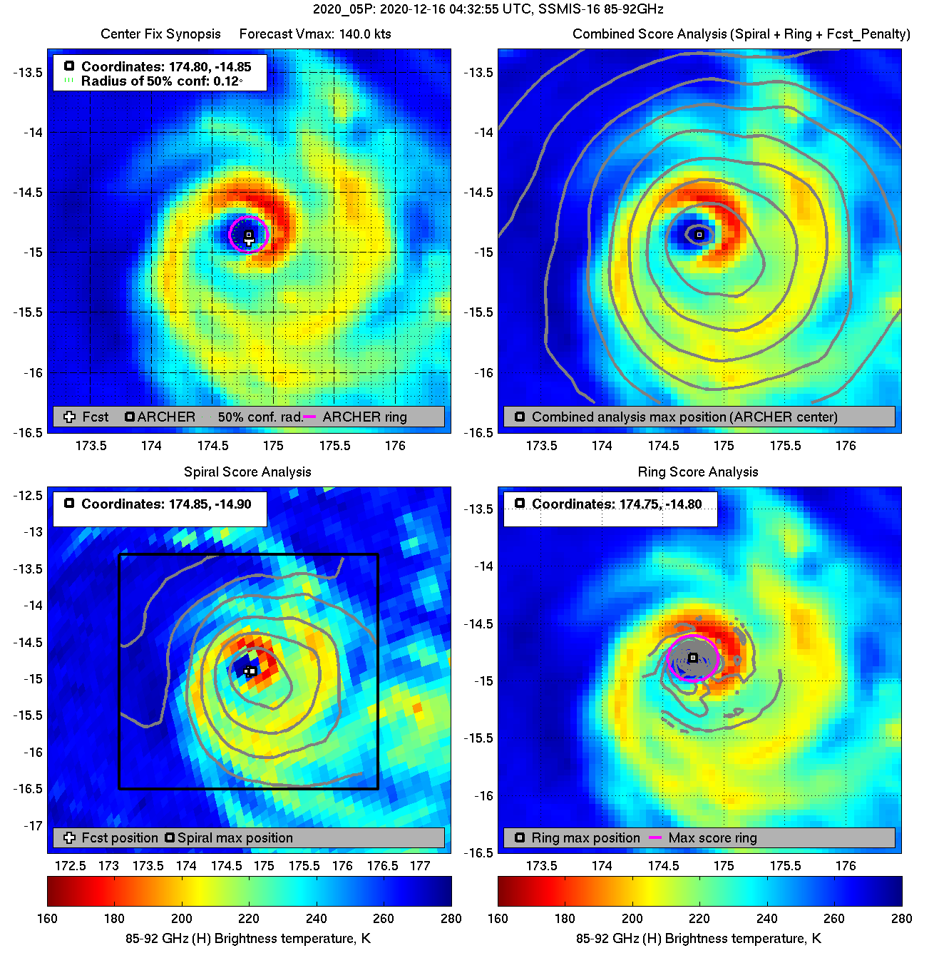
| 20201216 04:32:55 |
SSMIS-16 |
85-92GHz |
140.0 |
-14.85 |
174.80 |
-14.92 |
174.94 |
0.12 |
0.33 |
0.30 |
100.0 |
|
|
|
 |
 |
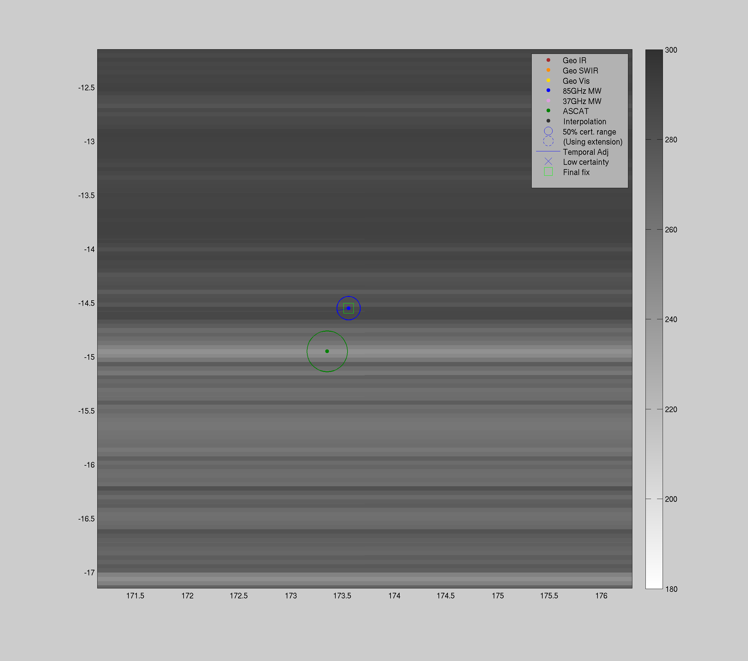
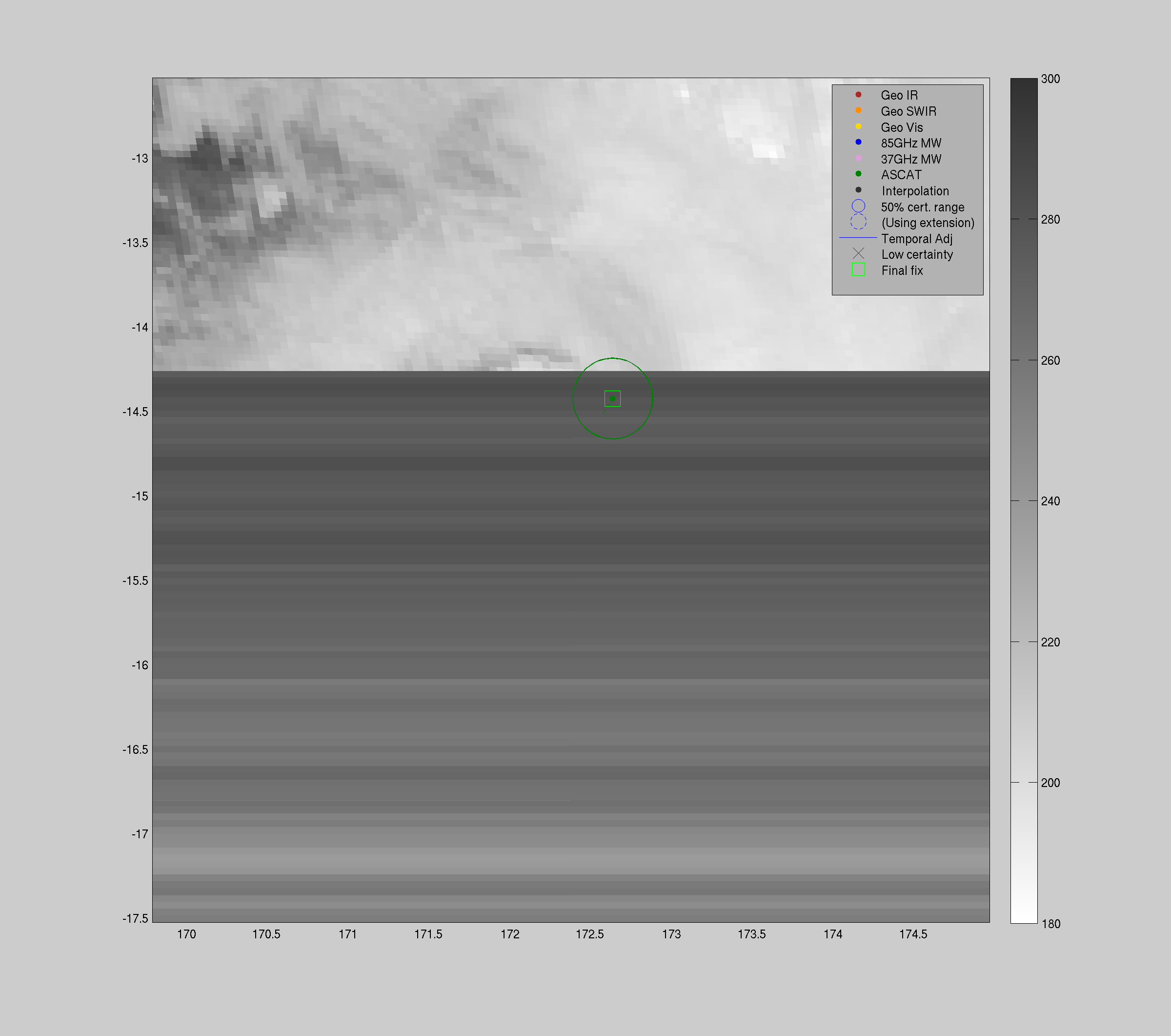
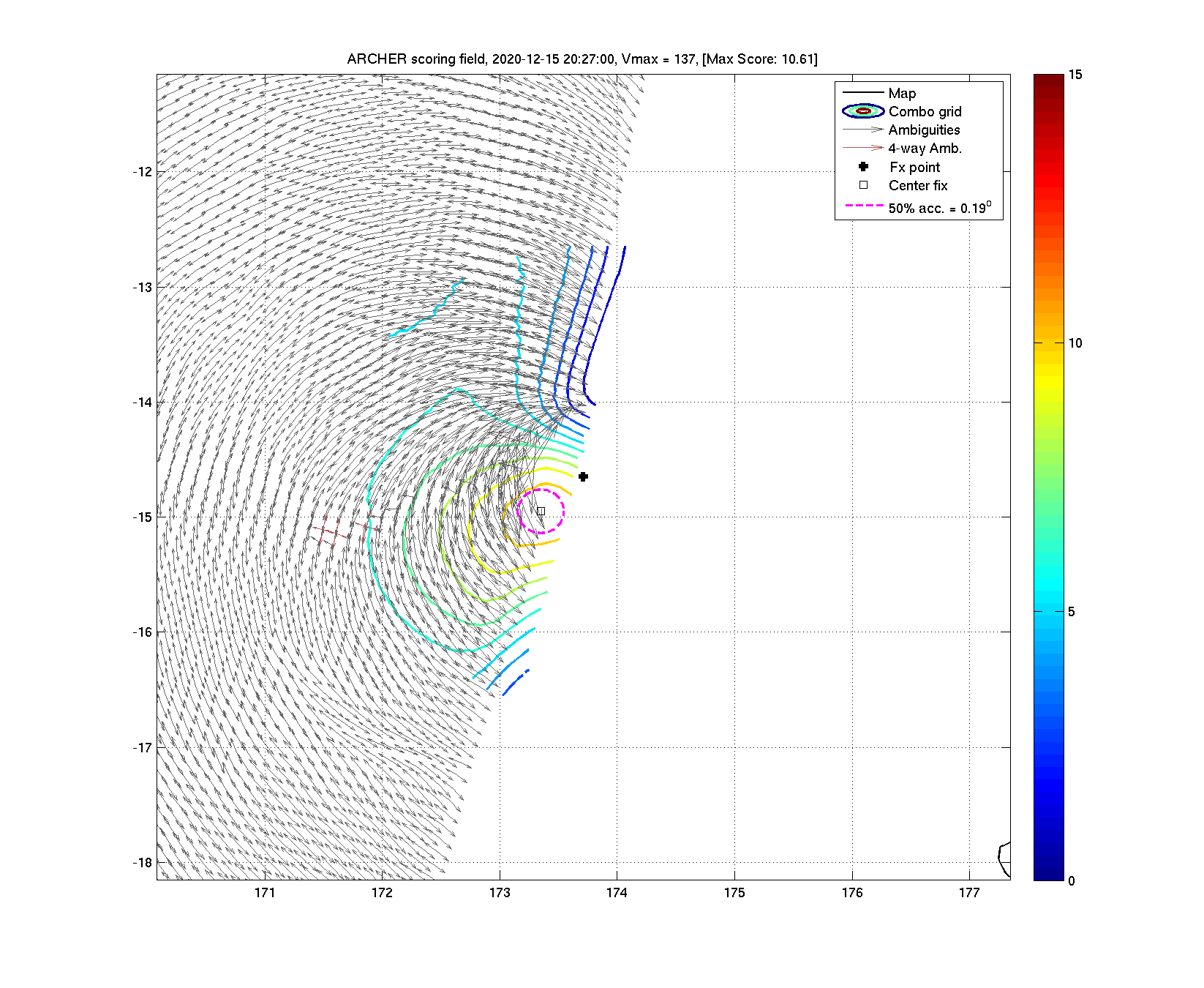
| 20201215 20:27:00 |
Metop-A |
ASCAT |
137.0 |
-14.95 |
173.35 |
-14.95 |
173.35 |
0.19 |
0.53 |
*** |
*** |
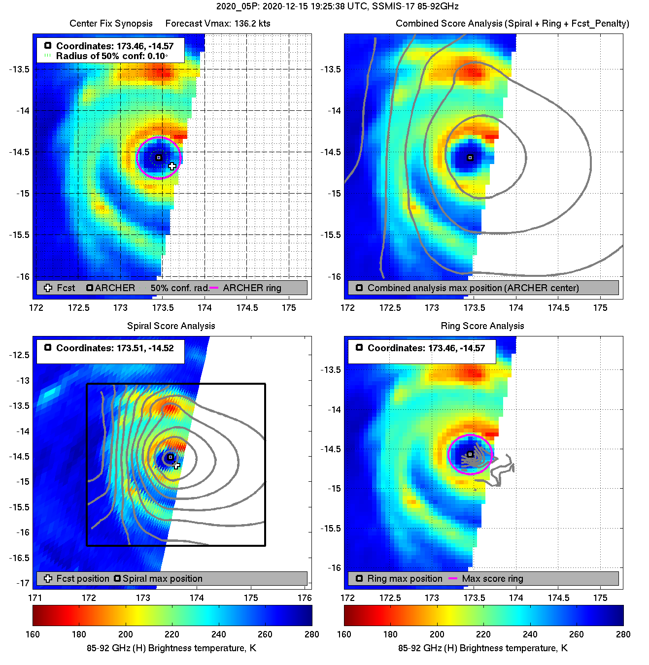
| 20201215 19:25:38 * |
SSMIS-17 |
85-92GHz |
136.2 |
-14.57 |
173.46 |
-14.55 |
173.56 |
0.10 |
0.27 |
0.50 |
100.0 |
|
|
|
 |
 |
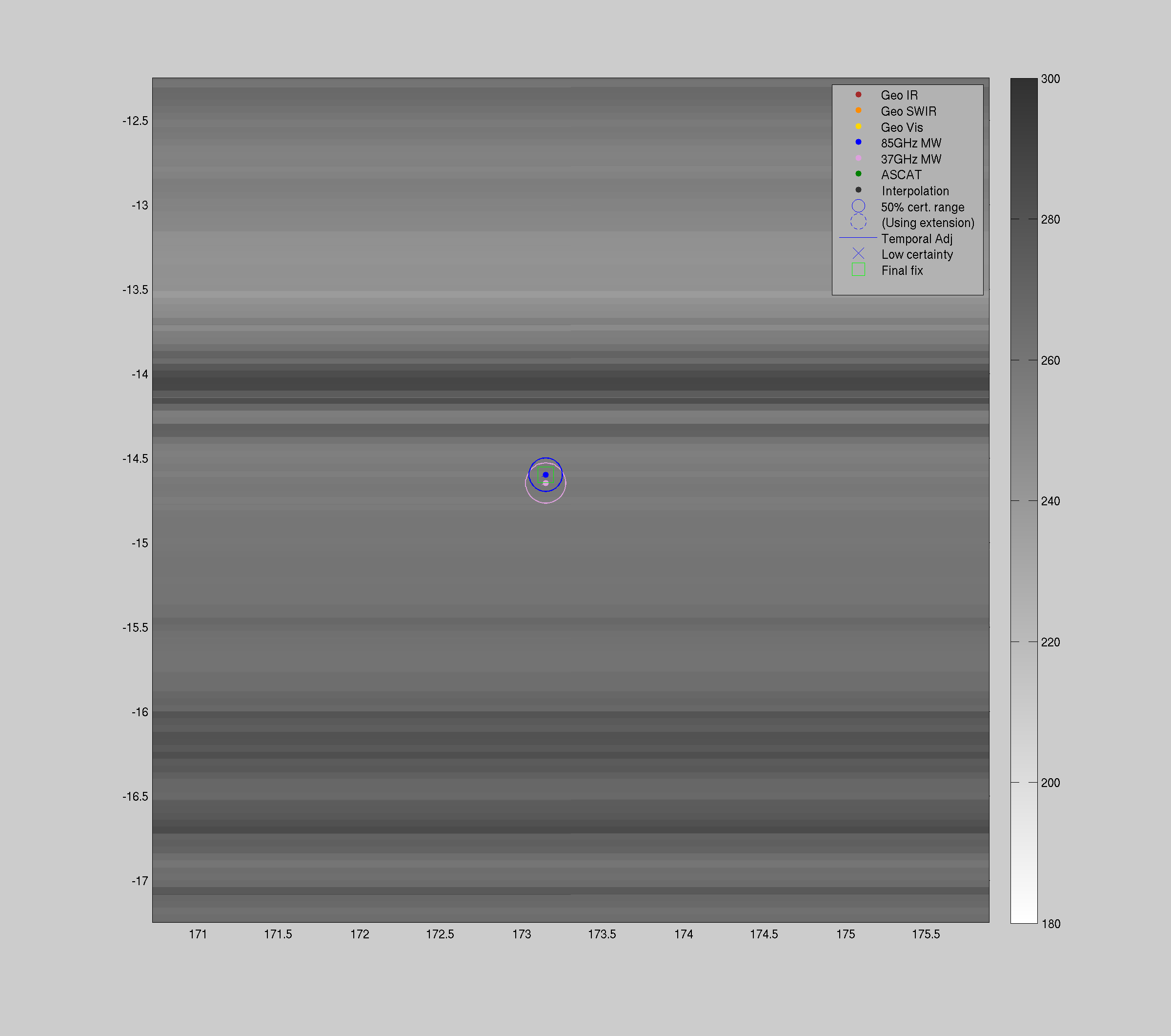
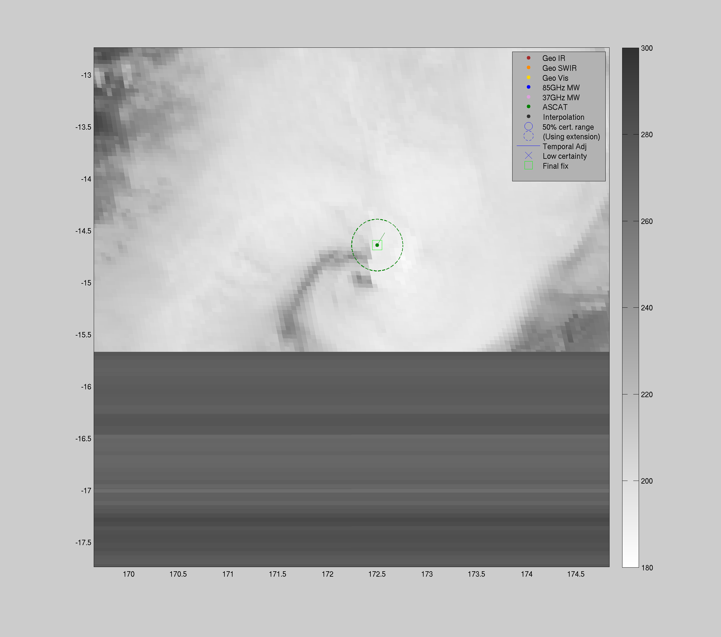
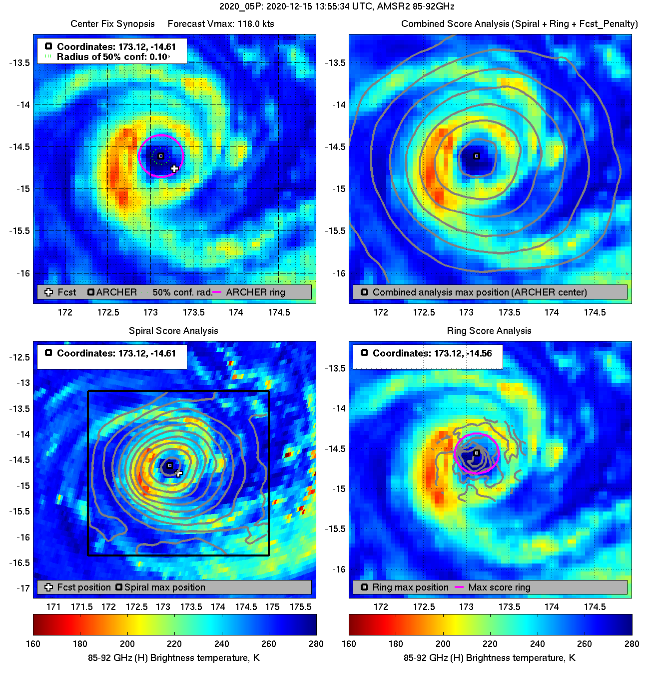
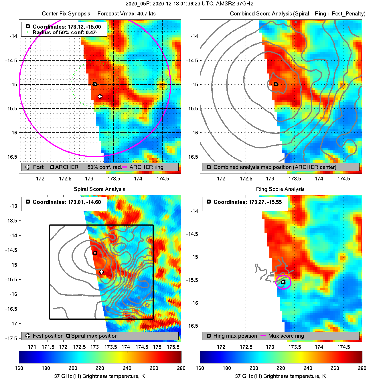
| 20201215 13:55:34 * |
AMSR2 |
85-92GHz |
118.0 |
-14.61 |
173.12 |
-14.60 |
173.15 |
0.10 |
0.28 |
0.50 |
100.0 |
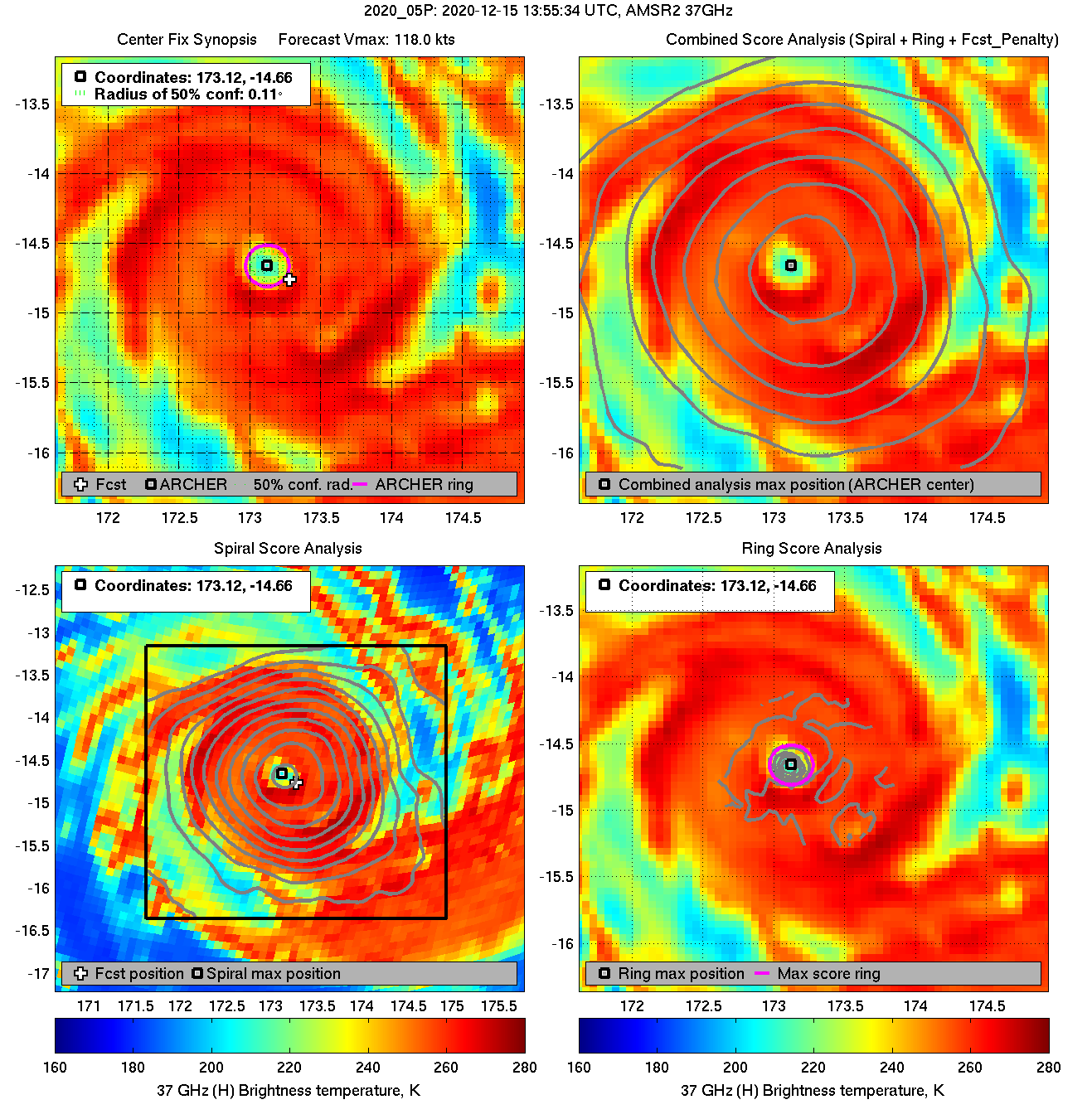
| 20201215 13:55:34 |
AMSR2 |
37GHz |
118.0 |
-14.66 |
173.12 |
-14.65 |
173.15 |
0.11 |
0.32 |
0.30 |
*** |
|
|
|
 |
 |
|
|
|
 |
 |
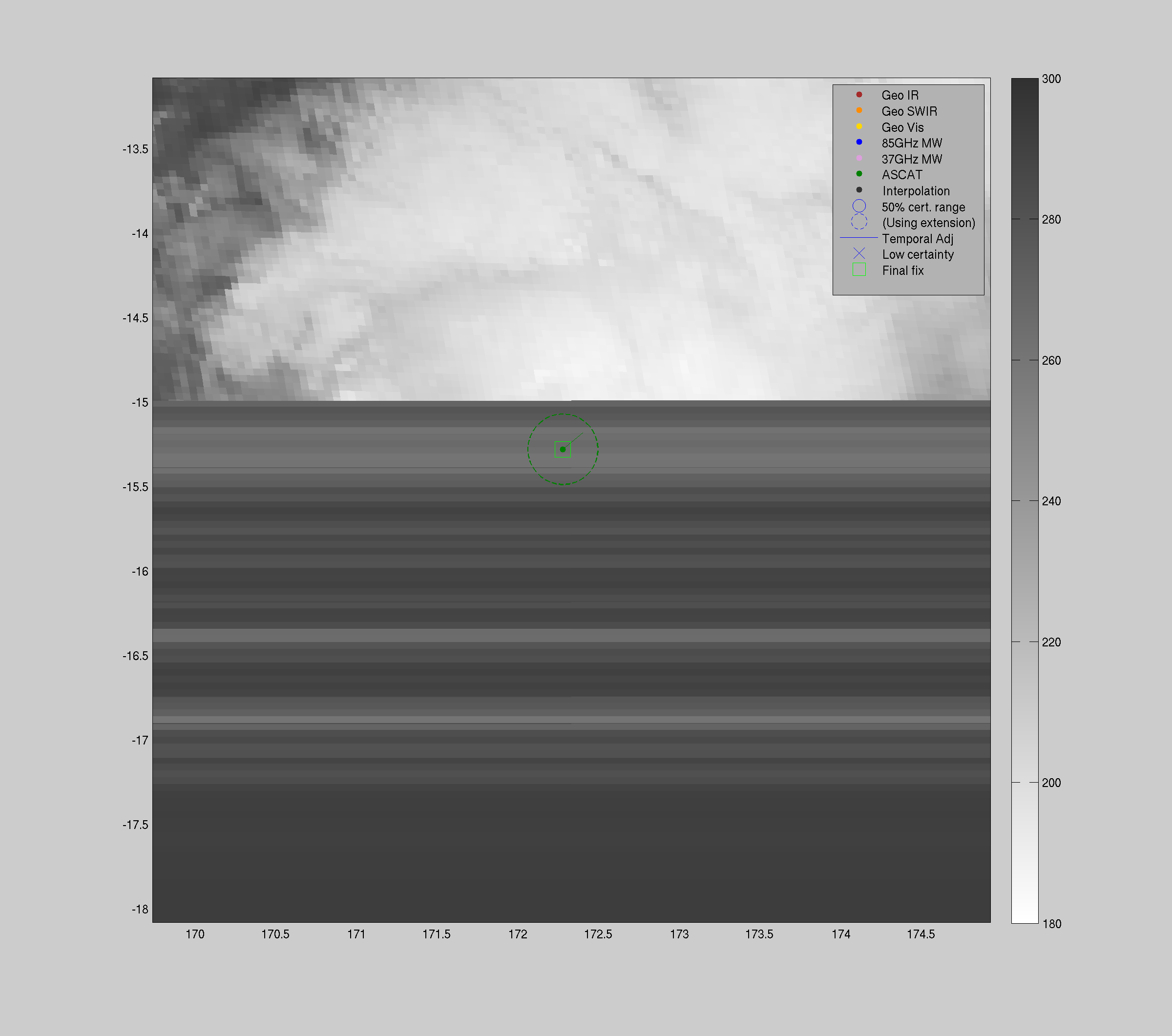
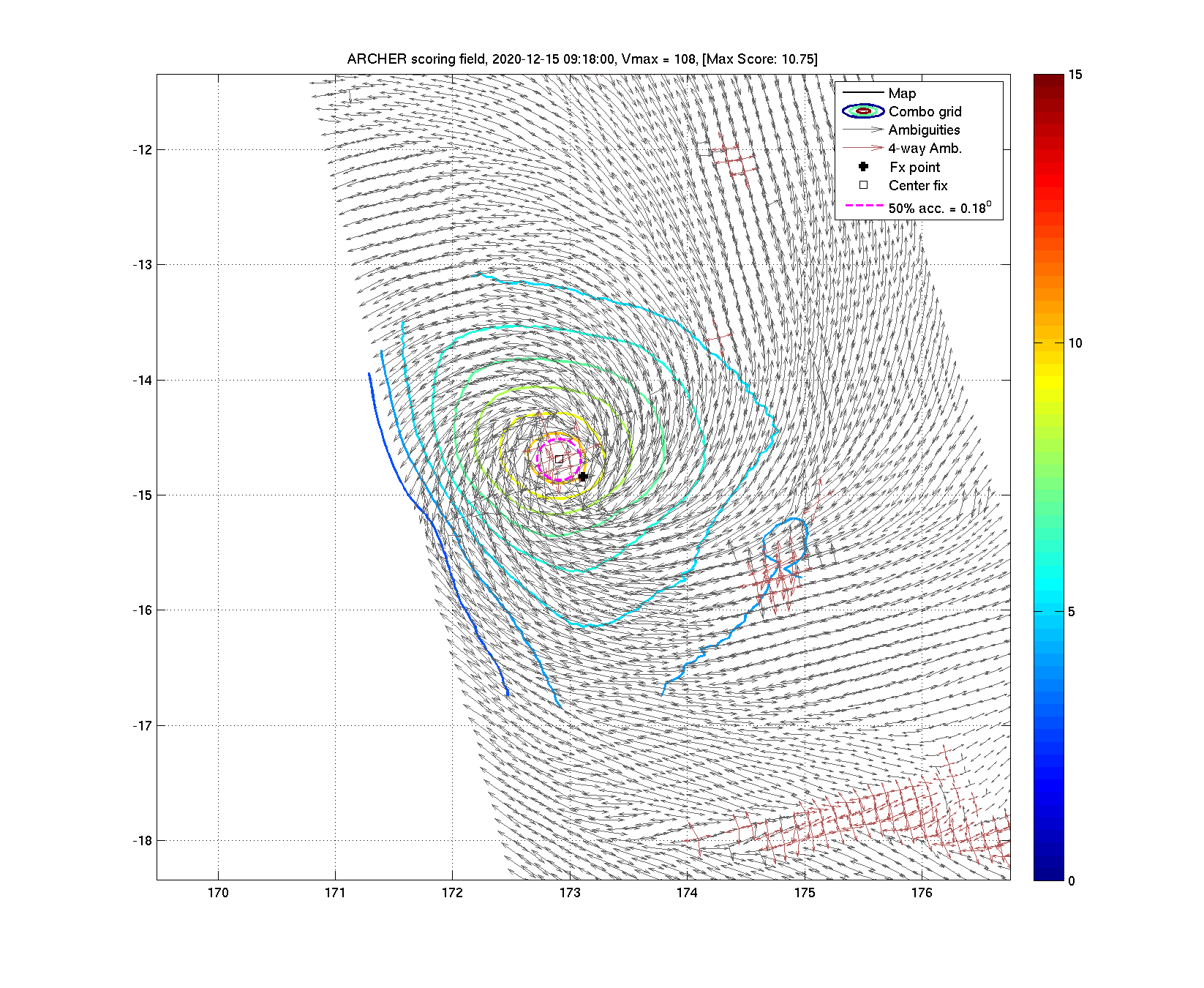
| 20201215 09:18:00 * |
Metop-A |
ASCAT |
107.7 |
-14.69 |
172.91 |
-14.70 |
172.88 |
0.18 |
0.51 |
*** |
*** |
|
|
|
 |
 |
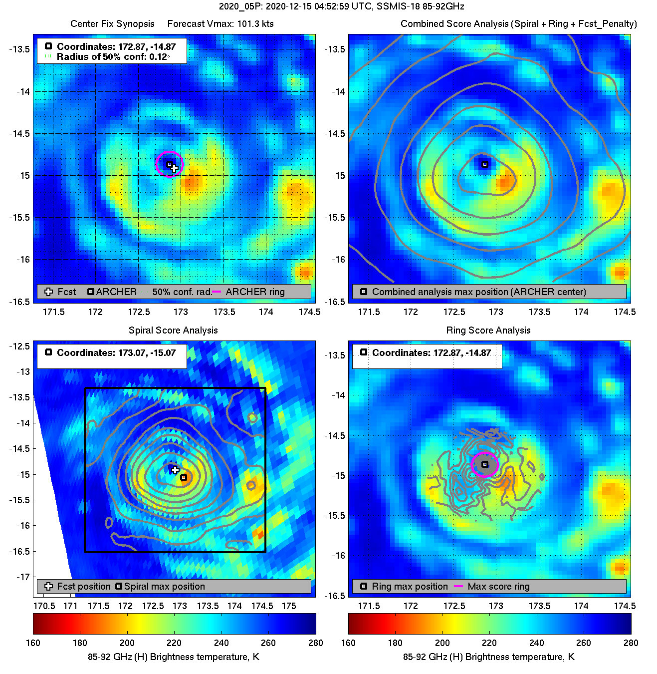
| 20201215 04:52:59 |
SSMIS-18 |
85-92GHz |
101.3 |
-14.87 |
172.87 |
-14.86 |
172.92 |
0.12 |
0.33 |
0.30 |
97.4 |
| 20201215 04:46:01 * |
SSMIS-16 |
85-92GHz |
100.9 |
-14.92 |
172.86 |
-14.91 |
172.92 |
0.11 |
0.30 |
0.30 |
100.0 |
|
|
|
 |
 |
|
|
|
 |
 |
|
|
|
 |
 |
|
|
|
 |
 |
|
|
|
 |
 |
|
|
|
 |
 |
|
|
|
 |
 |
|
|
|
 |
 |
|
|
|
 |
 |
|
|
|
 |
 |
|
|
|
 |
 |
|
|
|
 |
 |
|
|
|
 |
 |
|
|
|
 |
 |
|
|
|
 |
 |
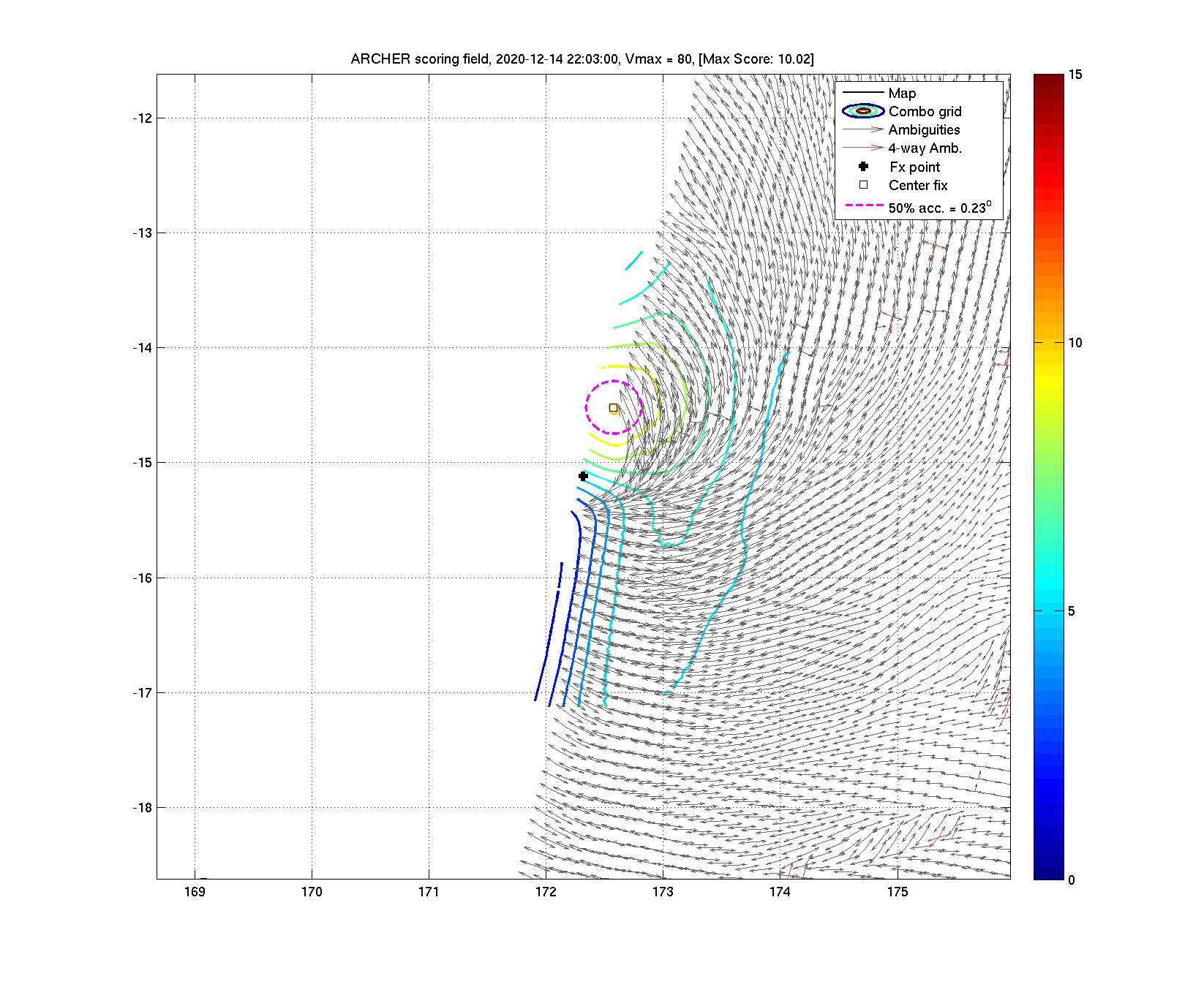
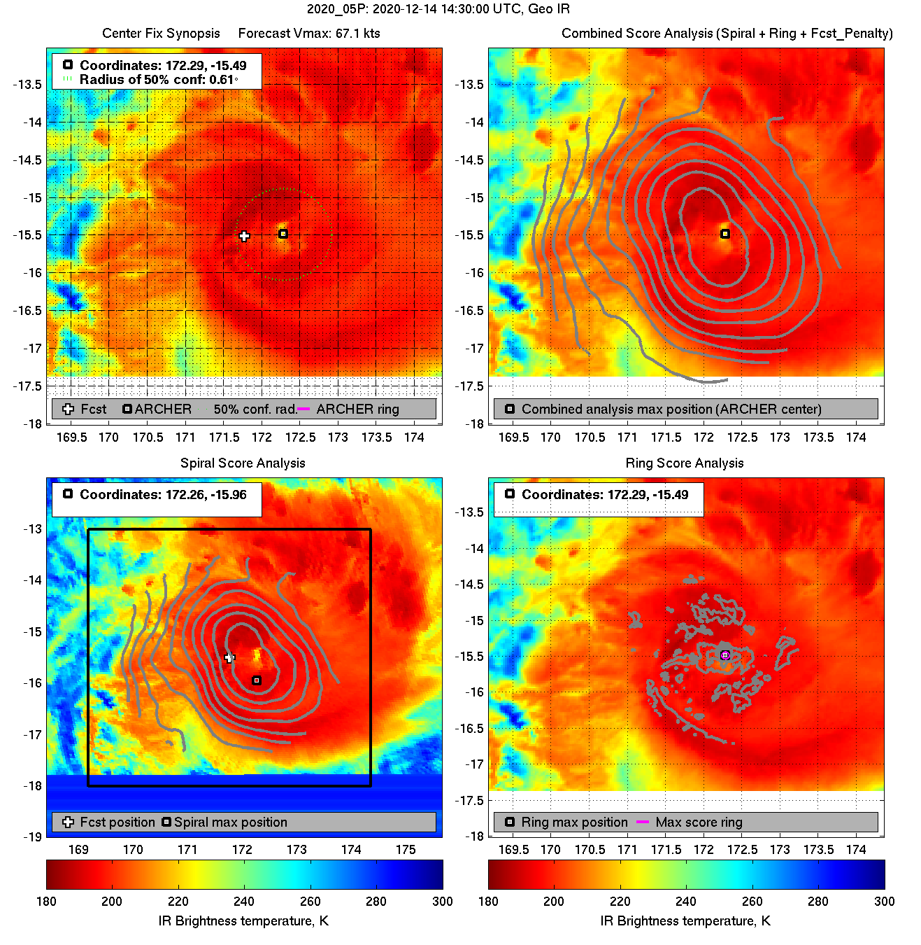
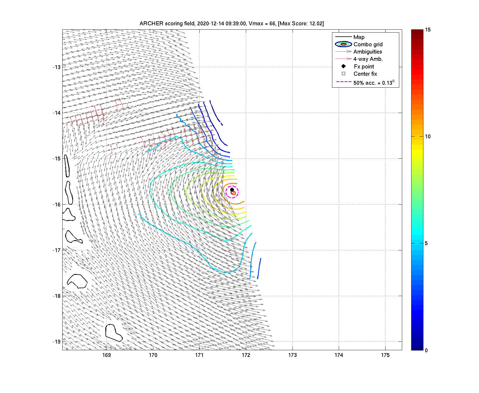
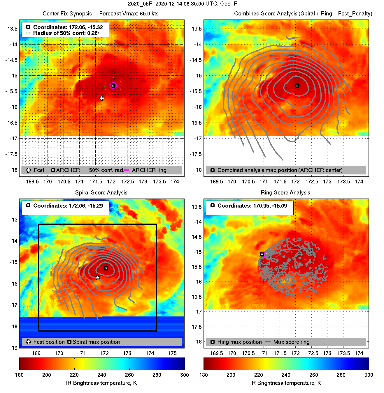
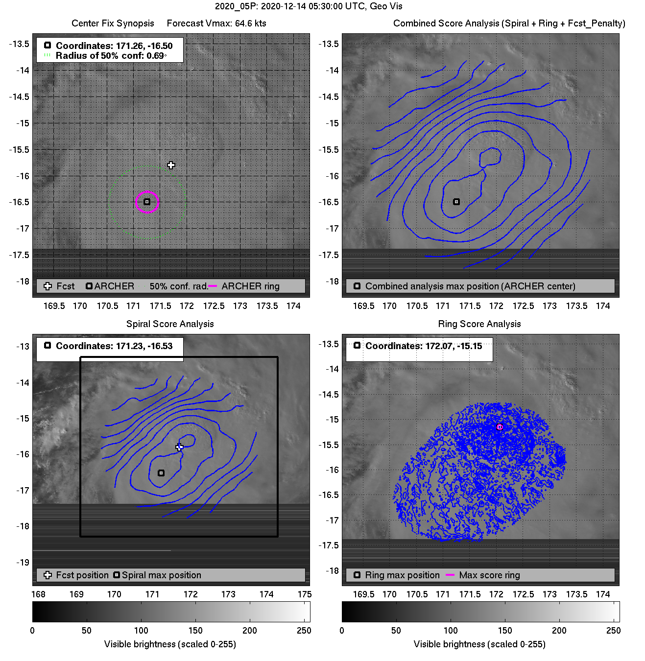
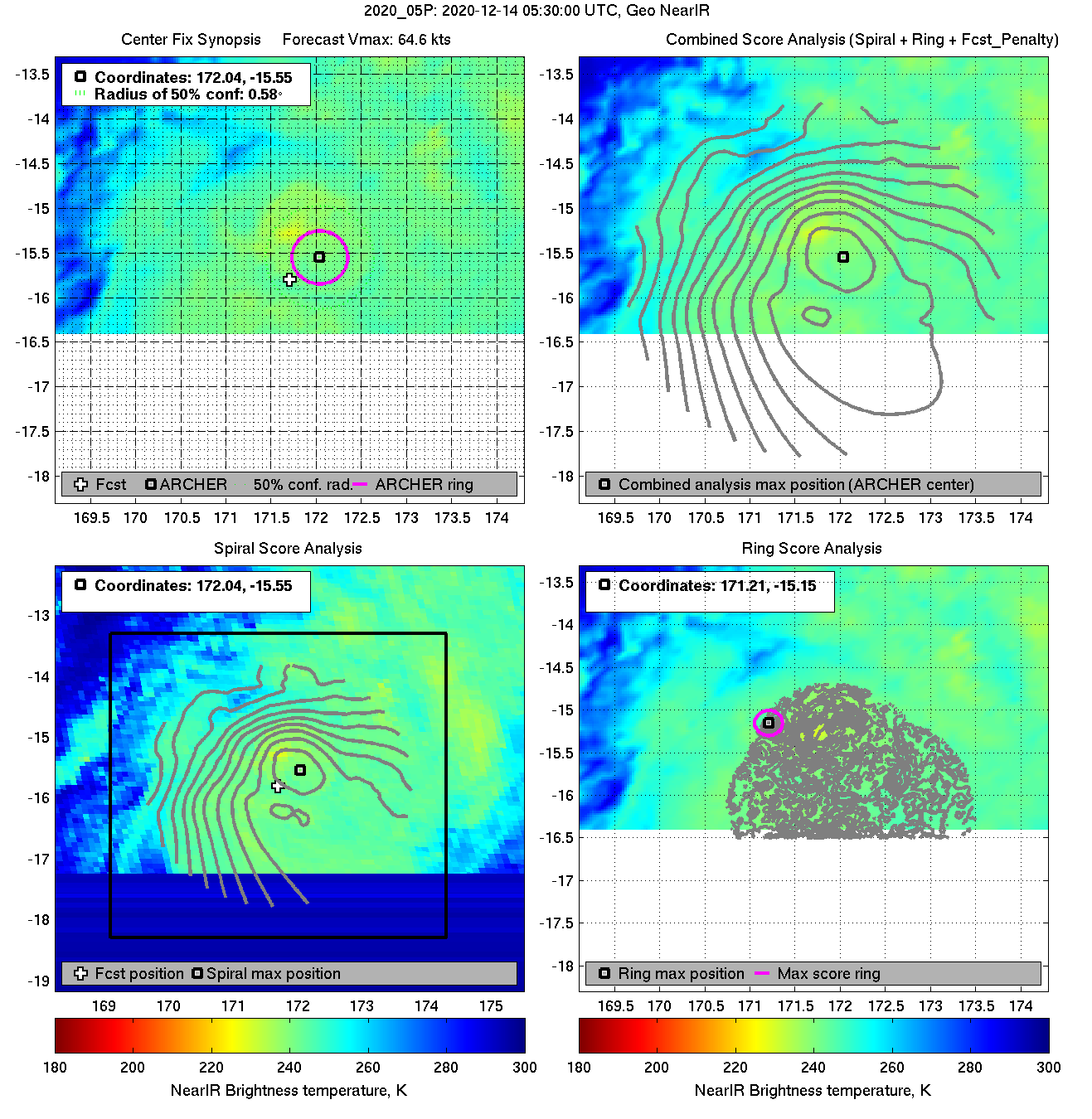
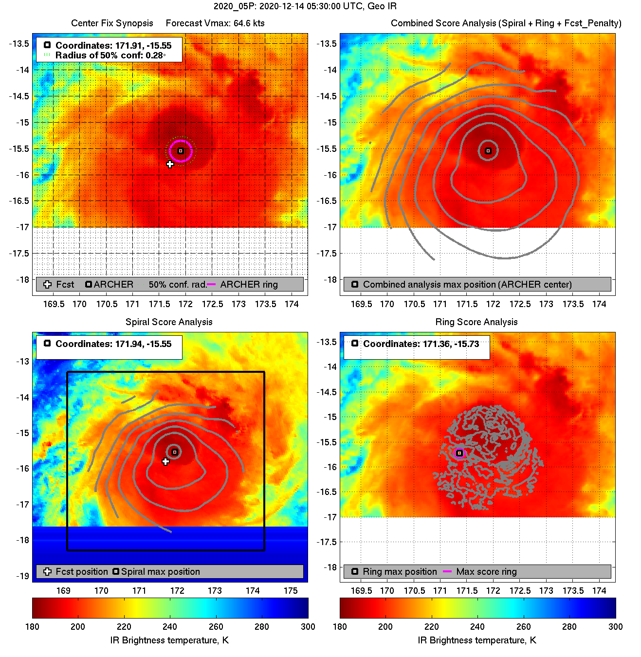
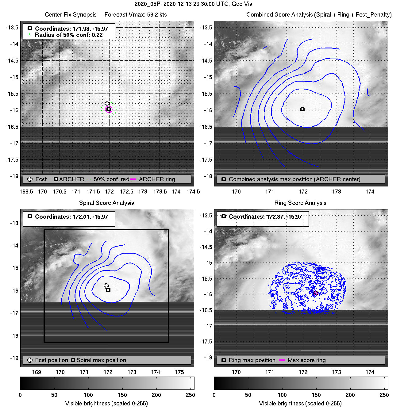
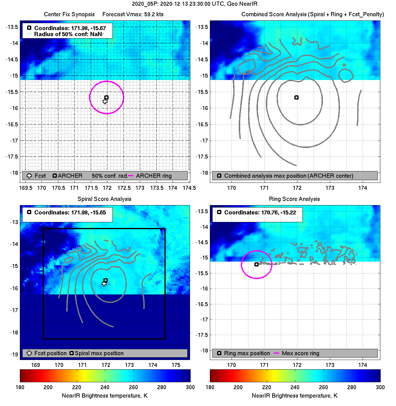
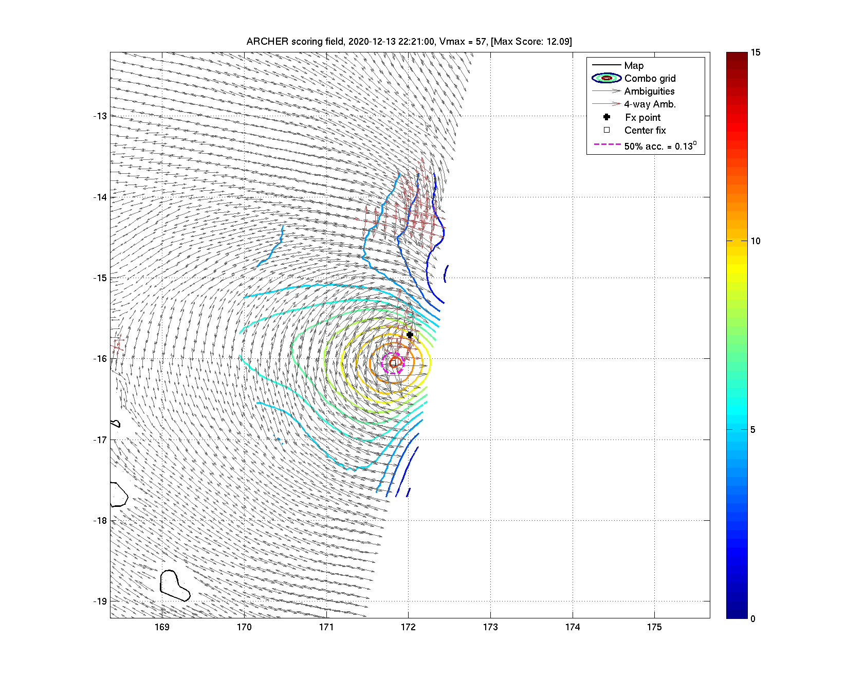
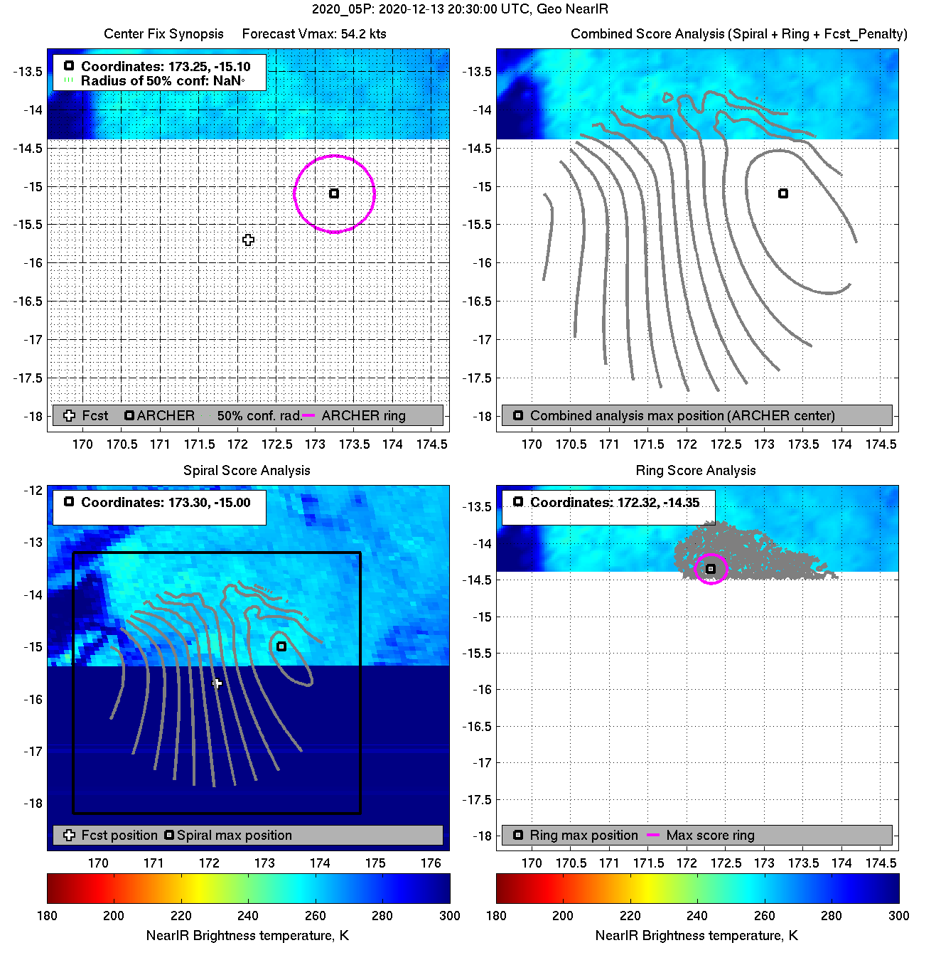
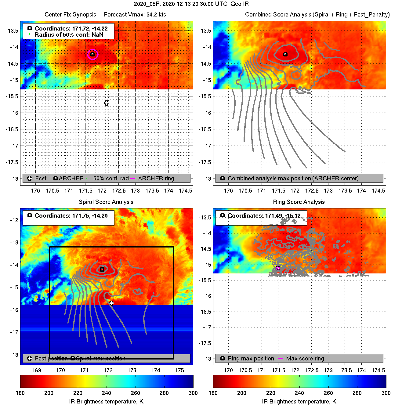
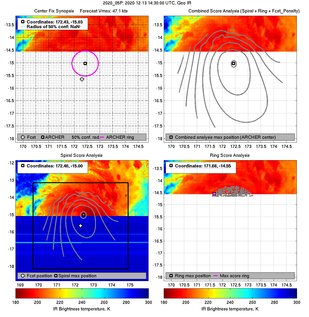
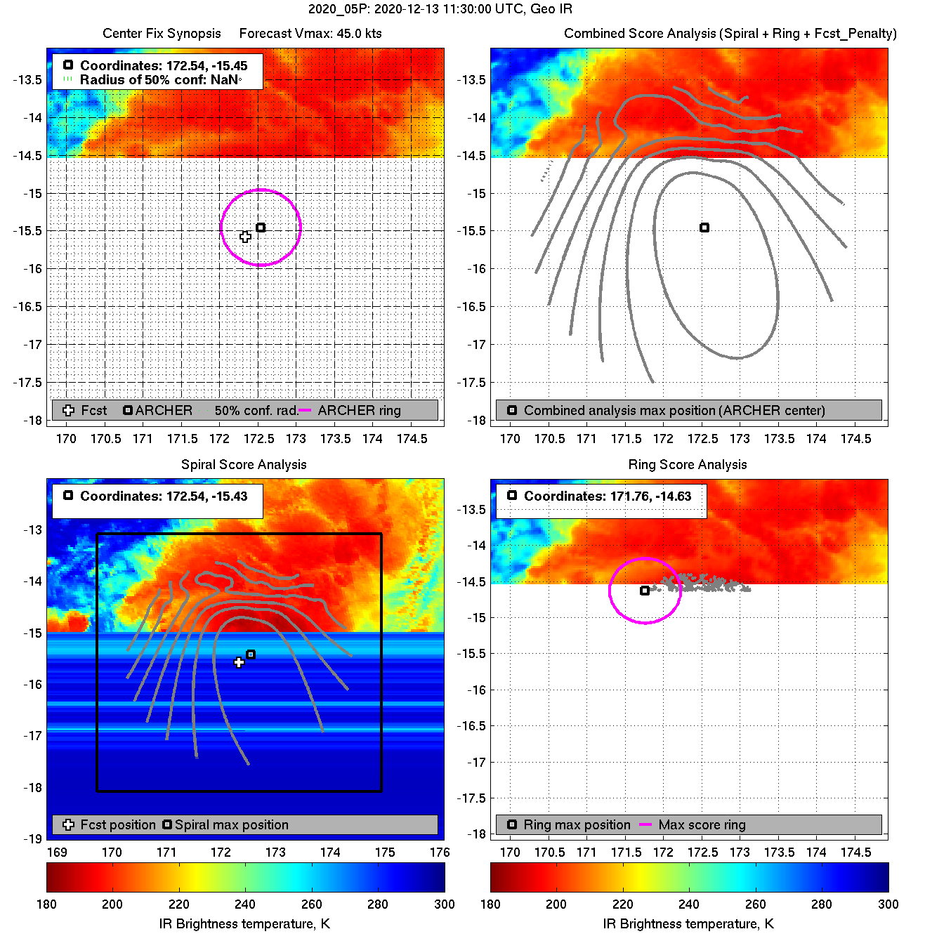
| 20201213 09:33:00 * |
Metop-B |
ASCAT |
45.0 |
-15.18 |
172.40 |
-15.12 |
172.49 |
0.19 |
0.53 |
*** |
*** |
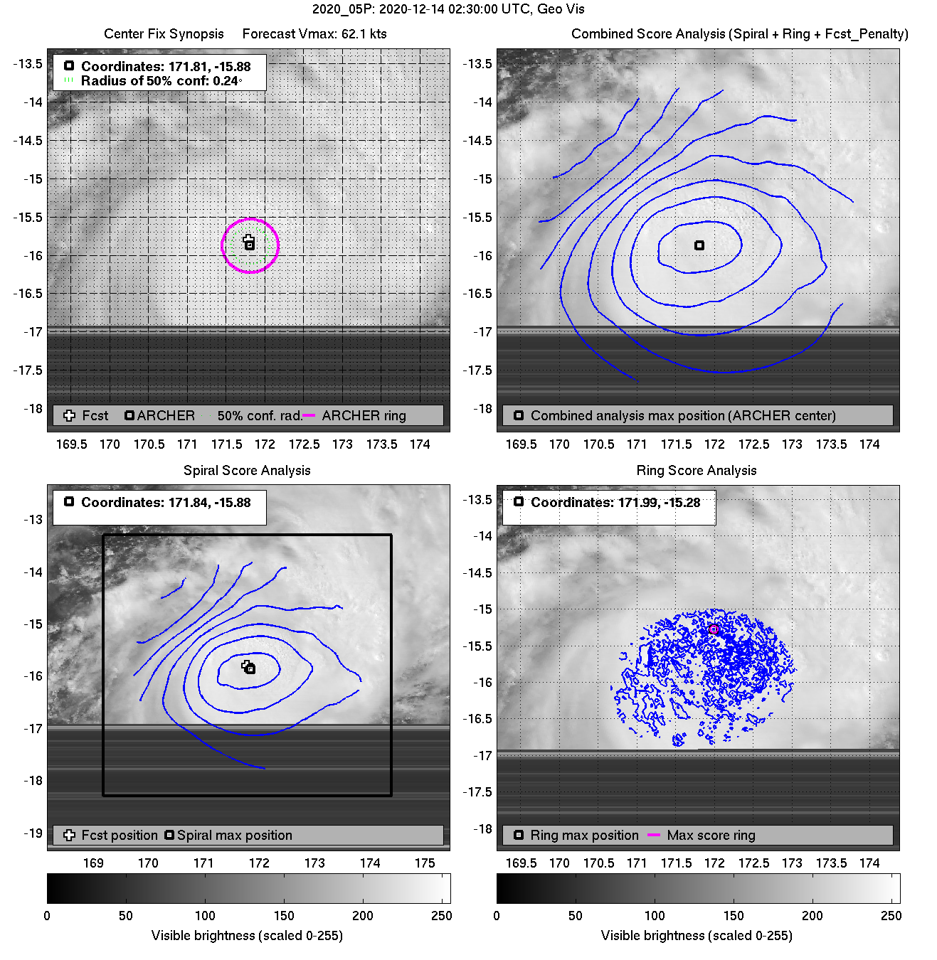
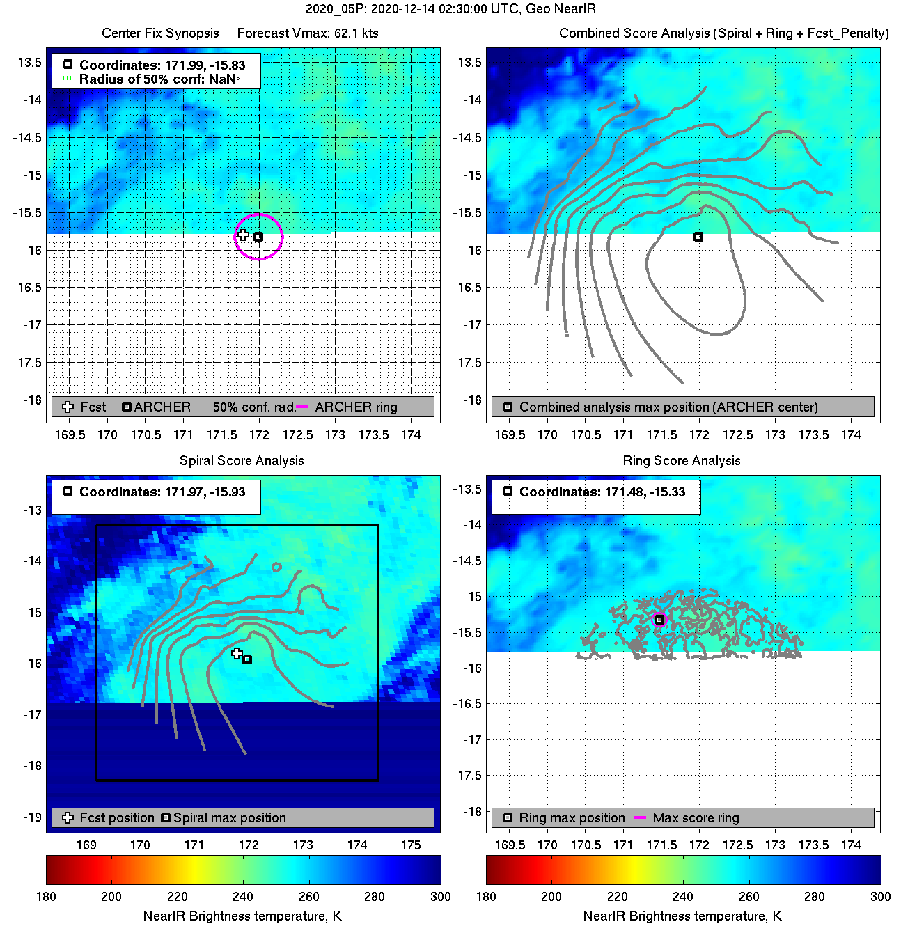
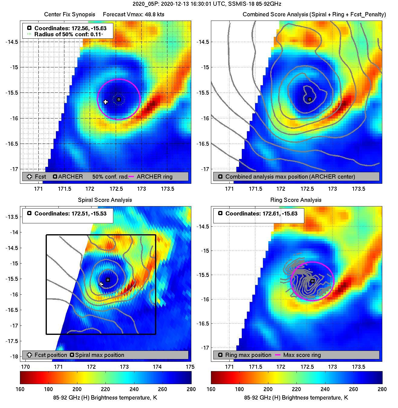
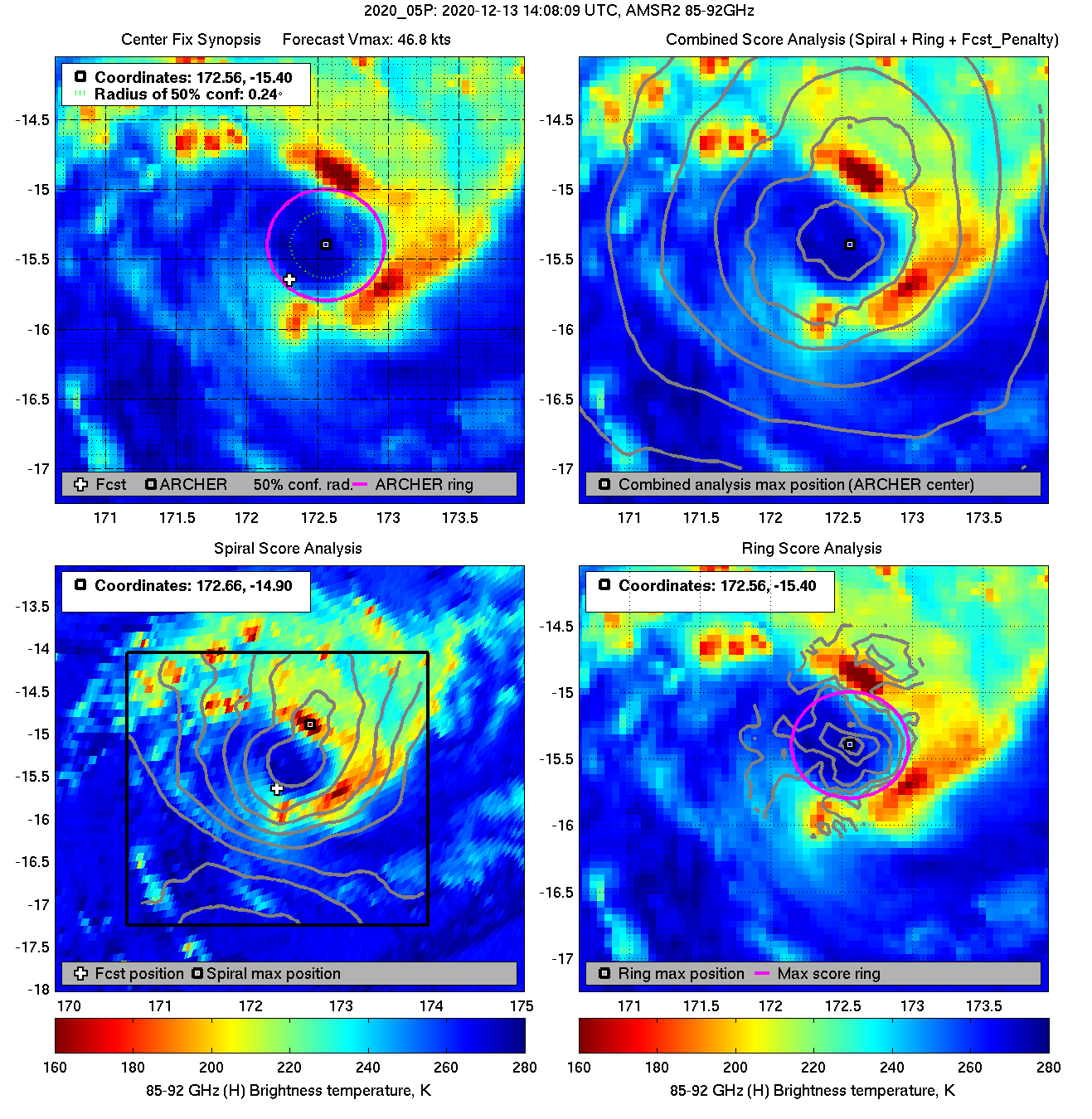
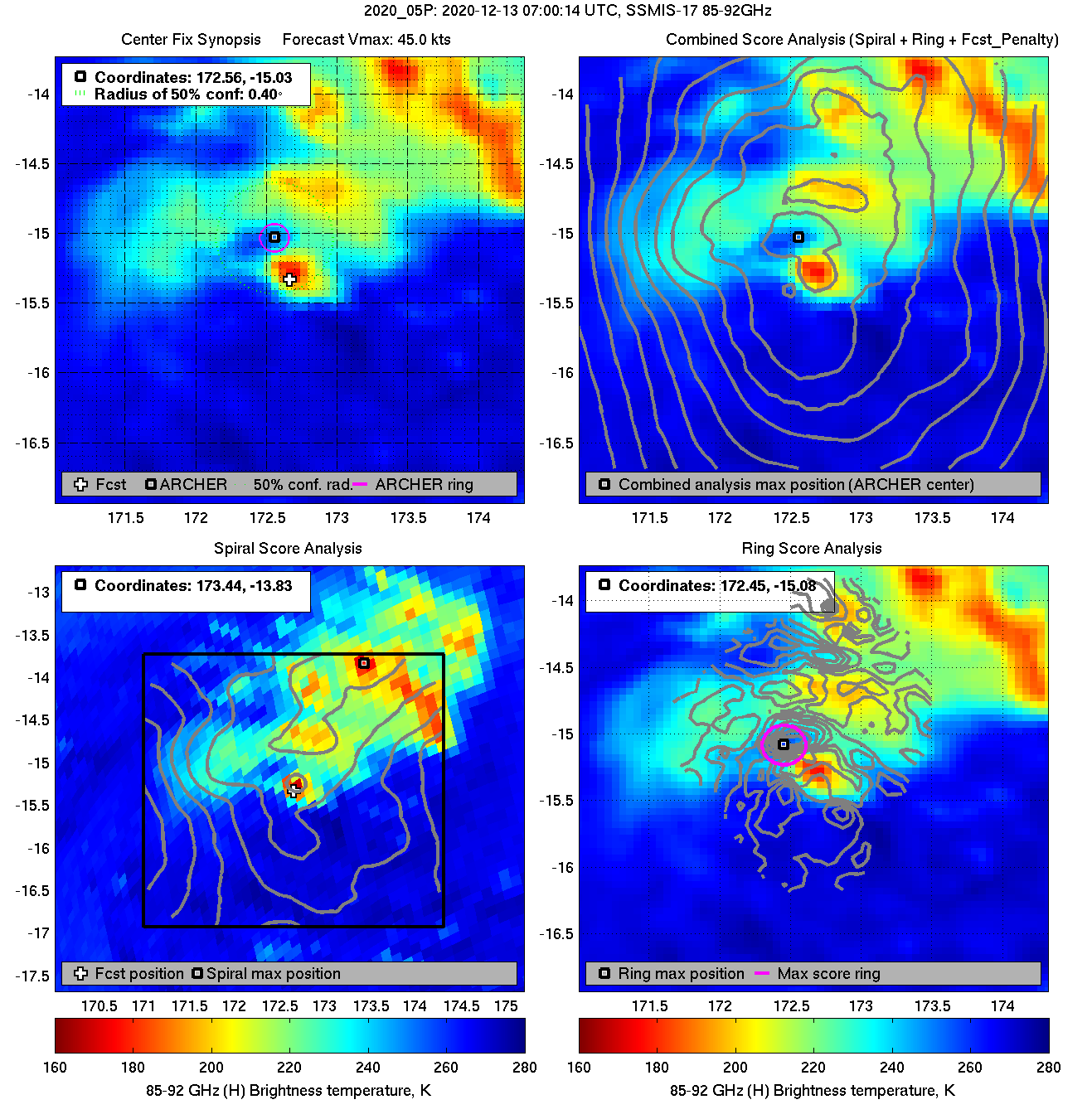
| 20201213 07:00:14 |
SSMIS-17 |
85-92GHz |
45.0 |
-15.03 |
172.56 |
-15.12 |
172.43 |
0.40 |
1.13 |
0.20 |
16.8 |
|
|
|
 |
 |
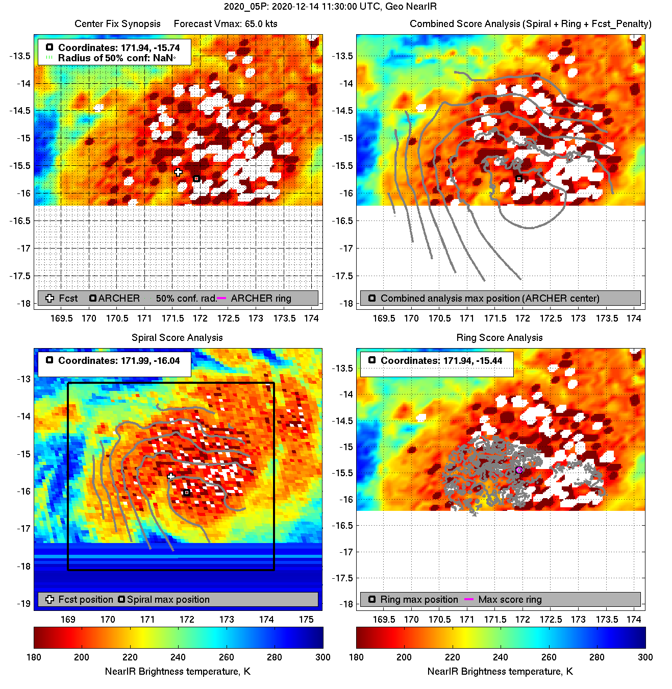
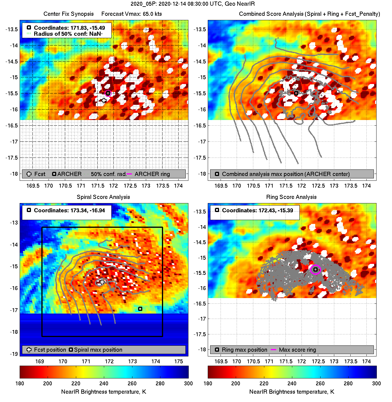
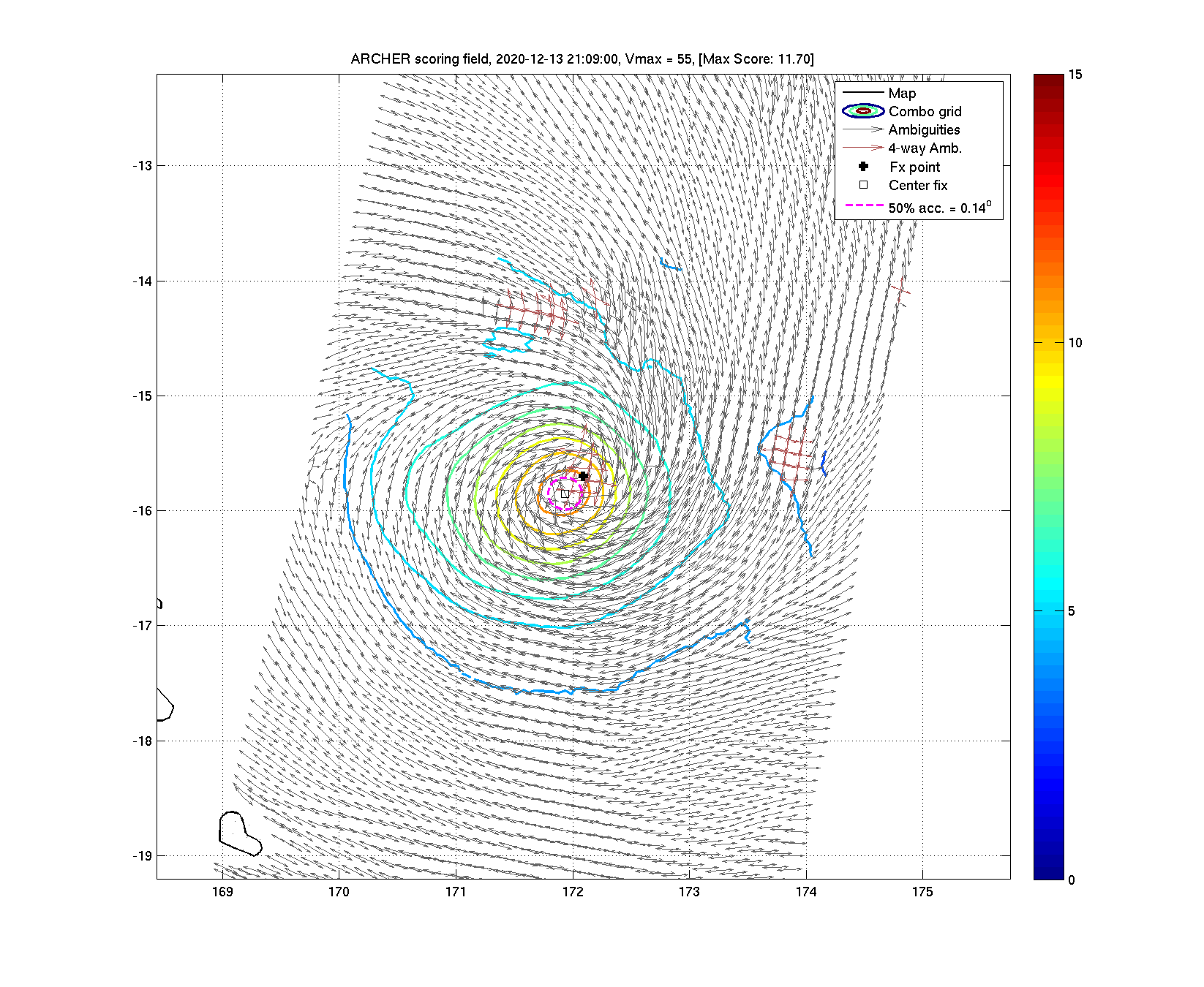
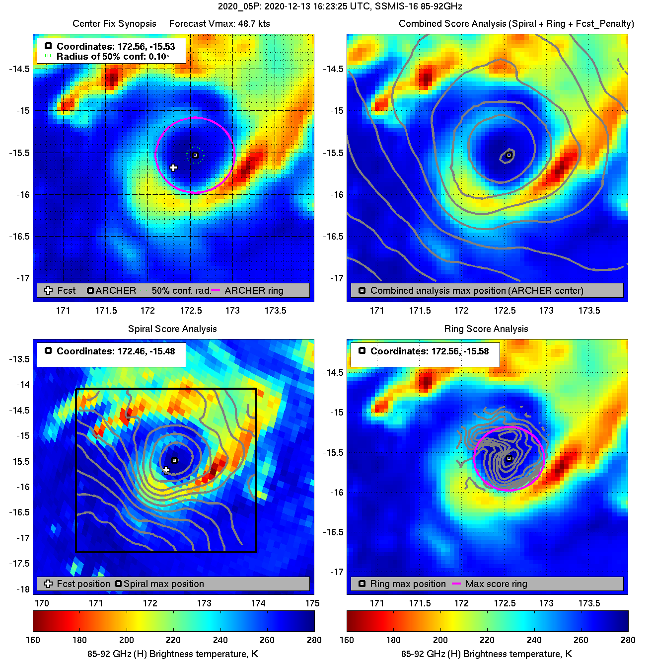
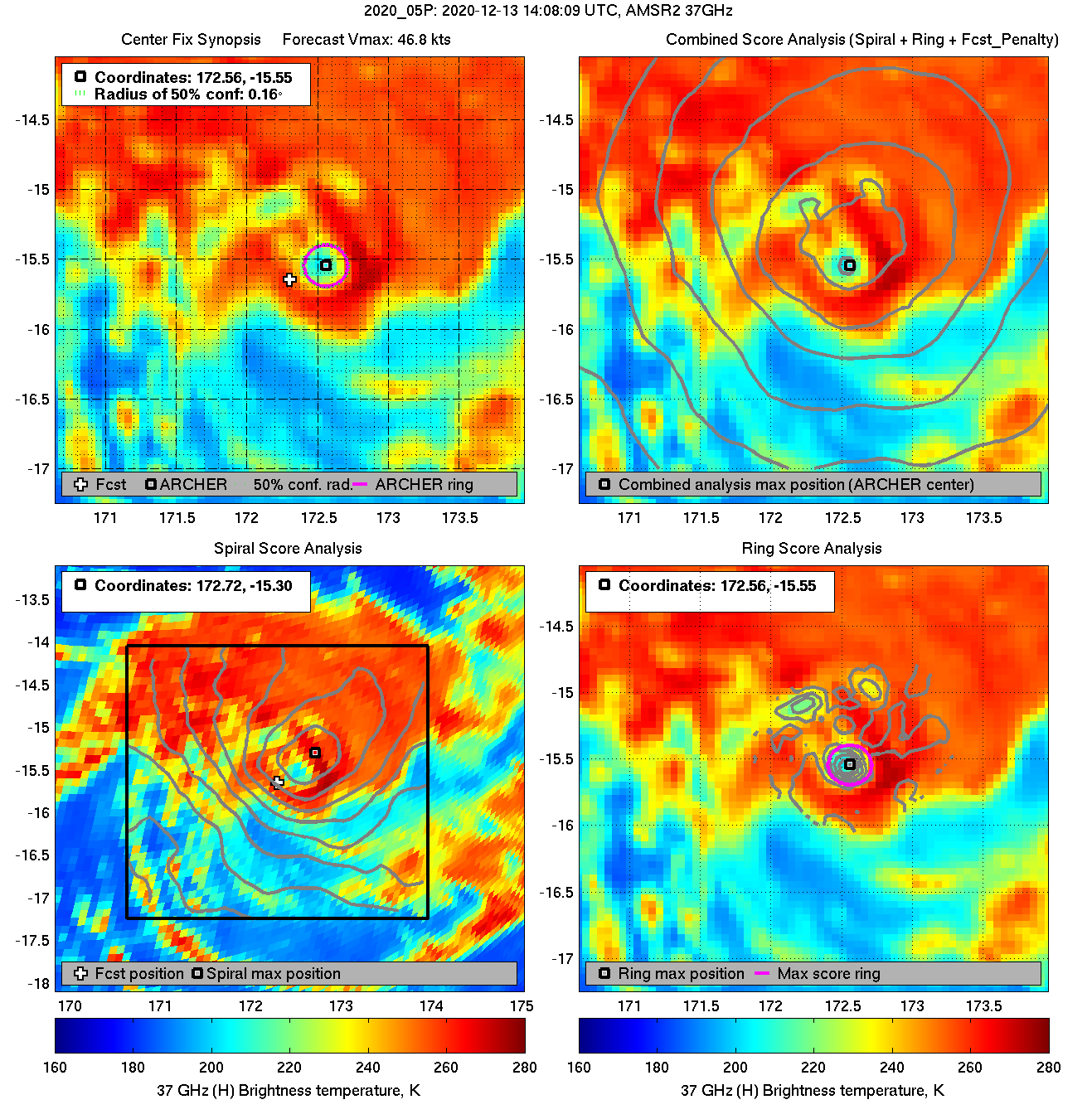
| 20201213 05:18:02 |
SSMIS-18 |
85-92GHz |
44.4 |
-14.88 |
172.64 |
-14.88 |
172.62 |
0.24 |
0.68 |
1.40 |
6.2 |
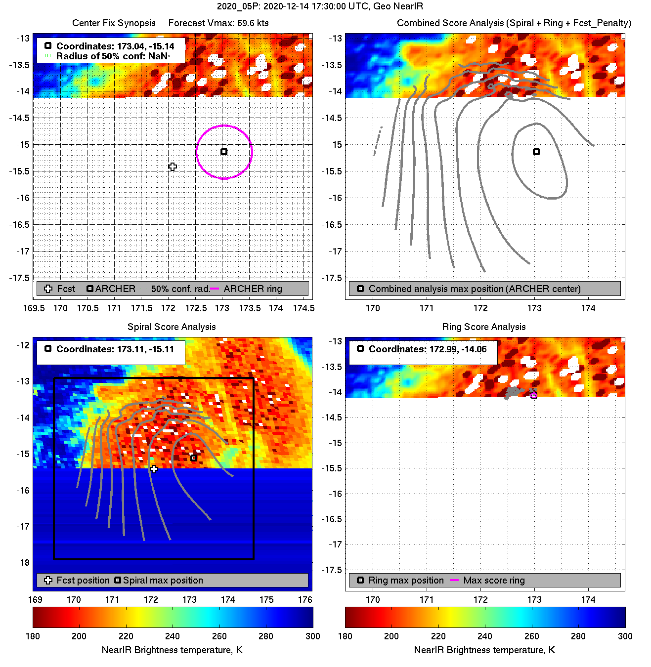
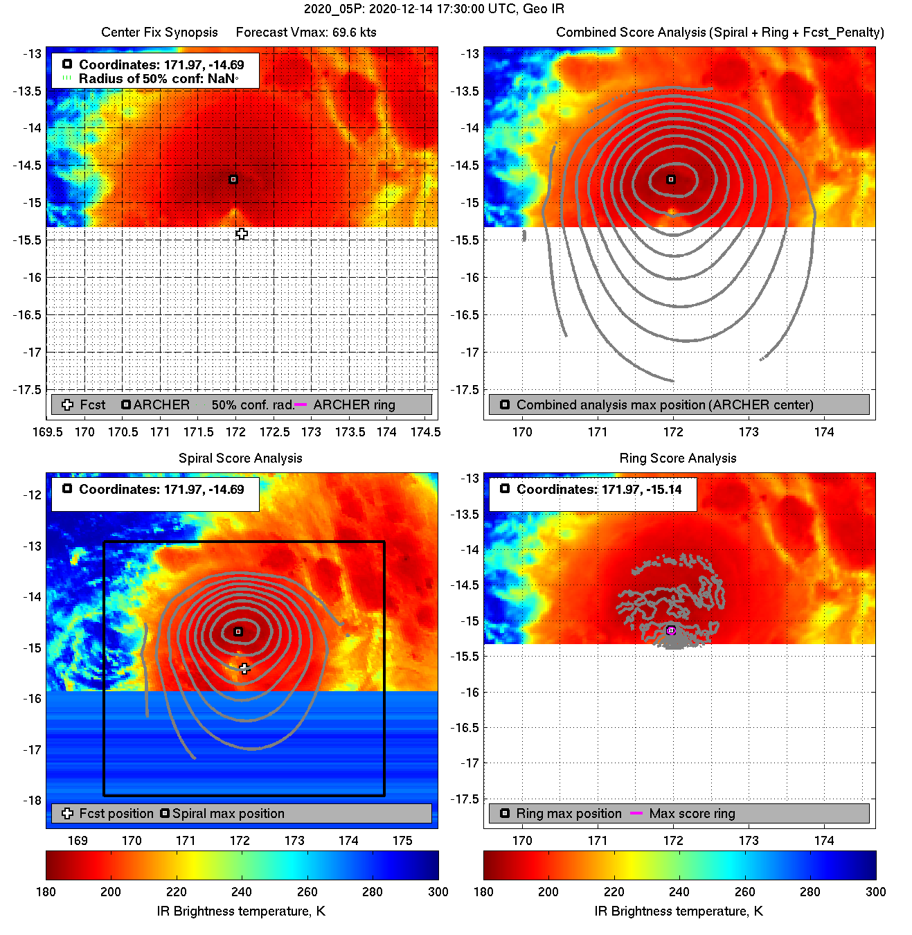
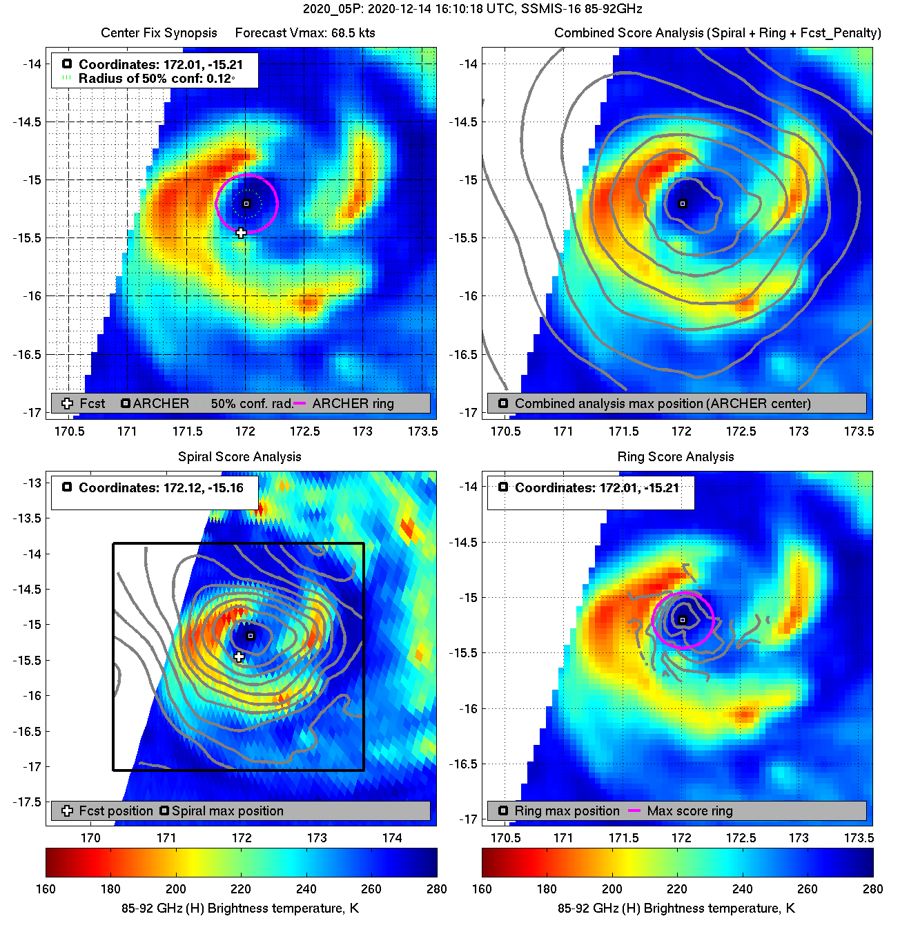
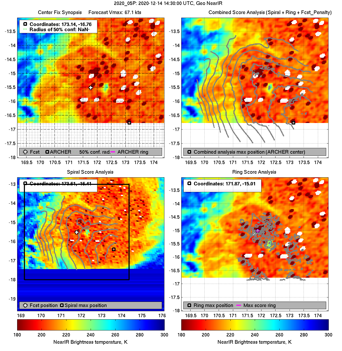
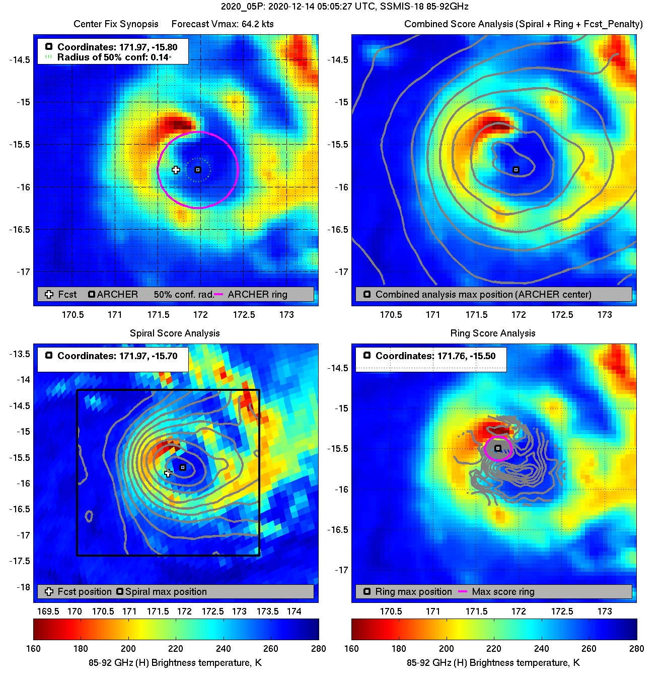
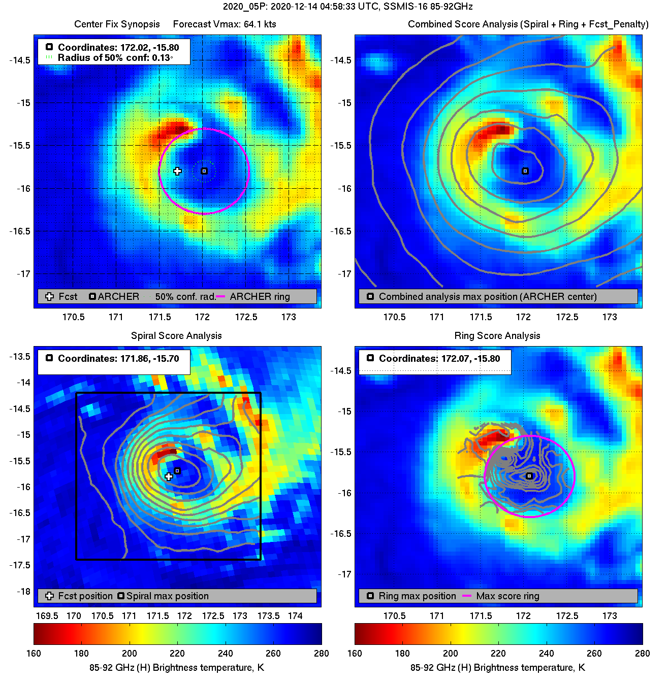
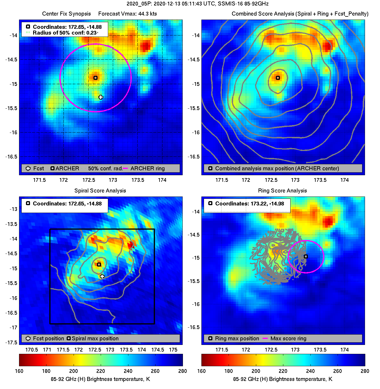
| 20201213 05:11:43 * |
SSMIS-16 |
85-92GHz |
44.3 |
-14.88 |
172.65 |
-14.89 |
172.62 |
0.23 |
0.66 |
1.40 |
10.1 |
|
|
|
 |
 |
|
|
|
 |
 |
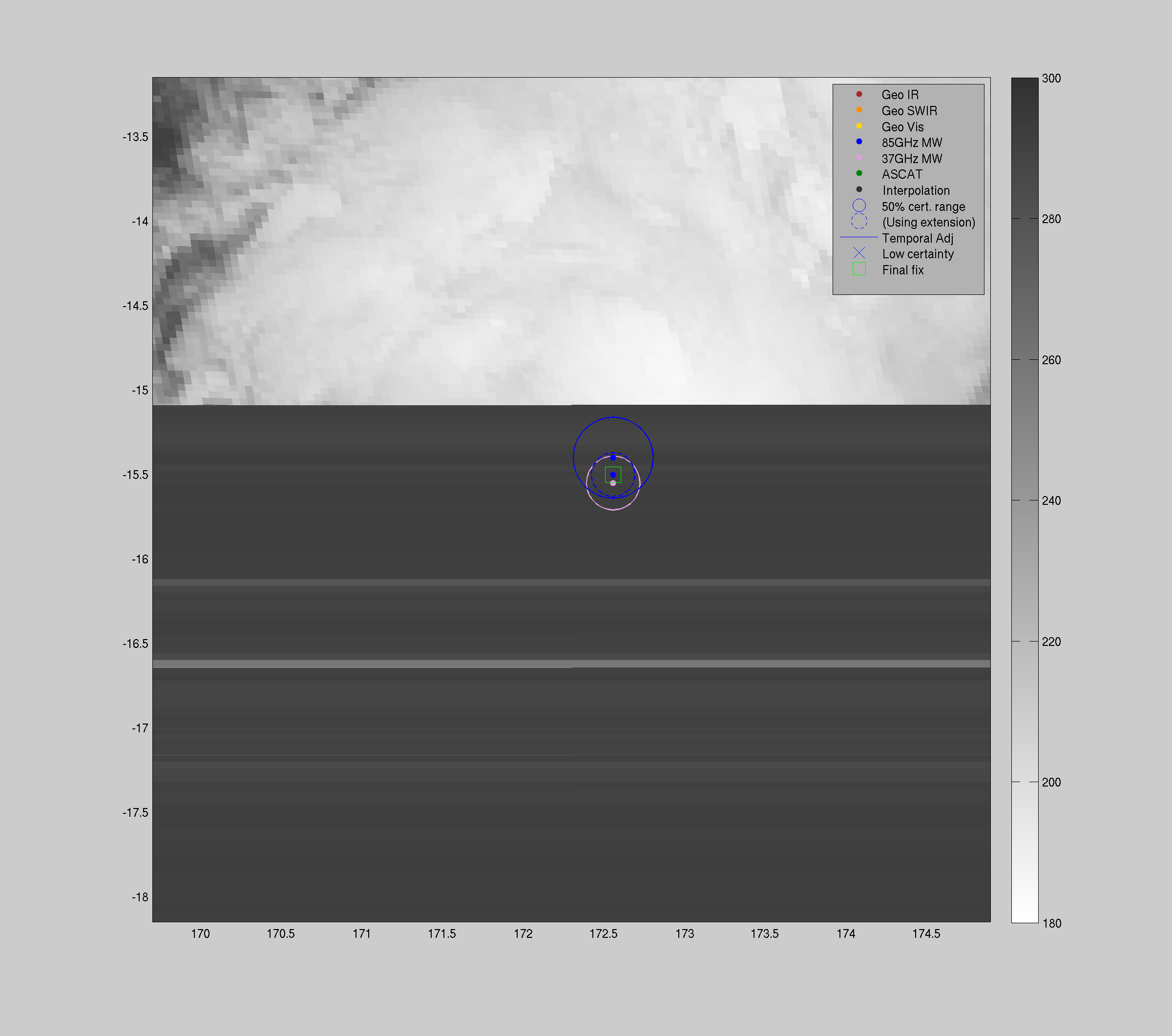
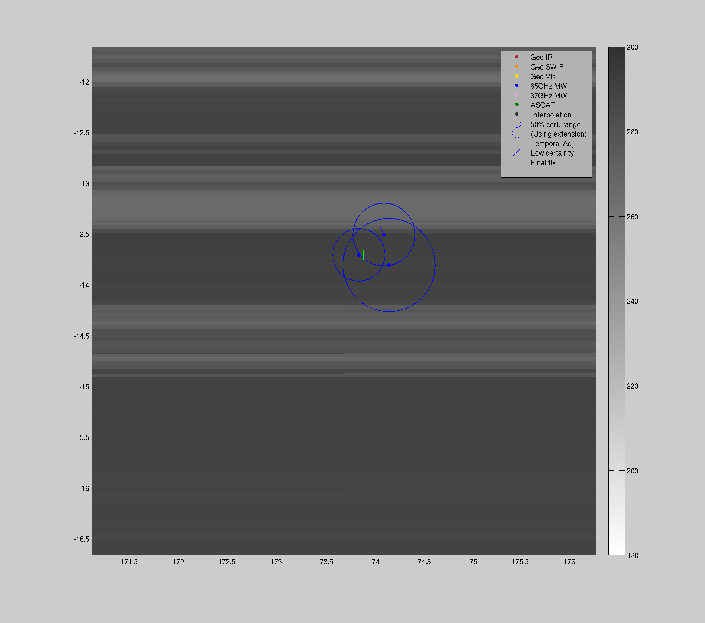
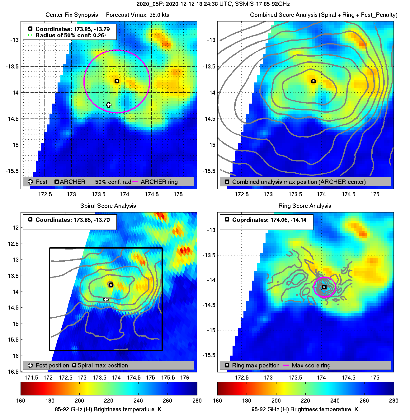
| 20201212 18:24:38 * |
SSMIS-17 |
85-92GHz |
35.0 |
-13.79 |
173.85 |
-13.69 |
173.85 |
0.26 |
0.73 |
1.20 |
-2.0 |
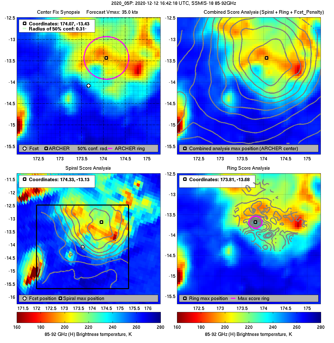
| 20201212 16:42:18 * |
SSMIS-18 |
85-92GHz |
35.0 |
-13.43 |
174.07 |
-13.51 |
174.11 |
0.31 |
0.87 |
1.00 |
-0.4 |
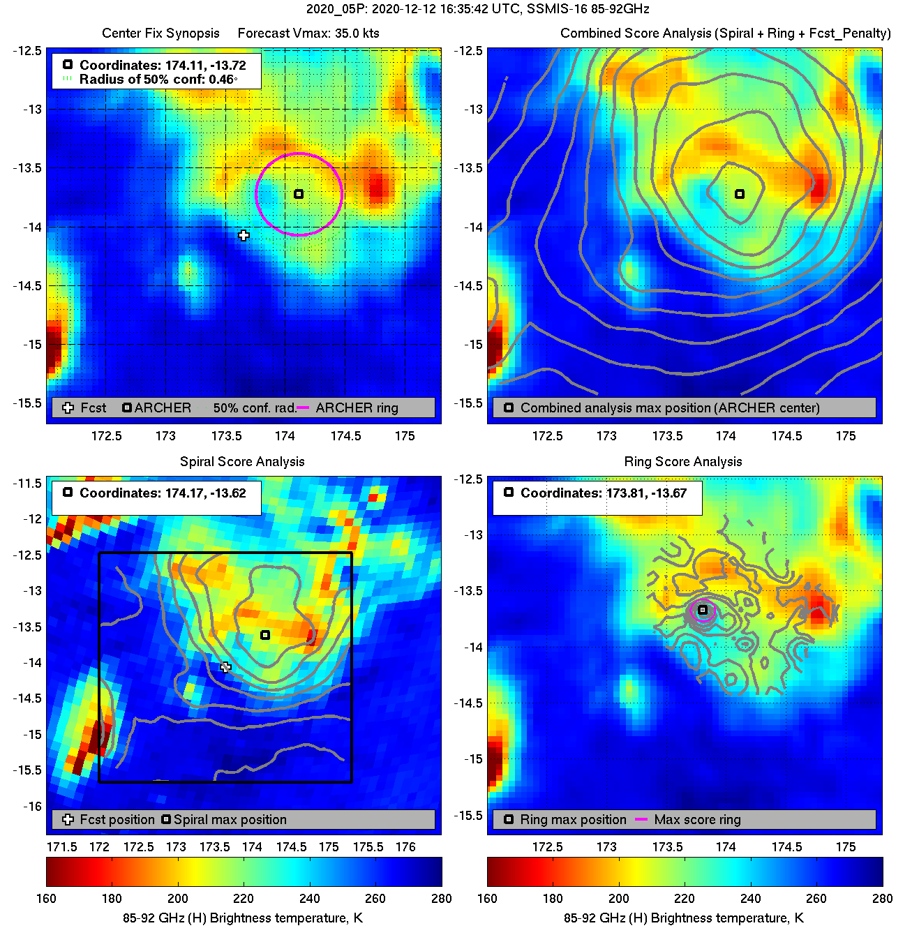
| 20201212 16:35:42 |
SSMIS-16 |
85-92GHz |
35.0 |
-13.72 |
174.11 |
-13.82 |
174.16 |
0.46 |
1.29 |
0.70 |
2.2 |
|


