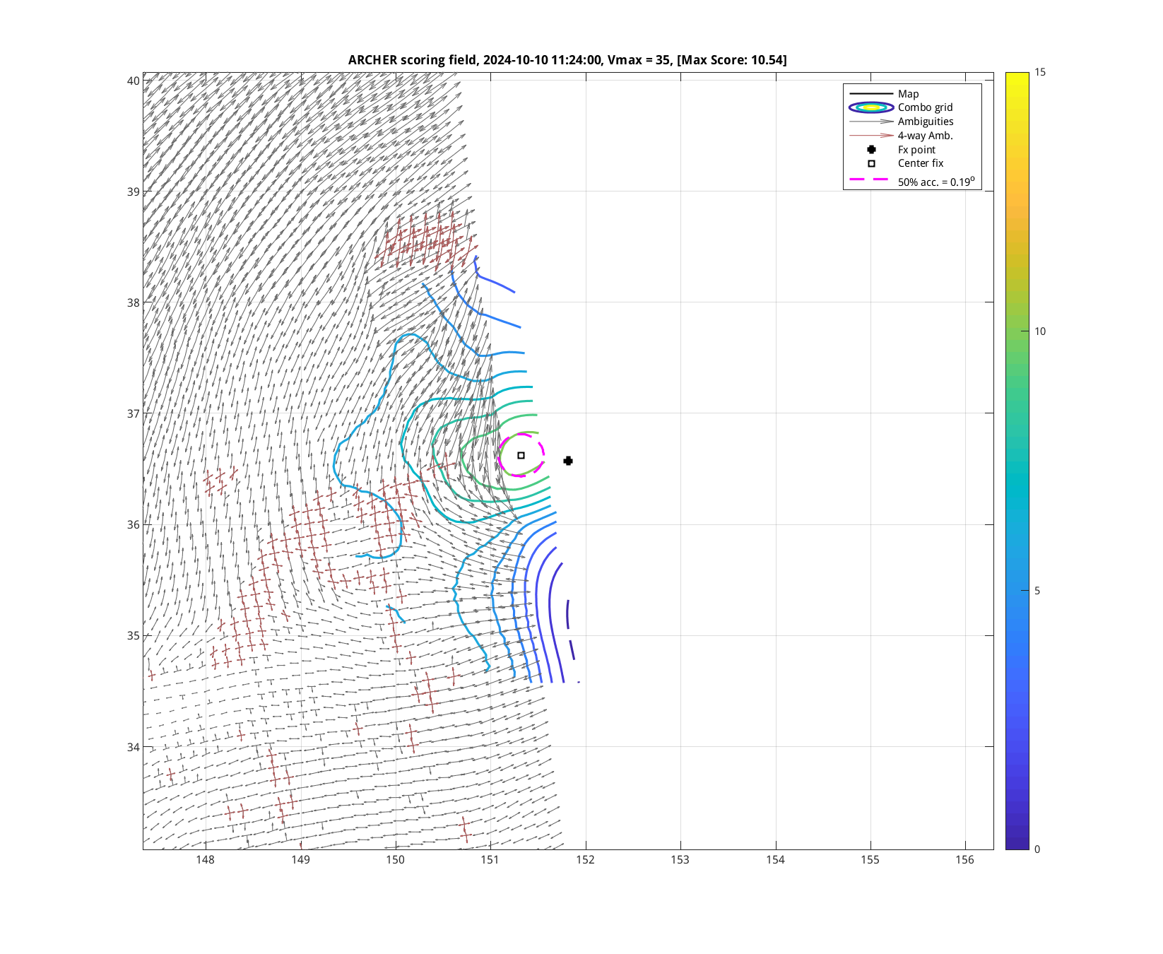
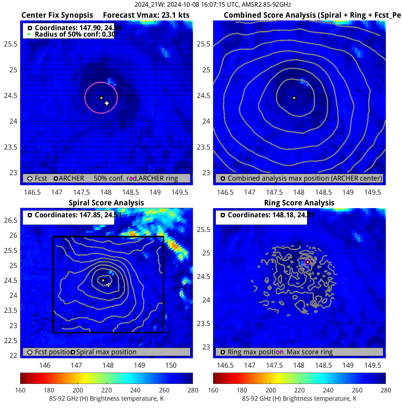
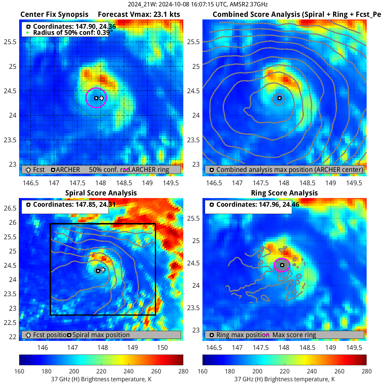
|
| Geo IR |
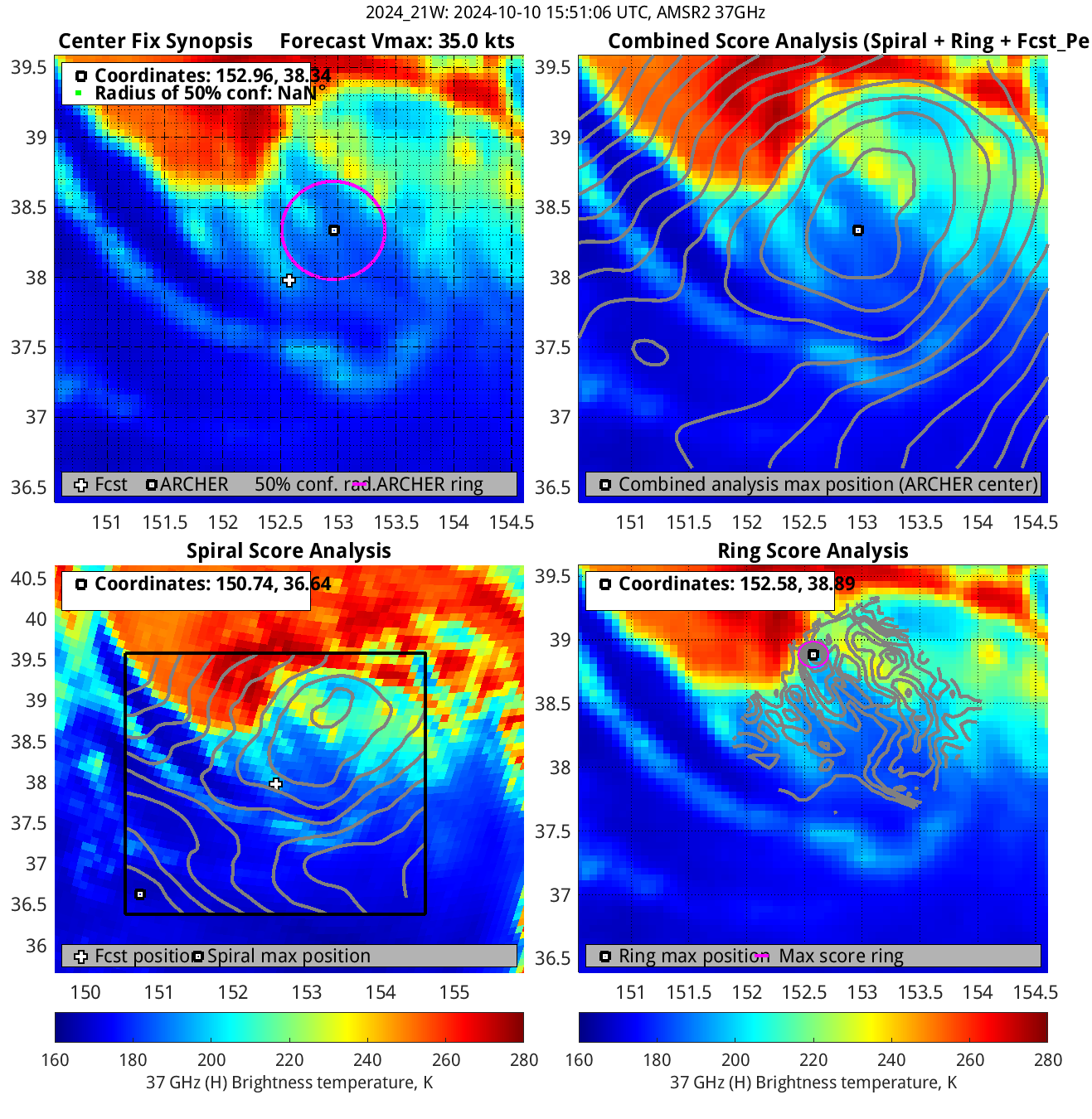
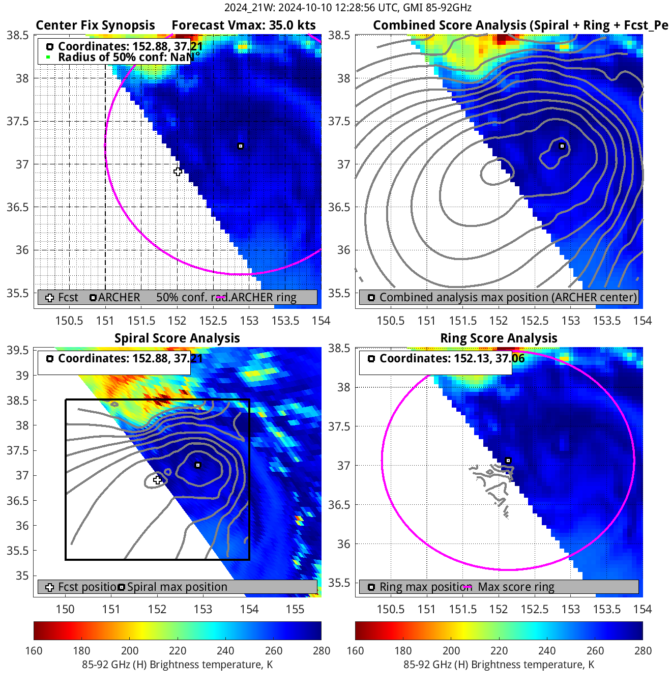
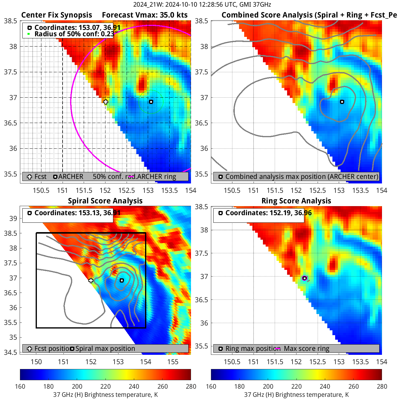
85-92GHz |
| Date/Time_(UTC) |
Source |
Sensor |
Vmax(kts) |
ARCHER Lat |
Lon |
Geo-ref Lat |
Lon |
50% cert. rad. |
95% cert. rad. |
Eye diam (deg) |
% cert. of eye |
|
|
|
|
 |
 |
|
|
|
 |
 |
|
|
|
 |
 |
|
|
|
 |
 |
|
|
|
 |
 |
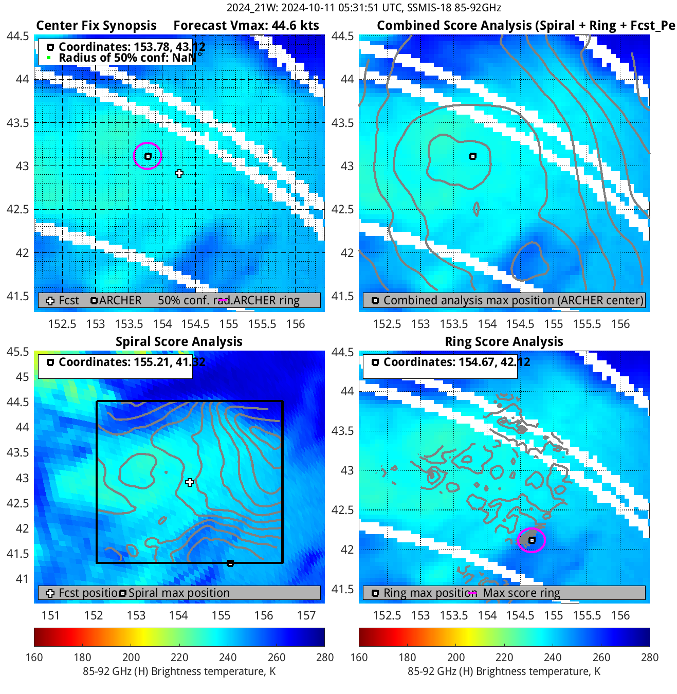
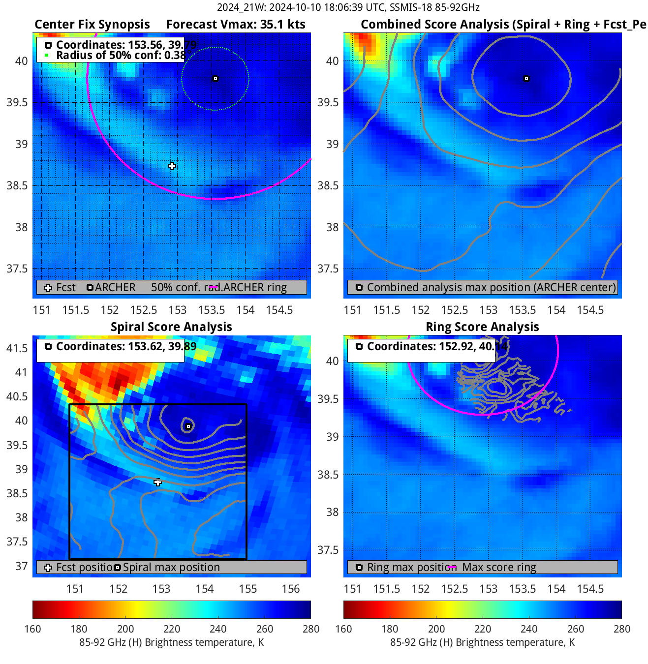
| 20241010 18:06:39 * |
SSMIS-18 |
85-92GHz |
35.1 |
39.79 |
153.56 |
39.58 |
153.47 |
0.38 |
1.08 |
2.90 |
2.4 |
|
|
|
 |
 |
|
|
|
 |
 |
|
|
|
 |
 |
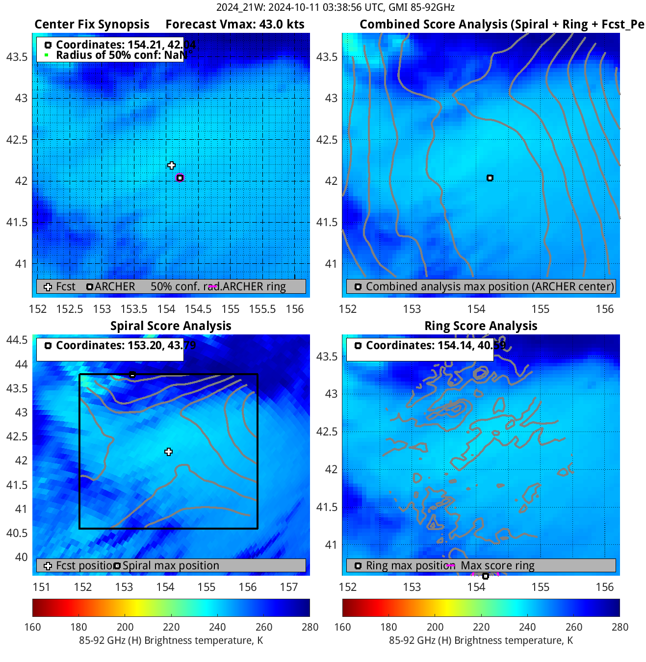
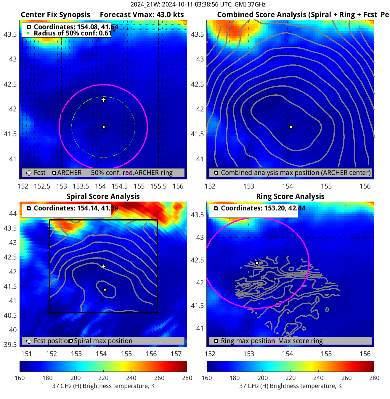
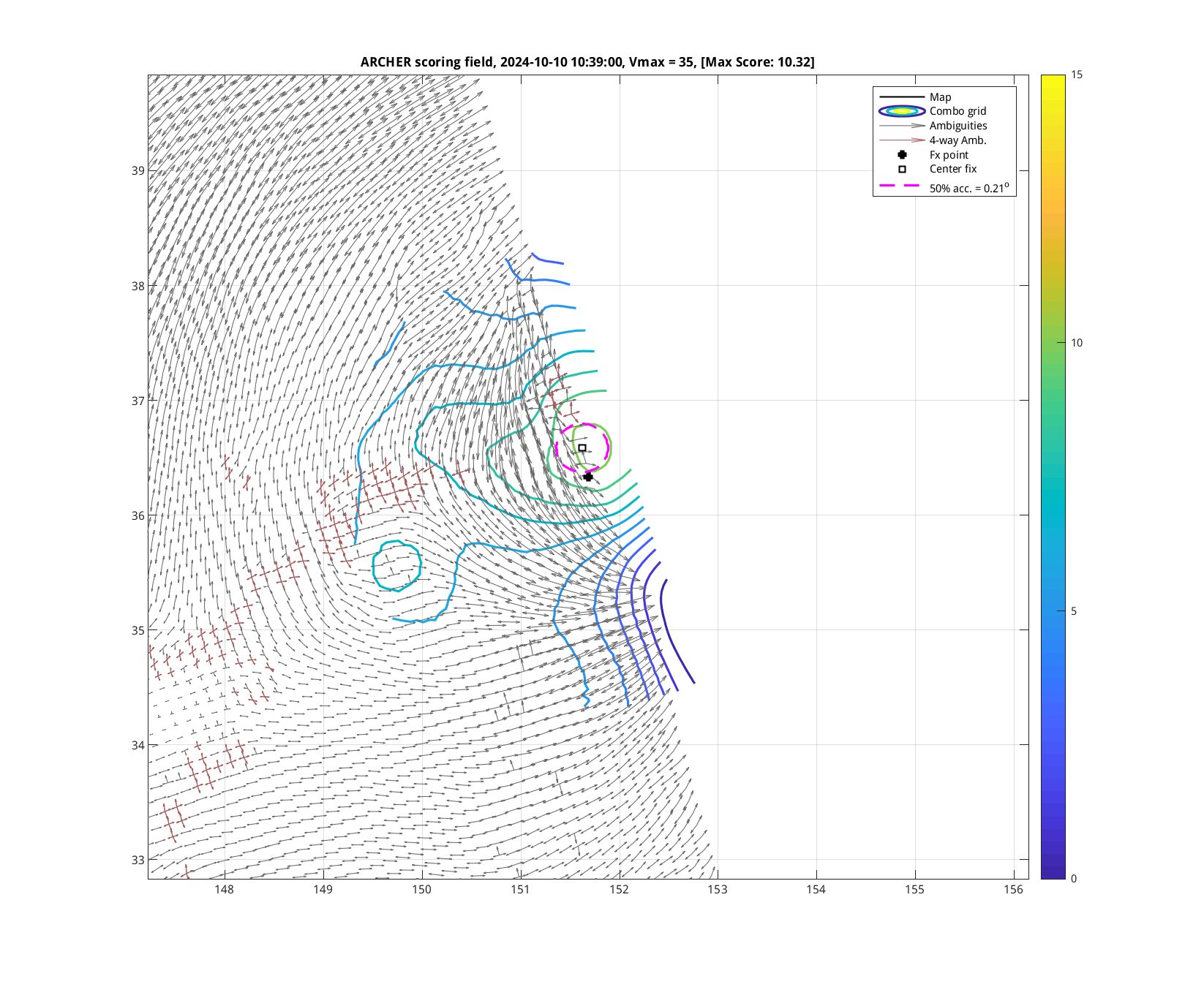
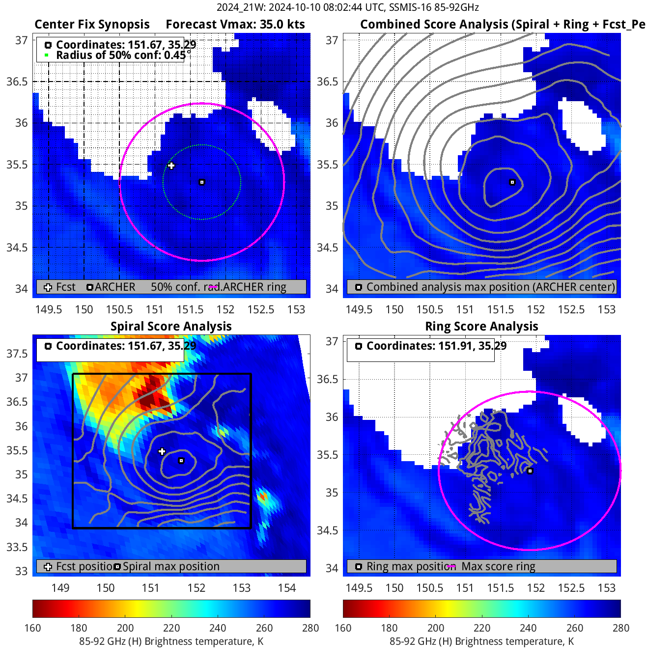
| 20241010 08:02:44 |
SSMIS-16 |
85-92GHz |
35.0 |
35.29 |
151.67 |
35.44 |
151.74 |
0.45 |
1.26 |
1.90 |
1.4 |
|
|
|
 |
 |
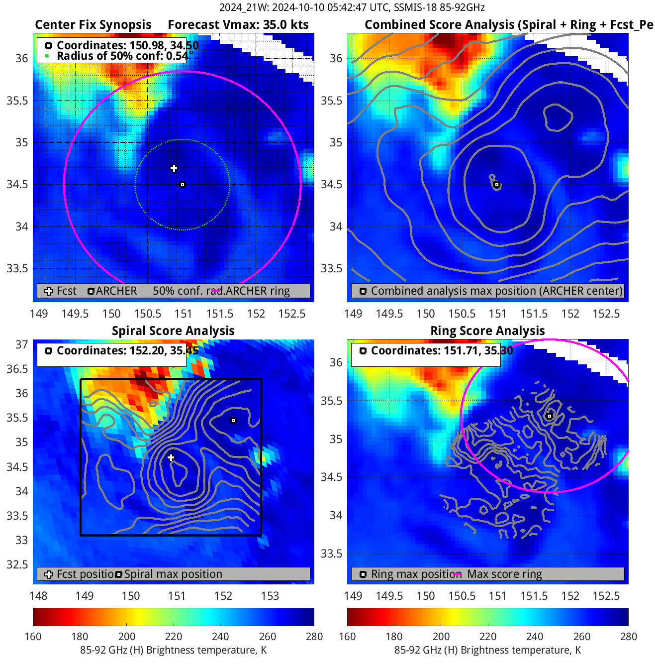
| 20241010 05:42:47 |
SSMIS-18 |
85-92GHz |
35.0 |
34.50 |
150.98 |
34.42 |
150.95 |
0.54 |
1.53 |
2.70 |
0.9 |
|
|
|
 |
 |
|
|
|
 |
 |
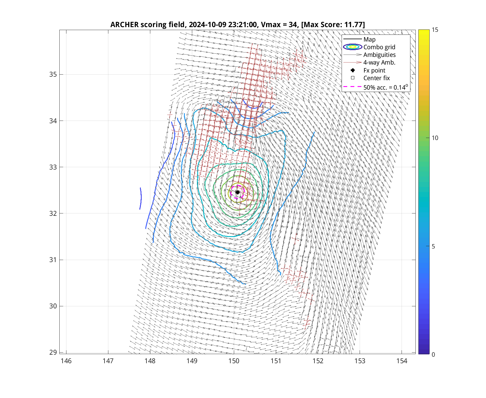
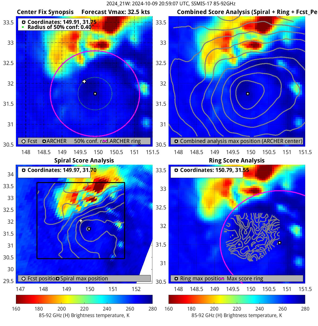
| 20241009 20:59:07 |
SSMIS-17 |
85-92GHz |
32.5 |
31.75 |
149.91 |
31.68 |
149.81 |
0.40 |
1.12 |
2.10 |
5.6 |
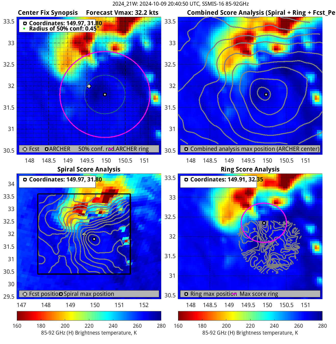
| 20241009 20:40:50 |
SSMIS-16 |
85-92GHz |
32.2 |
31.80 |
149.97 |
31.77 |
149.93 |
0.45 |
1.27 |
2.00 |
5.1 |
|
|
|
 |
 |
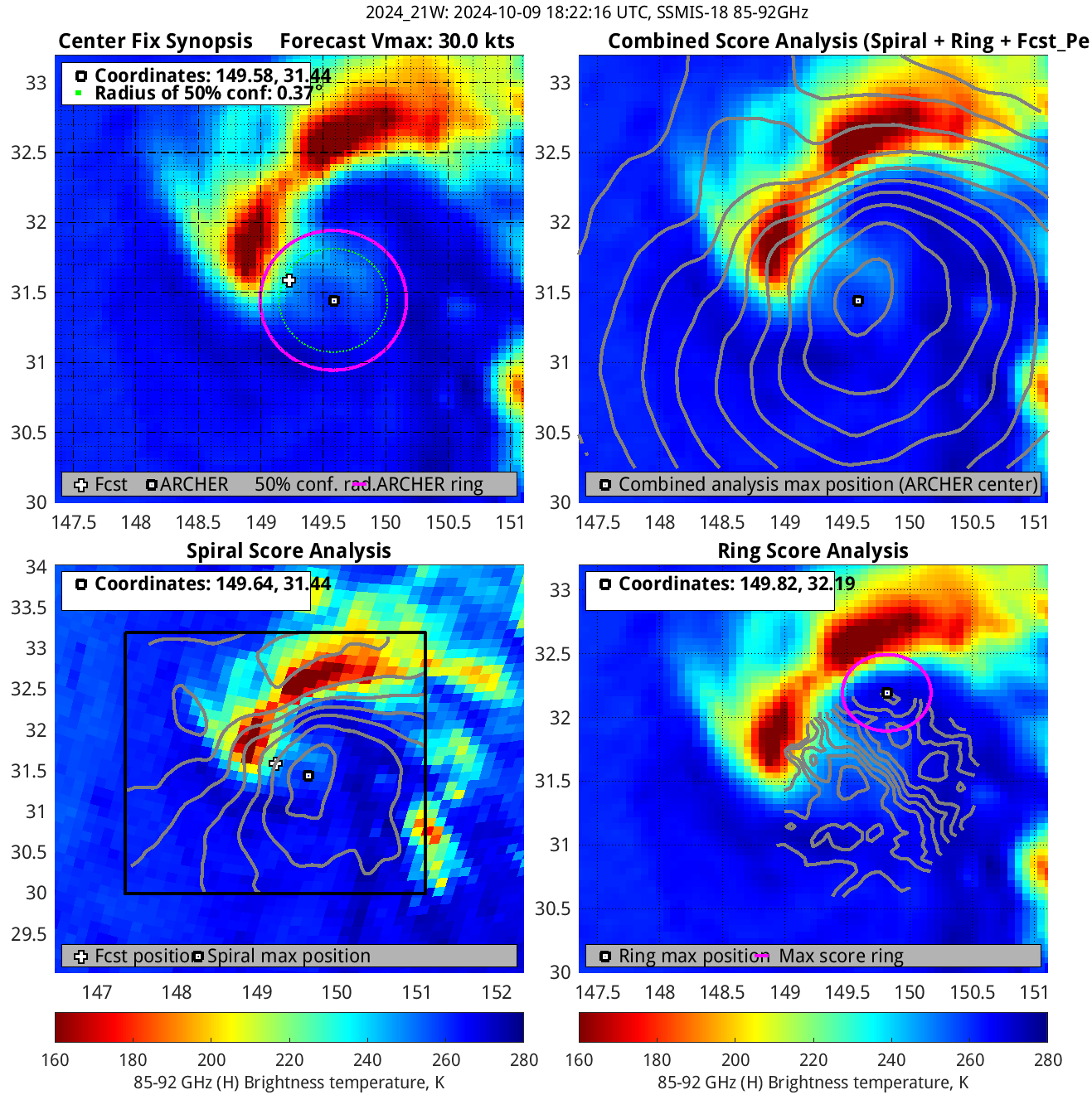
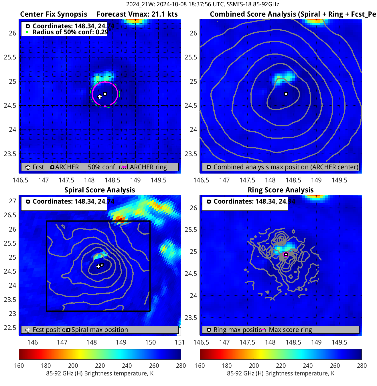
| 20241009 18:22:16 |
SSMIS-18 |
85-92GHz |
30.0 |
31.44 |
149.58 |
31.24 |
149.53 |
0.37 |
1.05 |
1.00 |
3.3 |
|
|
|
 |
 |
|
|
|
 |
 |
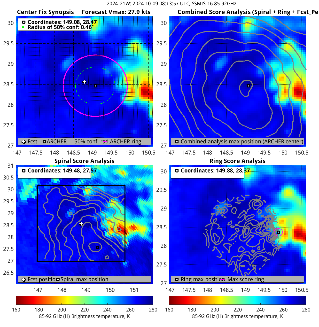
| 20241009 08:13:57 |
SSMIS-16 |
85-92GHz |
27.9 |
28.47 |
149.08 |
28.55 |
149.09 |
0.46 |
1.30 |
1.50 |
3.3 |
|
|
|
 |
 |
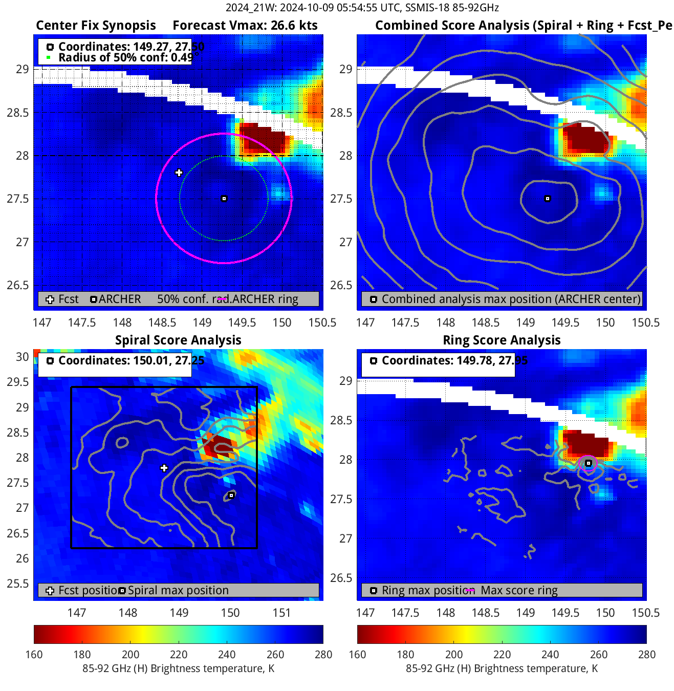
| 20241009 05:54:55 * |
SSMIS-18 |
85-92GHz |
26.6 |
27.50 |
149.27 |
27.37 |
149.26 |
0.49 |
1.39 |
1.50 |
2.9 |
|
|
|
 |
 |
|
|
|
 |
 |
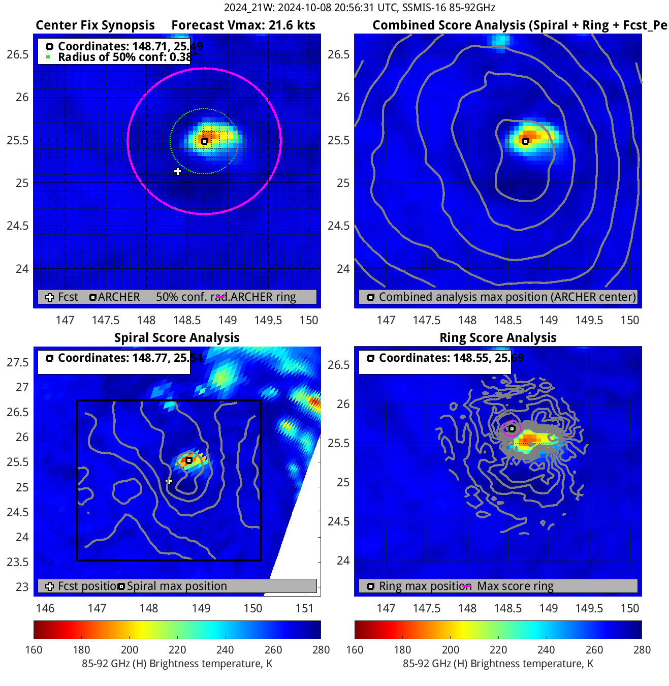
| 20241008 20:56:31 * |
SSMIS-16 |
85-92GHz |
21.6 |
25.49 |
148.71 |
25.39 |
148.68 |
0.38 |
1.08 |
1.70 |
1.3 |
|
|
|
 |
 |
|
|
|
 |
 |
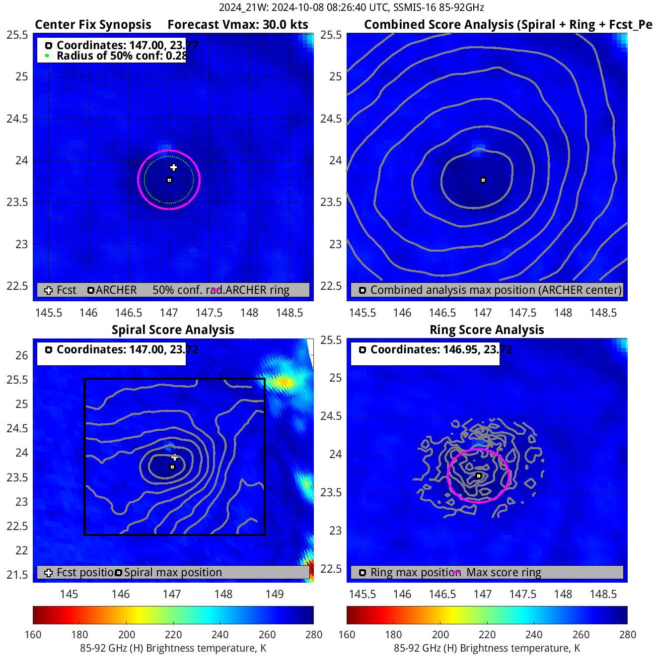
| 20241008 08:26:40 |
SSMIS-16 |
85-92GHz |
30.0 |
23.77 |
147.00 |
23.77 |
147.00 |
0.28 |
0.79 |
0.70 |
4.3 |
|
|
|
 |
 |
|
|
|
 |
 |
|
|
|
 |
 |
|
|
|
 |
 |
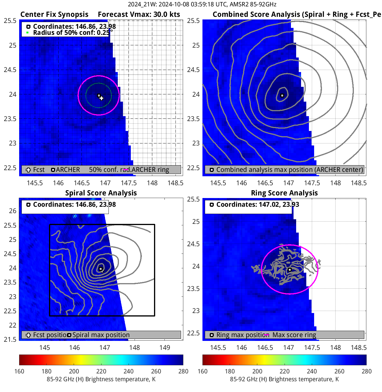
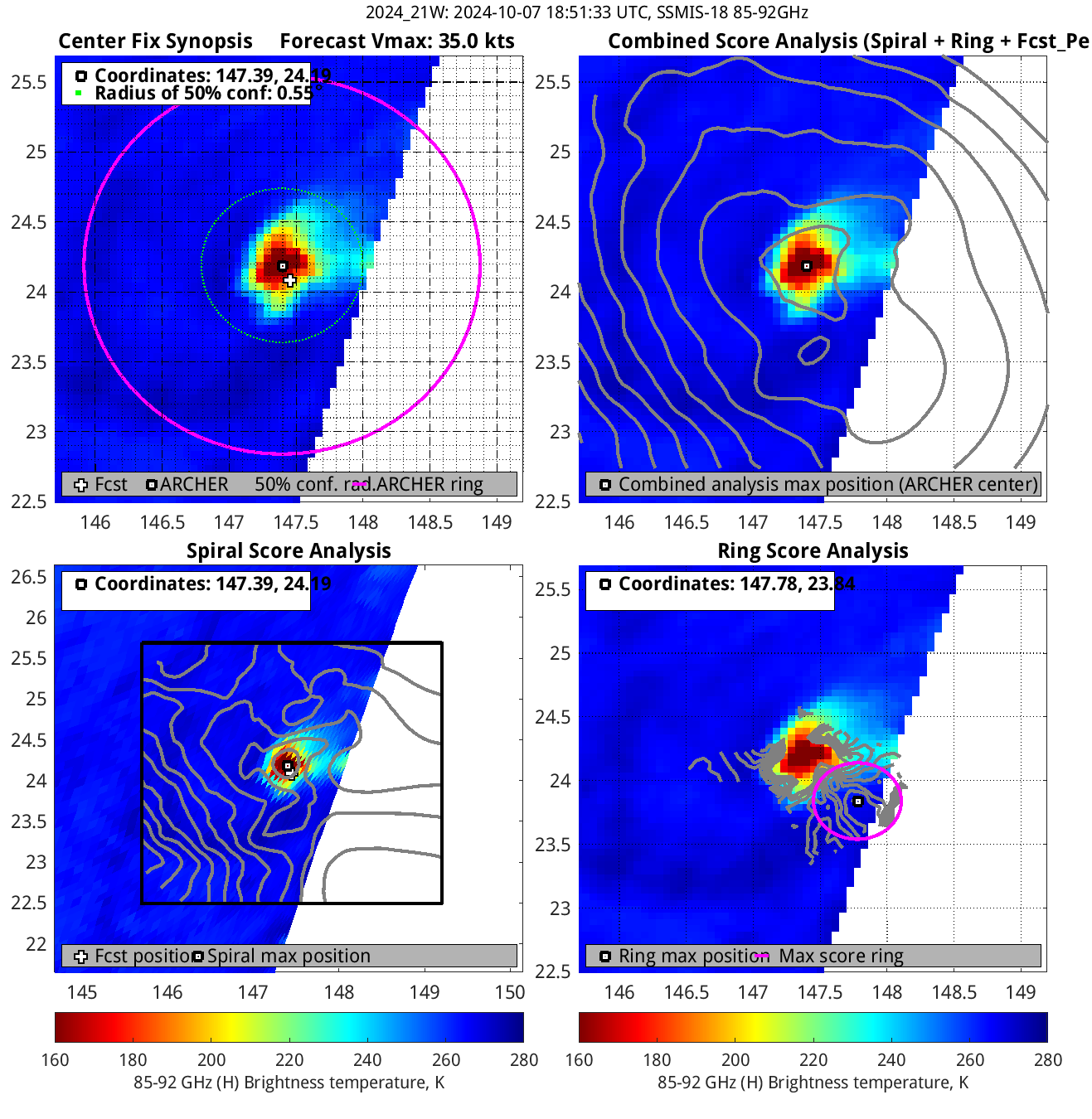
| 20241007 18:51:33 |
SSMIS-18 |
85-92GHz |
35.0 |
24.19 |
147.39 |
24.18 |
147.41 |
0.55 |
1.56 |
2.70 |
0.1 |
|
|
|
 |
 |
|
|
|
 |
 |
|
|
|
 |
 |
|
|
|
 |
 |
|
|
|
 |
 |
|
|
|
 |
 |
|
|
|
 |
 |
|
|
|
 |
 |
|
|
|
 |
 |
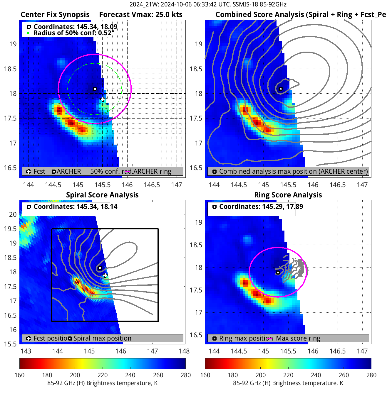
| 20241006 06:33:42 * |
SSMIS-18 |
85-92GHz |
25.0 |
18.09 |
145.34 |
18.00 |
145.34 |
0.52 |
1.48 |
1.40 |
5.8 |
|


