About the MIMIC-TPW2 product
Overview
MIMIC-TPW2 is an experimental global product of total precipitable water (TPW), using morphological compositing of the MIRS retrieval from several available operational microwave-frequency sensors. The specific technique used here was initially described in a 2010 paper by Wimmers and Velden. This Version 2 is developed from an older method (still running in real-time) that uses simpler, but more limited TPW retrievals and advection calculations.
Data sources
The composite product is made from retrievals using AMSU-B and MSU from NOAA-18, NOAA-19, Metop-A and Metop-B. It also uses the retrieval from ATMS of Suomi-NPP and soon, the JPSS generation of polar orbiters.
The advection function uses a vertically weighted average of 0.50-degree resolution winds from the NCEP GFS global model. The GFS forecast is used on satellite data in near-real time, and when the data has sufficiently aged, it is reprocessed using the GFS analysis.
How is “morphological compositing” done?
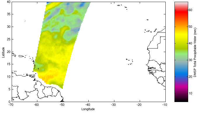
Our normal experience of imagery from polar orbiters is either viewing single scans, or a composite of many orbitals valid within a several-hour time period. However, a smoother, more accurate representation is possible by “nudging” the water vapor data forward and backward with the local winds toward a common valid image time. The following example shows this process at work on a single section of one DMSP/SSMI orbital in the Atlantic Ocean, valid at 3 Sept 2004 1015 UTC:

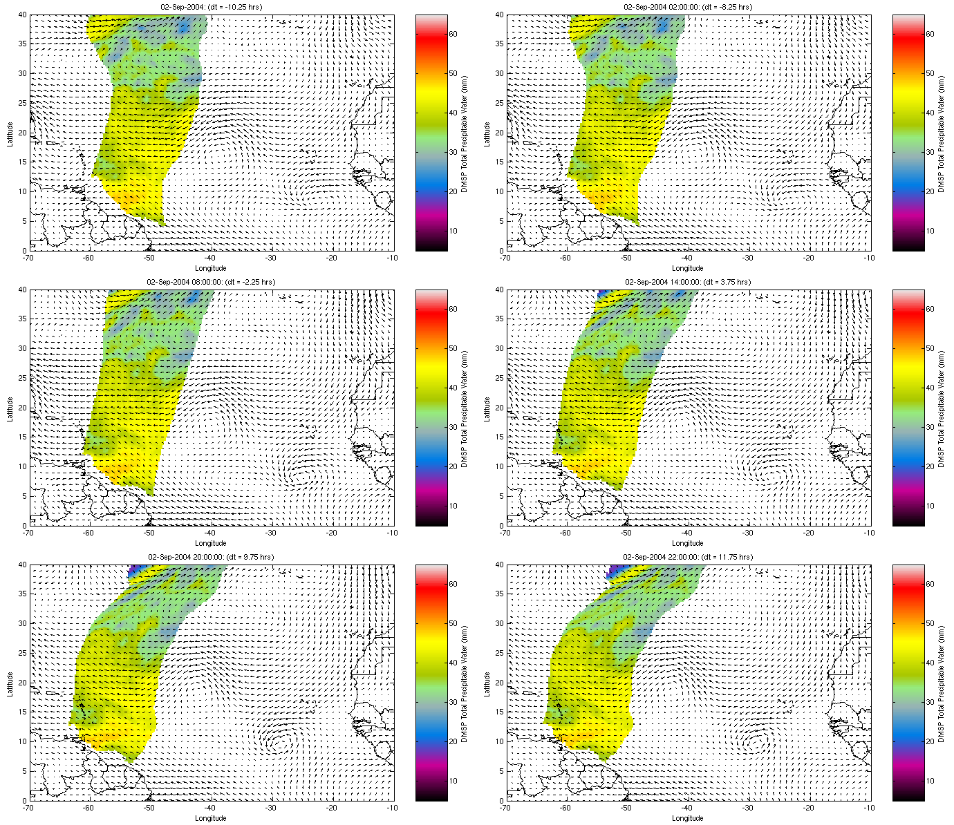
Our algorithm “advects” the data backward and forward in time using a vertically-averaged wind field. This new advected dataset then can be used in a full sequence of composite images valid exactly on the hour (or at any desired timestep):

This is the “morphological” piece of the algorithm. That is, it uses the best possible estimate of the shape of the data at the valid time of the product rather than presenting a simple record of the data, which may not represent the atmosphere very well at the valid time.
From here, the compositing process is a simple matter of selecting the data nearest in time a) prior to the valid time, and b) subsequent to the valid time, as in this example at 14 October 2016 1100 UTC:

The final product is a temporally weighted average of the “prior” and “subsequent” composite data. For example, if one grid cell on the prior composite is 50 minutes before the valid time, and the corresponding cell on the subsequent composite is 150 minutes after the valid time, then the grid cell of the final product is 75% from the prior data and 25% from the subsequent data. This allows for a very smooth and accurate depiction of a tracer from multiple sources. If the composite product valid time is close to the present, only the “prior” composite is used, meaning that the data shown has been advected forward from a time in the near past.
Because new satellite data is arriving almost continuously, the MIMIC-TPW2 product works by updating a full range of times affected by the new data. A given image and corresponding data file is likely to be overwritten with improved composites at least 20 times before it is in final form in the archive. (A composite is usually in “final form” 18 hours after the present time.)
Accuracy
Wimmers and Velden (2010) demonstrated that the morphological compositing process added a mean average error of only 1-2 mm TPW in a multi-satellite composite over the ocean, which is usually negligible. We assume that the error over land is somewhat larger, but this will have to be investigated sometime later.
Notes on interpreting the product


