Tropical Storm Erika
| STORM TRACK | STORM TRACK with Forecast Positions | Special Images | Latest NCEP/TPC Forecast Discussion |
Latest Reconnaissance Report (Explanation) |
Latest NCEP/Tropical Prediction Center (TPC) Forecast Positions

Tropical Storm Erika
| STORM TRACK | STORM TRACK with Forecast Positions | Special Images | Latest NCEP/TPC Forecast Discussion |
Latest Reconnaissance Report (Explanation) |
   Saffir-Simpson      Max. Sustained          Minimum Sfc.
       Scale       Wind Speed (mph) [knots]    Pressure (mb)
         1             74- 95    [ 64- 83]        >= 980
         2             96-110    [ 84- 96]       979-965
         3            111-130    [ 97-113]       964-945
         4            131-155    [114-135]       944-920
         5             > 156     [ > 135 ]         < 920
Presented are the current position (the large, red Tropical Storm/Hurricane symbol), intensity (the number within the symbol, as listed above), and forecast positions for 12, 24, 36, 48, and 72 hours (the small, white symbols). The text version corresponding to this figure is presented in the Latest NCEP/TPC Discussion link in the STORM COVERAGE section.
Disclaimer : The hurricane track forecasts displayed here are based on
the latest NHC/TPC track forecasts received here at CIMSS, and may or
may not be the most current forecast available from NHC/TPC. CIMSS provides
this product for the general public's viewing, but is not responsible for
its ultimate use in the forecasting of tropical cyclones and/or the use
of public watches/warnings. Concerned customers should confirm these
prognostications with official sources.
Special Images :
Other Images :
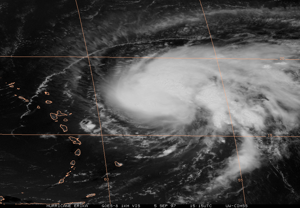
Hurricane Erika - Visible (5 September 1997 / 15:15UTC)
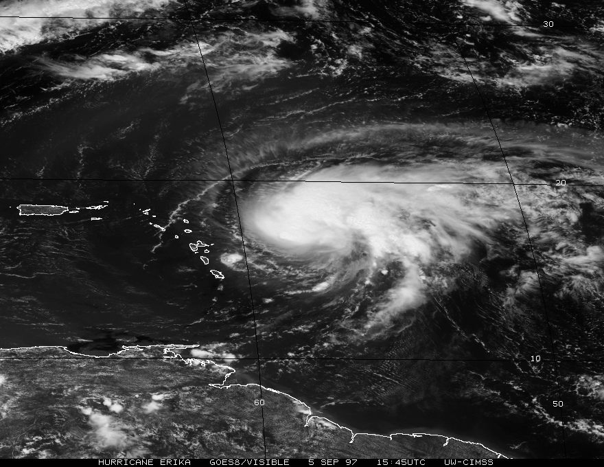
Hurricane Erika - Visible (5 September 1997 / 15:45UTC)
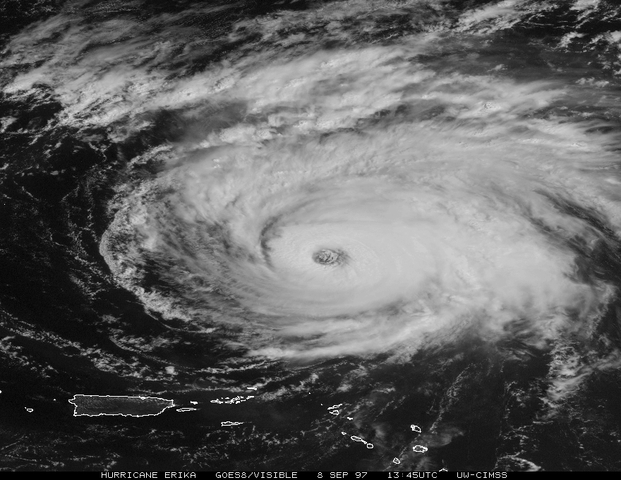
Hurricane Erika - Visible (8 September 1997 / 13:45UTC)
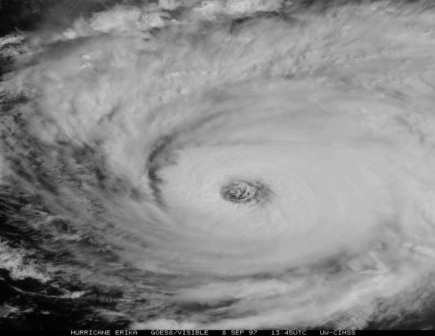
Hurricane Erika - Visible (8 September 1997 / 13:45UTC) - closeup of eye
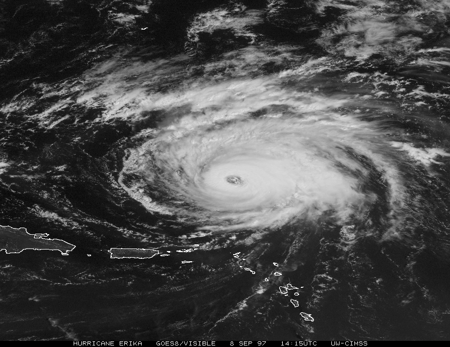
Hurricane Erika - Visible (8 September 1997 / 14:15UTC)