|
||

 |
D-MINT HISTORY FILE for 2023_01W
| Date | Time | MW Sensor | MSLP | Vmax (30th-70th percentile average) | Vmax 25th percentile | Vmax 75th percentile | Image |
| 20230421 | 1522 UTC | AMSR2 | NaN hPa | 26 kts | 23 kts | 30 kts | 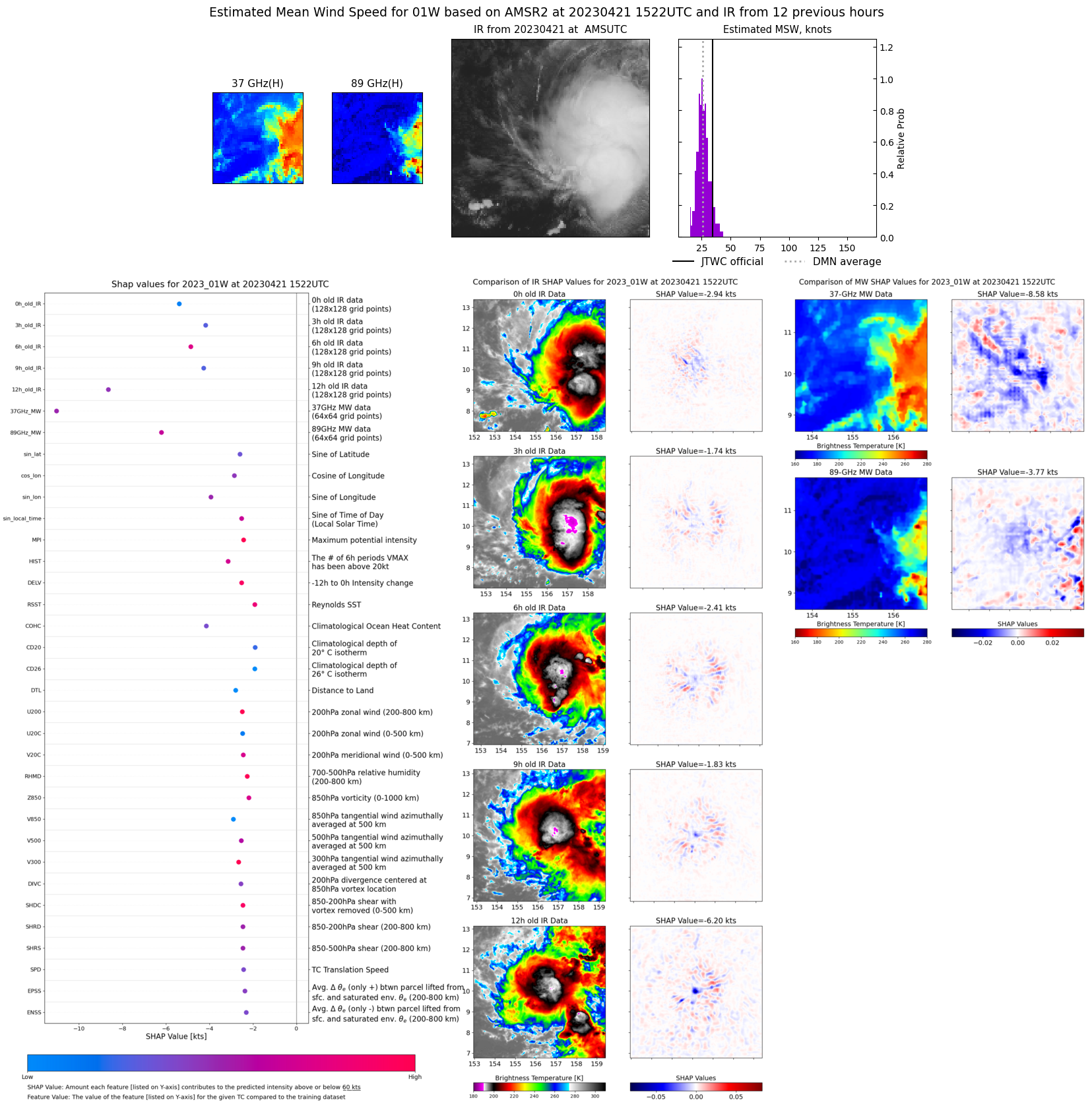 |
| 20230421 | 1431 UTC | GMI | NaN hPa | 31 kts | 26 kts | 36 kts | 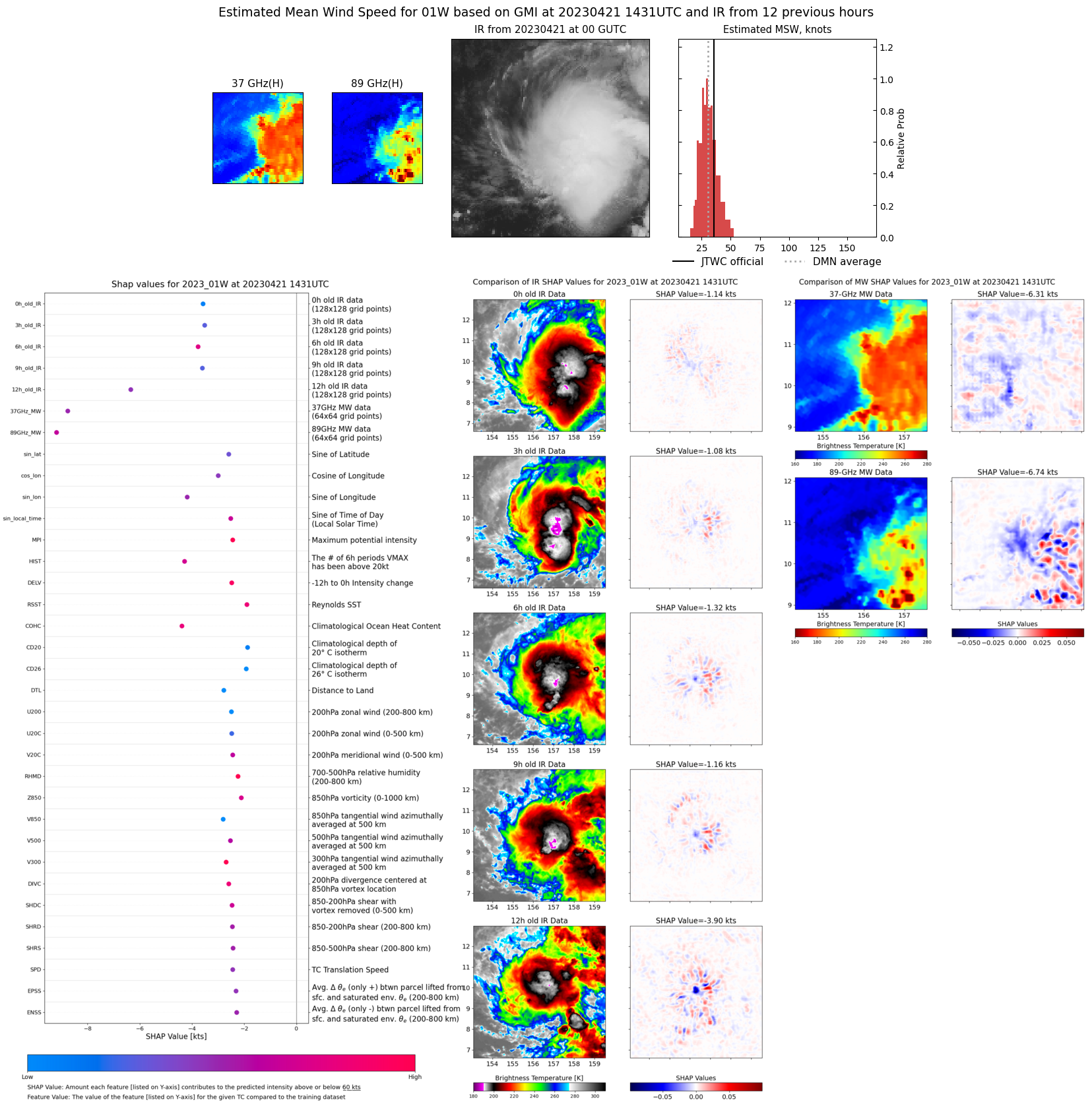 |
| 20230421 | 0532 UTC | SSMISF18 | NaN hPa | 35 kts | 29 kts | 41 kts | 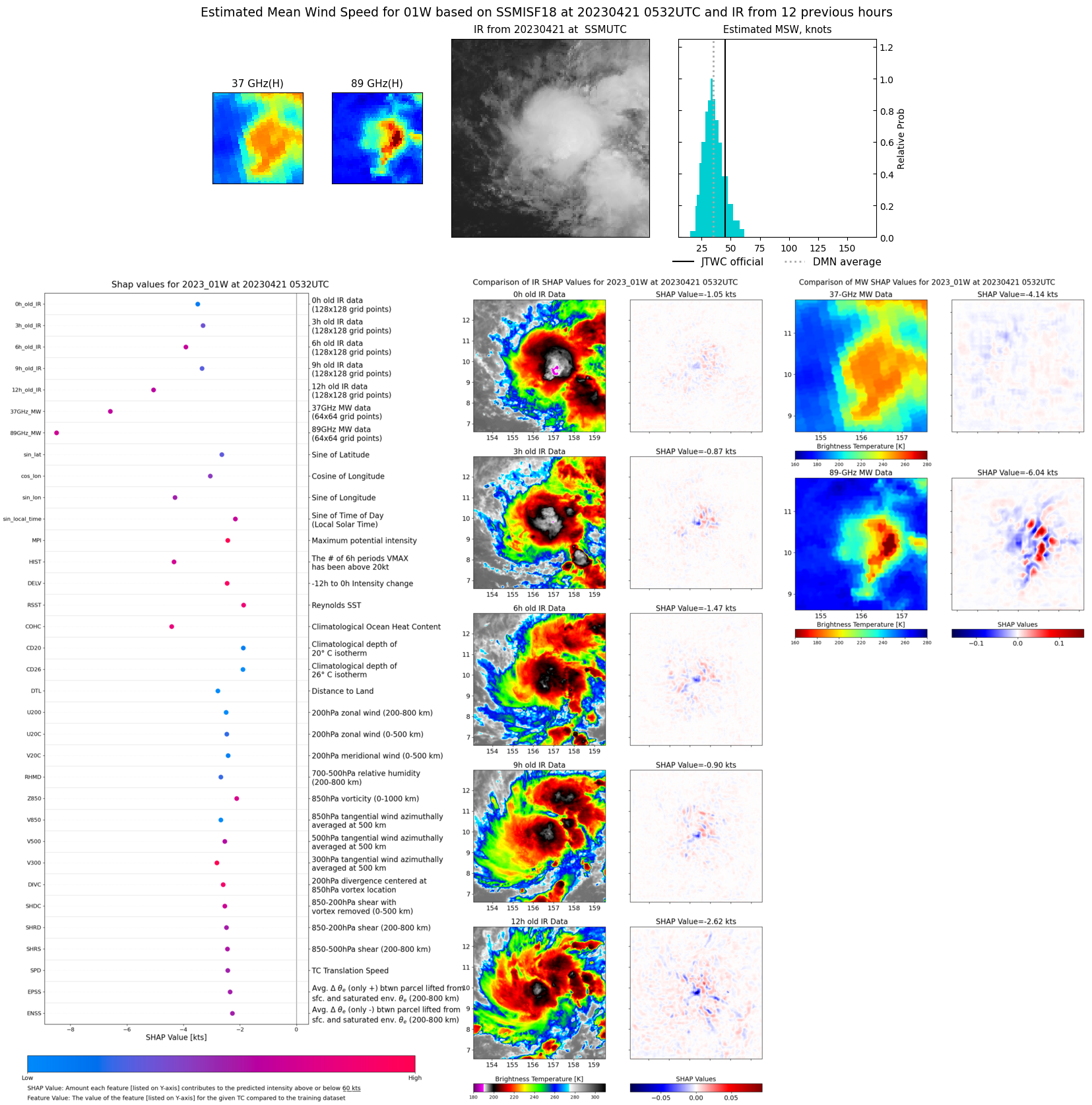 |
| 20230421 | 0306 UTC | AMSR2 | NaN hPa | 38 kts | 32 kts | 44 kts | 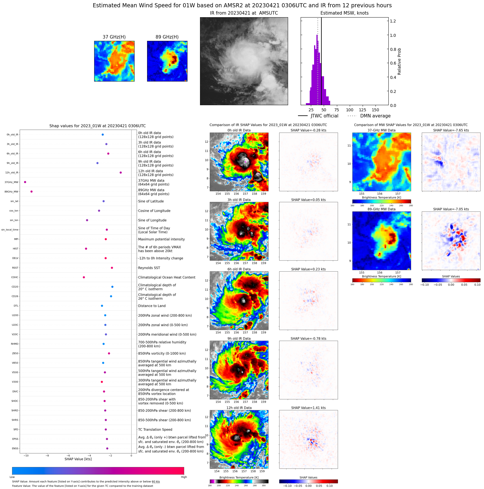 |
| 20230420 | 1937 UTC | SSMISF17 | NaN hPa | 42 kts | 36 kts | 49 kts | 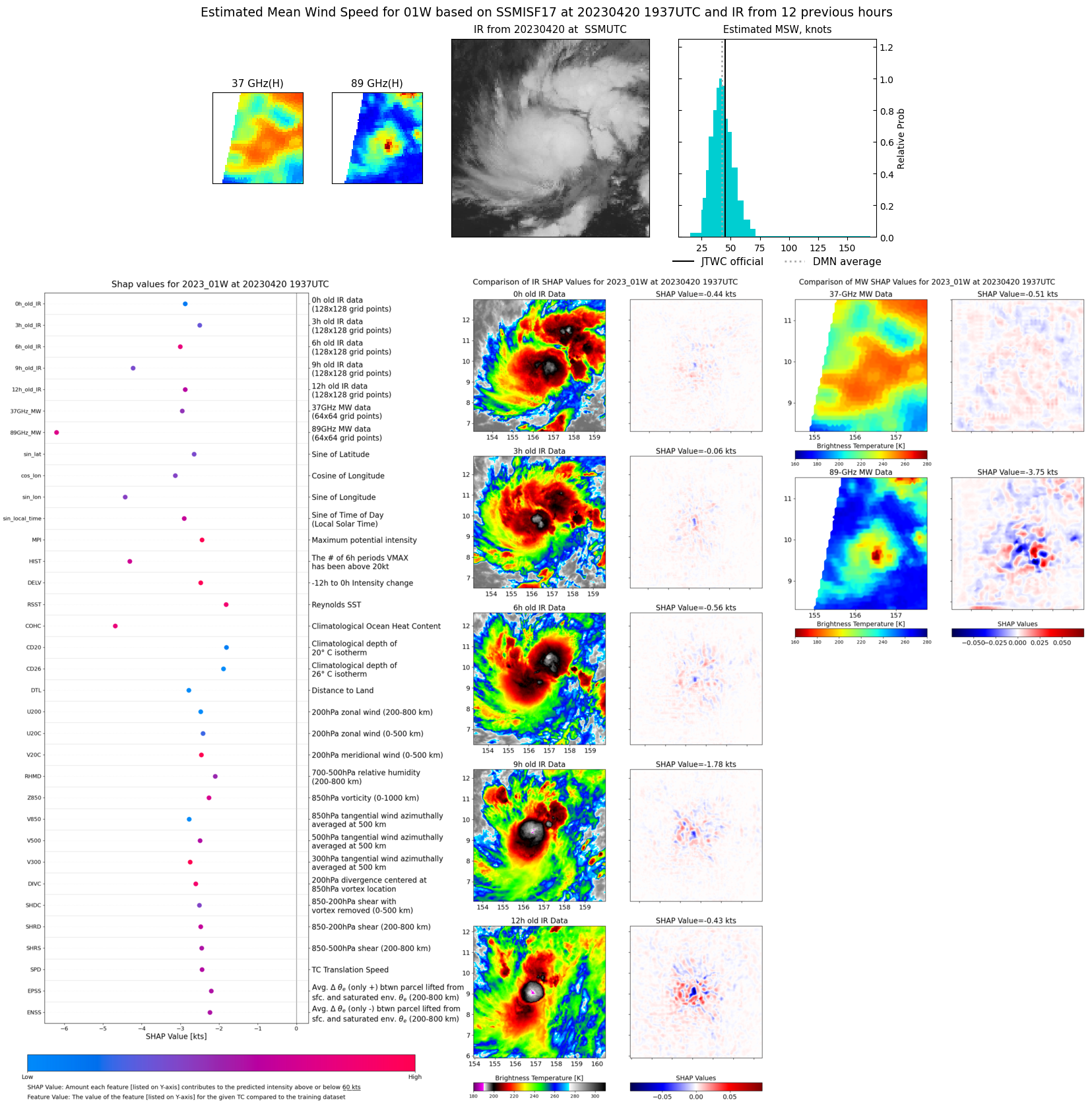 |
| 20230420 | 1841 UTC | SSMISF16 | NaN hPa | 39 kts | 33 kts | 45 kts | 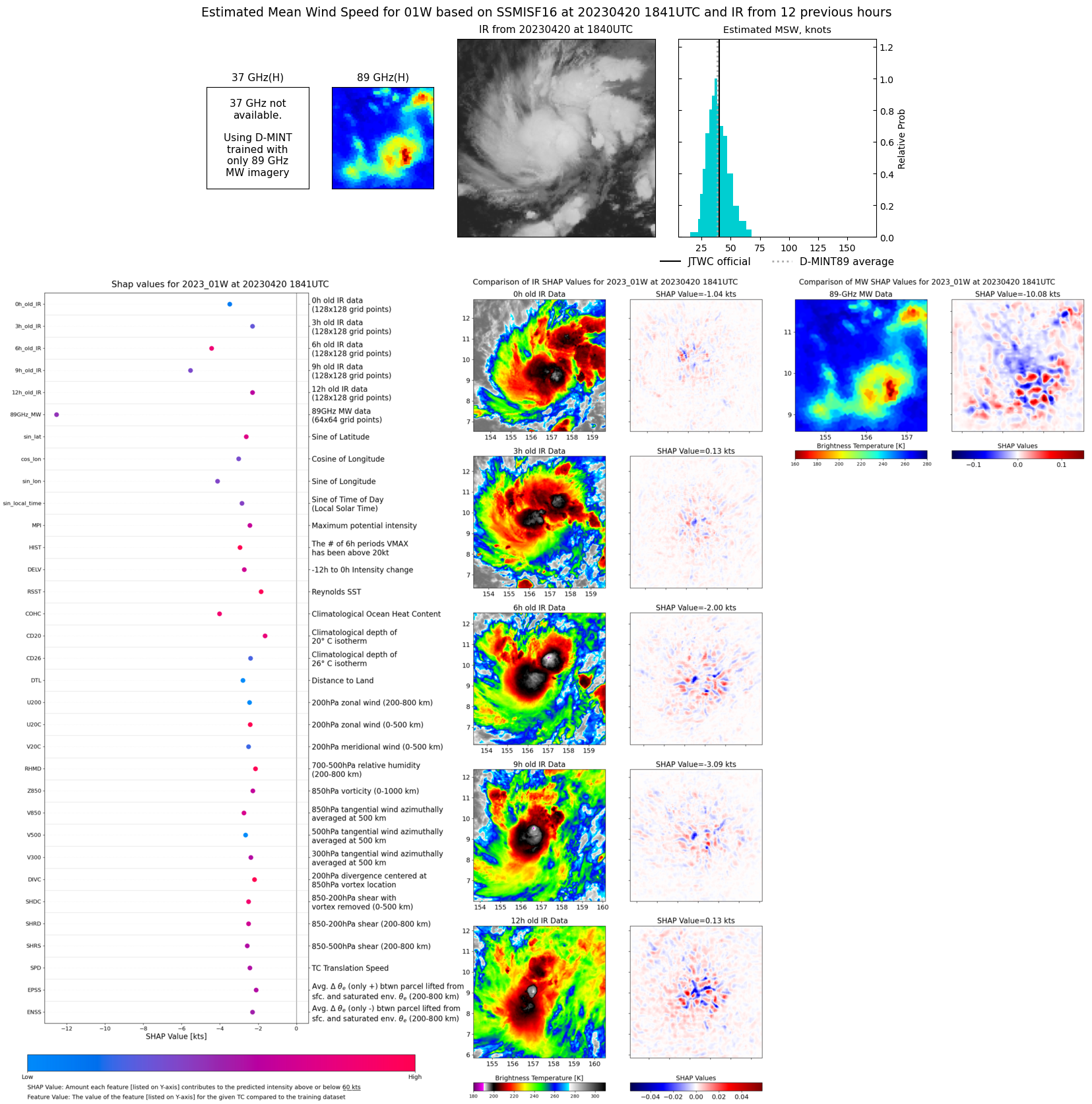 |
| 20230420 | 0546 UTC | SSMISF18 | NaN hPa | 33 kts | 28 kts | 38 kts |  |
| 20230420 | 0211 UTC | GMI | NaN hPa | 33 kts | 29 kts | 37 kts | 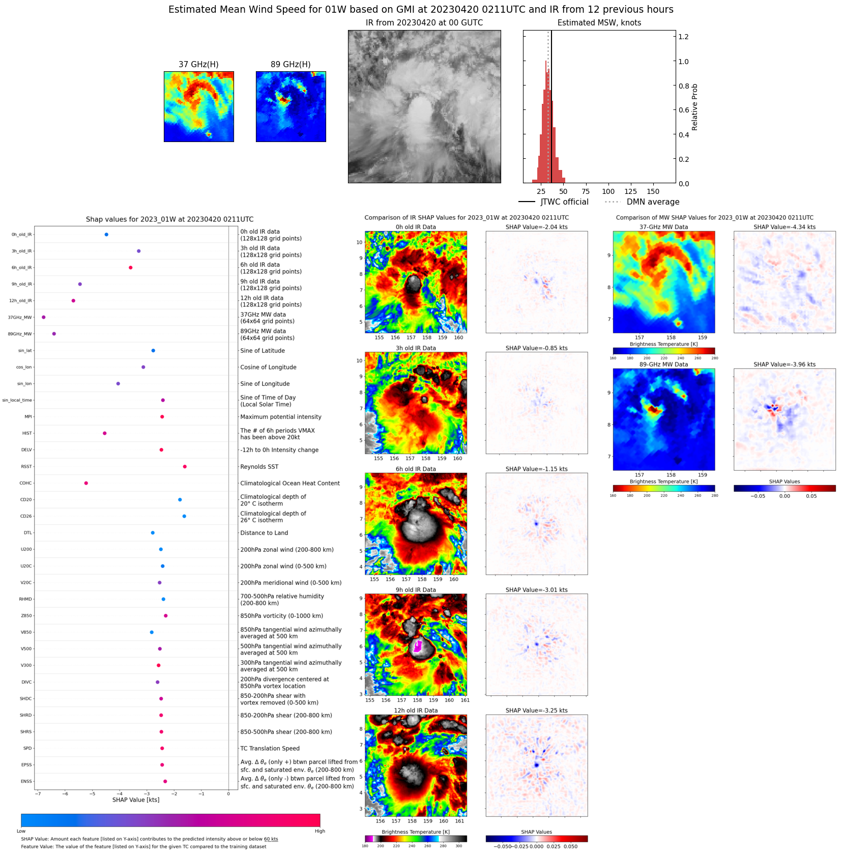 |
| 20230419 | 1950 UTC | SSMISF17 | NaN hPa | 31 kts | 26 kts | 37 kts |  |
| 20230419 | 1855 UTC | SSMISF16 | NaN hPa | 30 kts | 26 kts | 35 kts | 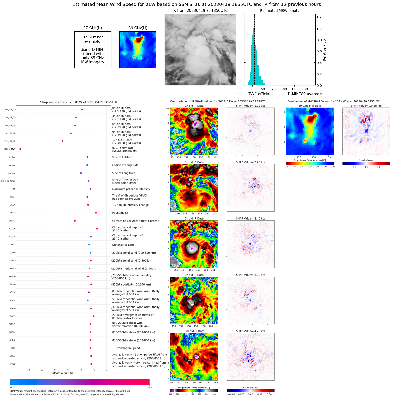 |
| 20230419 | 1441 UTC | GMI | NaN hPa | 34 kts | 29 kts | 40 kts | 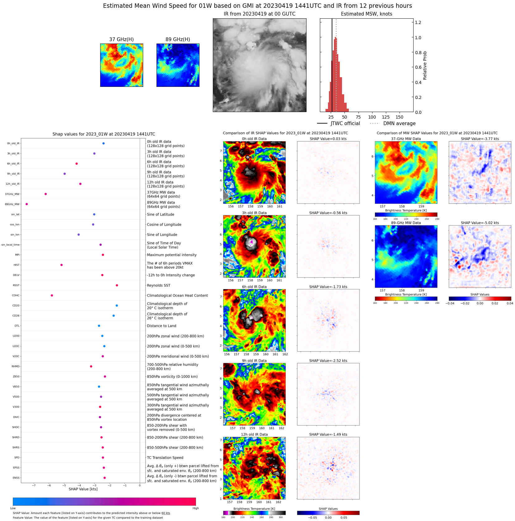 |
| 20230419 | 0615 UTC | SSMISF16 | NaN hPa | 27 kts | 24 kts | 31 kts | 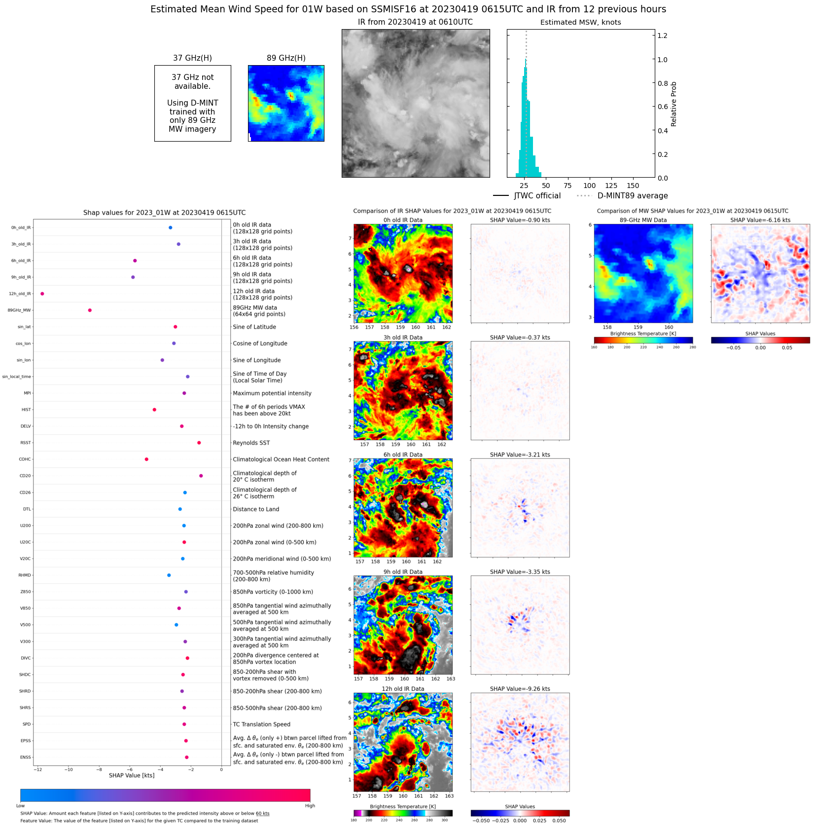 |
| 20230419 | 0318 UTC | AMSR2 | NaN hPa | 30 kts | 26 kts | 34 kts | 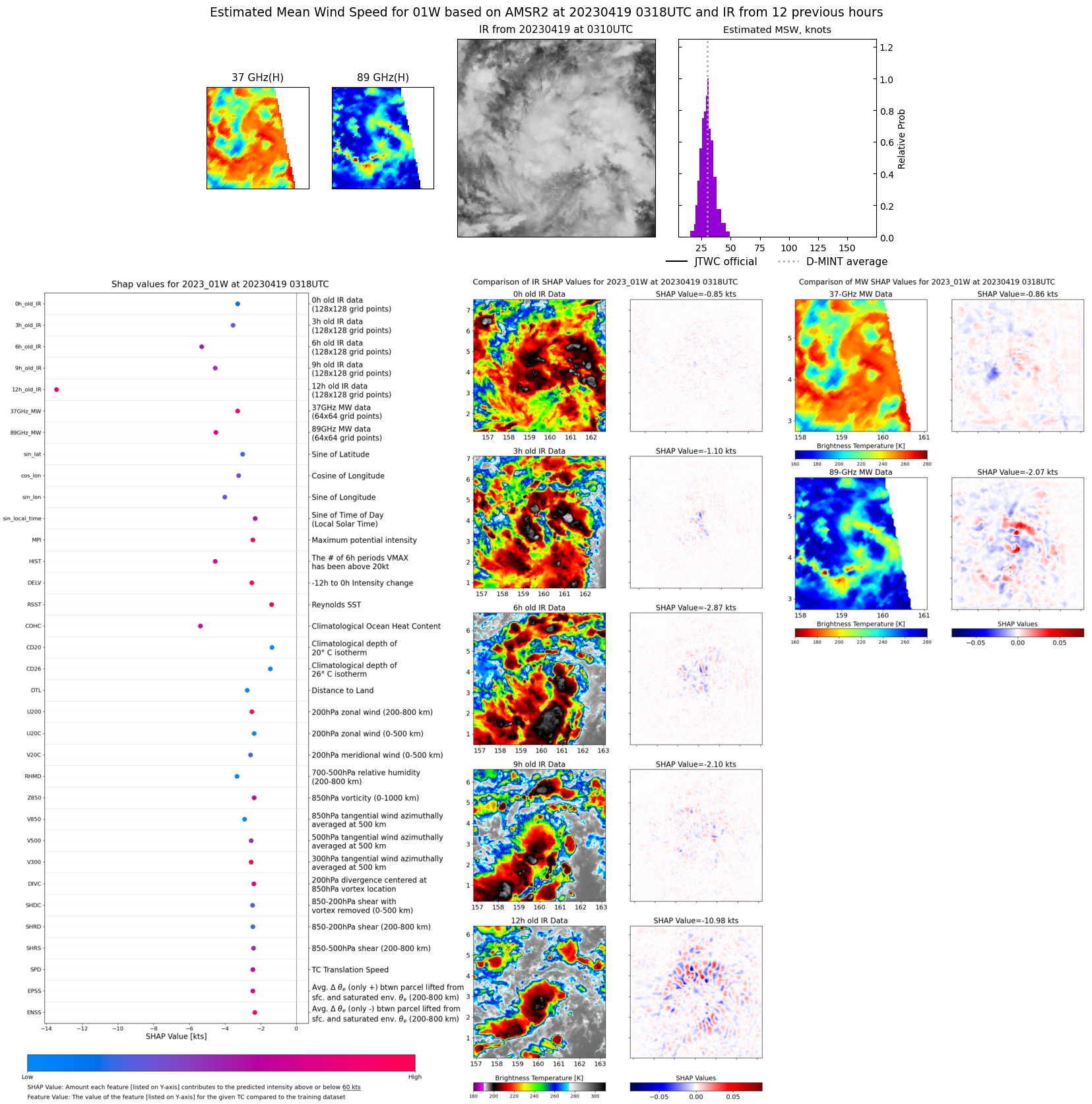 |