|
||

 |
D-MINT HISTORY FILE for 2023_02E
| Date | Time | MW Sensor | MSLP | Vmax (30th-70th percentile average) | Vmax 25th percentile | Vmax 75th percentile | Image |
| 20230701 | 1317 UTC | SSMISF17 | NaN hPa | 38 kts | 32 kts | 43 kts | 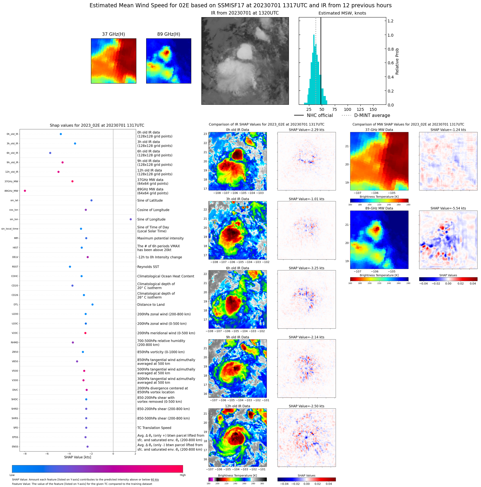 |
| 20230701 | 1253 UTC | SSMISF16 | NaN hPa | 39 kts | 34 kts | 45 kts |  |
| 20230701 | 1142 UTC | GMI | NaN hPa | 43 kts | 37 kts | 49 kts |  |
| 20230701 | 1136 UTC | GMI | NaN hPa | 45 kts | 39 kts | 51 kts |  |
| 20230701 | 1059 UTC | SSMISF18 | NaN hPa | 45 kts | 38 kts | 52 kts |  |
| 20230701 | 0849 UTC | AMSR2 | NaN hPa | 51 kts | 44 kts | 59 kts |  |
| 20230701 | 0044 UTC | SSMISF17 | NaN hPa | 59 kts | 51 kts | 67 kts |  |
| 20230701 | 0020 UTC | SSMISF16 | NaN hPa | 59 kts | 52 kts | 66 kts | 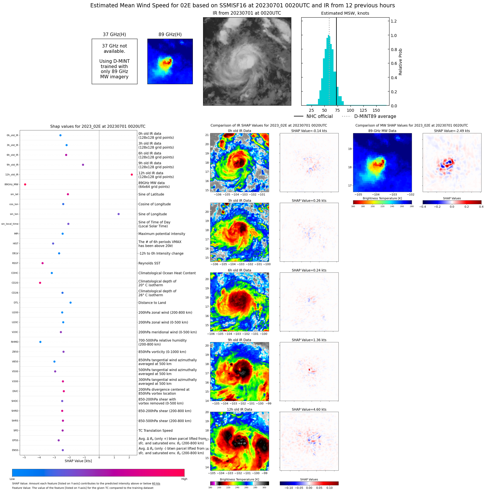 |
| 20230630 | 2226 UTC | SSMISF18 | NaN hPa | 65 kts | 57 kts | 74 kts | 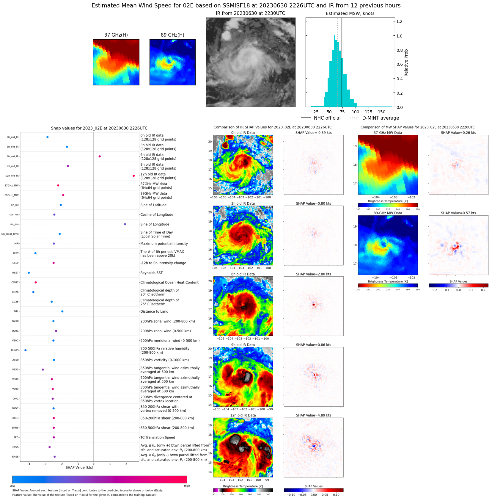 |
| 20230630 | 2221 UTC | GMI | NaN hPa | 66 kts | 58 kts | 75 kts | 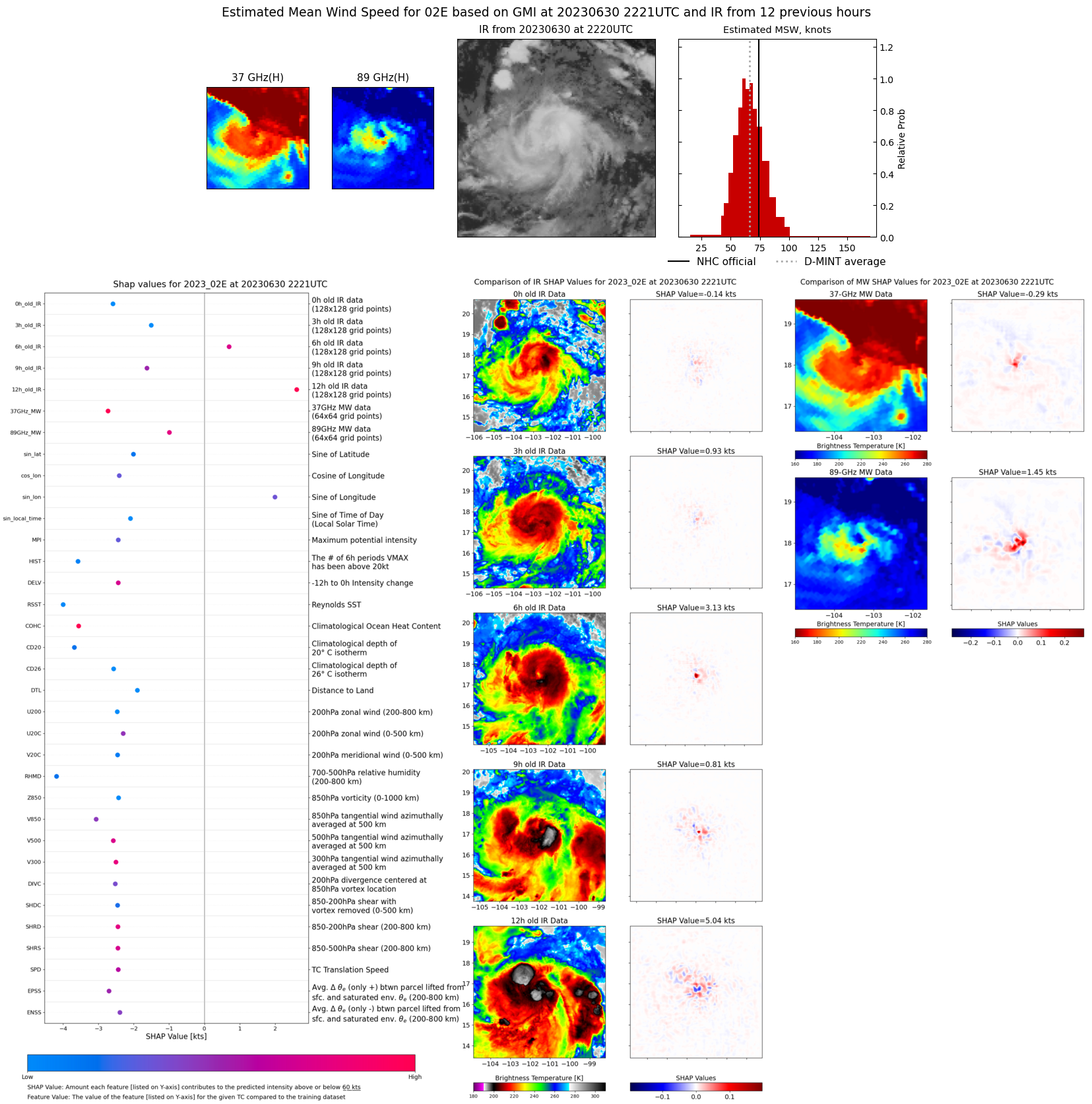 |
| 20230630 | 2038 UTC | AMSR2 | NaN hPa | 66 kts | 58 kts | 74 kts | 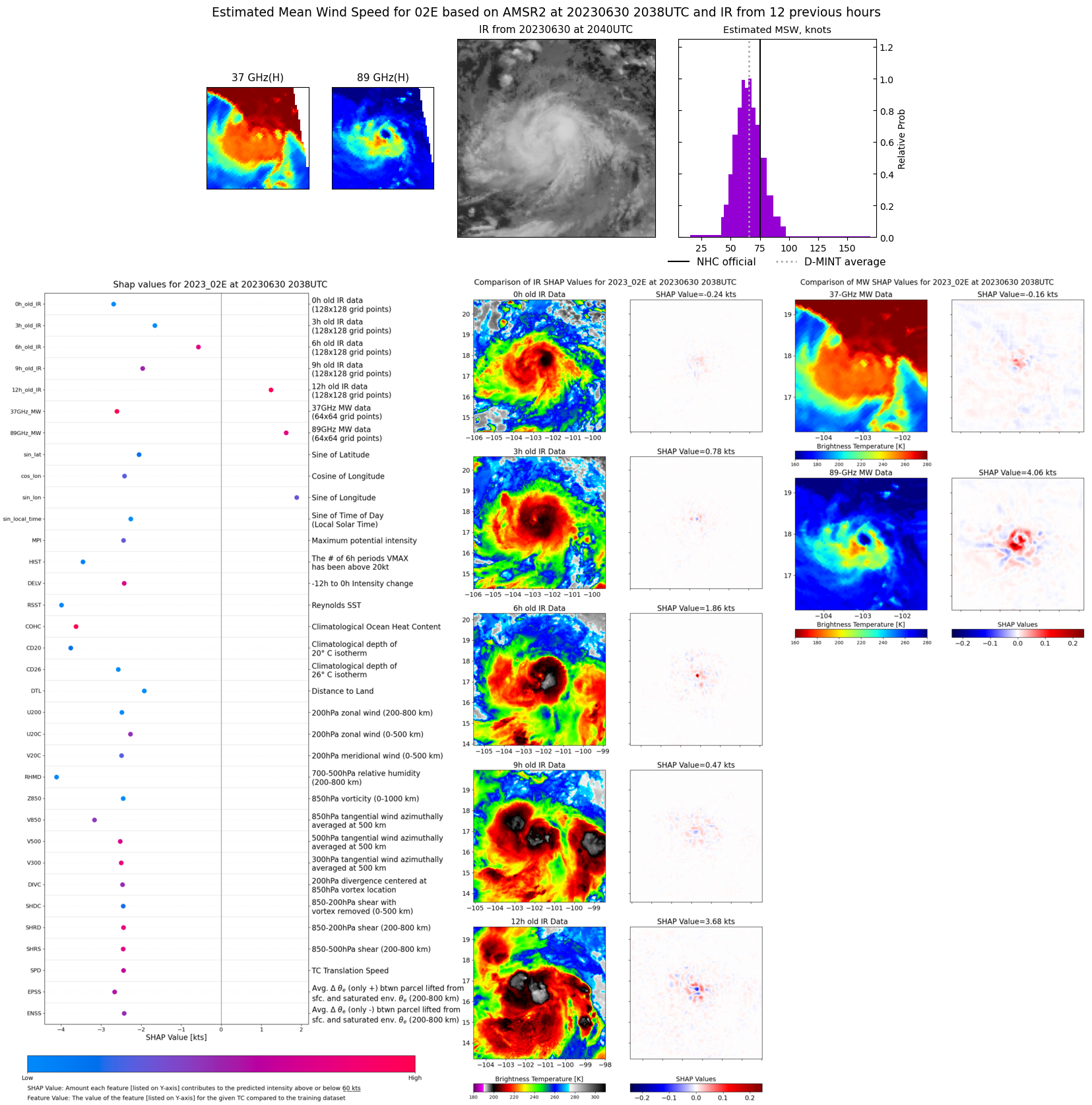 |
| 20230630 | 1331 UTC | SSMISF17 | NaN hPa | 59 kts | 53 kts | 66 kts |  |
| 20230630 | 1113 UTC | SSMISF18 | NaN hPa | 50 kts | 44 kts | 55 kts |  |
| 20230630 | 0807 UTC | AMSR2 | NaN hPa | 44 kts | 39 kts | 49 kts | 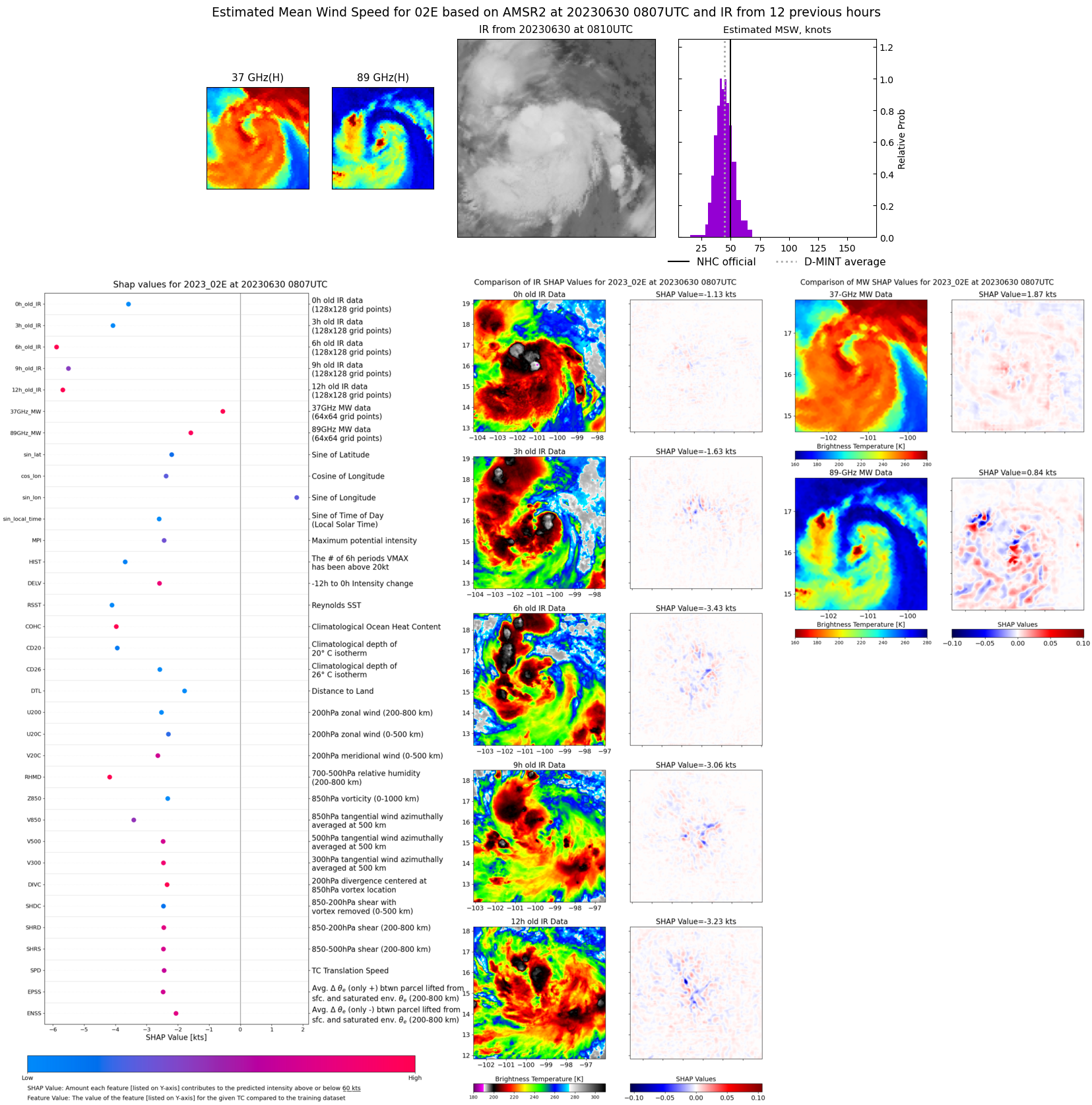 |
| 20230630 | 0056 UTC | SSMISF17 | NaN hPa | 39 kts | 35 kts | 44 kts | 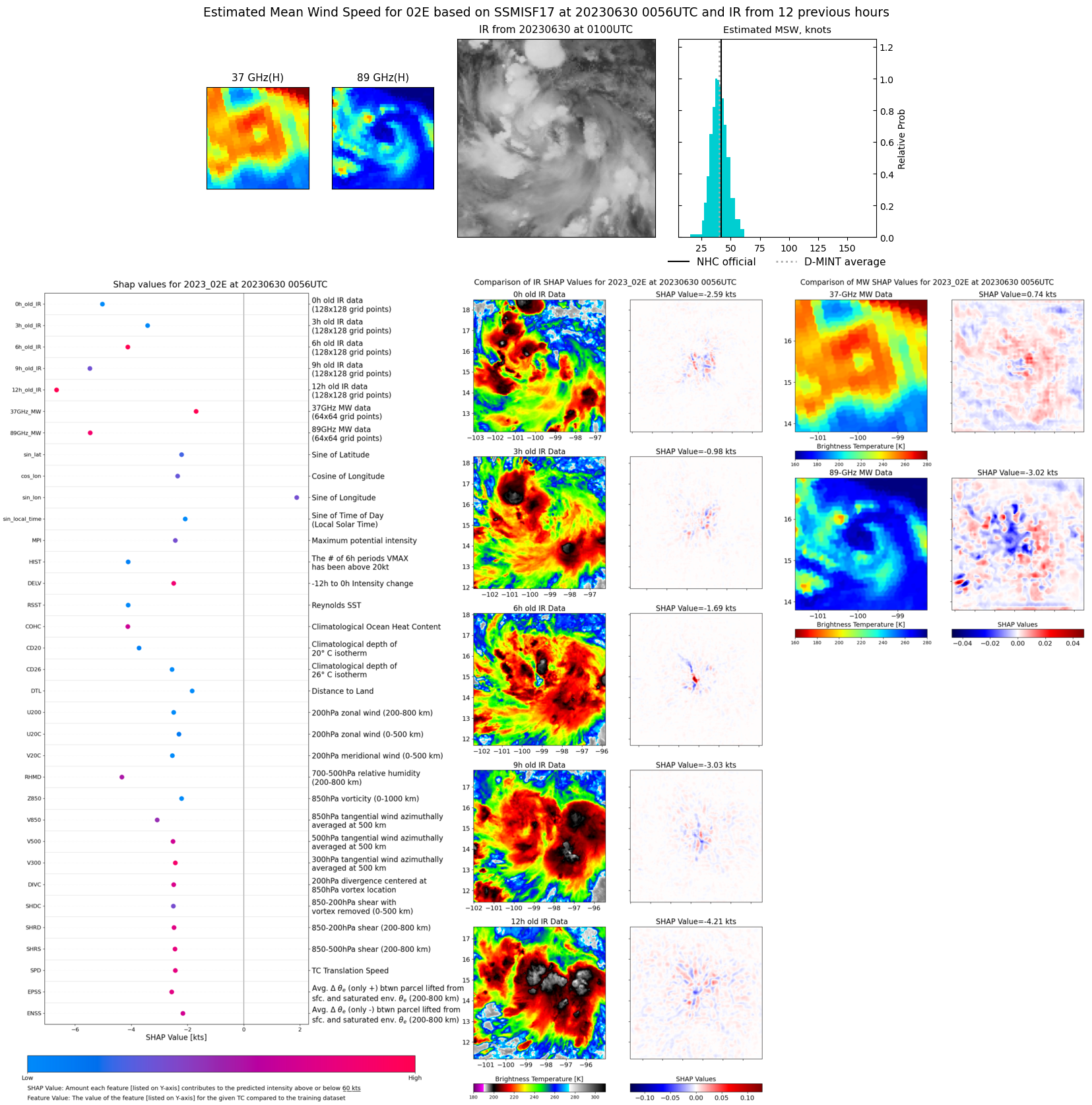 |
| 20230629 | 2238 UTC | SSMISF18 | NaN hPa | 38 kts | 33 kts | 43 kts |  |
| 20230629 | 1954 UTC | AMSR2 | NaN hPa | 39 kts | 35 kts | 44 kts | 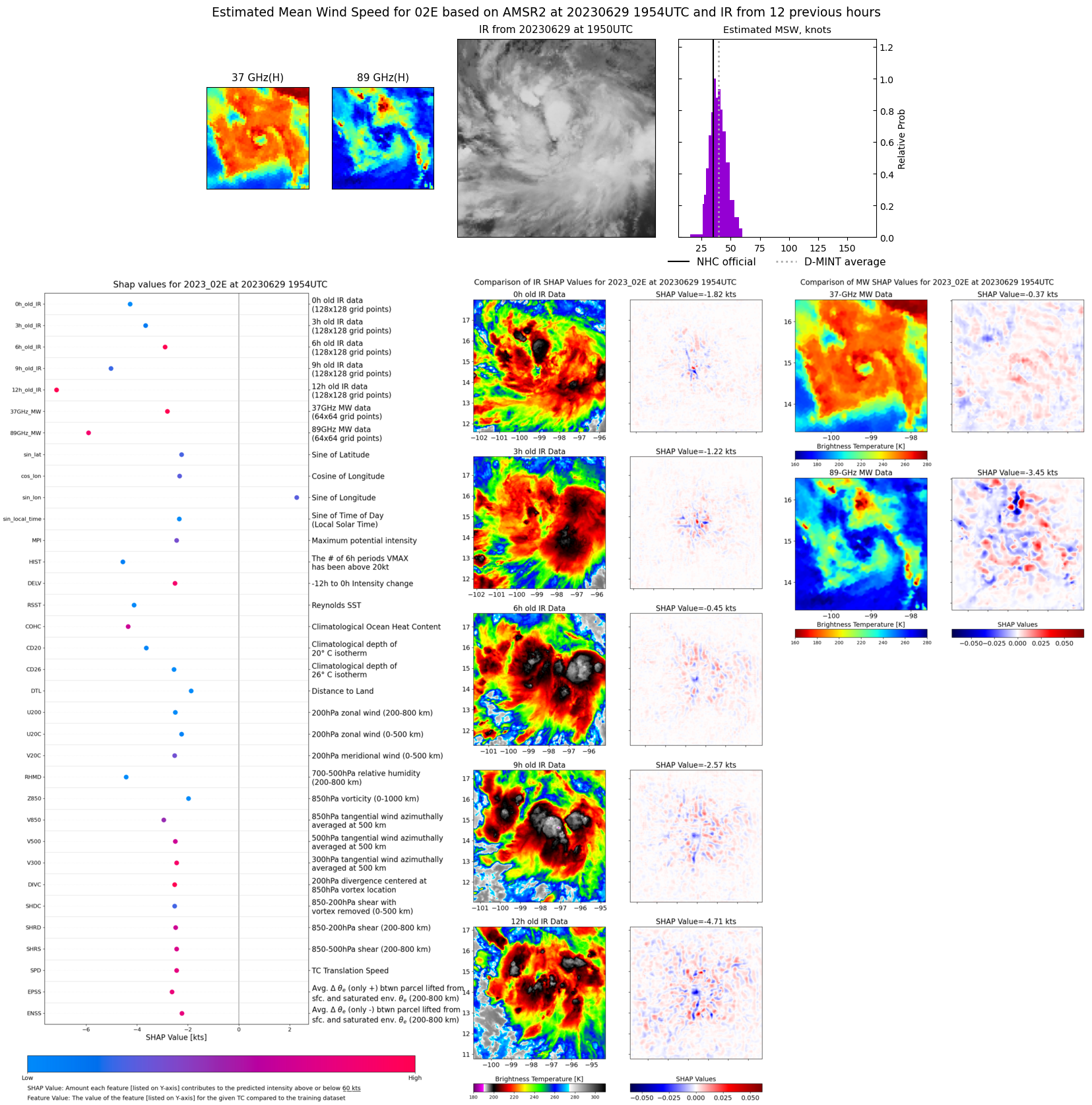 |
| 20230629 | 1140 UTC | SSMISF16 | NaN hPa | 32 kts | 28 kts | 36 kts |  |