|
||

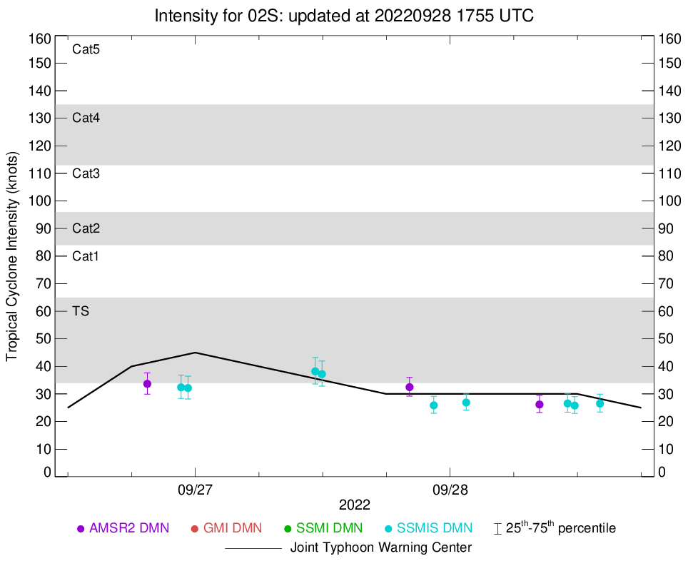 |
D-MINT HISTORY FILE for 2023_02S
| Date | Time | MW Sensor | MSLP | Vmax (30th-70th percentile average) | Vmax 25th percentile | Vmax 75th percentile | Image |
| 20220928 | 1407 UTC | SSMISF17 | NaN hPa | 29 kts | 27 kts | 31 kts |  |
| 20220928 | 1144 UTC | SSMISF16 | NaN hPa | 27 kts | 25 kts | 28 kts | 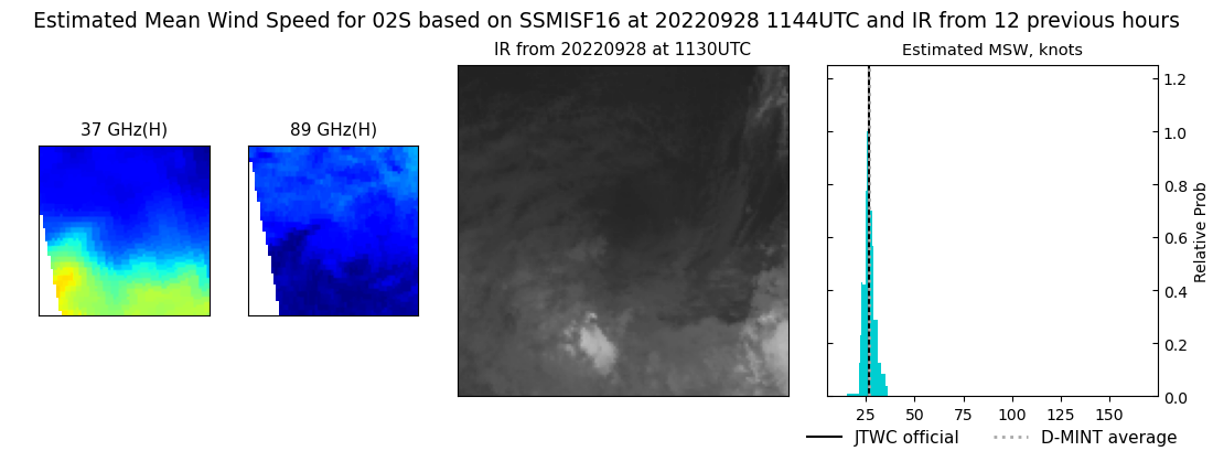 |
| 20220928 | 1104 UTC | SSMISF18 | NaN hPa | 28 kts | 26 kts | 31 kts | 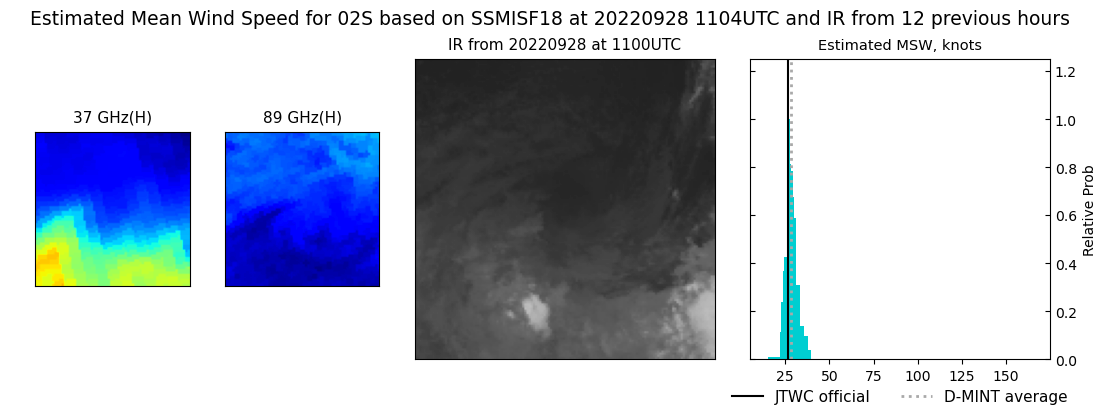 |
| 20220928 | 0825 UTC | AMSR2 | NaN hPa | 25 kts | 23 kts | 27 kts | 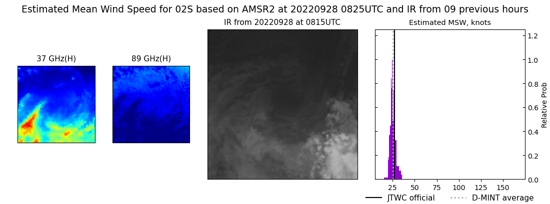 |
| 20220928 | 0131 UTC | SSMISF17 | NaN hPa | 0 kts | 0 kts | 0 kts |  |
| 20220927 | 2228 UTC | SSMISF18 | NaN hPa | 28 kts | 26 kts | 31 kts | 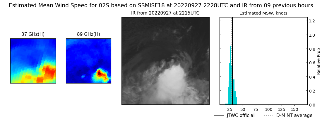 |
| 20220927 | 2011 UTC | AMSR2 | NaN hPa | 33 kts | 30 kts | 35 kts | 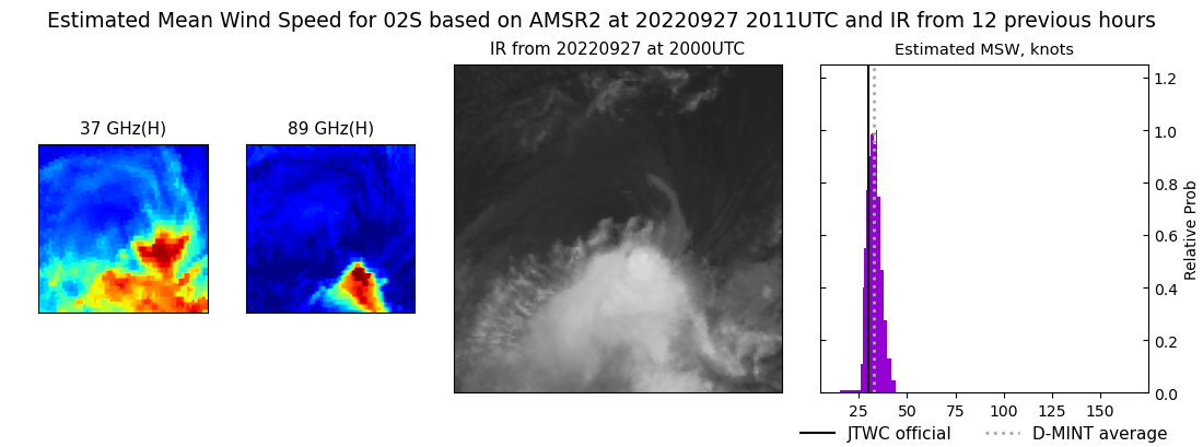 |
| 20220927 | 1156 UTC | SSMISF16 | NaN hPa | 32 kts | 29 kts | 35 kts | 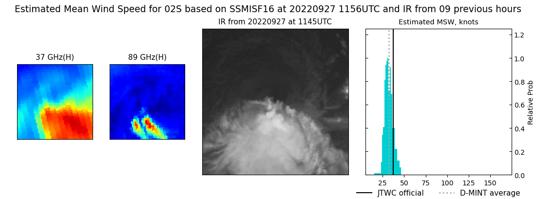 |
| 20220927 | 1118 UTC | SSMISF18 | NaN hPa | 37 kts | 34 kts | 41 kts | 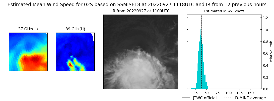 |
| 20220926 | 2319 UTC | SSMISF16 | NaN hPa | 33 kts | 30 kts | 36 kts |  |
| 20220926 | 2240 UTC | SSMISF18 | NaN hPa | 32 kts | 29 kts | 34 kts | 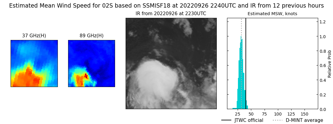 |
| 20220926 | 1929 UTC | AMSR2 | NaN hPa | 34 kts | 31 kts | 38 kts | 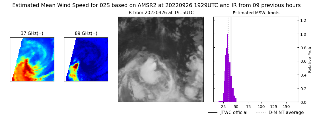 |