|
||

 |
D-MINT HISTORY FILE for 2023_04S
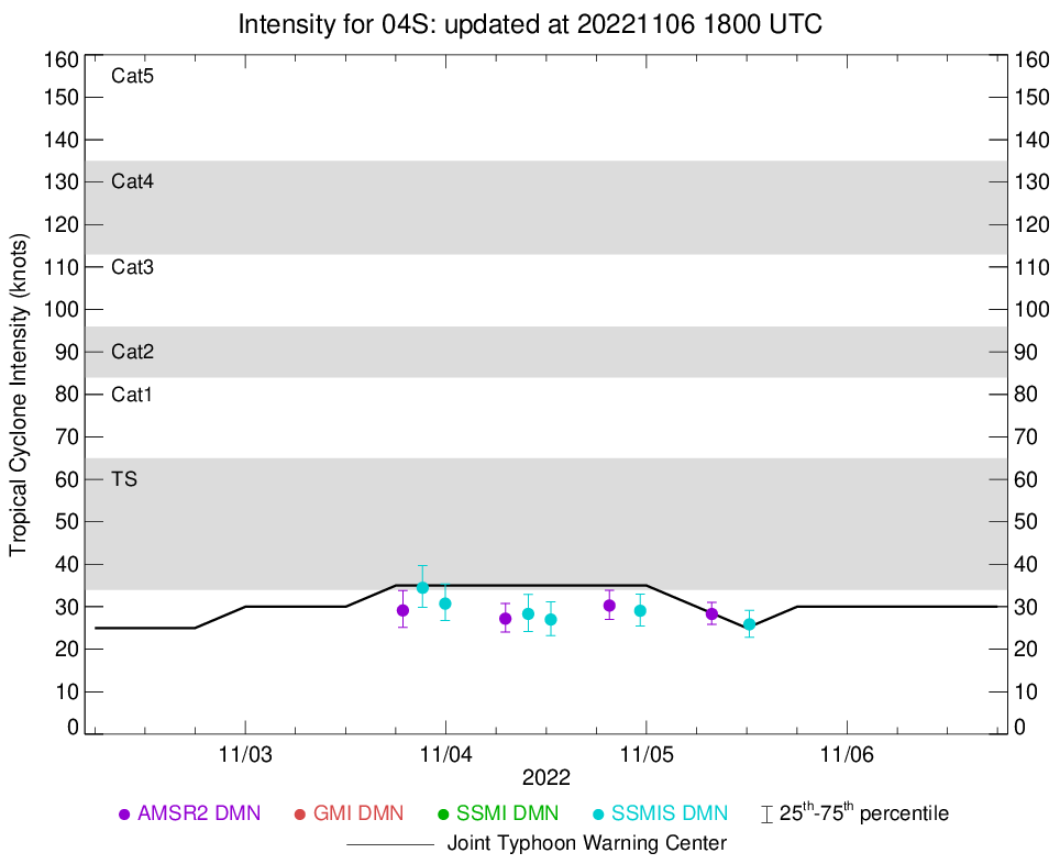
| Date | Time | MW Sensor | MSLP | Vmax (30th-70th percentile average) | Vmax 25th percentile | Vmax 75th percentile | Image |
| 20221105 | 1219 UTC | SSMISF17 | NaN hPa | 0 kts | 0 kts | 0 kts | 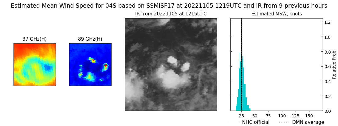 |
| 20221105 | 0749 UTC | AMSR2 | NaN hPa | 0 kts | 0 kts | 0 kts | 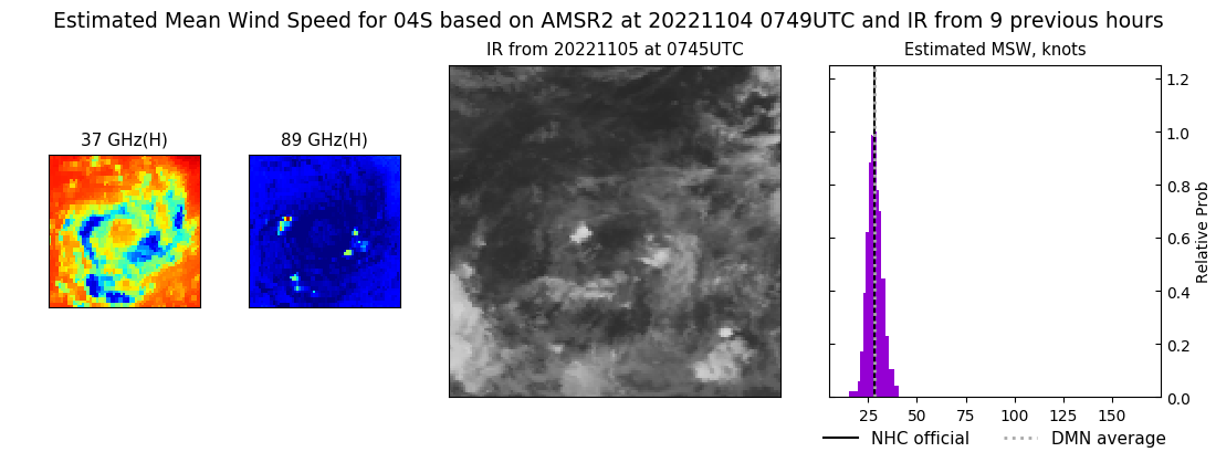 |
| 20221104 | 2315 UTC | SSMISF16 | NaN hPa | 0 kts | 0 kts | 0 kts |  |
| 20221104 | 1934 UTC | AMSR2 | NaN hPa | 31 kts | 28 kts | 34 kts |  |
| 20221104 | 1233 UTC | SSMISF17 | NaN hPa | 35 kts | 32 kts | 40 kts | 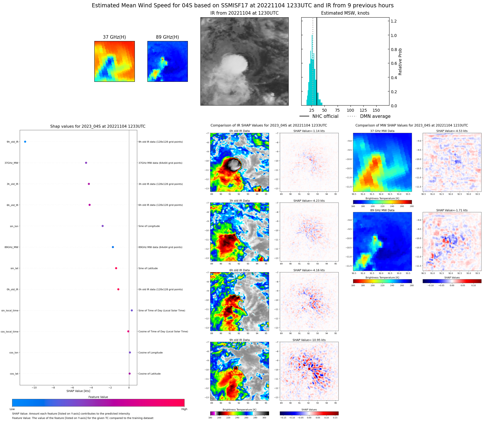 |
| 20221104 | 0951 UTC | SSMISF18 | NaN hPa | 0 kts | 0 kts | 0 kts | 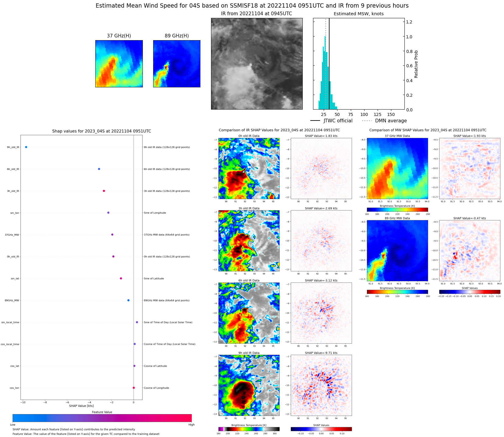 |
| 20221104 | 0707 UTC | AMSR2 | NaN hPa | 34 kts | 30 kts | 37 kts | 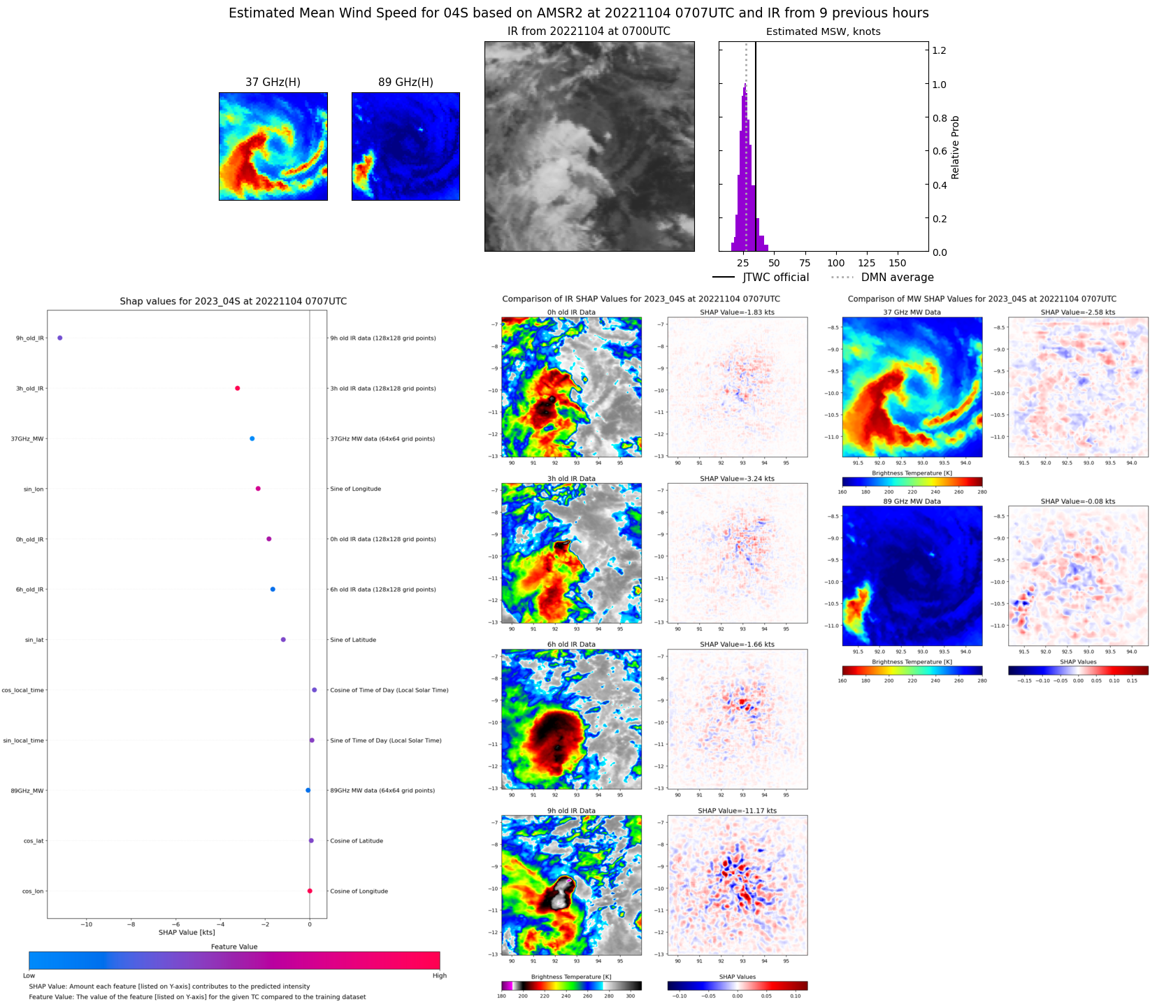 |
| 20221103 | 2355 UTC | SSMISF17 | NaN hPa | 35 kts | 32 kts | 40 kts |  |
| 20221103 | 2113 UTC | SSMISF18 | NaN hPa | 0 kts | 0 kts | 0 kts | 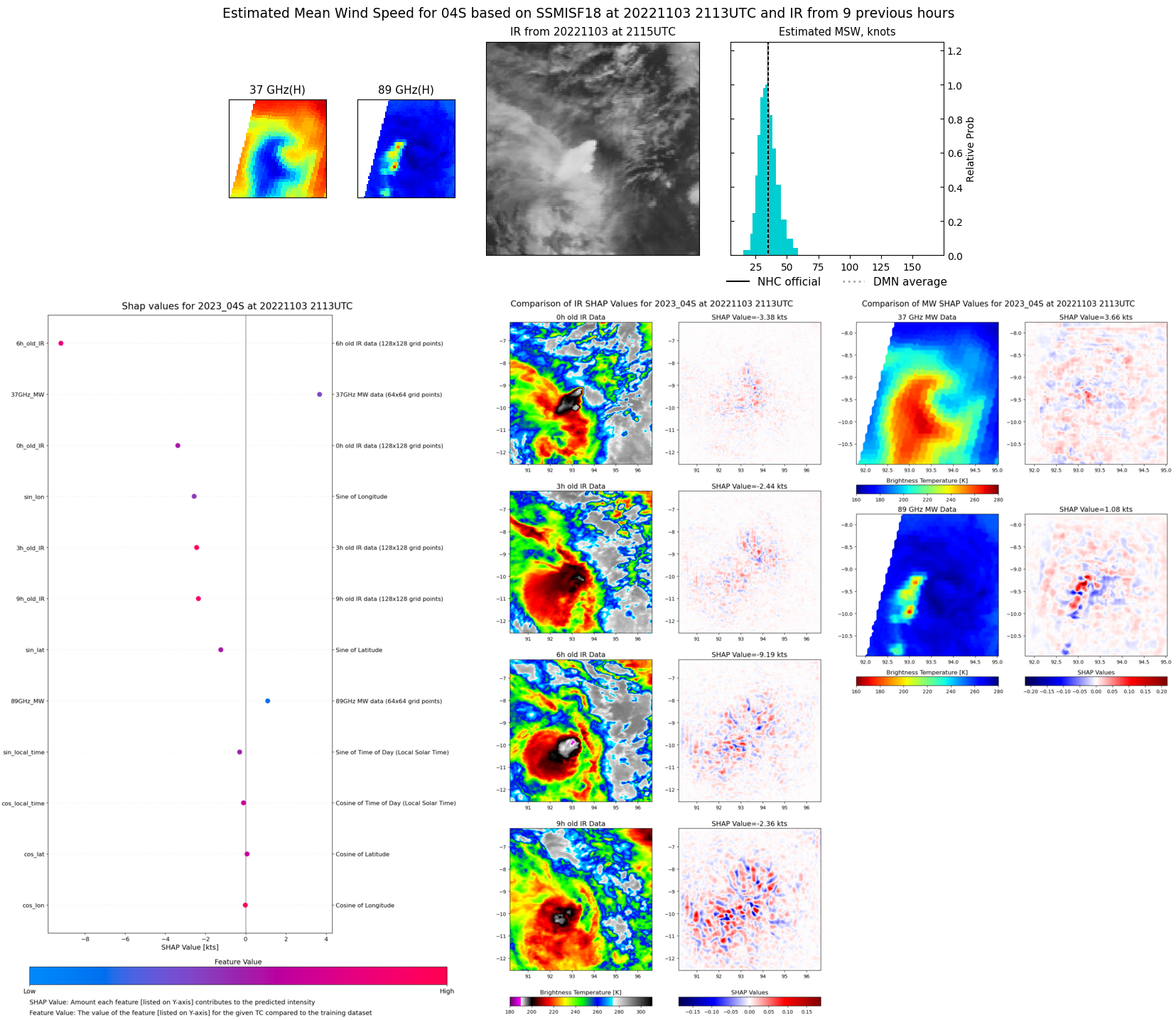 |
| 20221103 | 1851 UTC | AMSR2 | NaN hPa | 0 kts | 0 kts | 0 kts |  |