|
||

 |
D-MINT HISTORY FILE for 2023_07P
| Date | Time | MW Sensor | MSLP | Vmax (30th-70th percentile average) | Vmax 25th percentile | Vmax 75th percentile | Image |
| 20230109 | 0602 UTC | SSMISF16 | NaN hPa | 0 kts | 0 kts | 0 kts | 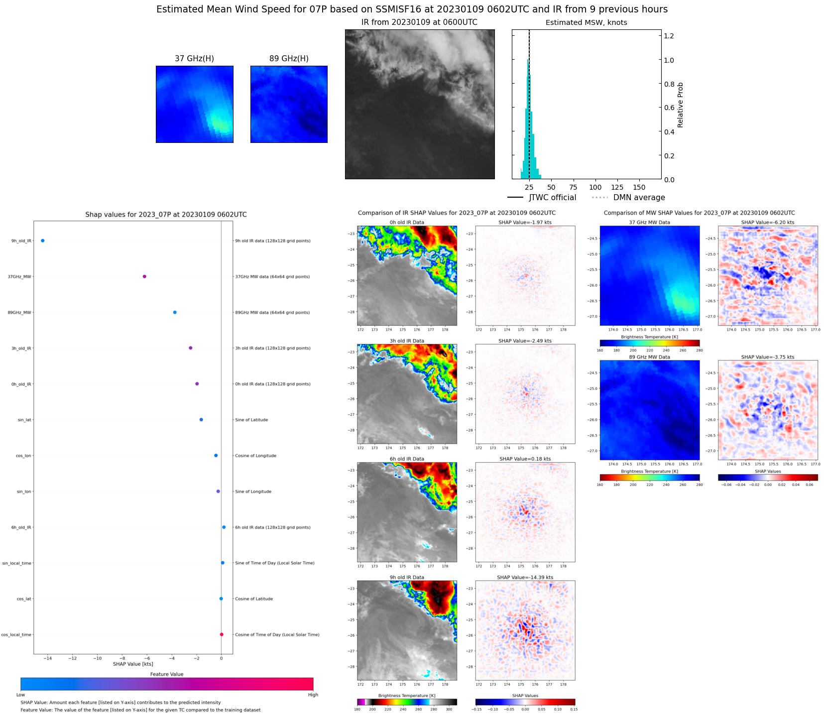 |
| 20230108 | 1912 UTC | SSMISF17 | NaN hPa | 0 kts | 0 kts | 0 kts | 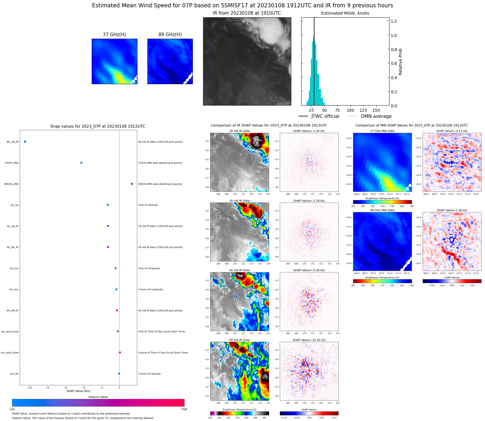 |
| 20230108 | 1732 UTC | SSMISF16 | NaN hPa | 0 kts | 0 kts | 0 kts | 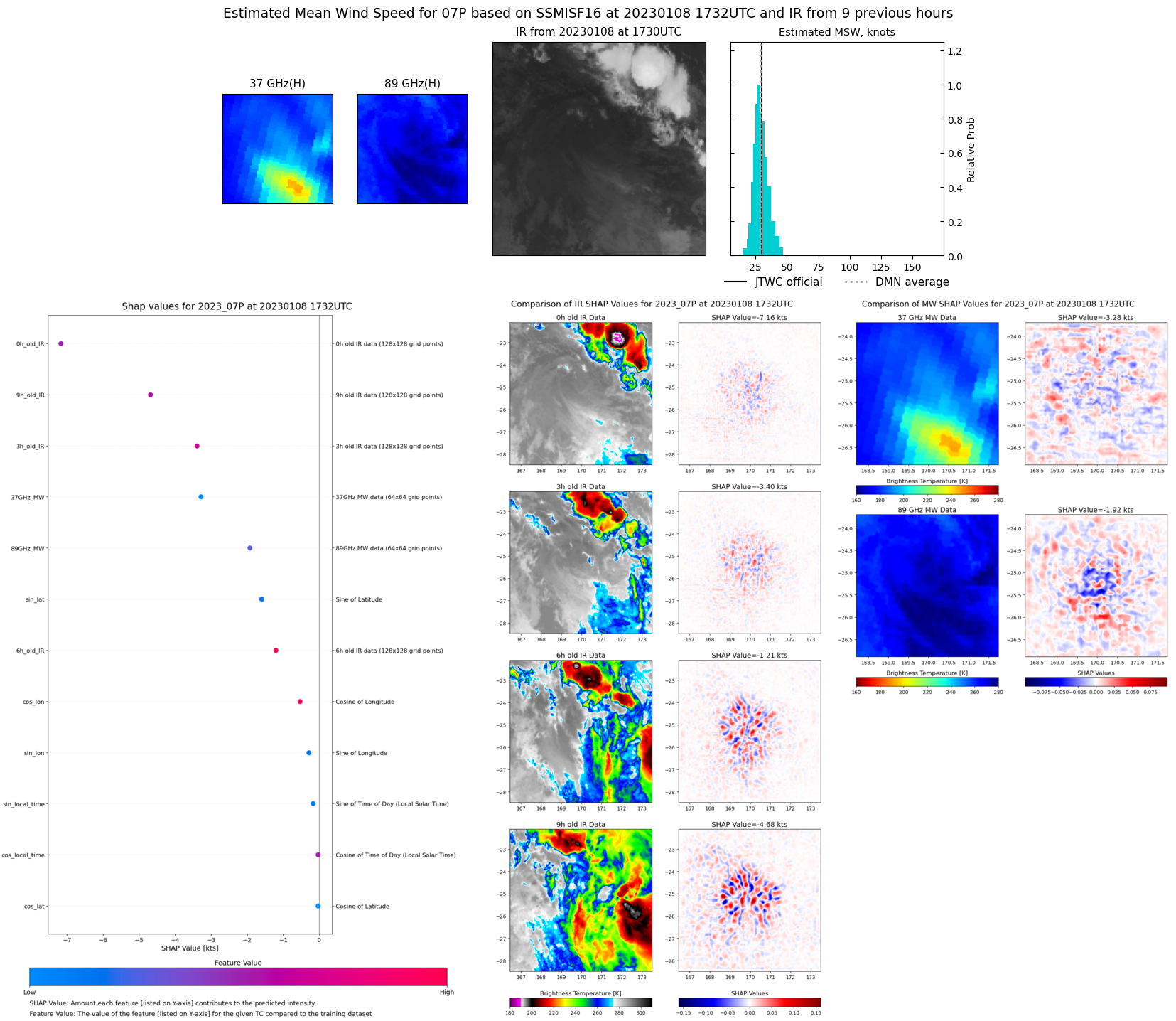 |
| 20230108 | 0756 UTC | SSMISF17 | NaN hPa | 0 kts | 0 kts | 0 kts | 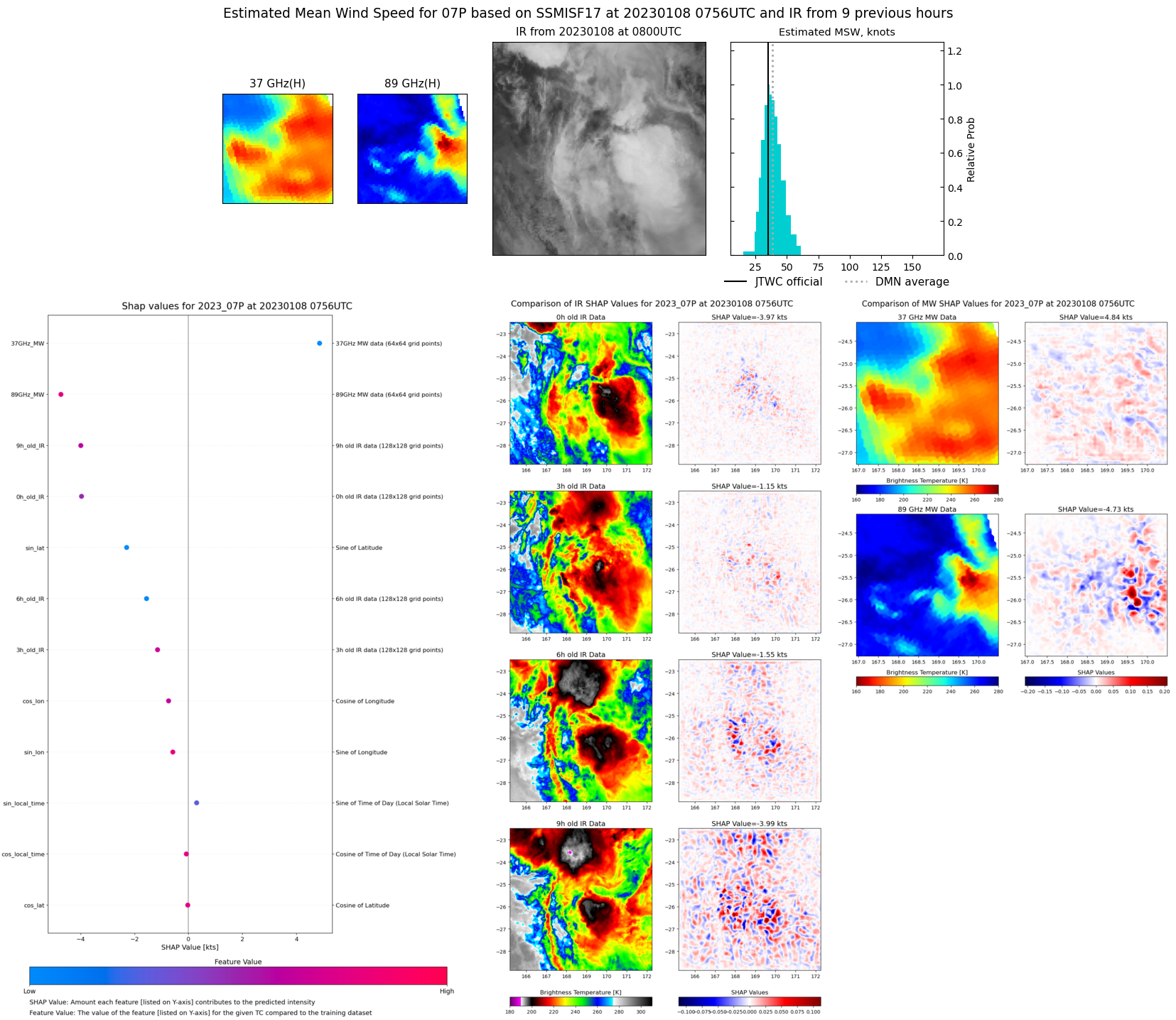 |
| 20230108 | 0615 UTC | SSMISF16 | NaN hPa | 0 kts | 0 kts | 0 kts | 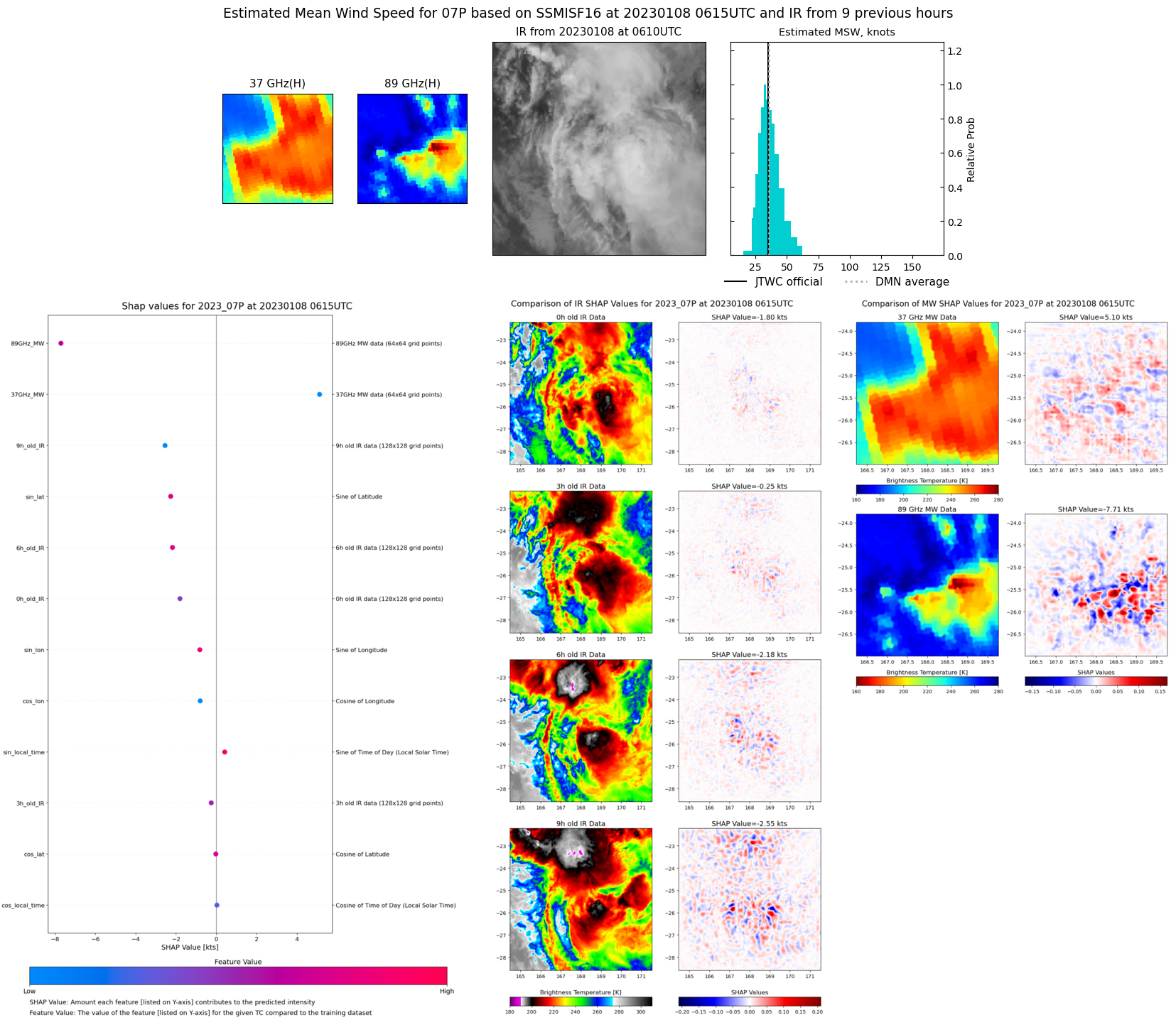 |
| 20230107 | 1925 UTC | SSMISF17 | NaN hPa | 0 kts | 0 kts | 0 kts | 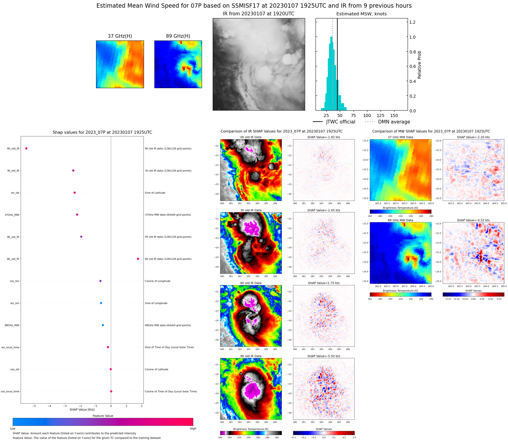 |
| 20230107 | 1746 UTC | SSMISF16 | NaN hPa | 0 kts | 0 kts | 0 kts | 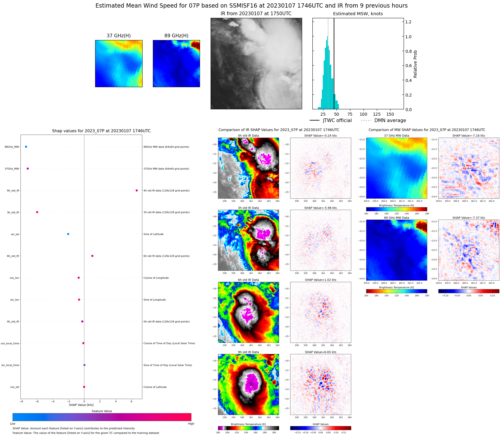 |
| 20230107 | 1719 UTC | SSMISF18 | NaN hPa | 0 kts | 0 kts | 0 kts | 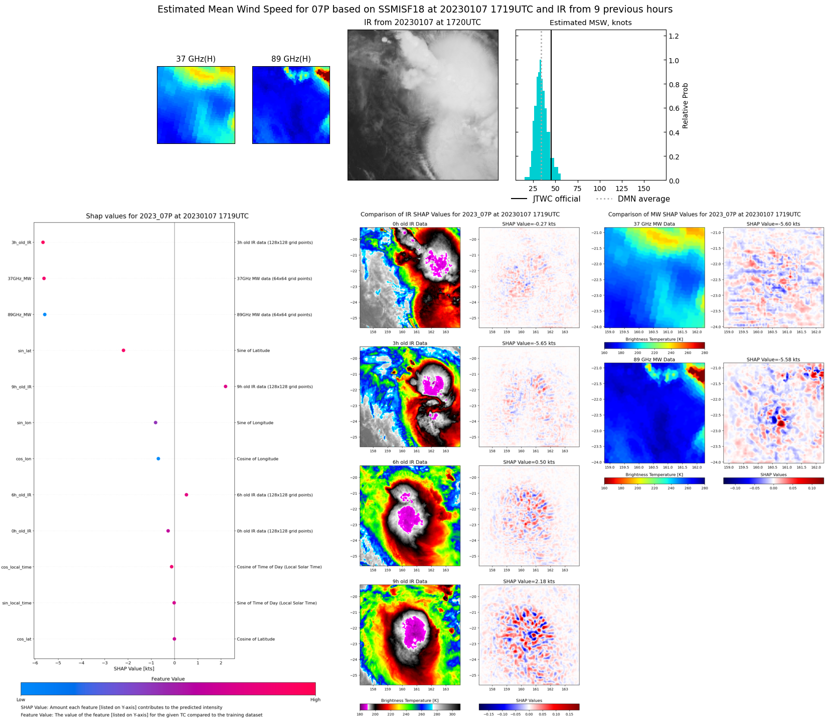 |
| 20230107 | 0810 UTC | SSMISF17 | NaN hPa | 0 kts | 0 kts | 0 kts | 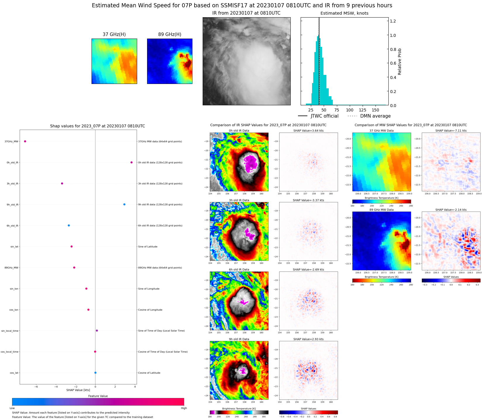 |
| 20230107 | 0631 UTC | SSMISF16 | NaN hPa | 0 kts | 0 kts | 0 kts | 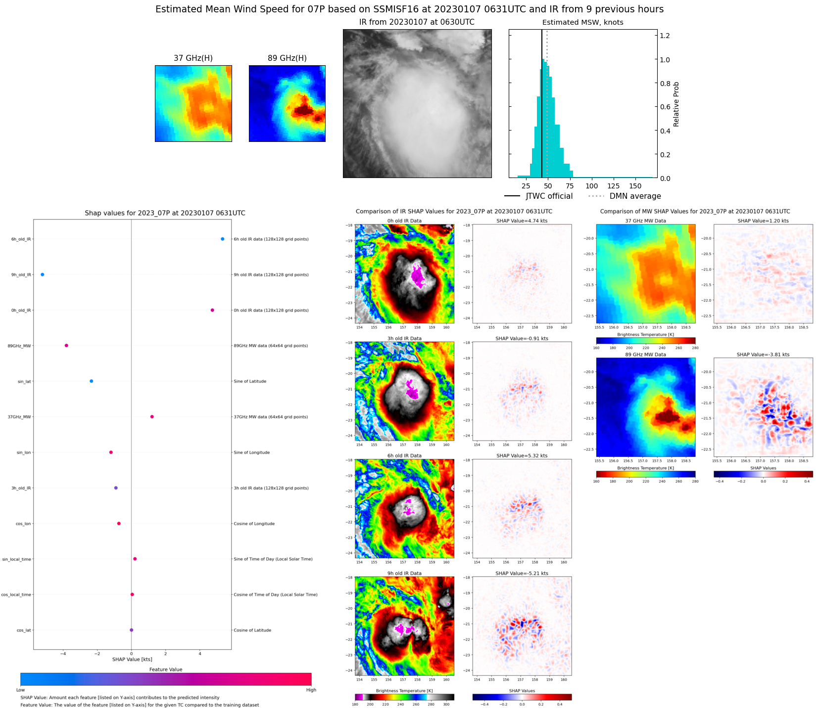 |
| 20230107 | 0604 UTC | SSMISF18 | NaN hPa | 0 kts | 0 kts | 0 kts | 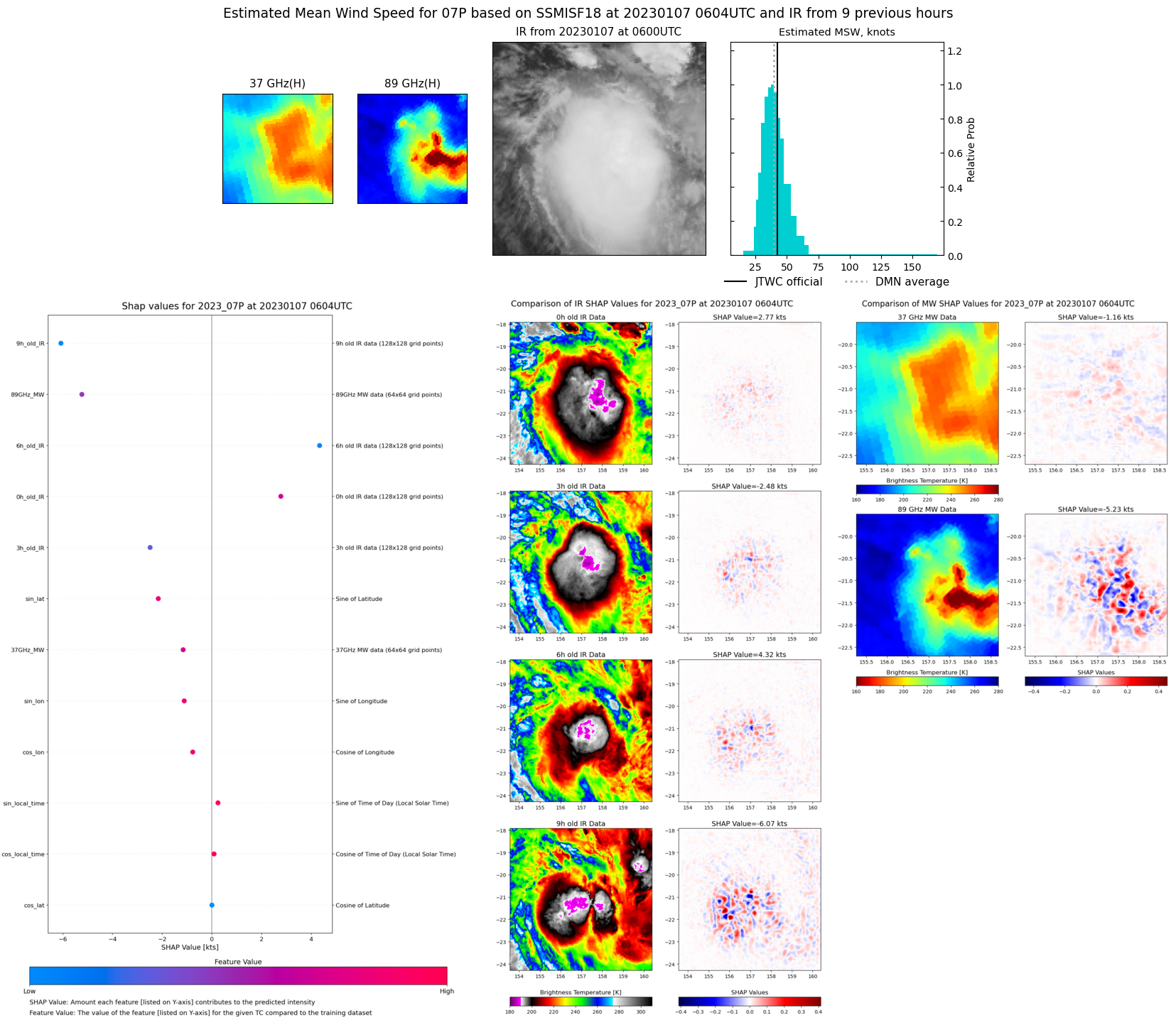 |
| 20230106 | 1938 UTC | SSMISF17 | NaN hPa | 0 kts | 0 kts | 0 kts | 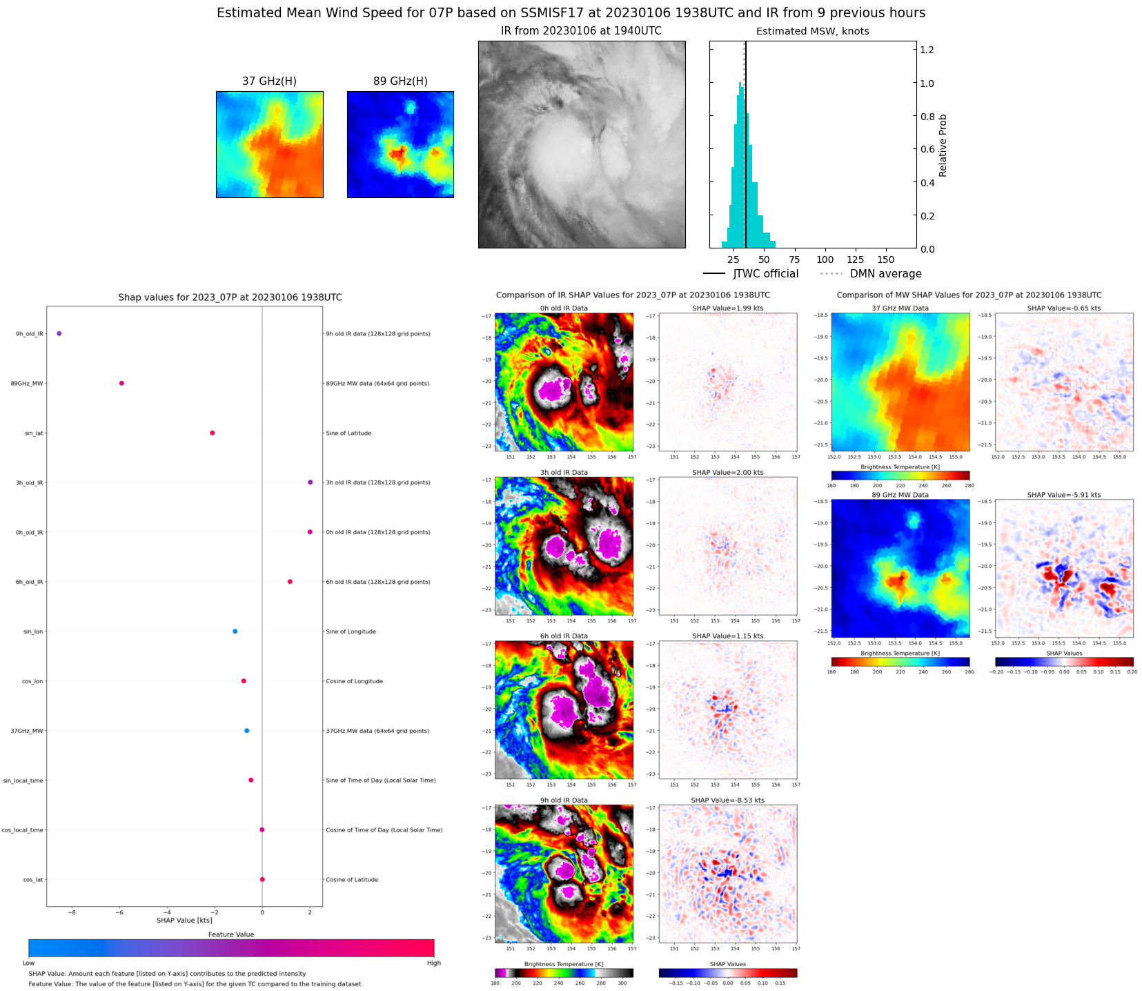 |
| 20230106 | 1731 UTC | SSMISF18 | NaN hPa | 0 kts | 0 kts | 0 kts | 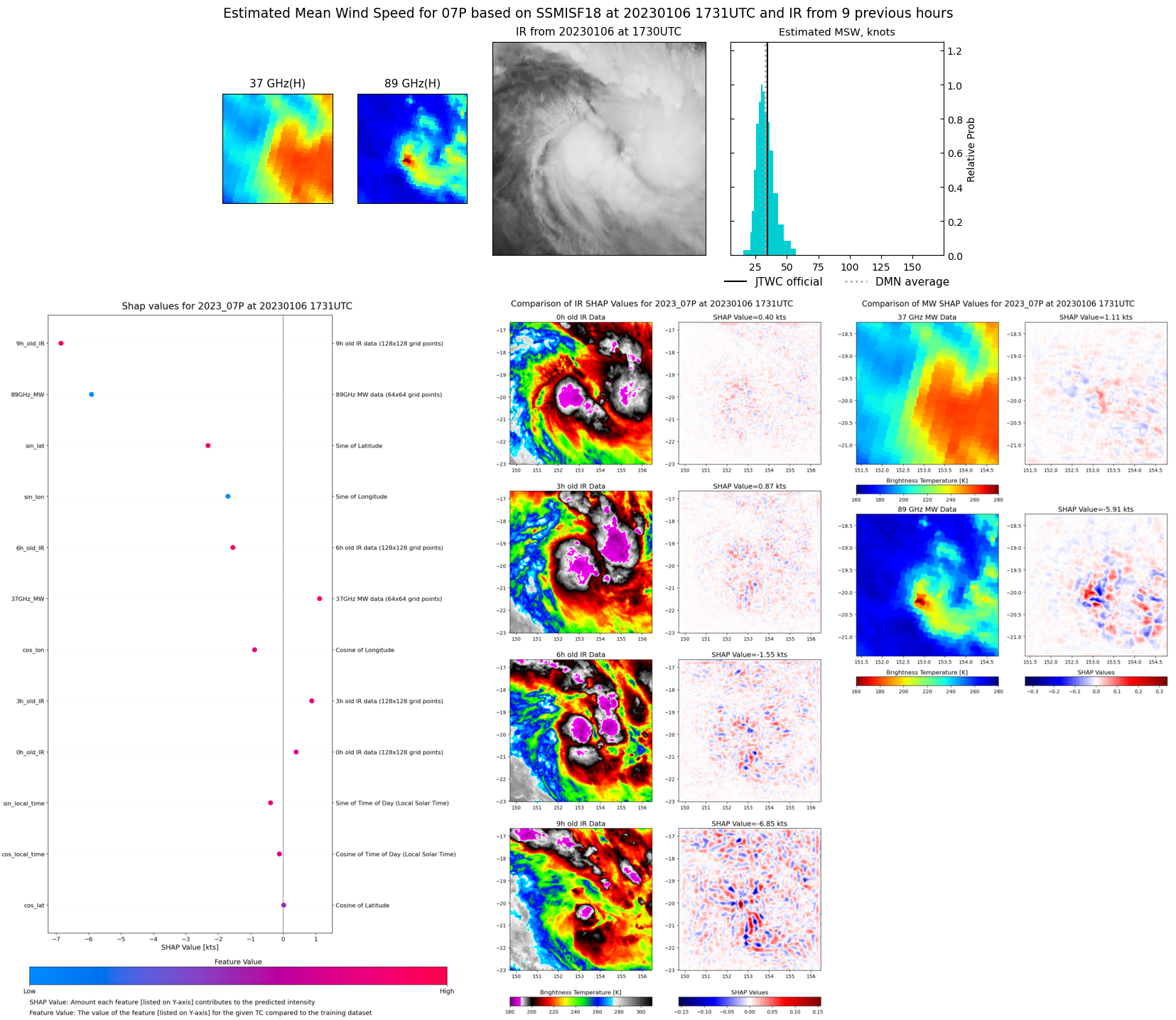 |