|
||

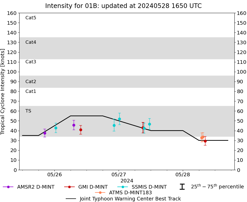 |
D-MINT HISTORY FILE for 2024_01B
| Date | Time | MW Sensor | MSLP | Vmax (30th-70th percentile average) | Vmax 25th percentile | Vmax 75th percentile | Image |
| 20240528 | 0818 UTC | GMI | 999 hPa | 29 kts | 25 kts | 34 kts | 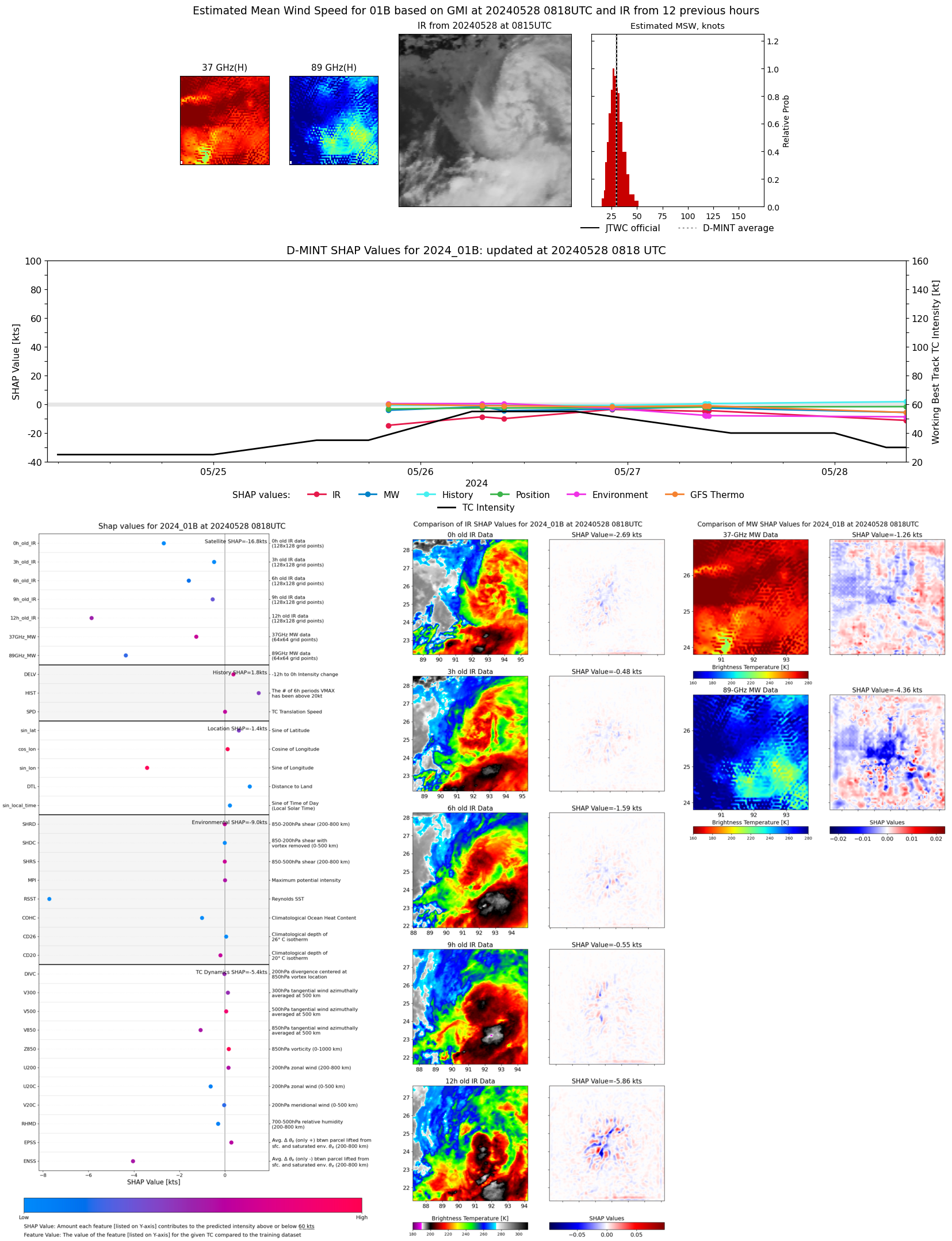 |
| 20240528 | 0727 UTC | ATMS | 989 hPa | 33 kts | 29 kts | 38 kts | 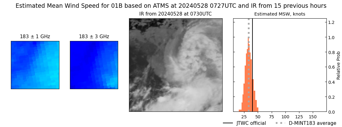 |
| 20240528 | 0701 UTC | ATMS | 988 hPa | 33 kts | 29 kts | 38 kts | 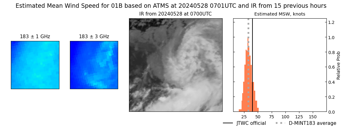 |
| 20240527 | 1129 UTC | SSMISF16 | 987 hPa | 47 kts | 41 kts | 52 kts | 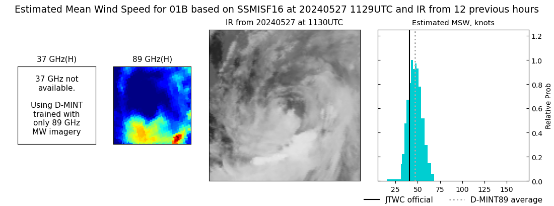 |
| 20240527 | 0927 UTC | SSMISF18 | 990 hPa | 43 kts | 38 kts | 48 kts | 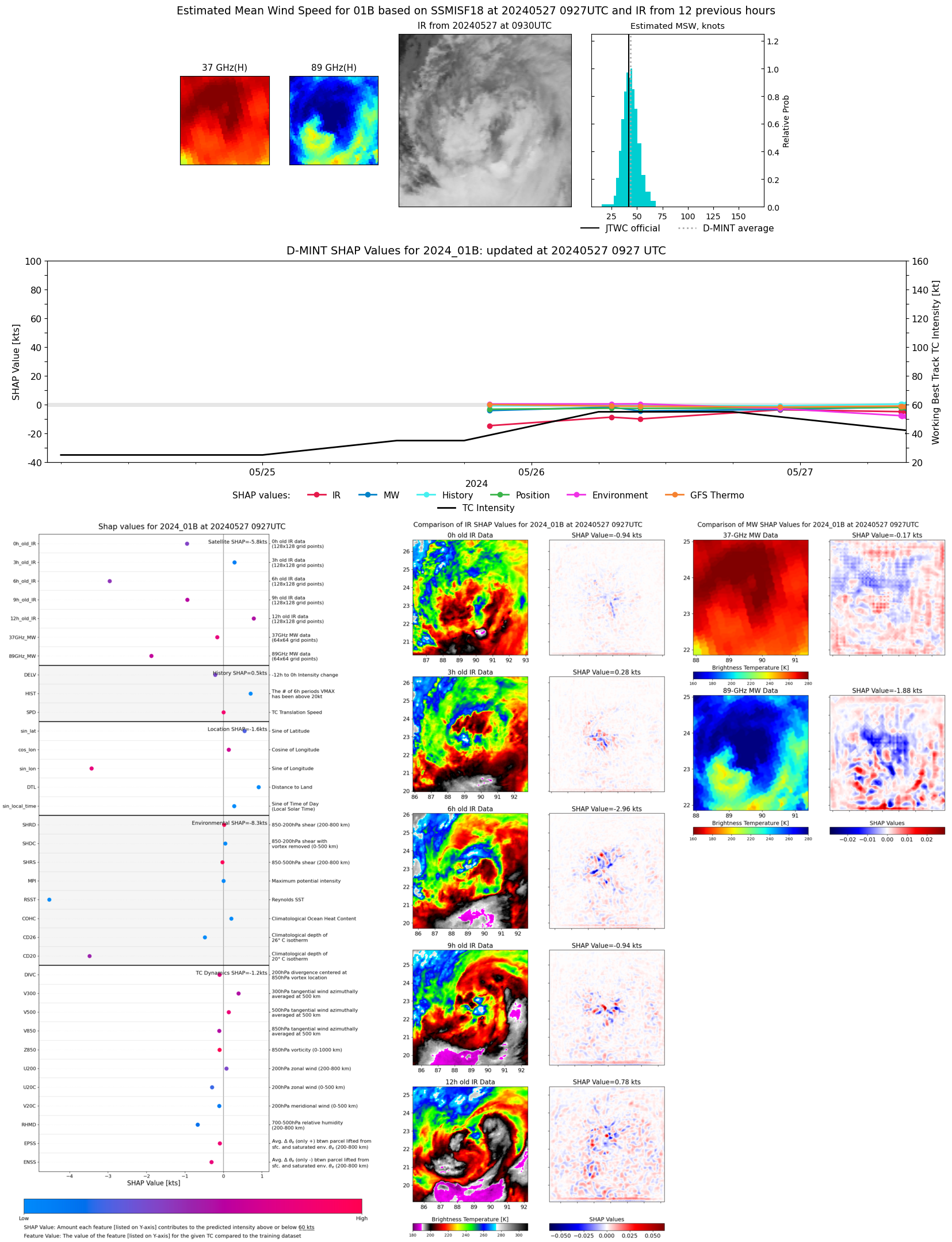 |
| 20240527 | 0904 UTC | GMI | 992 hPa | 43 kts | 38 kts | 48 kts | 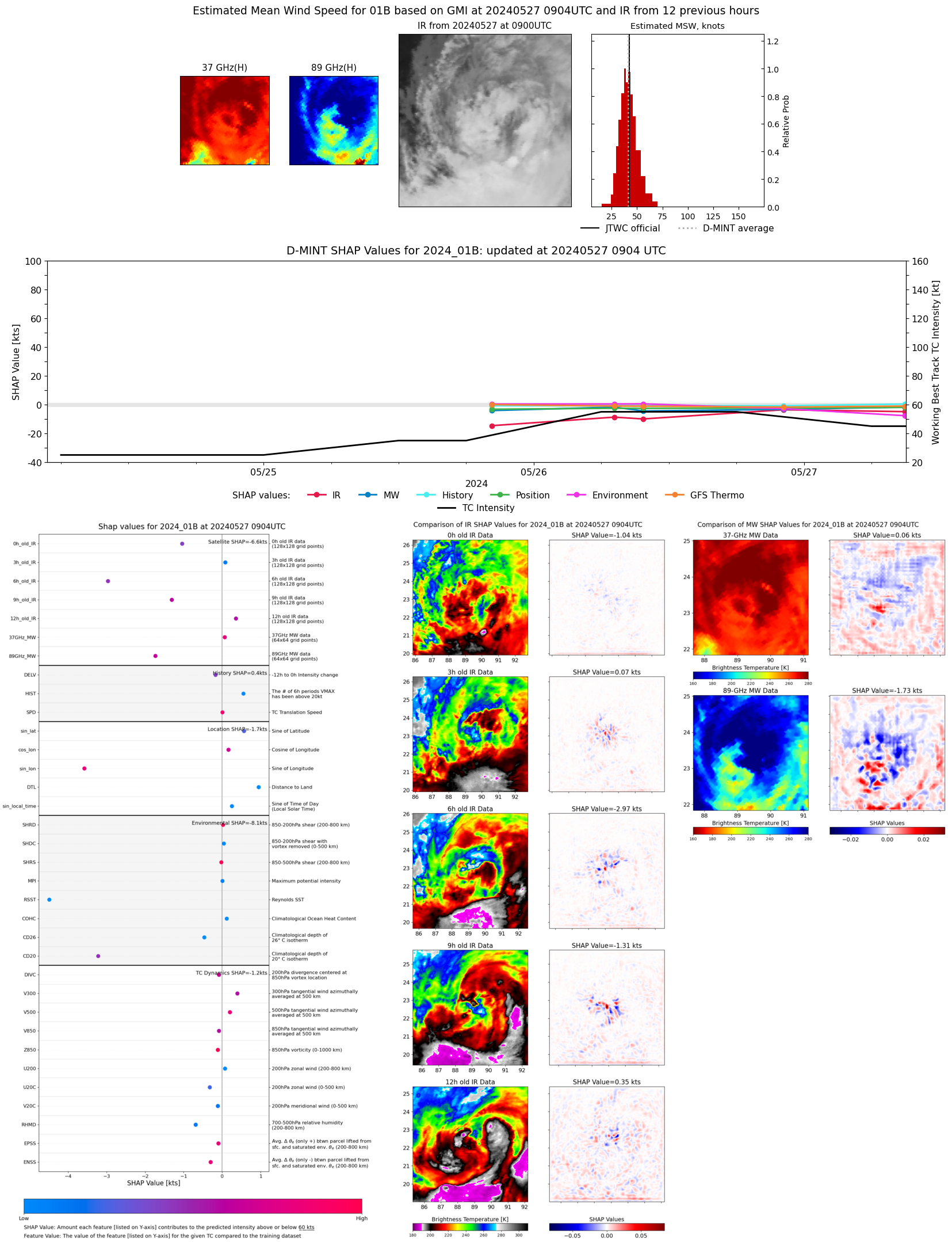 |
| 20240527 | 0858 UTC | GMI | 992 hPa | 43 kts | 38 kts | 49 kts | 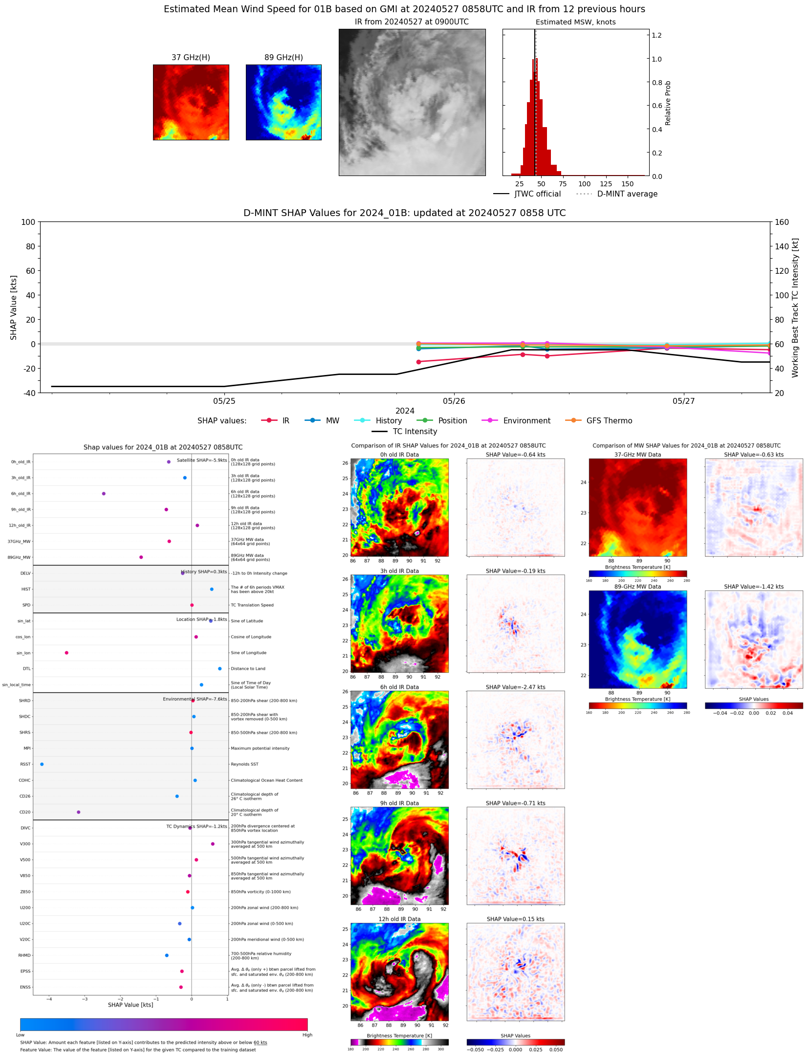 |
| 20240527 | 0014 UTC | SSMISF16 | 983 hPa | 52 kts | 46 kts | 58 kts | 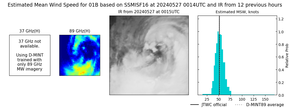 |
| 20240526 | 2212 UTC | SSMISF18 | 989 hPa | 45 kts | 39 kts | 52 kts |  |
| 20240526 | 0943 UTC | GMI | 988 hPa | 41 kts | 36 kts | 45 kts | 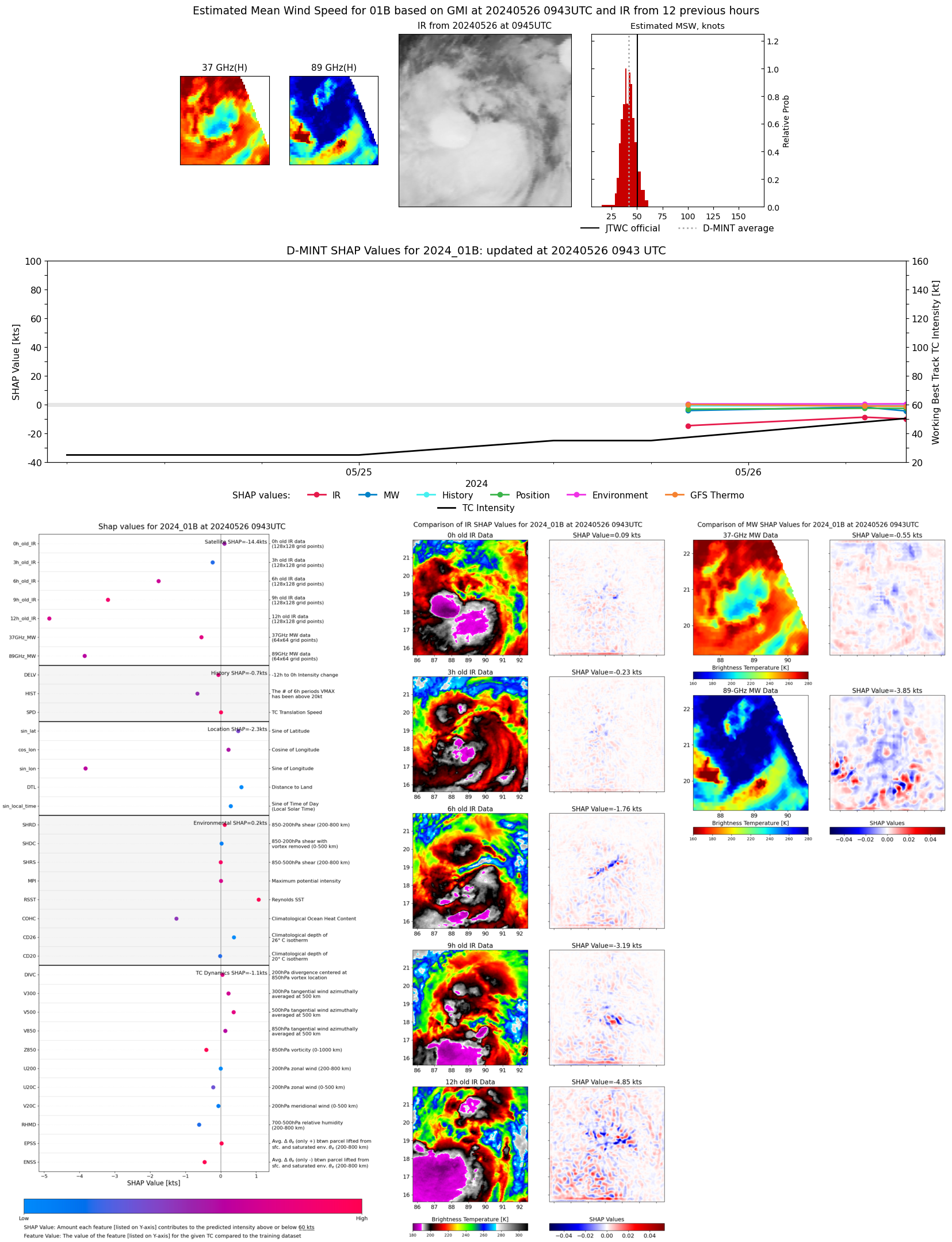 |
| 20240526 | 0709 UTC | AMSR2 | 990 hPa | 46 kts | 41 kts | 51 kts | 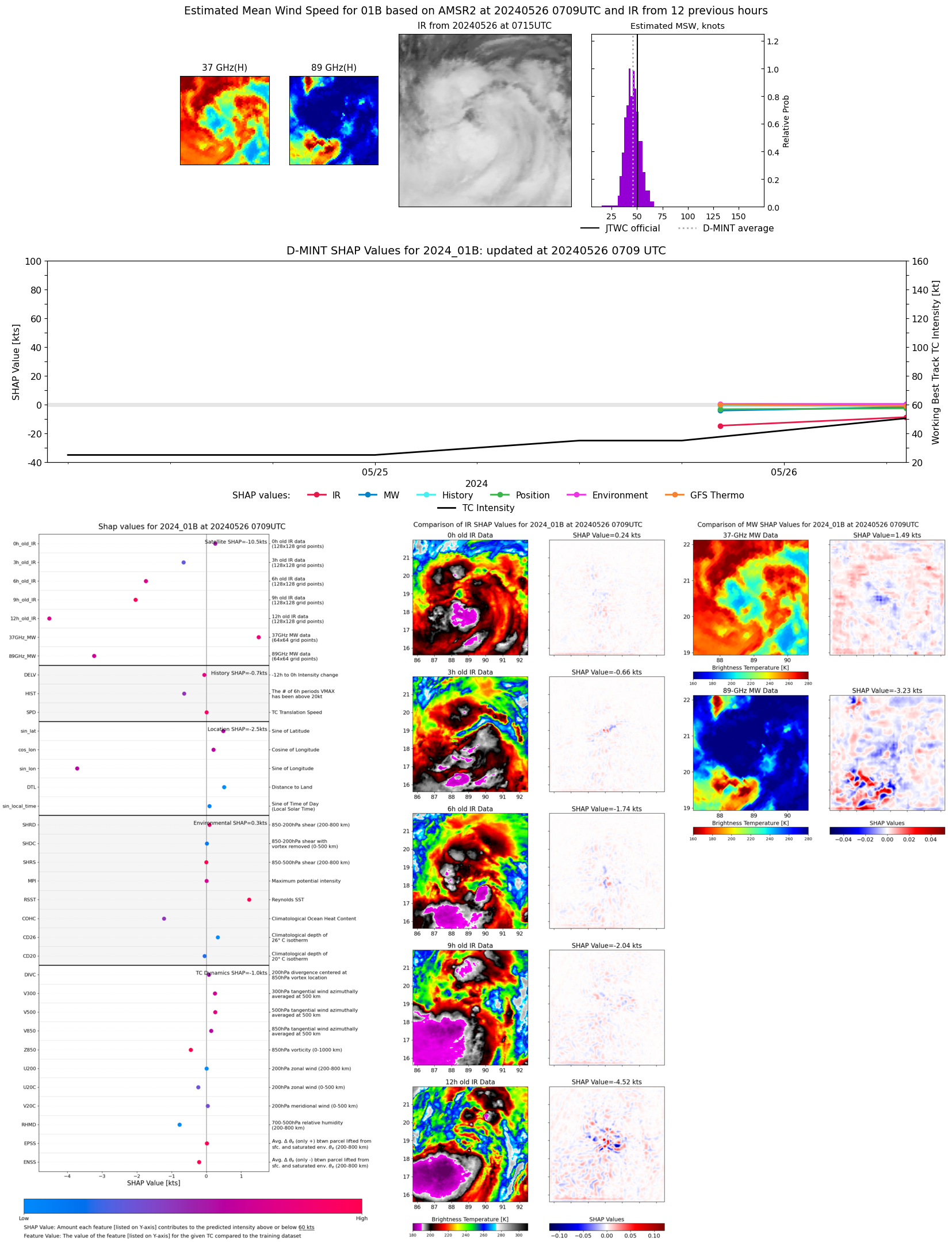 |
| 20240526 | 0028 UTC | SSMISF16 | 987 hPa | 43 kts | 38 kts | 48 kts | 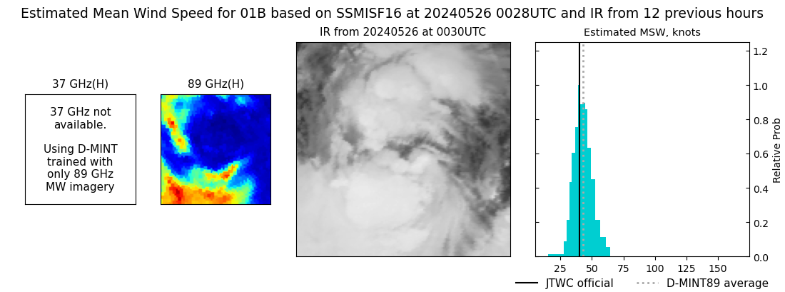 |
| 20240525 | 2016 UTC | AMSR2 | 992 hPa | 38 kts | 34 kts | 42 kts | 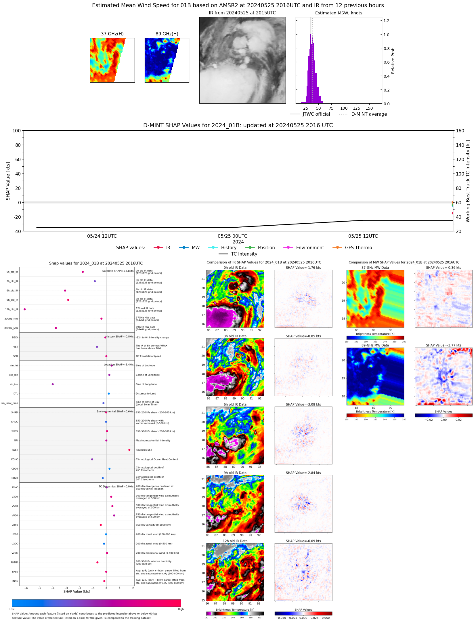 |