|
||

 |
D-MINT HISTORY FILE for 2024_02W
| Date | Time | MW Sensor | MSLP | Vmax (30th-70th percentile average) | Vmax 25th percentile | Vmax 75th percentile | Image |
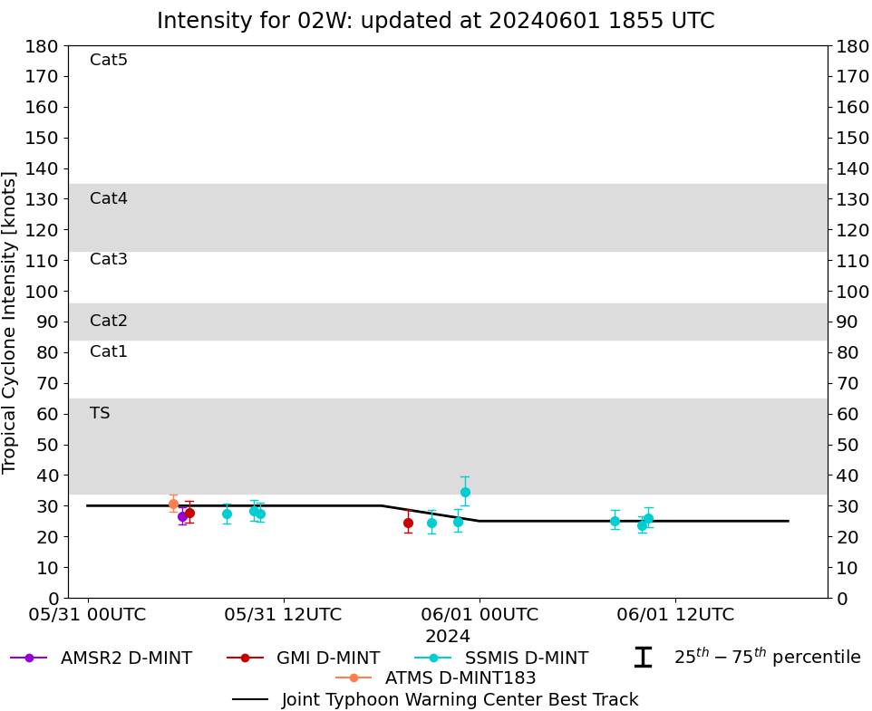
| 20240601 | 1022 UTC | SSMISF16 | 1005 hPa | 26 kts | 23 kts | 29 kts | 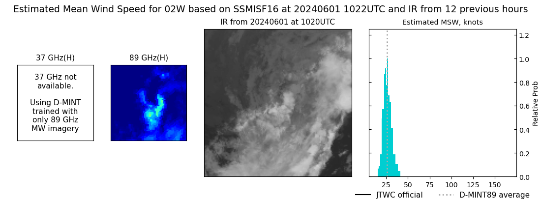 |
| 20240601 | 0959 UTC | SSMISF17 | 1002 hPa | 24 kts | 21 kts | 26 kts | 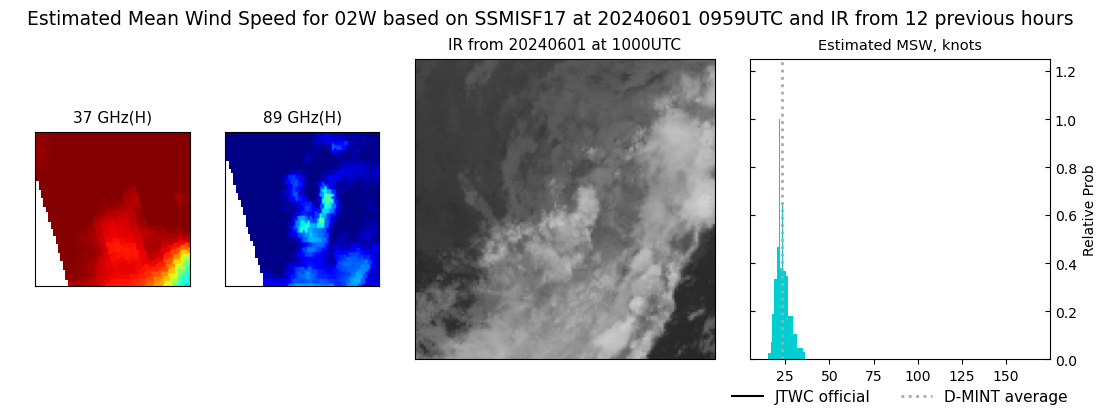 |
| 20240601 | 0819 UTC | SSMISF18 | 1003 hPa | 25 kts | 22 kts | 29 kts | 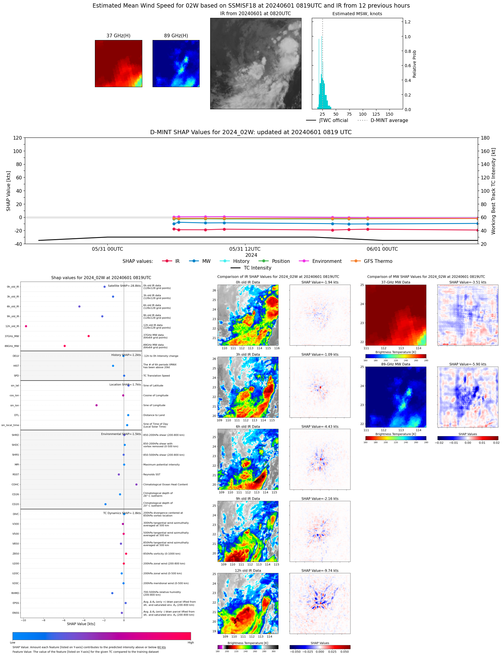 |
| 20240531 | 2306 UTC | SSMISF16 | 999 hPa | 35 kts | 30 kts | 39 kts |  |
| 20240531 | 2242 UTC | SSMISF17 | 1002 hPa | 25 kts | 21 kts | 29 kts | 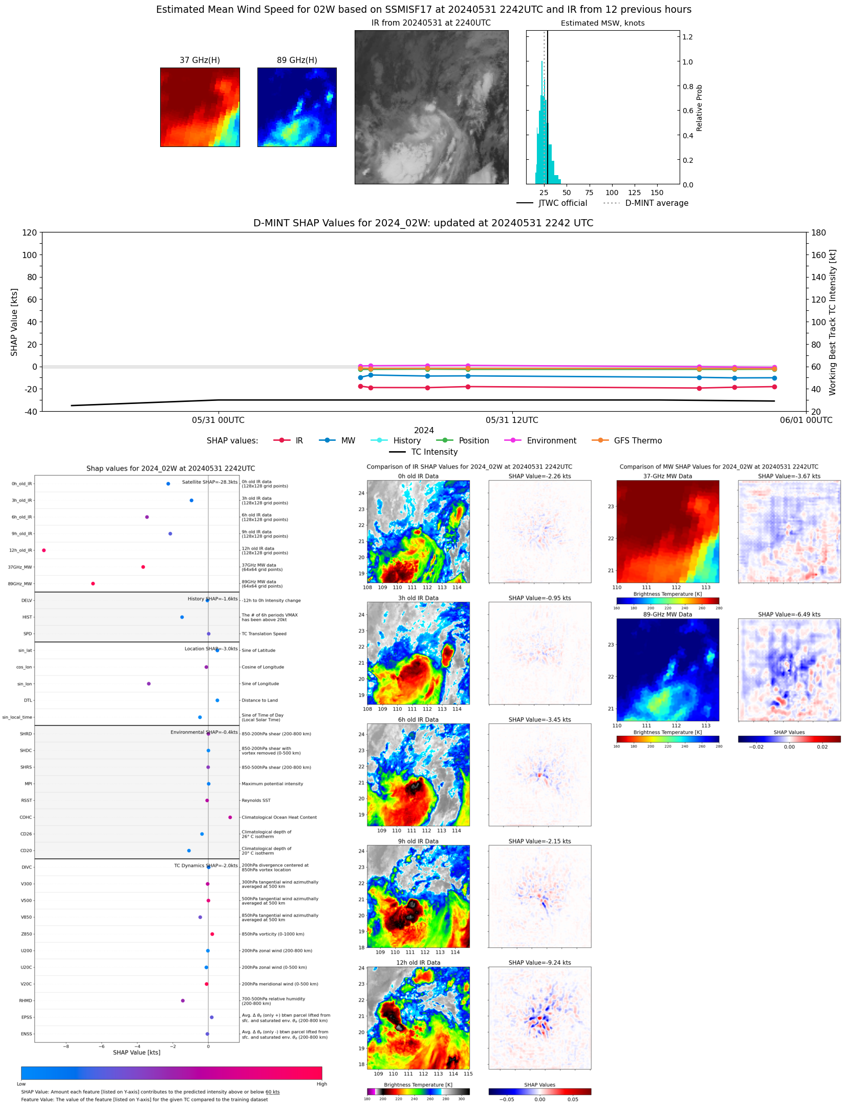 |
| 20240531 | 2104 UTC | SSMISF18 | 1001 hPa | 24 kts | 21 kts | 29 kts | 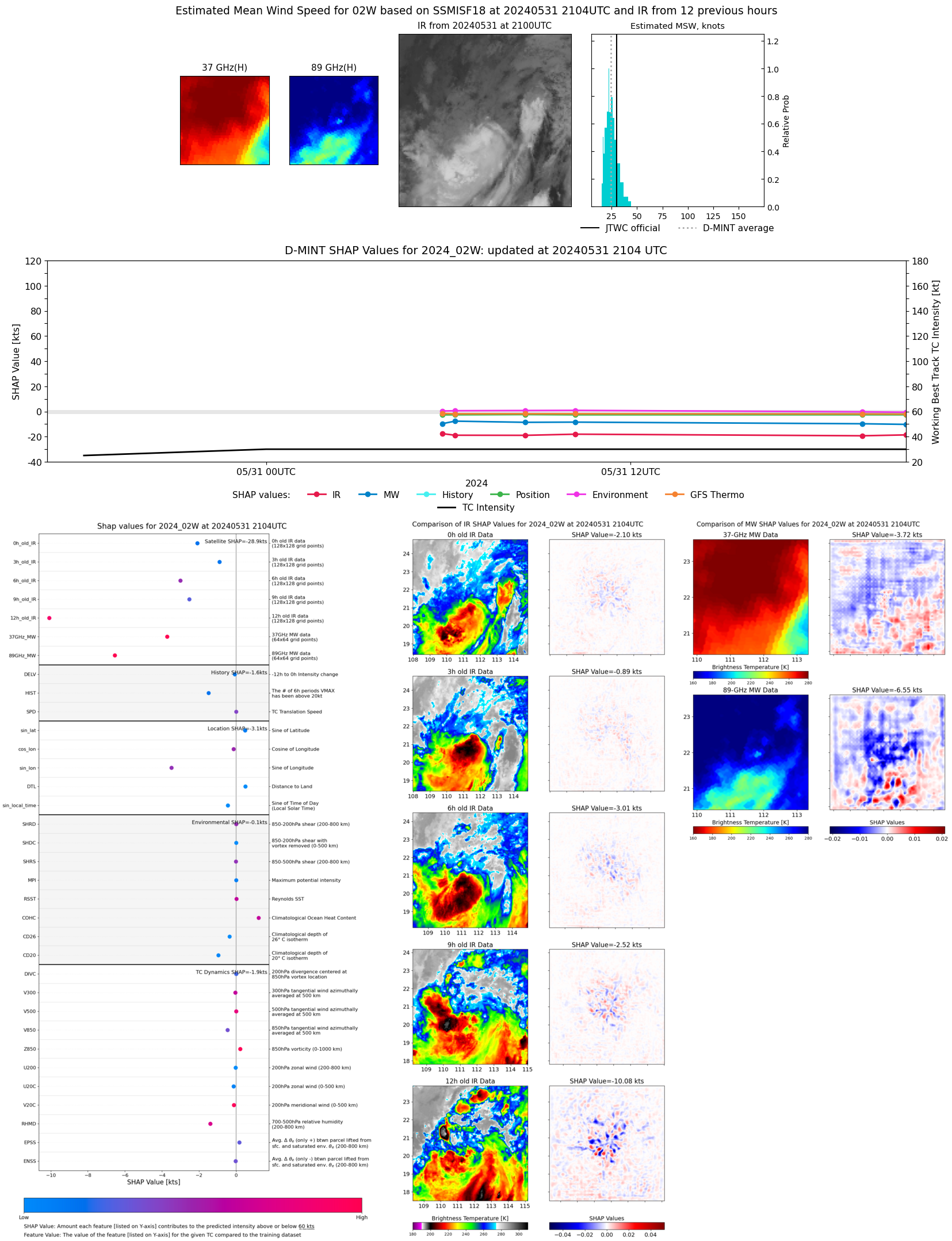 |
| 20240531 | 1938 UTC | GMI | 1001 hPa | 25 kts | 21 kts | 29 kts | 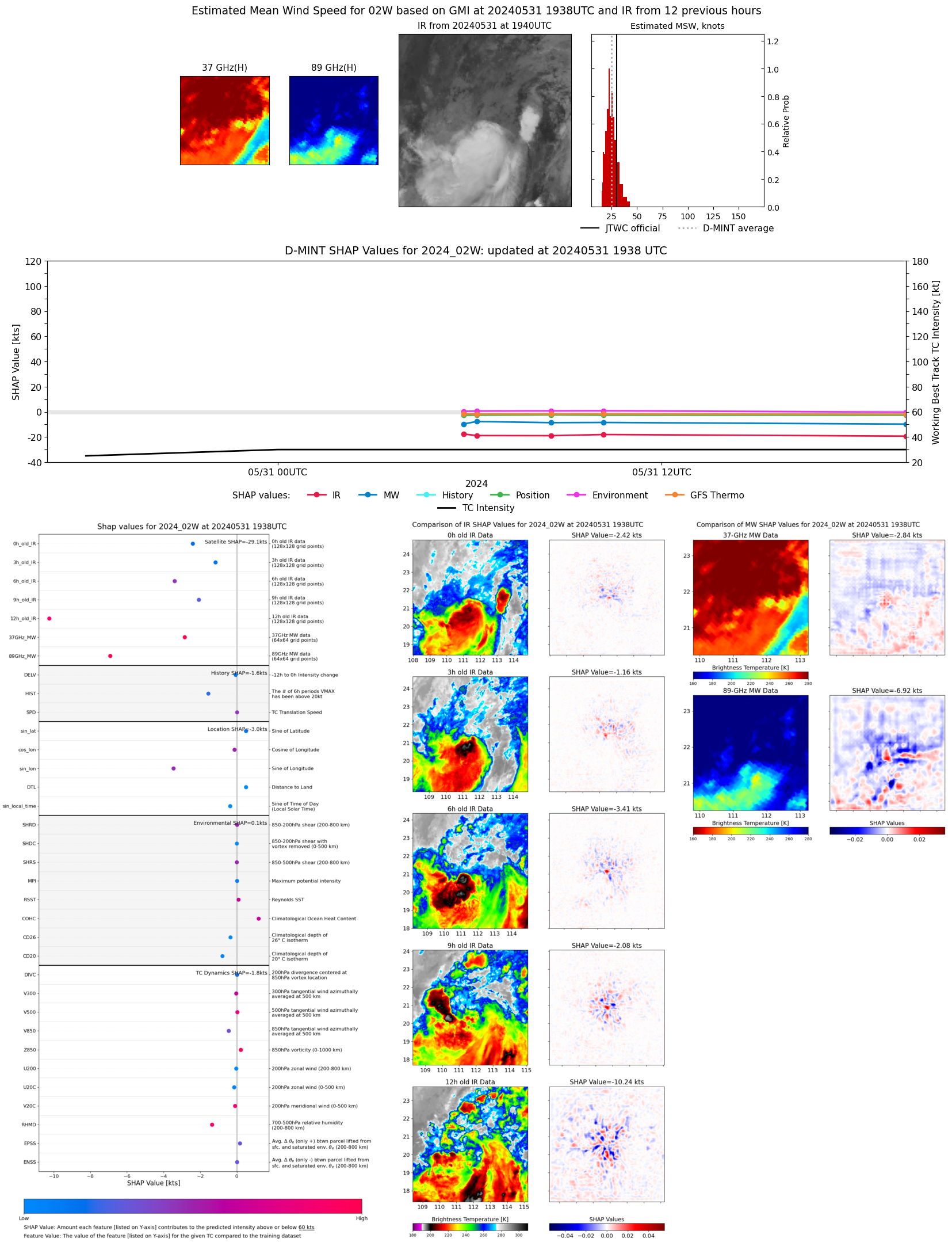 |
| 20240531 | 1035 UTC | SSMISF16 | 1002 hPa | 28 kts | 25 kts | 31 kts | 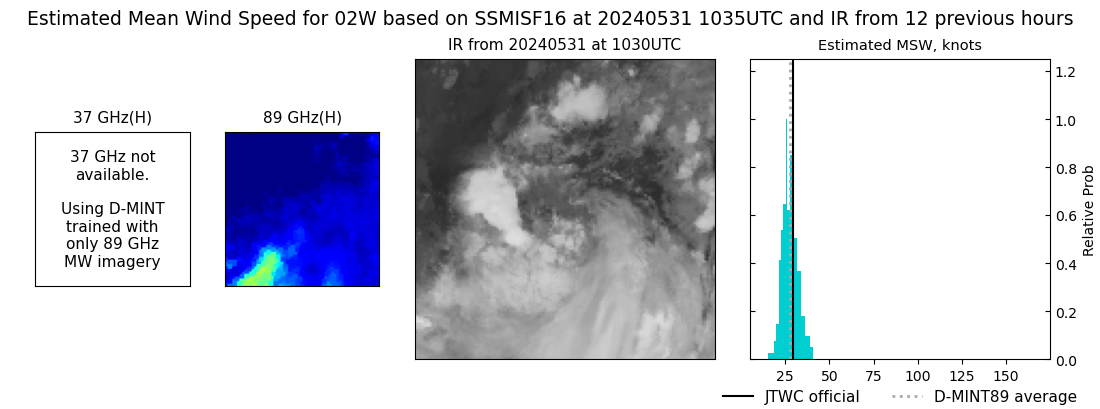 |
| 20240531 | 1011 UTC | SSMISF17 | 1000 hPa | 28 kts | 25 kts | 32 kts | 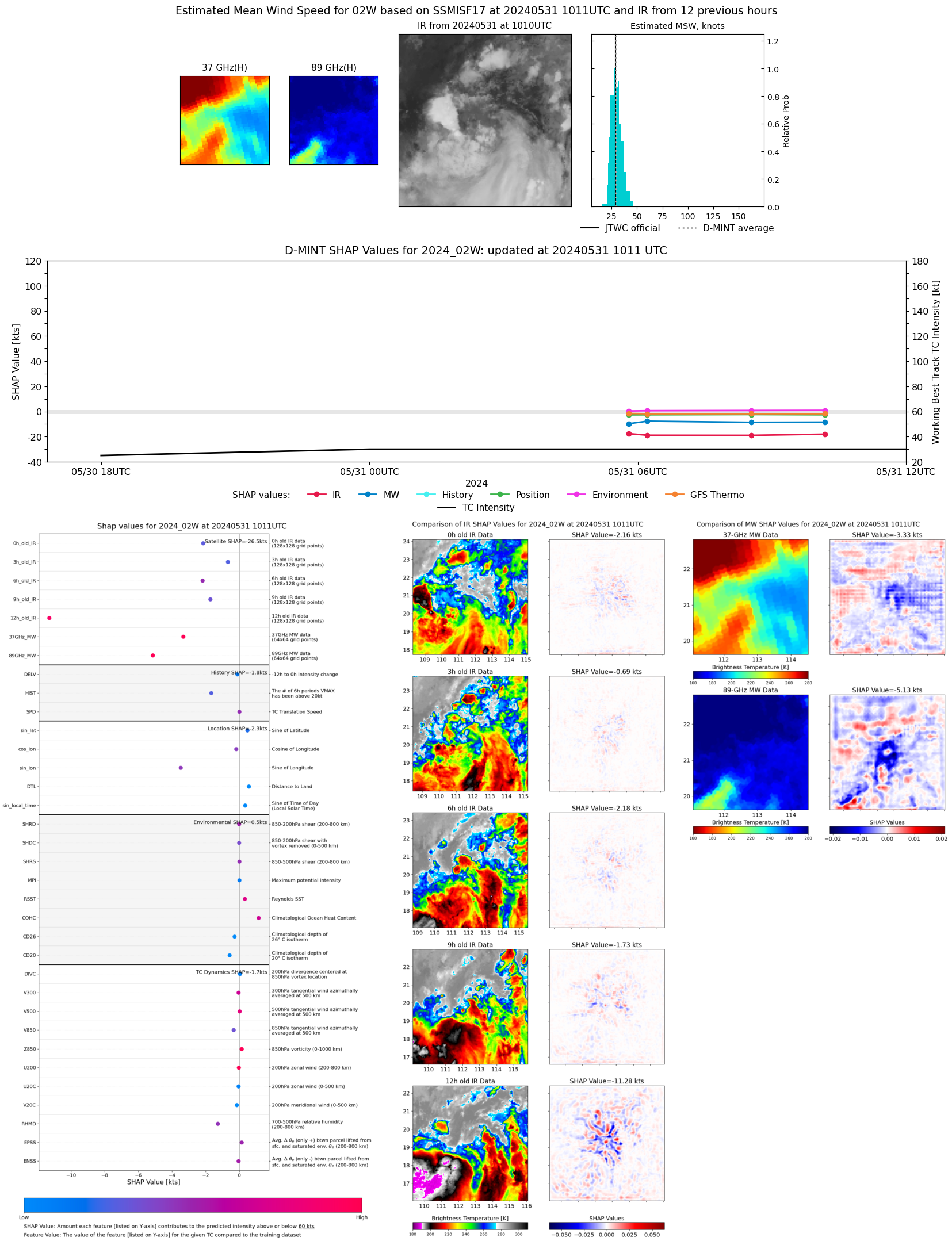 |
| 20240531 | 0832 UTC | SSMISF18 | 1000 hPa | 27 kts | 24 kts | 31 kts | 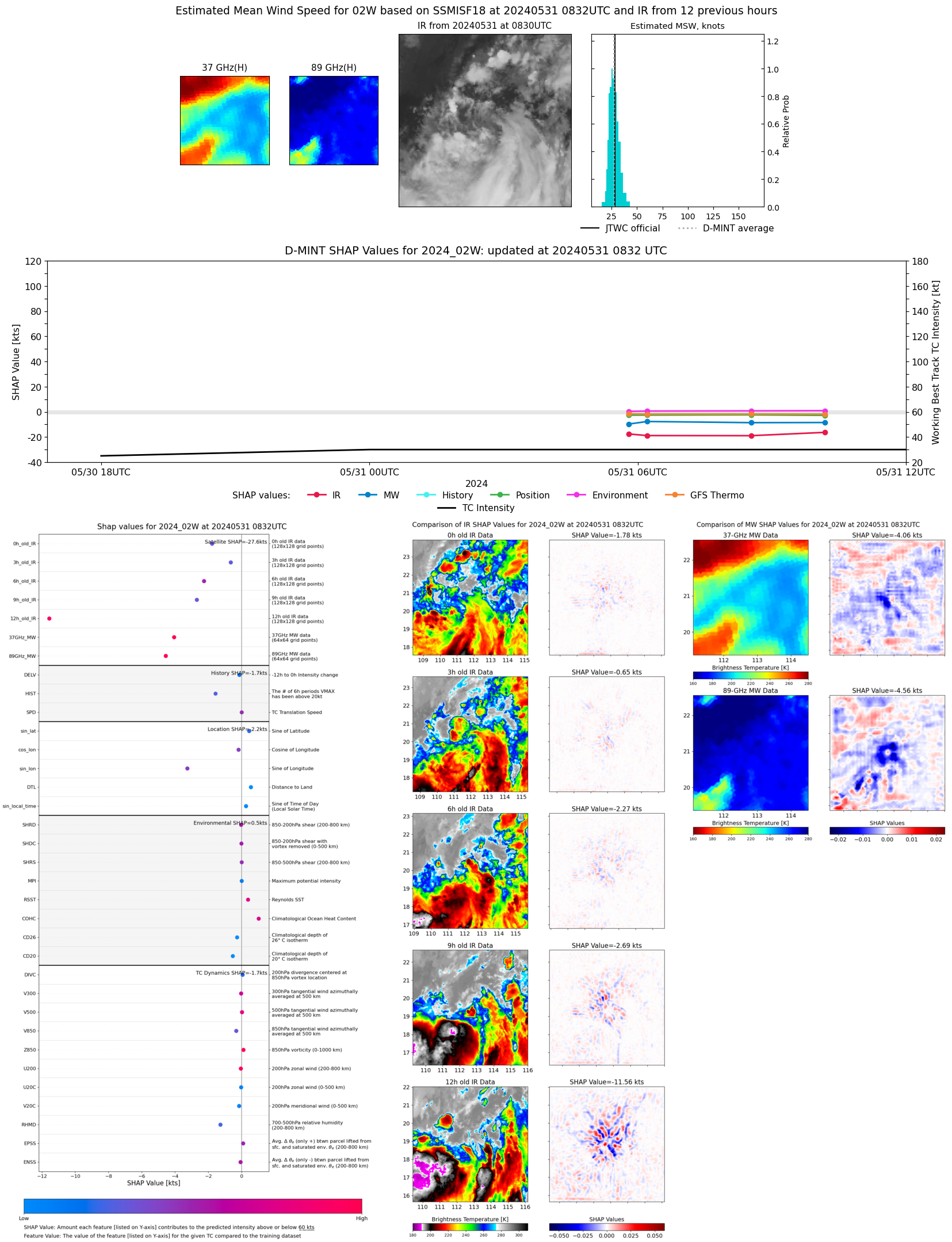 |
| 20240531 | 0613 UTC | GMI | 1000 hPa | 28 kts | 25 kts | 32 kts | 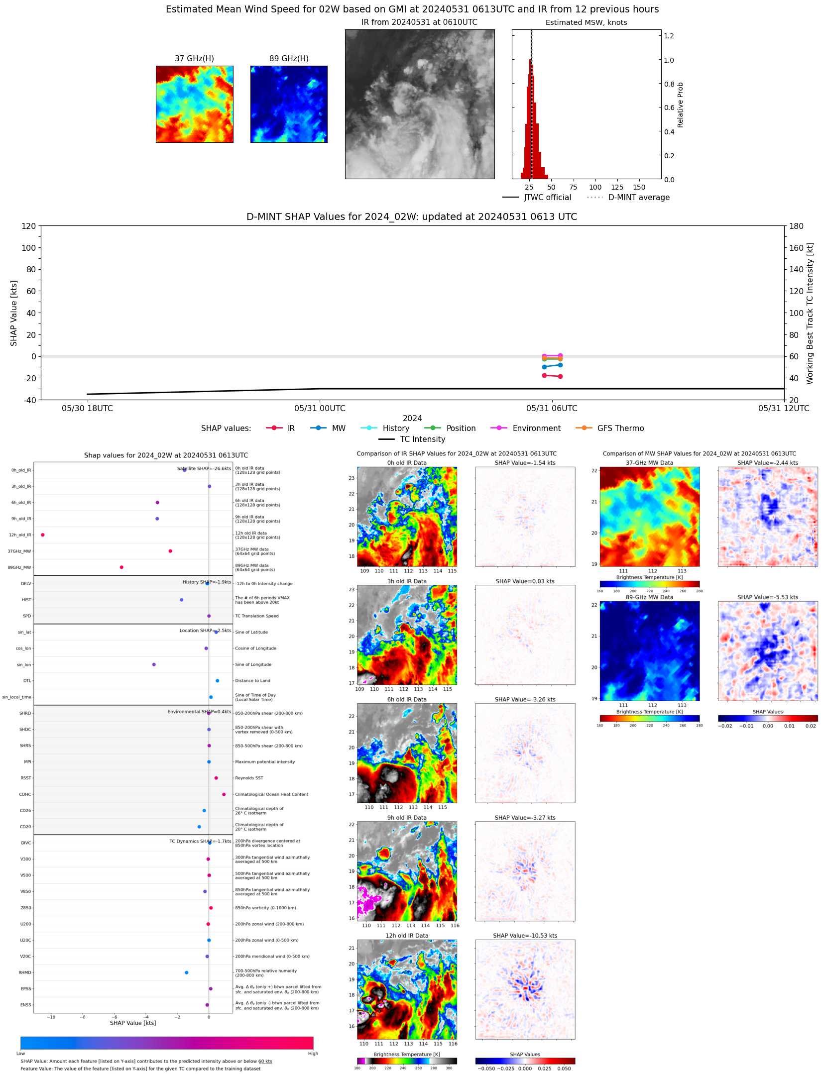 |
| 20240531 | 0548 UTC | AMSR2 | 1006 hPa | 27 kts | 24 kts | 30 kts | 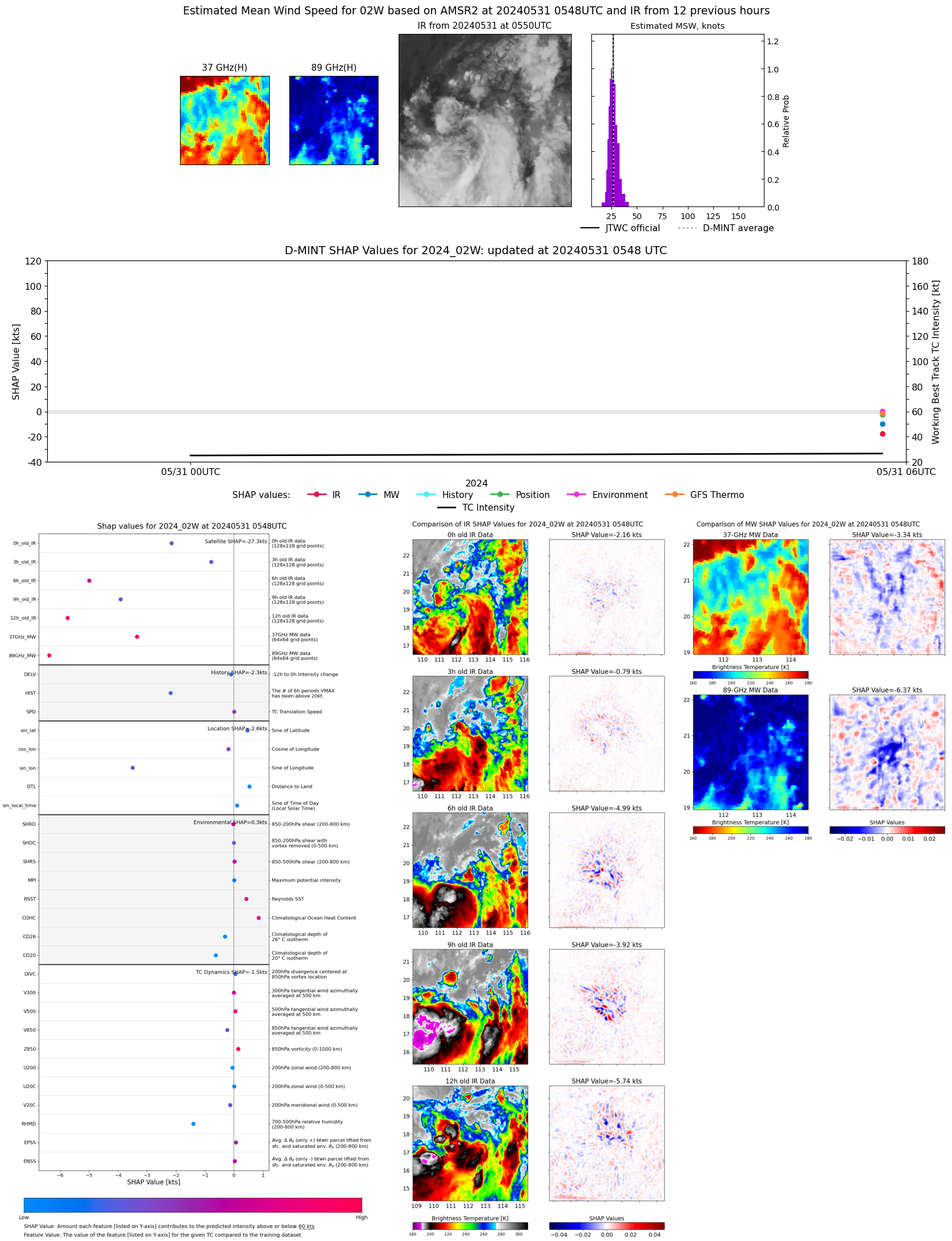 |
| 20240531 | 0514 UTC | ATMS | 1002 hPa | 31 kts | 28 kts | 34 kts | 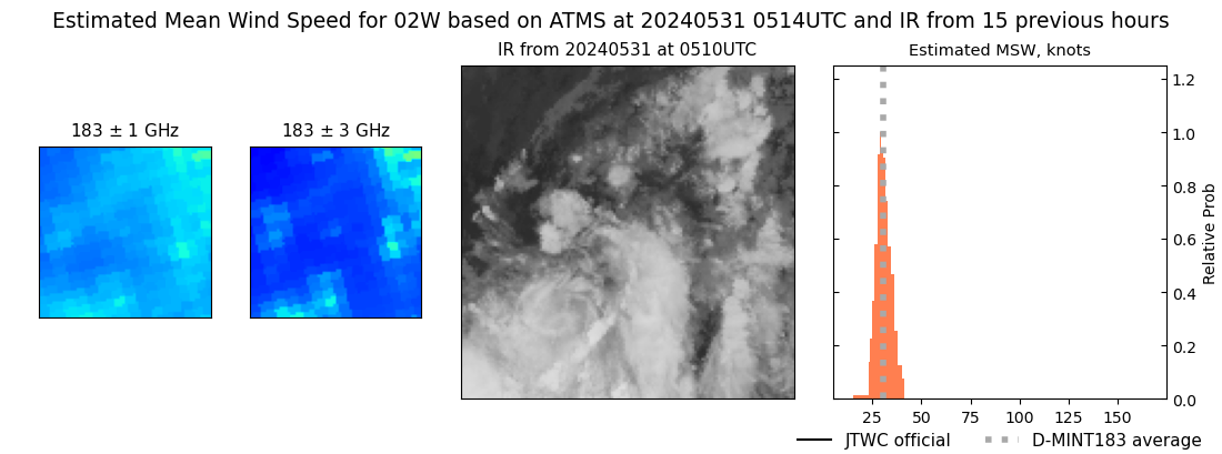 |