|
Storm: 03L
D-MINT HISTORY FILE for 2024_03L
| Date | Time | MW Sensor | MSLP | Vmax
(30th-70th percentile average) | Vmax
25th percentile | Vmax
75th percentile | Image |
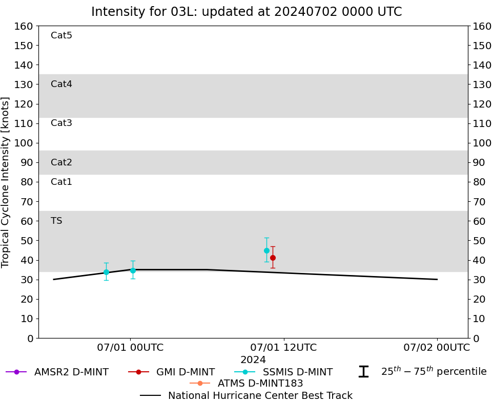
| 20240701 | 1108 UTC | GMI | 1003 hPa | 41 kts | 36 kts | 47 kts | 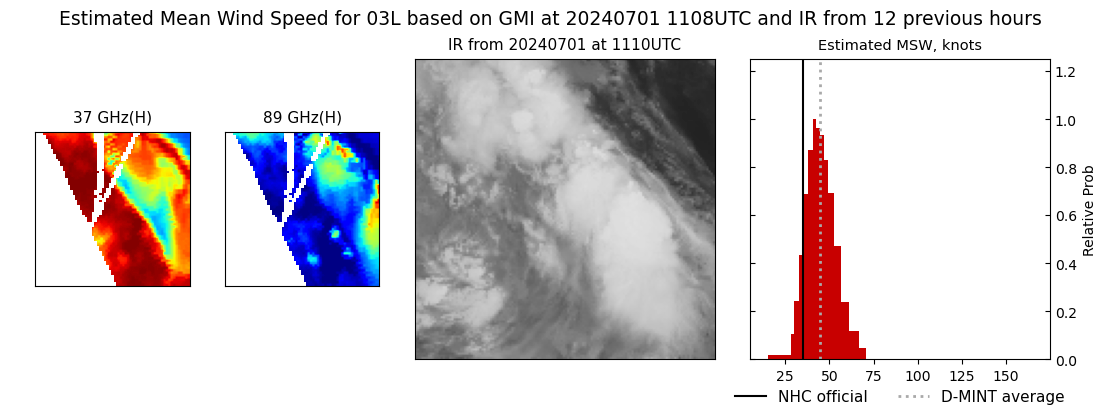 |
| 20240701 | 1039 UTC | SSMISF18 | 1000 hPa | 45 kts | 39 kts | 51 kts | 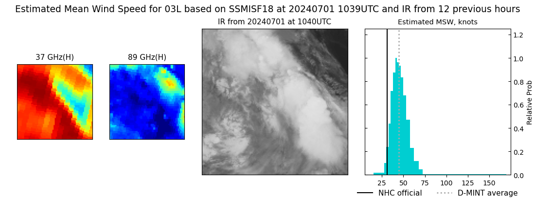 |
| 20240701 | 0011 UTC | SSMISF16 | 1003 hPa | 35 kts | 30 kts | 40 kts | 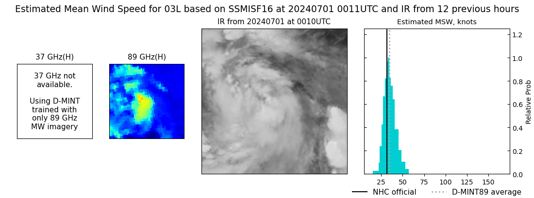 |
| 20240630 | 2206 UTC | SSMISF18 | 1002 hPa | 34 kts | 30 kts | 39 kts | 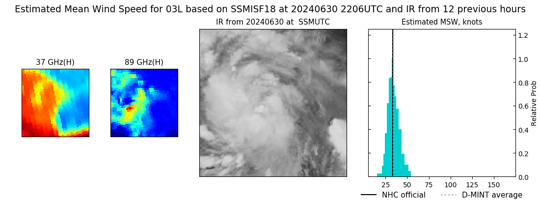 |
| 20240630 | 1222 UTC | SSMISF17 | NaN hPa | 29 kts | 25 kts | 34 kts |  |
| 20240629 | 2348 UTC | SSMISF17 | NaN hPa | 26 kts | 23 kts | 30 kts |  |
| 20240629 | 1235 UTC | SSMISF17 | NaN hPa | 27 kts | 23 kts | 31 kts |  |
| 20240629 | 0926 UTC | SSMISF18 | NaN hPa | 28 kts | 24 kts | 32 kts |  |
| 20240629 | 0735 UTC | AMSR2 | NaN hPa | 25 kts | 22 kts | 29 kts |  |
| 20240629 | 0001 UTC | SSMISF17 | NaN hPa | 28 kts | 25 kts | 32 kts |  |
| 20240628 | 1924 UTC | AMSR2 | NaN hPa | 23 kts | 21 kts | 26 kts |  |
| 20240628 | 1145 UTC | GMI | NaN hPa | 22 kts | 20 kts | 24 kts |  |
| 20240628 | 1143 UTC | SSMISF16 | NaN hPa | 22 kts | 20 kts | 24 kts |  |
| 20240628 | 0939 UTC | SSMISF18 | NaN hPa | 26 kts | 23 kts | 29 kts |  |
| 20240628 | 0654 UTC | AMSR2 | NaN hPa | 25 kts | 22 kts | 28 kts |  |
| 20240627 | 2310 UTC | SSMISF16 | NaN hPa | 24 kts | 22 kts | 26 kts |  |
| 20240627 | 2104 UTC | SSMISF18 | NaN hPa | 27 kts | 24 kts | 31 kts |  |
| 20240627 | 1840 UTC | AMSR2 | NaN hPa | 26 kts | 23 kts | 29 kts |  |
| 20240627 | 1158 UTC | SSMISF16 | NaN hPa | 25 kts | 22 kts | 29 kts |  |
| 20240627 | 1123 UTC | SSMISF17 | NaN hPa | 28 kts | 25 kts | 31 kts |  |
| 20240627 | 0058 UTC | GMI | NaN hPa | 23 kts | 20 kts | 26 kts |  |
| 20240626 | 2322 UTC | SSMISF16 | NaN hPa | 24 kts | 21 kts | 27 kts |  |
| 20240626 | 2117 UTC | SSMISF18 | NaN hPa | 26 kts | 23 kts | 30 kts |  |
| 20240626 | 1136 UTC | SSMISF17 | NaN hPa | 25 kts | 23 kts | 28 kts |  |
| 20240626 | 0827 UTC | SSMISF18 | NaN hPa | 29 kts | 26 kts | 33 kts |  |
| 20240625 | 2300 UTC | SSMISF17 | NaN hPa | 26 kts | 23 kts | 29 kts |  |
| 20240625 | 2154 UTC | SSMISF16 | NaN hPa | 23 kts | 21 kts | 25 kts |  |
|
