|
||
 |
D-MINT HISTORY FILE for 2024_04E
| Date | Time | MW Sensor | MSLP | Vmax (30th-70th percentile average) | Vmax 25th percentile | Vmax 75th percentile | Image |
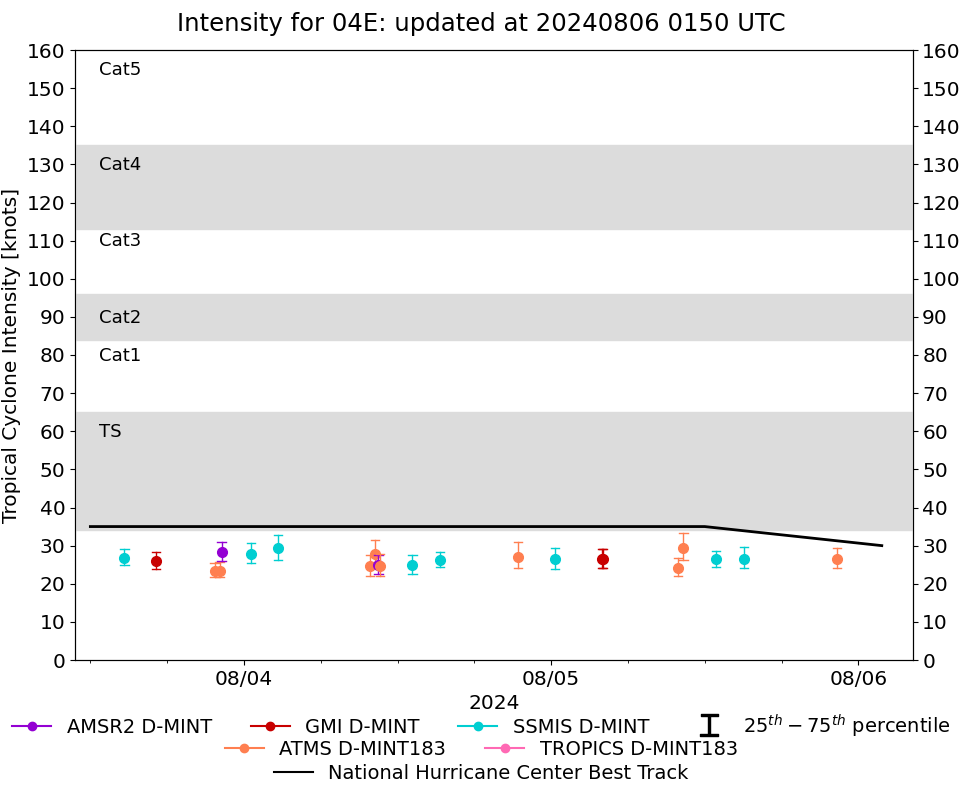
| 20240805 | 2204 UTC | AMSR2 | 1006 hPa | 27 kts | 24 kts | 29 kts | 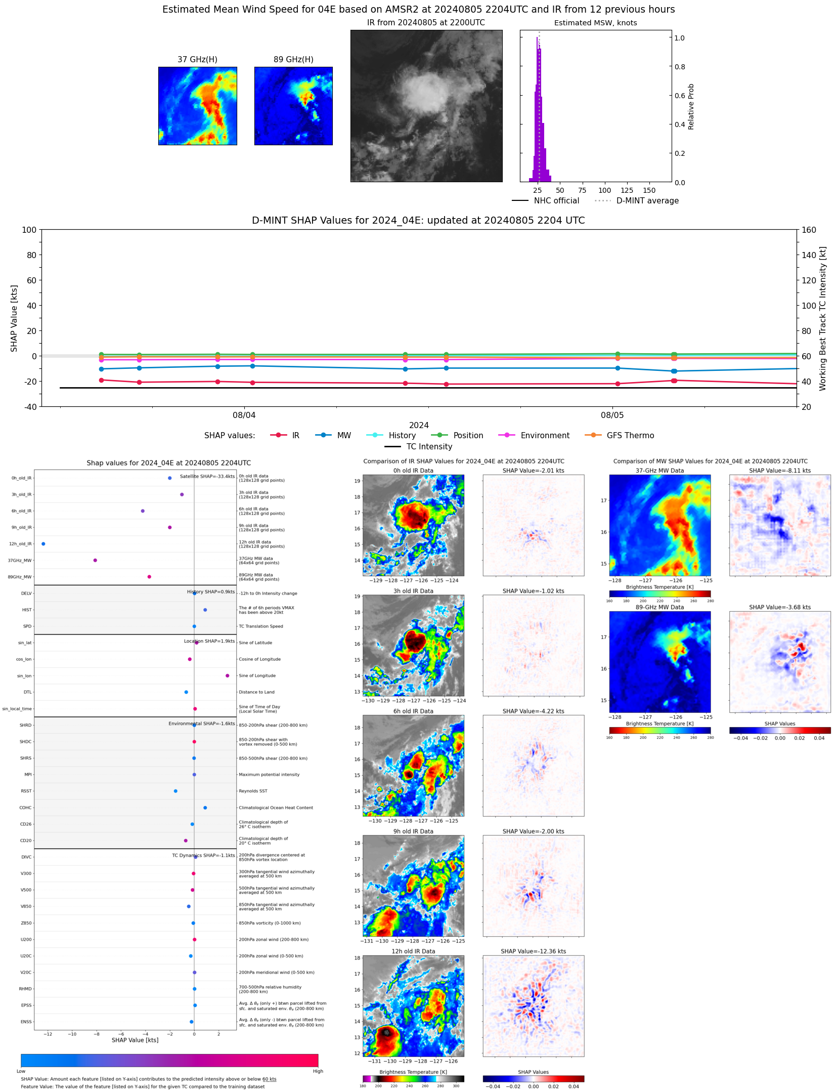 |
| 20240805 | 2121 UTC | TROPICS06 | 1005 hPa | 29 kts | 26 kts | 32 kts |  |
| 20240805 | 1504 UTC | SSMISF16 | 1006 hPa | 27 kts | 24 kts | 30 kts | 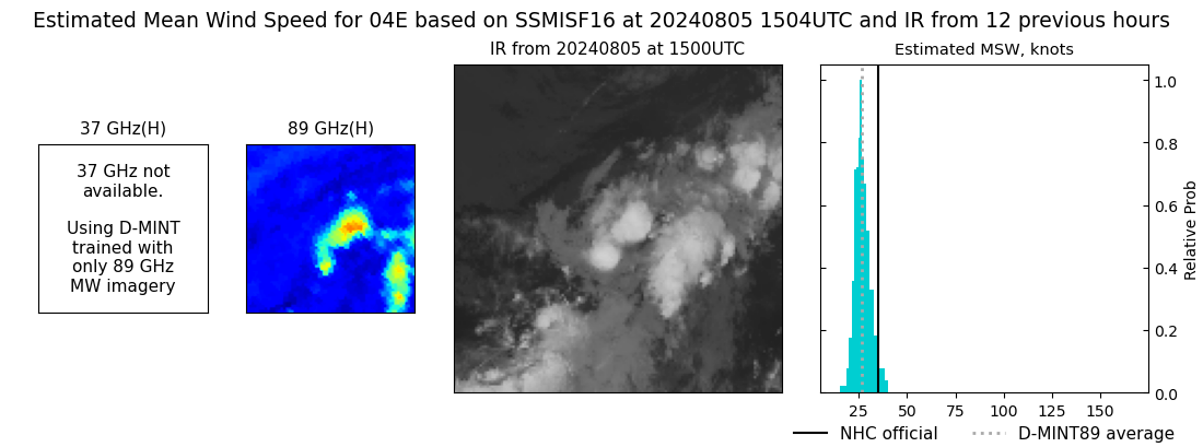 |
| 20240805 | 1254 UTC | SSMISF18 | 1006 hPa | 26 kts | 24 kts | 29 kts | 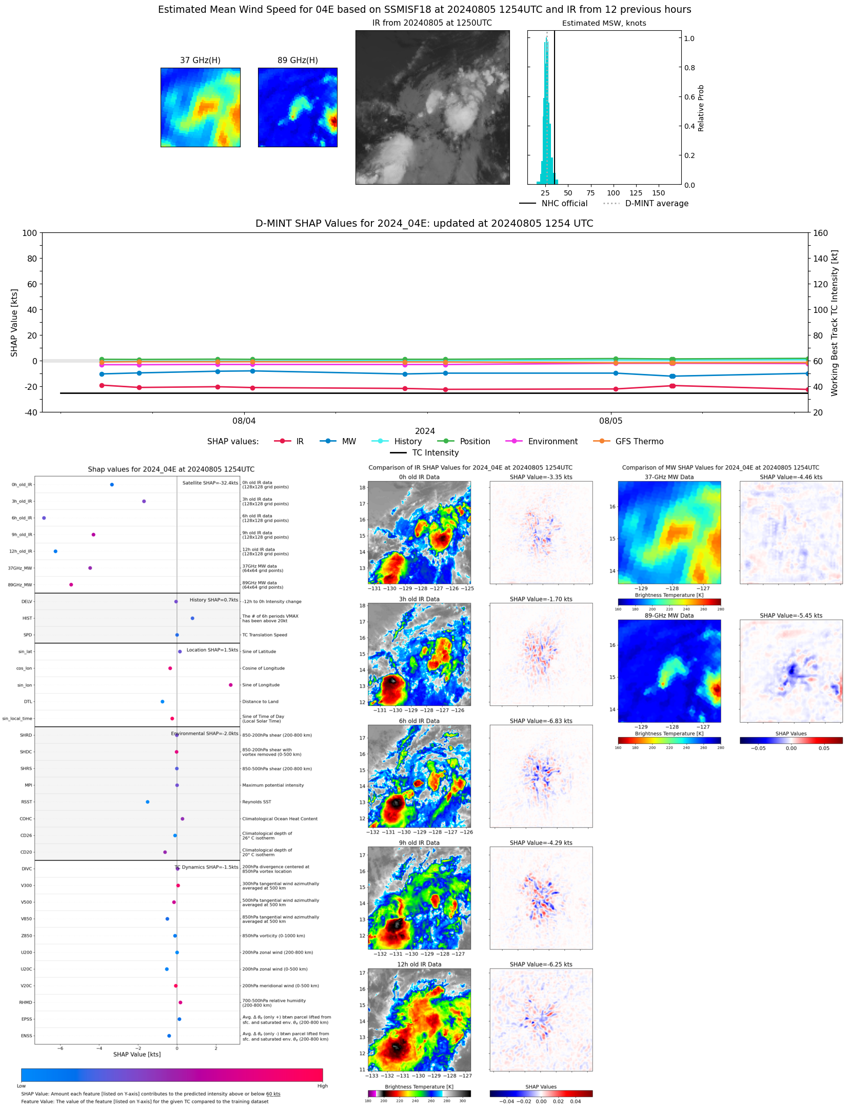 |
| 20240805 | 1020 UTC | ATMS-N20 | 1008 hPa | 29 kts | 26 kts | 33 kts | 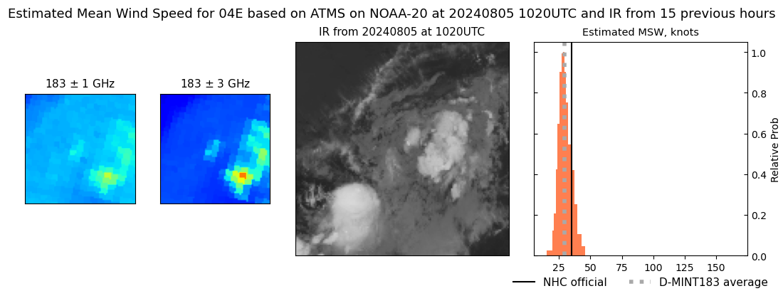 |
| 20240805 | 0956 UTC | ATMS-NPP | 1009 hPa | 24 kts | 22 kts | 27 kts | 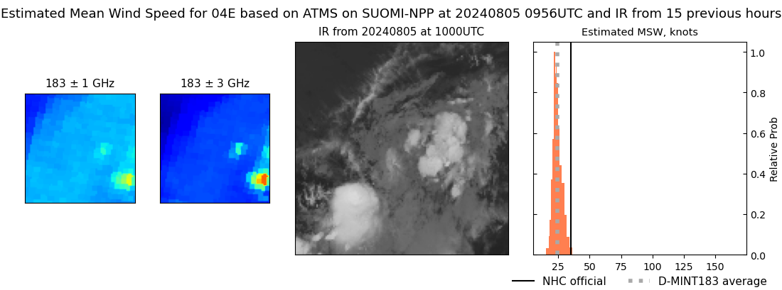 |
| 20240805 | 0404 UTC | GMI | 1010 hPa | 26 kts | 24 kts | 29 kts | 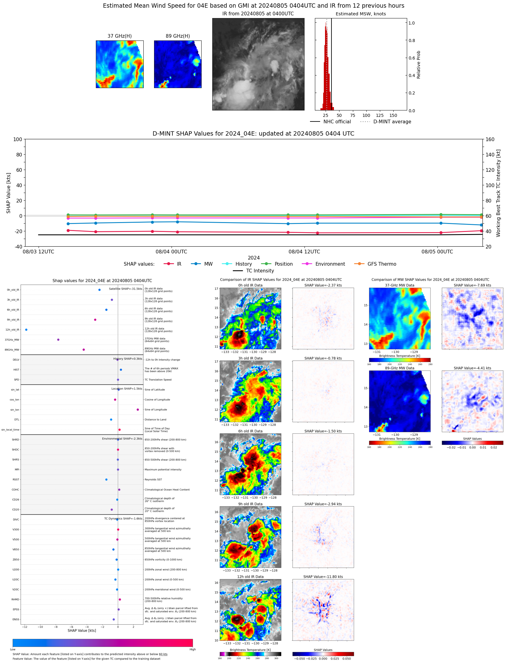 |
| 20240805 | 0358 UTC | GMI | 1010 hPa | 26 kts | 24 kts | 29 kts |  |
| 20240805 | 0019 UTC | SSMISF18 | 1009 hPa | 27 kts | 24 kts | 29 kts | 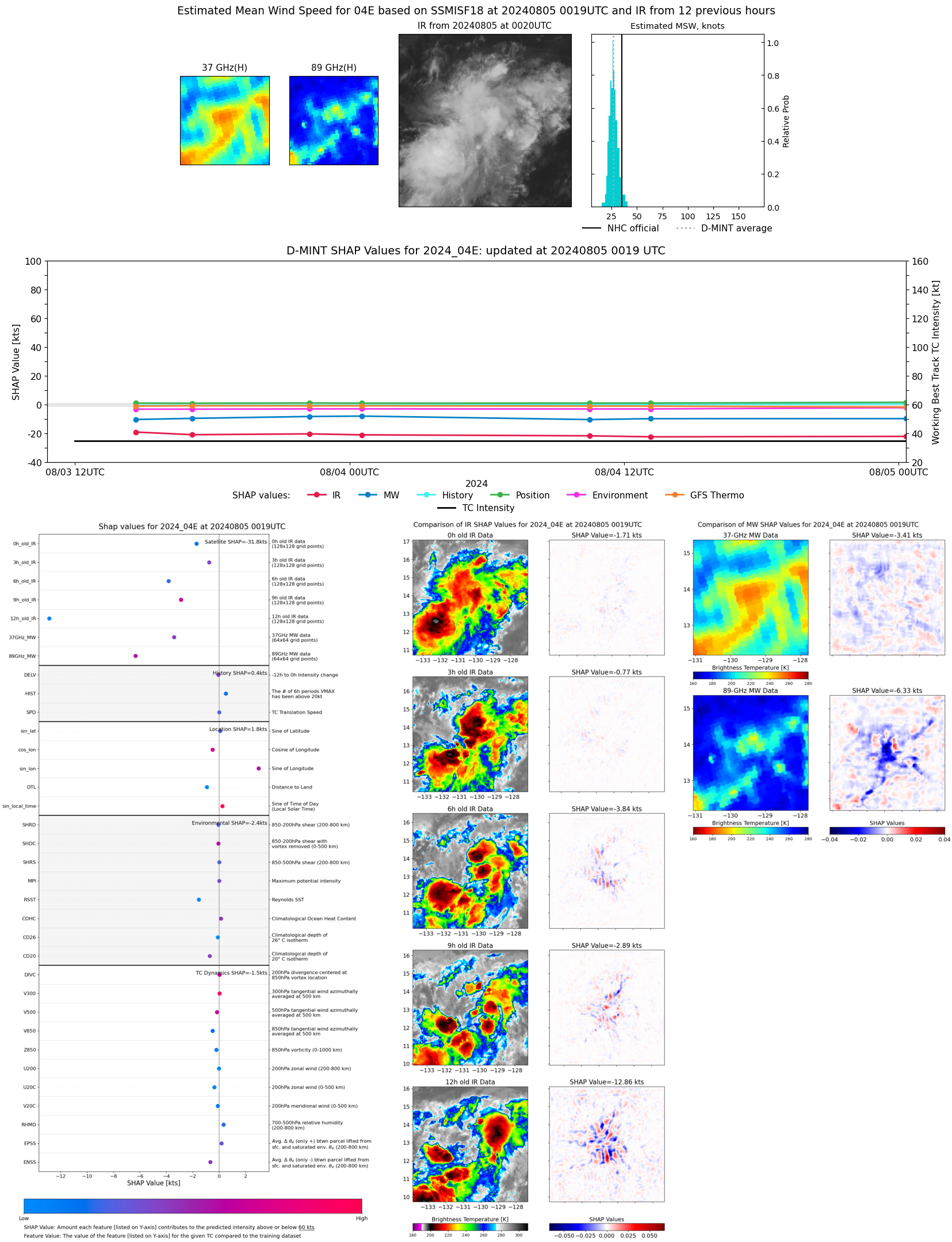 |
| 20240804 | 2124 UTC | ATMS-NPP | 1009 hPa | 27 kts | 24 kts | 31 kts | 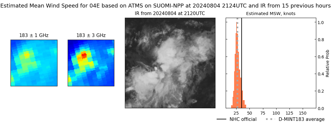 |
| 20240804 | 1518 UTC | SSMISF16 | 1010 hPa | 26 kts | 24 kts | 28 kts | 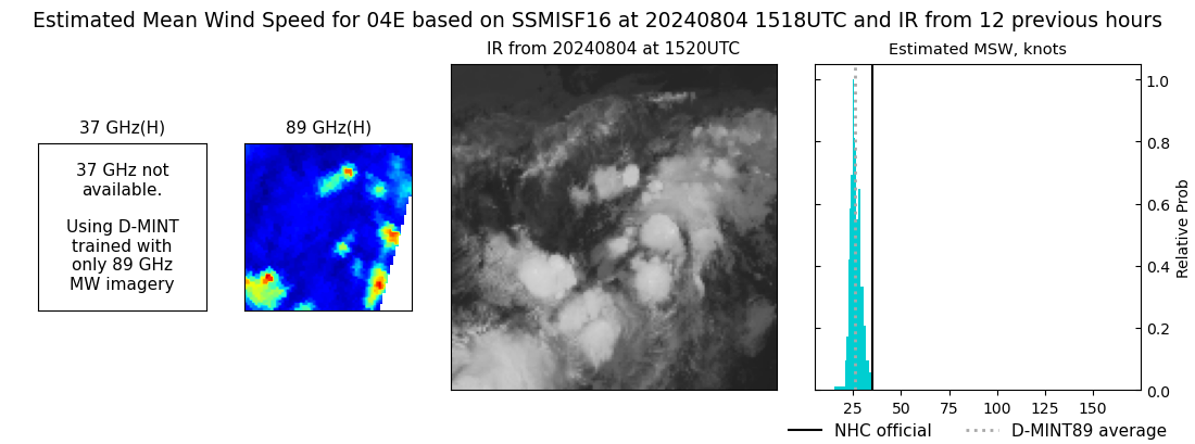 |
| 20240804 | 1310 UTC | SSMISF18 | 1010 hPa | 25 kts | 23 kts | 28 kts | 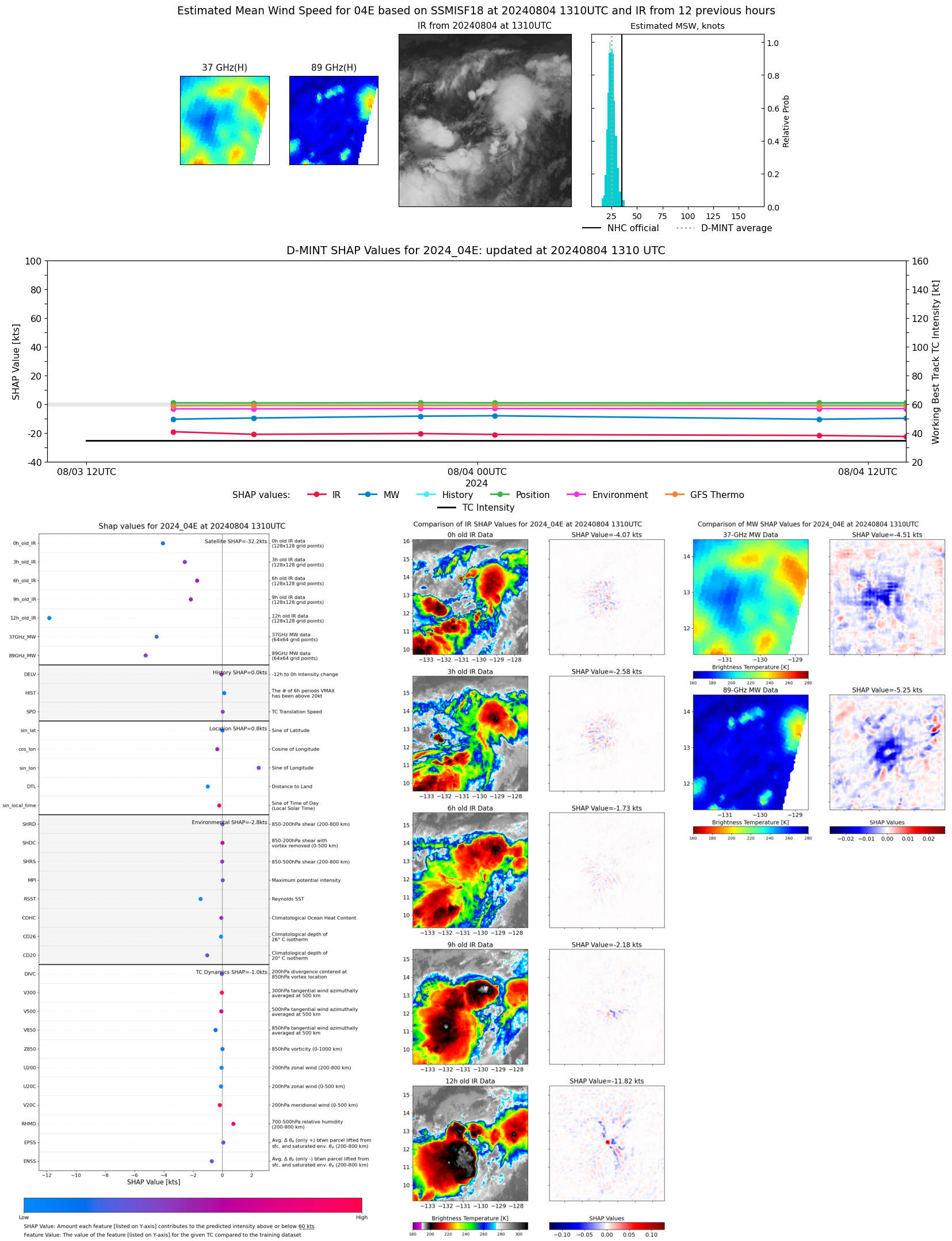 |
| 20240804 | 1039 UTC | ATMS-N20 | 1009 hPa | 25 kts | 22 kts | 28 kts | 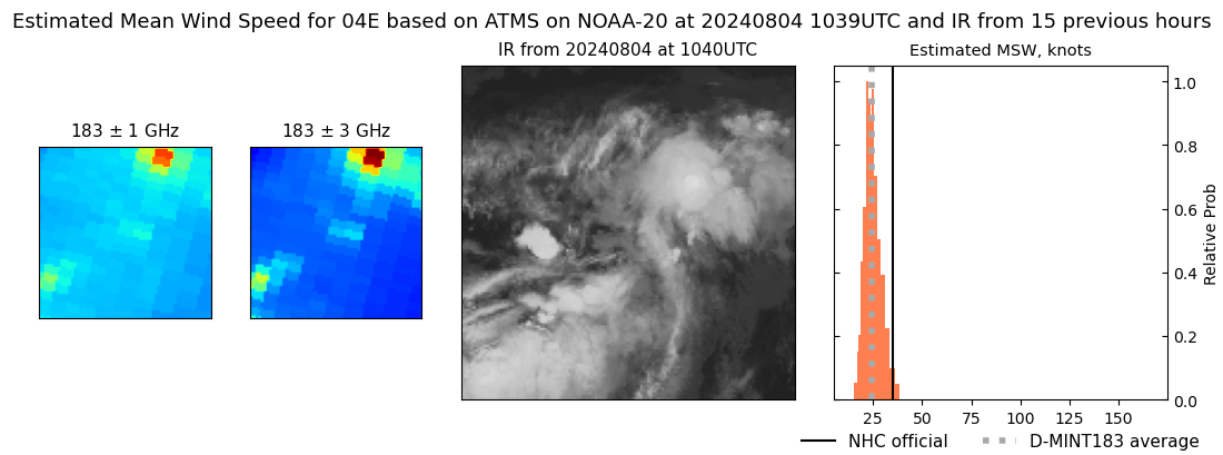 |
| 20240804 | 1030 UTC | AMSR2 | 1010 hPa | 25 kts | 23 kts | 27 kts | 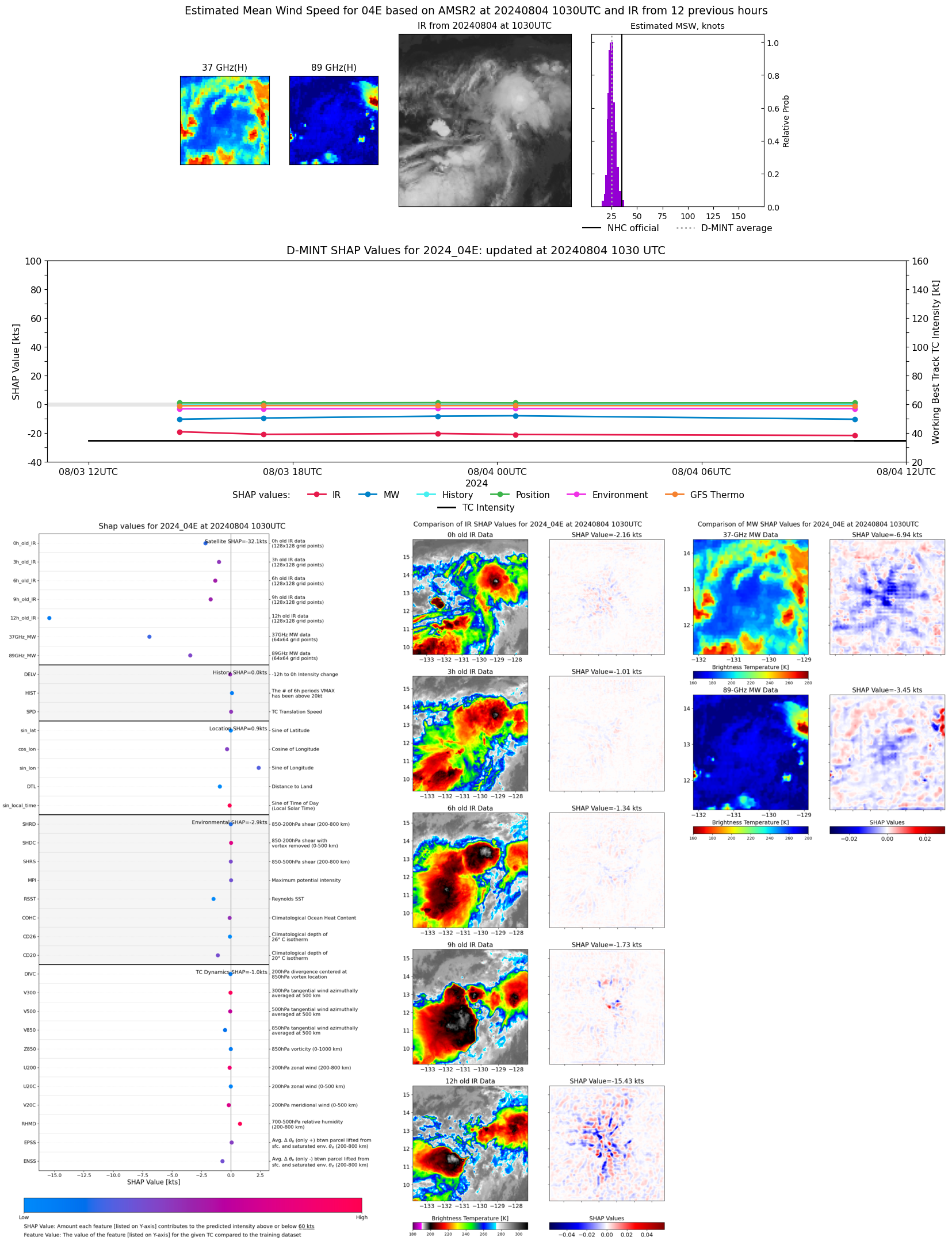 |
| 20240804 | 1015 UTC | ATMS-NPP | 1009 hPa | 28 kts | 25 kts | 31 kts | 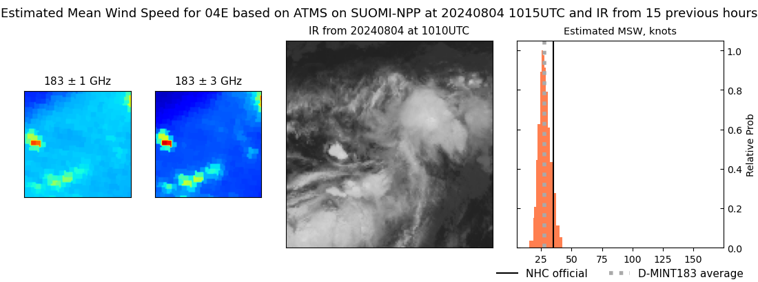 |
| 20240804 | 0950 UTC | ATMS-N21 | 1010 hPa | 25 kts | 22 kts | 28 kts | 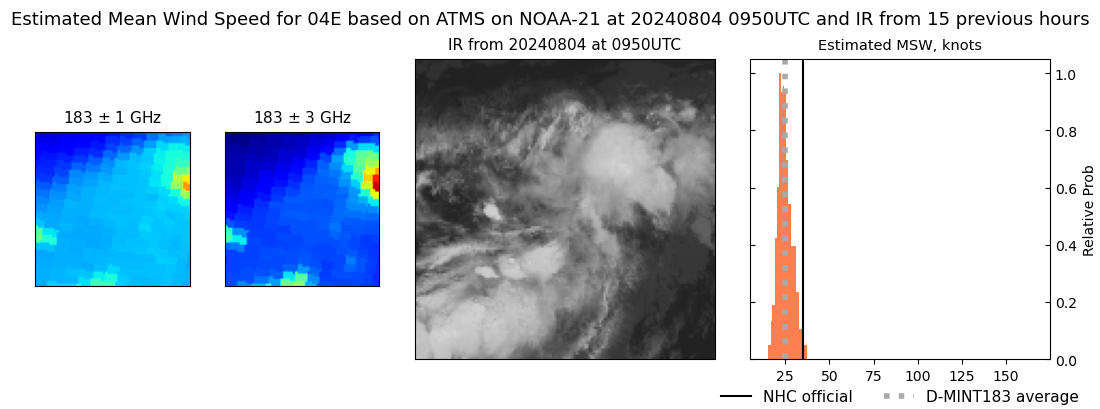 |
| 20240804 | 0241 UTC | SSMISF16 | 1009 hPa | 29 kts | 26 kts | 33 kts | 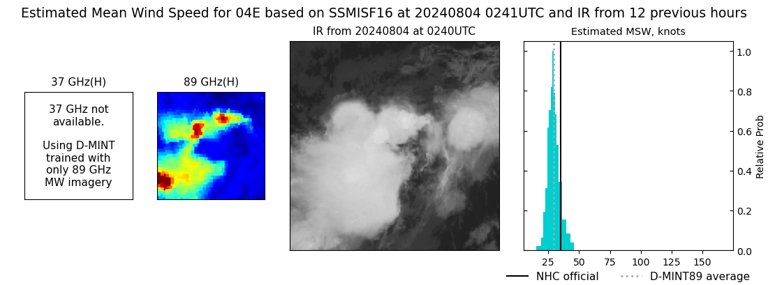 |
| 20240804 | 0032 UTC | SSMISF18 | 1009 hPa | 28 kts | 26 kts | 31 kts | 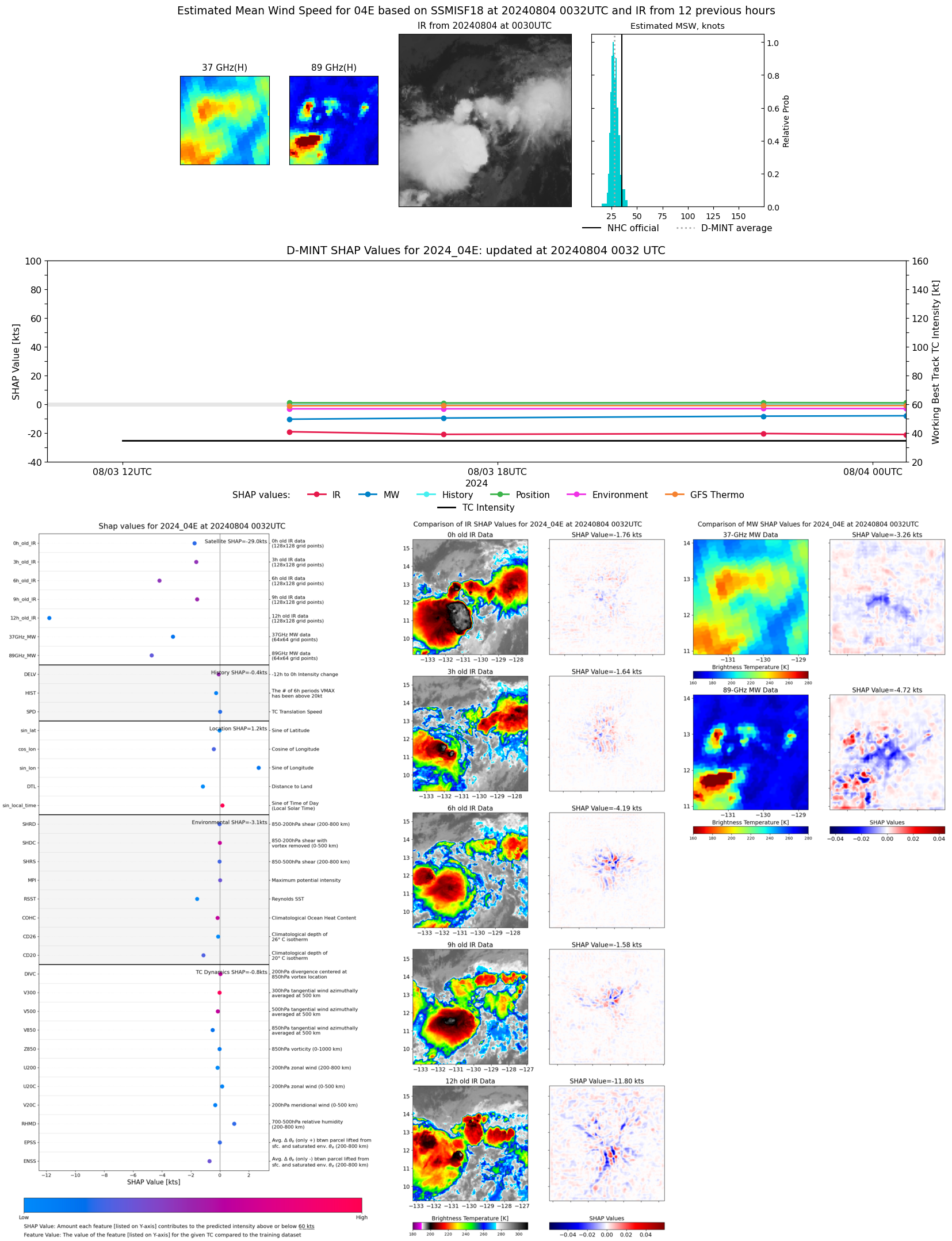 |
| 20240803 | 2215 UTC | AMSR2 | 1010 hPa | 28 kts | 26 kts | 31 kts | 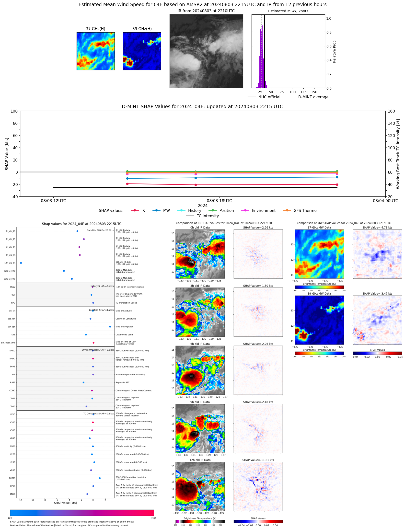 |
| 20240803 | 2206 UTC | ATMS-N20 | 1010 hPa | 23 kts | 22 kts | 26 kts | 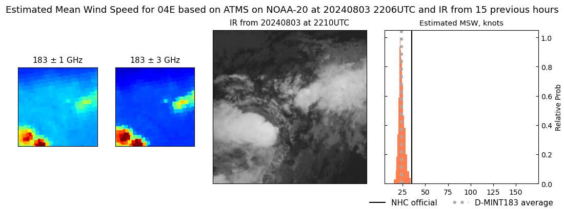 |
| 20240803 | 2142 UTC | ATMS-NPP | 1010 hPa | 23 kts | 22 kts | 25 kts | 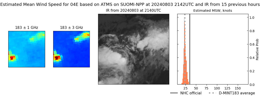 |
| 20240803 | 1708 UTC | GMI | 1010 hPa | 26 kts | 24 kts | 28 kts | 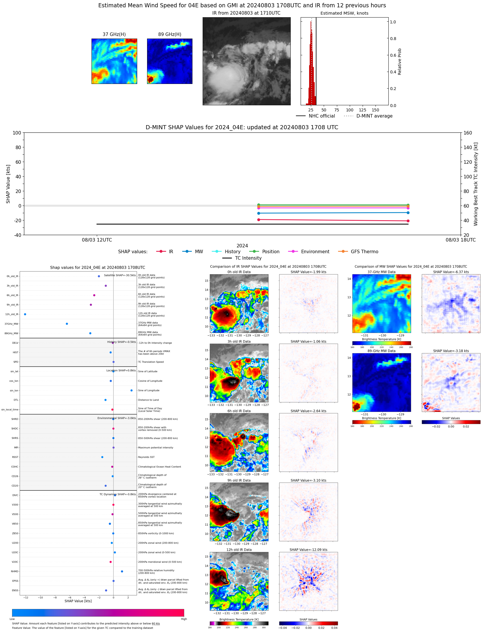 |
| 20240803 | 1440 UTC | SSMISF17 | 1010 hPa | 27 kts | 25 kts | 29 kts | 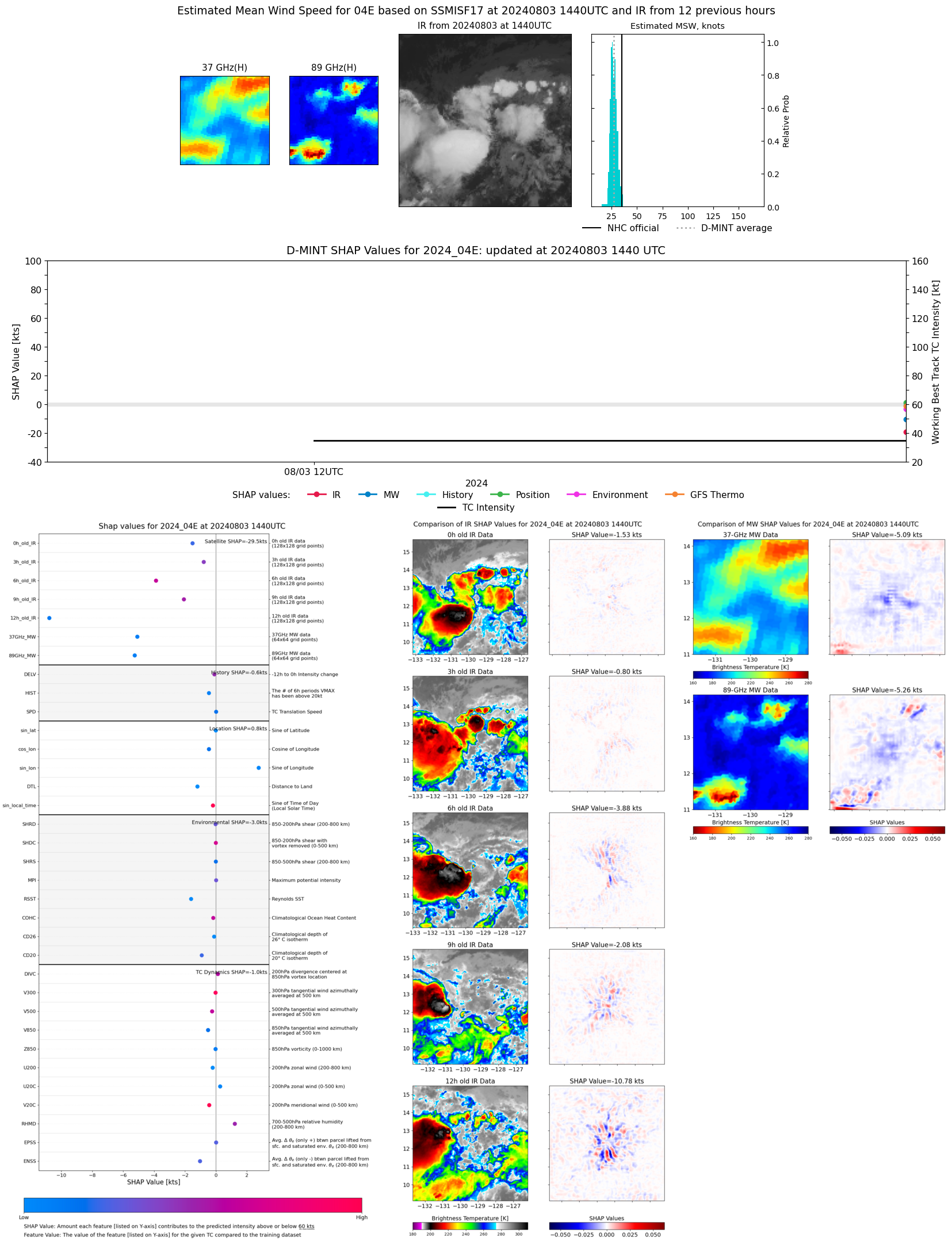 |
| 20240803 | 0255 UTC | SSMISF16 | NaN hPa | 33 kts | 28 kts | 37 kts |  |
| 20240803 | 0046 UTC | SSMISF18 | NaN hPa | 33 kts | 29 kts | 38 kts |  |
| 20240802 | 1453 UTC | SSMISF17 | NaN hPa | 28 kts | 25 kts | 32 kts |  |
| 20240802 | 0437 UTC | GMI | NaN hPa | 22 kts | 20 kts | 25 kts | 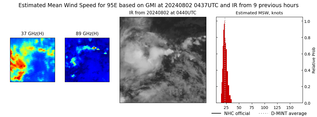 |
| 20240802 | 0217 UTC | SSMISF17 | NaN hPa | 25 kts | 22 kts | 28 kts |  |
| 20240801 | 2017 UTC | TROPICS03 | 1005 hPa | 28 kts | 25 kts | 31 kts |  |
| 20240801 | 1507 UTC | SSMISF17 | NaN hPa | 24 kts | 22 kts | 28 kts |  |
| 20240801 | 1417 UTC | SSMISF16 | NaN hPa | 23 kts | 20 kts | 26 kts |  |
| 20240801 | 1208 UTC | SSMISF18 | NaN hPa | 27 kts | 23 kts | 30 kts |  |
| 20240801 | 0959 UTC | AMSR2 | NaN hPa | 24 kts | 21 kts | 27 kts | 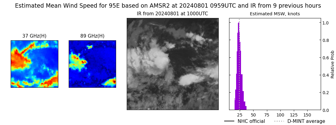 |
| 20240801 | 0230 UTC | SSMISF17 | NaN hPa | 25 kts | 22 kts | 29 kts |  |
| 20240731 | 2332 UTC | SSMISF18 | NaN hPa | 26 kts | 23 kts | 30 kts |  |
| 20240731 | 2145 UTC | AMSR2 | NaN hPa | 22 kts | 20 kts | 25 kts |  |
| 20240731 | 1747 UTC | GMI | NaN hPa | 22 kts | 19 kts | 24 kts | 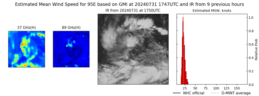 |
| 20240731 | 1430 UTC | SSMISF16 | NaN hPa | 22 kts | 19 kts | 25 kts |  |
| 20240731 | 1222 UTC | SSMISF18 | NaN hPa | 24 kts | 21 kts | 28 kts |  |
| 20240731 | 0153 UTC | SSMISF16 | NaN hPa | 21 kts | 18 kts | 24 kts |  |
| 20240730 | 2345 UTC | SSMISF18 | NaN hPa | 23 kts | 21 kts | 26 kts |  |