|
||

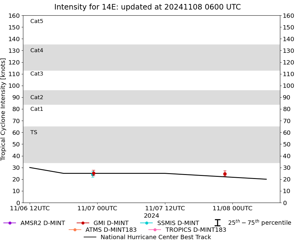 |
D-MINT HISTORY FILE for 2024_14E
| Date | Time | MW Sensor | MSLP | Vmax (30th-70th percentile average) | Vmax 25th percentile | Vmax 75th percentile | Image |
| 20241107 | 2238 UTC | GMI | 1007 hPa | 25 kts | 23 kts | 27 kts | 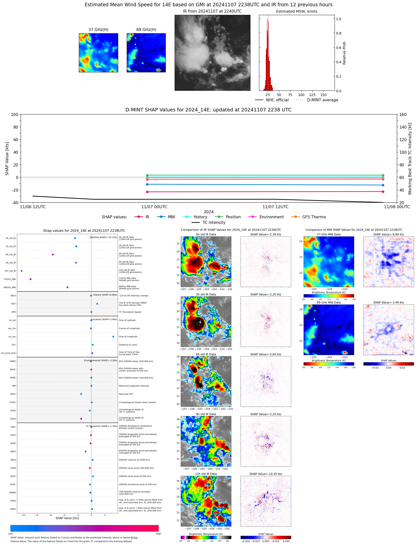 |
| 20241106 | 2318 UTC | GMI | 1008 hPa | 25 kts | 23 kts | 28 kts | 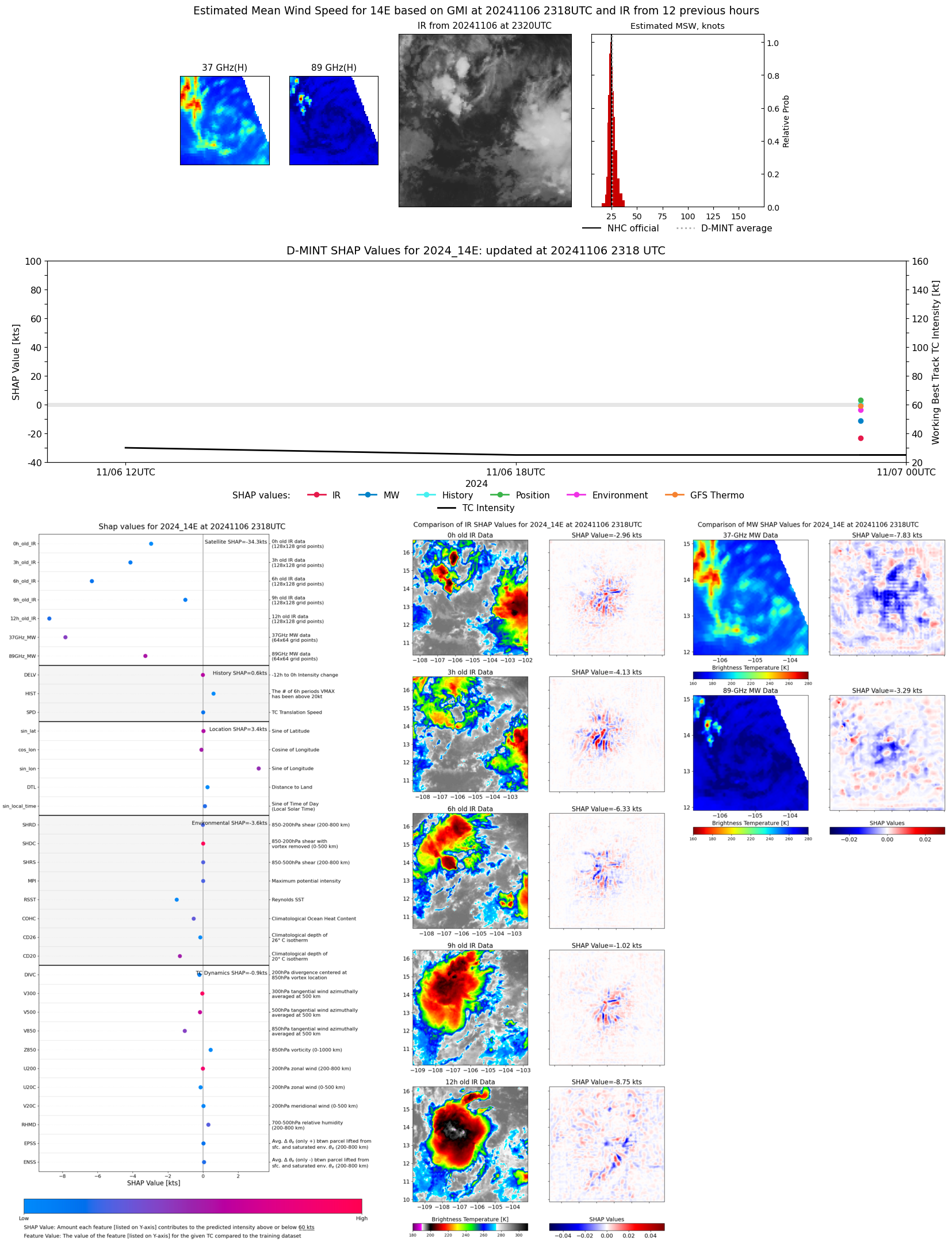 |
| 20241106 | 2310 UTC | SSMISF18 | 1008 hPa | 24 kts | 22 kts | 27 kts | 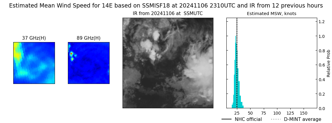 |
| 20241106 | 0945 UTC | TROPICS03 | 1006 hPa | 31 kts | 28 kts | 35 kts | 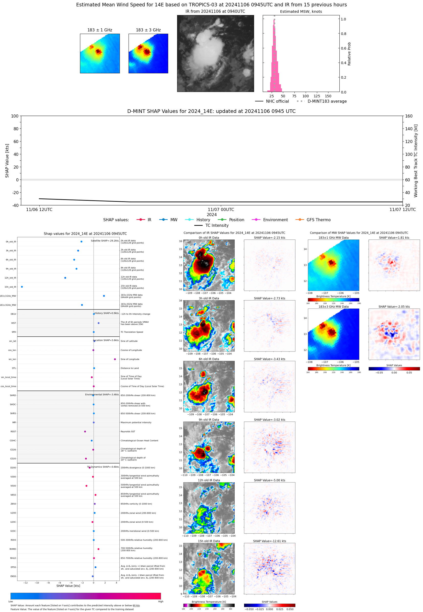 |
| 20241106 | 0903 UTC | AMSR2 | NaN hPa | 30 kts | 27 kts | 33 kts |  |
| 20241105 | 2324 UTC | SSMISF18 | NaN hPa | 32 kts | 28 kts | 36 kts | 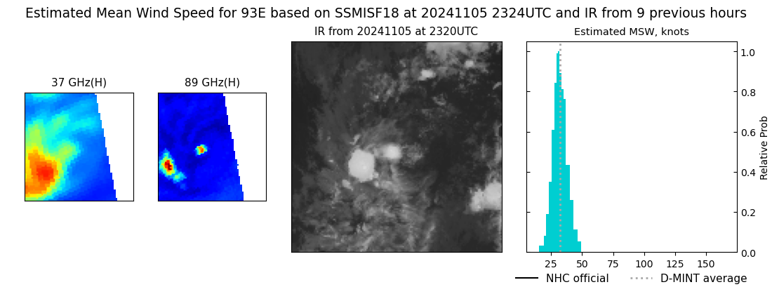 |
| 20241105 | 2224 UTC | TROPICS05 | 1008 hPa | 30 kts | 27 kts | 34 kts | 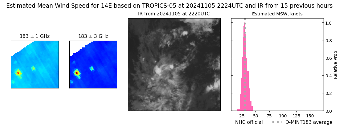 |
| 20241105 | 2049 UTC | AMSR2 | NaN hPa | 29 kts | 26 kts | 32 kts |  |
| 20241105 | 1302 UTC | SSMISF17 | NaN hPa | 32 kts | 29 kts | 35 kts |  |
| 20241105 | 1232 UTC | GMI | NaN hPa | 30 kts | 27 kts | 33 kts | 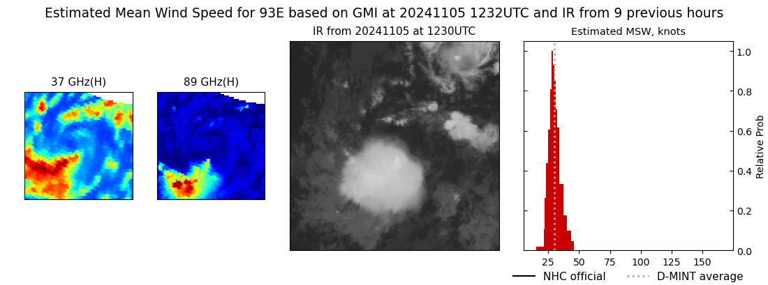 |
| 20241105 | 1014 UTC | TROPICS03 | 1006 hPa | 29 kts | 26 kts | 32 kts | 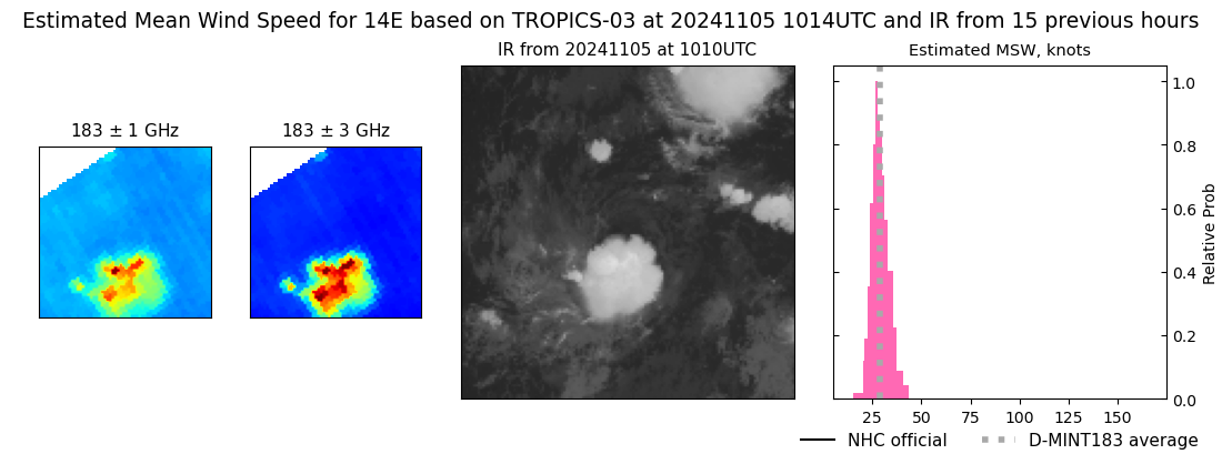 |
| 20241105 | 0800 UTC | TROPICS06 | 1007 hPa | 27 kts | 25 kts | 30 kts | 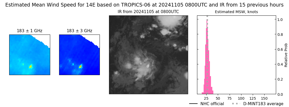 |
| 20241104 | 1316 UTC | SSMISF17 | NaN hPa | 30 kts | 27 kts | 34 kts | 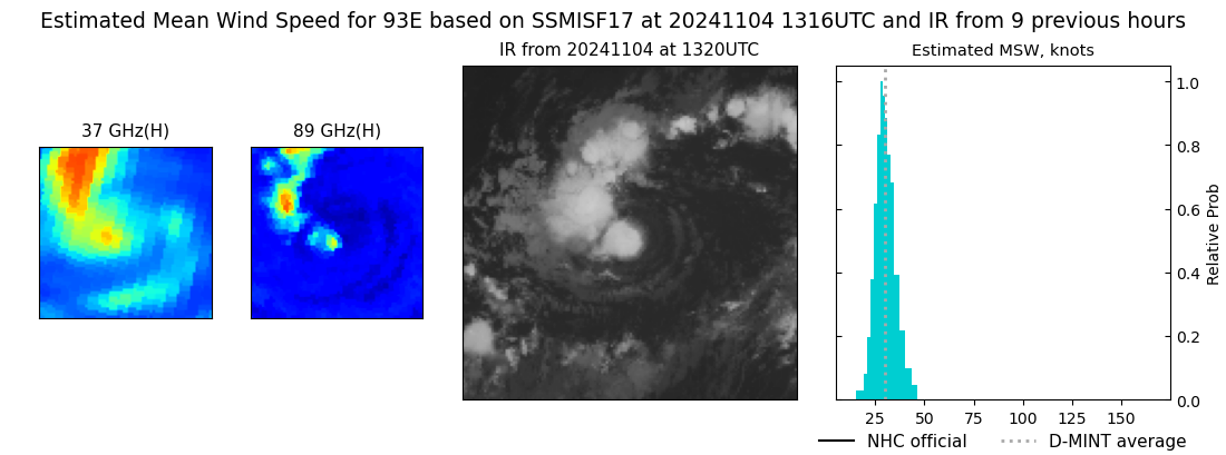 |
| 20241104 | 1310 UTC | SSMISF16 | NaN hPa | 29 kts | 25 kts | 32 kts |  |
| 20241104 | 0916 UTC | AMSR2 | NaN hPa | 31 kts | 28 kts | 35 kts | 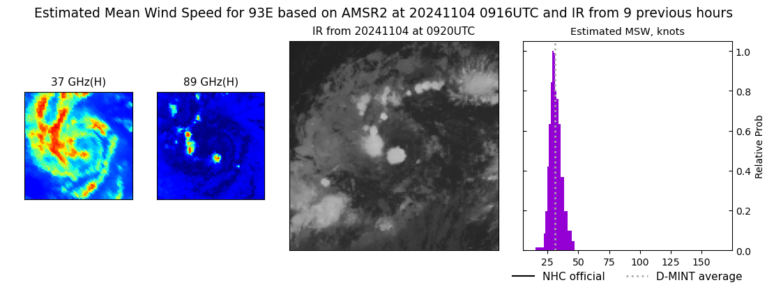 |
| 20241103 | 2101 UTC | AMSR2 | NaN hPa | 33 kts | 30 kts | 38 kts | 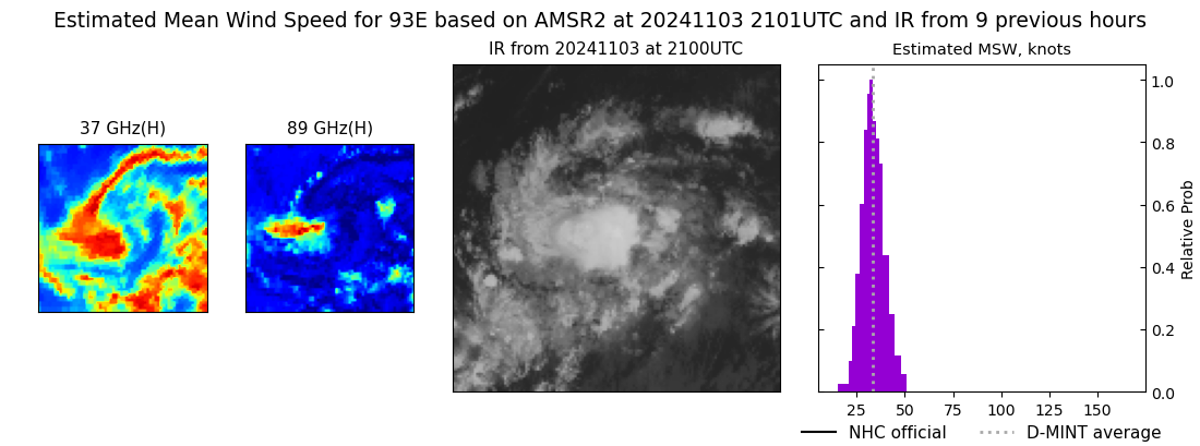 |
| 20241103 | 1330 UTC | SSMISF17 | NaN hPa | 37 kts | 32 kts | 42 kts | 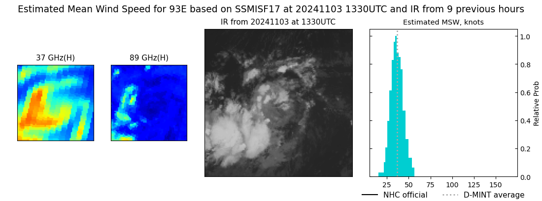 |
| 20241103 | 1323 UTC | SSMISF16 | NaN hPa | 31 kts | 27 kts | 36 kts | 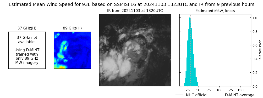 |
| 20241103 | 0036 UTC | GMI | NaN hPa | 39 kts | 34 kts | 43 kts |  |