|
||

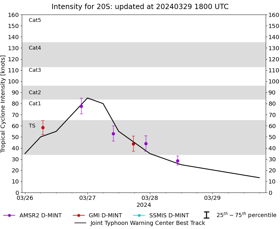 |
D-MINT HISTORY FILE for 2024_20S
| Date | Time | MW Sensor | MSLP | Vmax (30th-70th percentile average) | Vmax 25th percentile | Vmax 75th percentile | Image |
| 20240328 | 1036 UTC | AMSR2 | 1001 hPa | 29 kts | 25 kts | 33 kts | 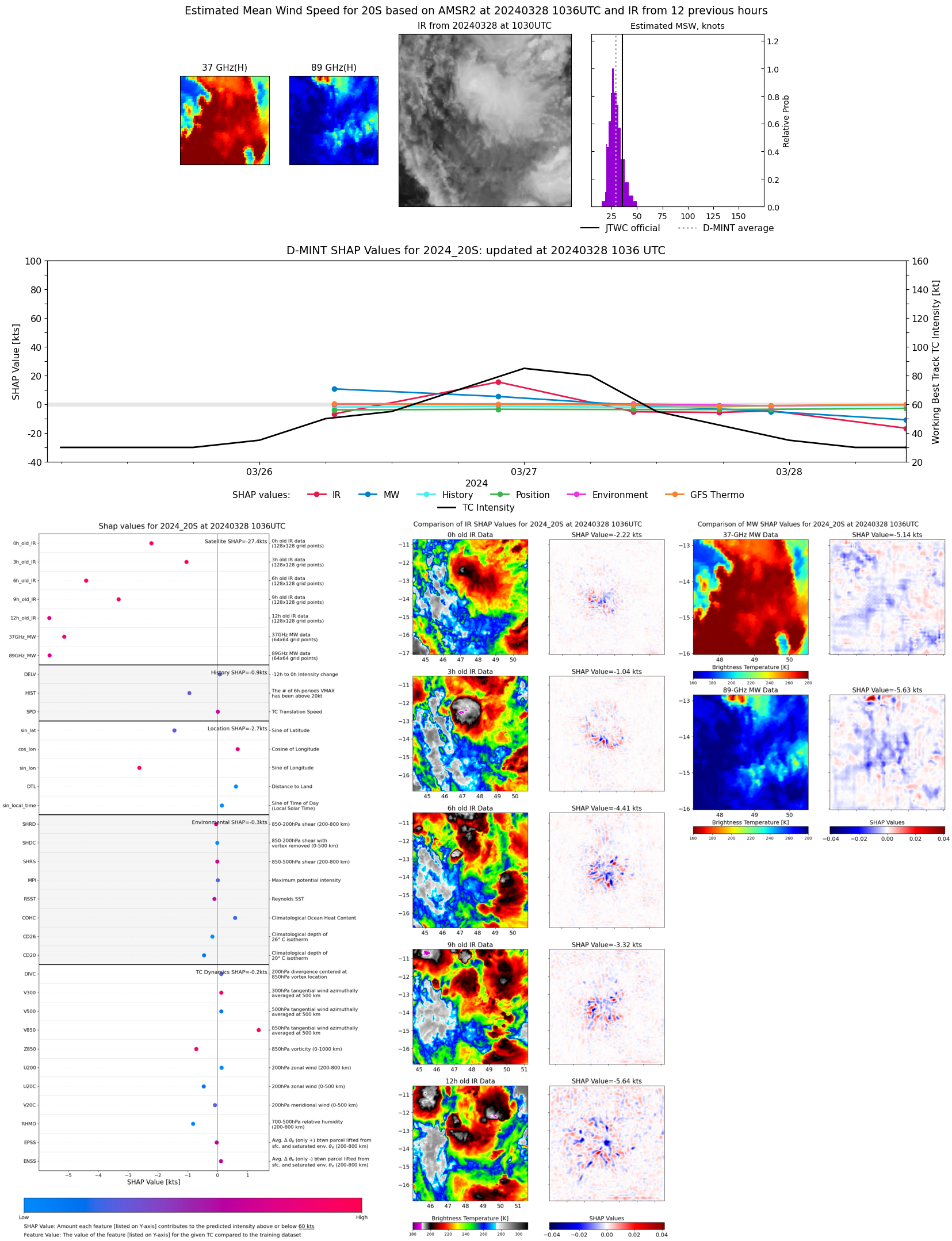 |
| 20240327 | 2222 UTC | AMSR2 | 993 hPa | 44 kts | 37 kts | 51 kts | 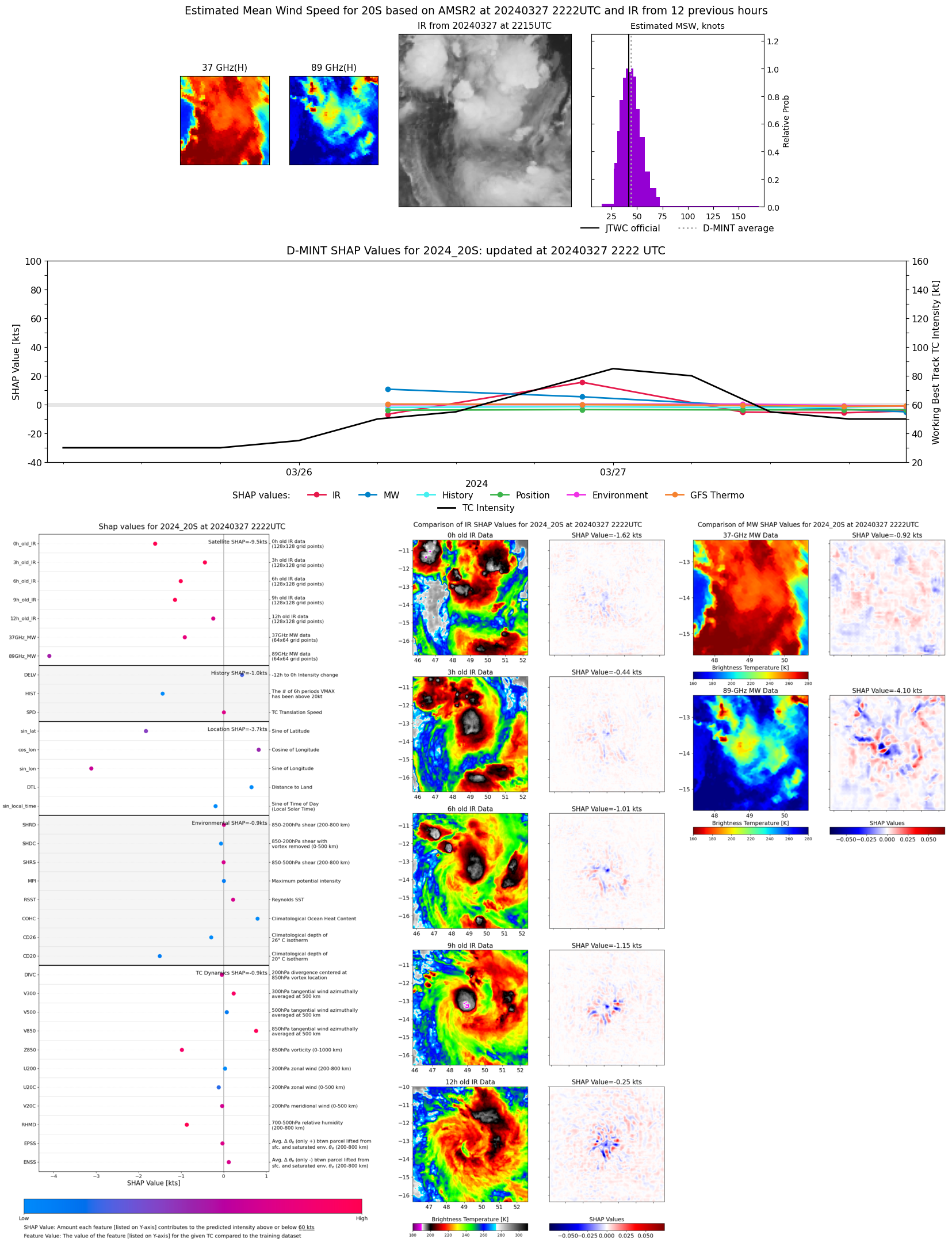 |
| 20240327 | 1738 UTC | GMI | 992 hPa | 44 kts | 37 kts | 51 kts | 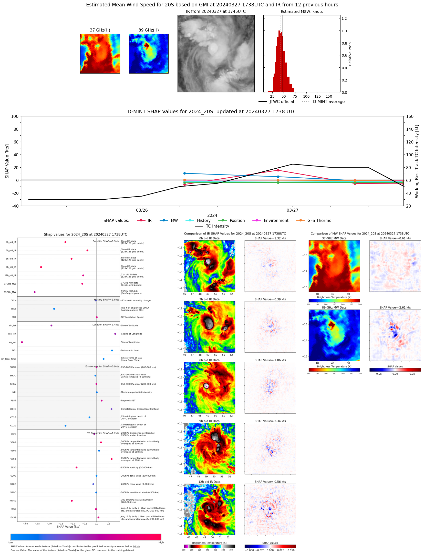 |
| 20240327 | 0954 UTC | AMSR2 | 992 hPa | 53 kts | 47 kts | 60 kts | 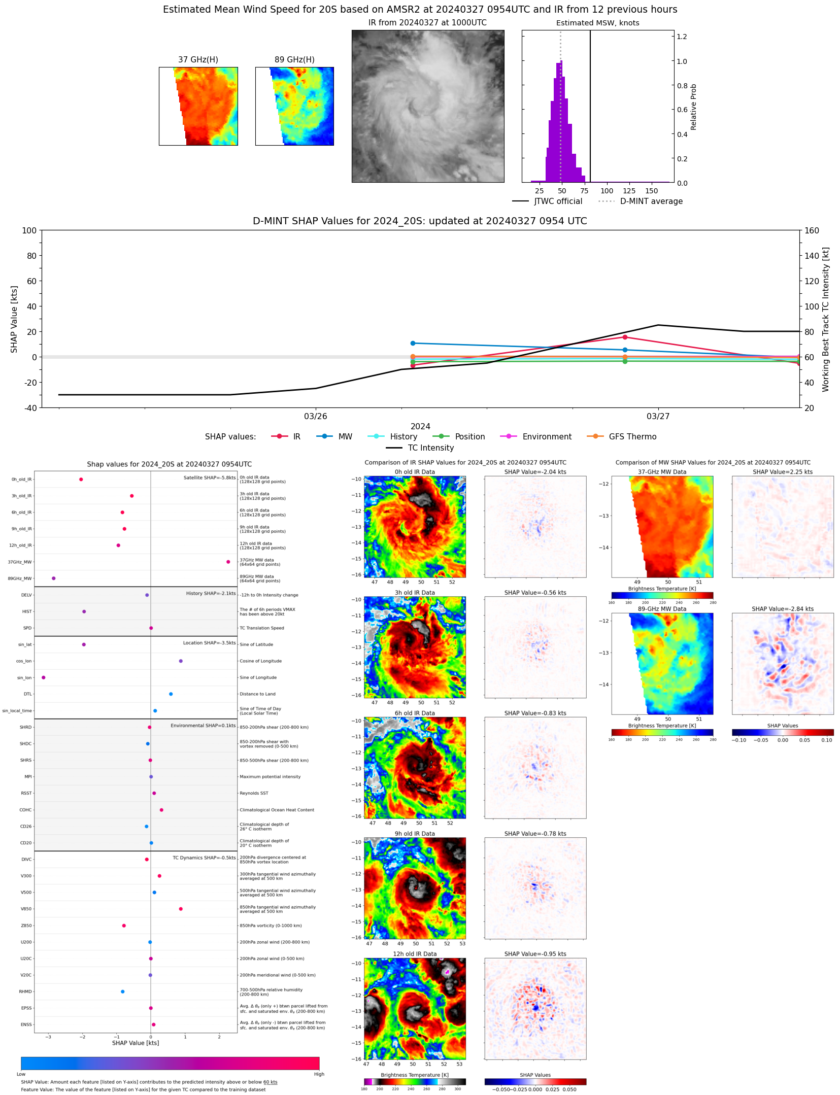 |
| 20240326 | 2139 UTC | AMSR2 | 978 hPa | 78 kts | 71 kts | 85 kts | 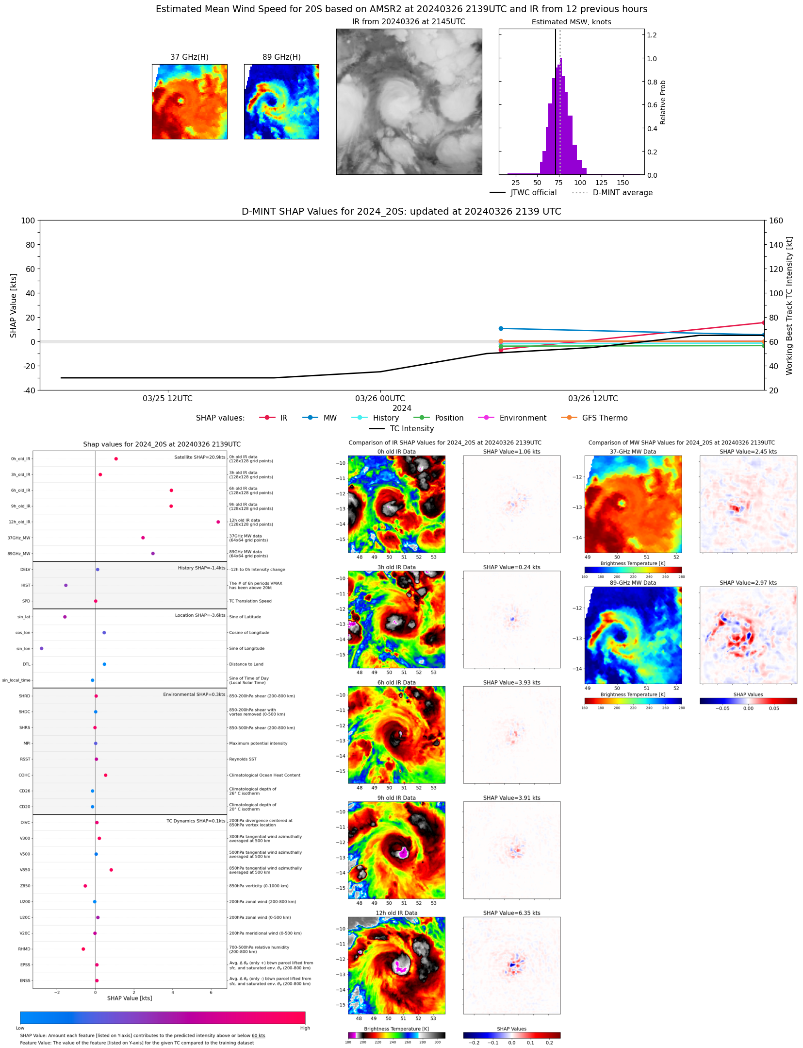 |
| 20240326 | 0648 UTC | GMI | 987 hPa | 58 kts | 52 kts | 65 kts | 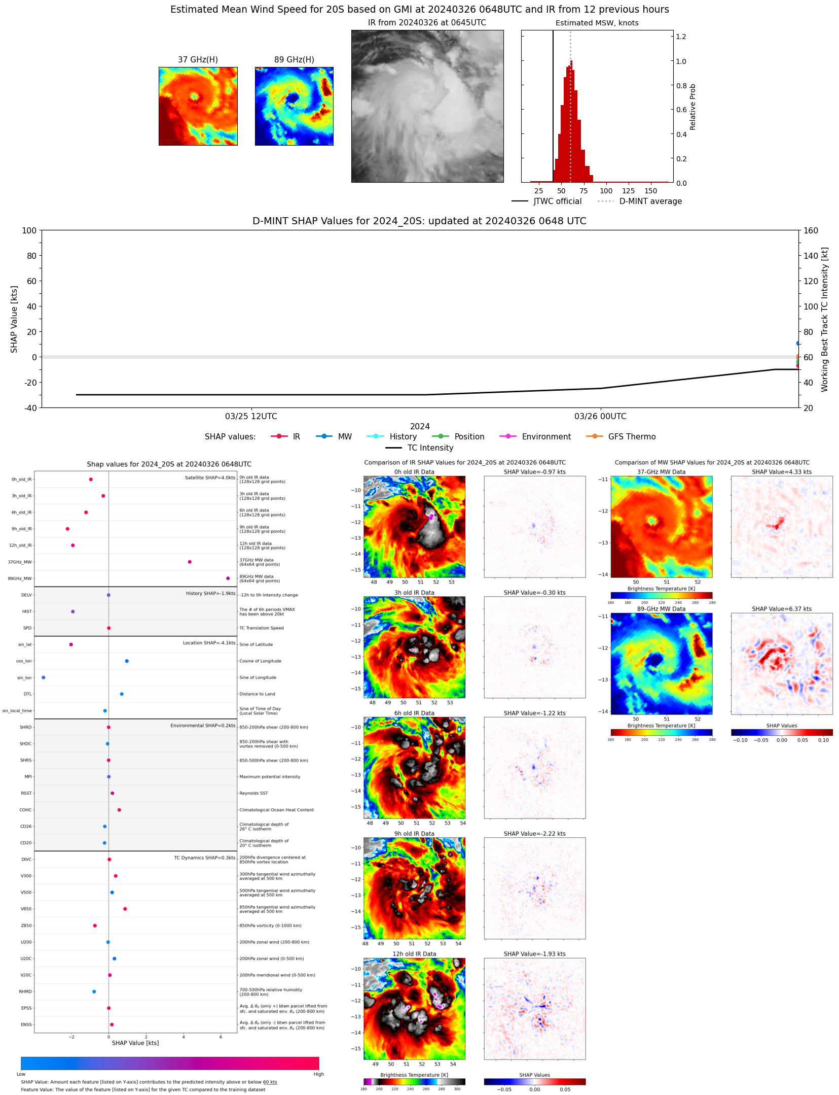 |