|
||

 |
D-MINT HISTORY FILE for 2024_23S
| Date | Time | MW Sensor | MSLP | Vmax (30th-70th percentile average) | Vmax 25th percentile | Vmax 75th percentile | Image |
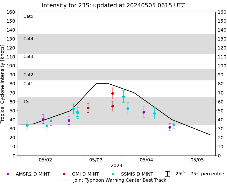
| 20240504 | 1250 UTC | SSMISF18 | 996 hPa | 34 kts | 30 kts | 39 kts | 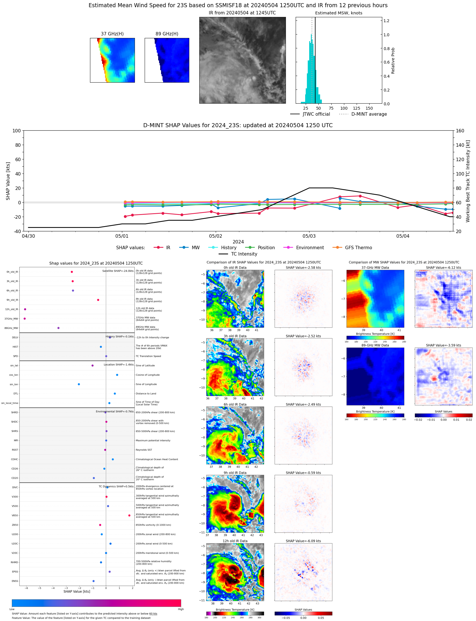 |
| 20240504 | 1056 UTC | AMSR2 | 1000 hPa | 32 kts | 28 kts | 36 kts | 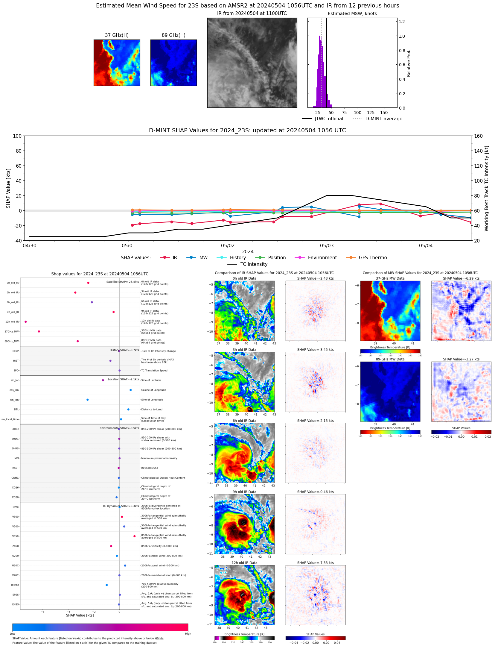 |
| 20240504 | 0339 UTC | SSMISF17 | 993 hPa | 47 kts | 41 kts | 54 kts | 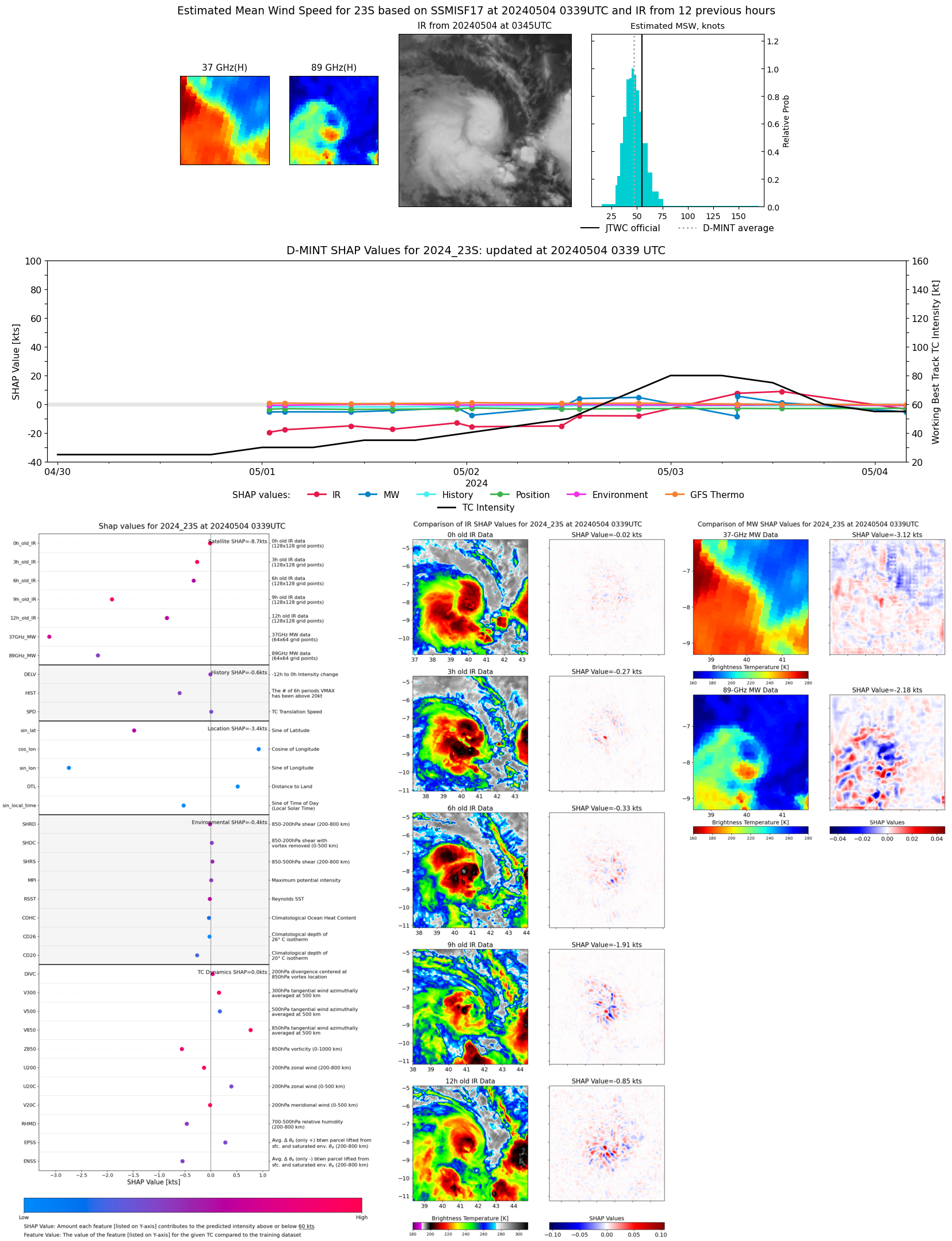 |
| 20240503 | 2239 UTC | AMSR2 | 989 hPa | 48 kts | 42 kts | 55 kts | 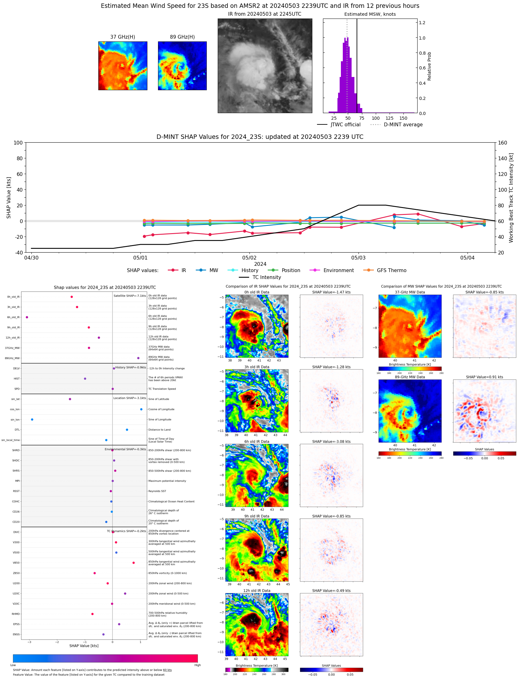 |
| 20240503 | 1502 UTC | SSMISF16 | 982 hPa | 52 kts | 46 kts | 59 kts | 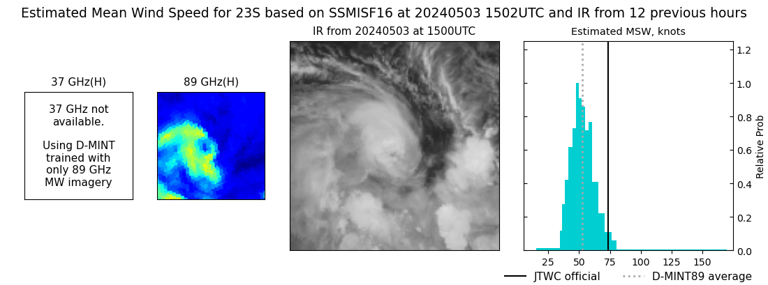 |
| 20240503 | 1302 UTC | SSMISF18 | 976 hPa | 66 kts | 59 kts | 73 kts | 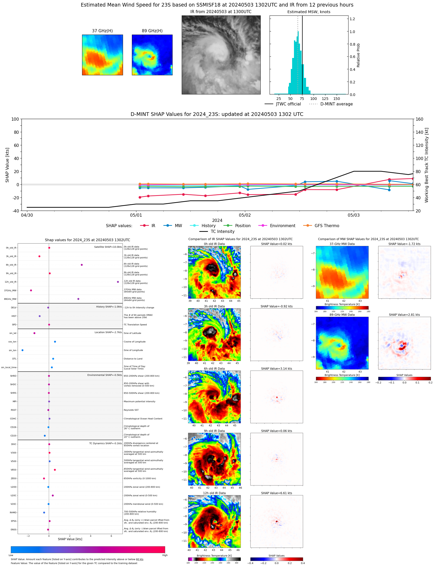 |
| 20240503 | 0751 UTC | GMI | 977 hPa | 69 kts | 63 kts | 75 kts | 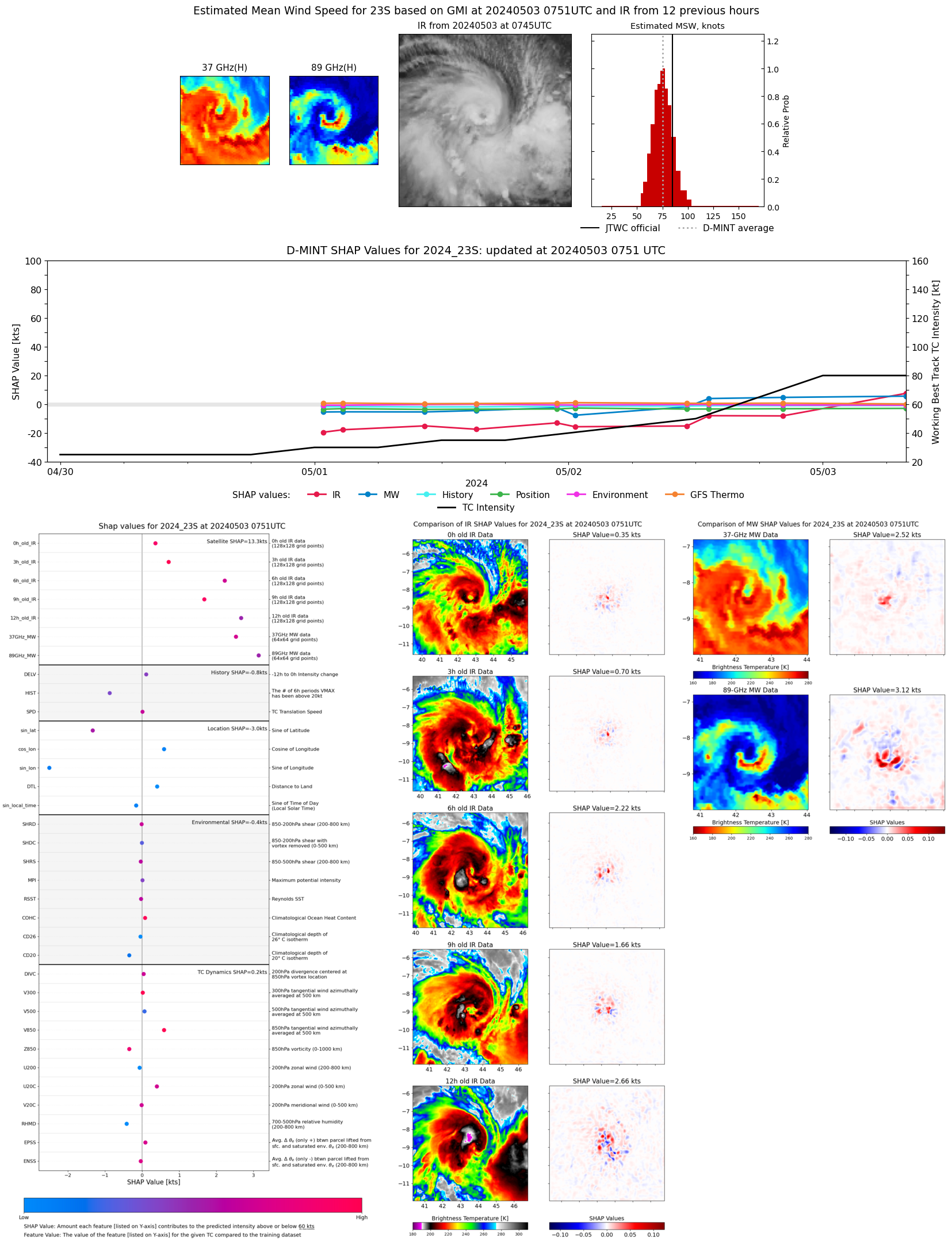 |
| 20240503 | 0748 UTC | GMI | 986 hPa | 55 kts | 50 kts | 61 kts | 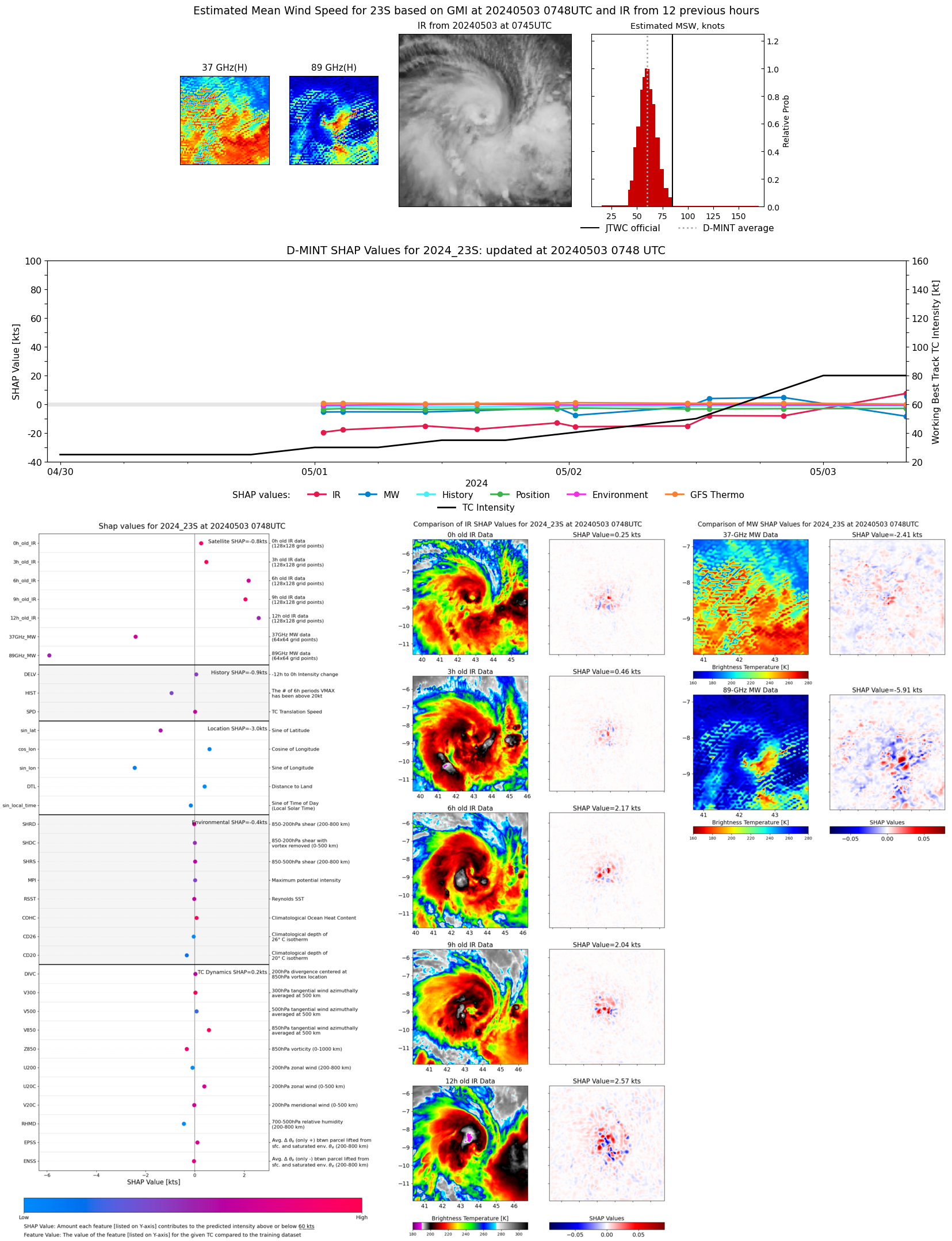 |
| 20240502 | 2013 UTC | GMI | 990 hPa | 53 kts | 48 kts | 58 kts | 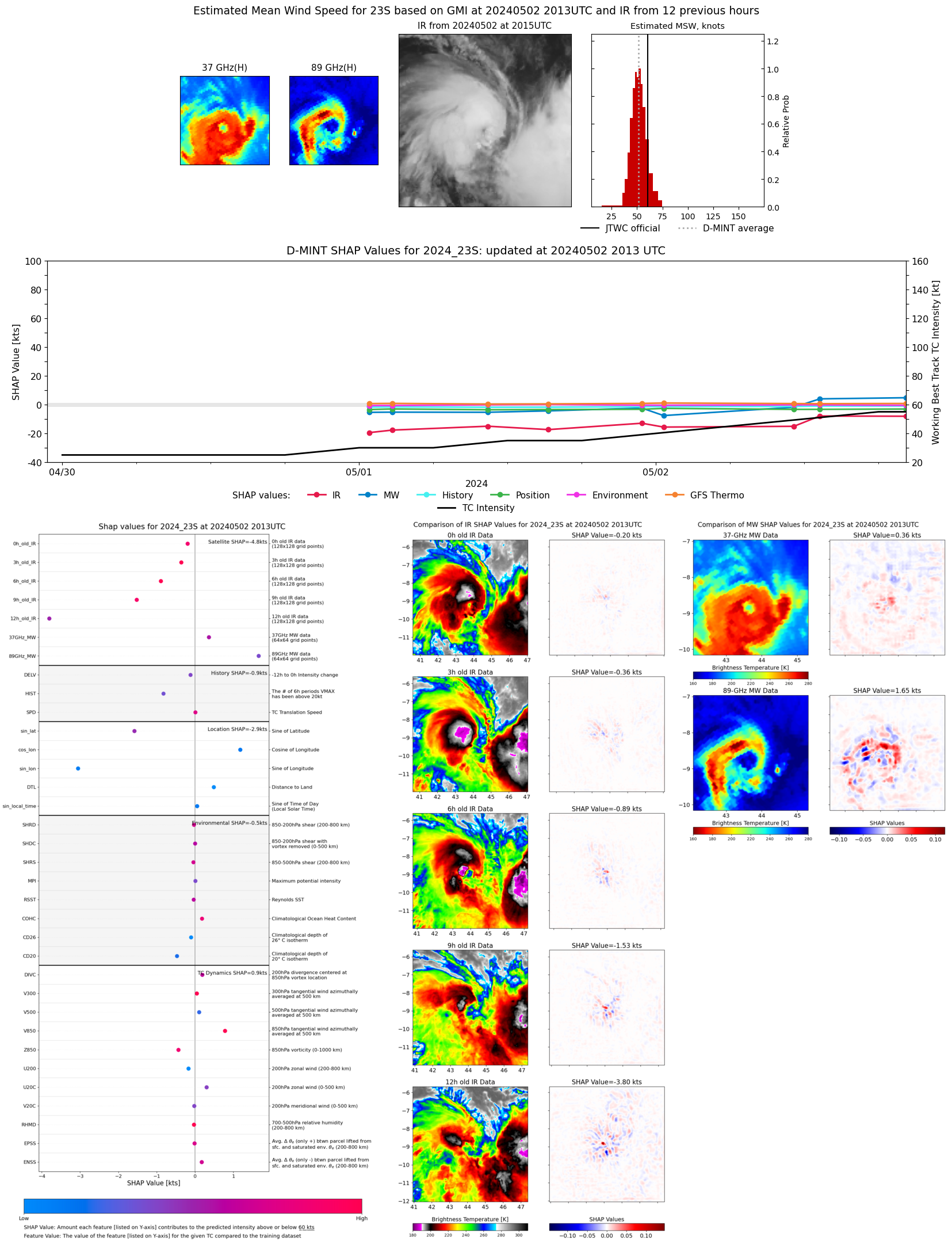 |
| 20240502 | 1515 UTC | SSMISF16 | 985 hPa | 47 kts | 42 kts | 54 kts | 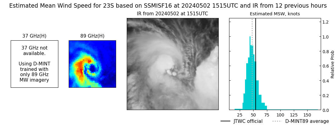 |
| 20240502 | 1505 UTC | SSMISF17 | 992 hPa | 49 kts | 44 kts | 54 kts | 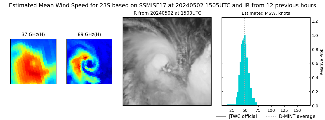 |
| 20240502 | 1315 UTC | SSMISF18 | 990 hPa | 52 kts | 47 kts | 58 kts | 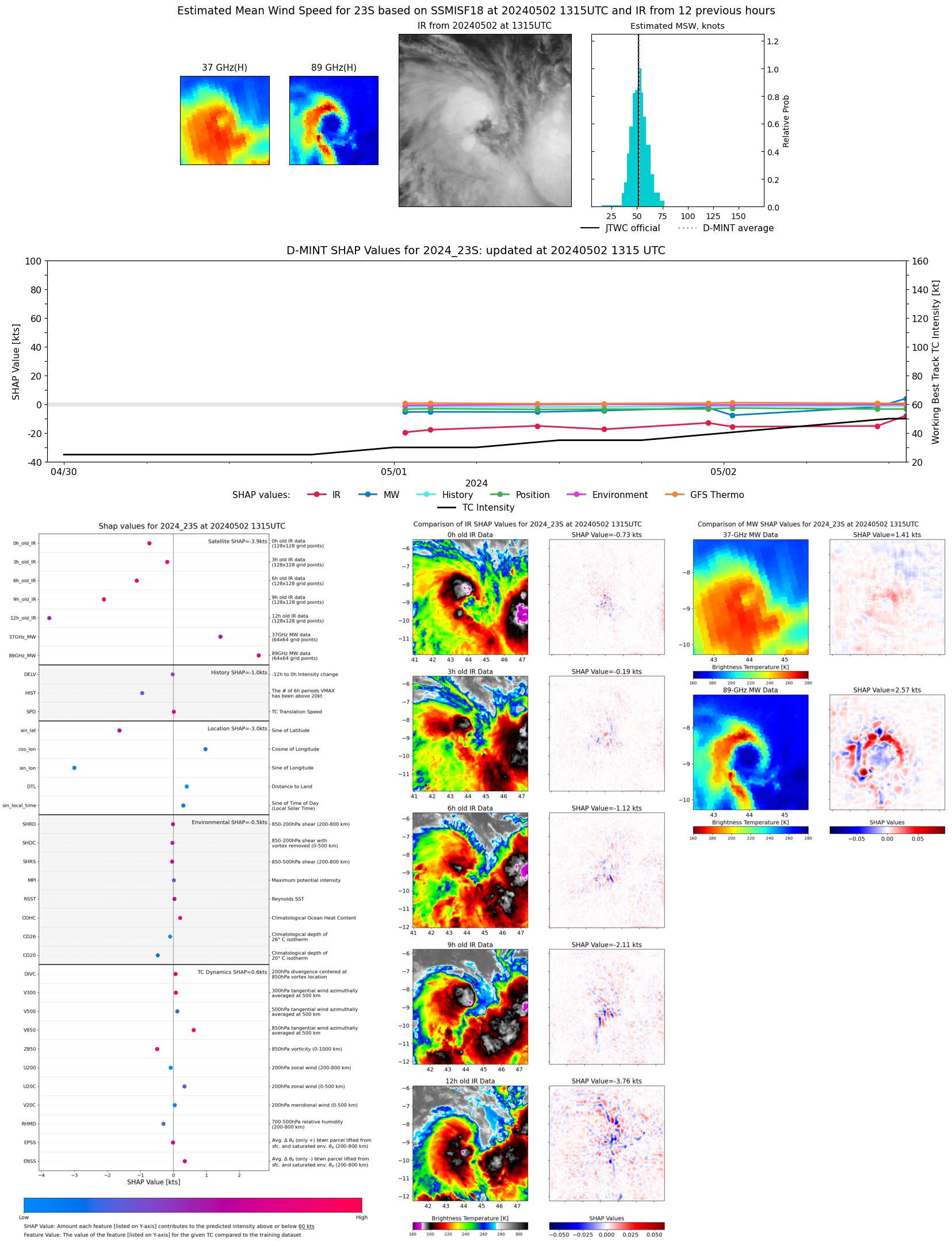 |
| 20240502 | 1109 UTC | AMSR2 | 992 hPa | 39 kts | 35 kts | 44 kts | 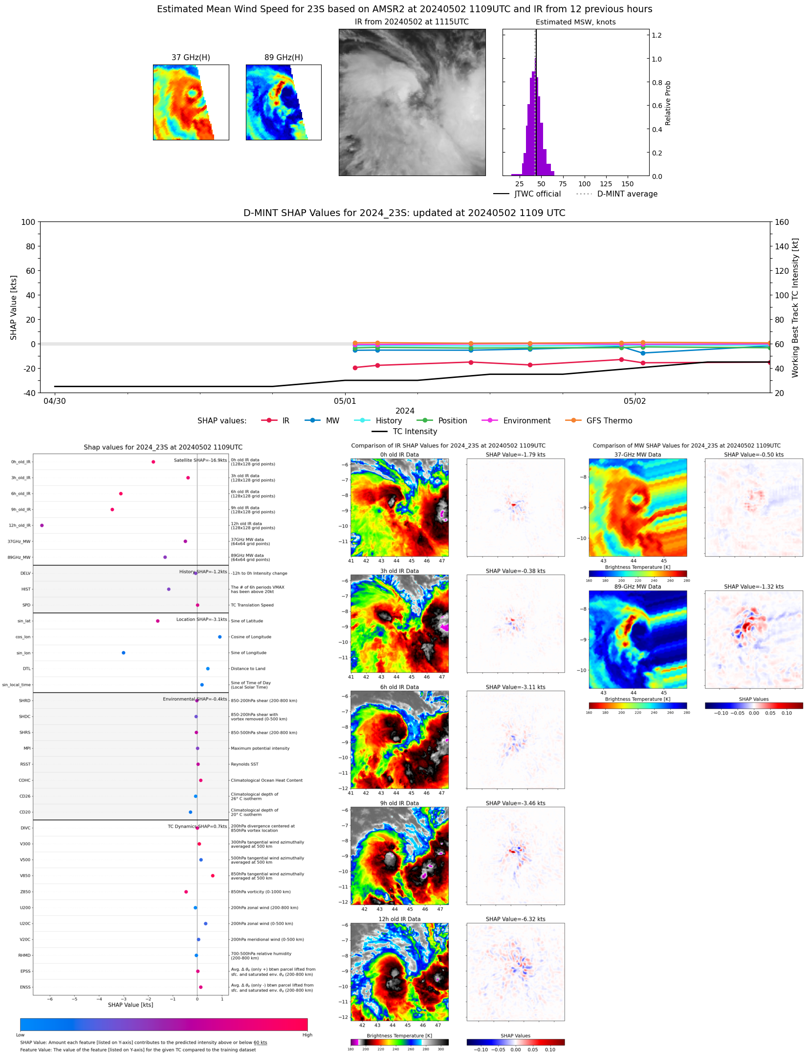 |
| 20240502 | 0236 UTC | SSMISF16 | 995 hPa | 39 kts | 34 kts | 44 kts | 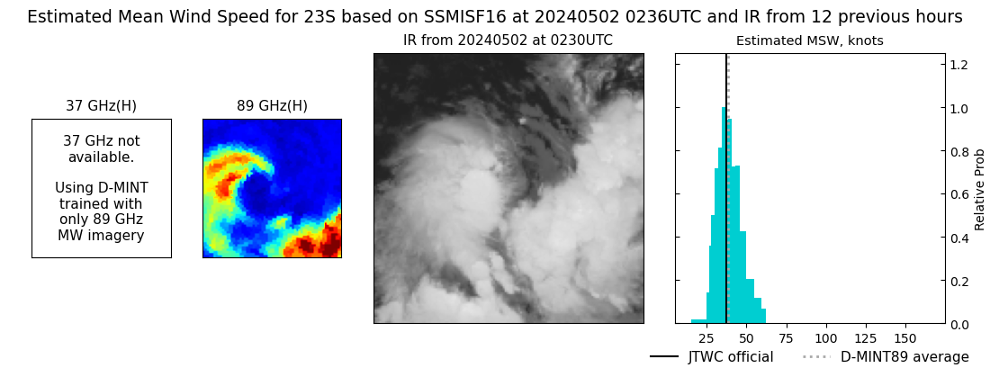 |
| 20240502 | 0037 UTC | SSMISF18 | 995 hPa | 33 kts | 29 kts | 37 kts | 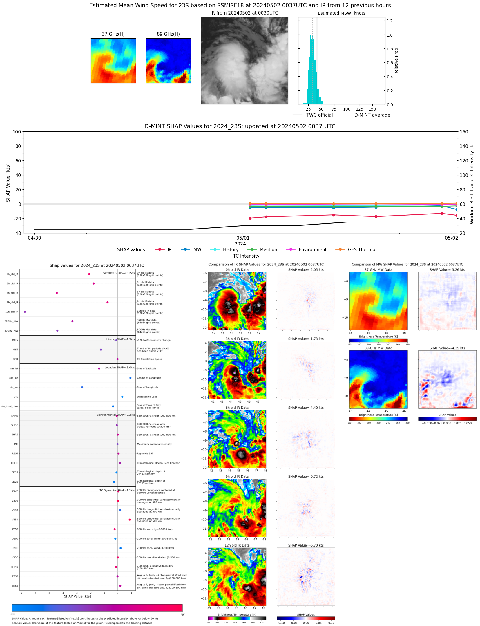 |
| 20240501 | 2252 UTC | AMSR2 | 994 hPa | 40 kts | 36 kts | 46 kts | 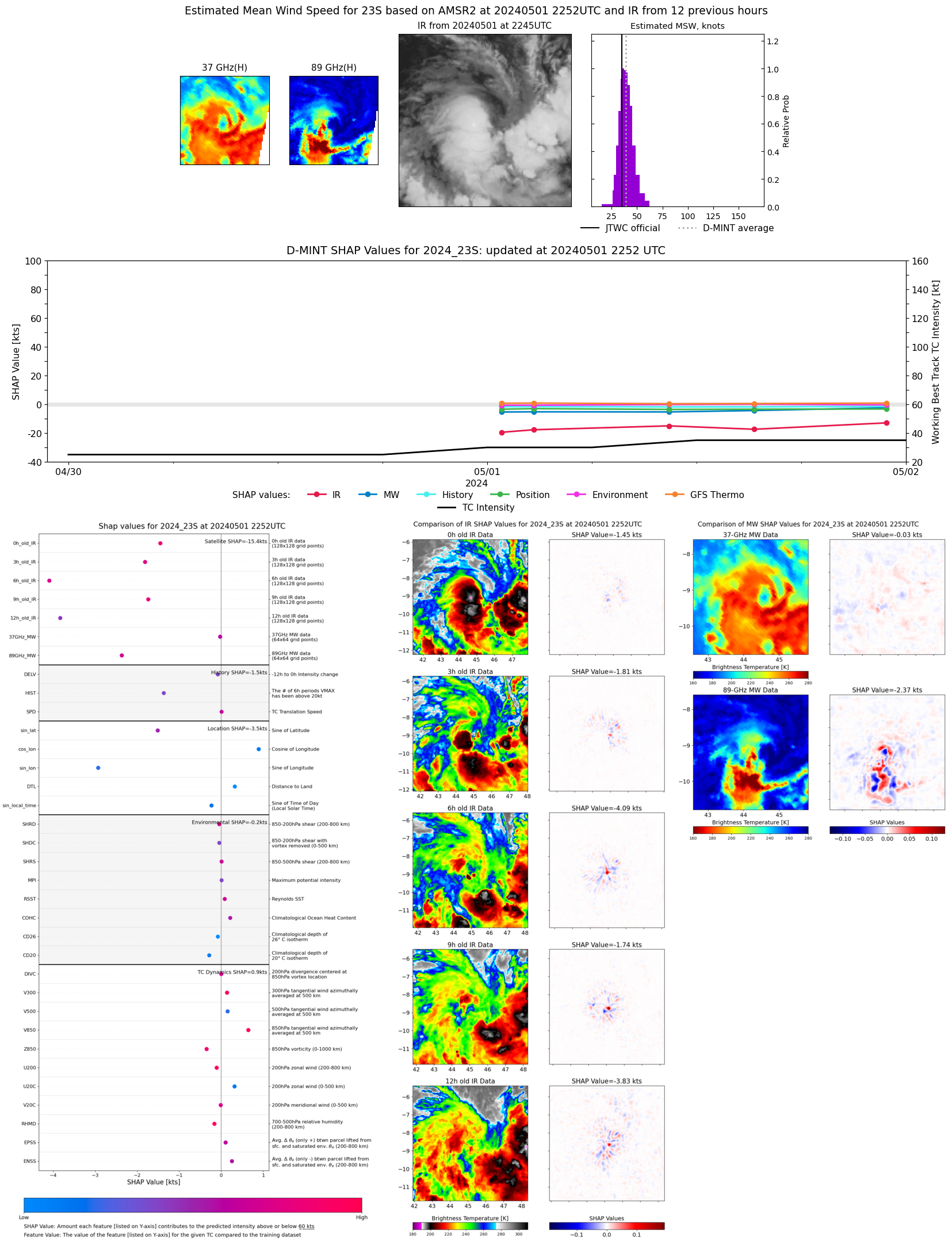 |
| 20240501 | 1518 UTC | SSMISF17 | 995 hPa | 34 kts | 29 kts | 39 kts | 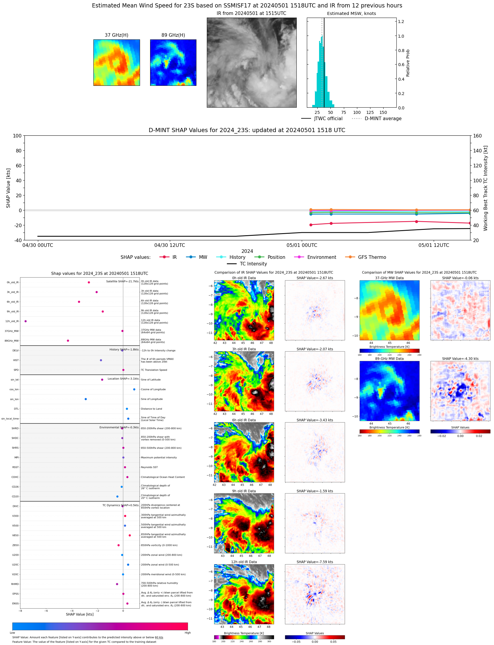 |
| 20240501 | 1025 UTC | AMSR2 | 996 hPa | 34 kts | 29 kts | 40 kts | 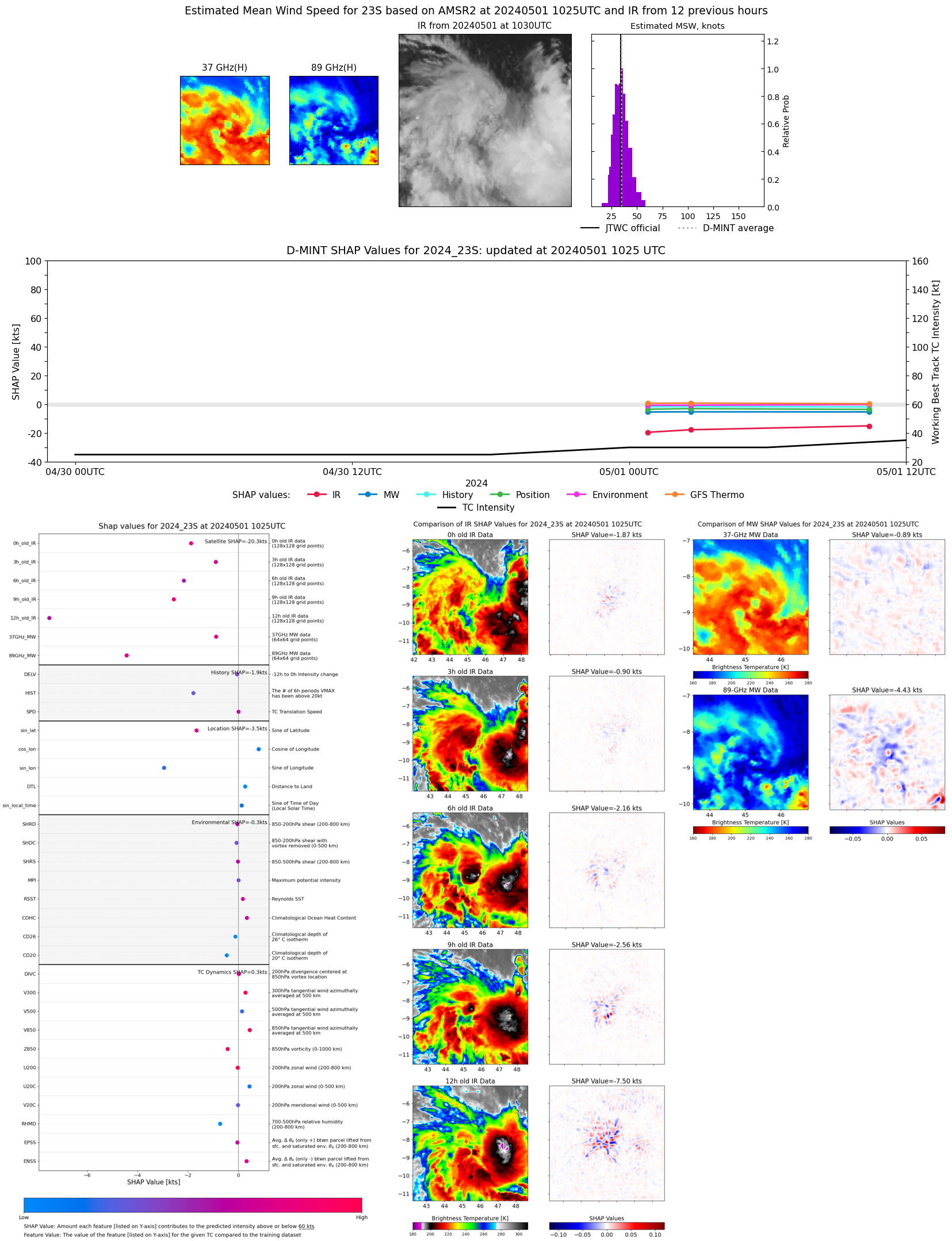 |
| 20240501 | 0249 UTC | SSMISF16 | 997 hPa | 31 kts | 27 kts | 36 kts | 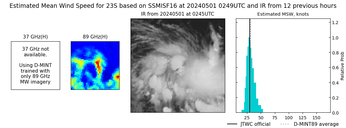 |
| 20240501 | 0240 UTC | SSMISF17 | 998 hPa | 33 kts | 29 kts | 37 kts | 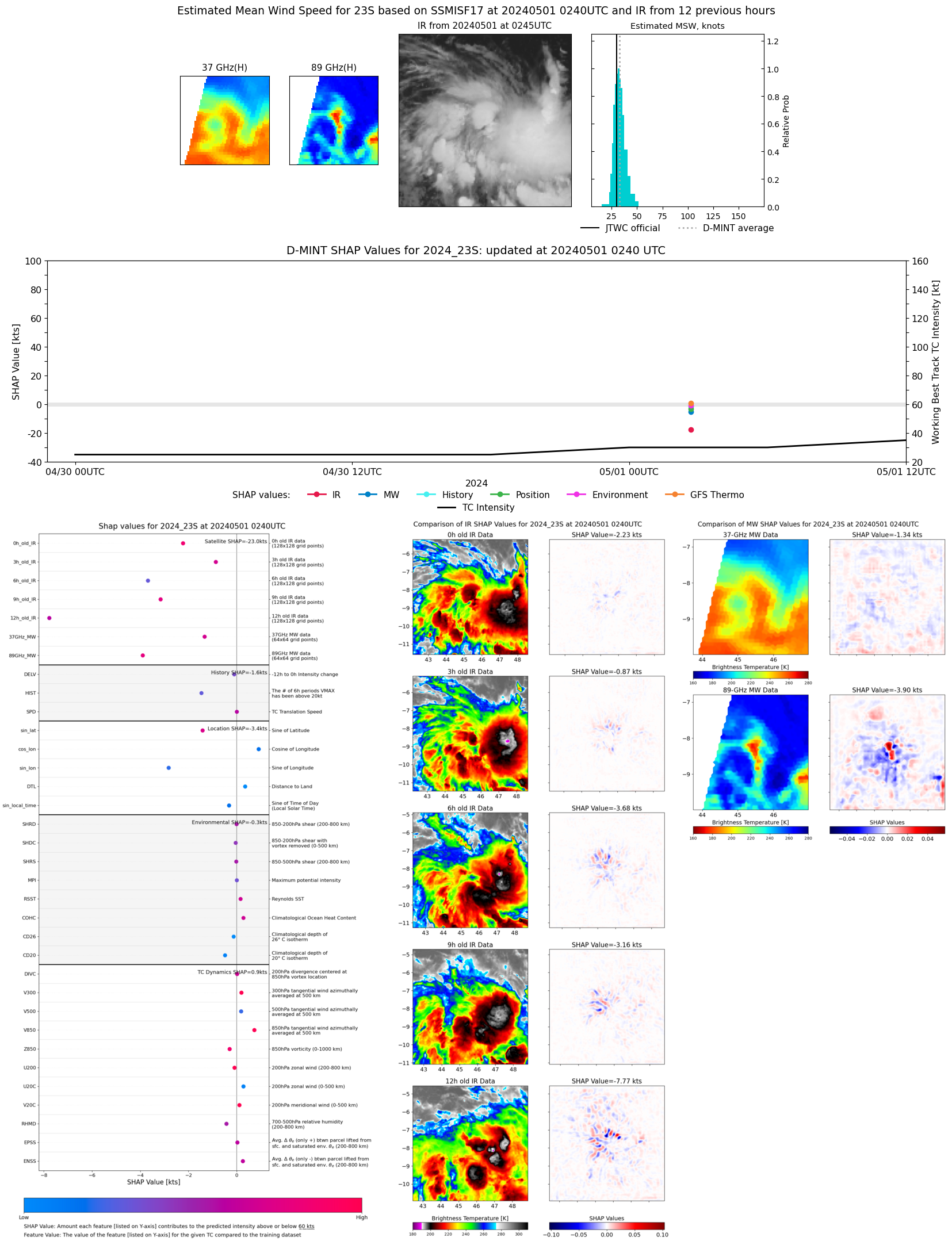 |
| 20240501 | 0049 UTC | SSMISF18 | 997 hPa | 30 kts | 26 kts | 34 kts | 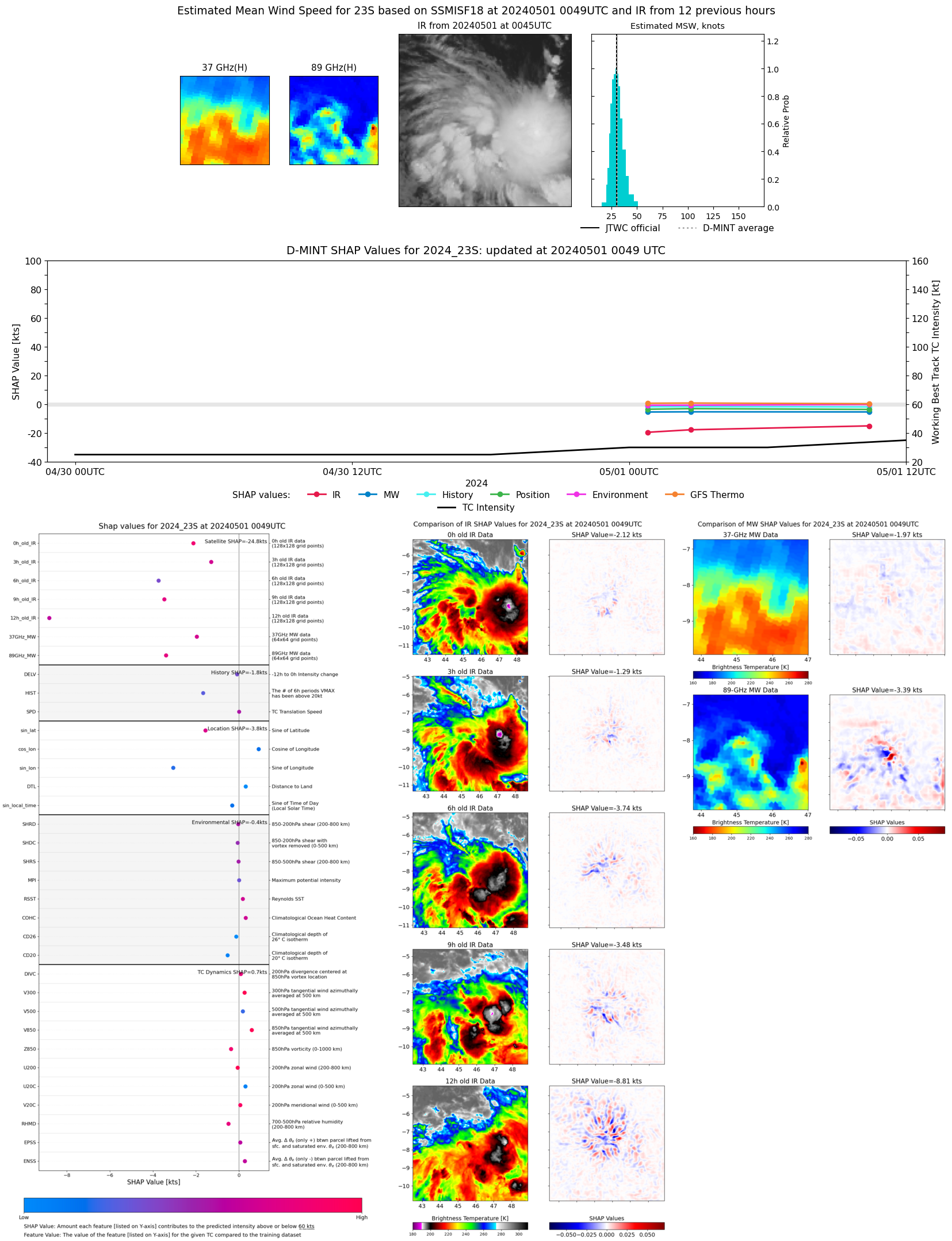 |