|
||

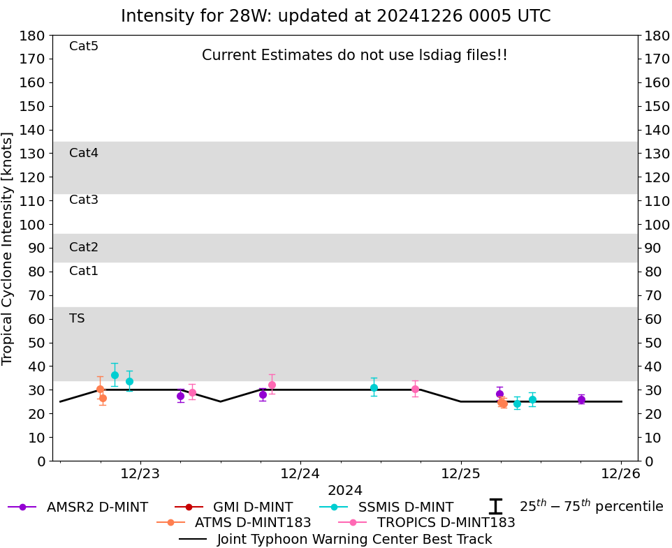 |
D-MINT HISTORY FILE for 2024_28W
| Date | Time | MW Sensor | MSLP | Vmax (30th-70th percentile average) | Vmax 25th percentile | Vmax 75th percentile | Image |
| 20241225 | 1805 UTC | AMSR2 | NaN hPa | 26 kts | 24 kts | 28 kts | 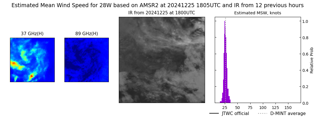 |
| 20241225 | 1041 UTC | SSMISF17 | NaN hPa | 26 kts | 23 kts | 29 kts | 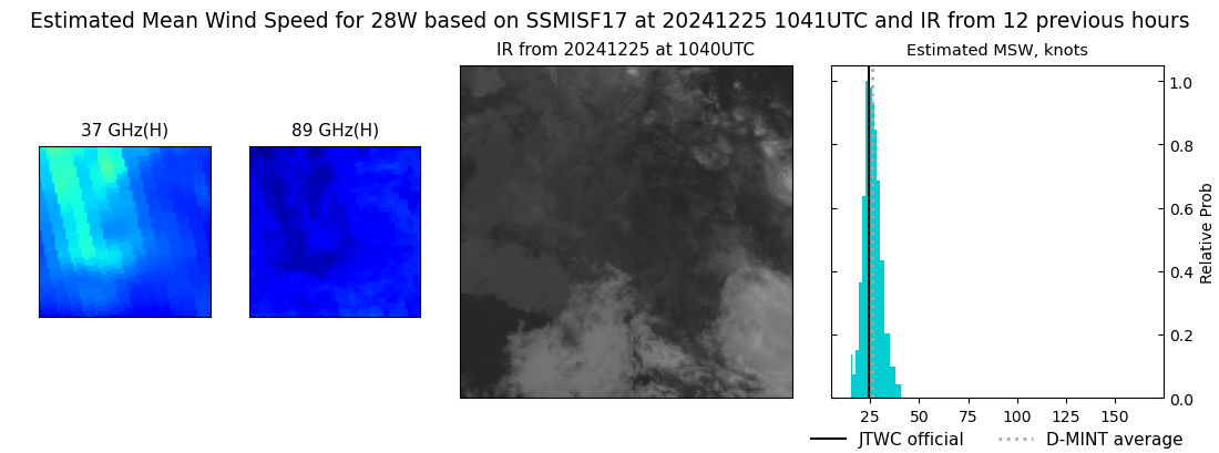 |
| 20241225 | 0825 UTC | SSMISF18 | NaN hPa | 24 kts | 22 kts | 27 kts | 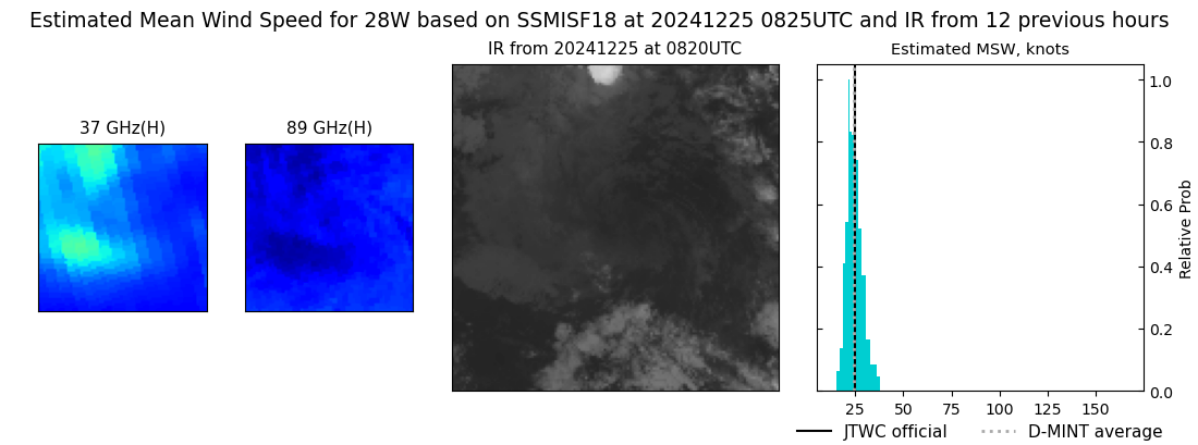 |
| 20241225 | 0627 UTC | ATMS-N20 | NaN hPa | 24 kts | 22 kts | 26 kts |  |
| 20241225 | 0603 UTC | ATMS-N20 | NaN hPa | 25 kts | 23 kts | 27 kts | 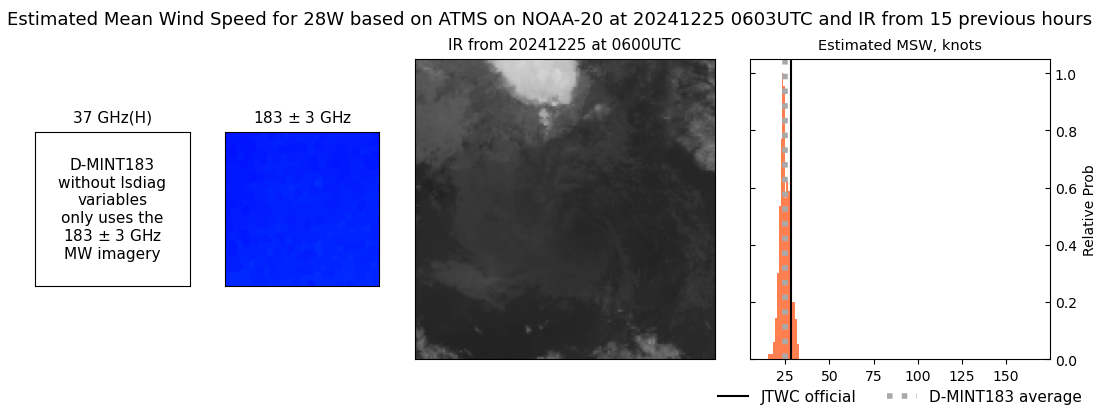 |
| 20241225 | 0548 UTC | AMSR2 | NaN hPa | 28 kts | 26 kts | 31 kts | 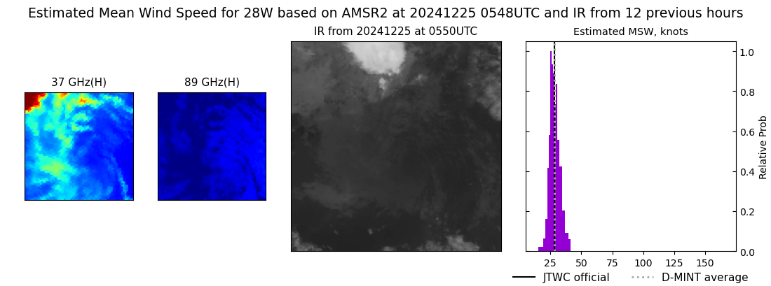 |
| 20241224 | 1707 UTC | TROPICS05 | NaN hPa | 30 kts | 27 kts | 34 kts | 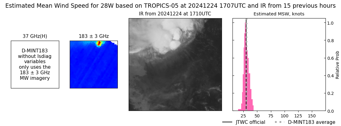 |
| 20241224 | 1056 UTC | SSMISF17 | NaN hPa | 31 kts | 27 kts | 35 kts | 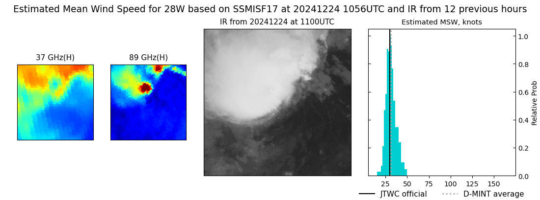 |
| 20241223 | 1942 UTC | TROPICS03 | NaN hPa | 32 kts | 28 kts | 37 kts | 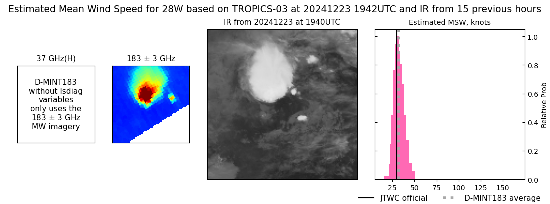 |
| 20241223 | 1816 UTC | AMSR2 | NaN hPa | 28 kts | 25 kts | 31 kts | 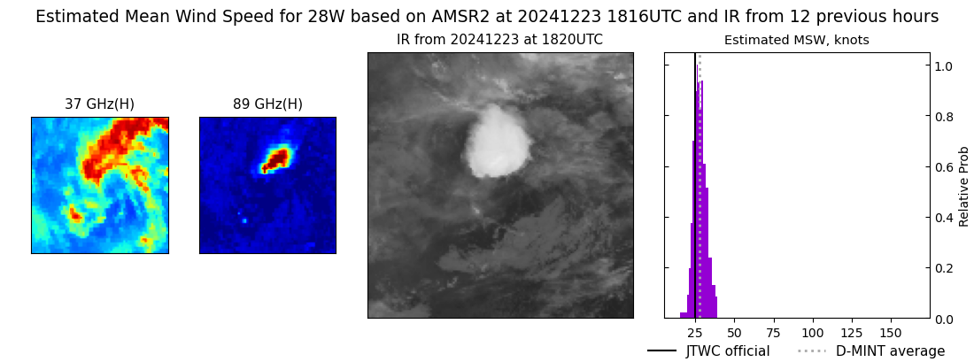 |
| 20241223 | 0742 UTC | TROPICS05 | NaN hPa | 29 kts | 26 kts | 32 kts | 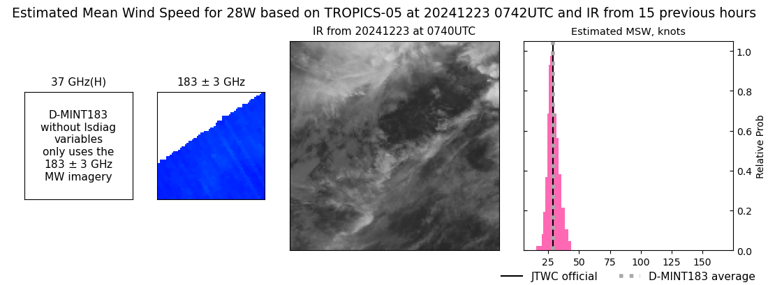 |
| 20241223 | 0600 UTC | AMSR2 | NaN hPa | 27 kts | 25 kts | 30 kts | 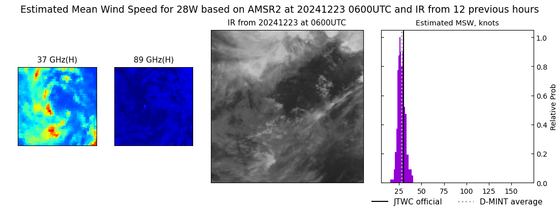 |
| 20241222 | 2220 UTC | SSMISF17 | NaN hPa | 34 kts | 29 kts | 38 kts | 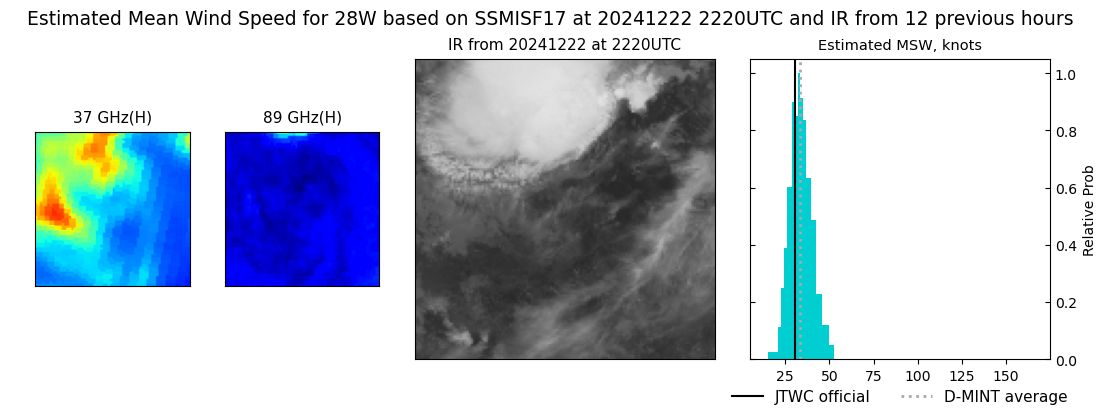 |
| 20241222 | 2004 UTC | SSMISF18 | NaN hPa | 36 kts | 32 kts | 41 kts | 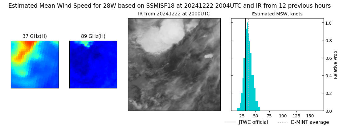 |
| 20241222 | 1818 UTC | ATMS-N20 | NaN hPa | 27 kts | 24 kts | 30 kts | 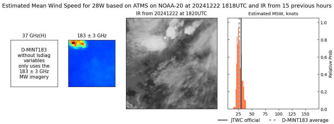 |
| 20241222 | 1754 UTC | ATMS-N20 | NaN hPa | 30 kts | 26 kts | 36 kts | 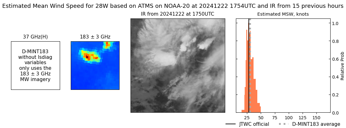 |
| 20241222 | 0756 UTC | GMI | NaN hPa | 32 kts | 28 kts | 36 kts | 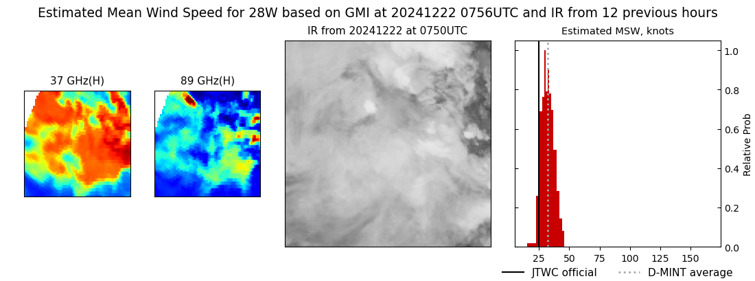 |
| 20241222 | 0520 UTC | ATMS-N20 | NaN hPa | 37 kts | 32 kts | 42 kts | 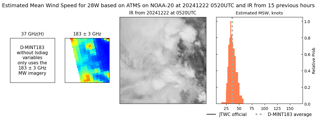 |
| 20241221 | 1812 UTC | ATMS-N20 | NaN hPa | 29 kts | 27 kts | 32 kts | 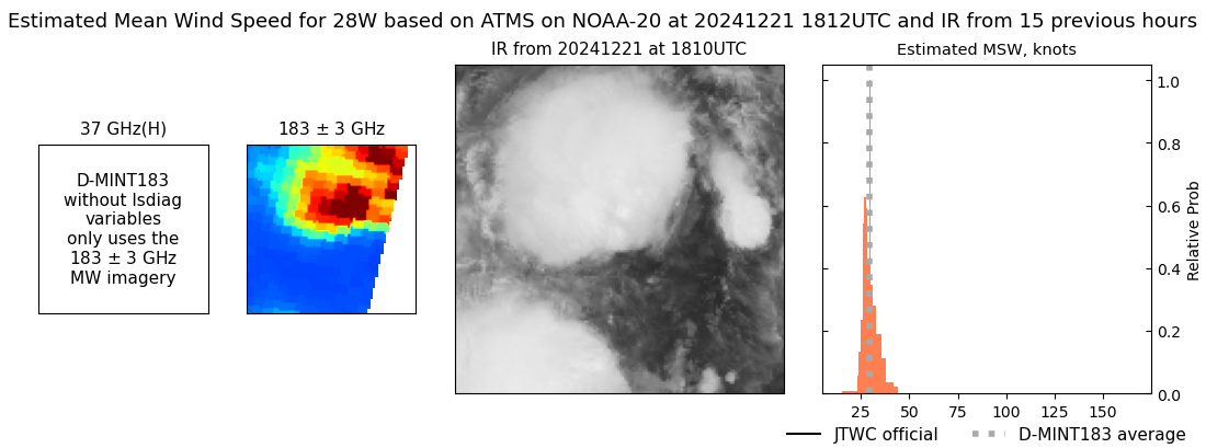 |